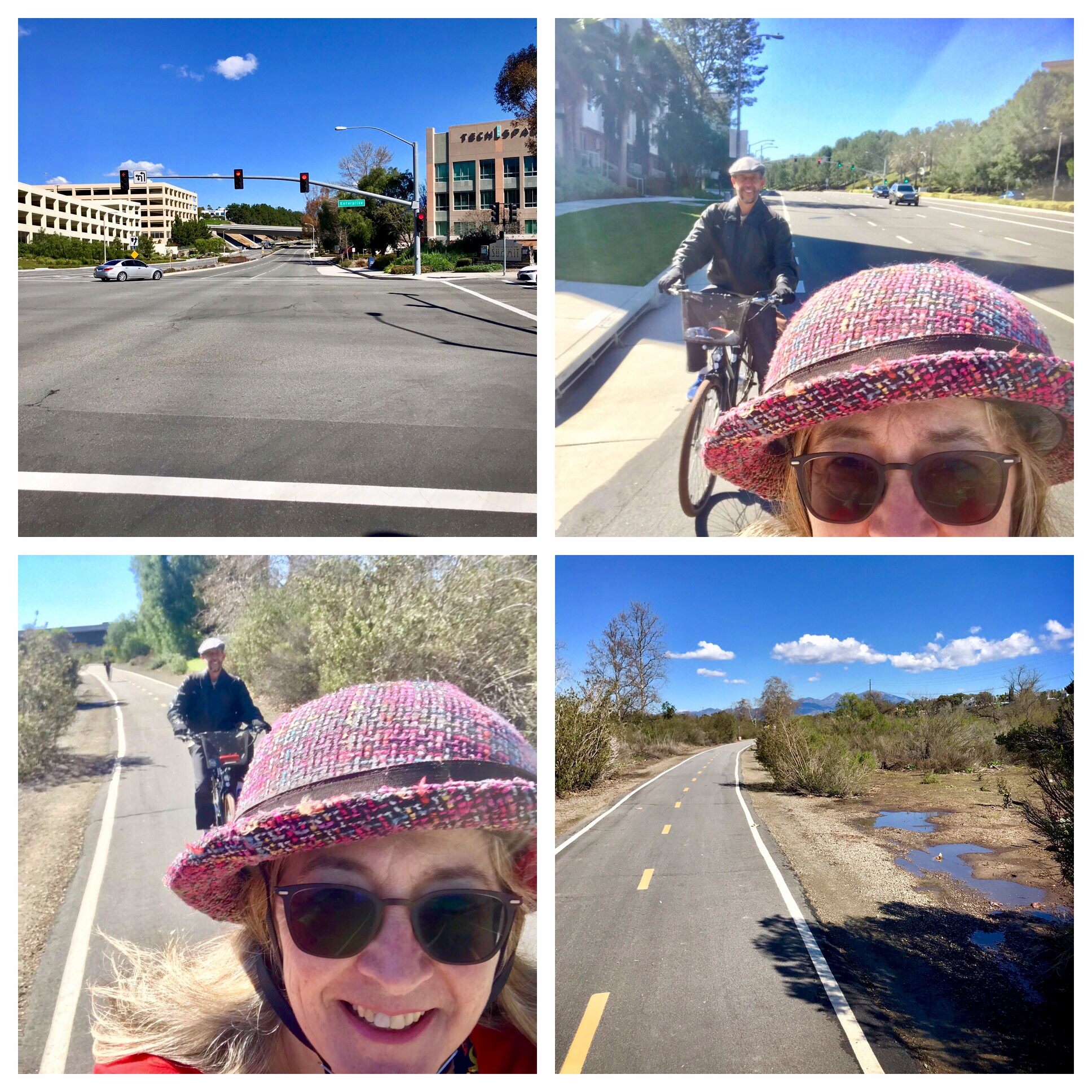
Coffeeneuring is a Fall challenge to keep us riding our bikes as the days get shorter and the temperatures drop. We tackle this by biking 7 times to at least 6 different coffee shops (or other places to drink coffee, or a coffee-type beverage) over the course of 7 weeks or so. The detailed rules get adjusted from year to year, but can be found at the blog hosted by our Coffeeneur-in-Chief. This year we are celebrating 15 years of the coffeeneuring challenge (just 10 years for yours truly). What follows is my official documentation, or Control Card.
Each year the Challenge embraces a theme. This year’s theme is a nod to the 15th year: “You’re Only 15 Once”. One of the joys of the coffeeneuring community is seeing how different participants will interpret or express the theme in different ways. An optional feature is to develop a theme within the theme (visiting a particular category of establishment, trying a favorite food or beverage at each coffee shop, meeting up with friends, exploring different parks or trails, etc.). I started out this year deciding my theme would be seeking out coffee shops that are beautiful. This was inspired by an Instagram post that named a list of beautiful places to drink coffee in Los Angeles, or something like that. Along the way, however, it occurred to me that I just might be able to get in 15 coffee rides during the dates of the challenge, so why not make that part of the “You’re Only 15 Once” theme?
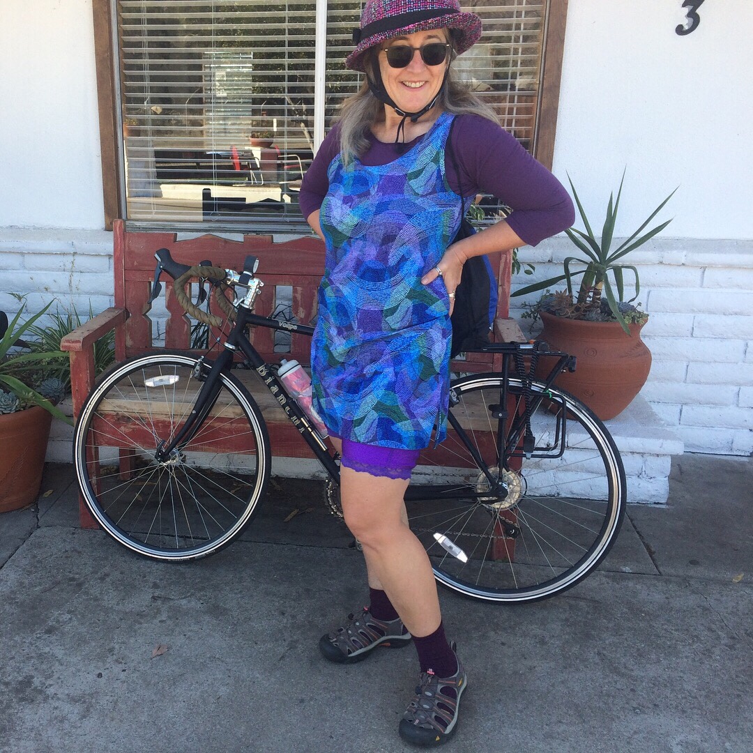
What follows is my report. While it is only necessary to keep track of the beverage, location, and mileage, I also like to include in my report which bike I rode and which Bloomers I wore, in addition to a few notes on what stood out about that experience, and who joined me for this one (my “C+1”).
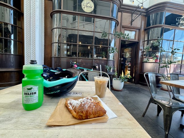
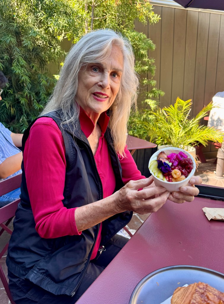
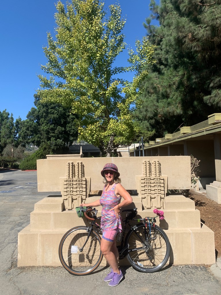
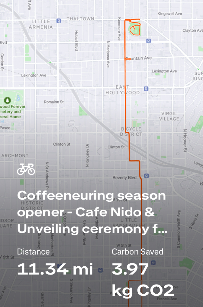
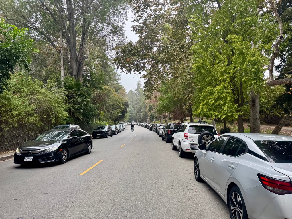
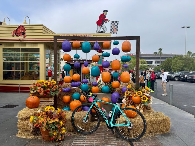
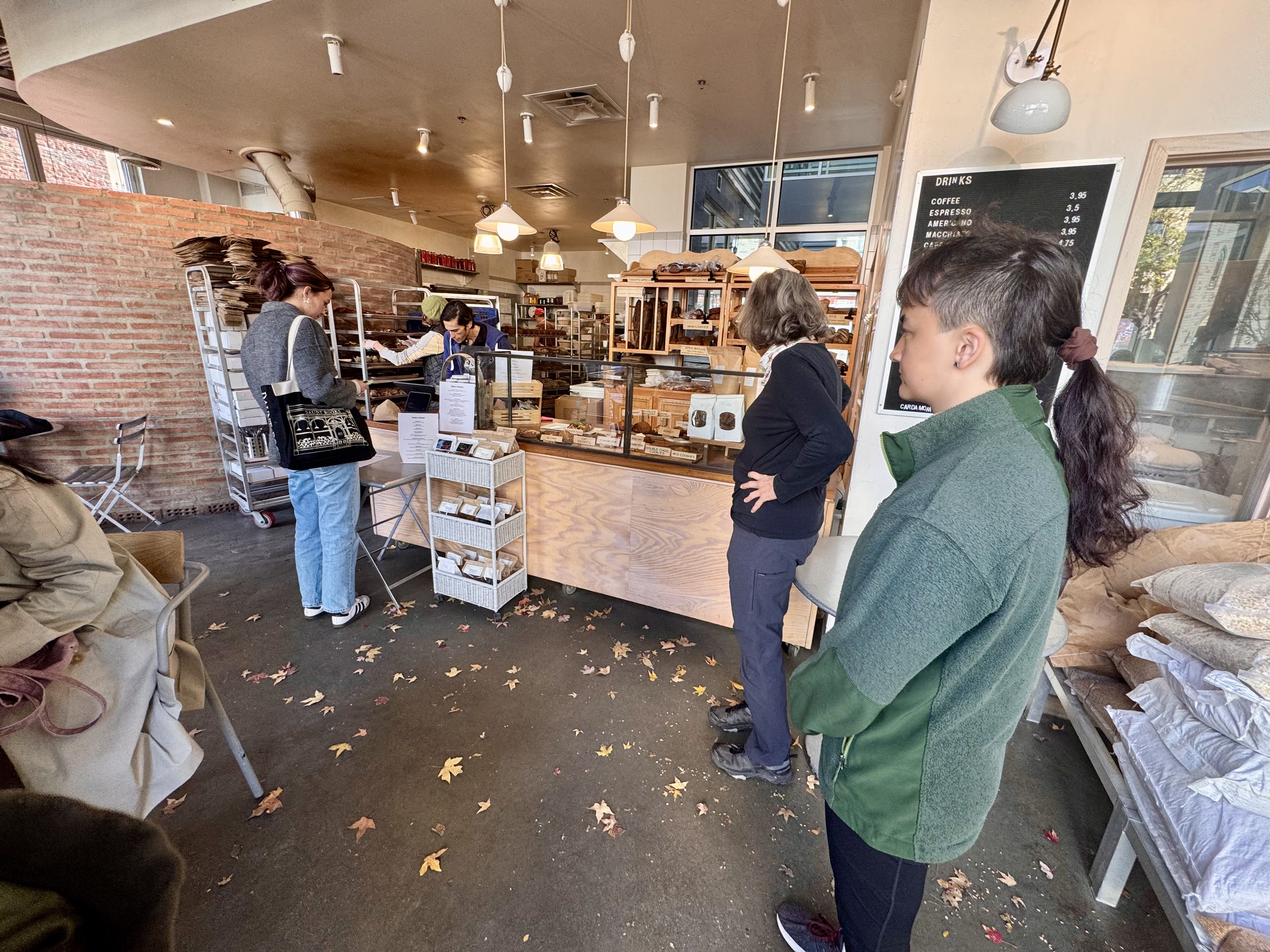
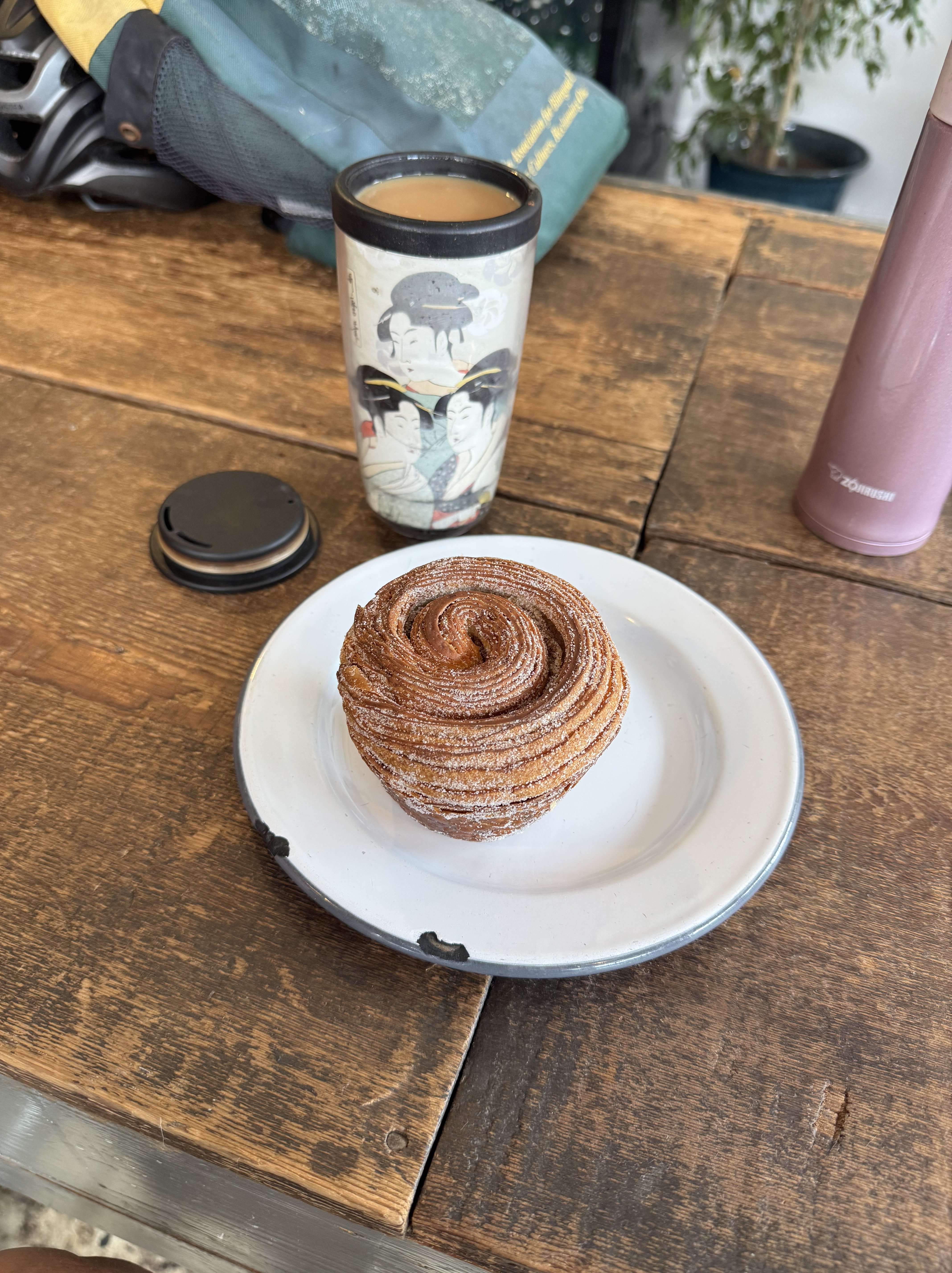
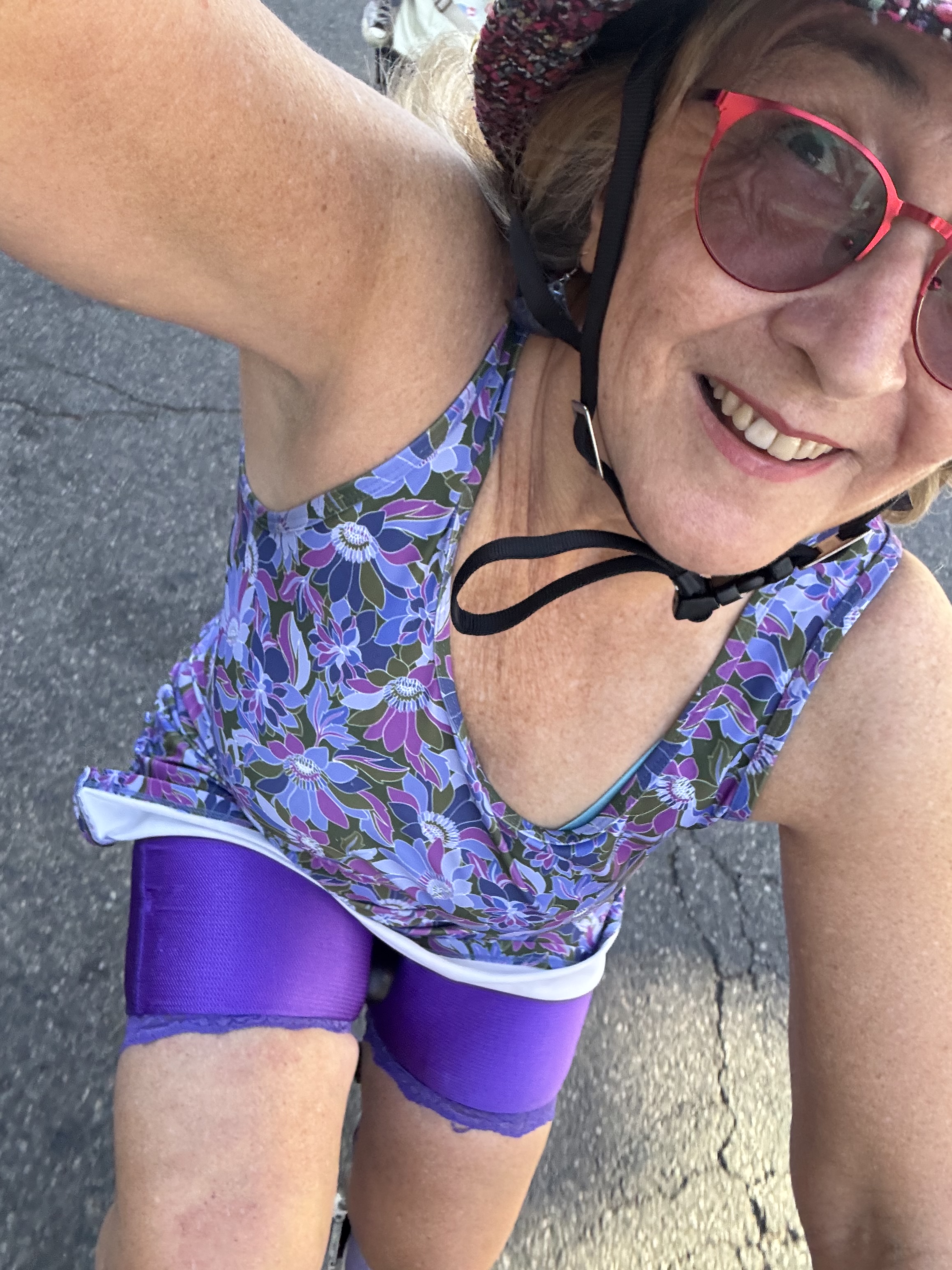
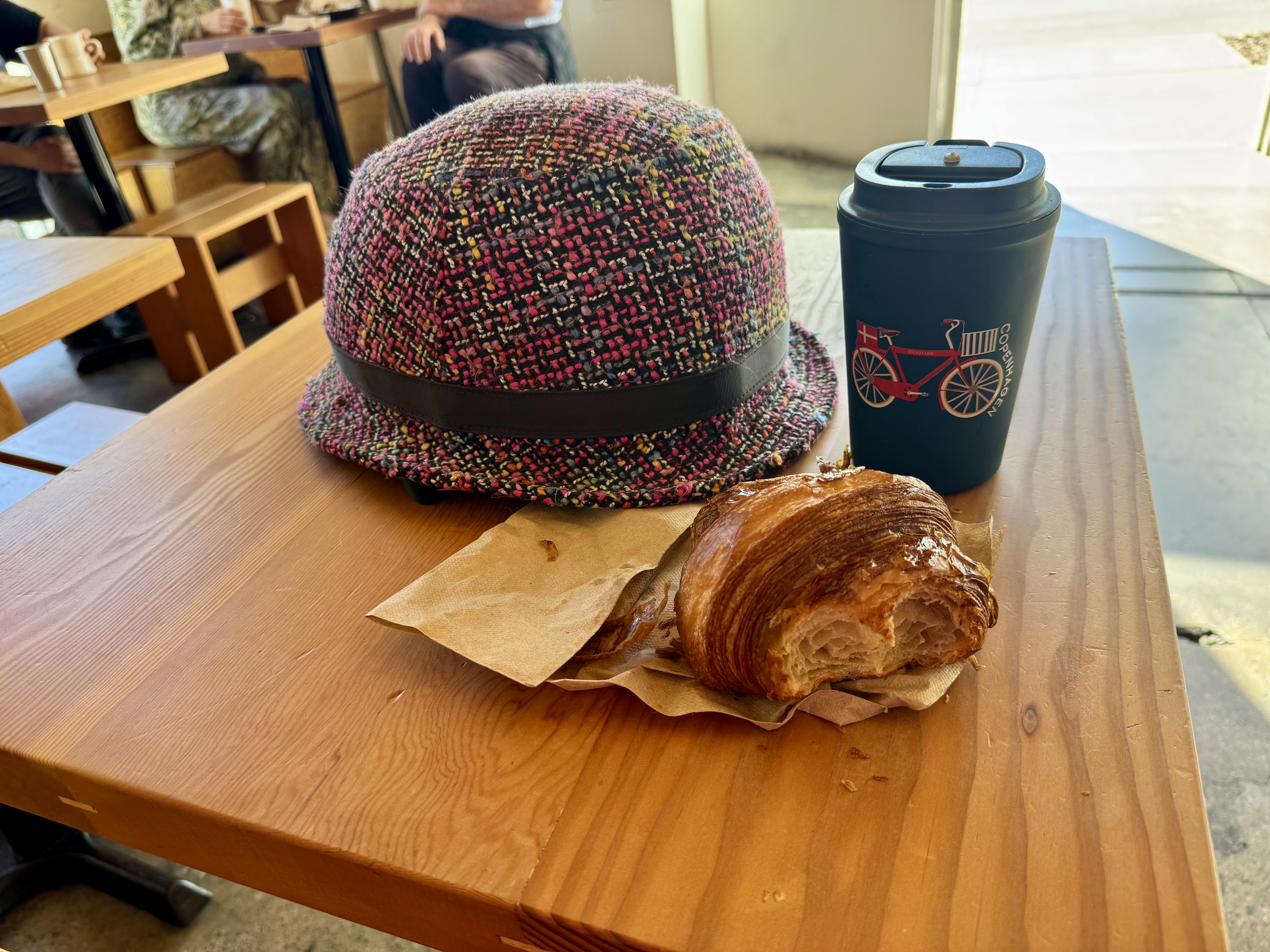
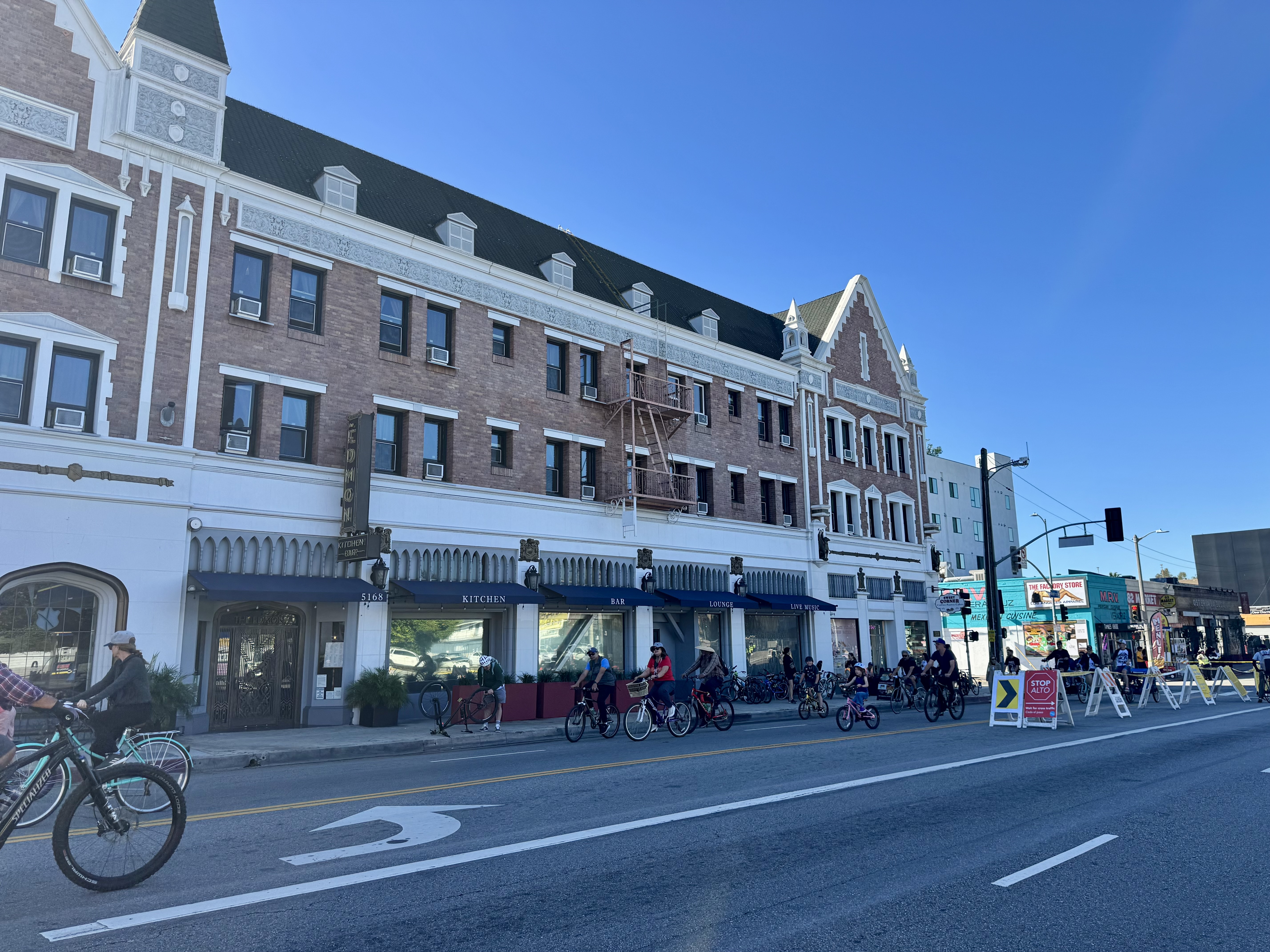
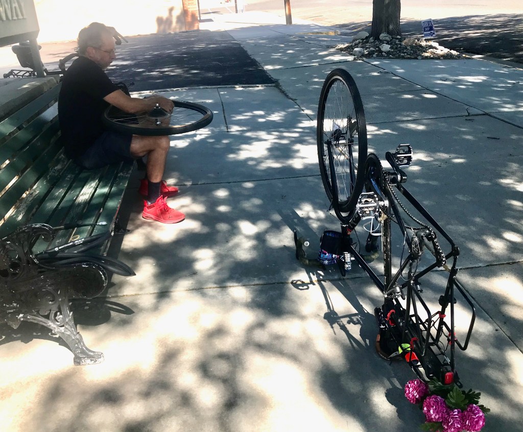
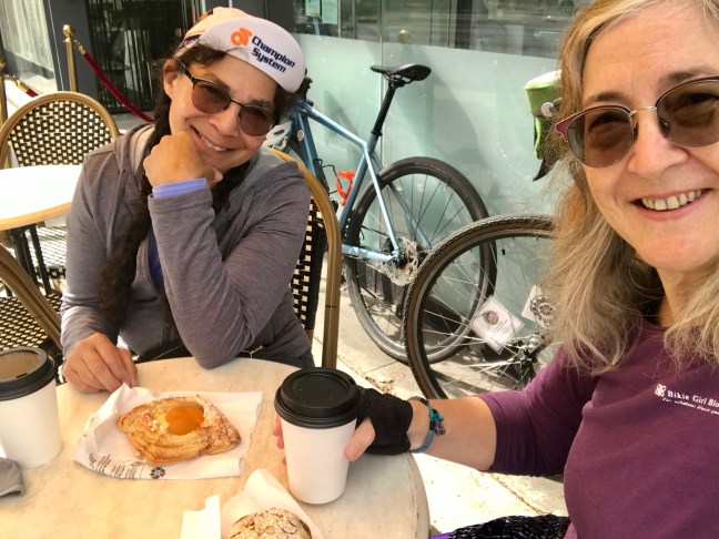
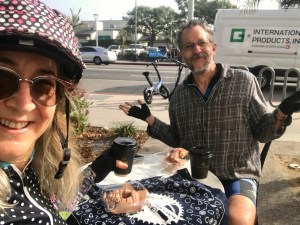
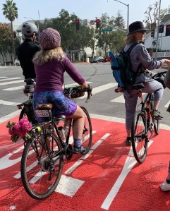
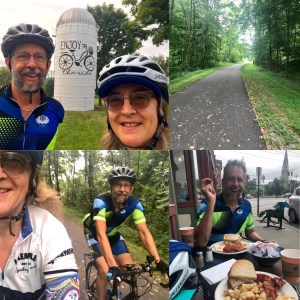
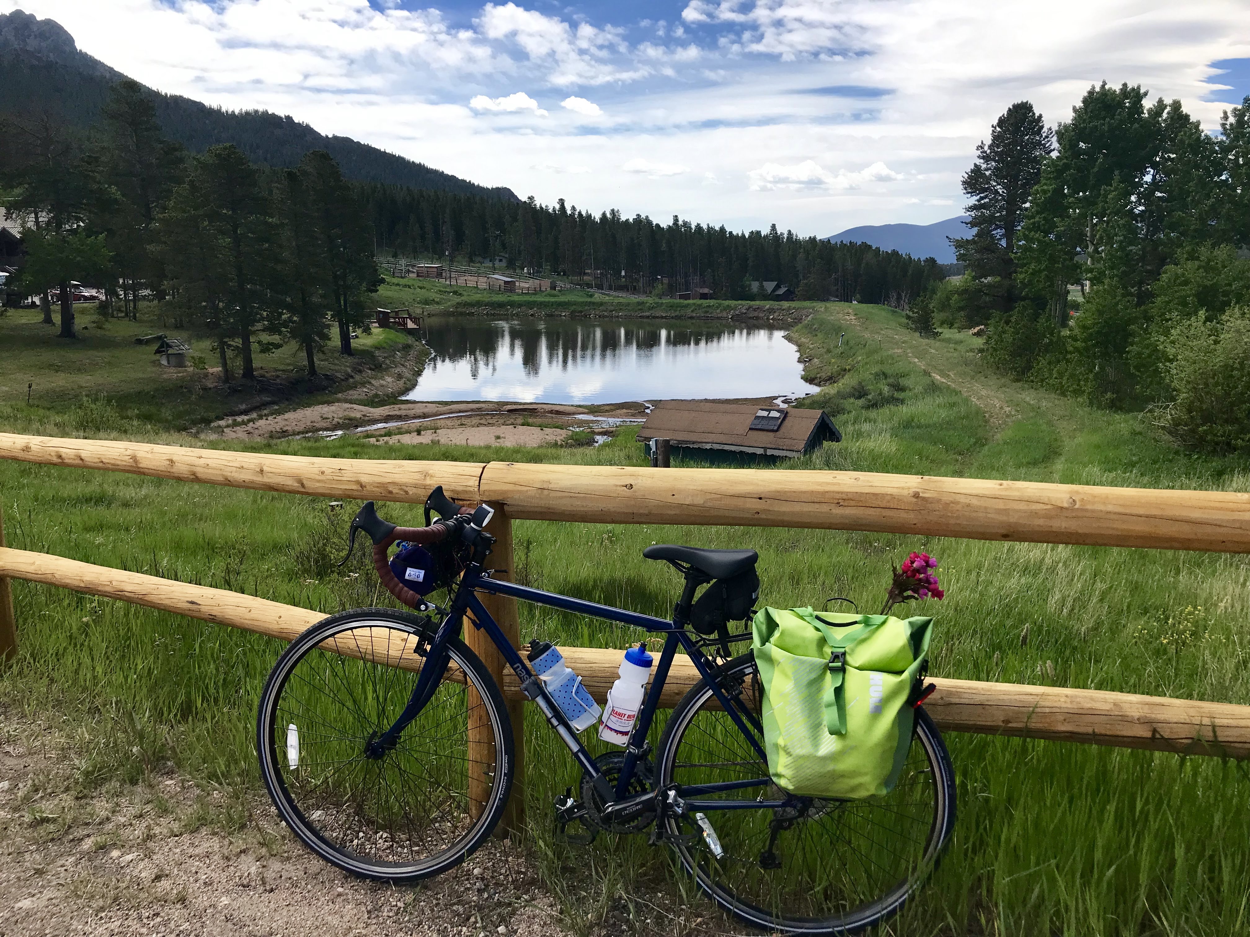
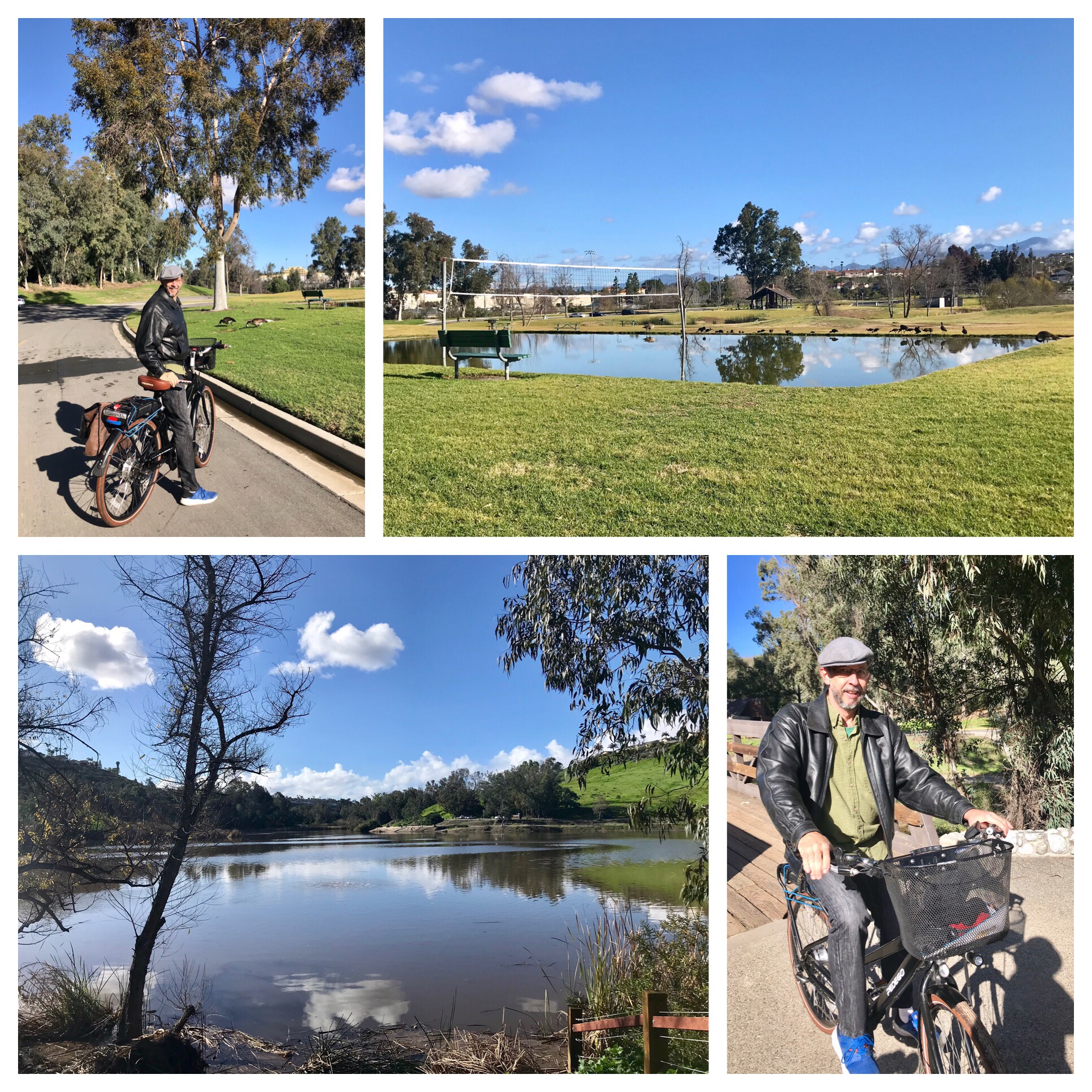
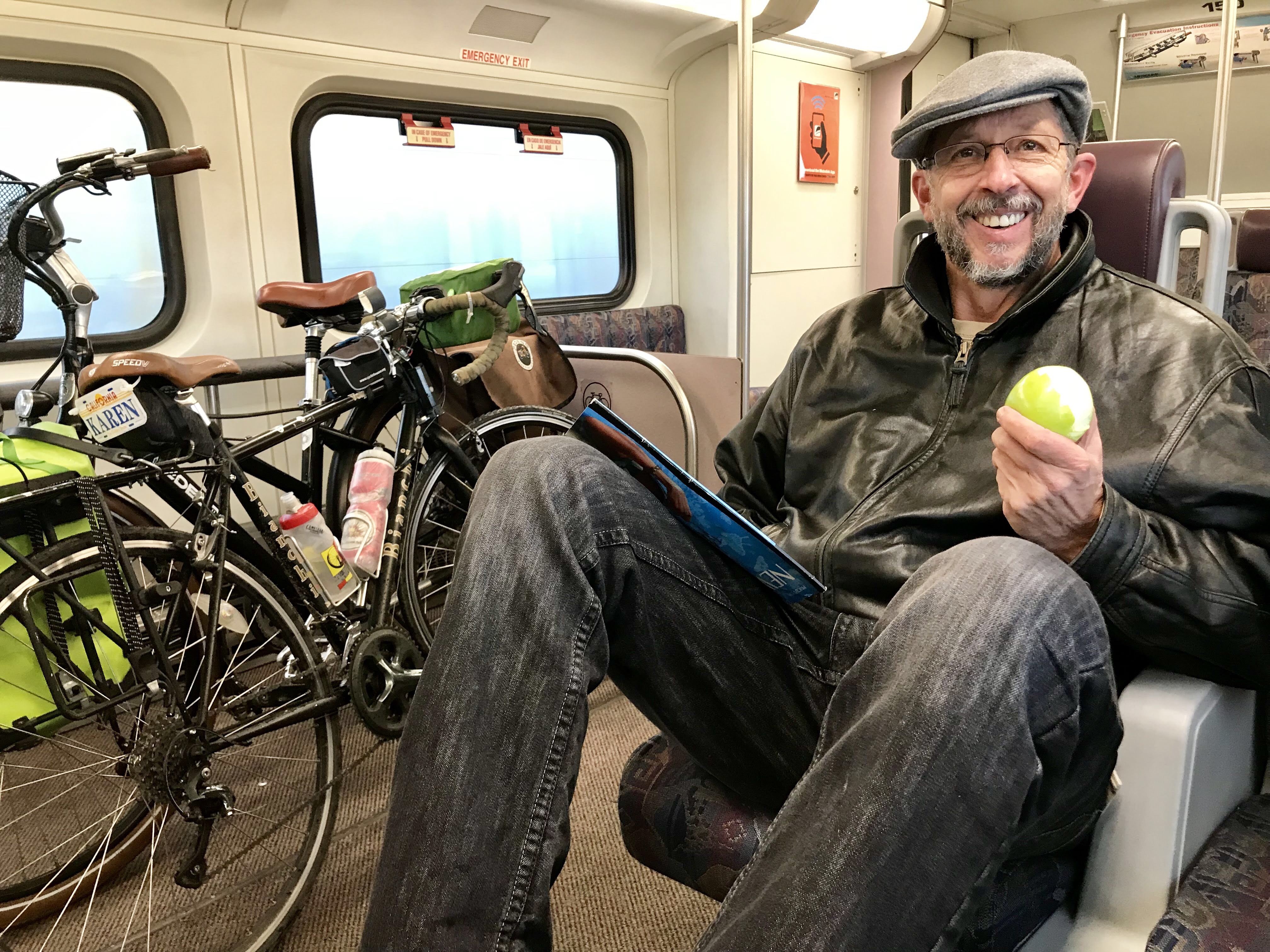
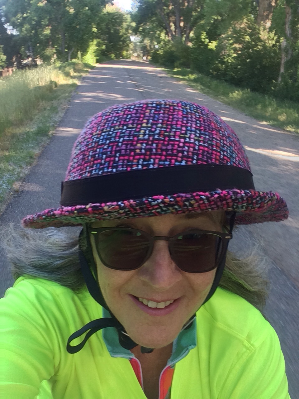
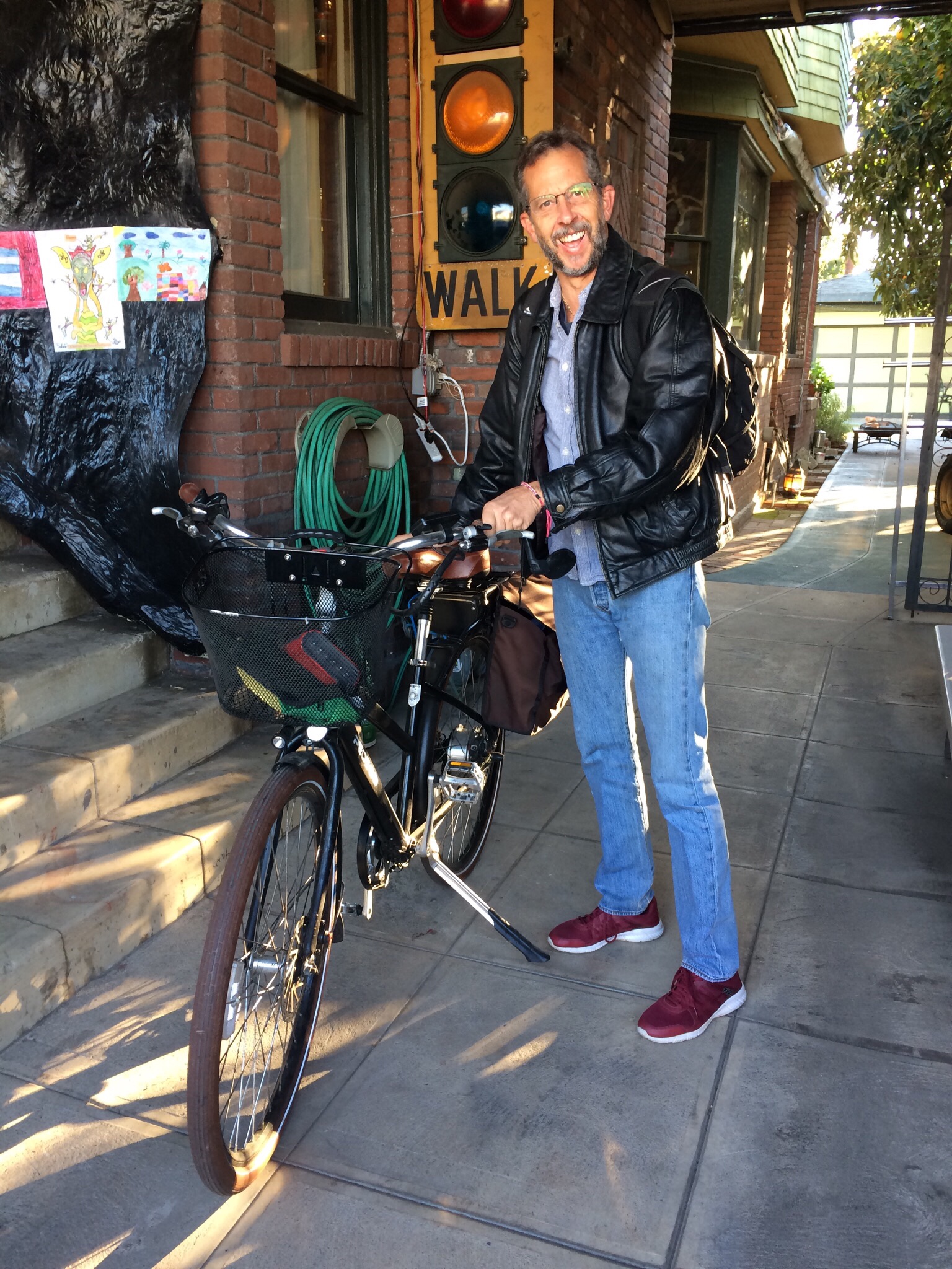
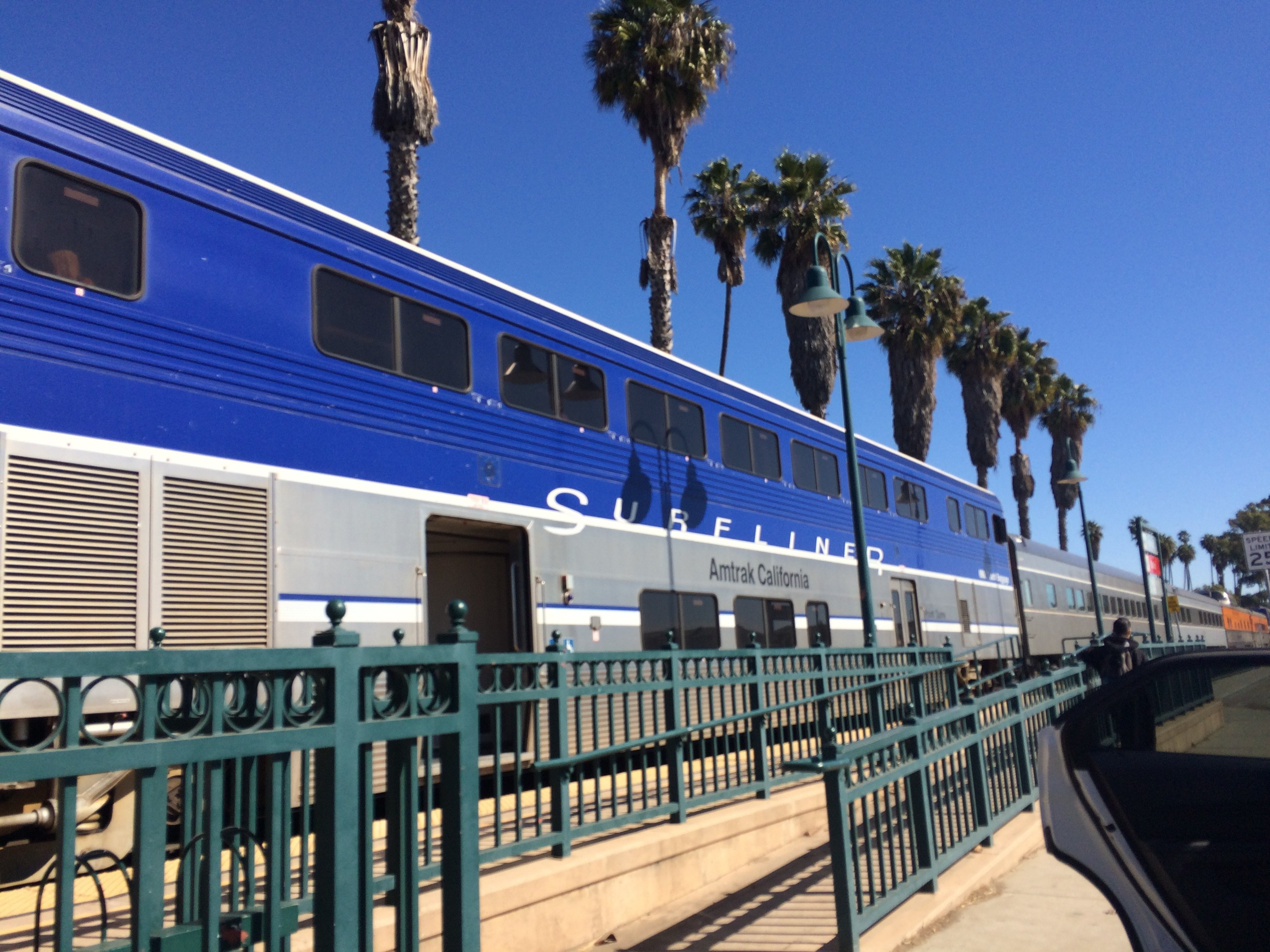
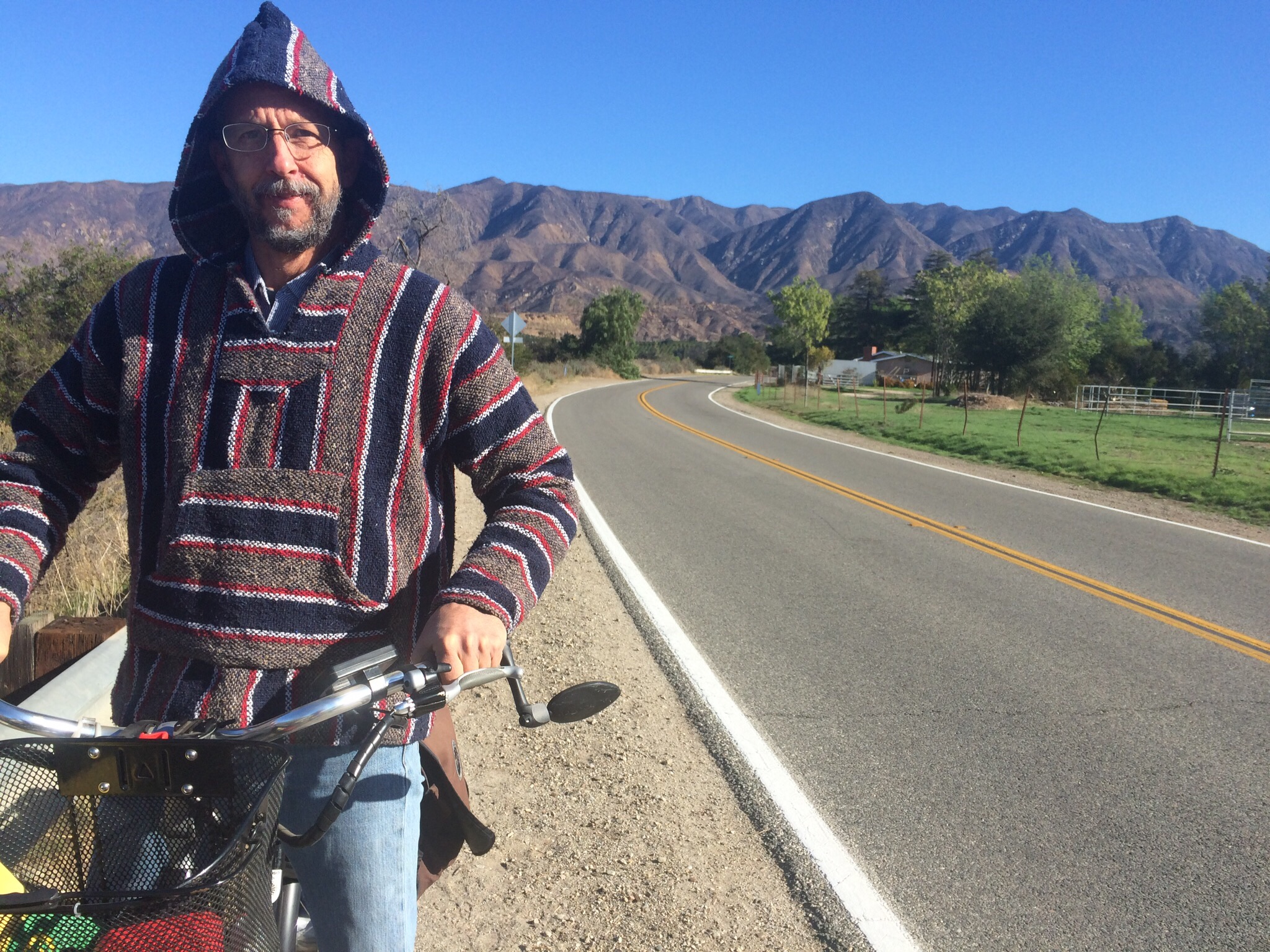
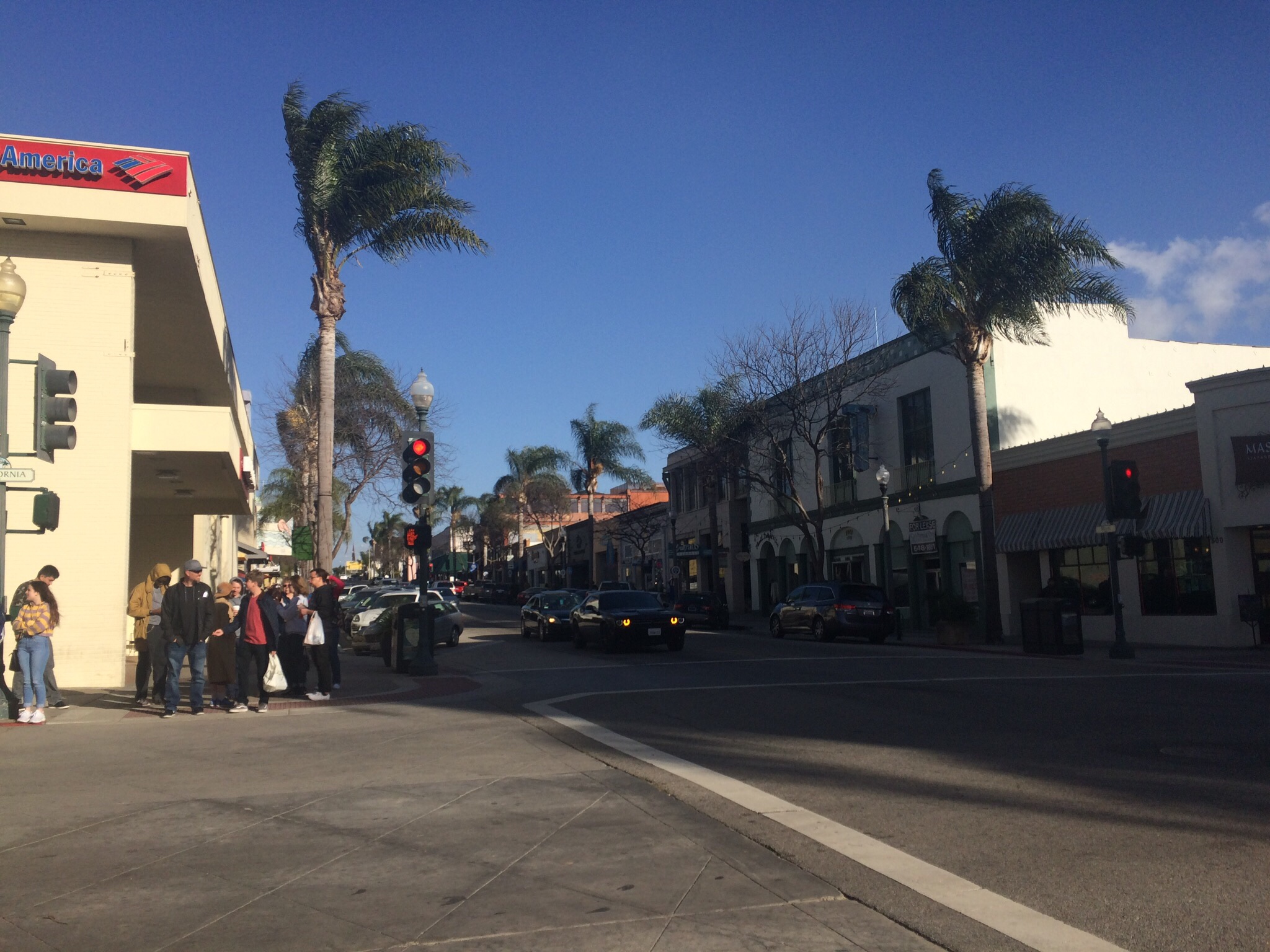
Control No. 1: 10/11/25 Cafe Nido in East Hollywood
Beverage: Pumpkin Mocha (+ chocolate croissant)
Bike: Volpe
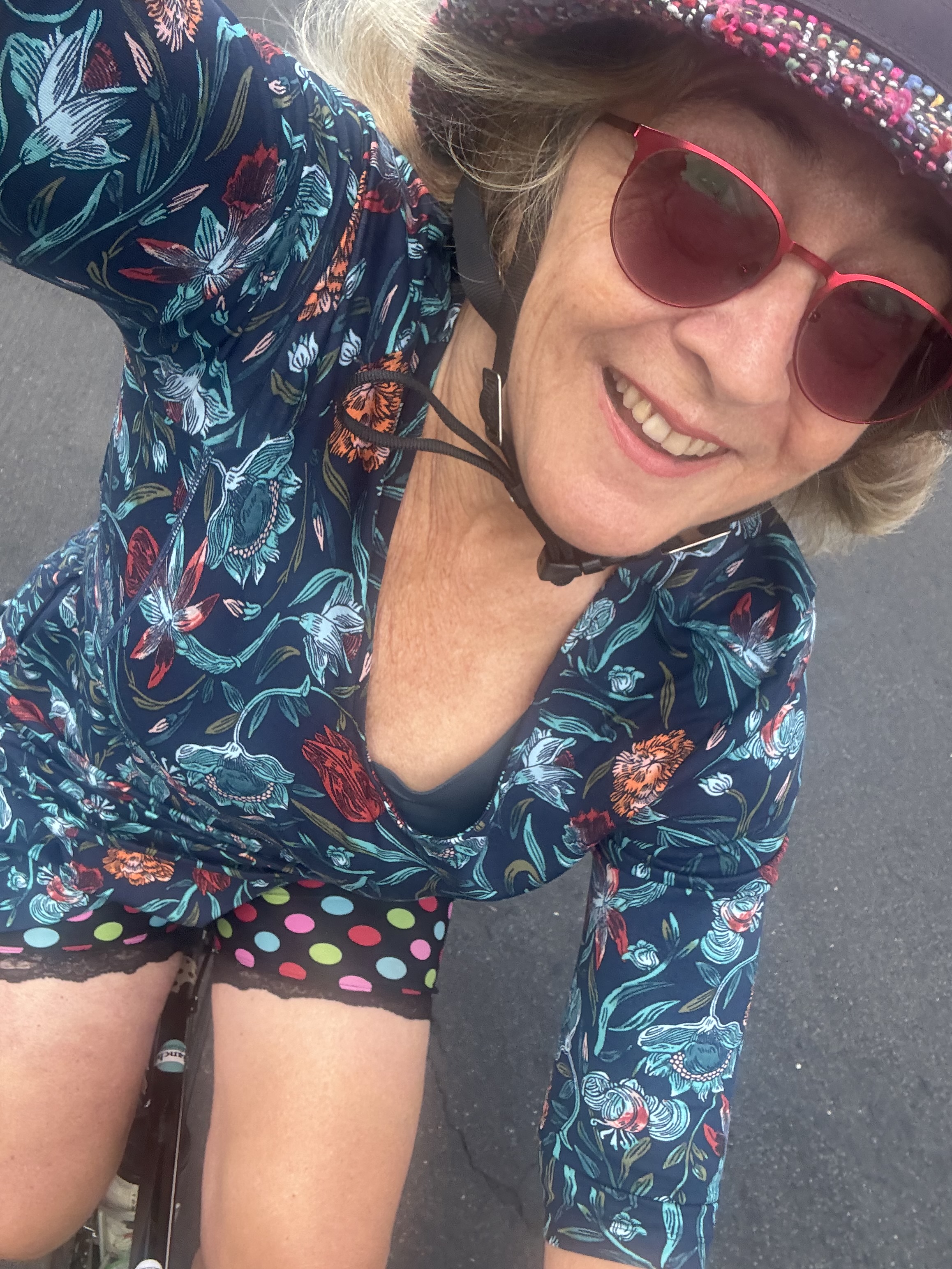
Bloomers: Groovy Tie Dye
C+1: Jennifer
Beauty: Patio seating area features lots of plants & books
Miles: 11.3
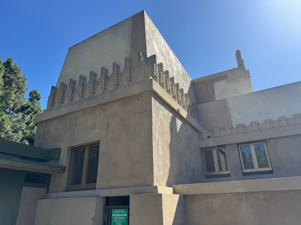
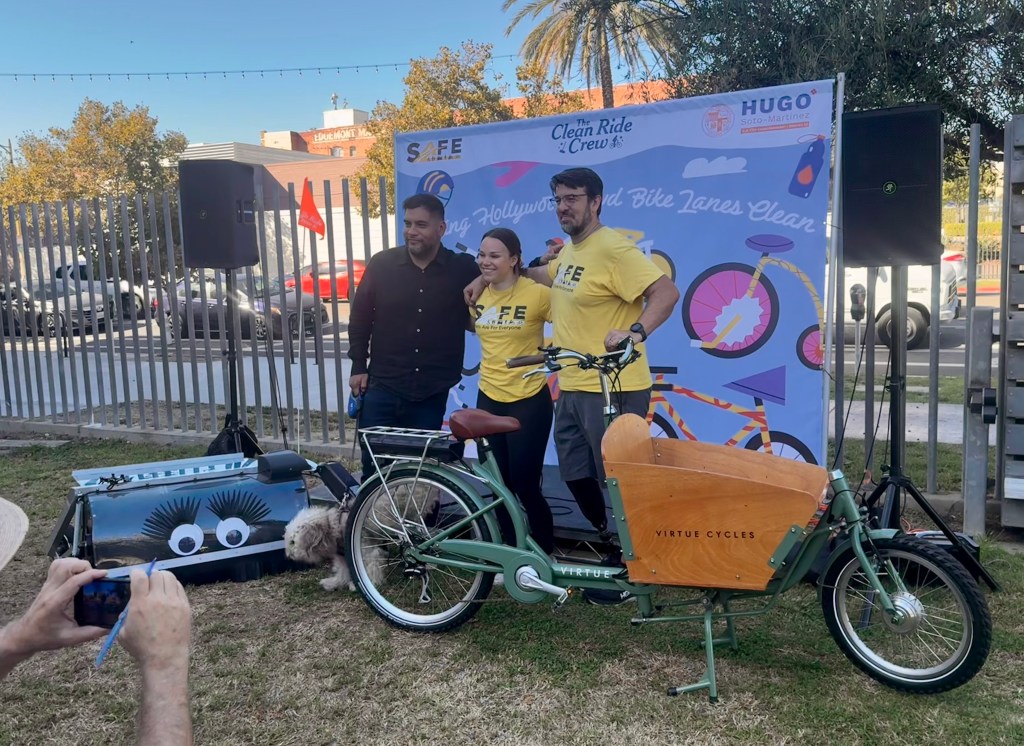
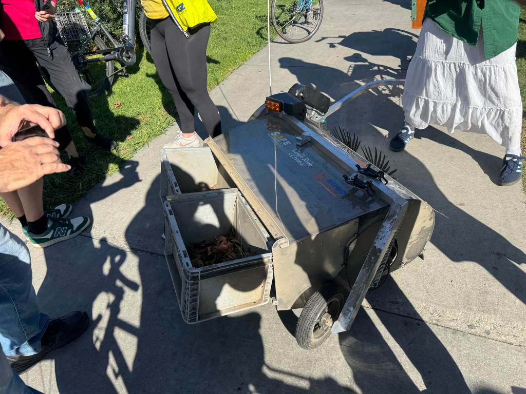
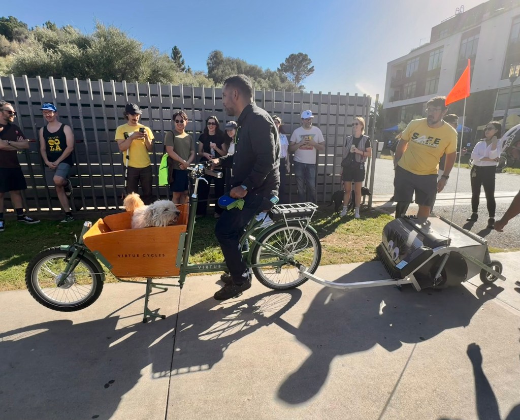
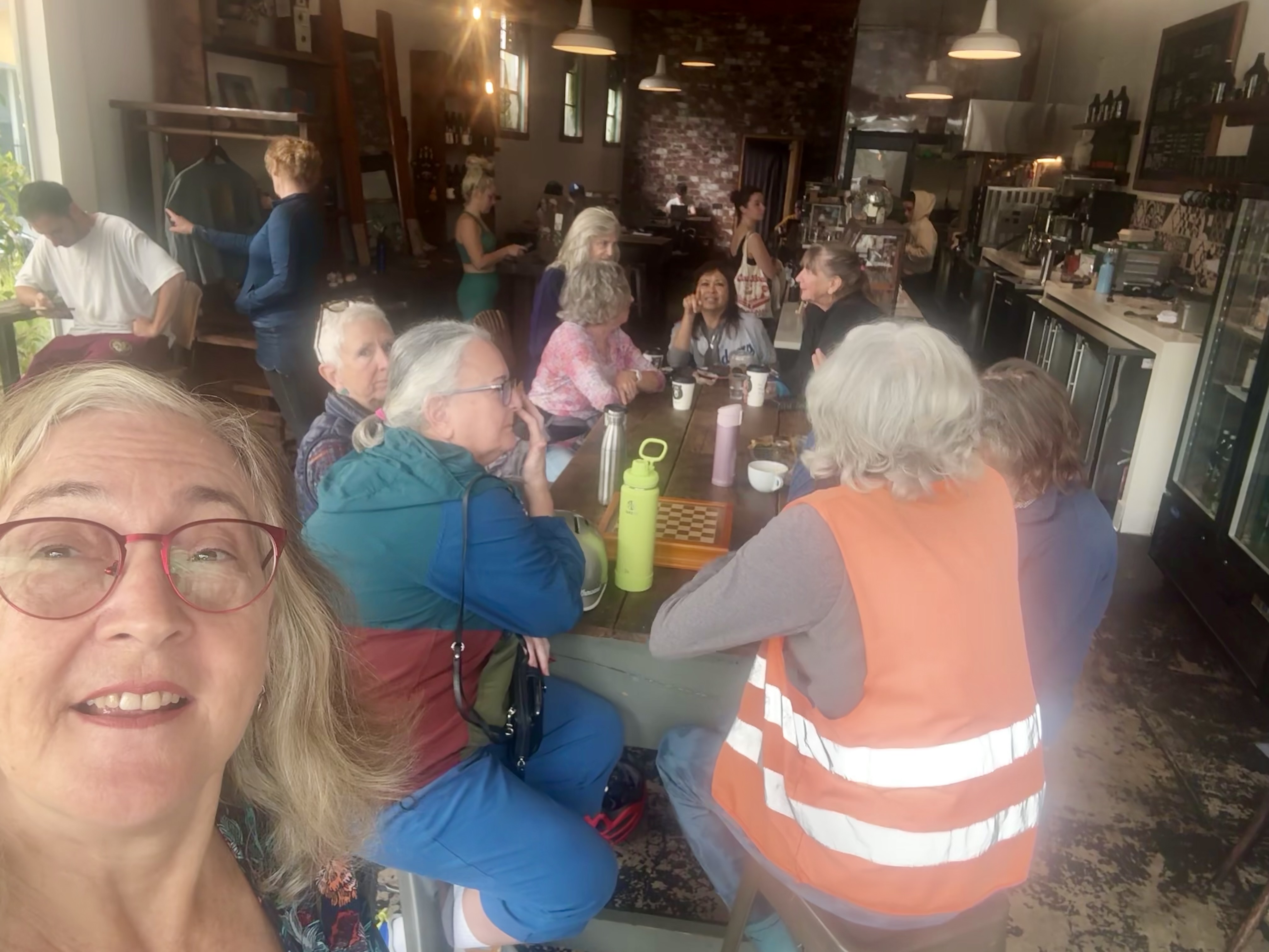
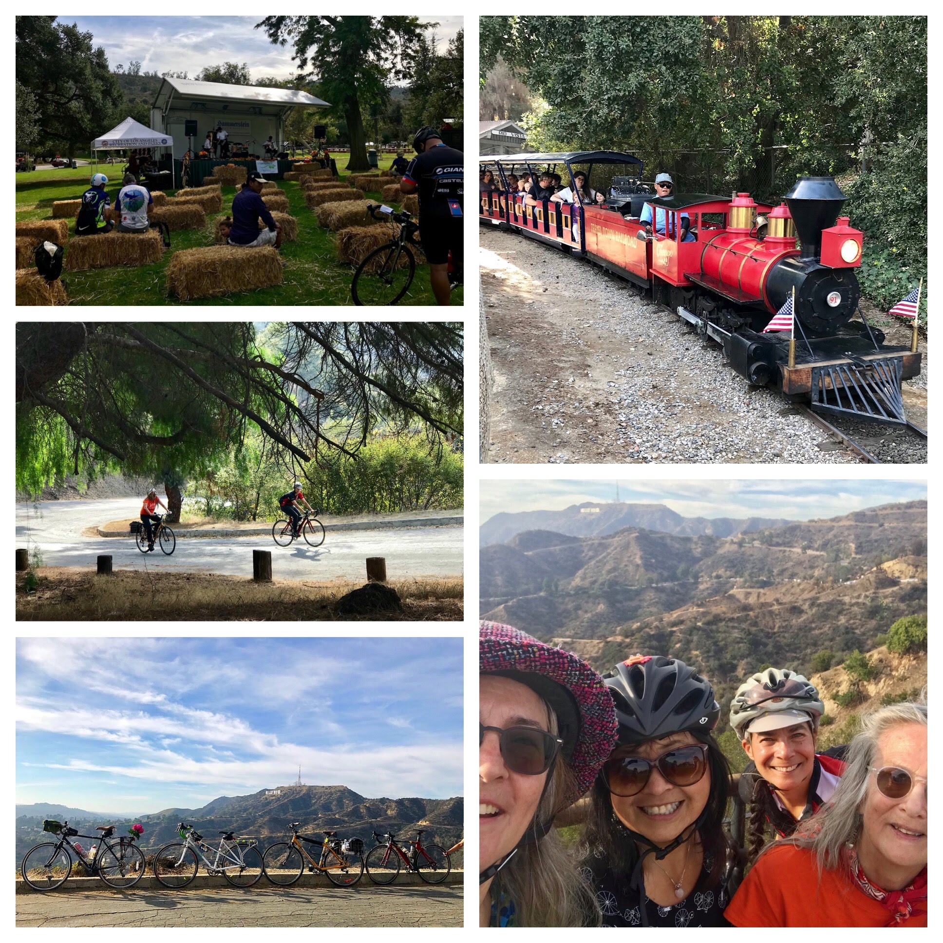
Opening day of the challenge began with a visit to Cafe Nido, which was featured on the Instagram list of most beautiful coffee shops in LA. My friend Jennifer agreed to join me for the experience. We were both planning to attend an event in East Hollywood that day, and Cafe Nido would be on the way. We rolled our bikes into the pretty patio area that is filled with lots of plants and books. I had a pumpkin mocha (delicious) and a chocolate croissant, while Jennifer had the most impressive yogurt cup I’ve ever seen. The patio area is indeed gorgeous and inviting. From there we rode on to nearby Barnsdall Park for the unveiling of a new bike lane cleaner dubbed Sweeping Beauty. In attendance, and honored for having supported this project, was L.A. City Councilmember Hugo Martinez, who has also been a strong supporter of the Hollywood Blvd bike lanes. Since we got to the park at little early, we had time to ride up the hill to take in the views and appreciate the beautiful Hollyhock House, a Frank Lloyd Wright gem that was his first Los Angeles commission and the highlight of Barnsdall Art Park.
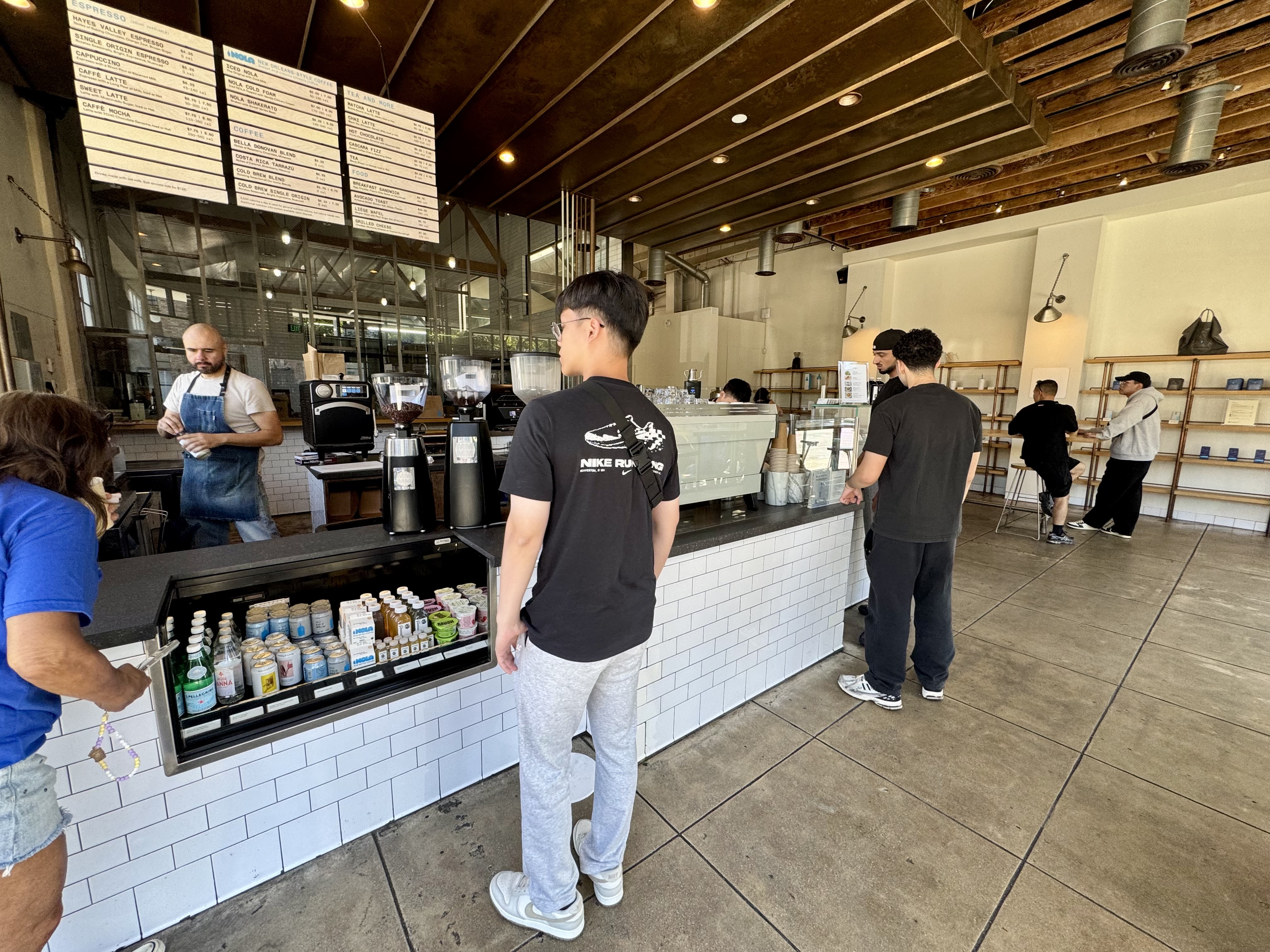
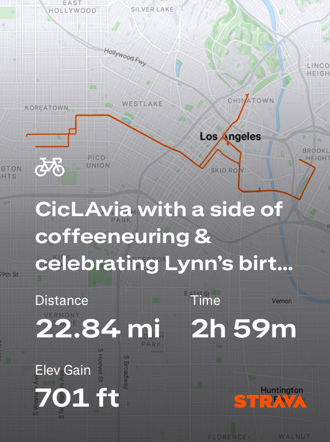
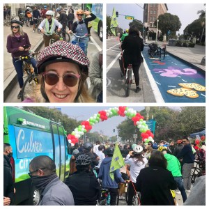
Control No. 2: 10/12/25 Blue Bottle Coffee in the Arts District(downtown Los Angeles)
Beverage: NOLA Shakerato (latte shaken over ice with vanilla)
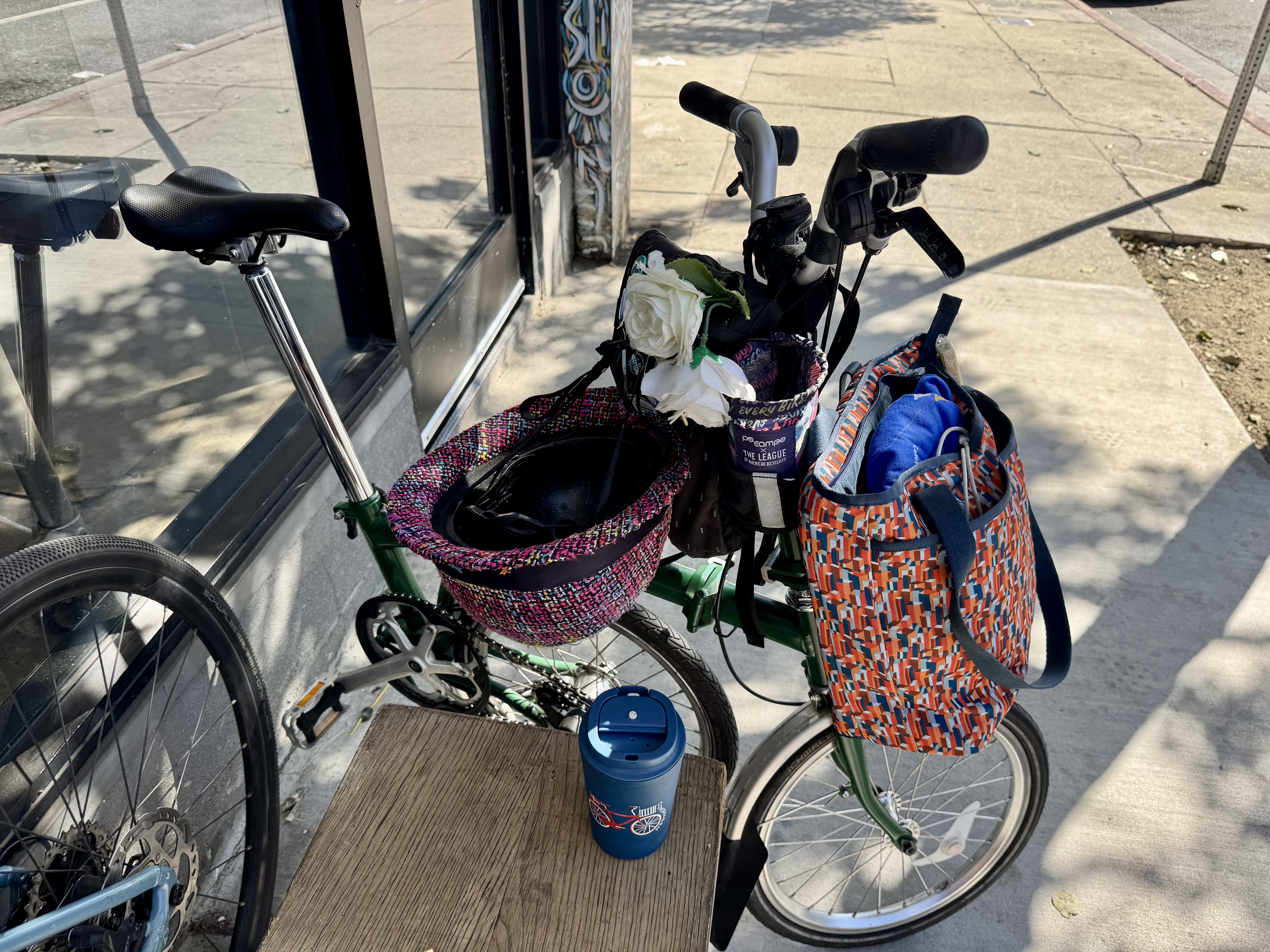
Bike: Brompton
Bloomers: Party Pants
C+1: Joni, Lynn, Jennifer + several thousand Angelenos
Beauty: Car-free streets
Miles: 22.8
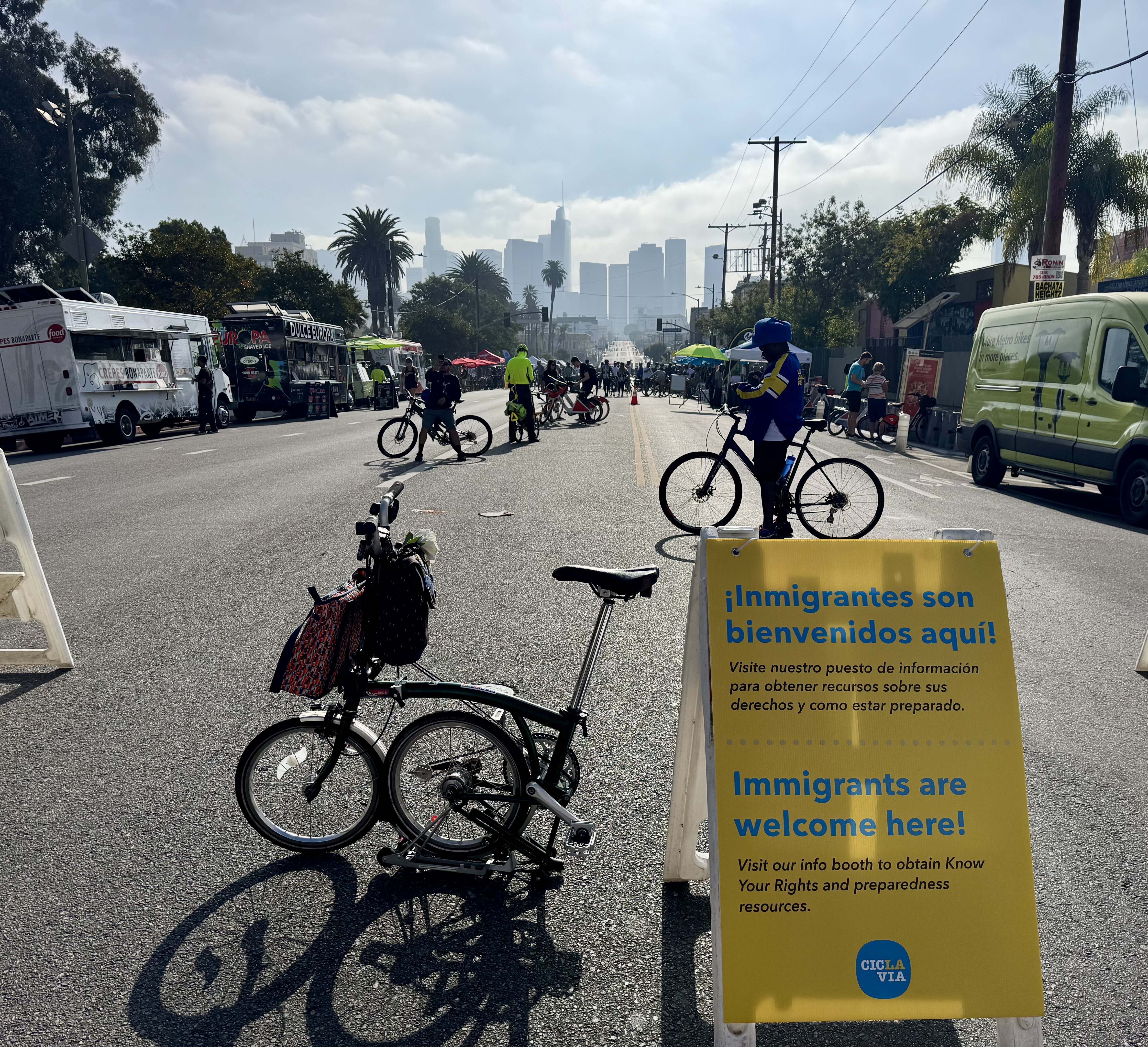
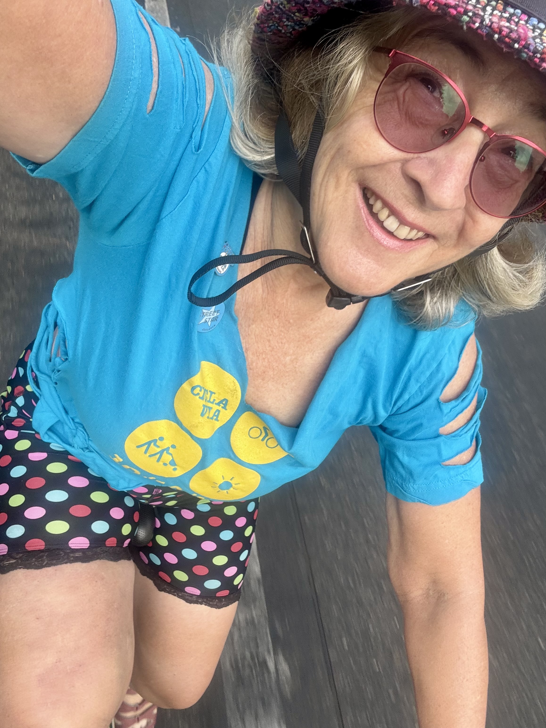
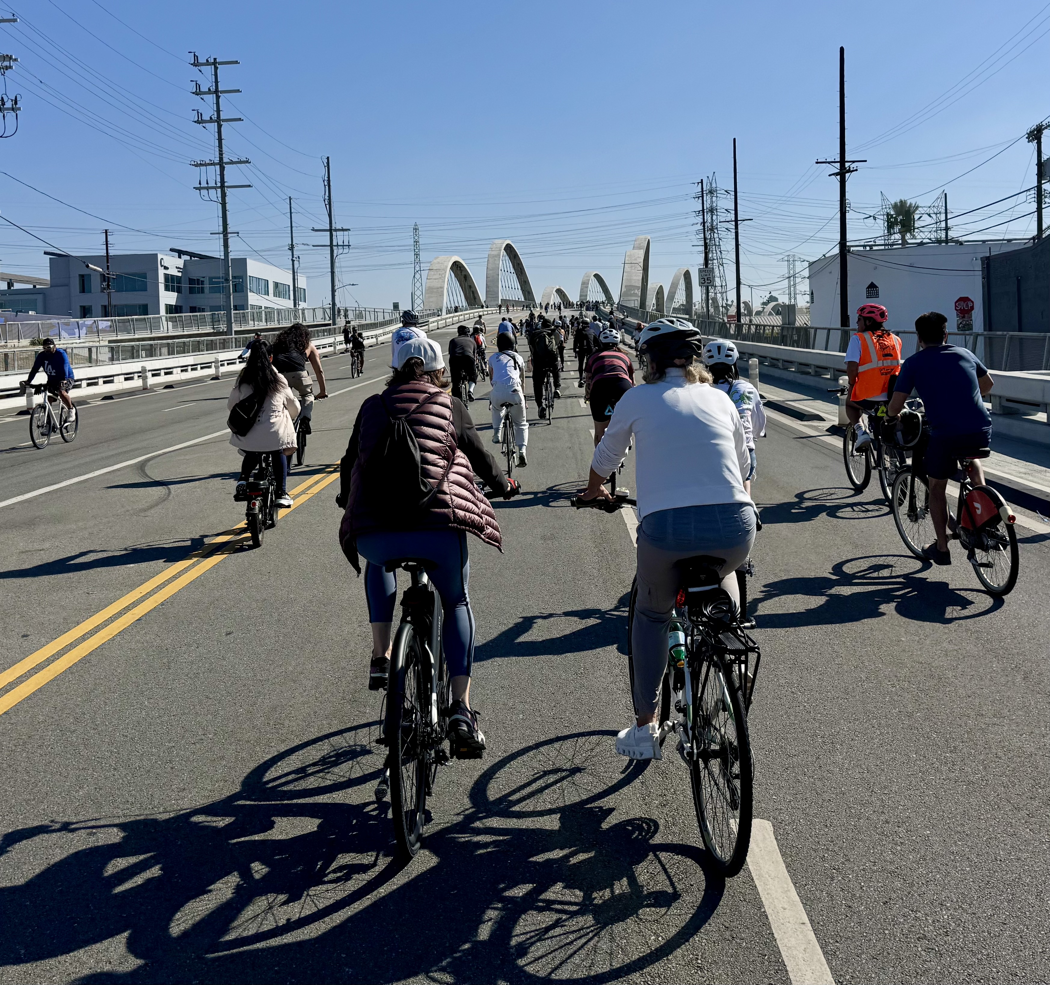
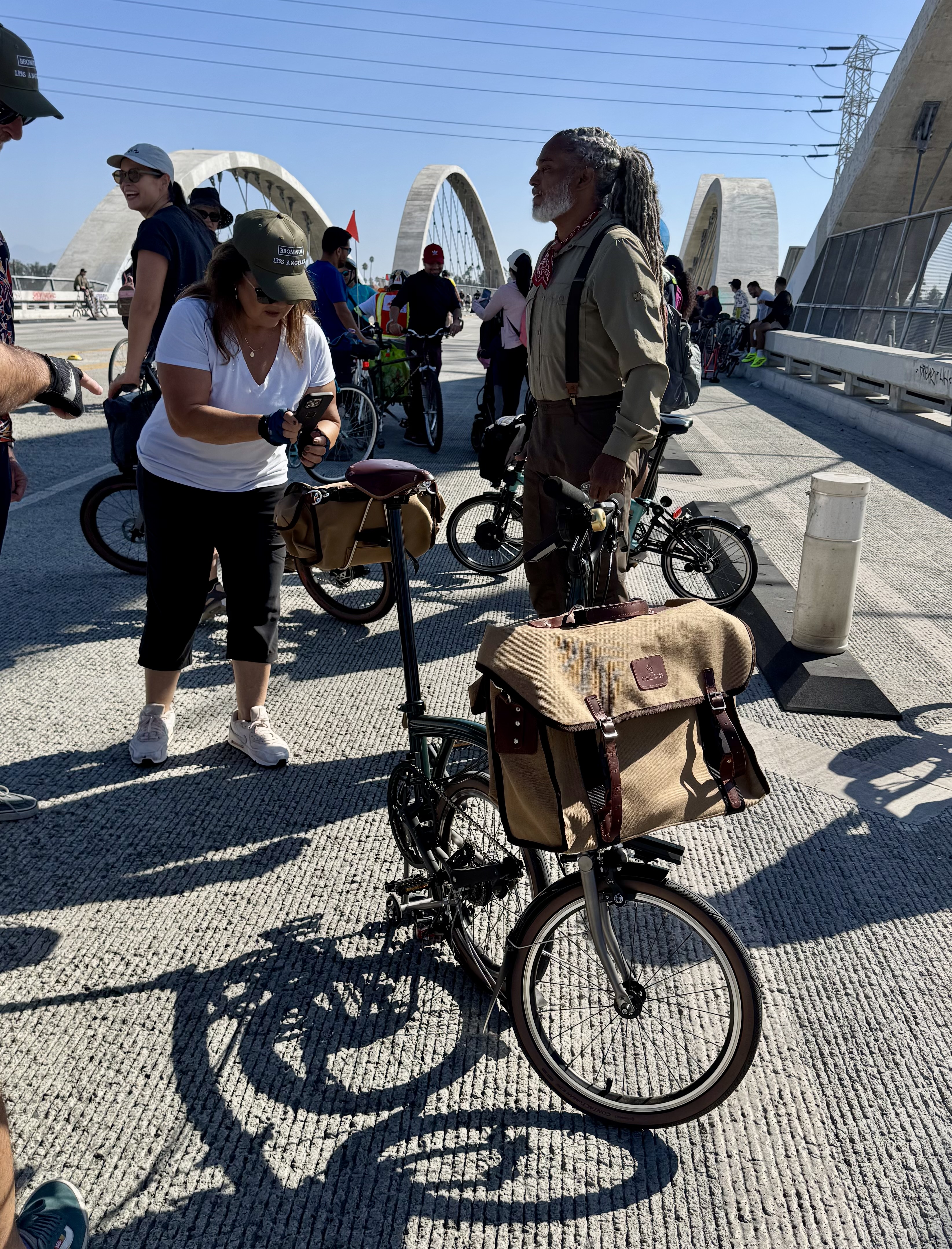
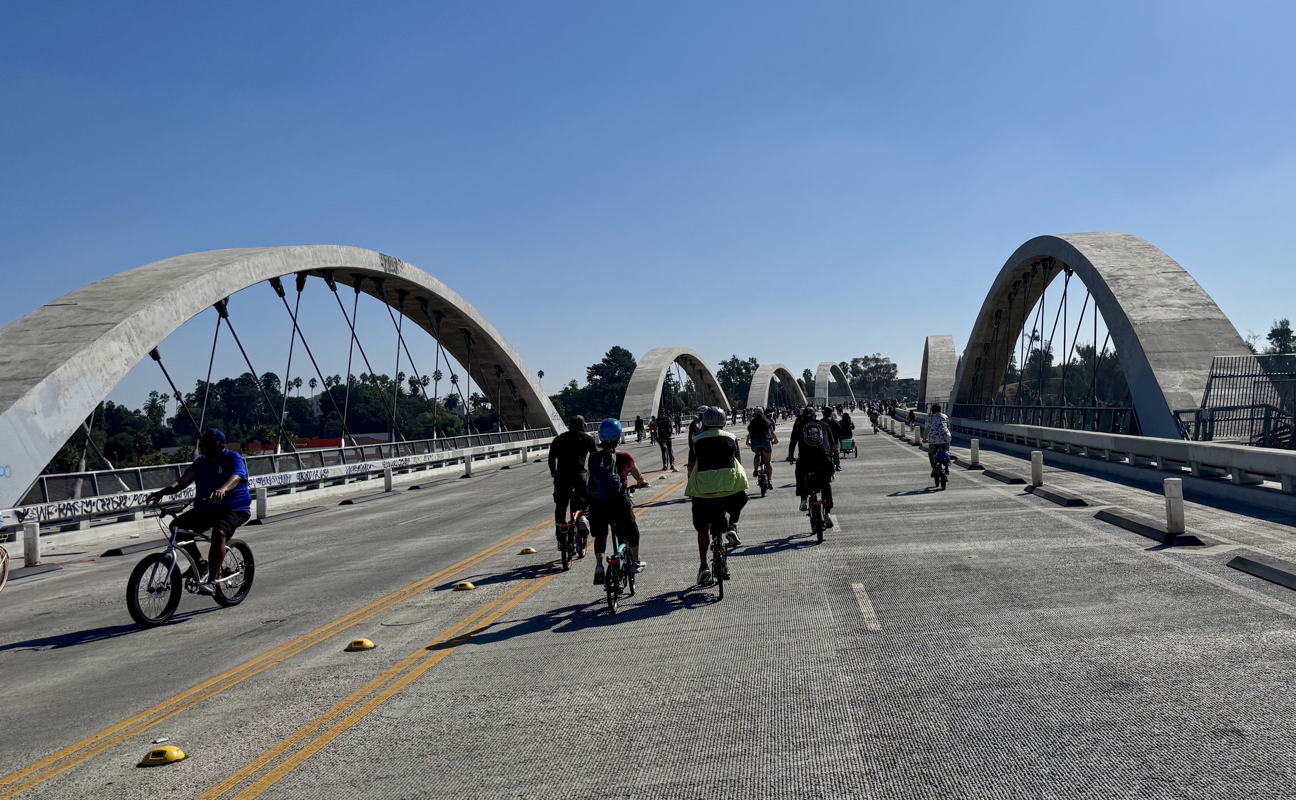
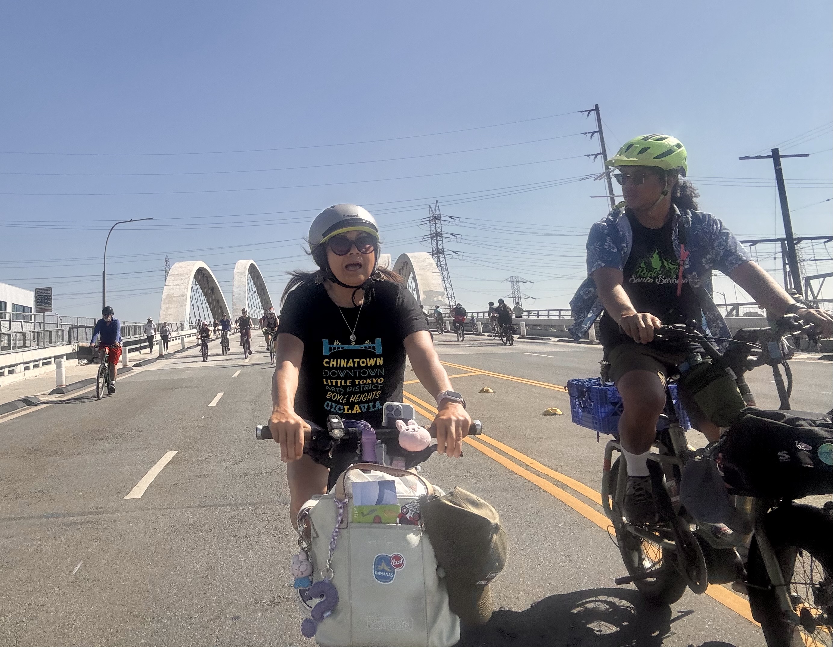
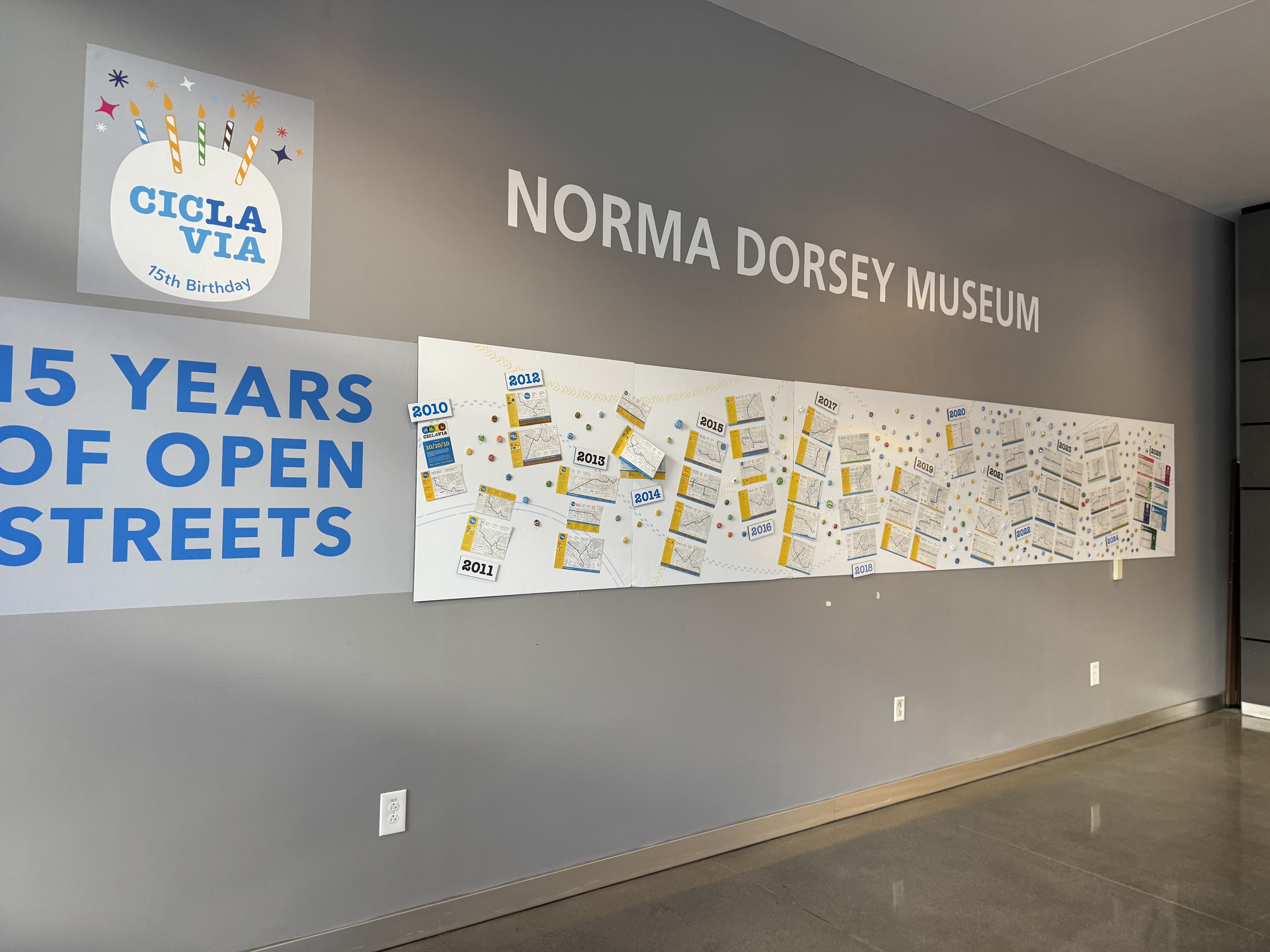
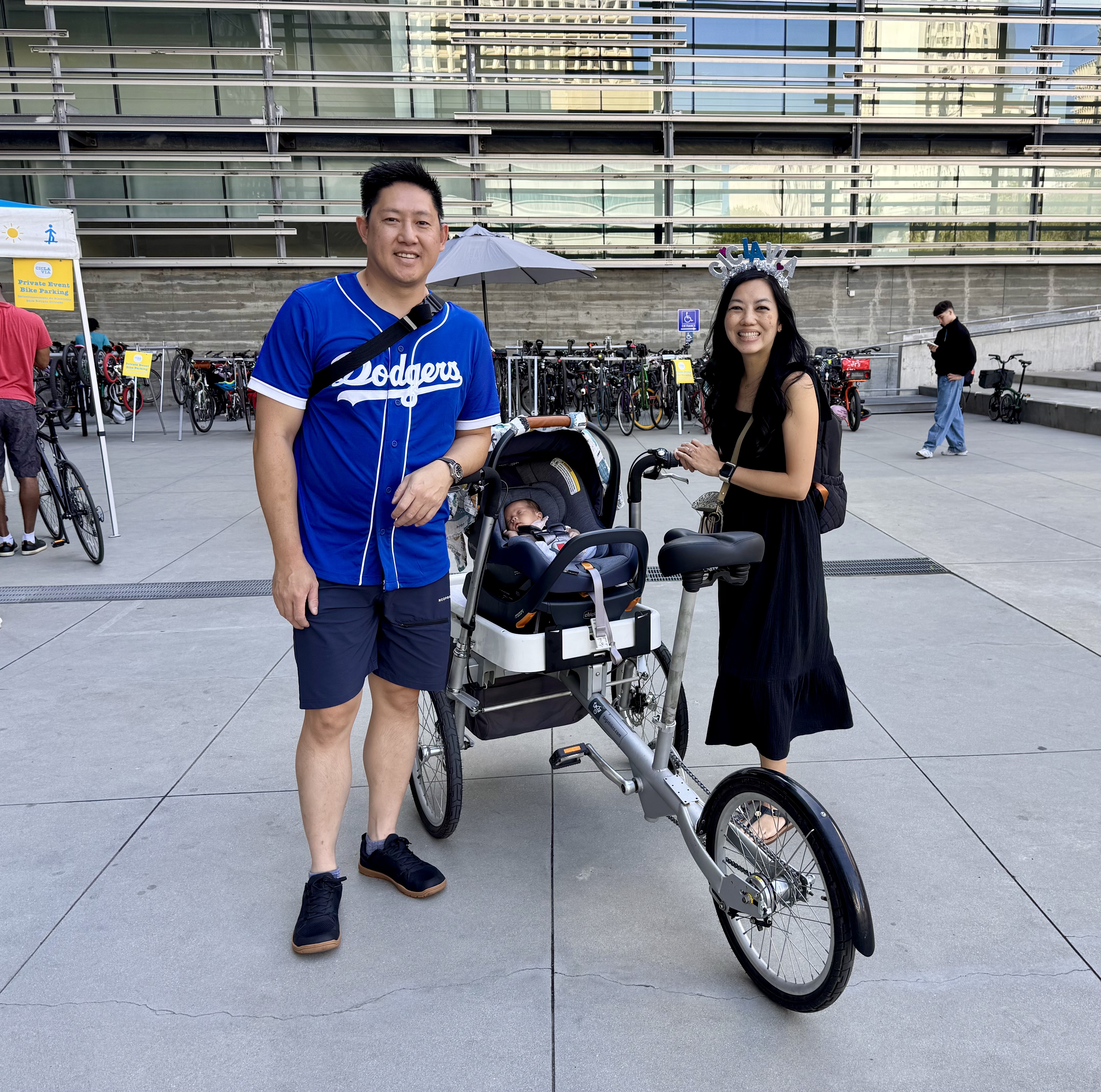
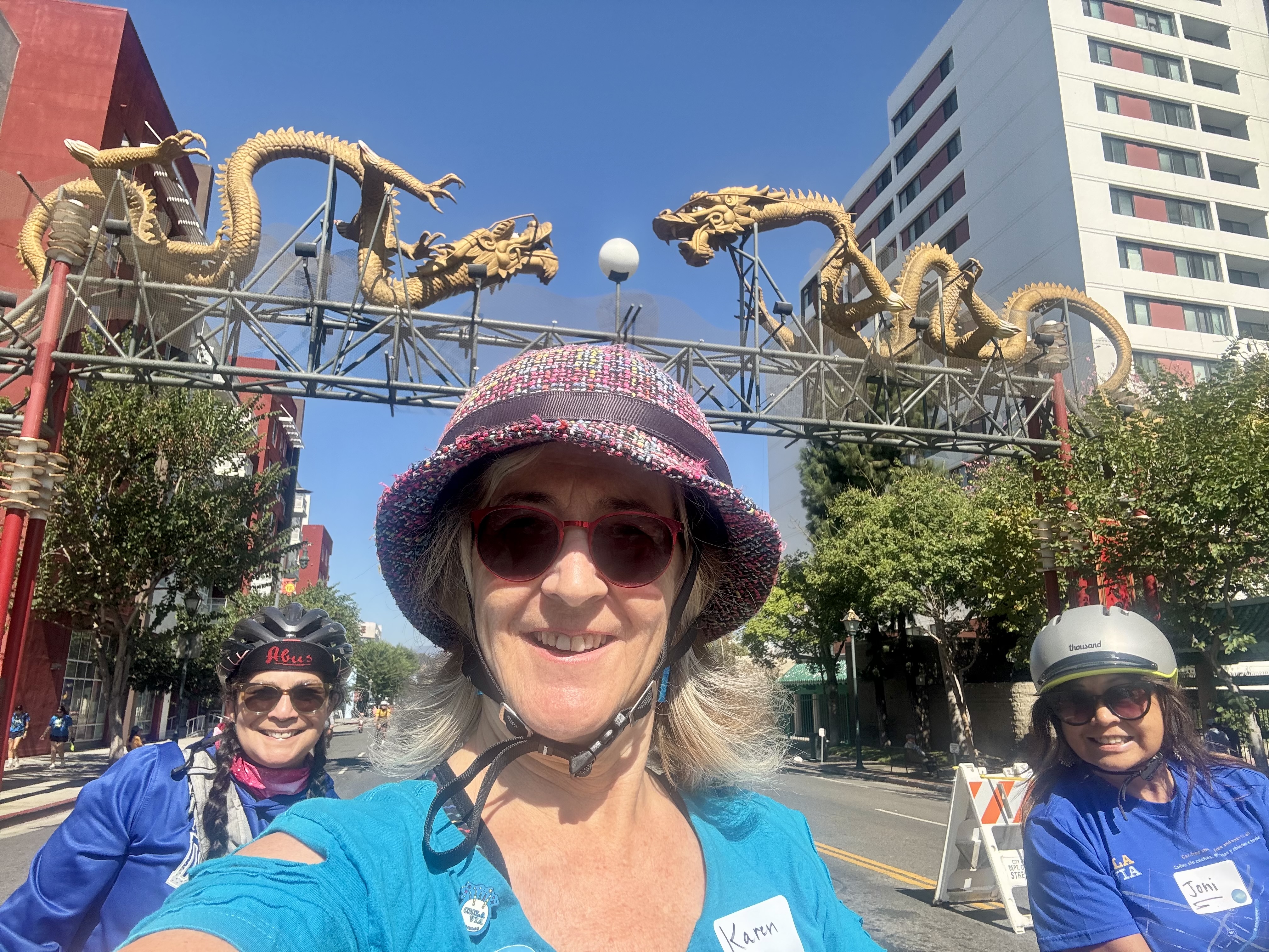
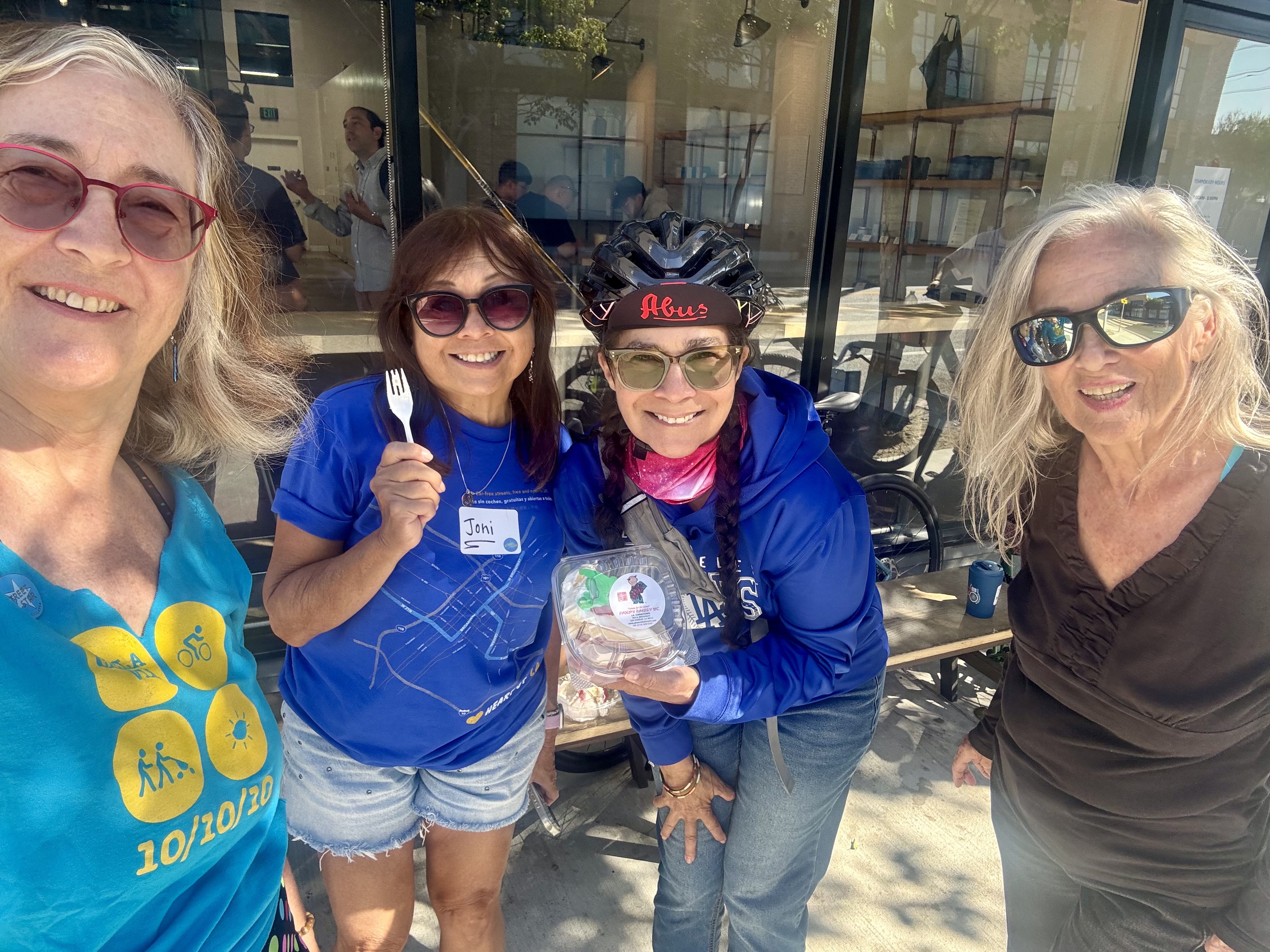
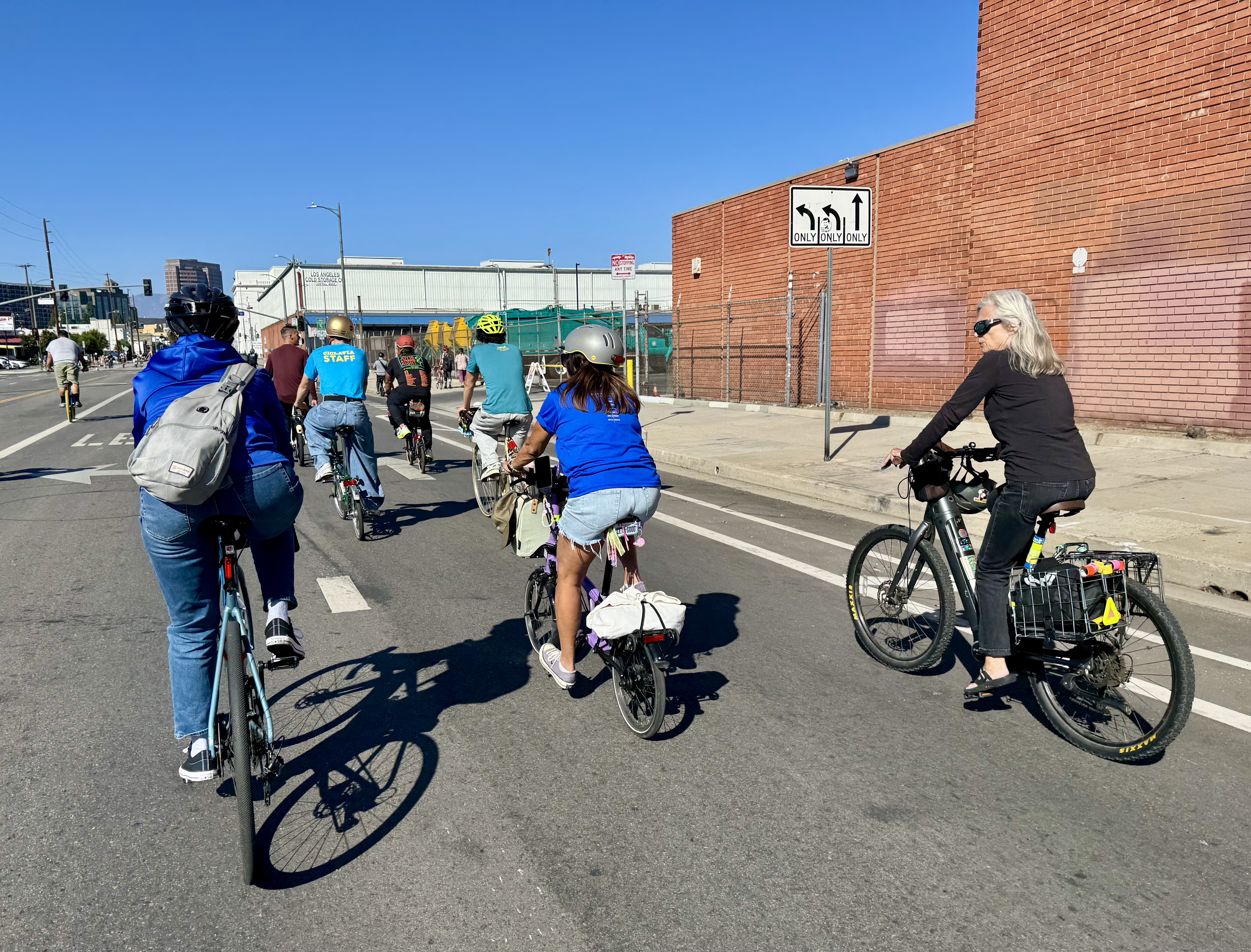
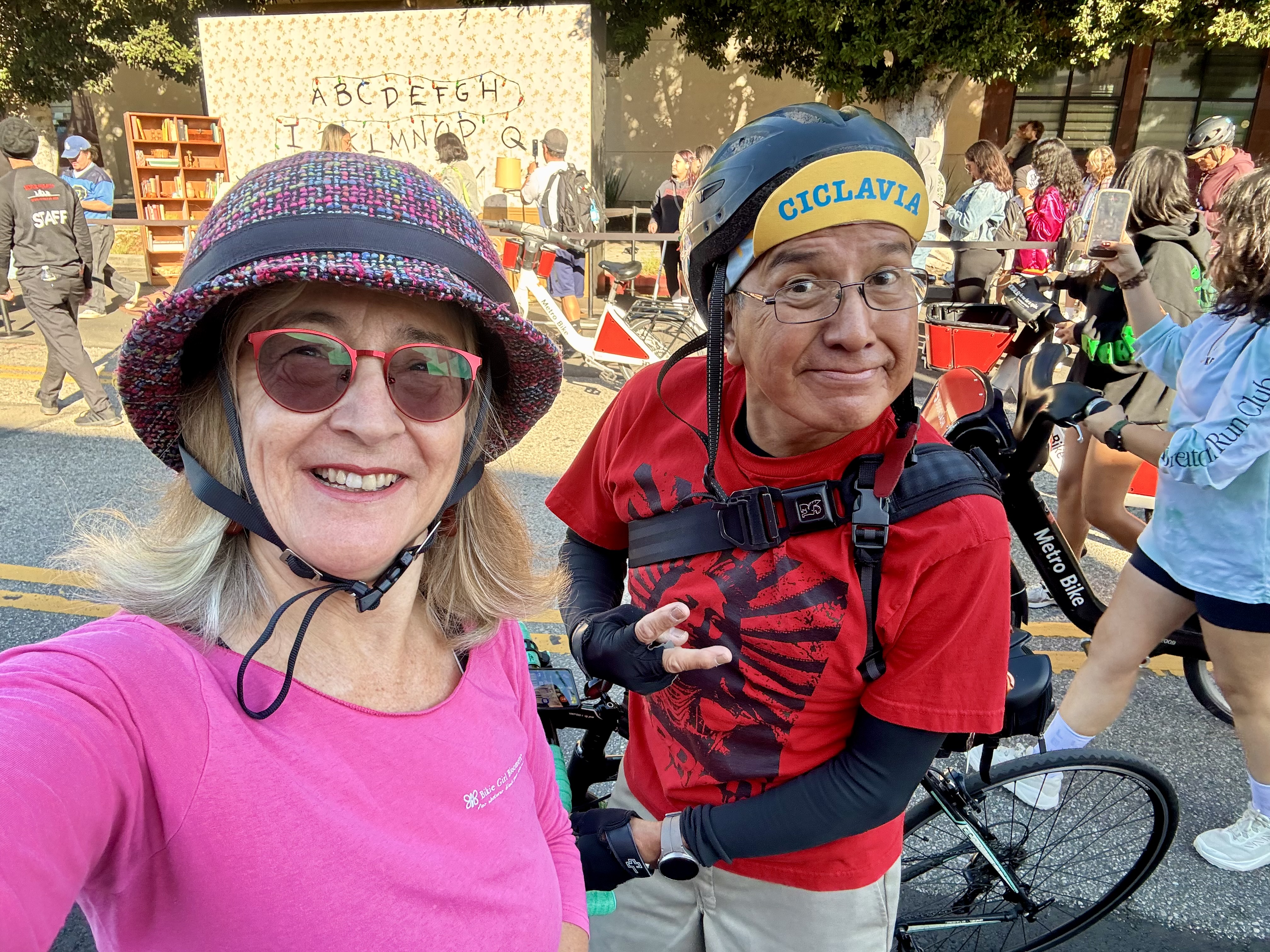
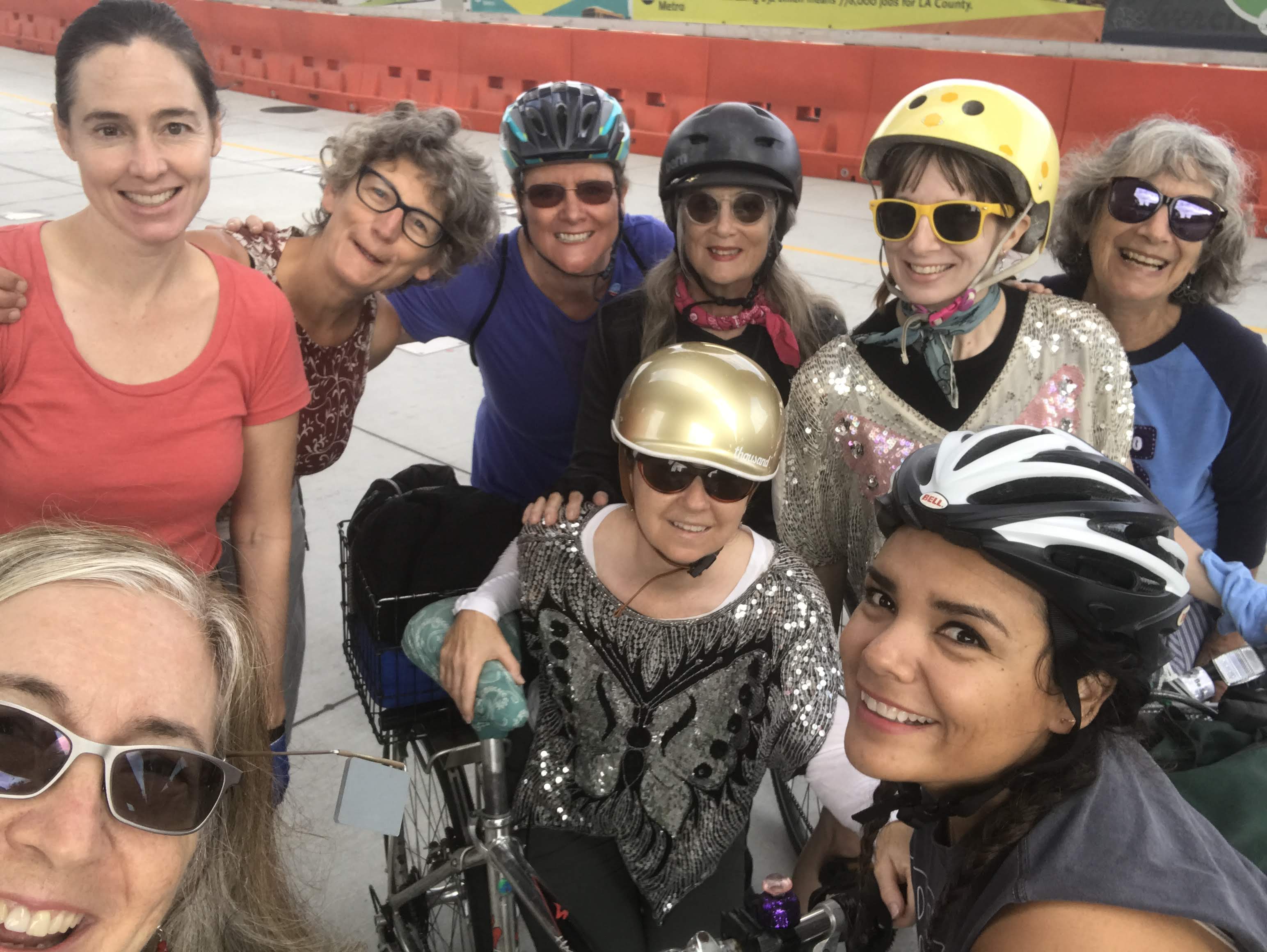
The very next day was another one of L.A.’s iconic open streets events: CicLAvia. Two of my favorite things, CicLAvia and Coffeeneuring are both celebrating 15 years! What an auspicious kickoff weekend for the coffeeneuring season. I celebrated by wearing my Party Pants Bloomers with the tee shirt I have from the very first CicLAvia held on 10/10/10. CicLAvia always means running into my bike friends, and today we got to celebrate a birthday for Lynn. Today’s CicLAvia route (they change to different parts of the city and different routes each time) honored the route of the first CicLAvia, in what is referred to as the Heart of LA route, which centers on downtown, with legs extending out to MacArthur Park to the west, Chinatown to the north, and Boyle Heights to the East.
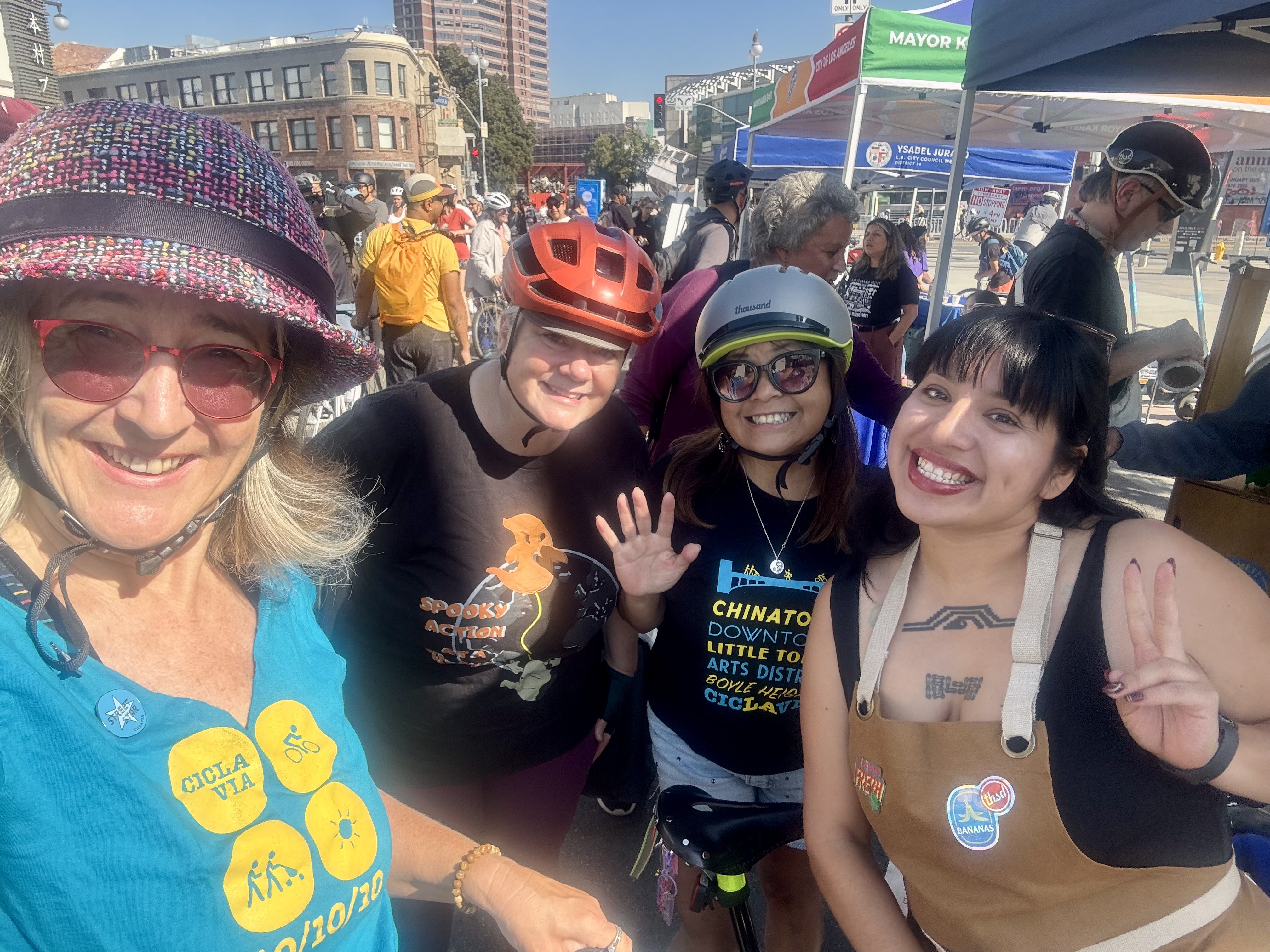
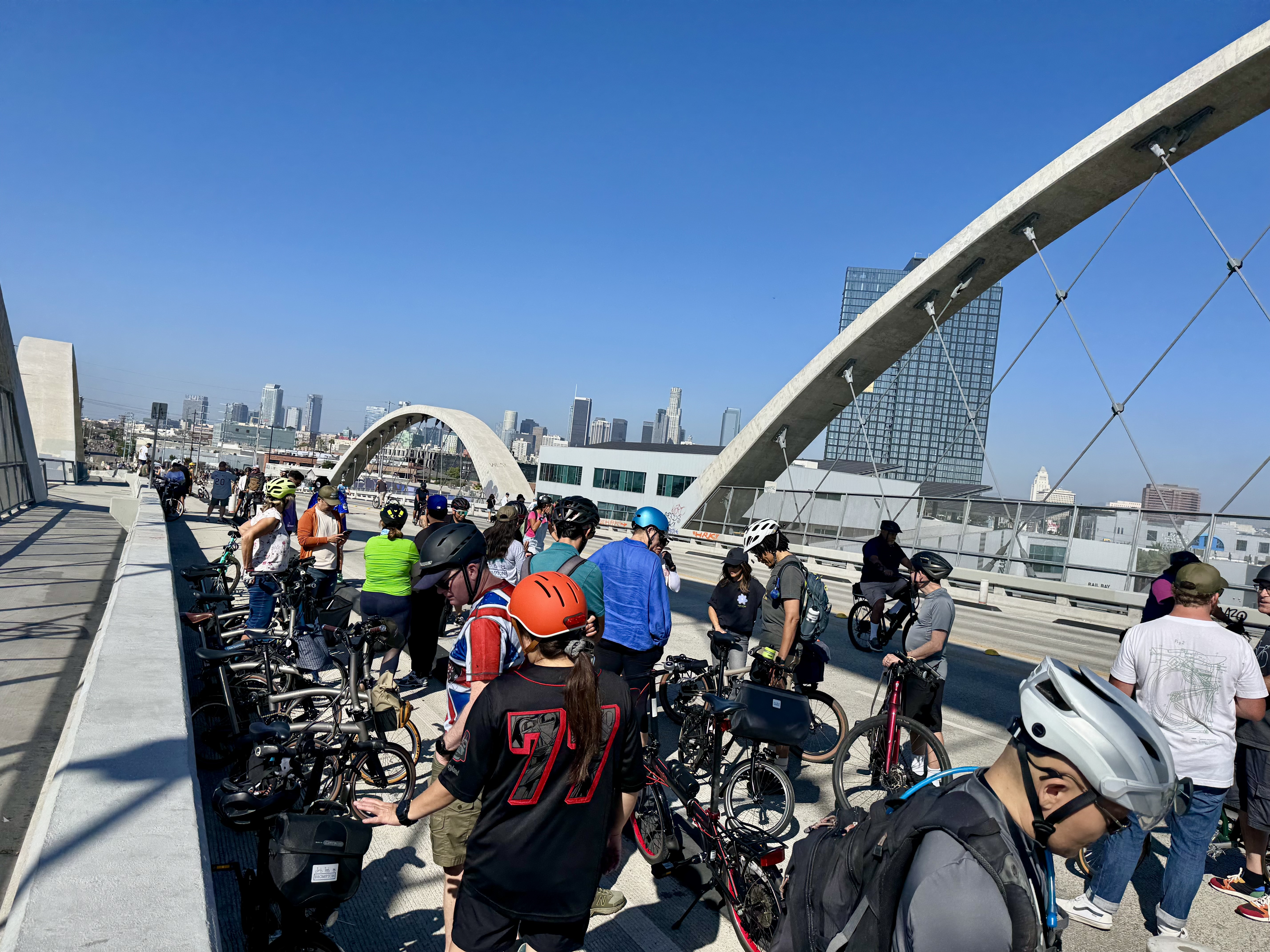
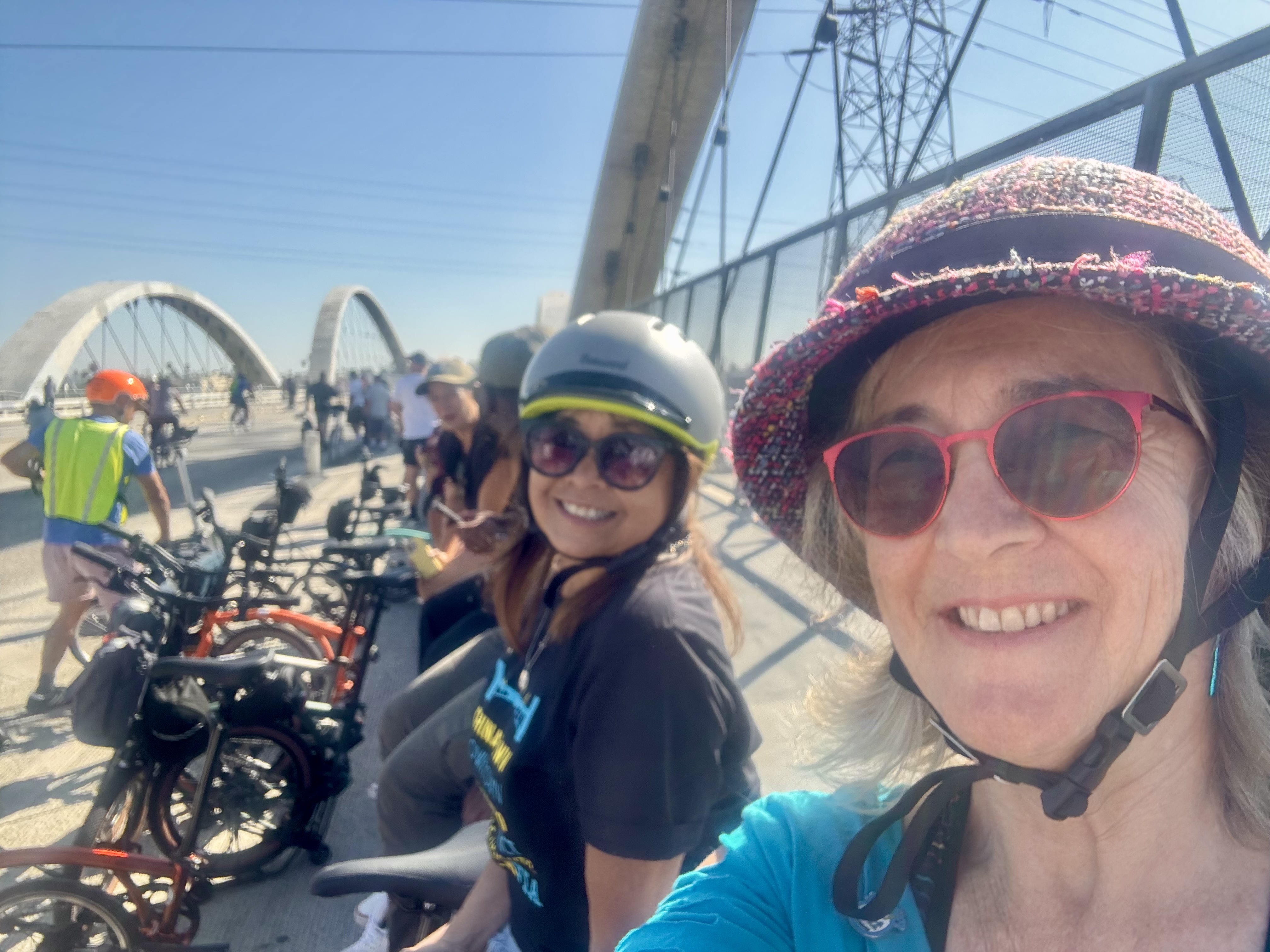
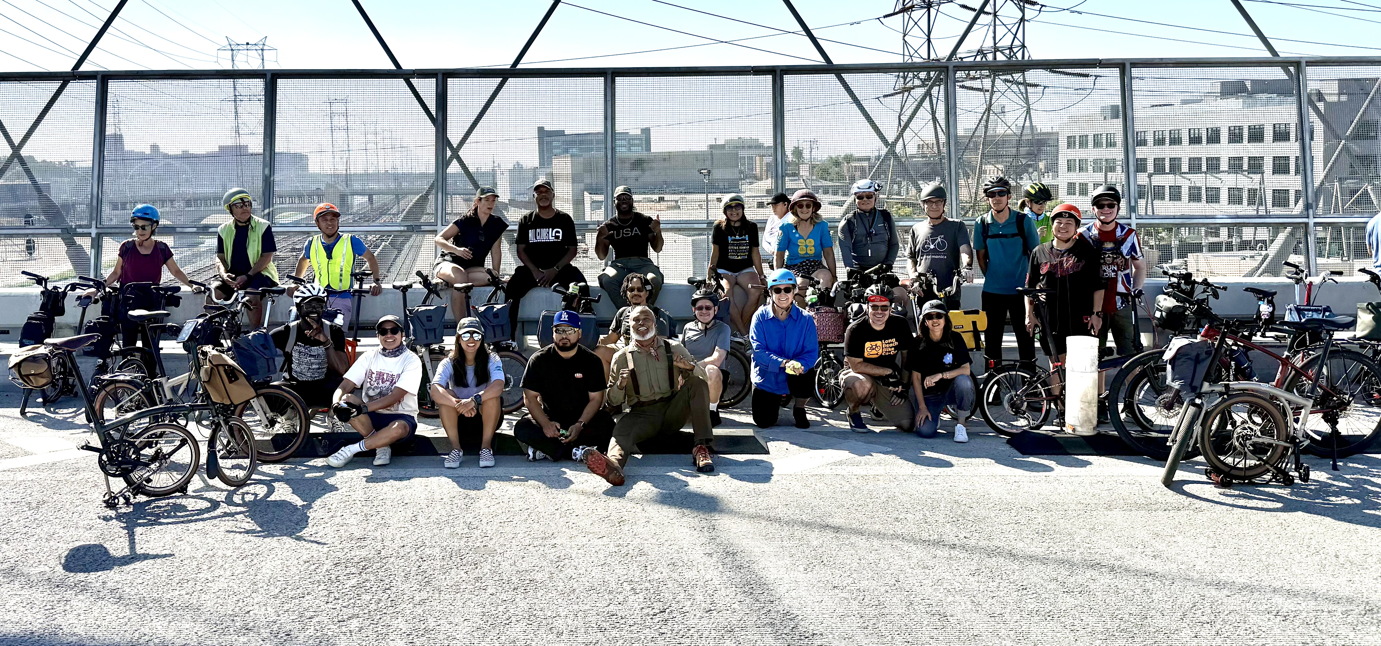
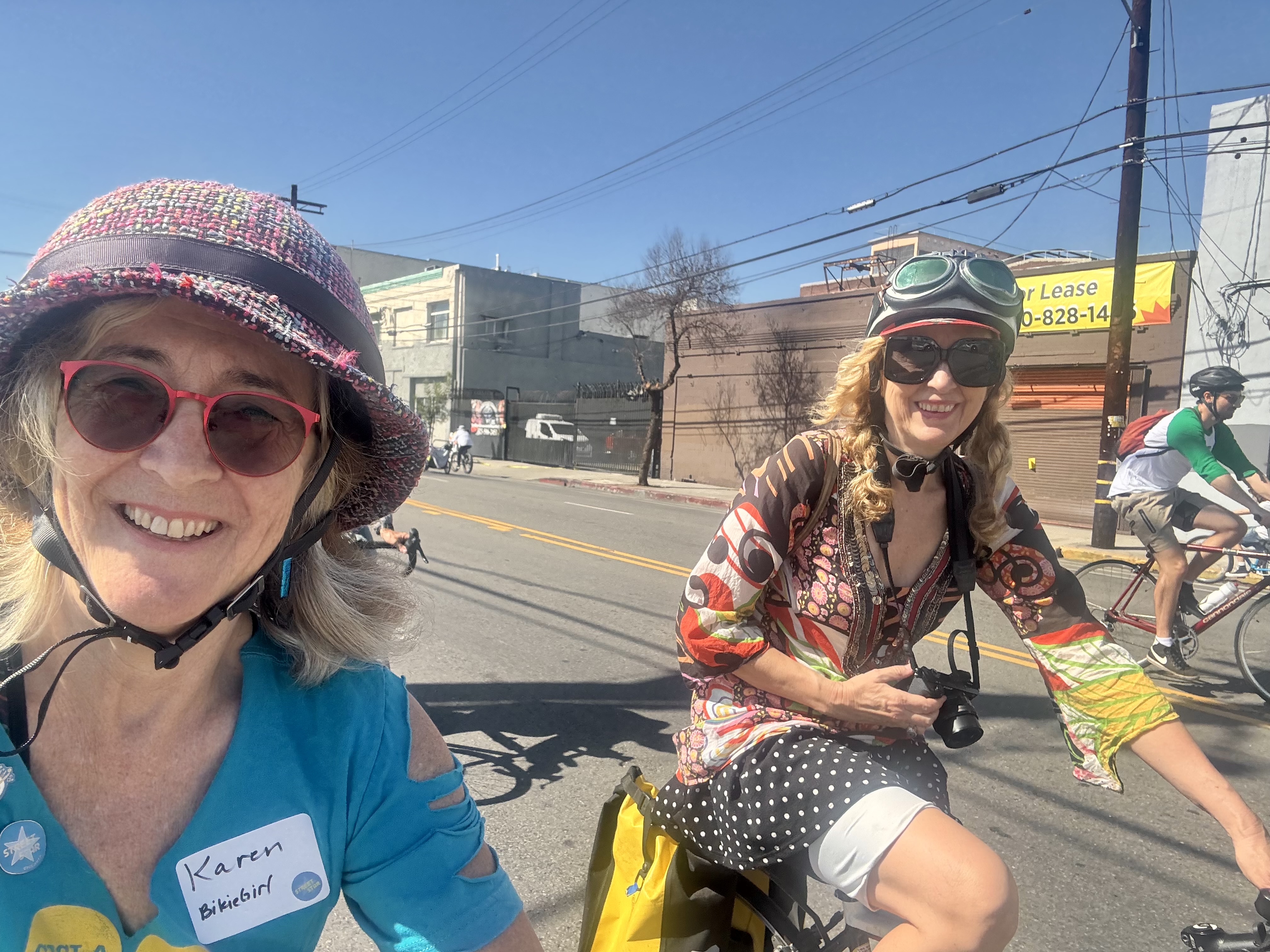
I hopped on the course at MacArthur Park and quite soon saw a large group of folks on Bromptons. I realized this must be the organized Brompton group that often rides together at CicLAvia events. I don’t always ride my Brompton for these events, but this time I did. I spotted my Brompton-owning friend Joni and she encouraged me to partake of the provided coffee and pastries, but it looked like the good stuff had already been taken. I did ride with the group into downtown where we participated in a group photo on the 6th Street Bridge. It was an impressively large group. One Brompton was drawing a lot of attention, the specially outfitted one ridden by Eric Cedeño, also known as the Bicycle Nomad. He is a fun one to follow on Instagram.
From there, we rode on into Boyle Heights and then doubled back through downtown and joined the CicLAvia “Street Stars” (what they call their monthly donors) for a special celebratory lunch in the courtyard of the CalTrans building. The building has a small museum space off the courtyard that was displaying memoribilia from the 15 year history of CicLAvia events. It’s always fun to hang with bike friends at the Street Stars lunches, but it was especially sweet this time to meet the newest BikieGirl, the baby daughter of one of the most elegant cyclists I know, Serena Liu, a transportation planner with CalTrans. It was also cool to see the cargo bike set up her husband had created for carrying their baby.
After lunch, we followed the Chinatown leg of the route. There we stopped at a bakery to pick out cake to celebrate Lynn’s birthday. And because I was wanting to visit Zinc Cafe and the Arts District (it was on the Instagram list of beautiful coffee places AND it was very close to the CicLAvia route), we had planned to meet (Joni, Jennifer, Lynn and me) there. Along the way, I rode alongside Carolin Kewer, the creative force behind the legendary Art Crash rides that used to happen from time to time in the pre-COVID era. She is one of my favorite examples of a woman who knows how to ride in style!
Unfortunately, Zinc did not appear to be a place where we could bring in our own cake, so we opted instead for the nearby Blue Bottle Coffee, which has a bench along the sidewalk out front. I had to try their intriguing NOLA Shakerato (a latte shaken over ice with vanilla), and we had us a beautiful time enjoying our beverages and Lynn’s birthday cake right there. I will have to save Zinc for another day.
C+1: Spirit of Coffeeneuring (as in alone, but not lonely)
Beauty: Old-timey arcade + scenic route
Miles: 37
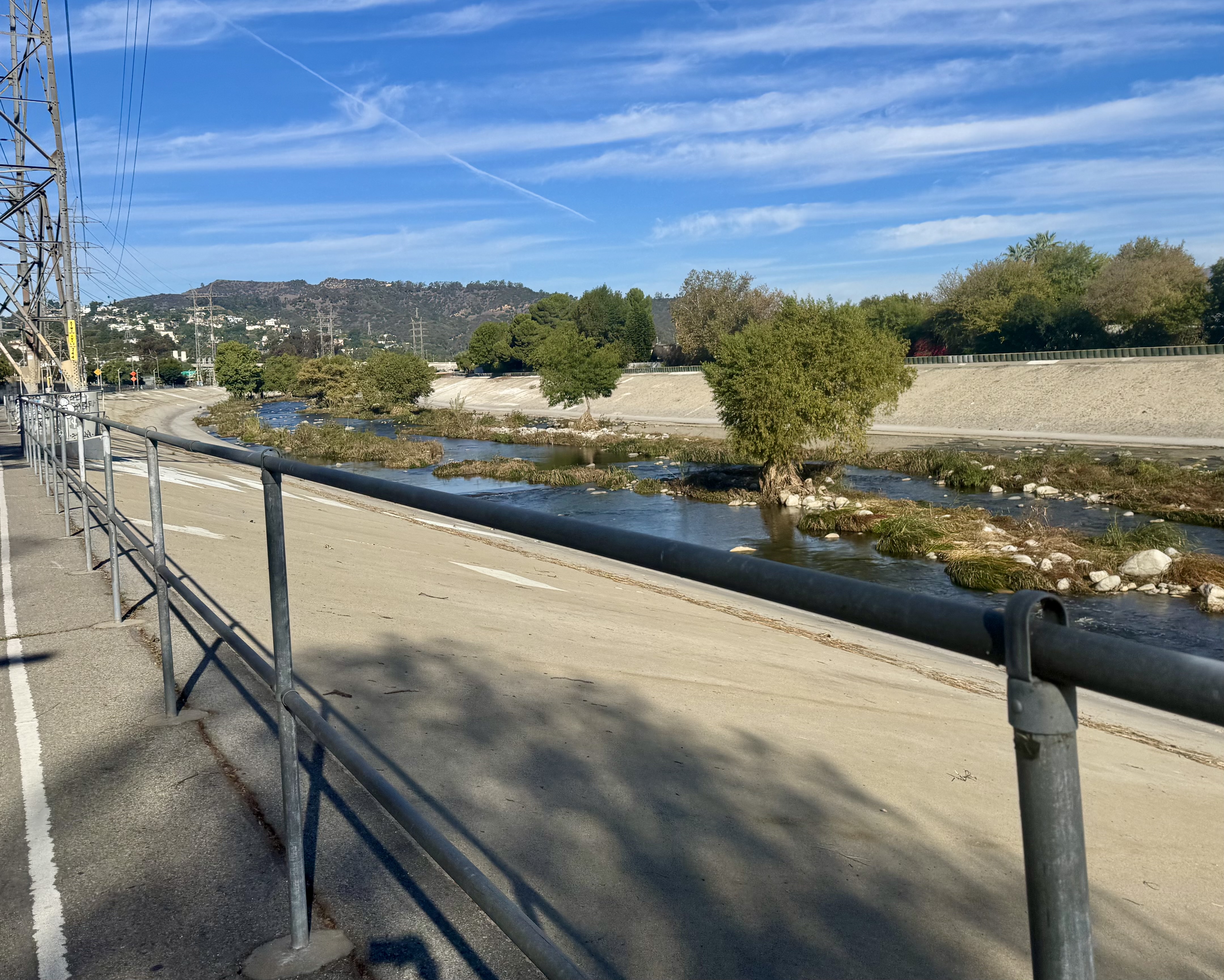
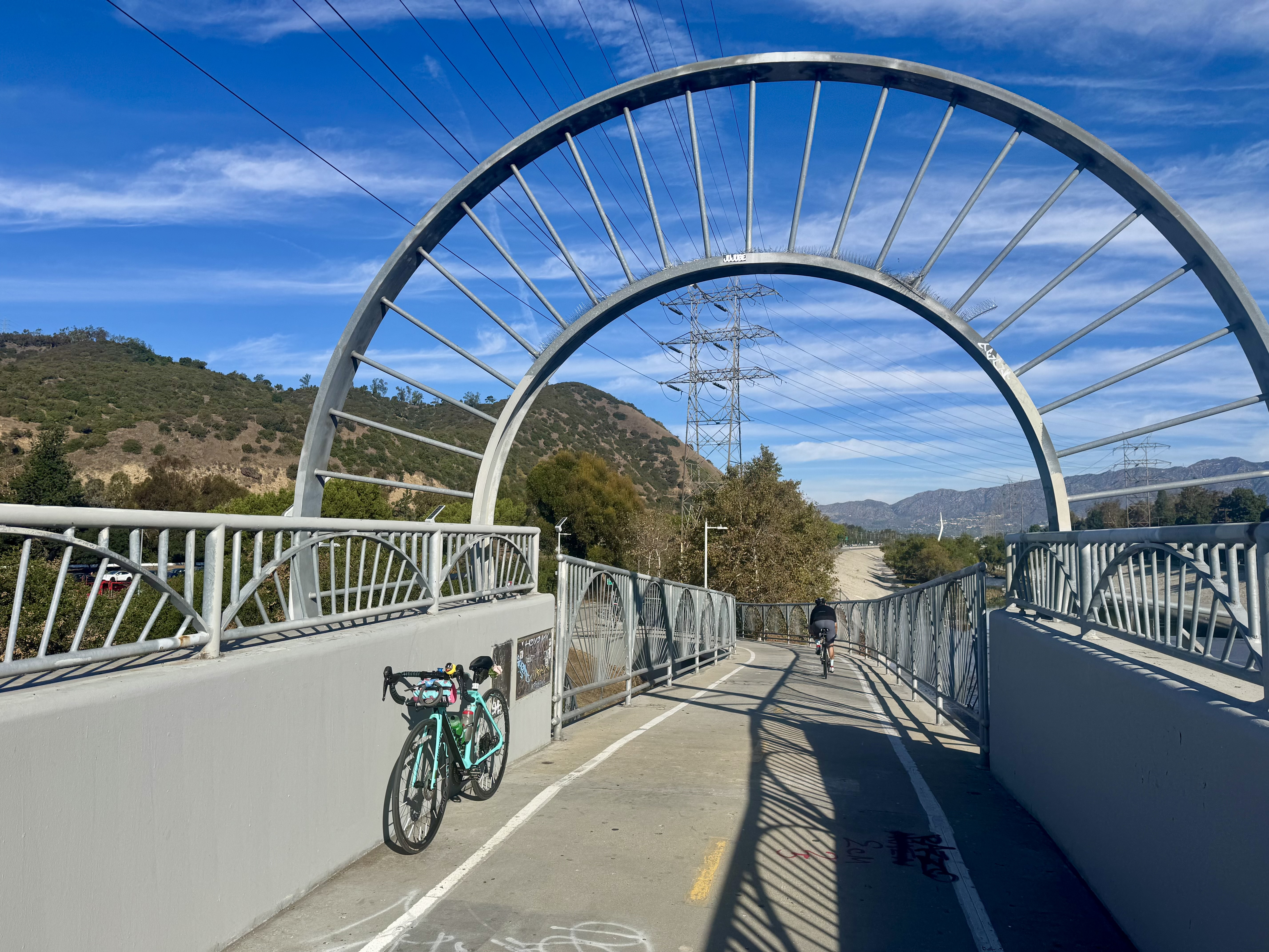
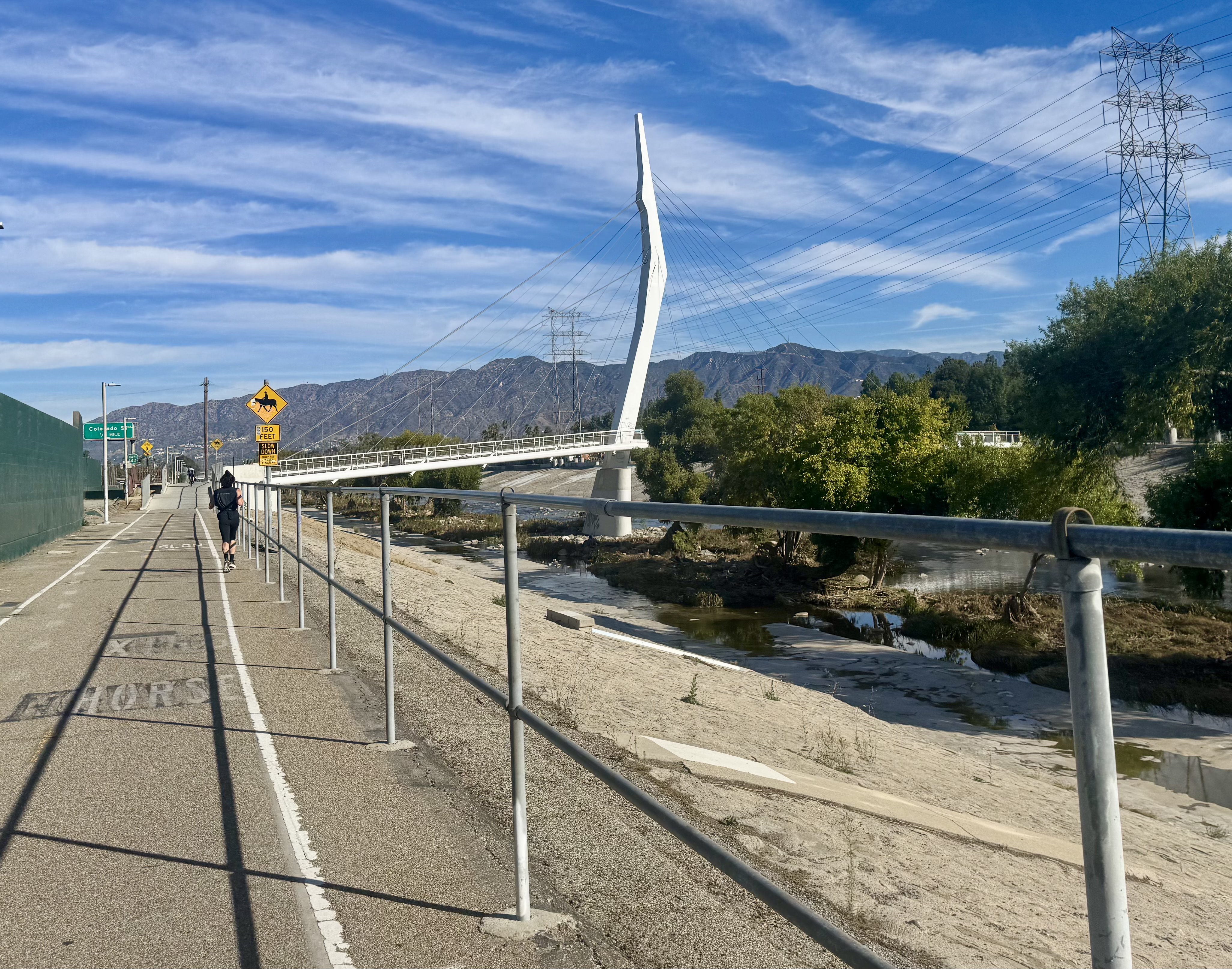
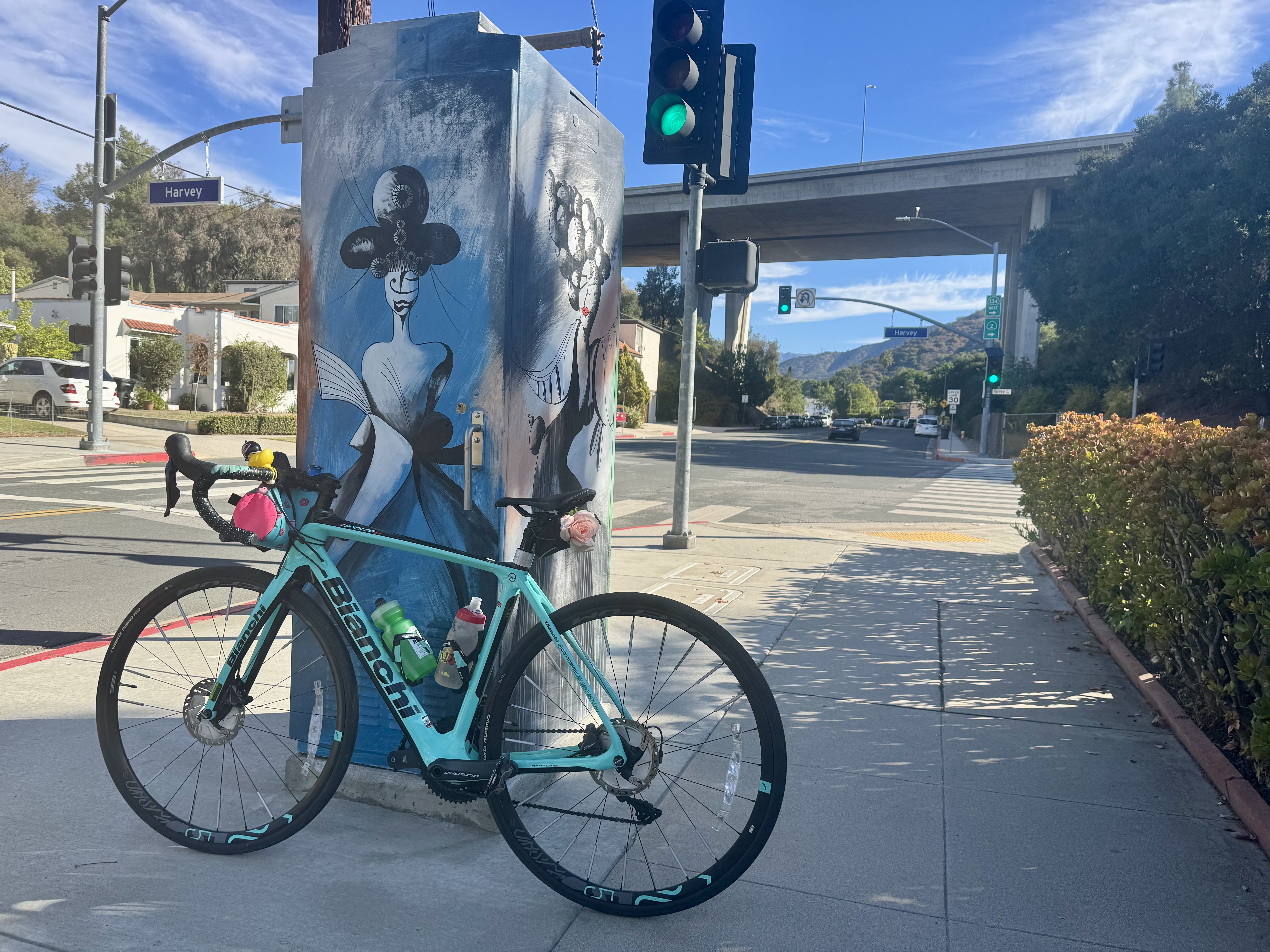
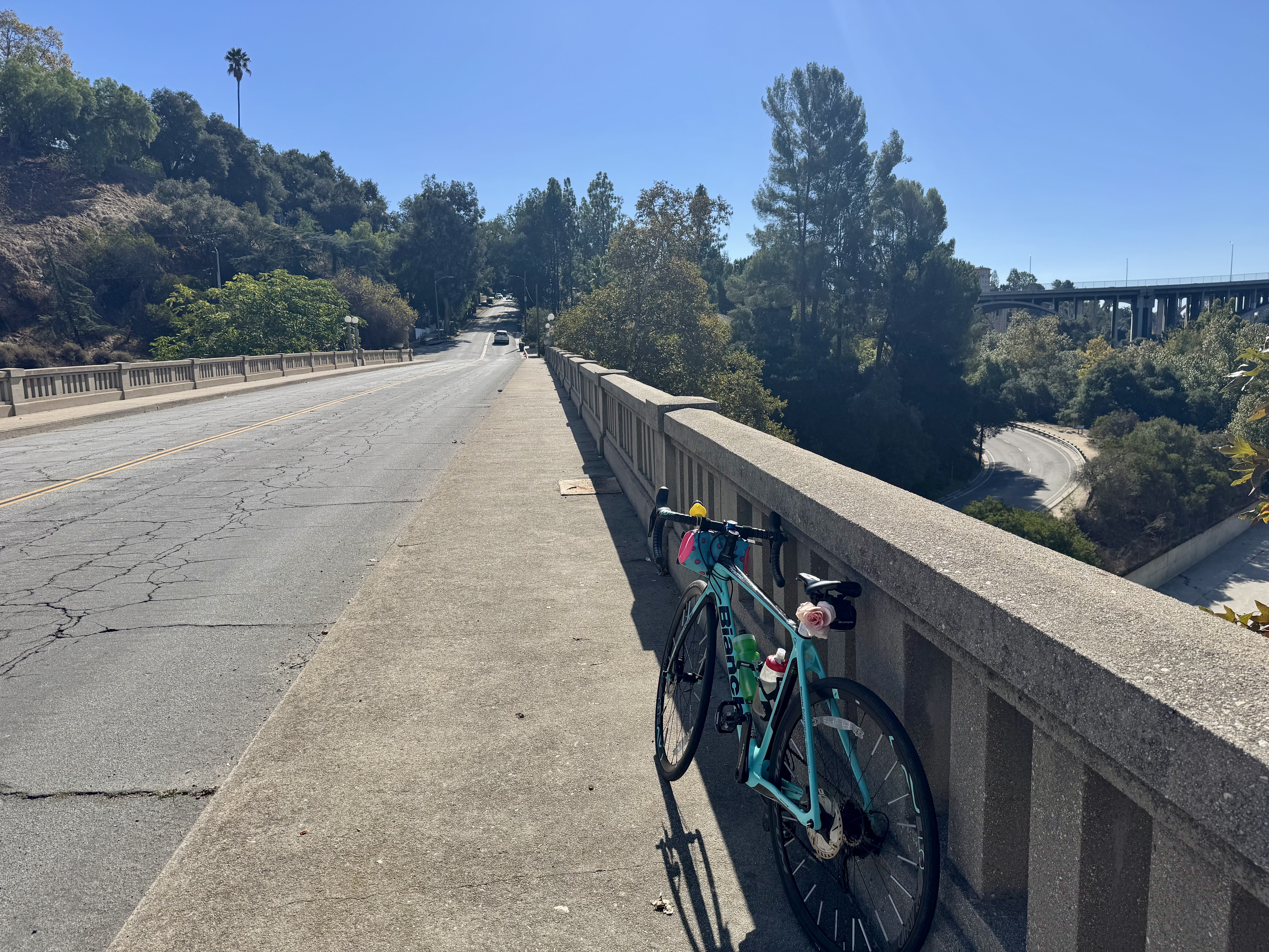
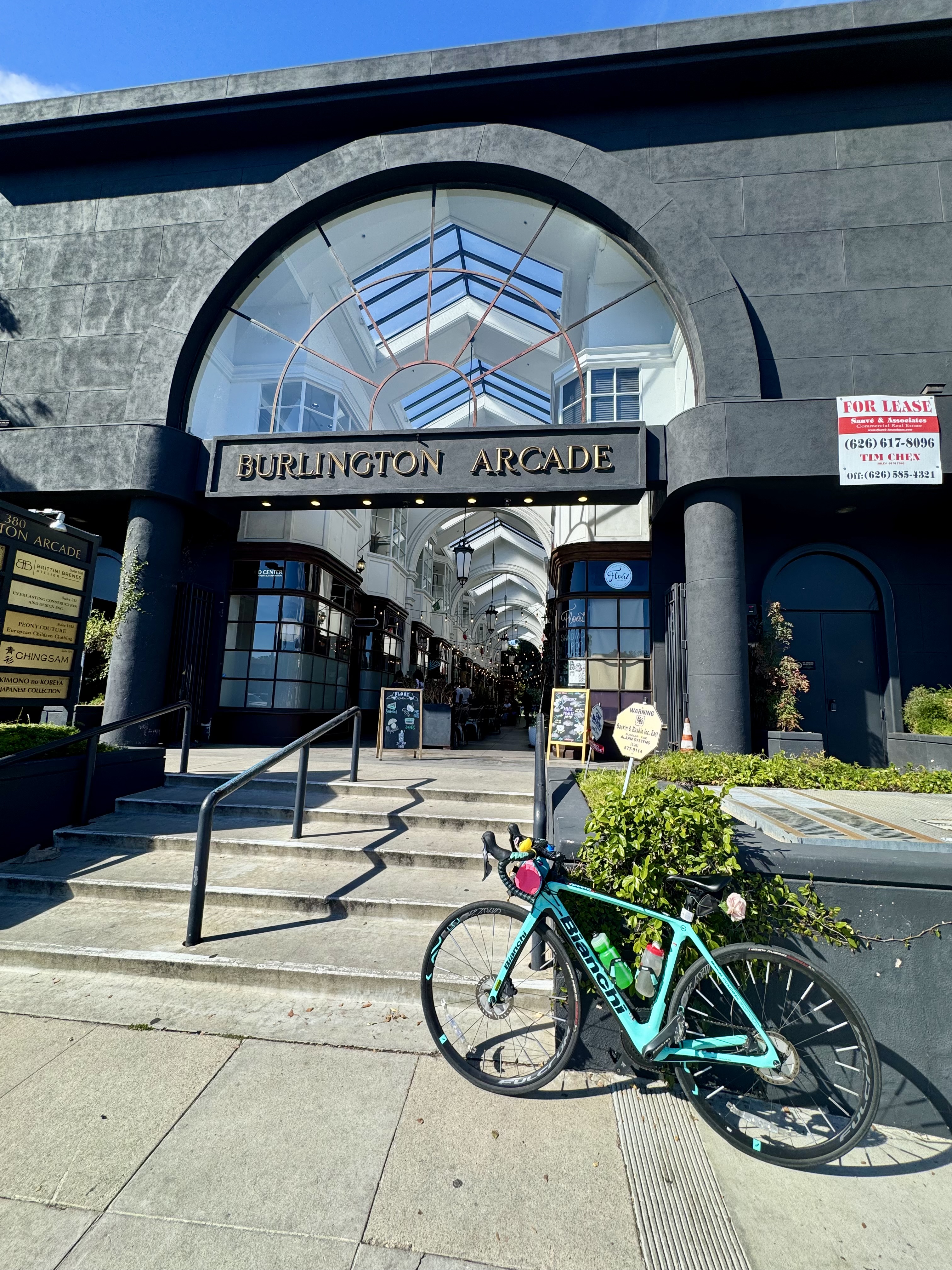
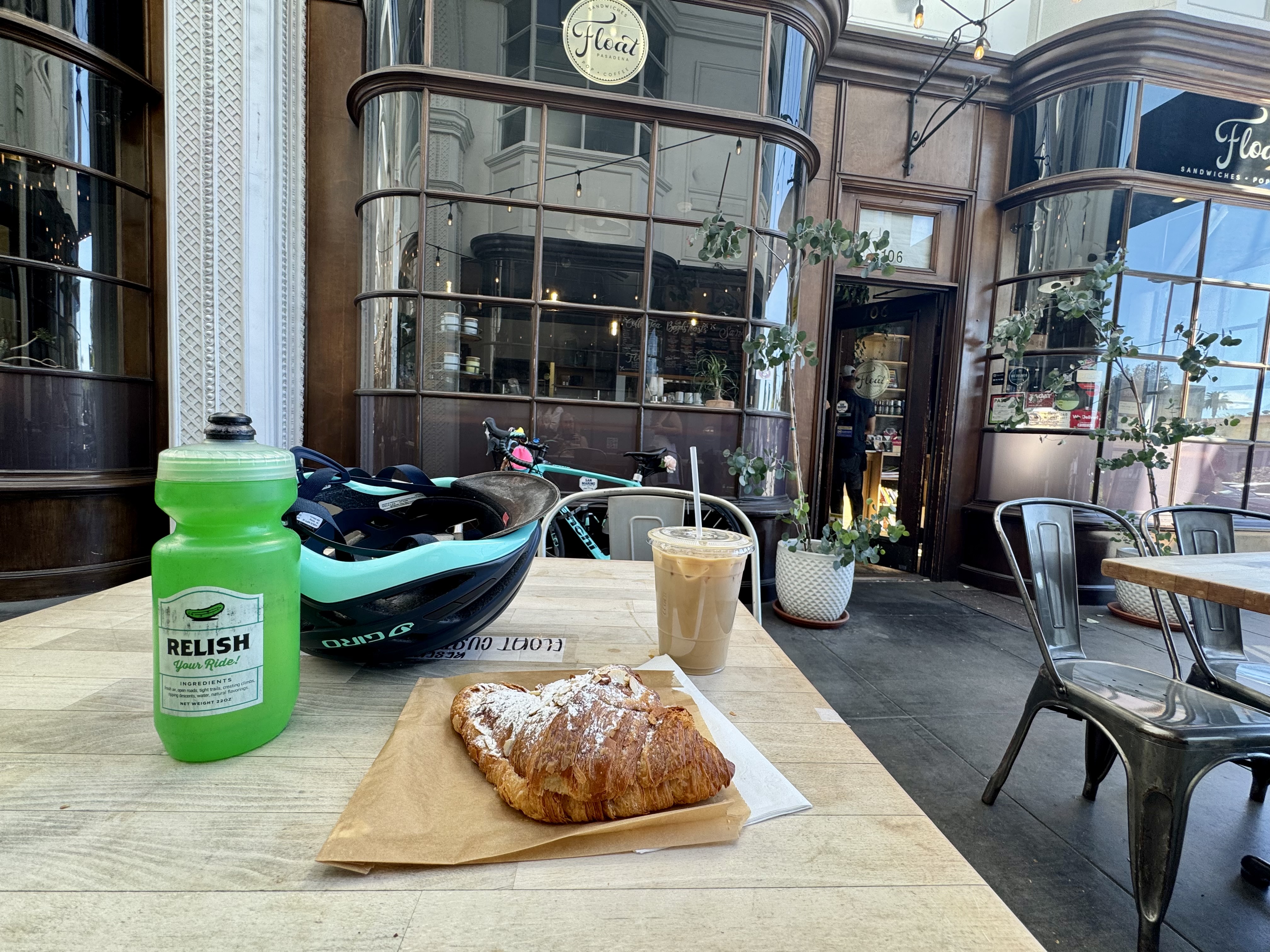
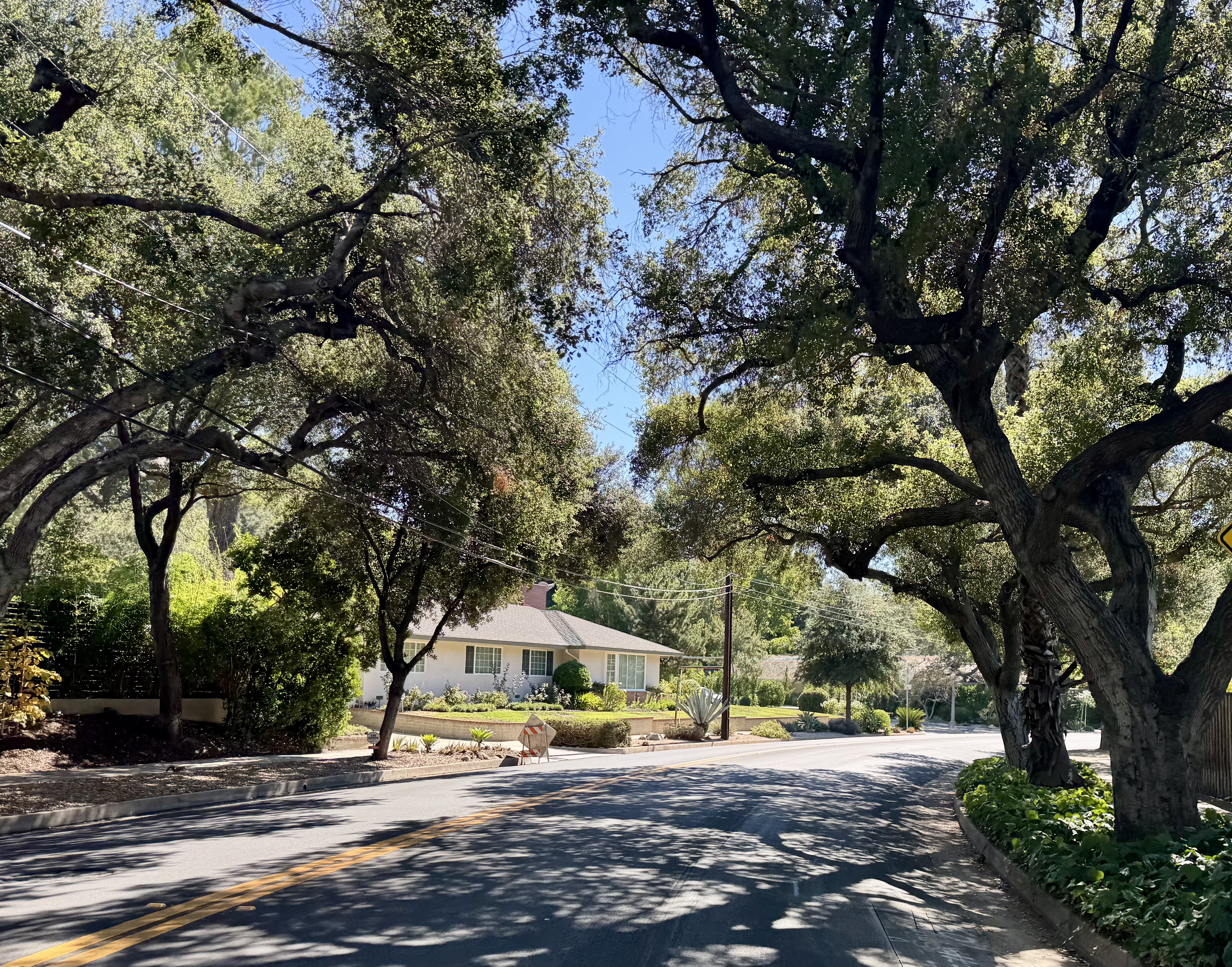
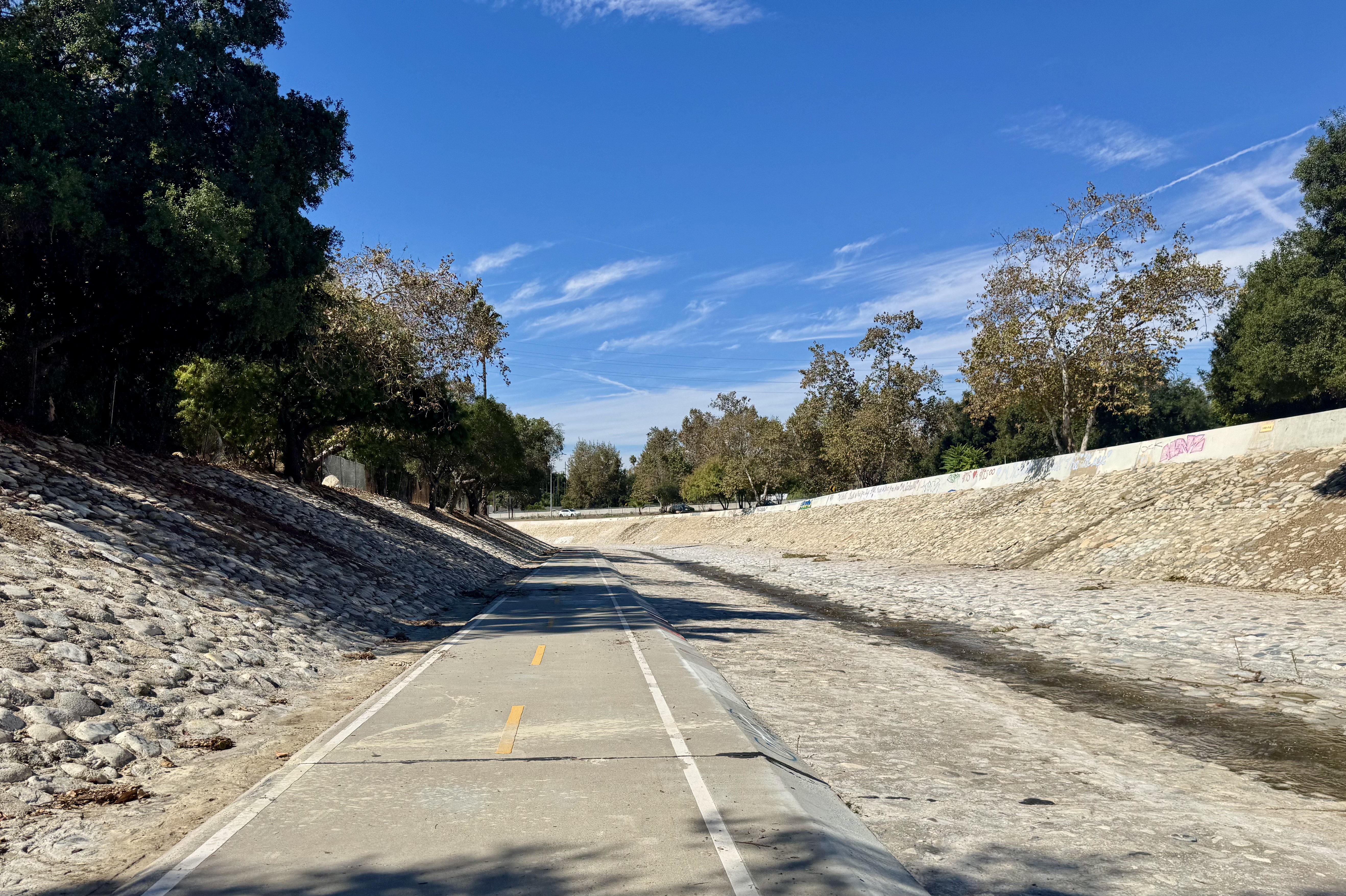
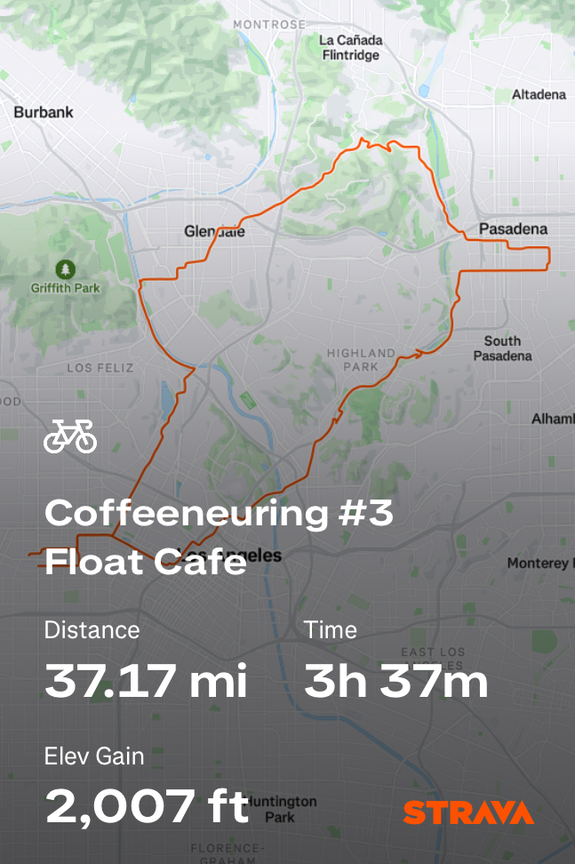
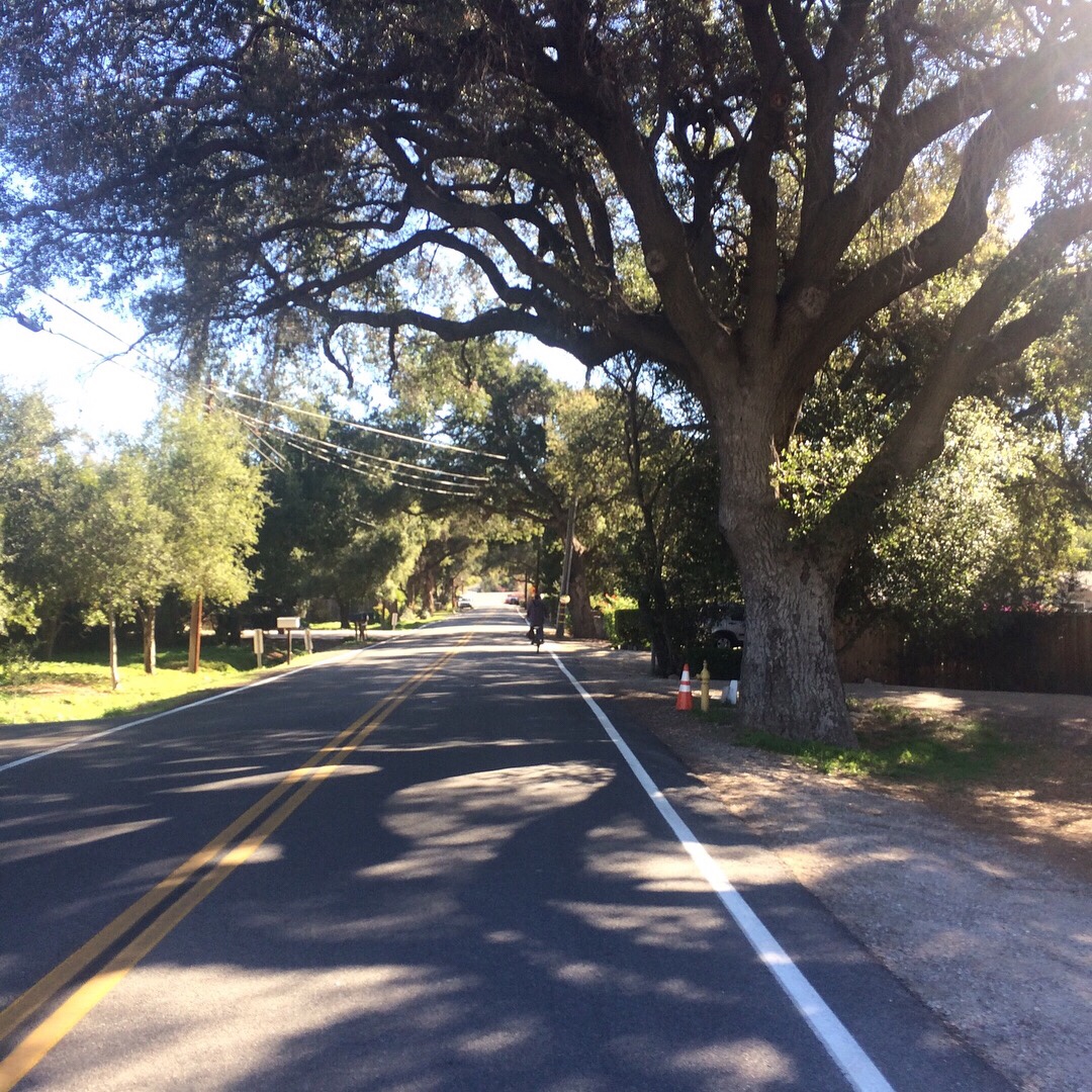
Another find from that Instagram post I’d seen listing beautiful coffee shops was Float, located in the Burlington Arcade in Pasadena. That one called to me. I love biking to Pasadena, as there are some beautiful streets to bike on out that way, and I had a hankering for a longer ride that day. And to stop in an old-timey looking coffee shop in an old-timey looking arcade? How is it I’d never heard of this place before? So off I went, and not in the most direct route, no. I embraced the opportunity to plan my route by first hopping on the L.A. River bike path so I could cross the “witch’s finger” bridge, more properly known as the North Atwater Bridge or the La Kretz Crossing, and then taking what I think of as the reverse Chevy Chase route. You see, Chevy Chase Drive winds through the hills between the Rose Bowl and Glendale. I had ridden that route multiple times going west from Pasadena to Glendale and found it quite enjoyable. But one day, we rode it from Glendale to Pasadena and discovered some beauty we had rolled through to quickly when going downhill on the Glendale side. I wanted to ride it going east again and savor that scenery.
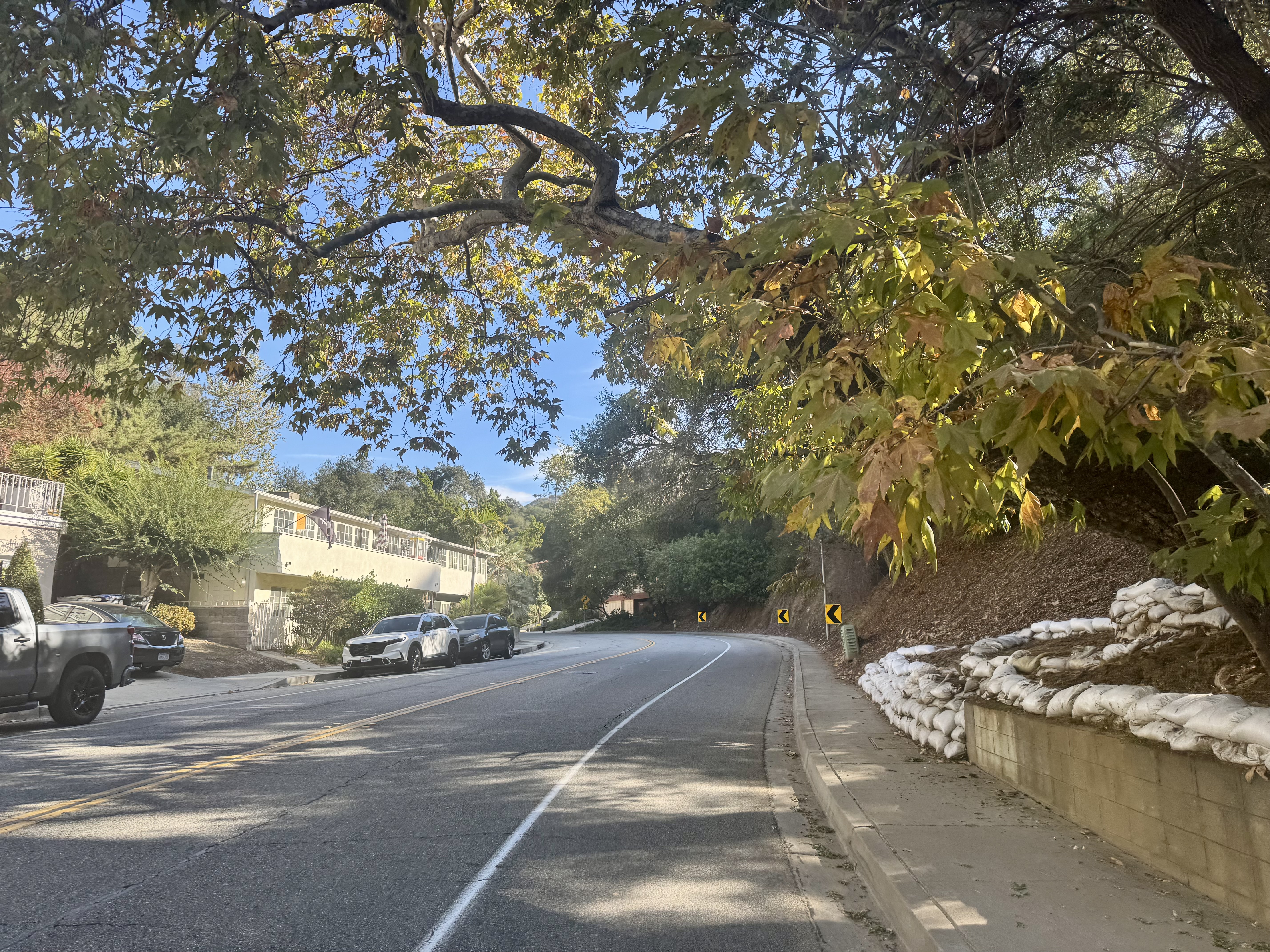
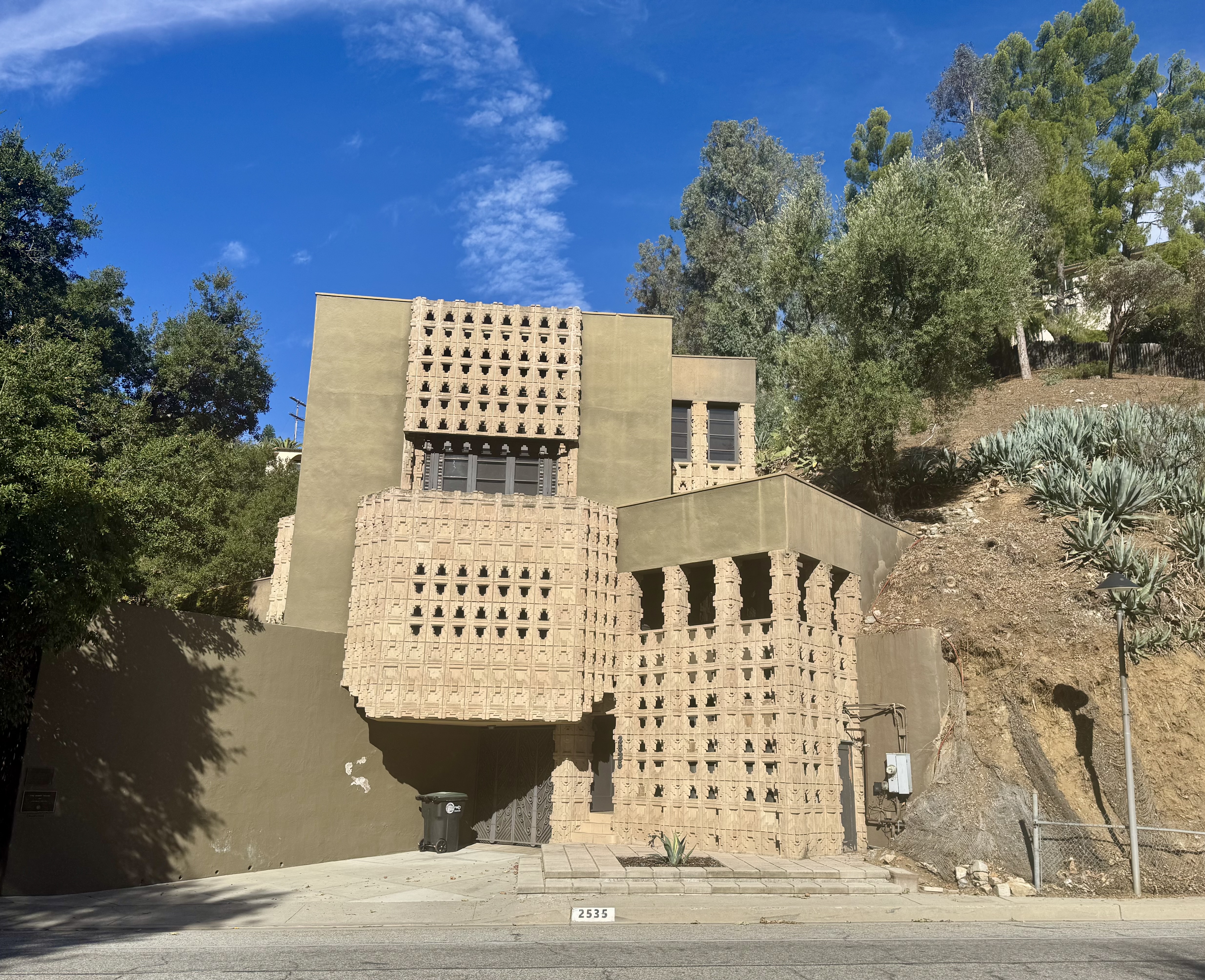
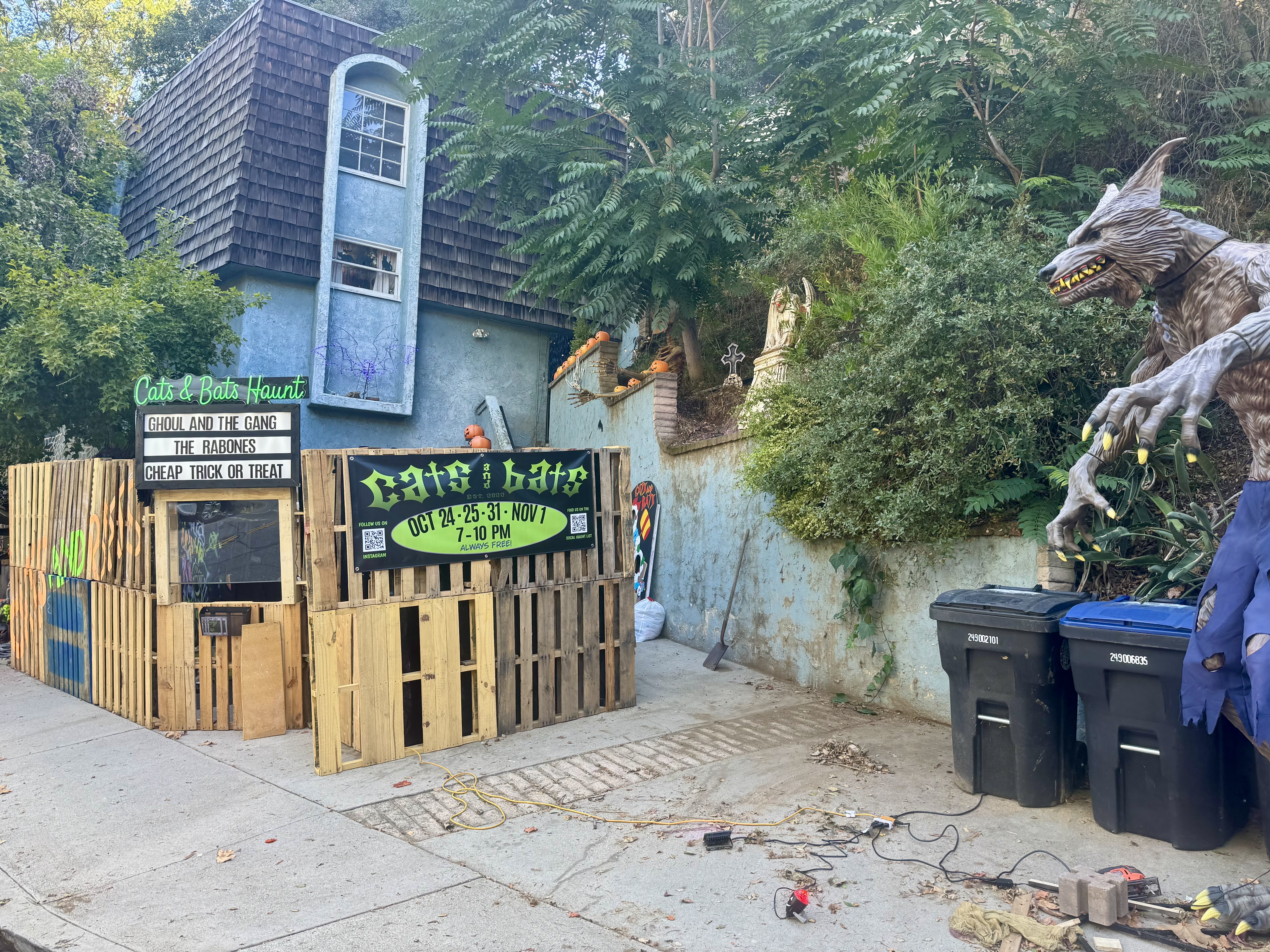
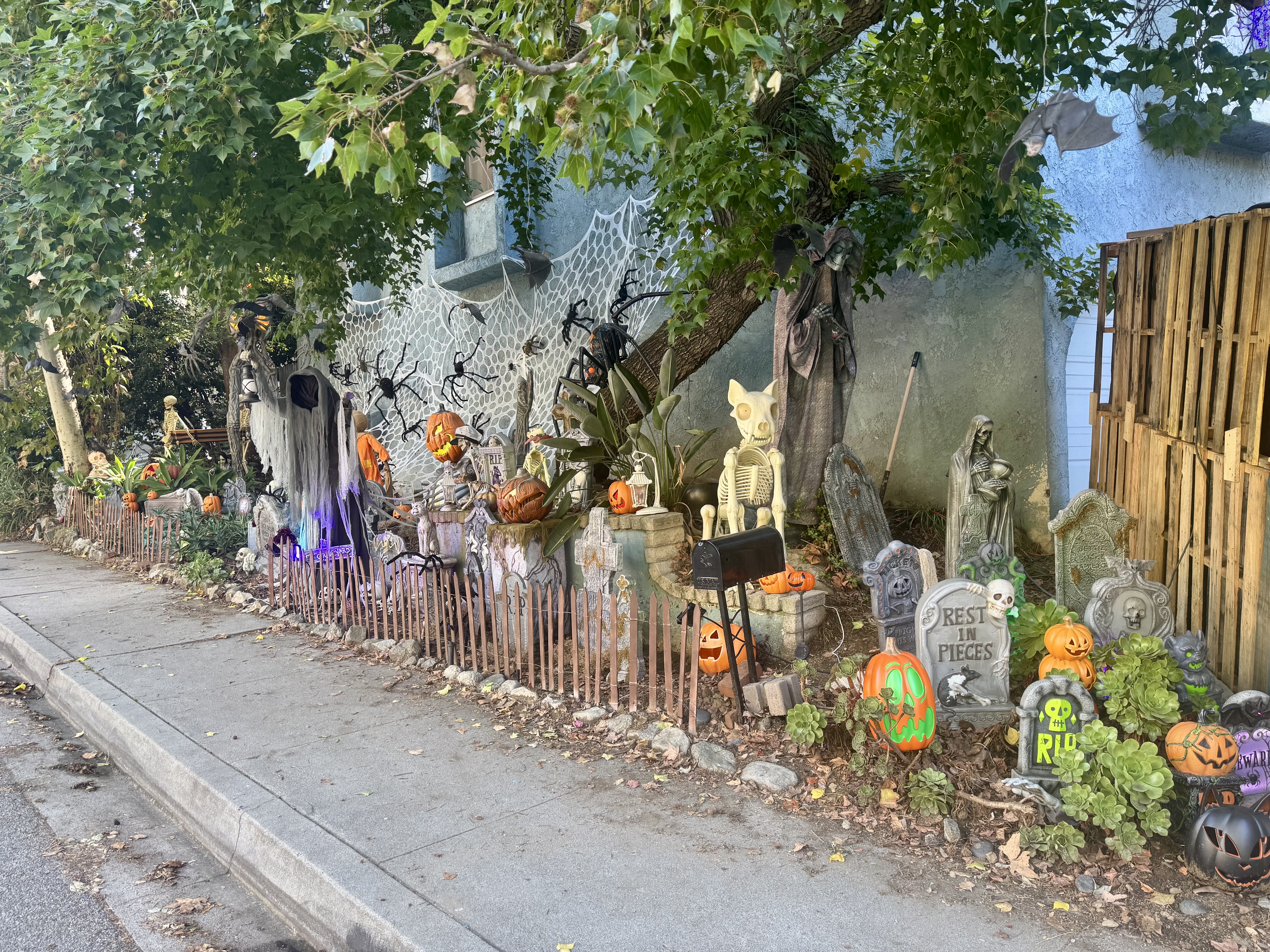
My favorite delight that surprised me the first time I rode Chevy Chase in the reverse direction was the Derby House, designed by Frank Lloyd Wright, Jr., built in 1926. After admiring the Derby House once again, I noticed another delight across the way. An elaborately decorated yard was ready for Halloween, even offering a “Cats and Bats Haunt” spook show beginning October 24th, with a marquee advertising “Ghoul and the Gang”, “The Rabones”, and “Cheap Trick or Treat”. From there, I wound my way up the pretty road to pass by the Wild Oak Cafe (an excellent coffeeneuring stop, but not on my agenda today).
After a little more climbing, I enjoyed the descent down Linda Vista followed by rolling past the Rose Bowl, and then heading over one of the stately historic bridges over the Arroyo Seco. If you’ve never biked through Pasadena, add that to your bike-it list. Beautiful bridges, gorgeous homes, wide, tree-lined streets make for a real treat.
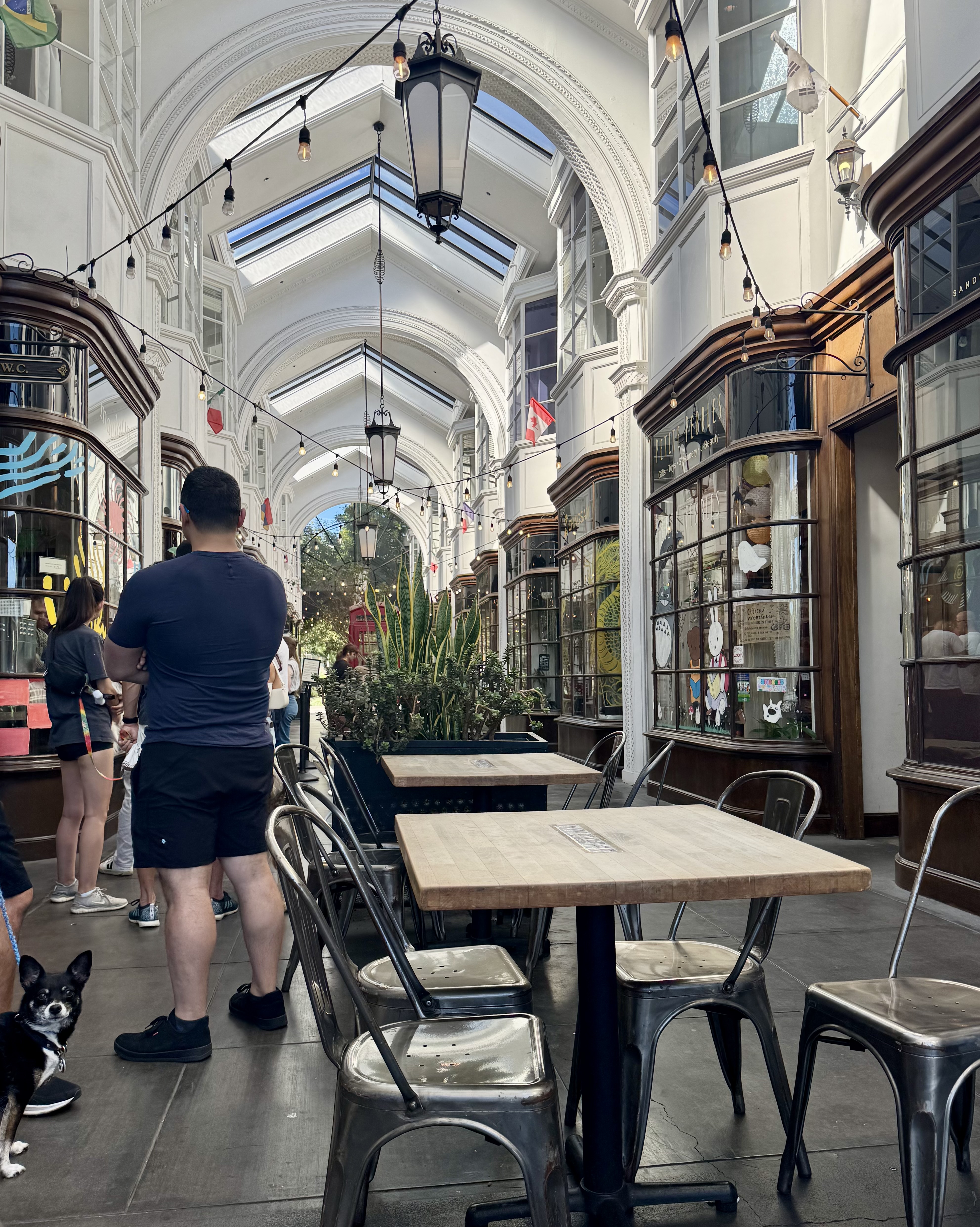
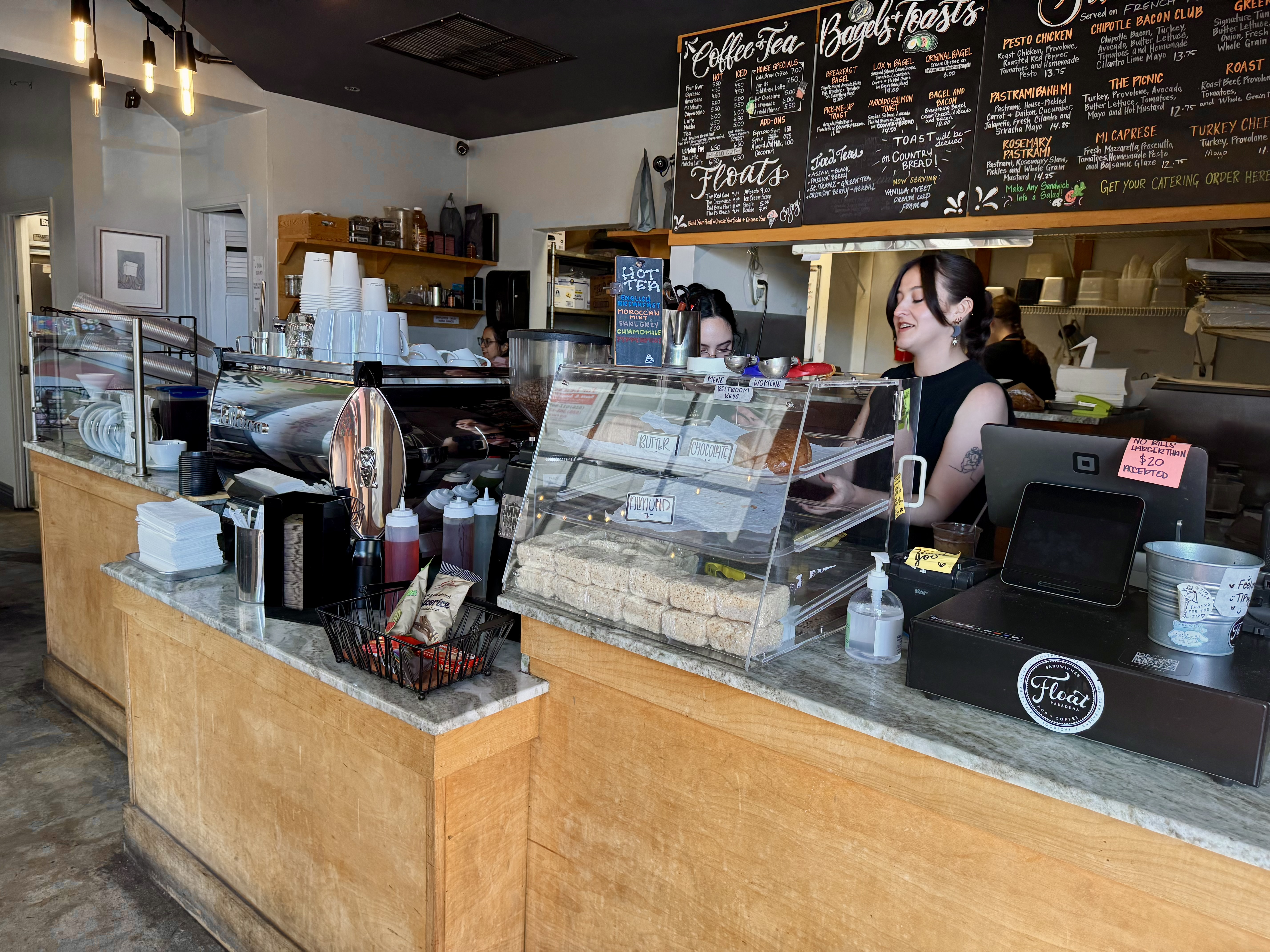
I made my way to the Burlington Arcade, and rolled my bike right on in. There was a long line of folks, but I was relieved to see that they were waiting to enter a different establishment in the arcade. I leaned my bike against the wall in front of Float and just locked the bike wheel to the frame, which seemed sufficient given I was never far from the bike or unable to keep it in view. Float seemed like more of an ice cream place, or as the name suggests, an ice cream float place. But I was on a coffee mission, so I ordered an iced lavendar latte and an almond croissant. The latter was quite good; the former was okay.
For the return trip, I took the devastatingly scenic Arroyo Parkway to the Arroyo Seco bike path. From there, I took Pasadena Avenue to Broadway, which passes by Elysian Park and into downtown Los Angeles, via Chinatown. This made for a nice loop. Most of all, it was a gorgeous ride on a lovely day to a beautiful place to enjoy a coffee drink. I would do it all again.
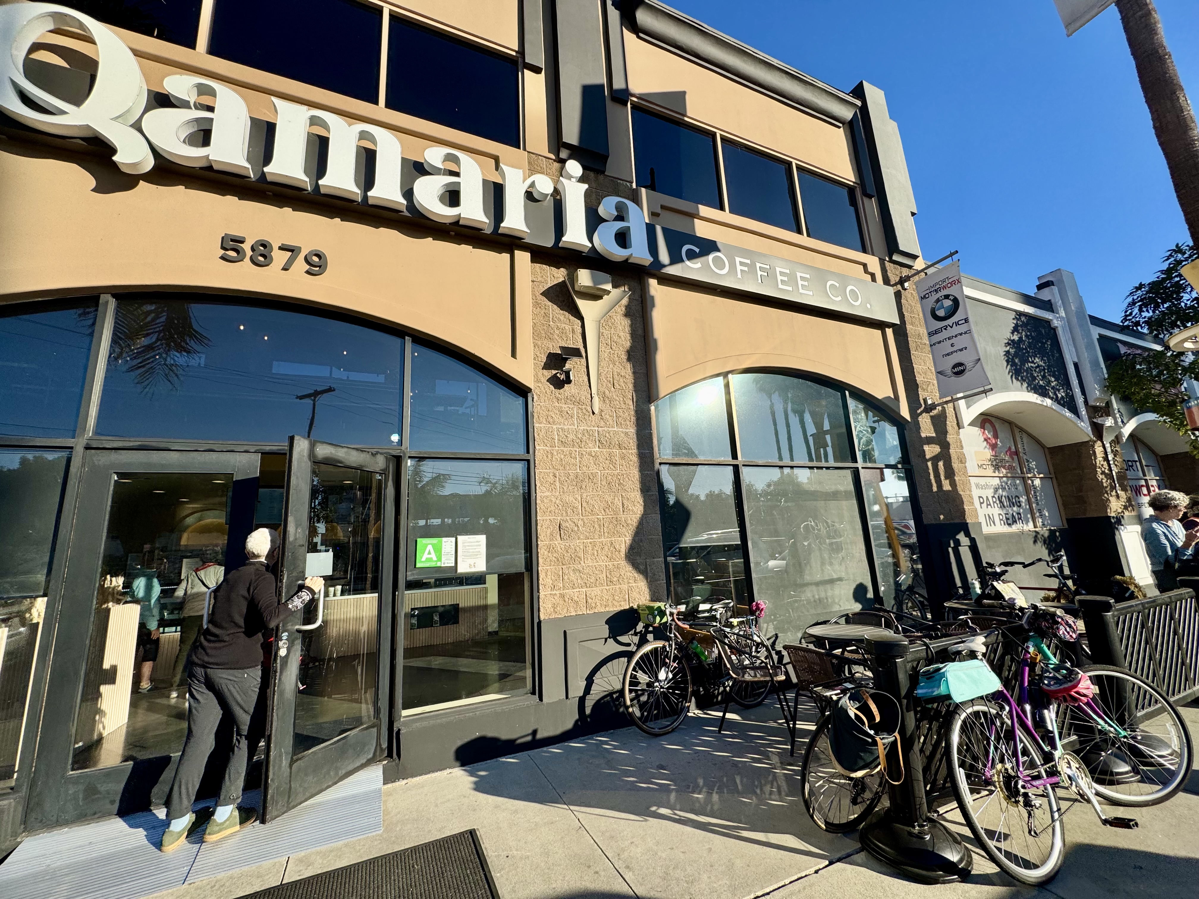
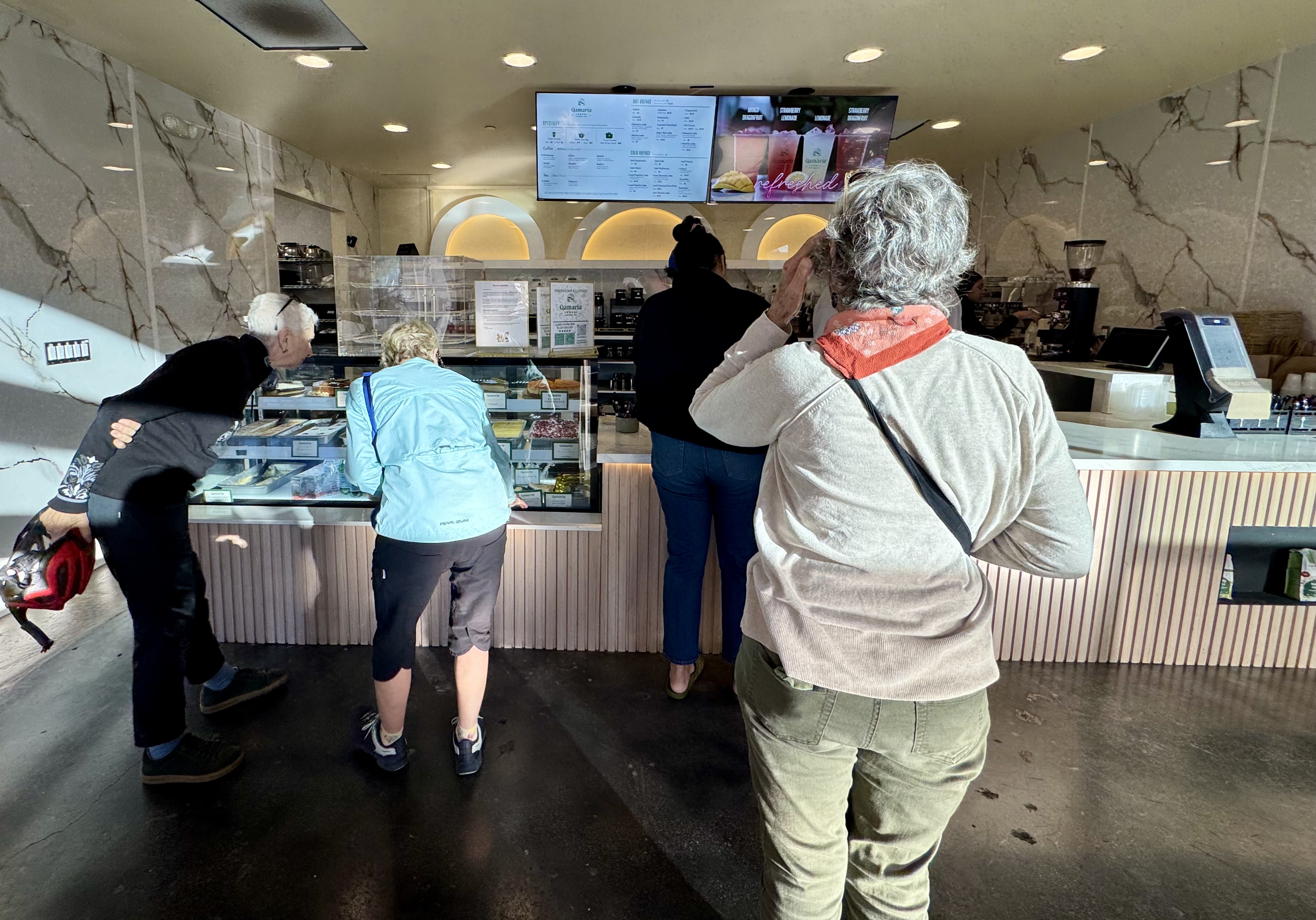
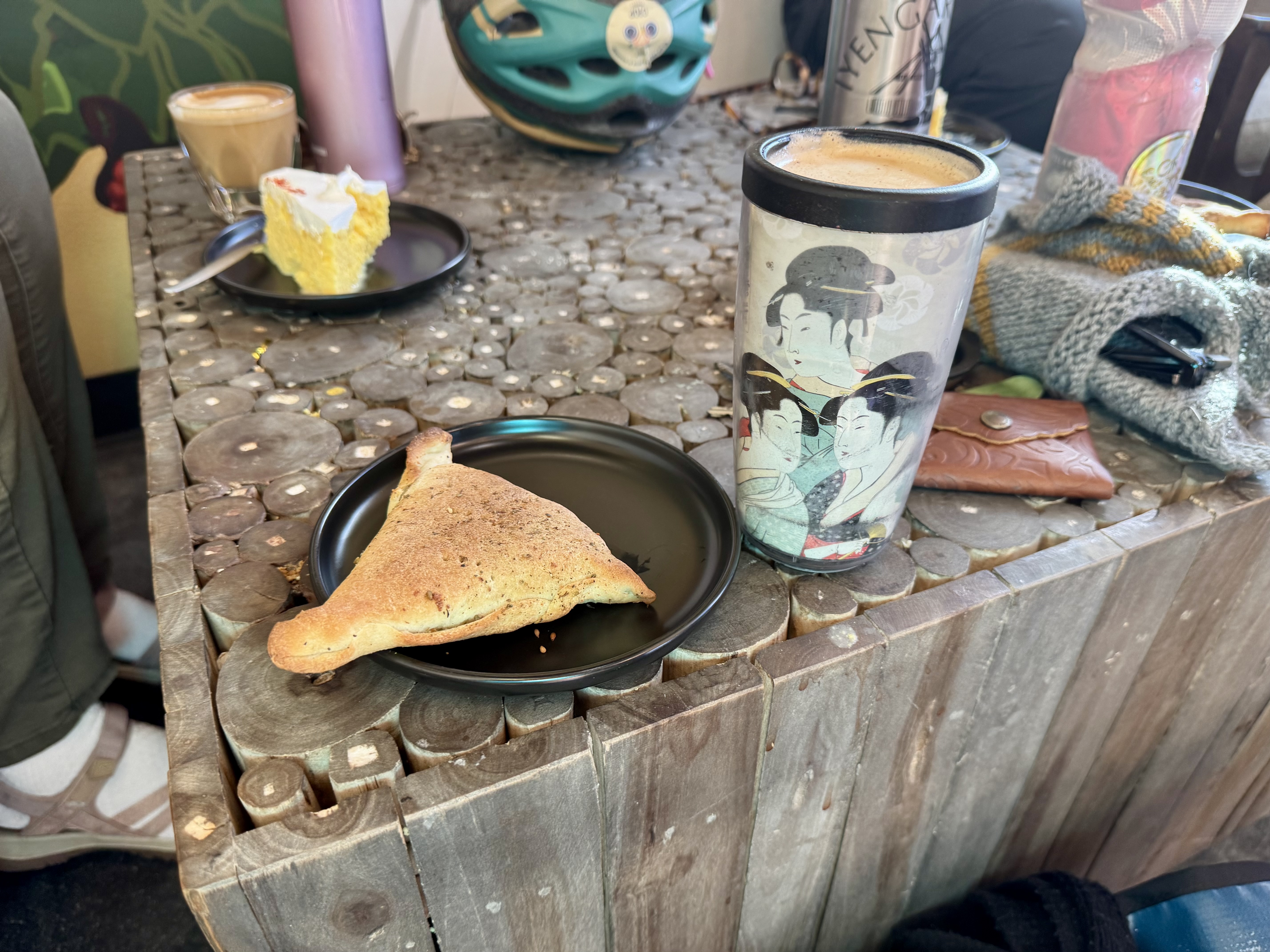
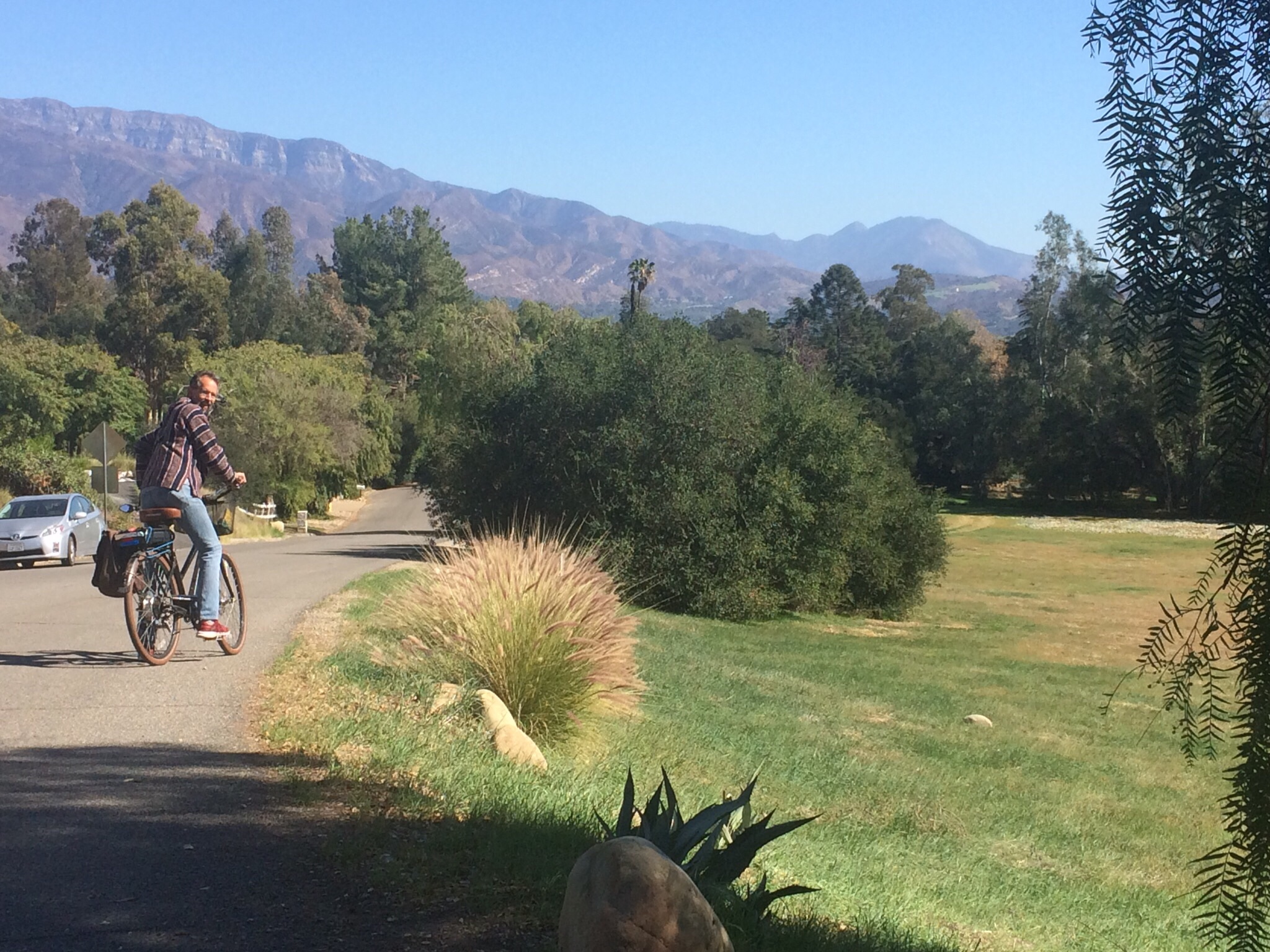
Control No. 4: 10/20/25 Qamaria Yemeni Coffee in Culver City
Beverage: Qamaria Latte (+ Zaatar Fatayer)
Bike: Volpe
Bloomers: Groovy Tie Dye
C+1: Women on Bikes Culver City
Beauty: High Ceiling, upper seating area
Miles: 14
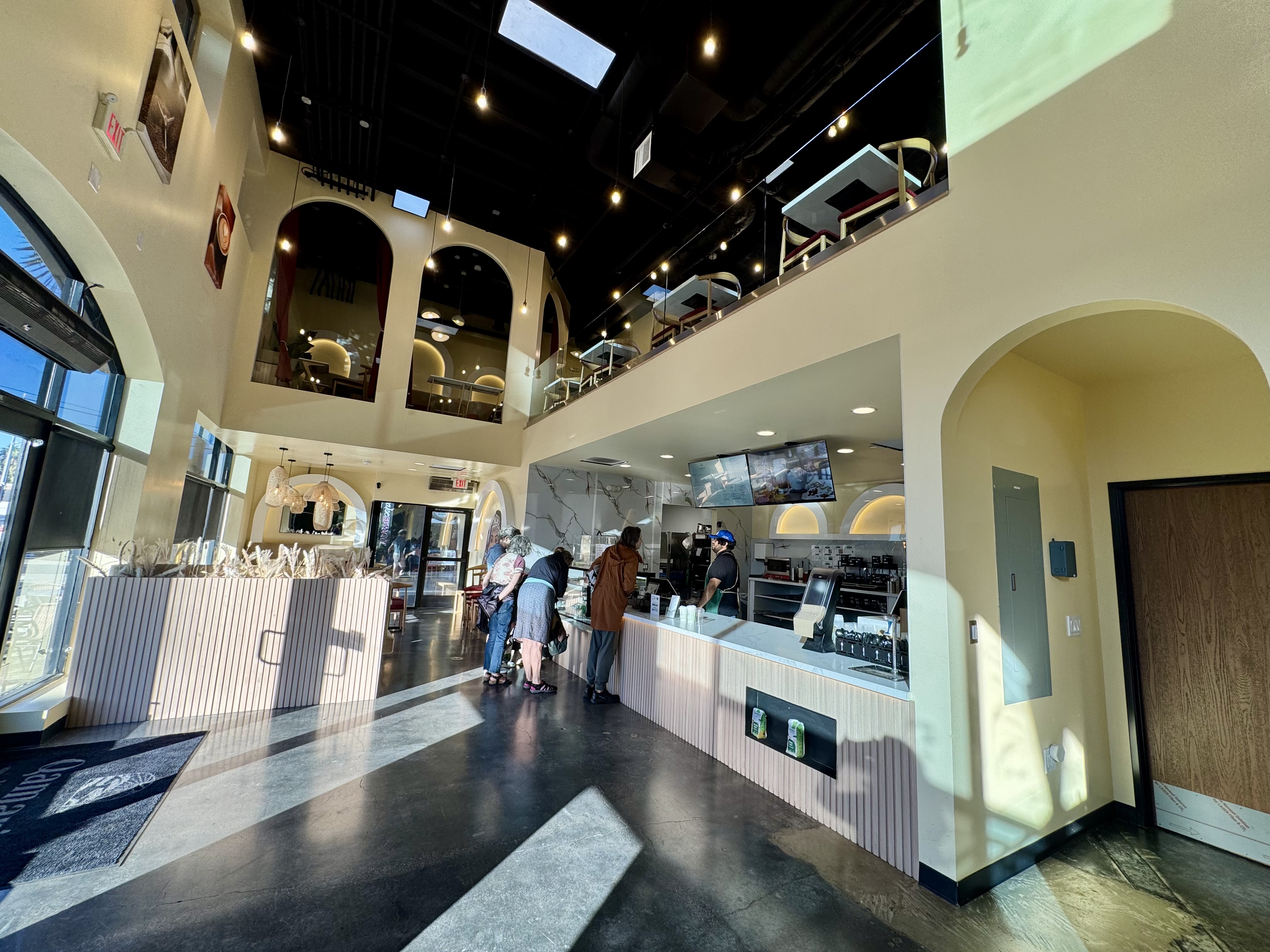
This was a social ride organized by Women on Bikes Culver City, one of their twice-monthly group rides to a coffee shop. I was so happy to discover this new-to-me coffee shop that is worthy of inclusion in a list of beautiful places to drink coffee. The space is unusual: a large, open space with a very high ceiling and contemporary decor. We sat in an attractive seating area in the main “lobby” near the coffee & pastry bar, but the place has additional seating in an upstairs area, as well as on the opposite side of the coffee & pastry bar. Qamaria Yemeni Coffee Co. offers some tasty treats. I loved my Qamaria Latte, spiced with cardamom and cinnamon, and zaatar fatayer (a savory hand pie).
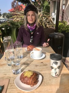
Control No. 5: 10/26/25 Coffee Corner in the Fairfax Farmer’s Market(Los Angeles)
Beverage: Cafe de Olla (+ Almond Croissant)
Bike: Infinito
Bloomers: Sweet Love
C+1: El Cochinito
Beauty: Fall leaves in Griffith Park
Miles: 16
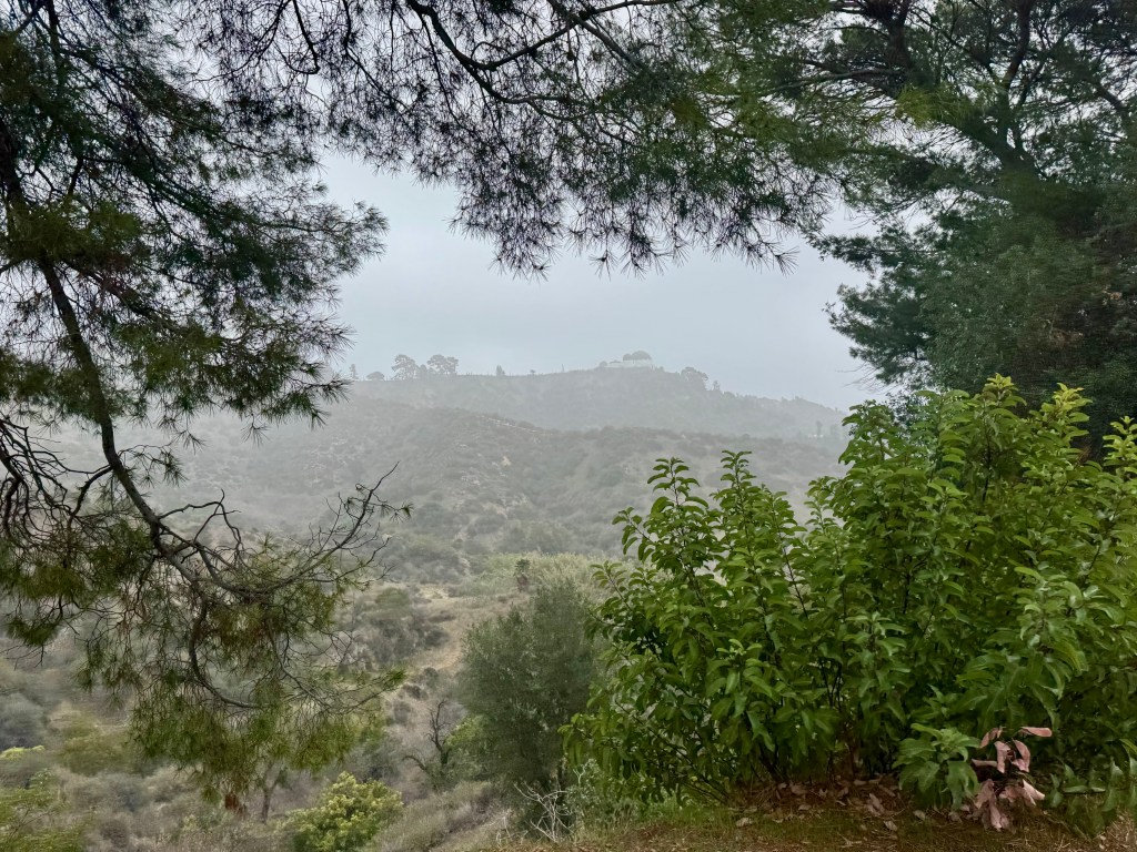
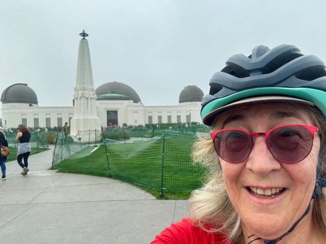
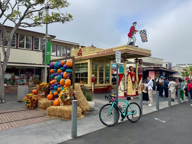
There’s something exciting about making plans to meet up with my husband somewhere. Once again, I was able to coordinate my morning bike ride with one of his meet-ups with his students. I felt a hankering to ride up to Griffith Observatory and get a quick little climb in while he met up with his students at the Original Farmer’s Market at 3rd & Fairfax. It’s a charming historic marketplace, and I love to get a cafe de olla at Coffee Corner, one of the many vendors in the market. So, after my ride up to Griffith Observatory, I headed for the Farmer’s Market via the bike lane on Hollywood Boulevard. Right in front of the entrance to the market, there was an Instagram-worthy stack of hay bales decorated for Halloween.
By the time I arrived, my husband had texted me a photo to help me find where he’d parked the car, and I put my bike in the back of our car. I got my coffee while he finished up with his students. When I went to sit down with him, we enjoyed sharing an almond croissant he had picked up for us.
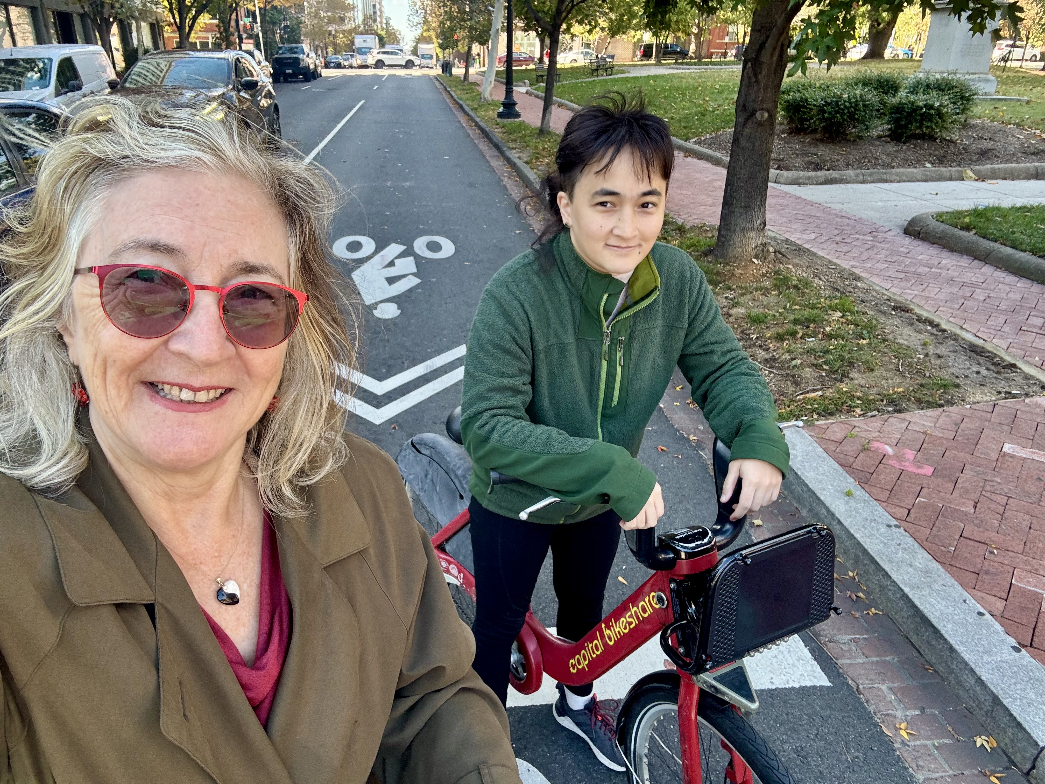
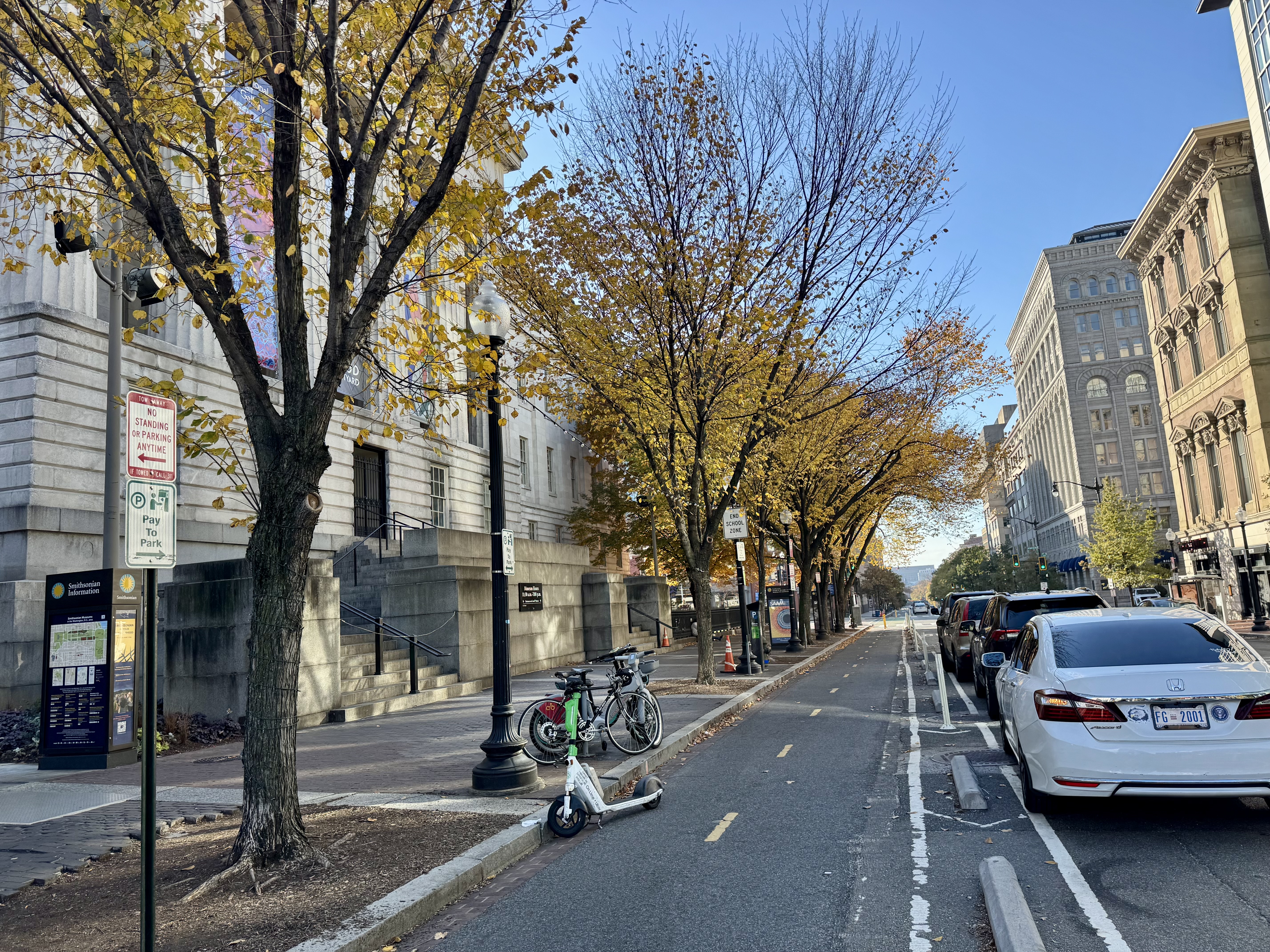
Control No. 6: 10/31/25 Seylou Bakery in Washington, D.C.
Beverage: Hot Chocolate (+ donut)
Bike: Capital Bikeshare
Bloomers: Sweet Love
C+1: Emilia and Ilga
Beauty: Fall leaves strewn across the floor
Miles: 4.3
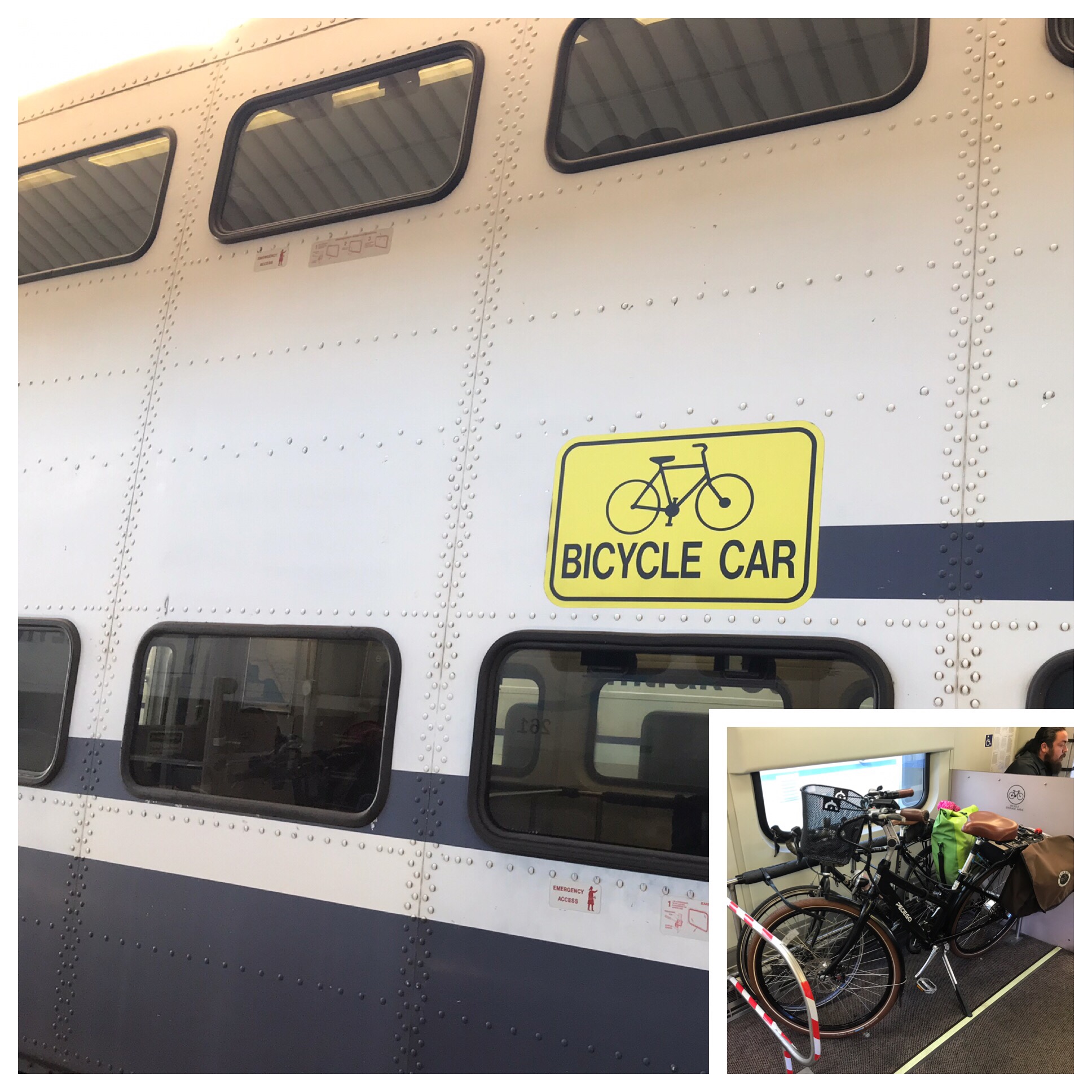
Each year I attend a conference for patent nerds in Washington D.C., so it has become a tradition to get together with a fellow coffeeneur I met a few years ago through the Facebook group for Coffeeneurs. I was especially excited that this year the conference moved back into D.C. proper from the less-appealing National Harbor on the Maryland side of the Woodrow Wilson Bridge. I let my coffeeneuring buddy, Ilga, know that this year I was staying near the convention center and that my daughter, Emilia, would be in town staying with me. Ilga told us about Seylou, one of her favorite coffee shops, which happens to be just a few blocks from where we were staying.
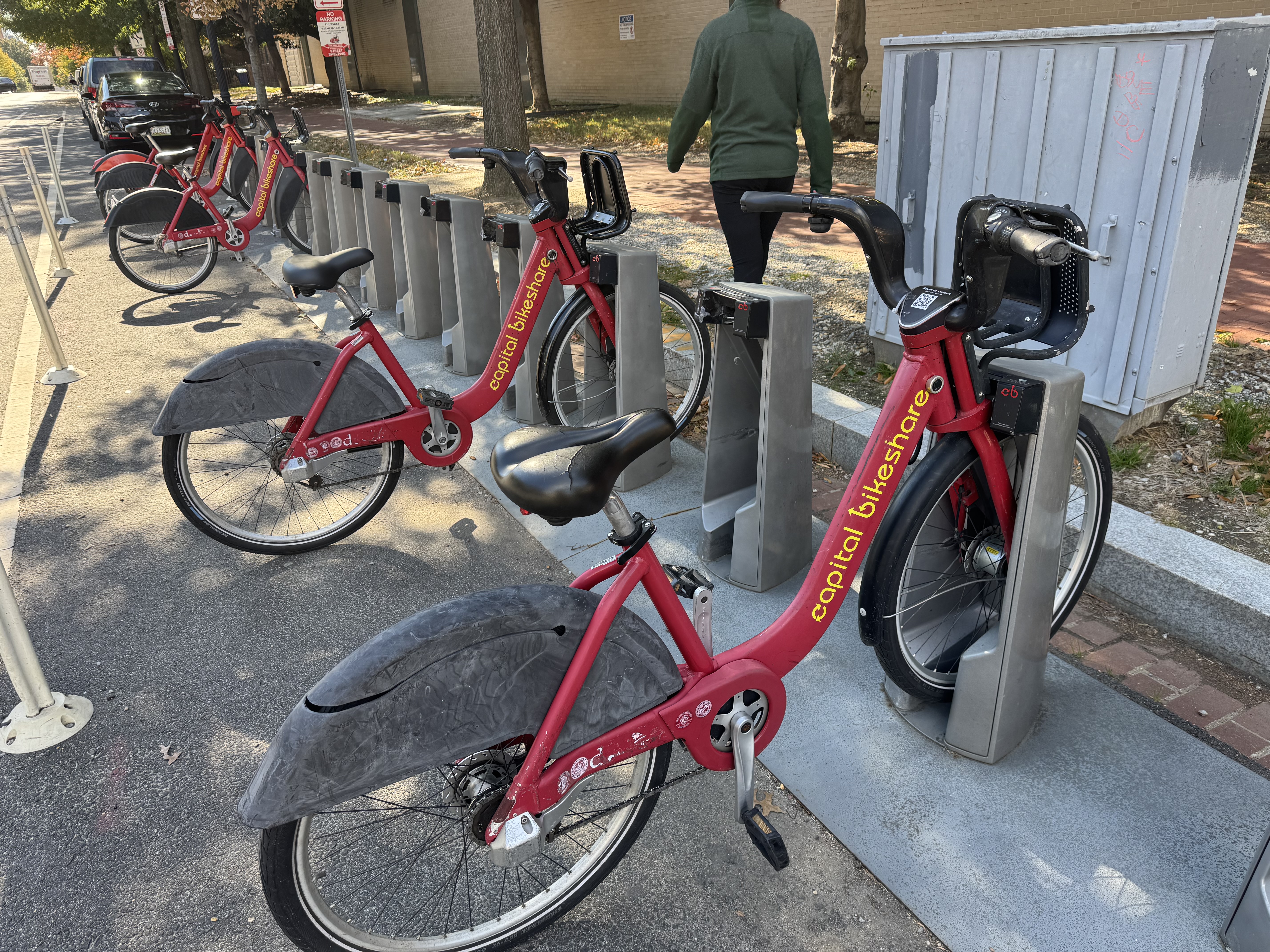
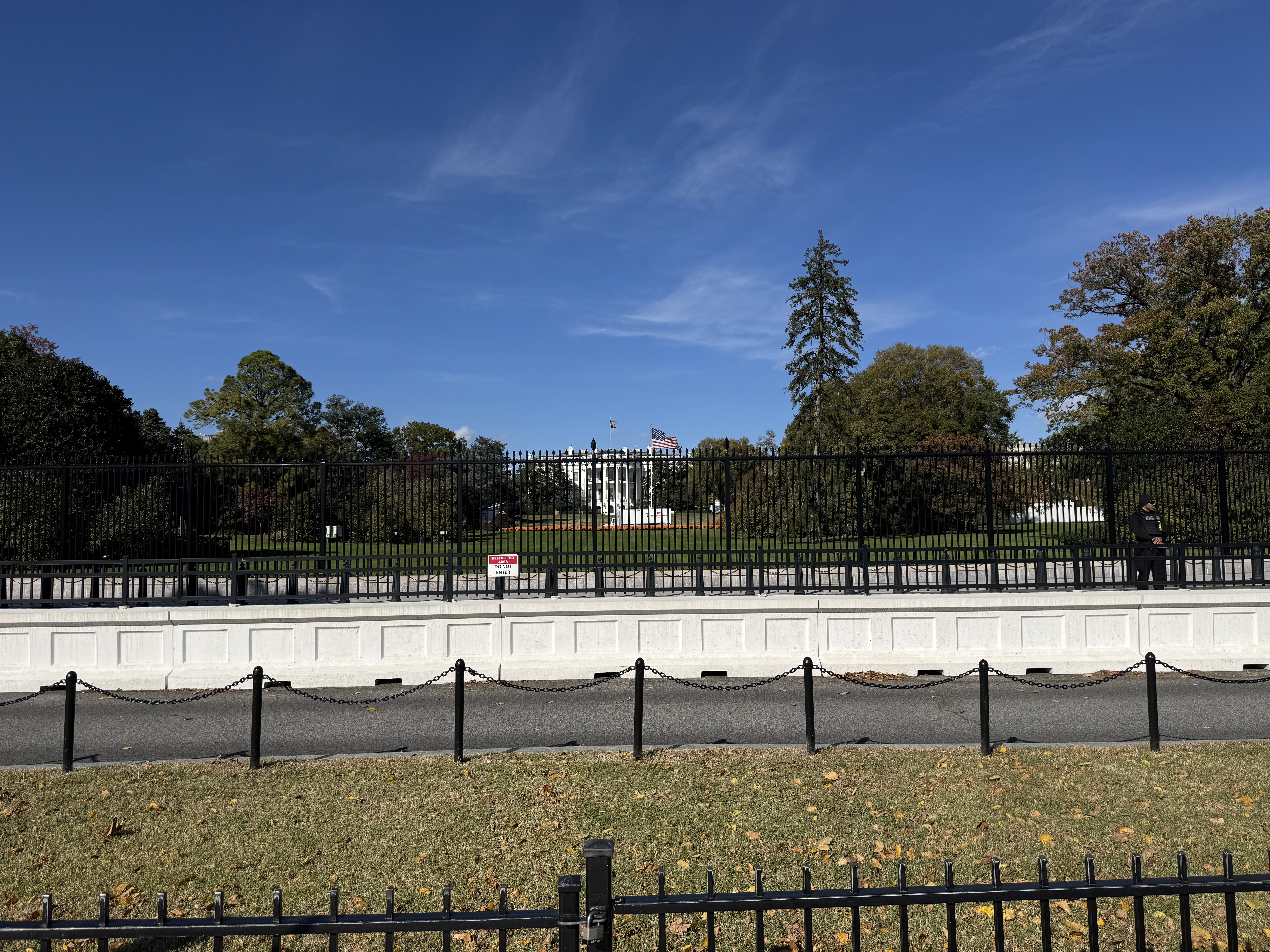
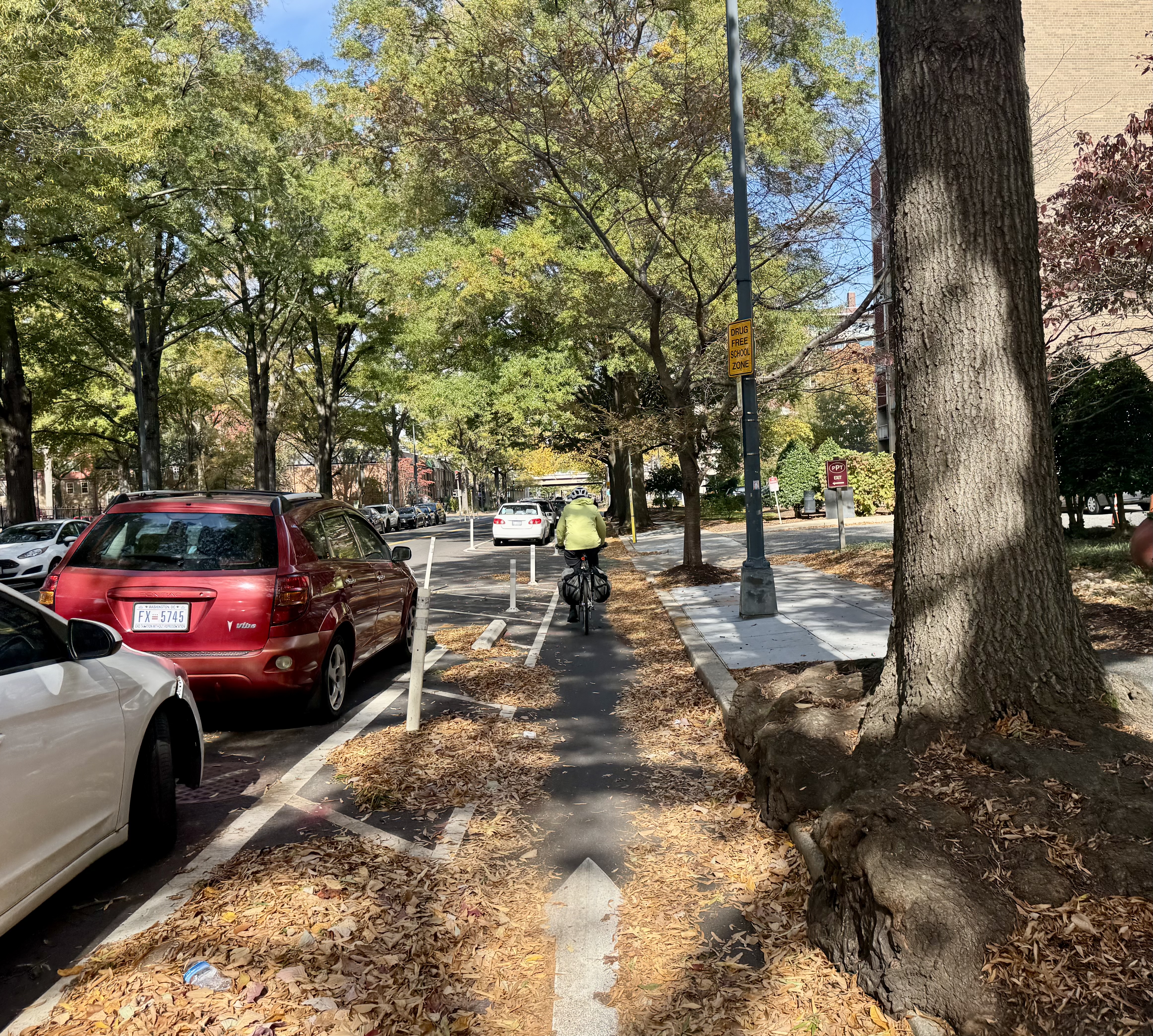
In order to meet the 2 mile minimum biking distance, I planned a route that would have Emilia and I swing by the White House and then loop back north toward Seylou. Unfortunately for my plan, we encountered a wee bit of difficulty getting set up with our bikes. First we had to walk a bit farther than planned to find a Capital Bikeshare docking station that had available bikes. Then, I had trouble figuring out how to check out two bikes at the same time. I had looked into it ahead of time and saw that it should be possible, but what I did not realize is that you have to check them out at the kiosk, not on the app, if you want to get two bikes. By the time I had sorted that all out and we were ready to ride, there wasn’t enough time and we needed to just roll straight on to Seylou.
We docked our bikes just a block or so away from our destination, and walked over to Seylou. Walking inside was a Fall delight, as they had Autumn leaves strewn about the place and across the floor, setting a warm vibe. The pastry case was interesting, and Ilga pointed out her favorites. I had hot chocolate and a donut. I believe the donut was a vegan, healthy version of a donut that I would not consider “worth the calories”, but the hot chocolate was delicious, and we had a most enjoyable visit.
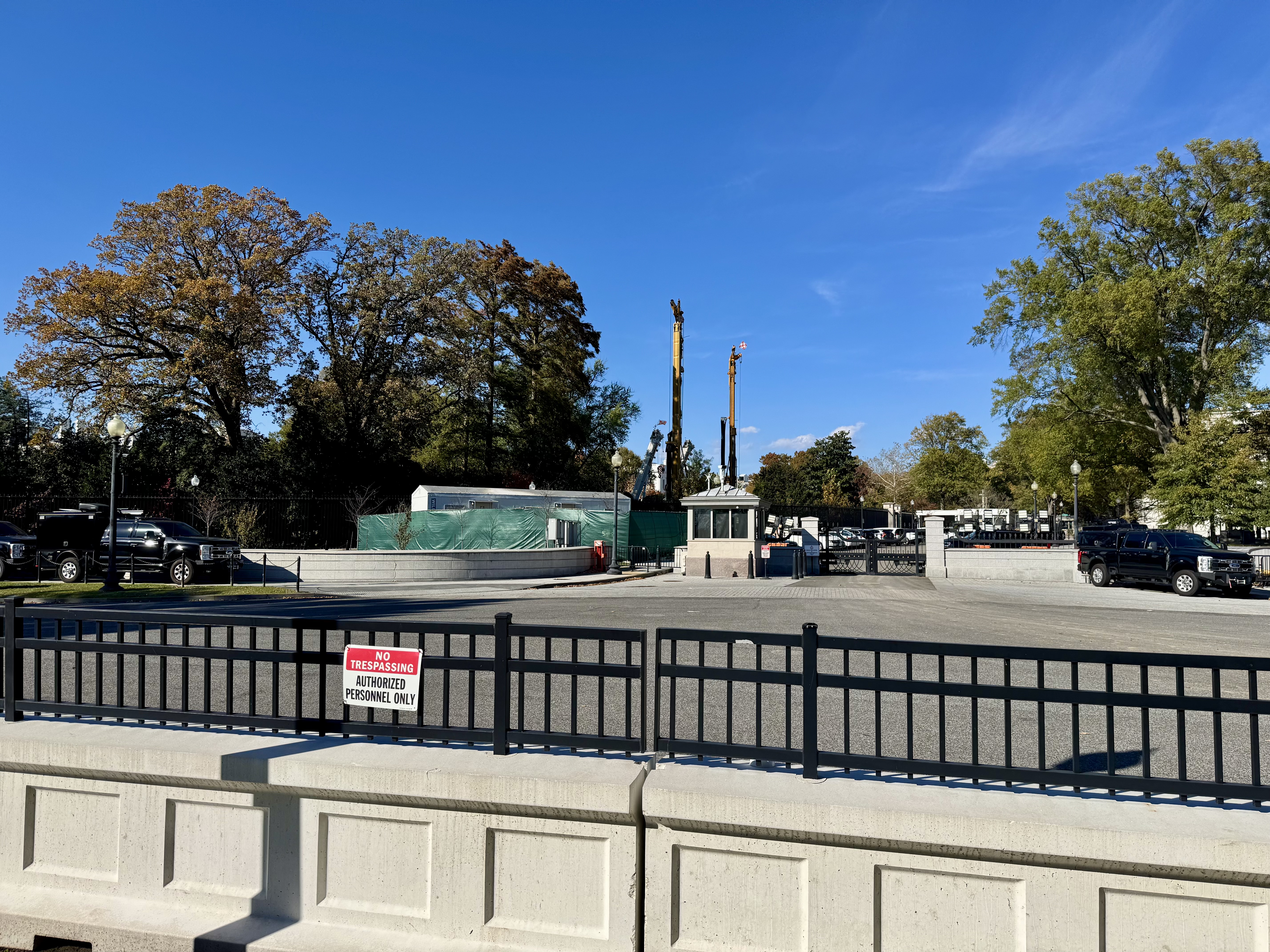
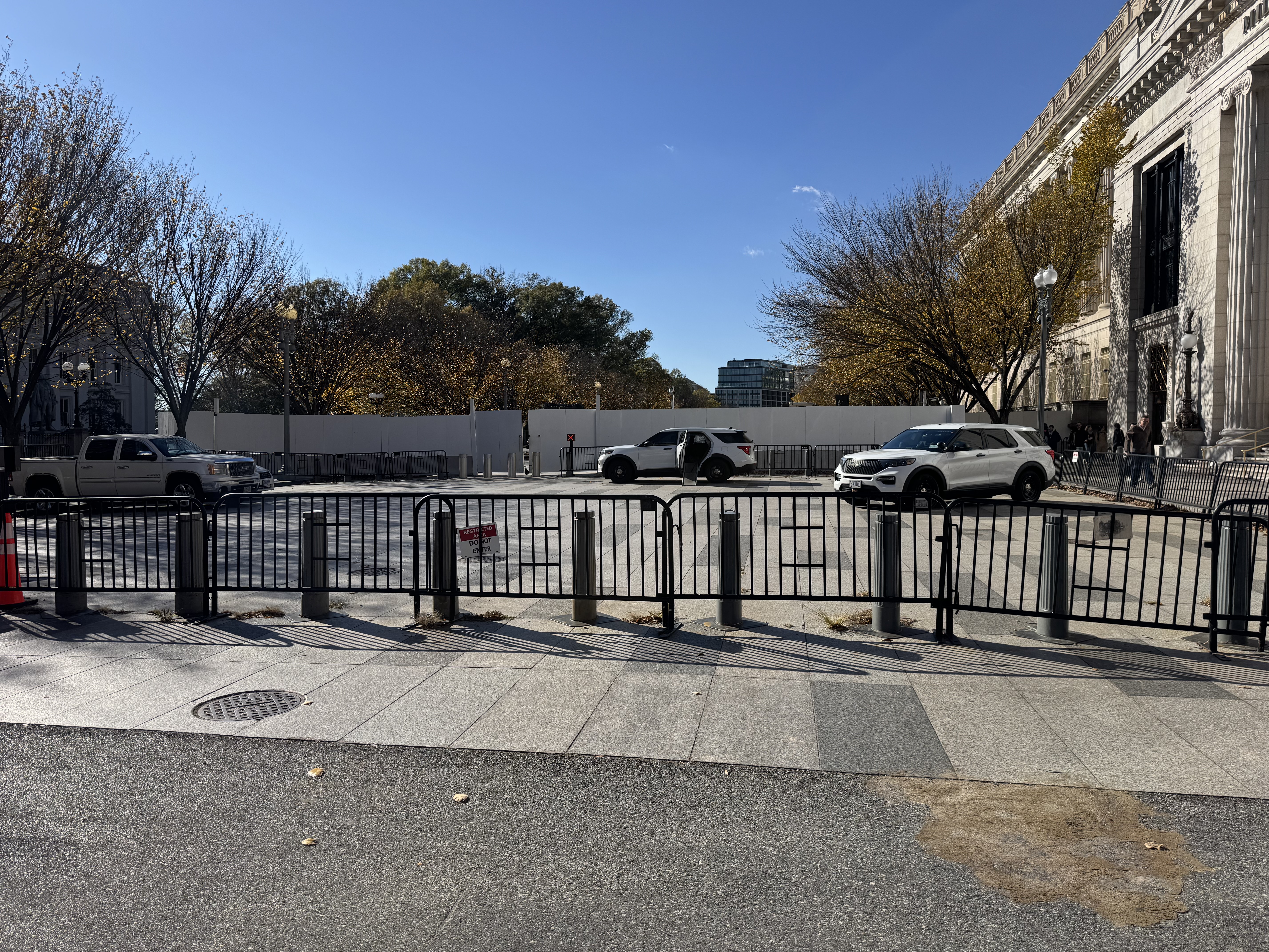
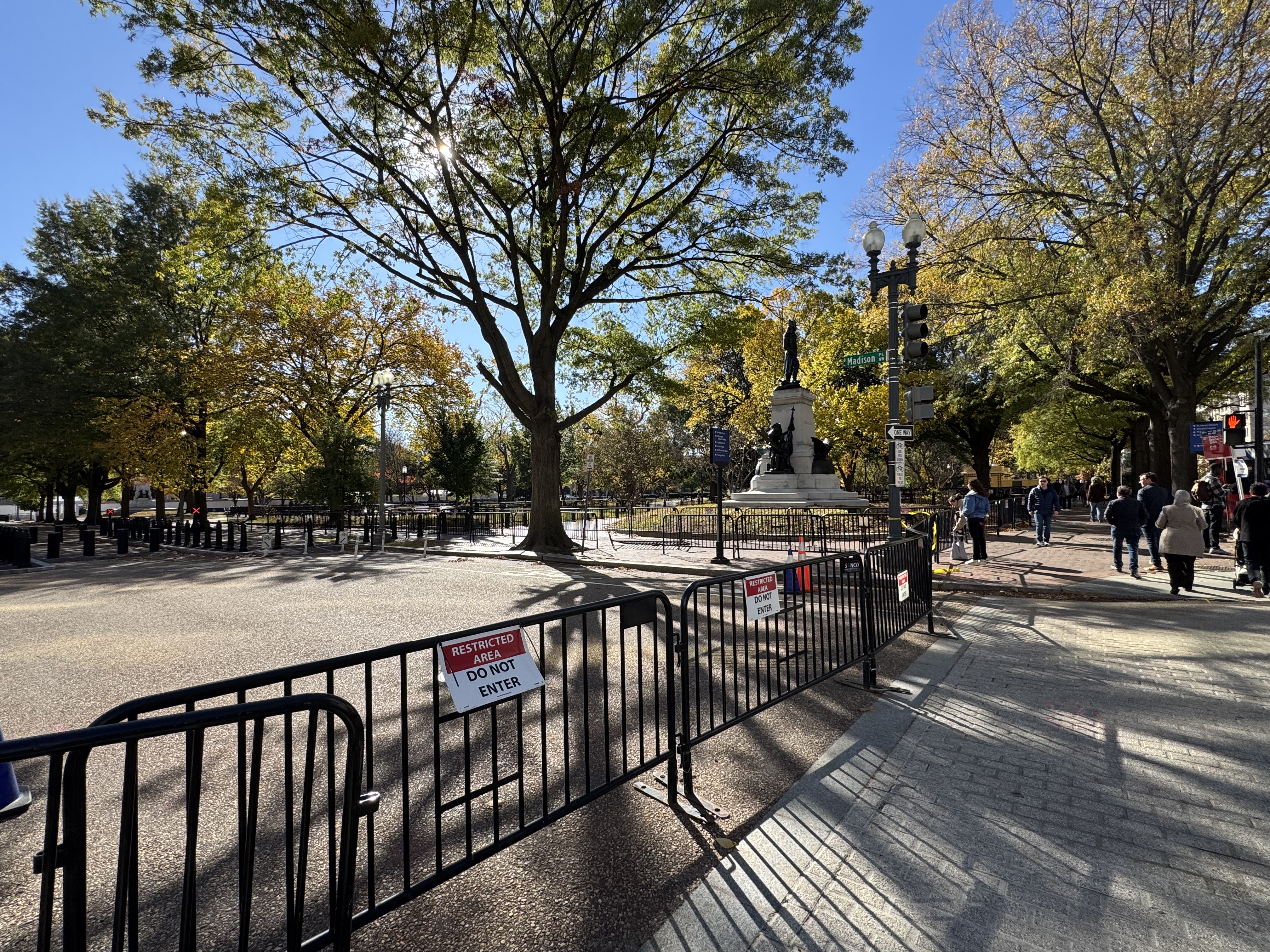
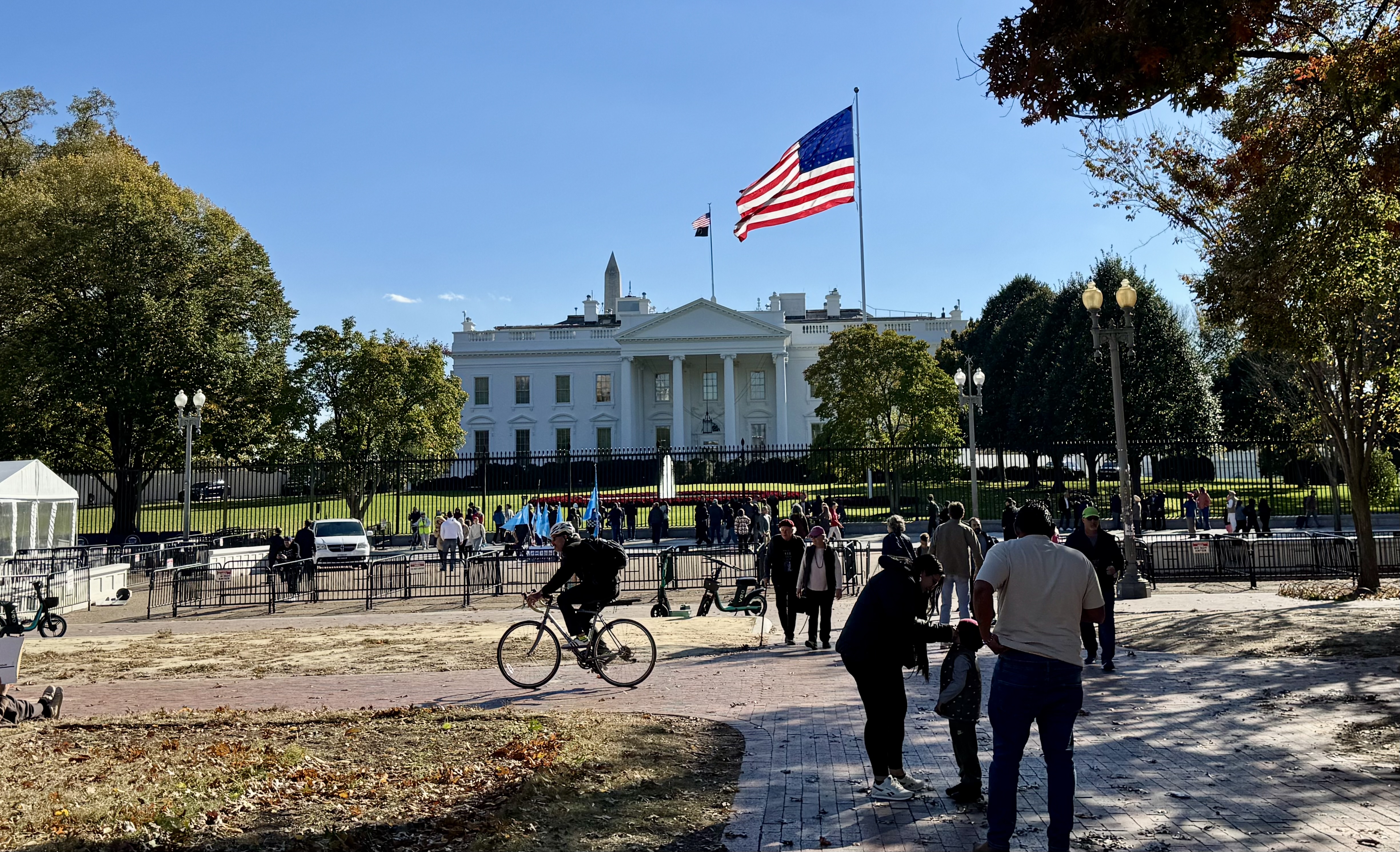
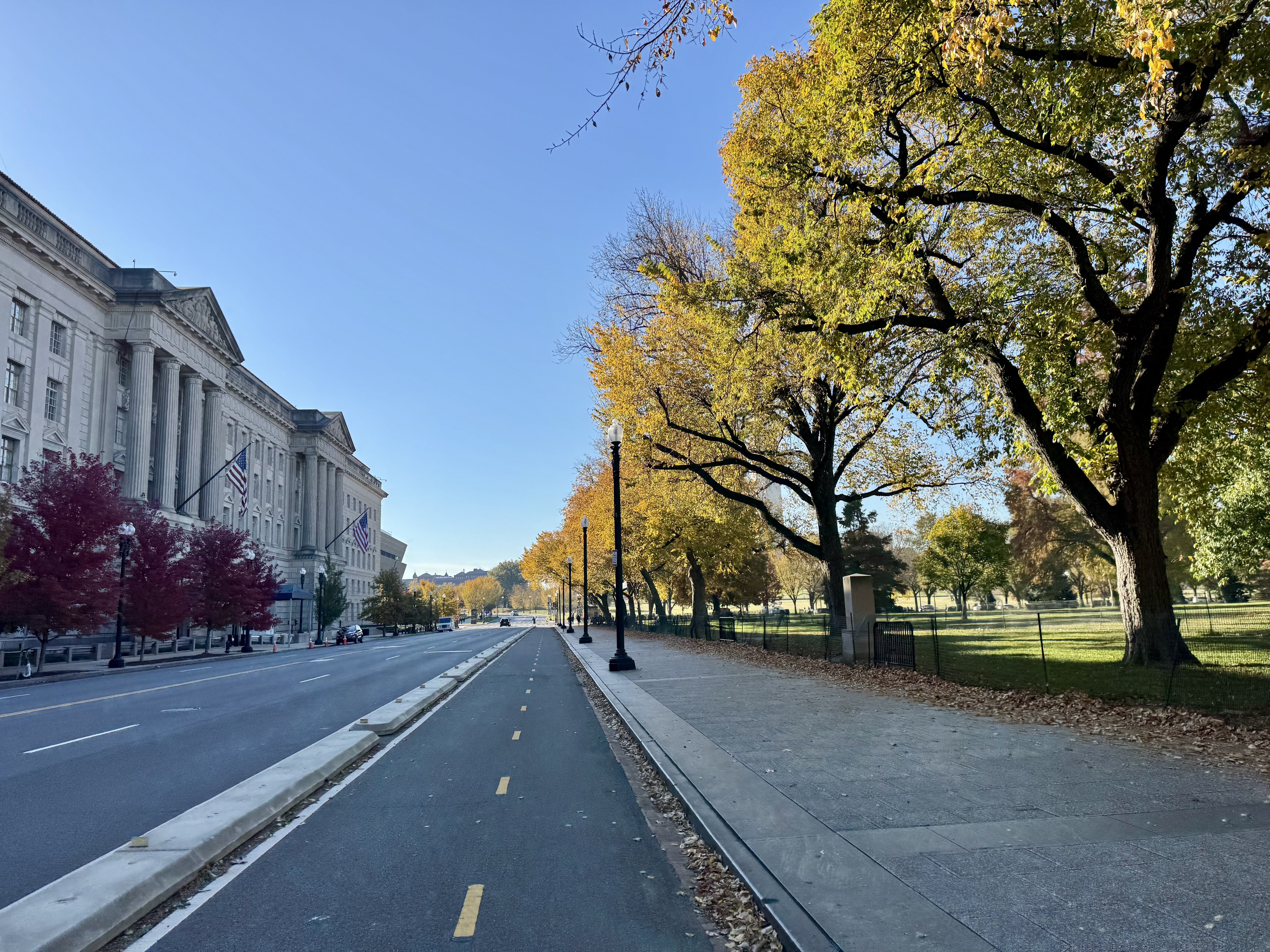
Afterward, Emilia was ready to just walk the few blocks back to our hotel, while I was eager to complete my intended route and biking mileage. So we parted ways and I walked over to a different bike dock alone and found me a fresh ride. From there, I rode through Chinatown and then along the Mall toward the White House. This allowed me to snap selfies in front of key landmarks as part of a game set up by the meeting organizers to get us out and seeing the sights of our nation’s Capitol. I wanted to roll by the White House because a hot topic in the news at the time was the demolition of the East Wing, and I was curious to see what was going on. Of course, the entire east end of the White House grounds was walled off and nothing could be seen other than some cranes that were taller than the walls. I was also saddened to see that the access to the street that runs in front of the White House was completely blocked off from the east side, as was Lafayette Square Park.
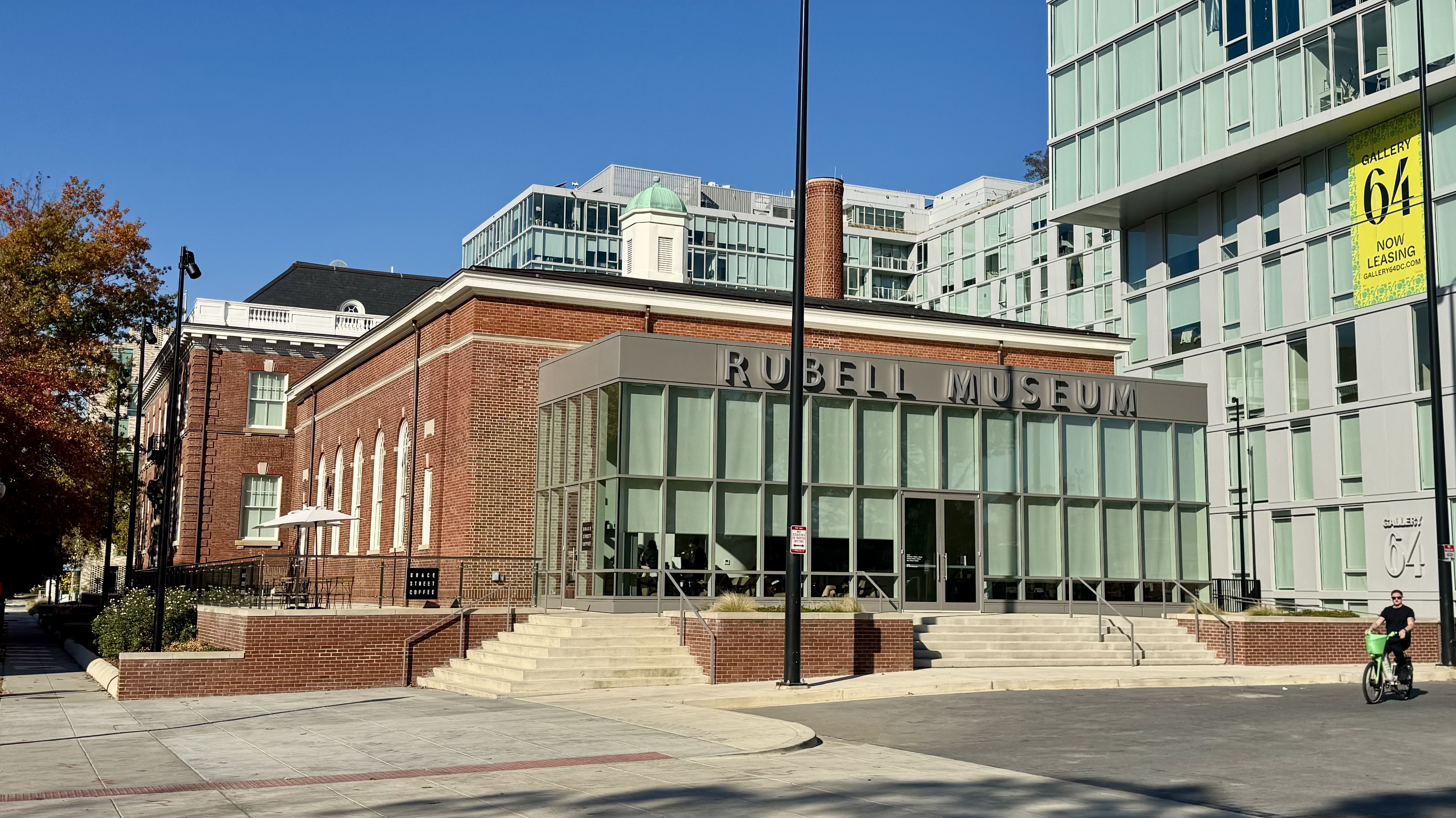
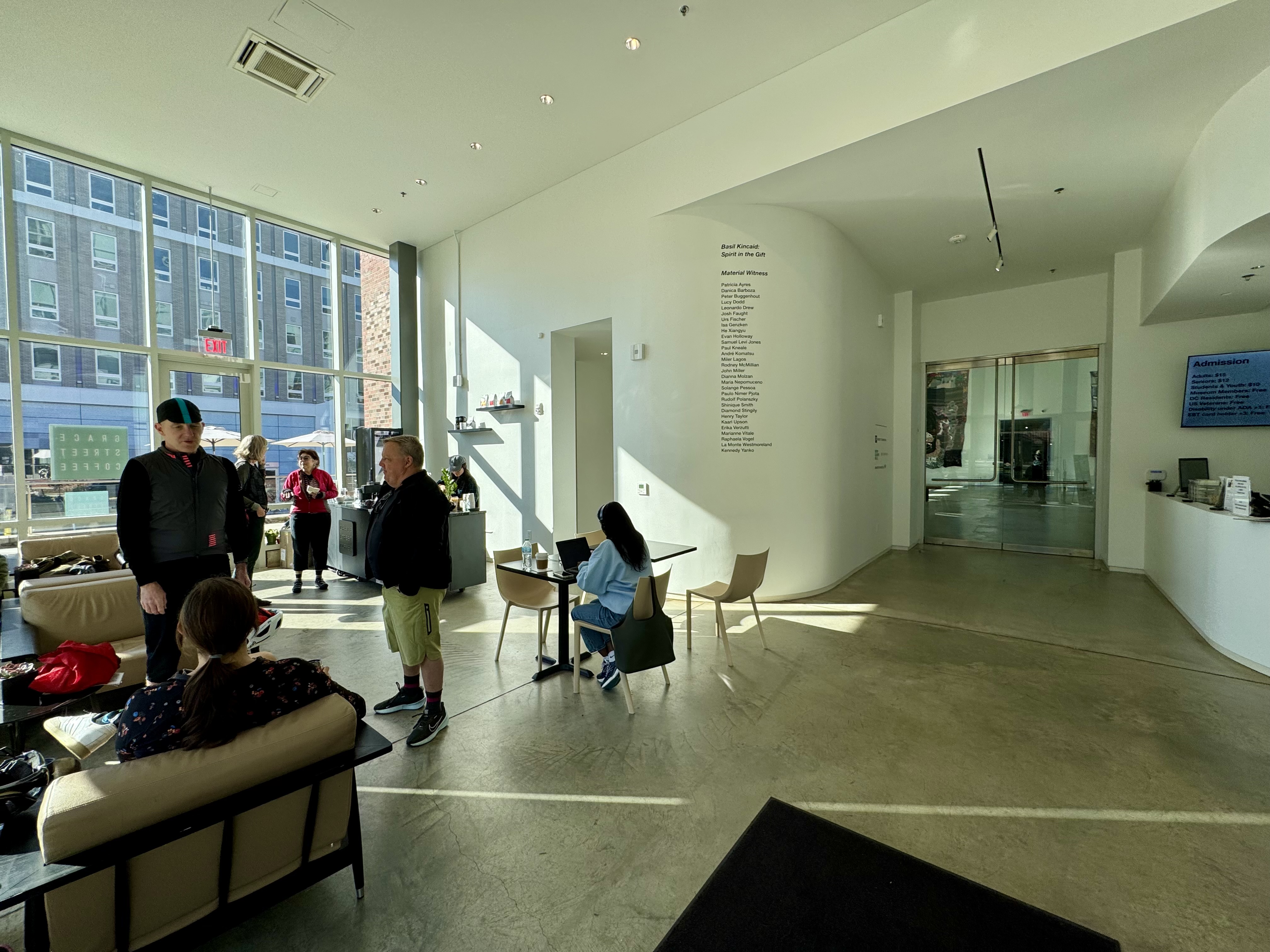
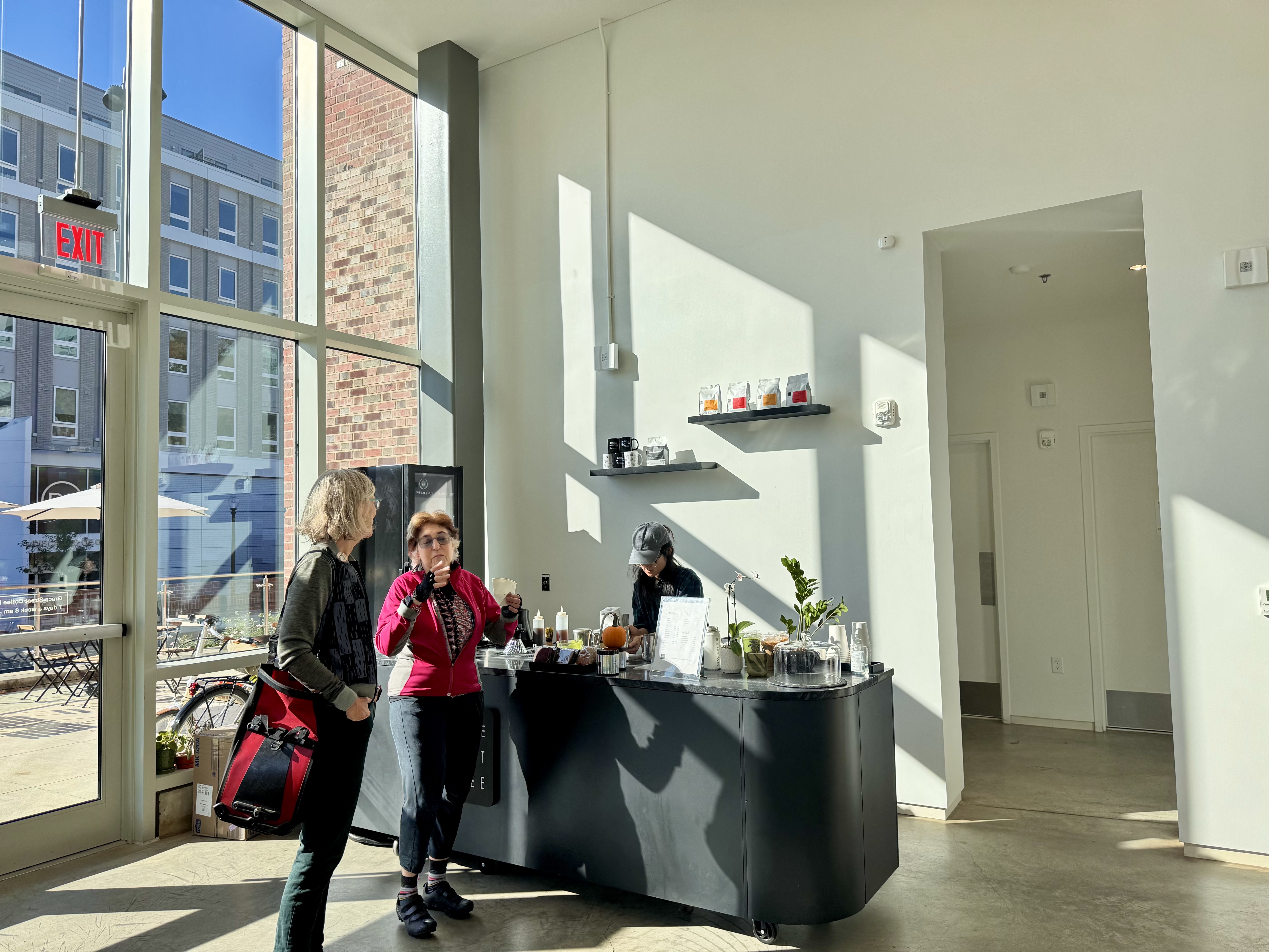
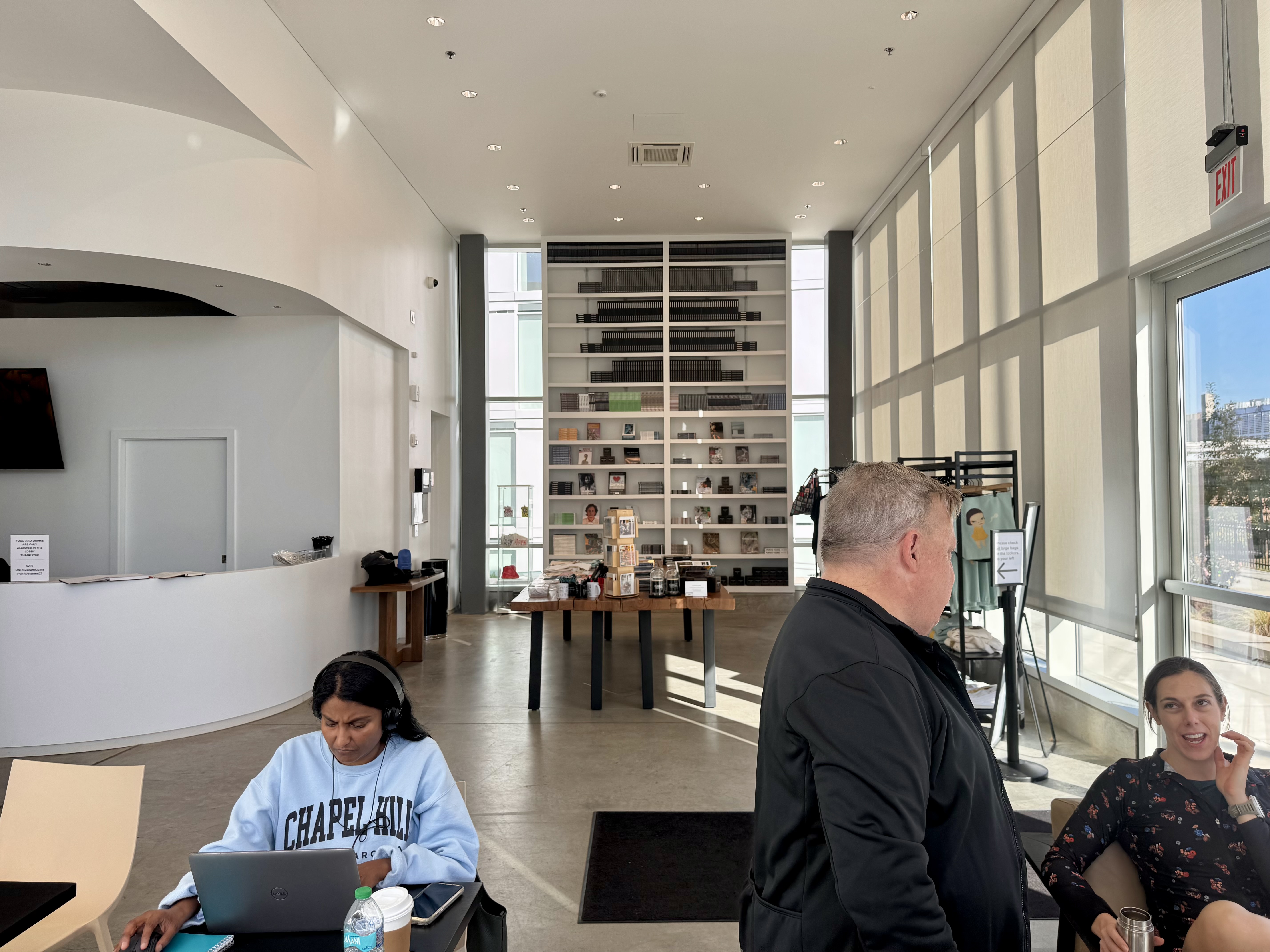
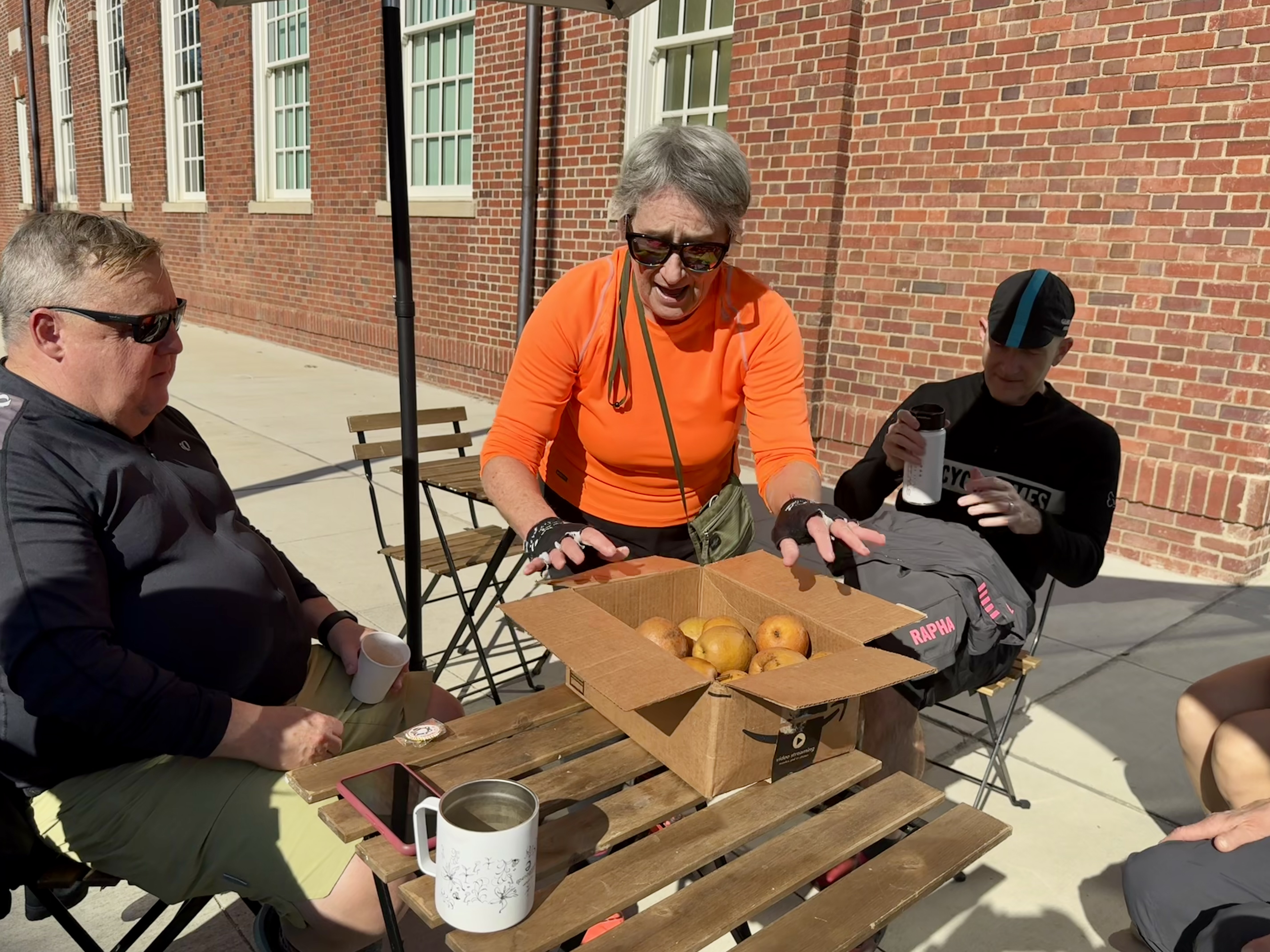
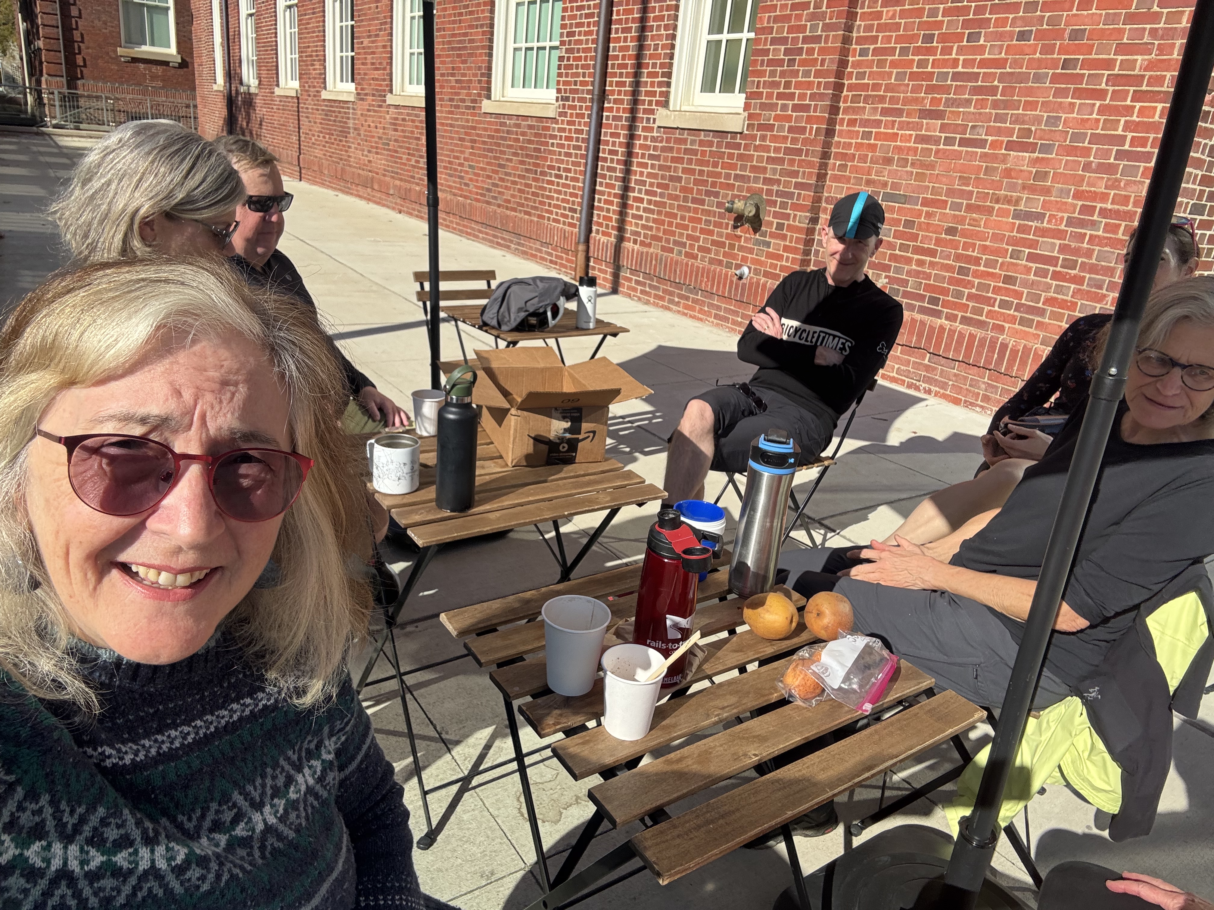
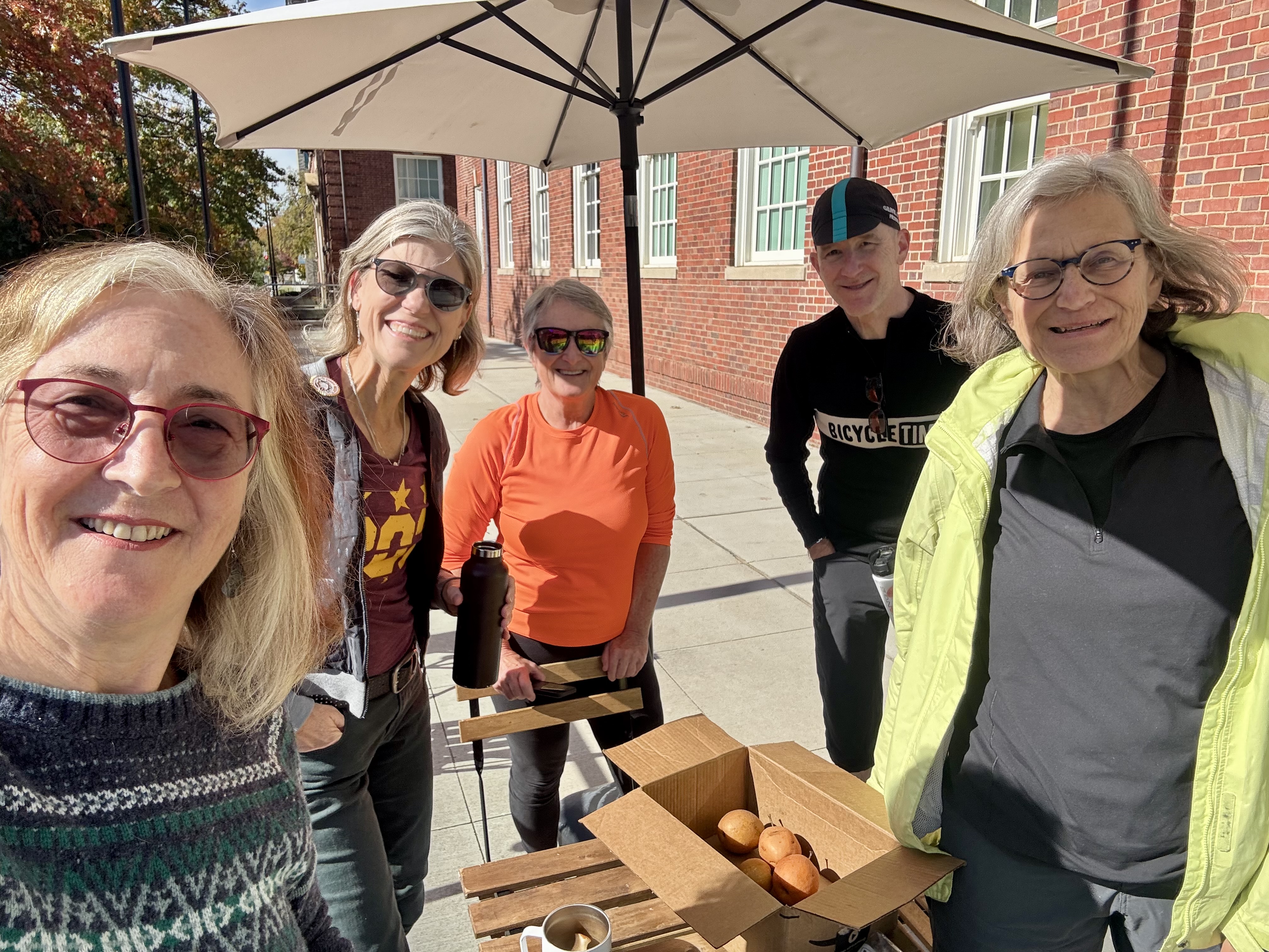
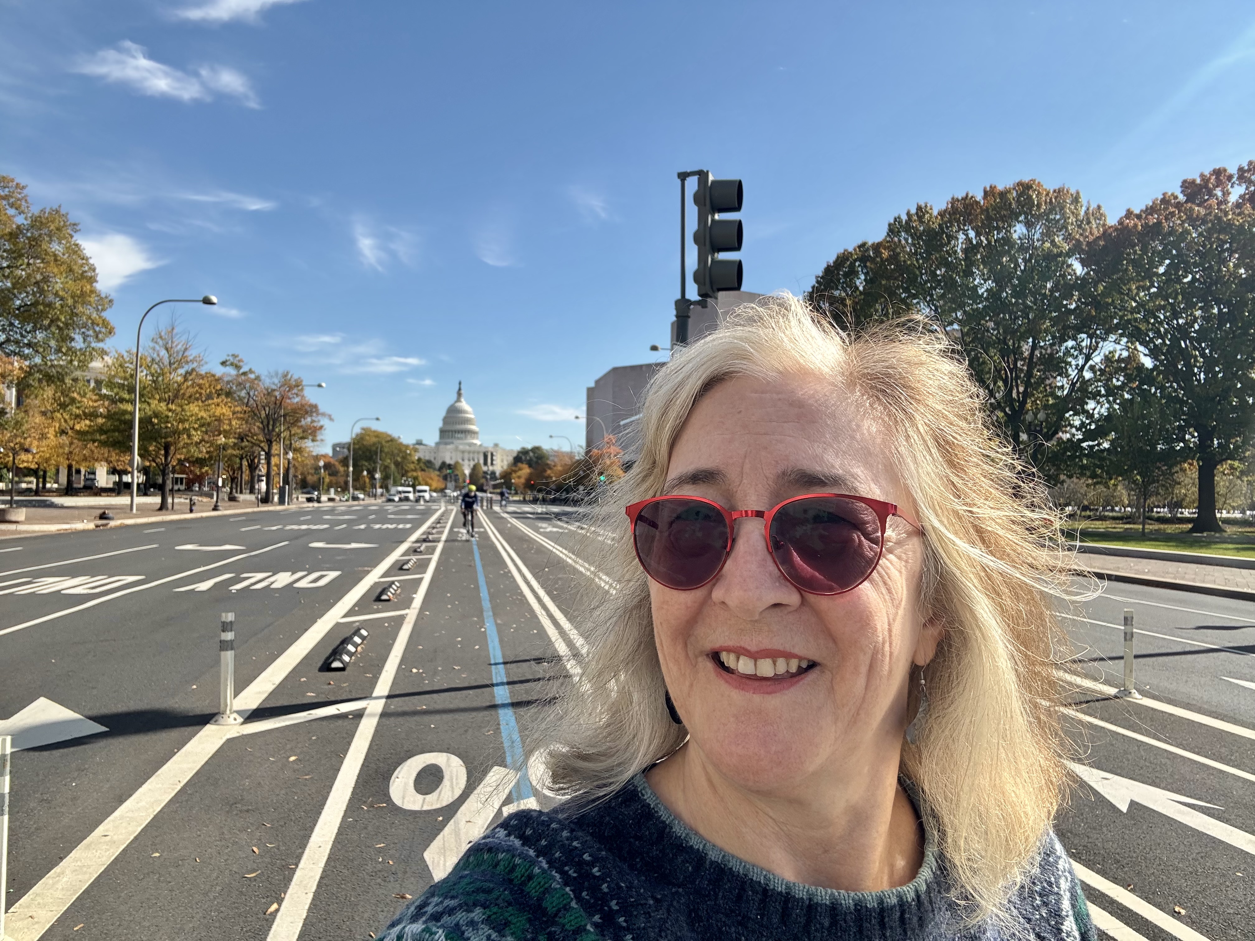
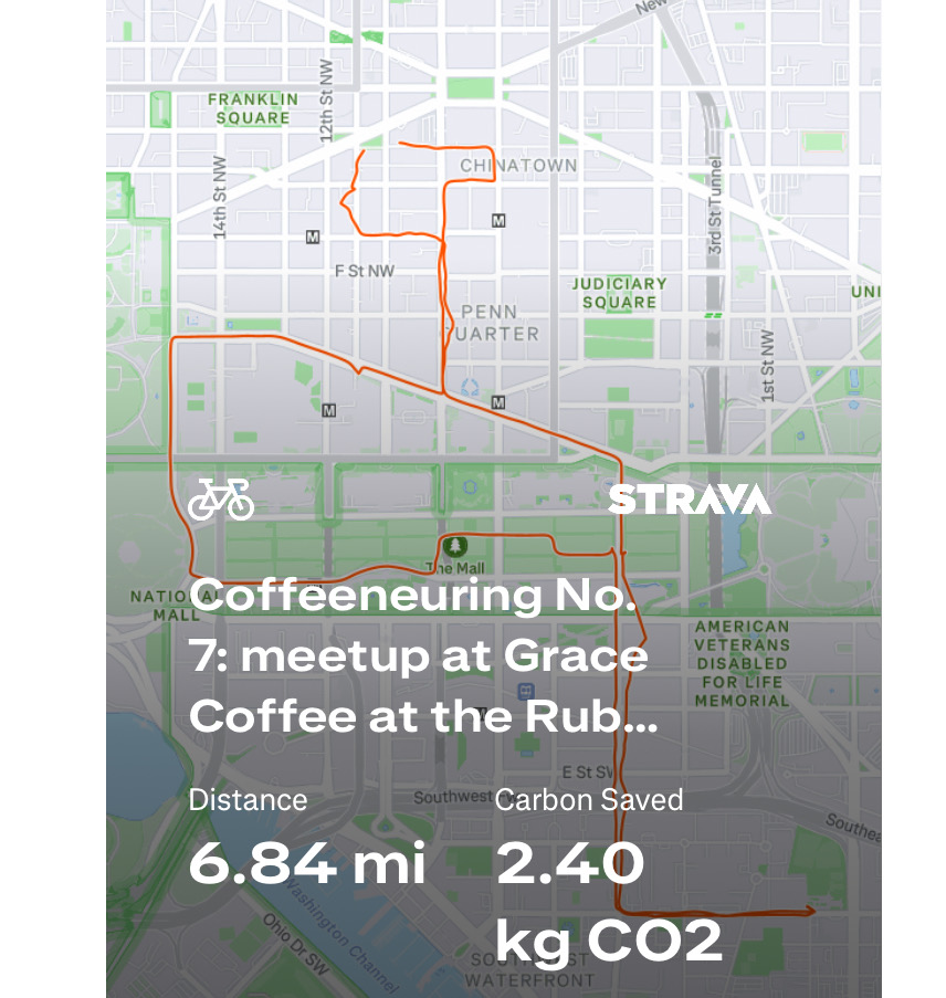
Control No. 7: 11/2/25 Grace Coffee at the Rubell Museum in Washington, D.C.
Beverage: Cafe au Lait
Bike: Capital Bikeshare
Bloomers: Bike Like A Boss (pinstripe)
C+1: D.C. Coffeeneurs
Beauty: super high-ceiling lobby of art museum & gift shop
Miles: 6.8
Last year, the Chief Coffeeneur, who is based in D.C., organized a meet-up on the Mall while I was in town. It was so fun and exciting to be able to hop on a bike and join them the day my conference ended. This year, she did it again, this time at Grace Coffee, which is inside the lobby of the Rubell Museum. I was nervous about the cold temperatures, so I wore my sweater dress and jacket, only to find myself sweating while biking on a lovely, sunny day. We sat out on the patio, and soaked up the sunshine while enjoying the company of fellow coffeeneurs. We had a good turnout; there must have been 7 of us in all, including the Chief Coffeeneur, the Intern, Ilga, and several others whose names I had seen in the Facebook group, and now could get to know in person. One was kind enough to bring a box full of asian pears from her generous tree to share with us.
Not only was the day a beautiful one, the coffee shop in the lobby was a beautiful setting as well. I had a cafe au lait, and also took a couple of asian pears home with me.
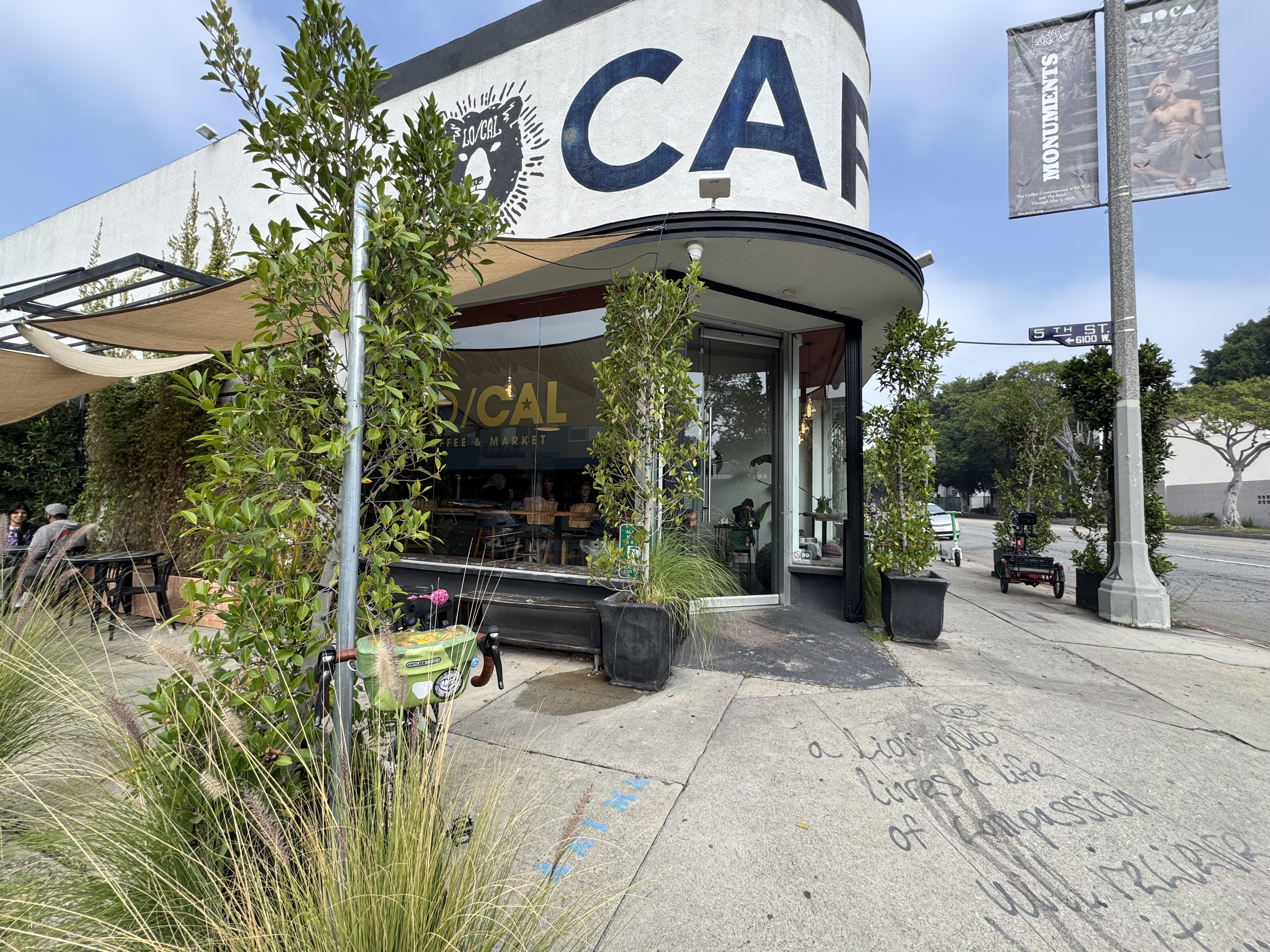
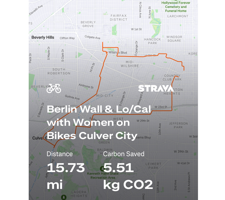
Control No. 8: 11/3/25 Lo/Cal in the Fairfax District(Los Angeles)
Beverage: Cafe au Lait with chocolate (+ sugar bun)
Bike: Volpe
Bloomers: Party Pants
C+1: Women on Bikes Culver City
Beauty: warm, dark wood gives place a cozy feel
Miles: 15.7
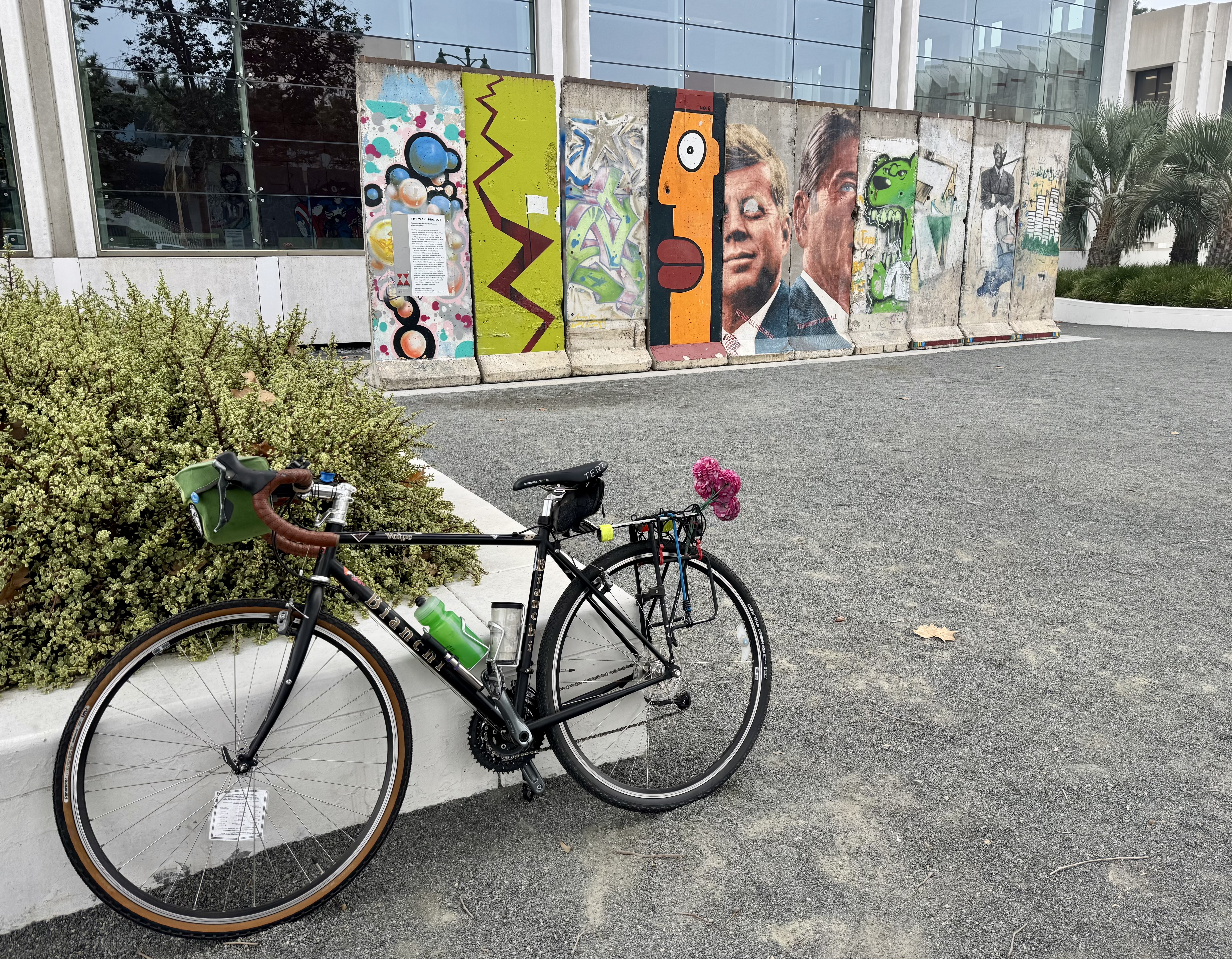
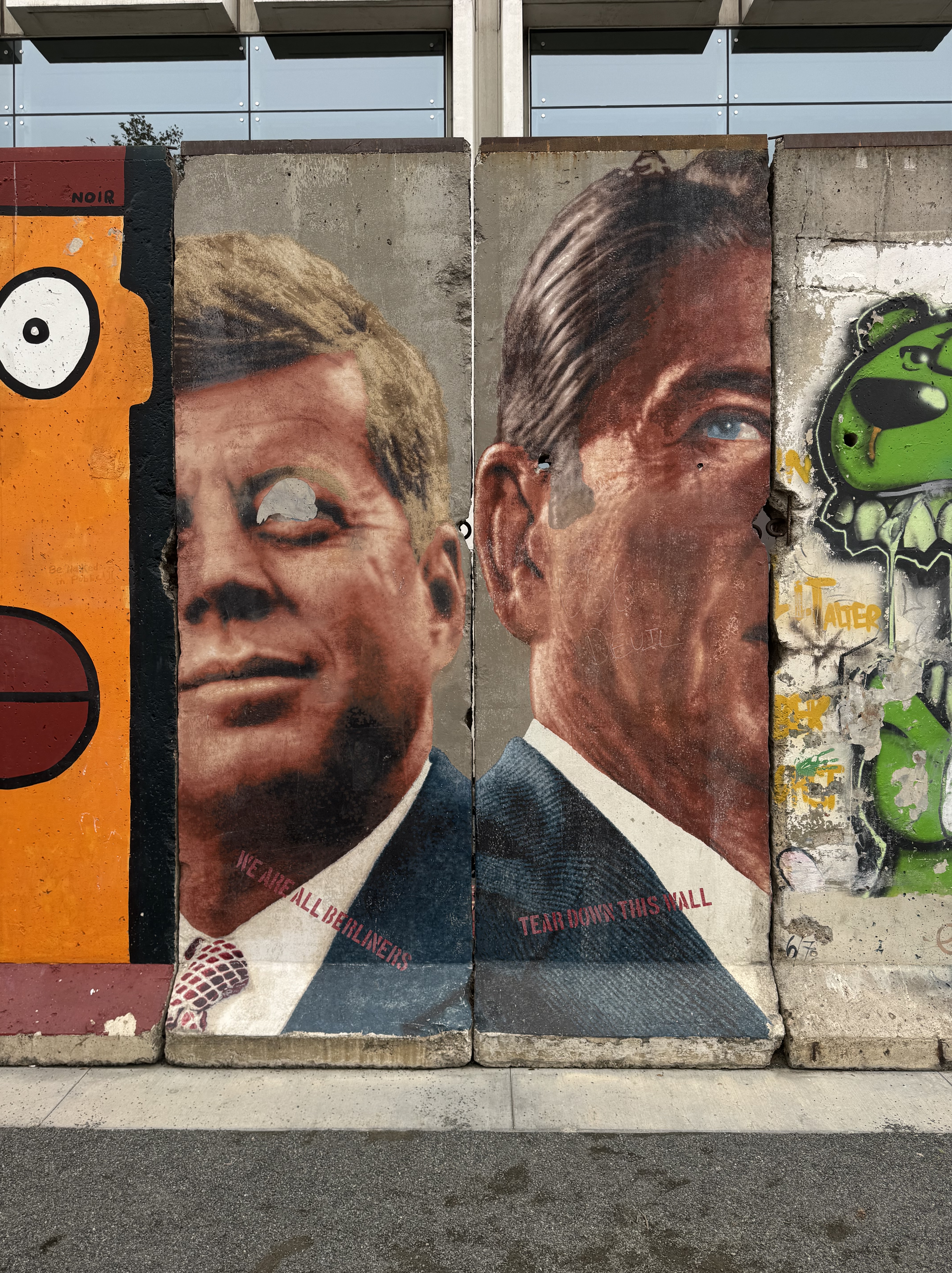
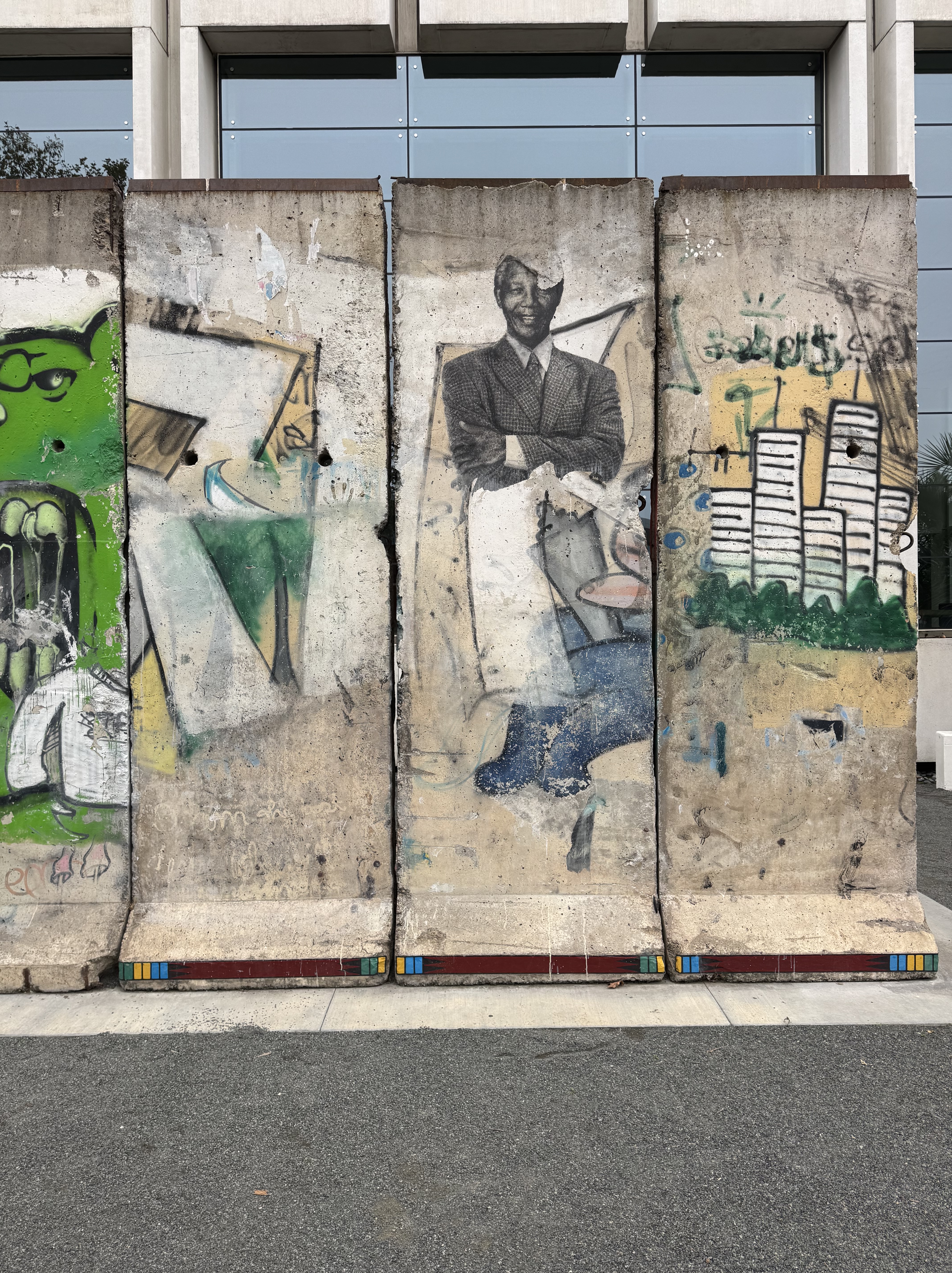
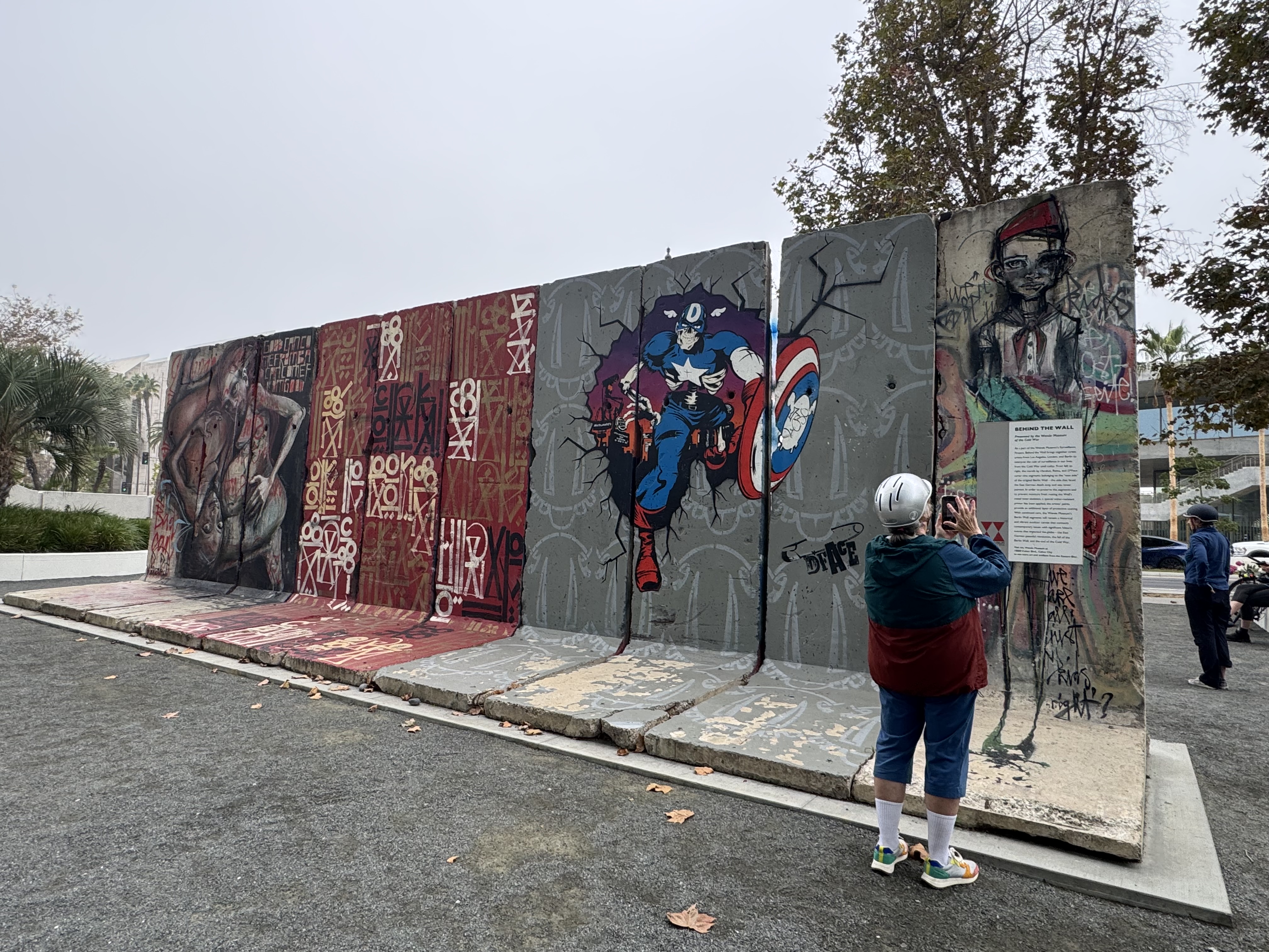
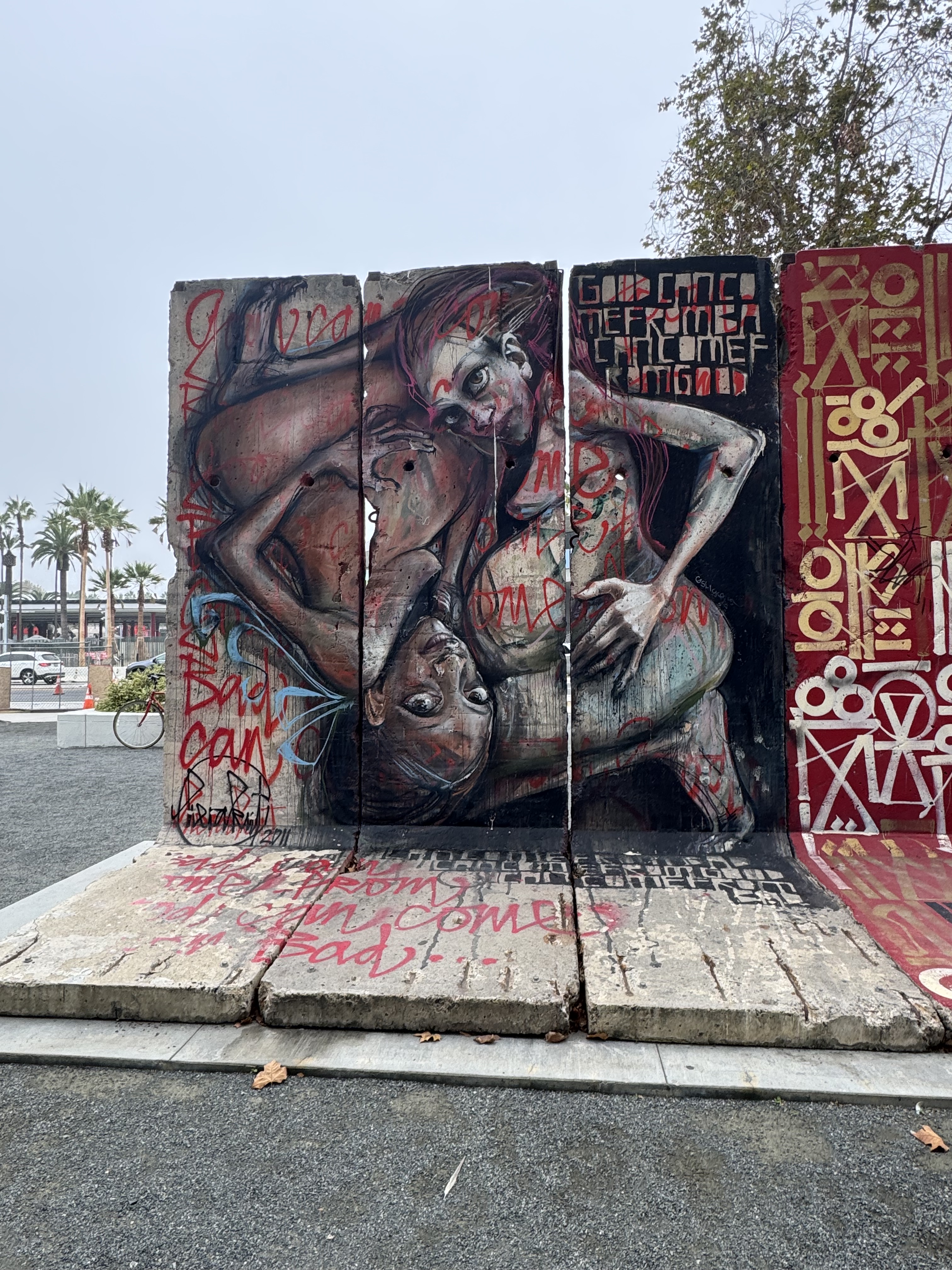
The very next morning after returning from our nation’s capital, the Women on Bikes Culver City group had a ride planned to swing by the pieces of the Berlin Wall on Wilshire Boulevard just across the street from the Los Angeles County Museum of Art (LACMA). I did not want to miss this outing, as I was curious to see the Berlin Wall pieces after having seen the East Side Gallery in Berlin the previous Summer. I was also interested in getting a glimpse of the ongoing construction of a fascinating addition to LACMA, which sweeps along and across Wilshire Boulevard, literally over the street. From there, the group rode over to Lo/Cal, a coffee shop with a very warm and inviting interior. I had a cafe au lait (again, but this time with chocolate added in) and a scrumptious sugar bun.
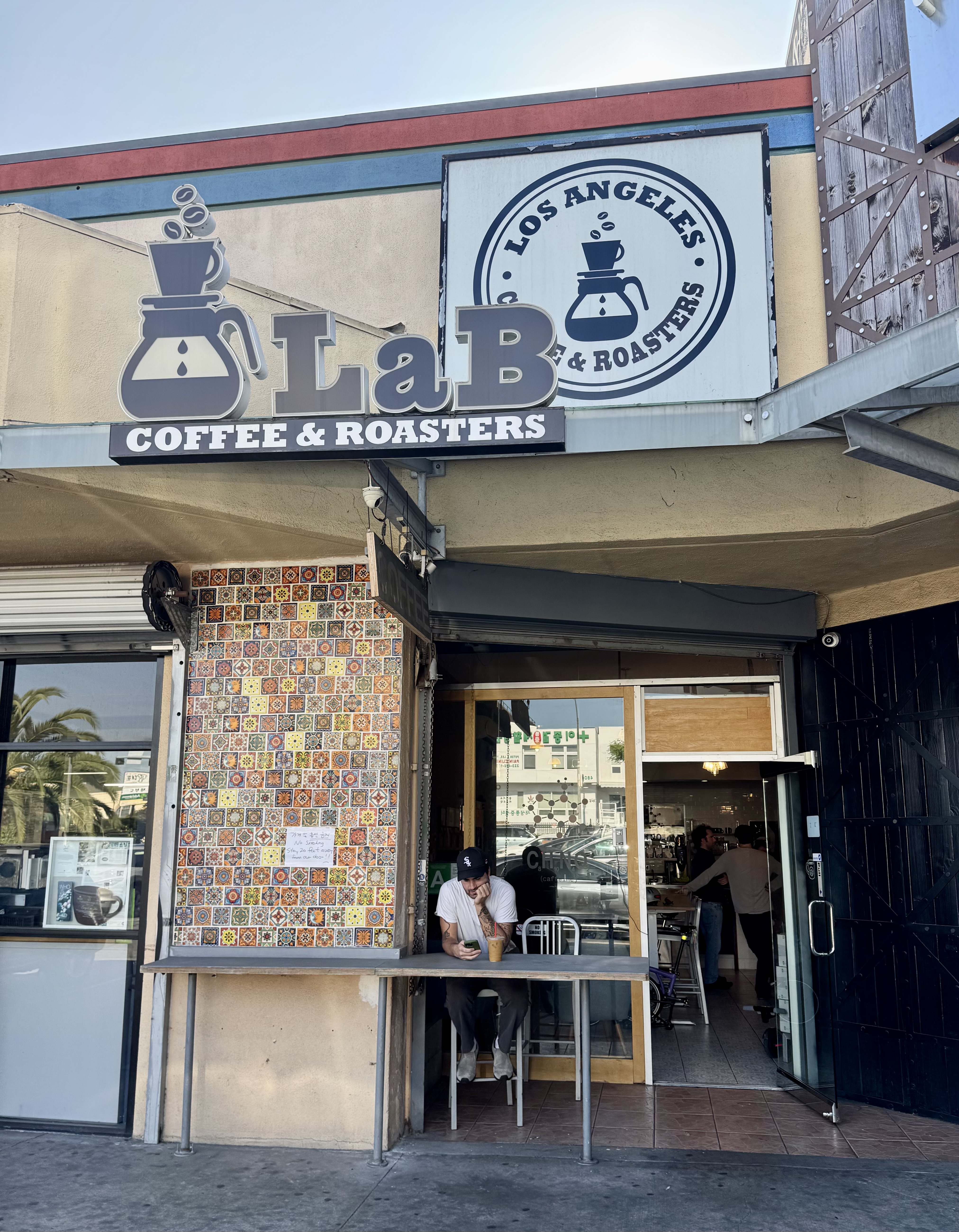
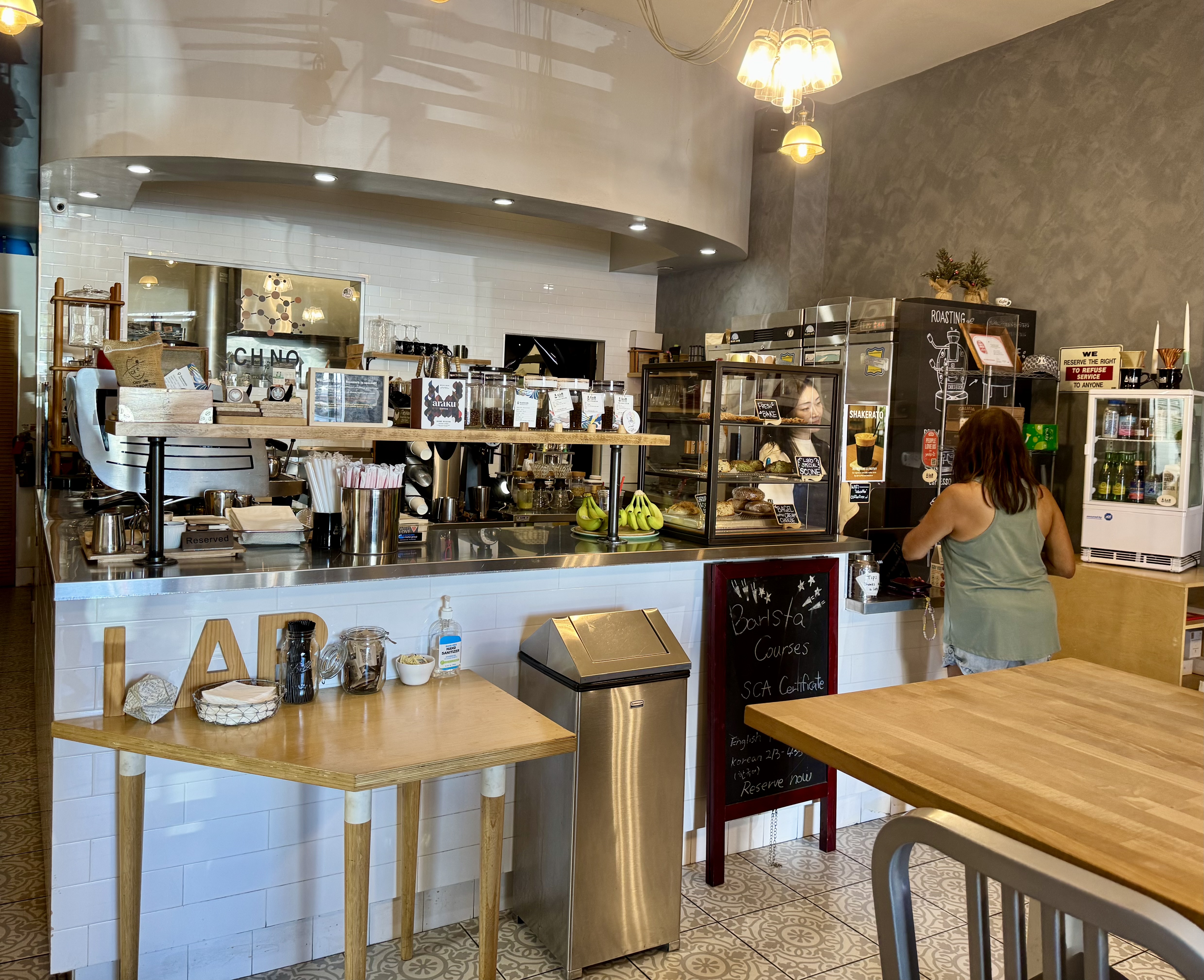
Control No. 9: 11/7/25 Lab Coffee & Roasters (Los Angeles)
Beverage: Spanish Latte
Bike: Brompton
Bloomers: Dazzling Amethyst Jeweltone Bloomers
C+1: Joni
Beauty: MONUMENTS Exhibits
Miles: 15
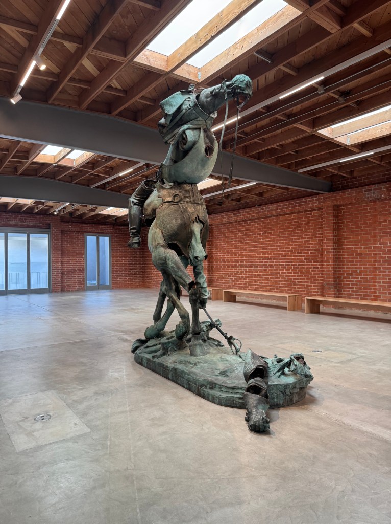
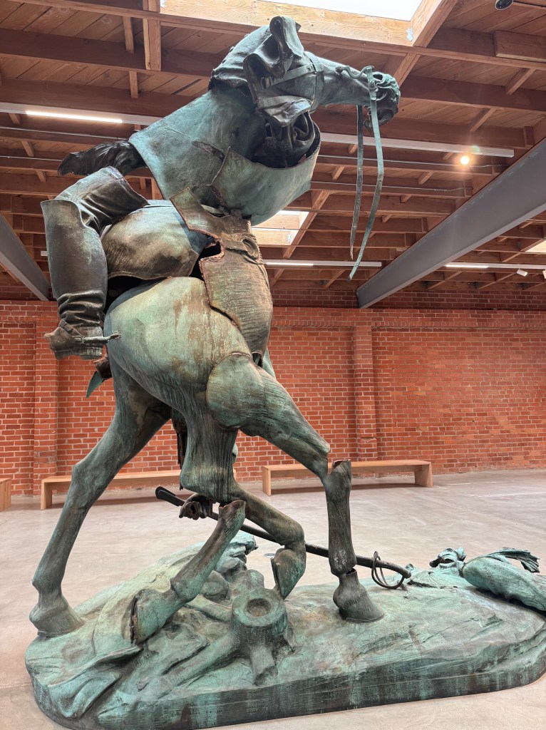
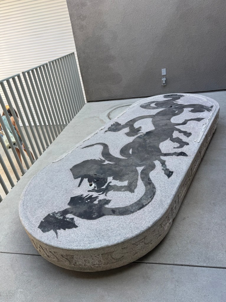
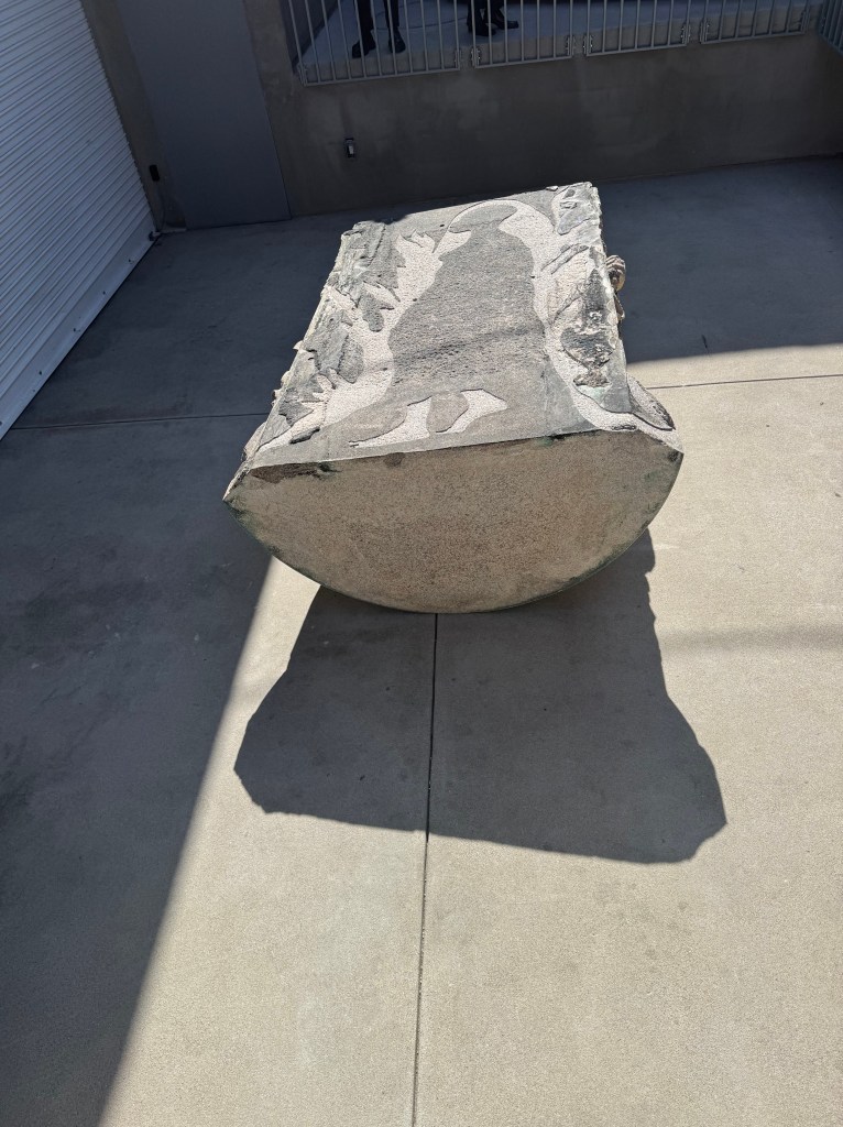
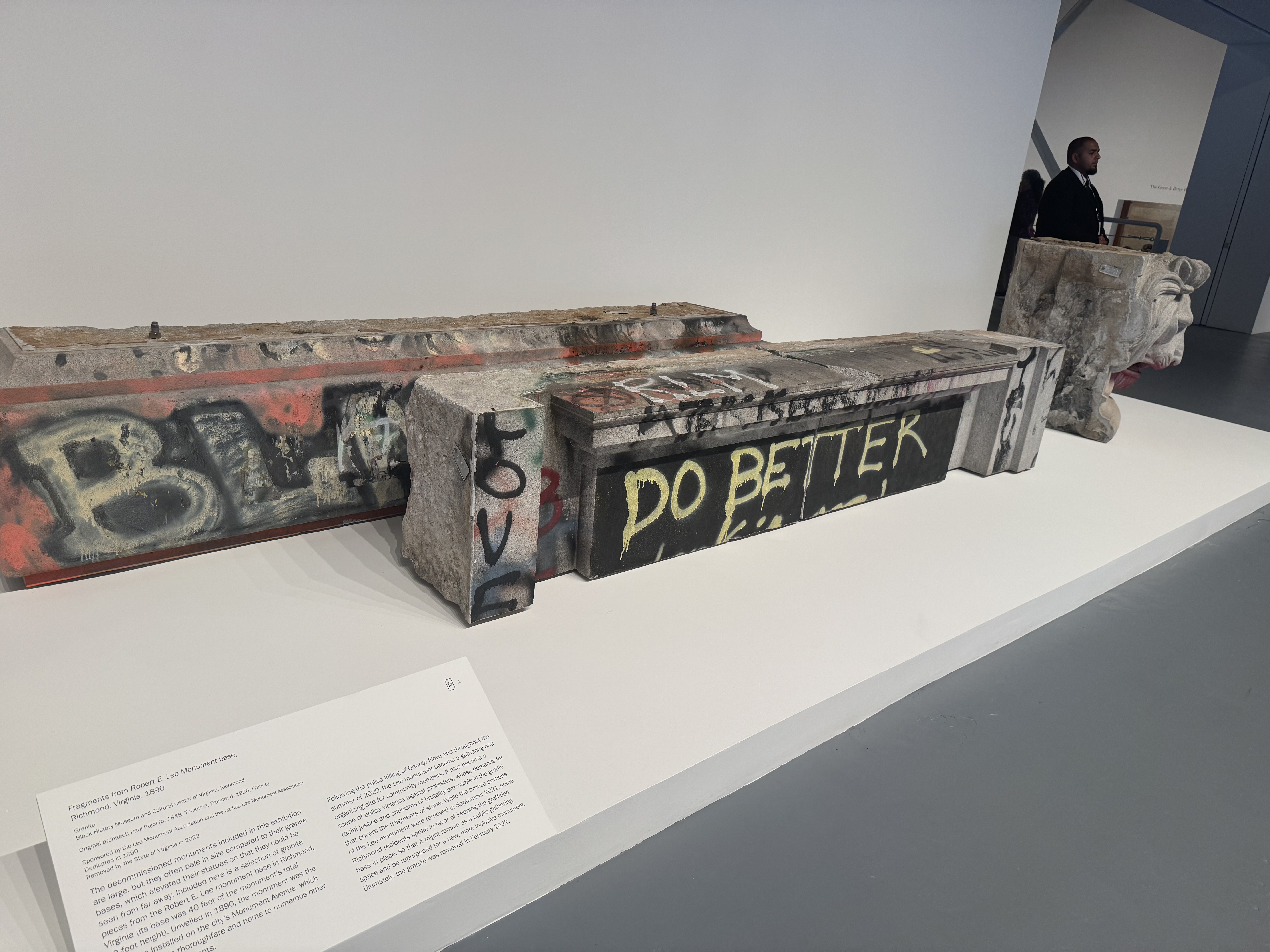
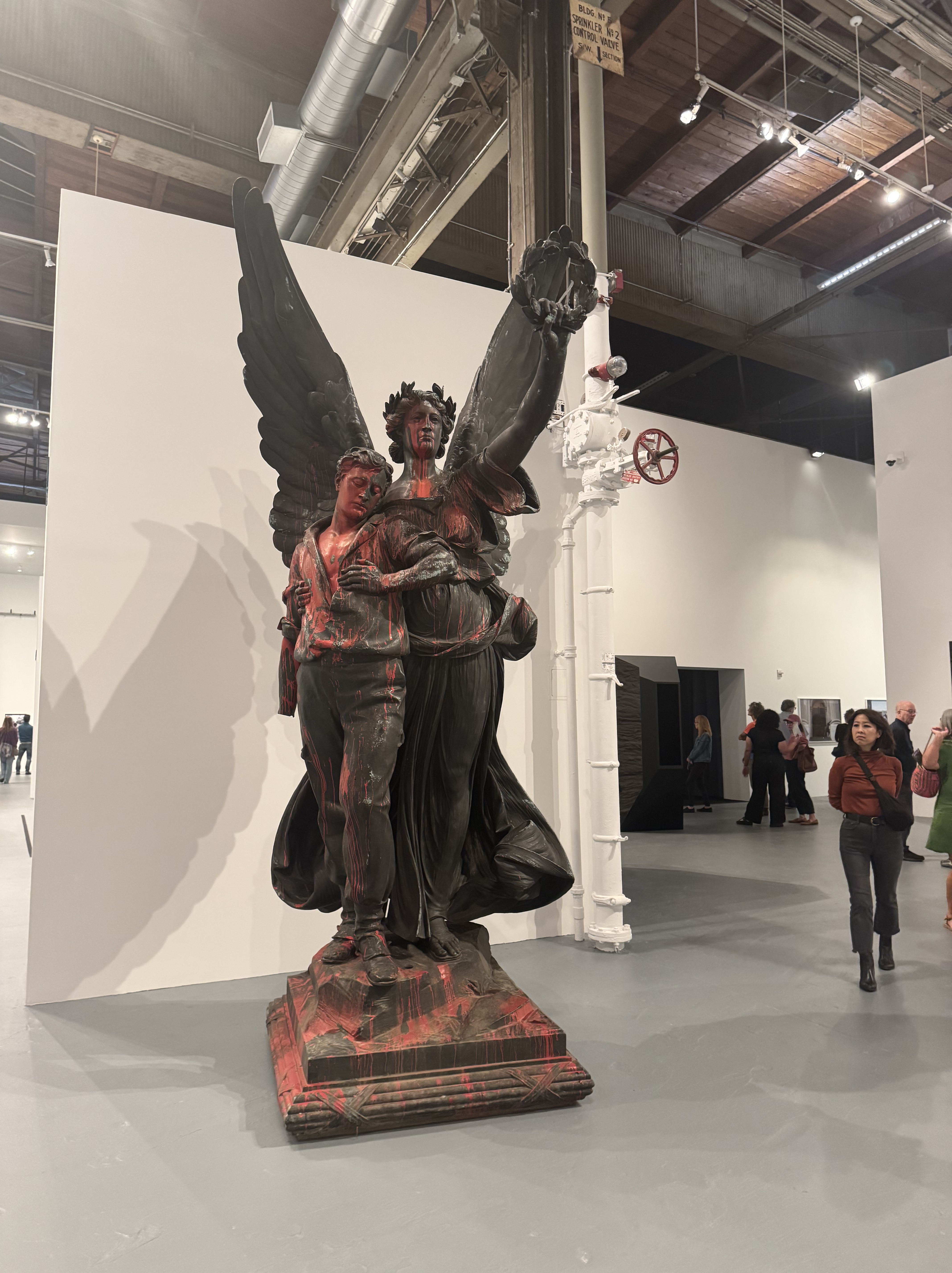
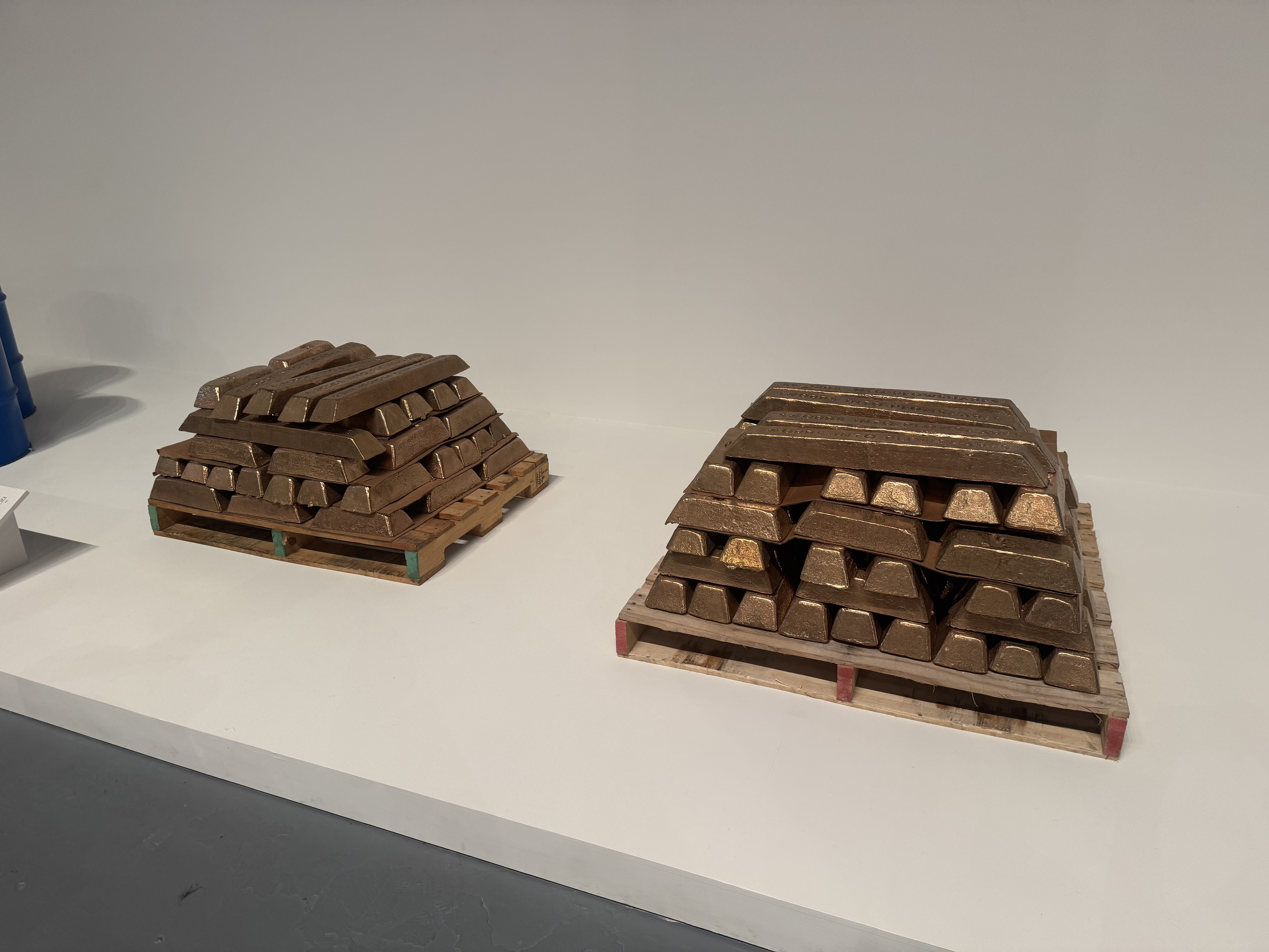
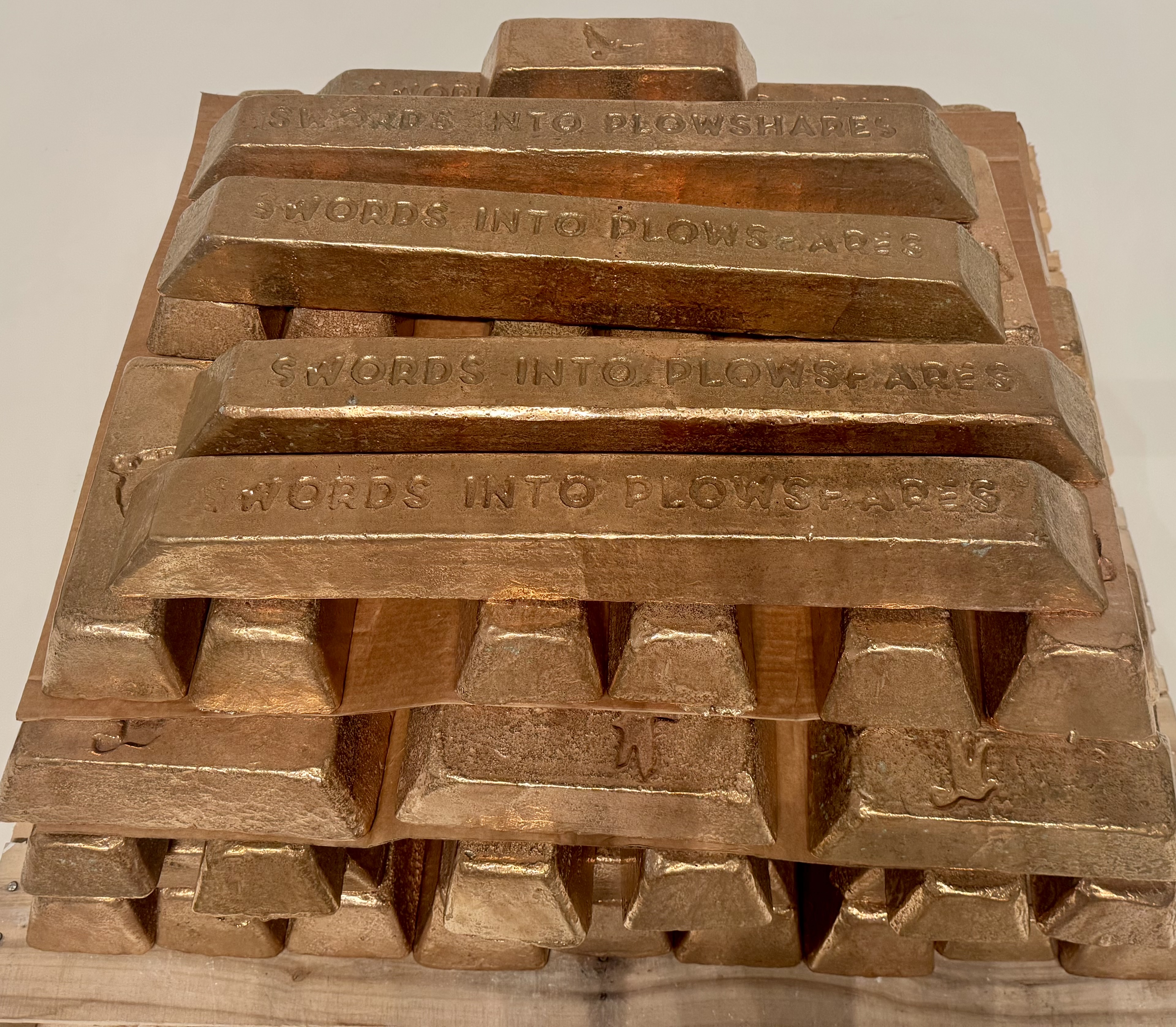
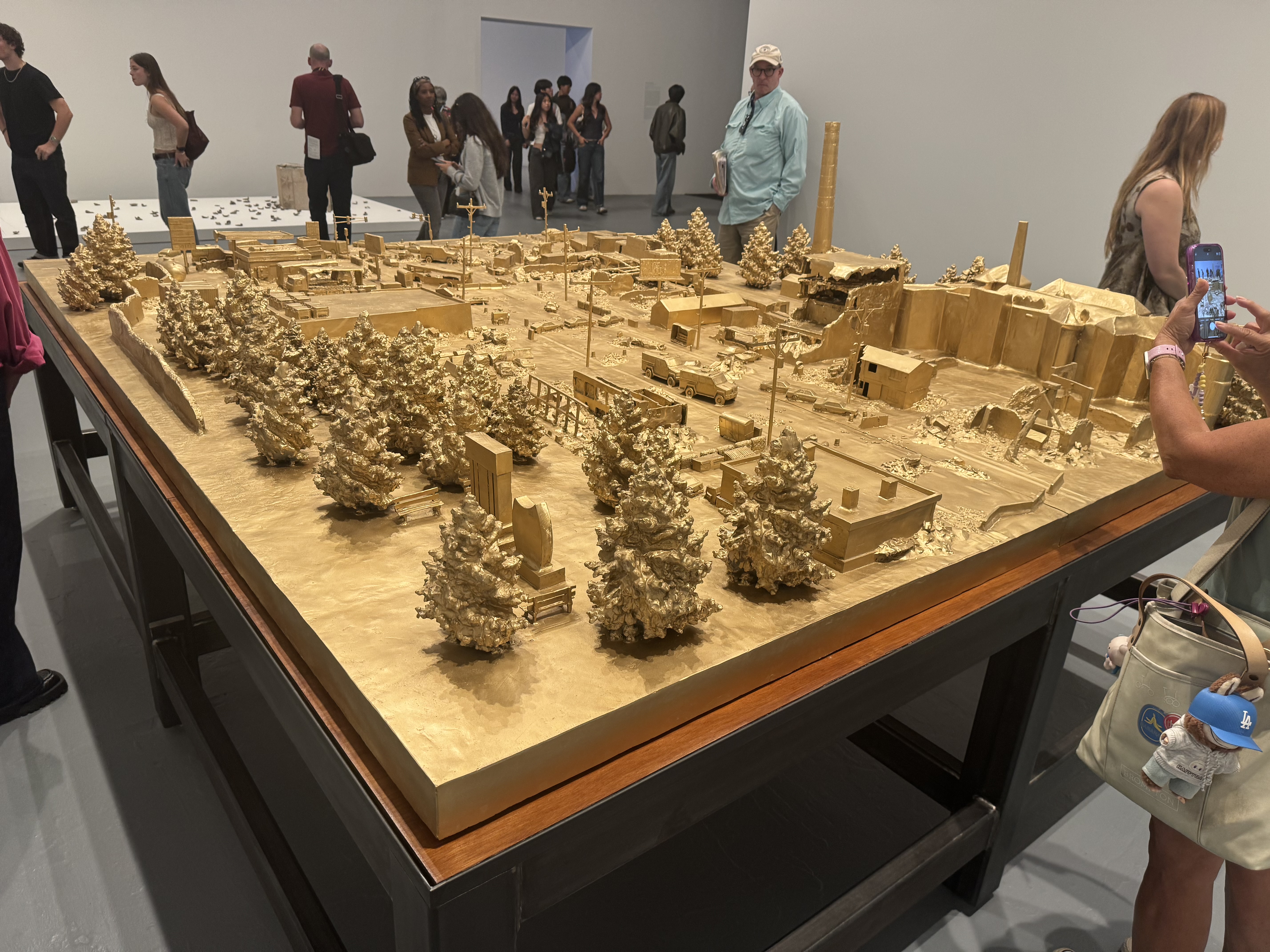
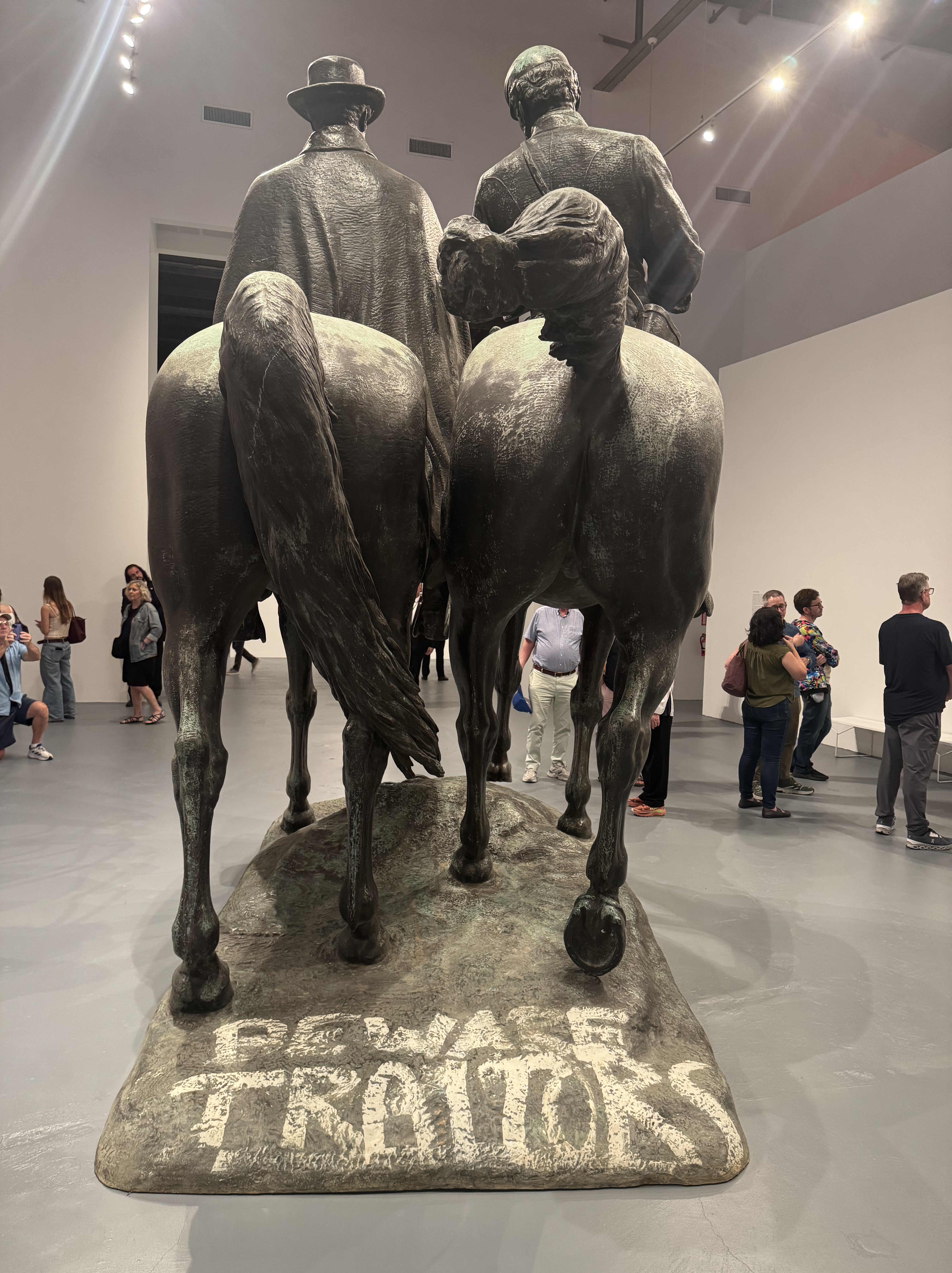
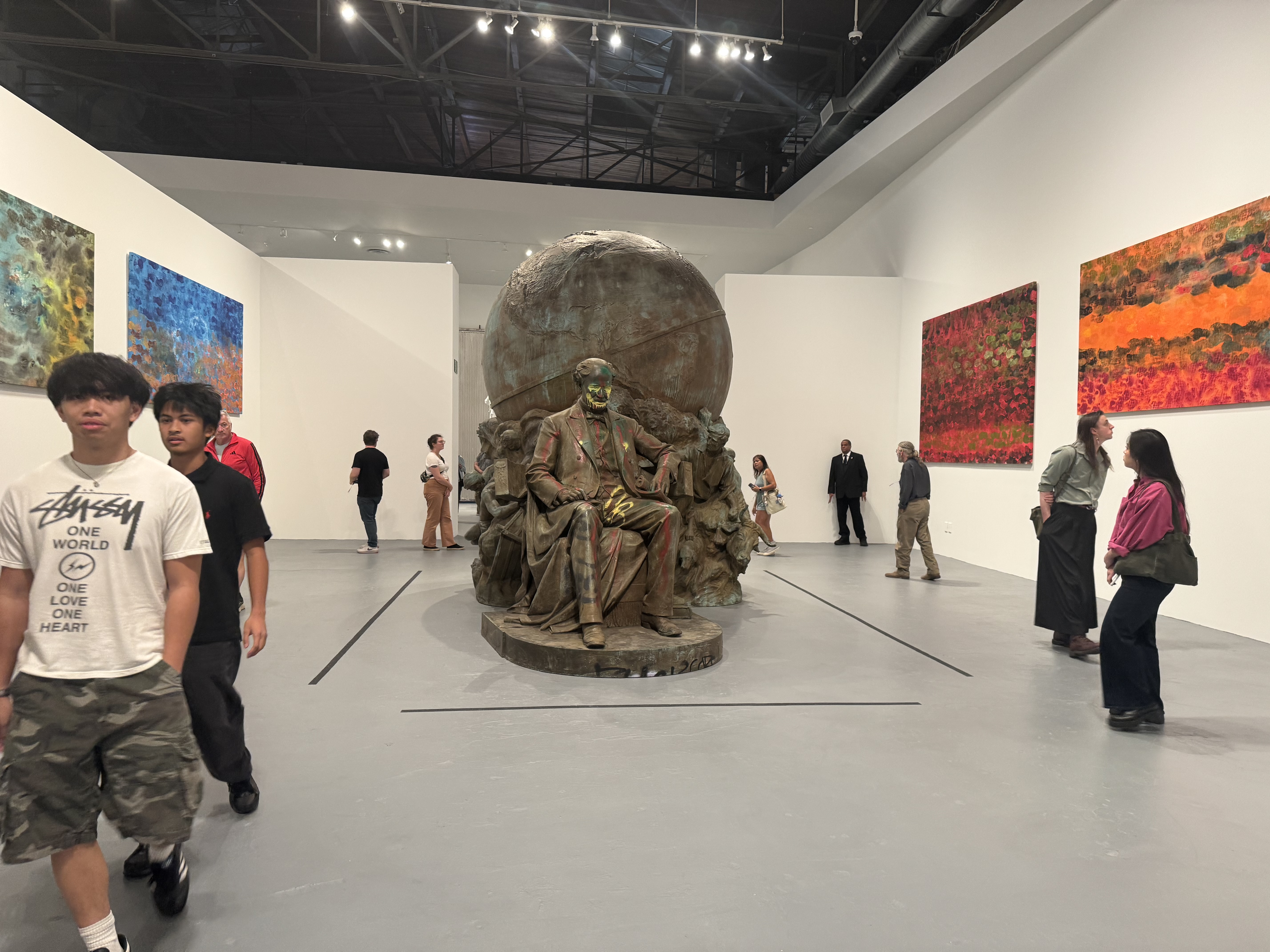
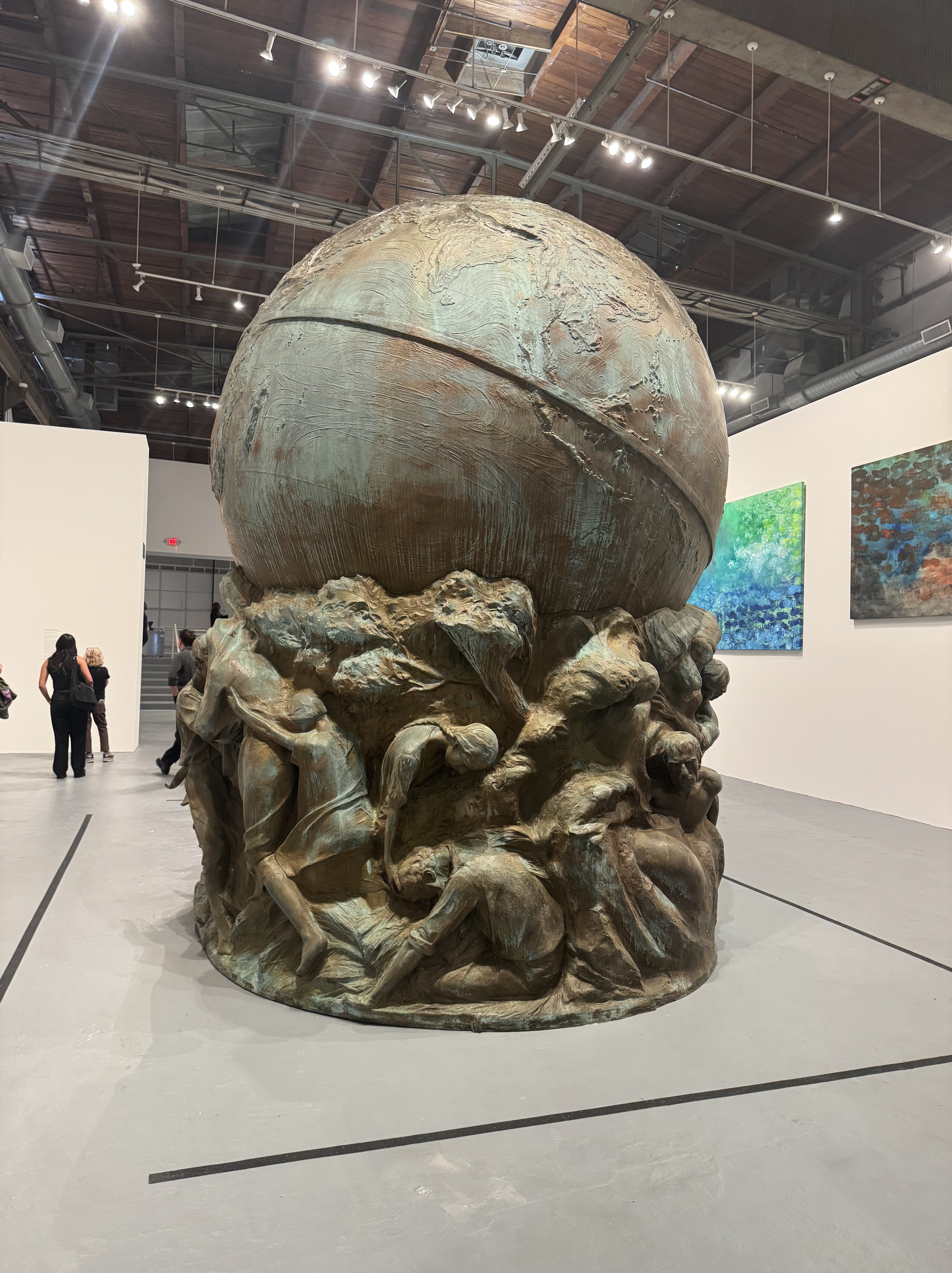
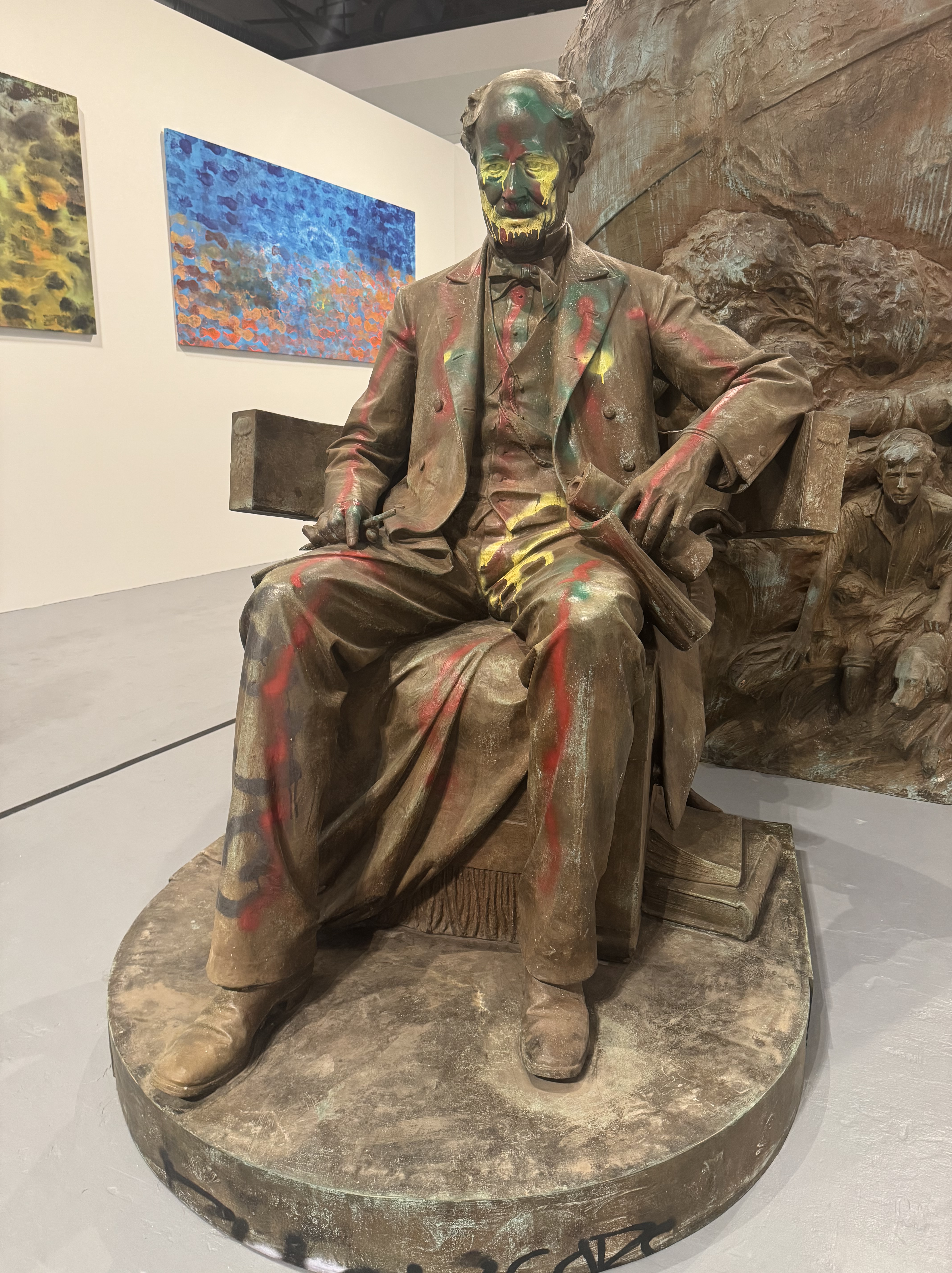
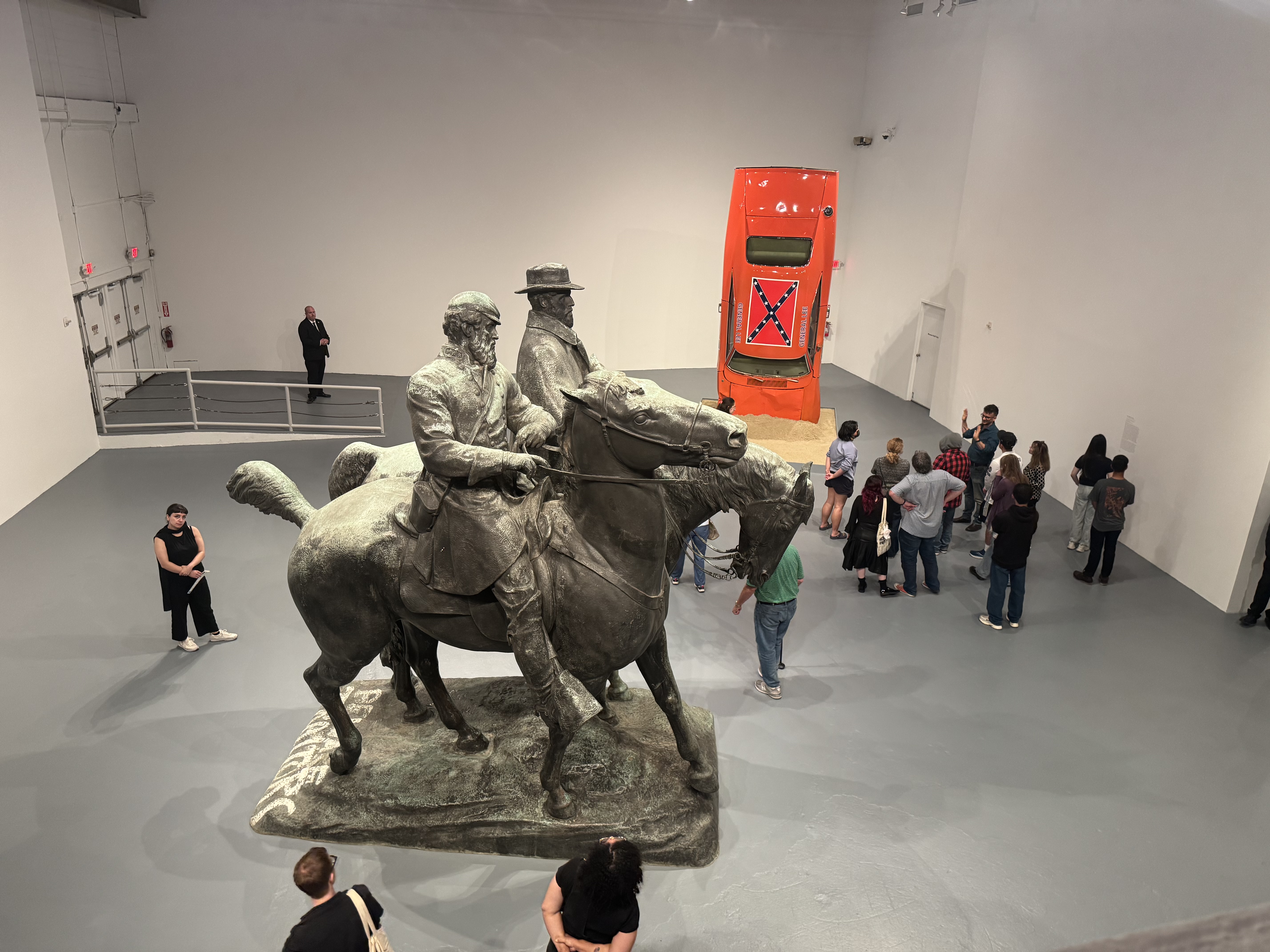
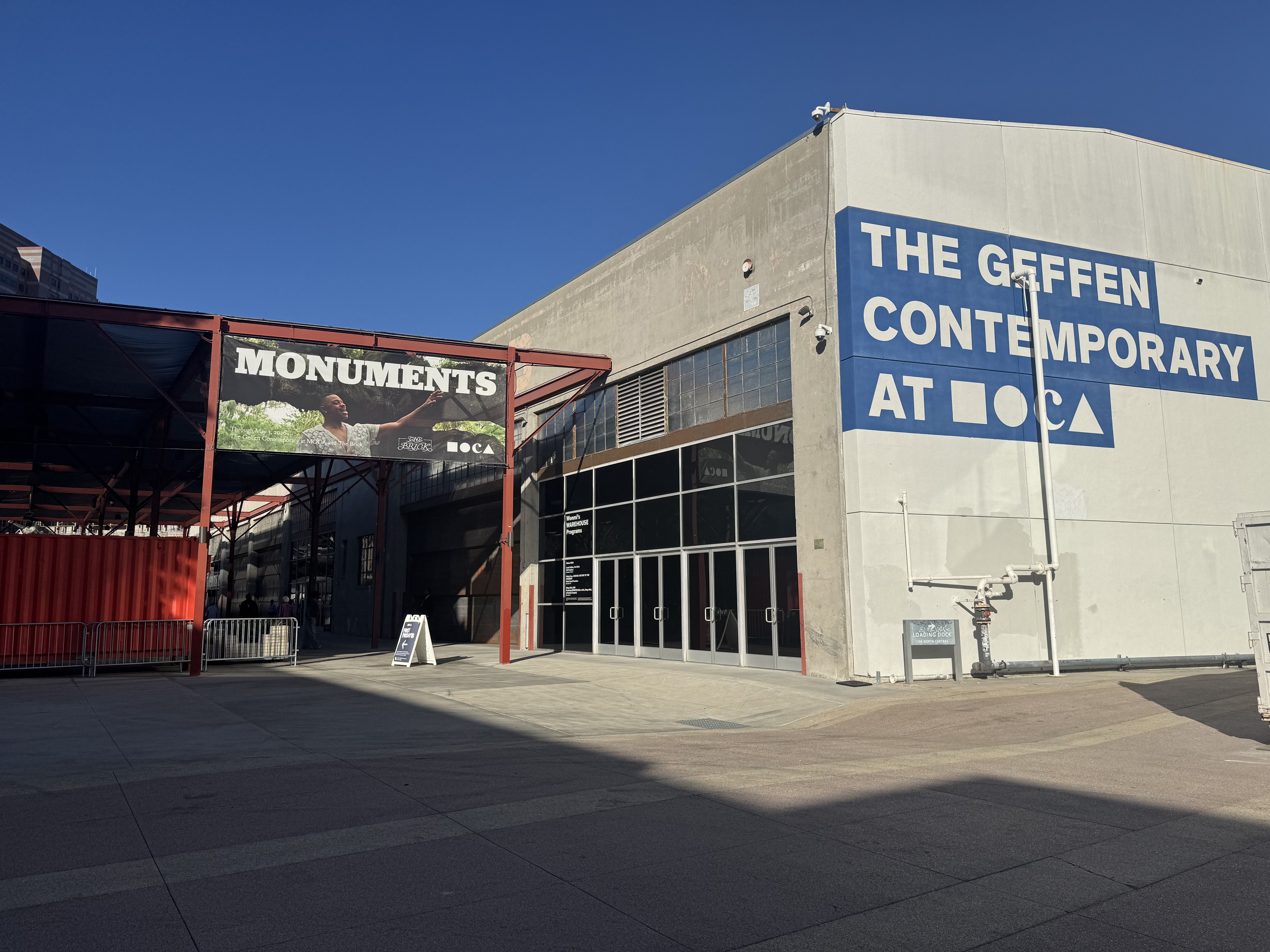
The following Friday was free day at the Museum of Contemporary Art (MOCA), and my friend Joni had alerted me that she had reserved a spot to see the new MONUMENTS exhibit showing at two locations, one of which is not far from where I live. So I reserved a spot to join her. The first stop was a smaller museum, The Brick, whose exhibit features the Charles Keck’s 1921 sculpture of Stonewall Jackson riding his mount Little Sorel. The piece is titled “Unmanned Drone” by Kara Walker, who took the statue apart and reimagined it in a rather gruesome spectacle. The large, powerful piece is appropriately given nearly the entire exhibit area. Just a few related pieces are on display in an adjacent patio area.
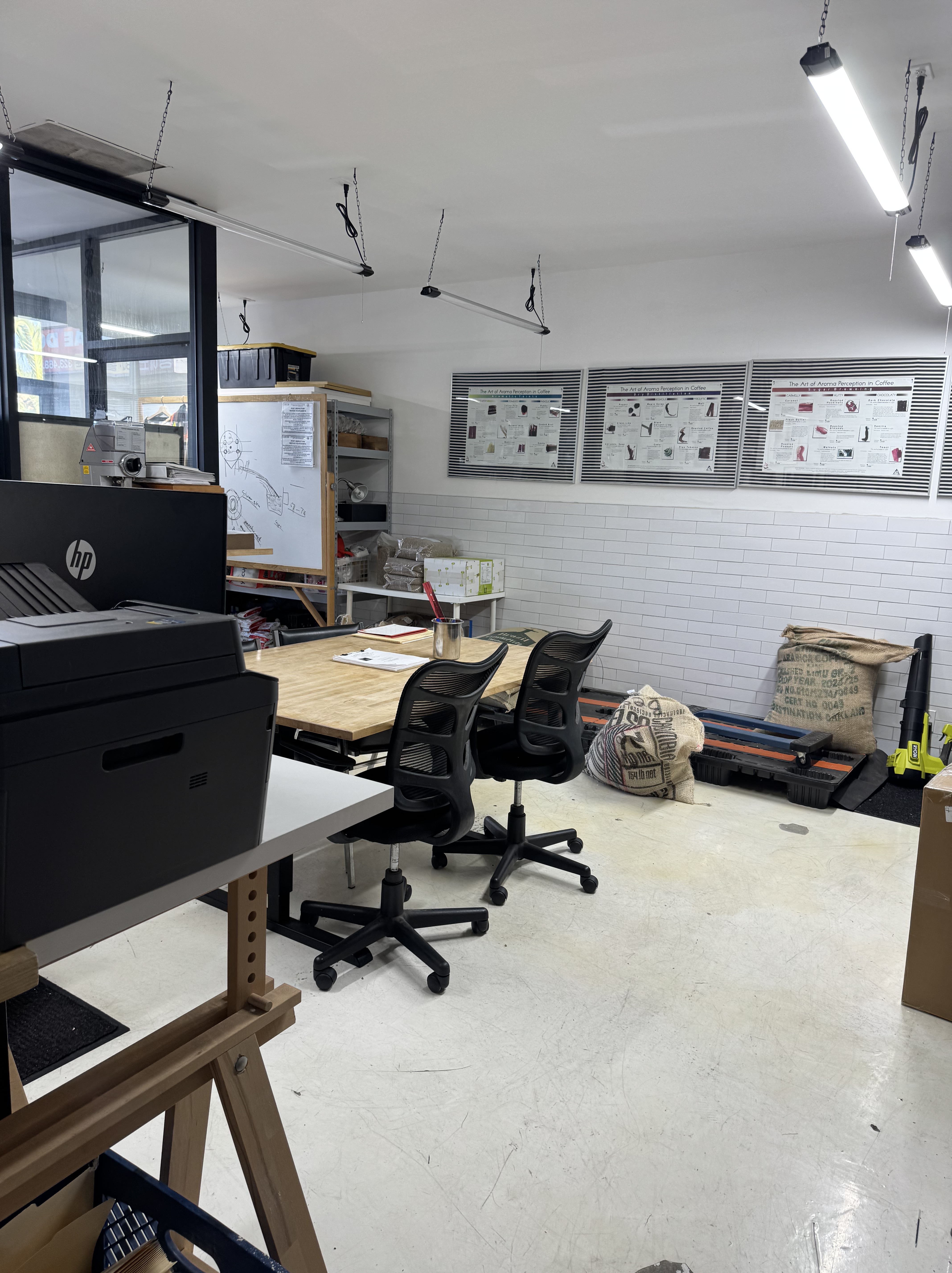
Our reservations were spaced apart, one at 11 AM and the other at 1 PM, so we had time for a coffee run before heading downtown. Joni led us to nearby Lab Coffee & Roasters, an interesting coffee shop with an adjacent teaching space for those wanting to learn how to roast coffee. I had a tasty Spanish Latte, and enjoyed browsing the shop’s interesting display of wares and awards, as well as peeking into the teaching lab next door.
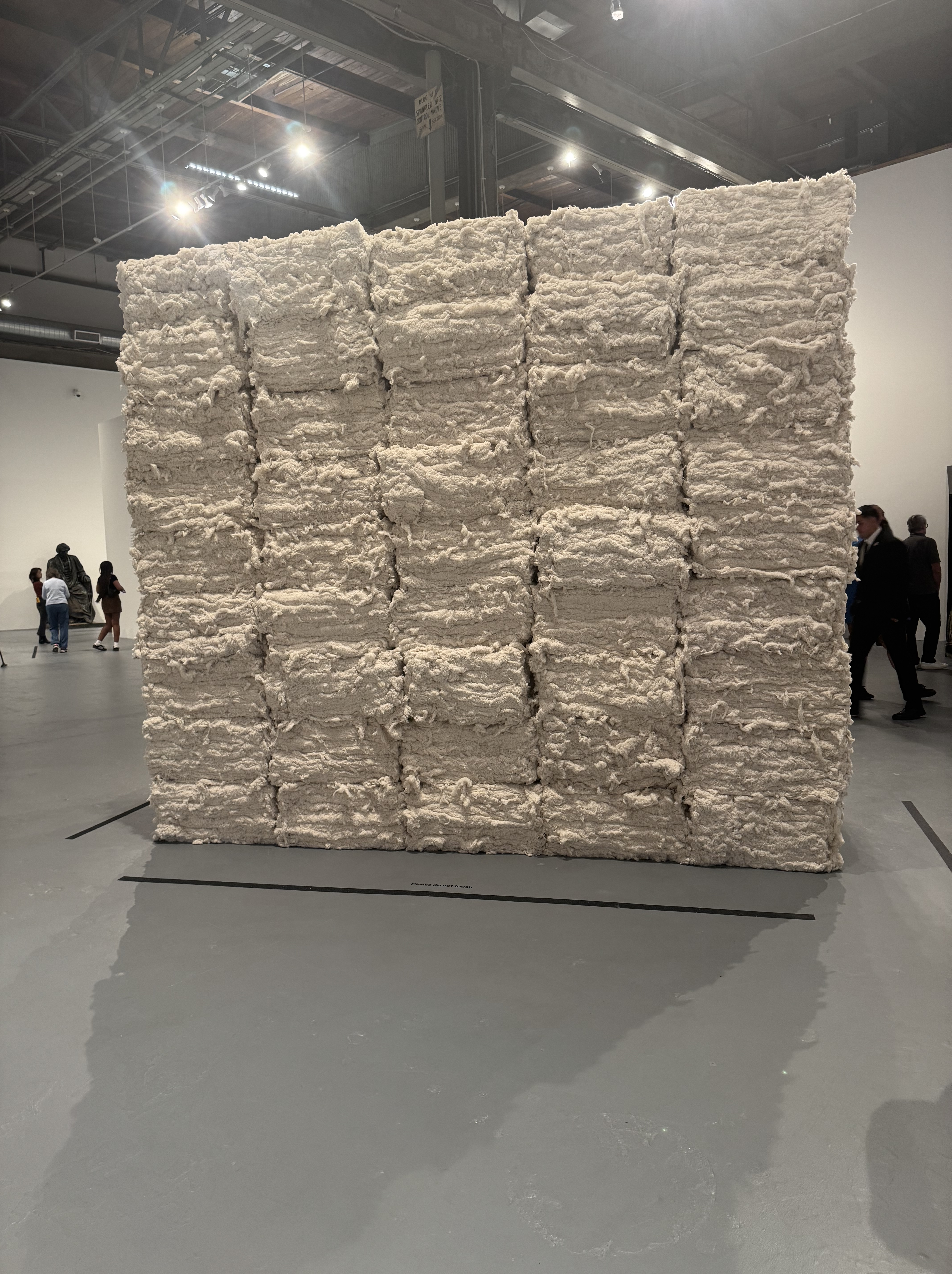
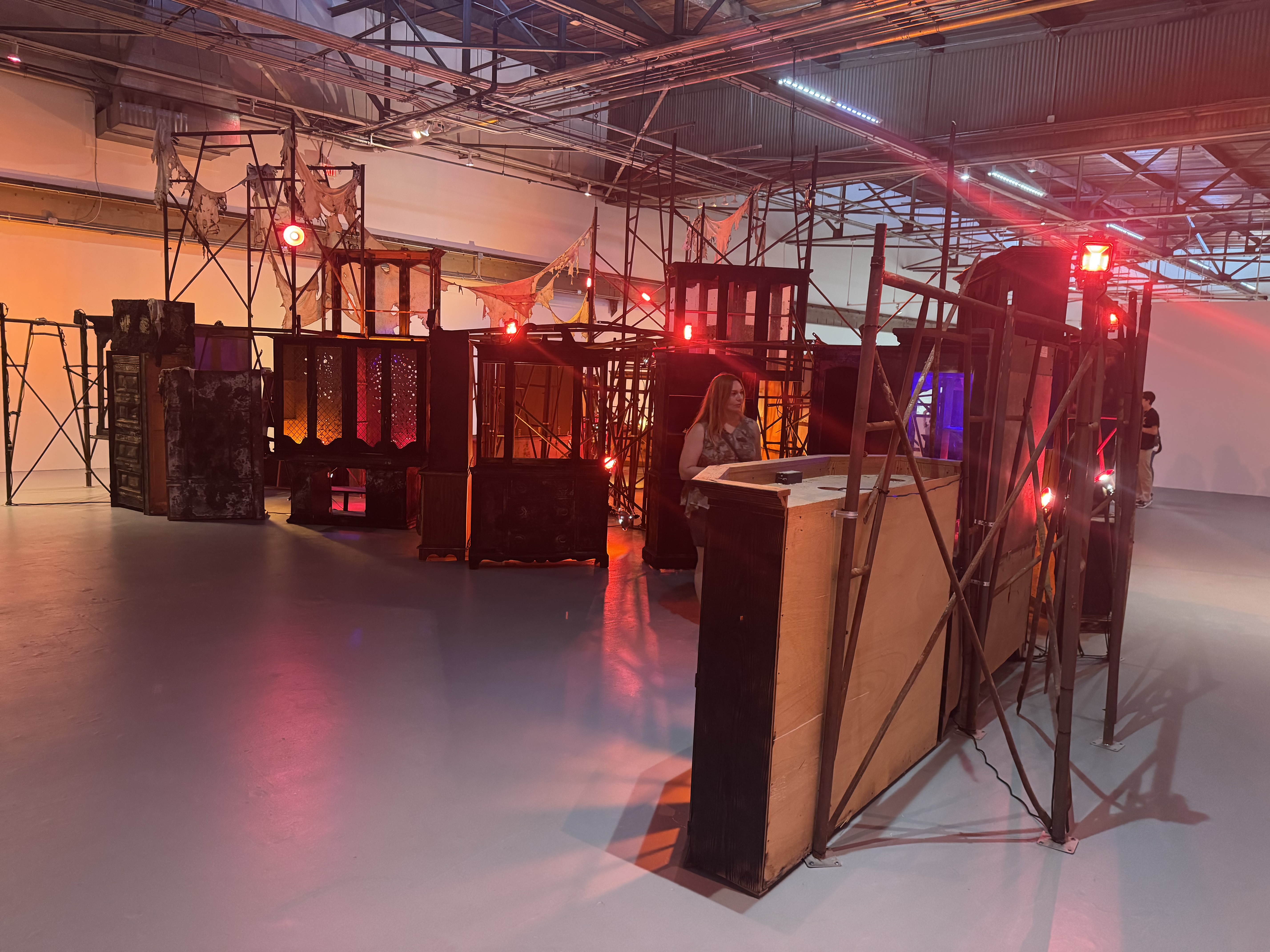
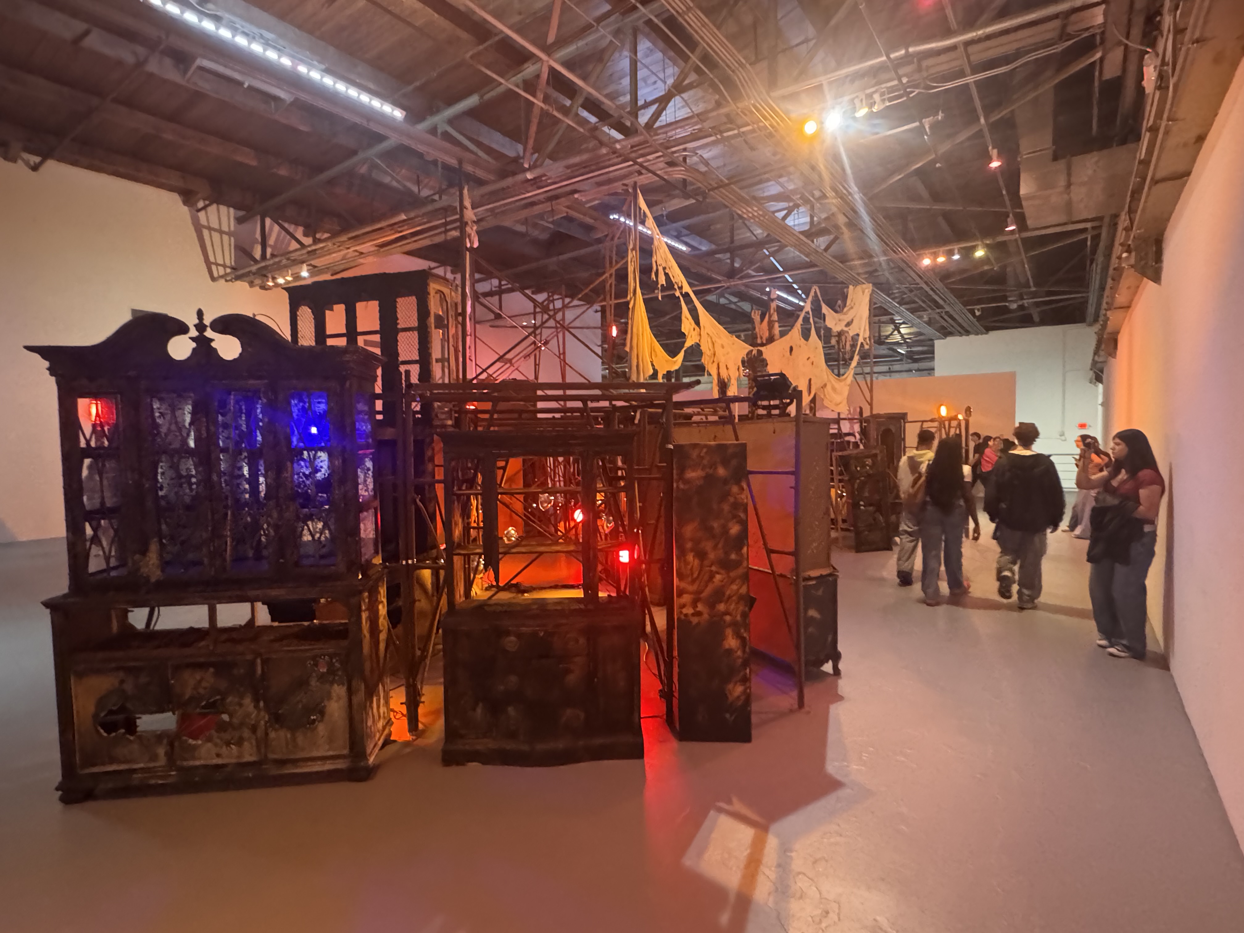
On we went into downtown to the main MOCA location, where a very friendly and helpful security guard guided us to the best place to lock up our bikes. We then walked over to the entrance, where another friendly and helpful person explained to us that the MONUMENTS exhibit was at the MOCA Geffen Contemporary in Little Tokyo. So we retrieved our bikes and rode to Little Tokyo. There, we did feel the outdoor bike parking was not sufficiently secure, so we rolled our Bromptons into the museum where we were allowed to fold them up and leave them with the coat and bag check. The folks at the security desk where we scanned our bags as we entered insisted that I leave my 3-way allen wrench at the security desk, as it was apparently considered a dangerous object. I was nervous that I might forget it when we went to leave, but during the retrieval of our bikes, it was easy to remember to go get the wrench.
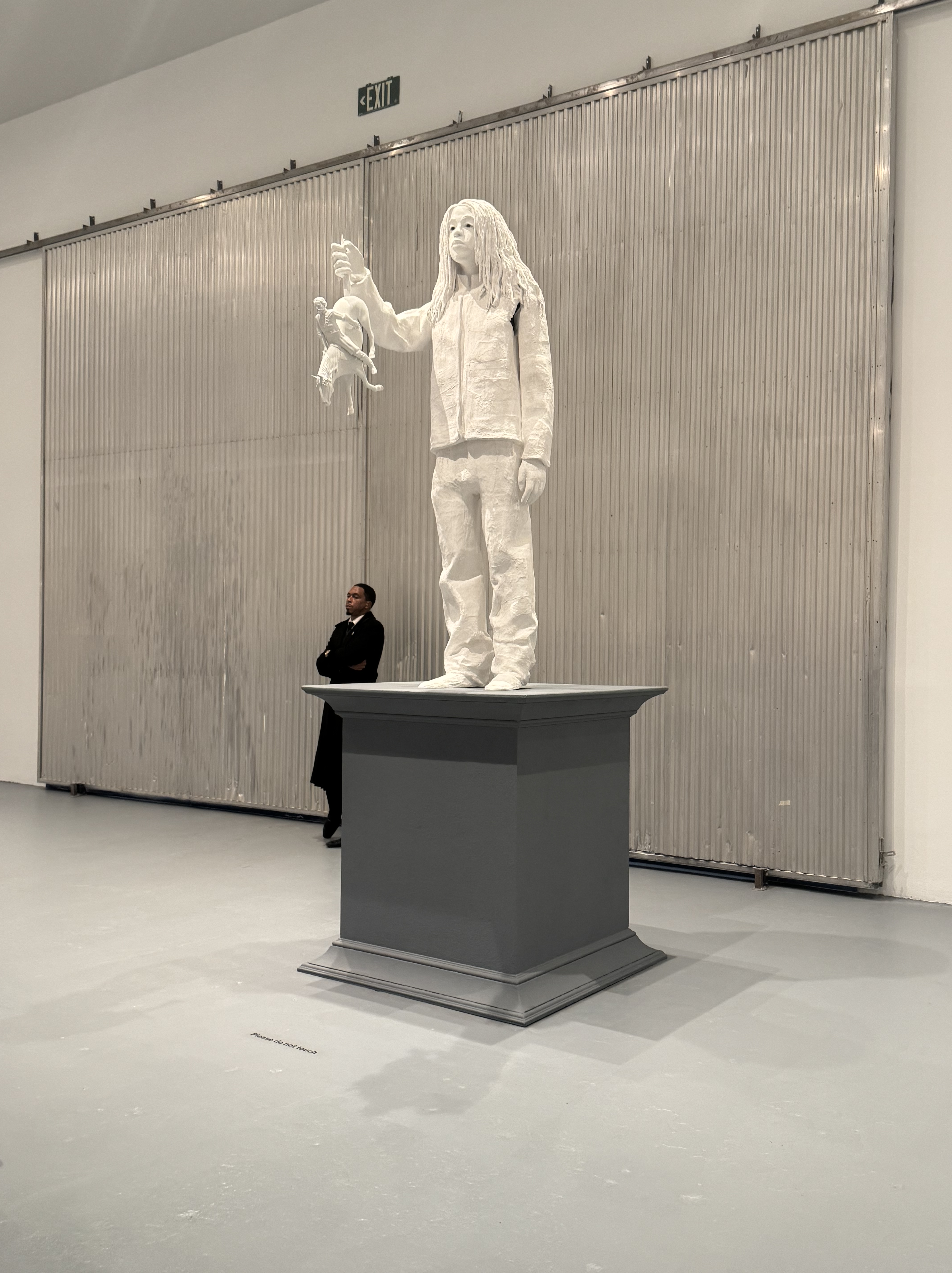
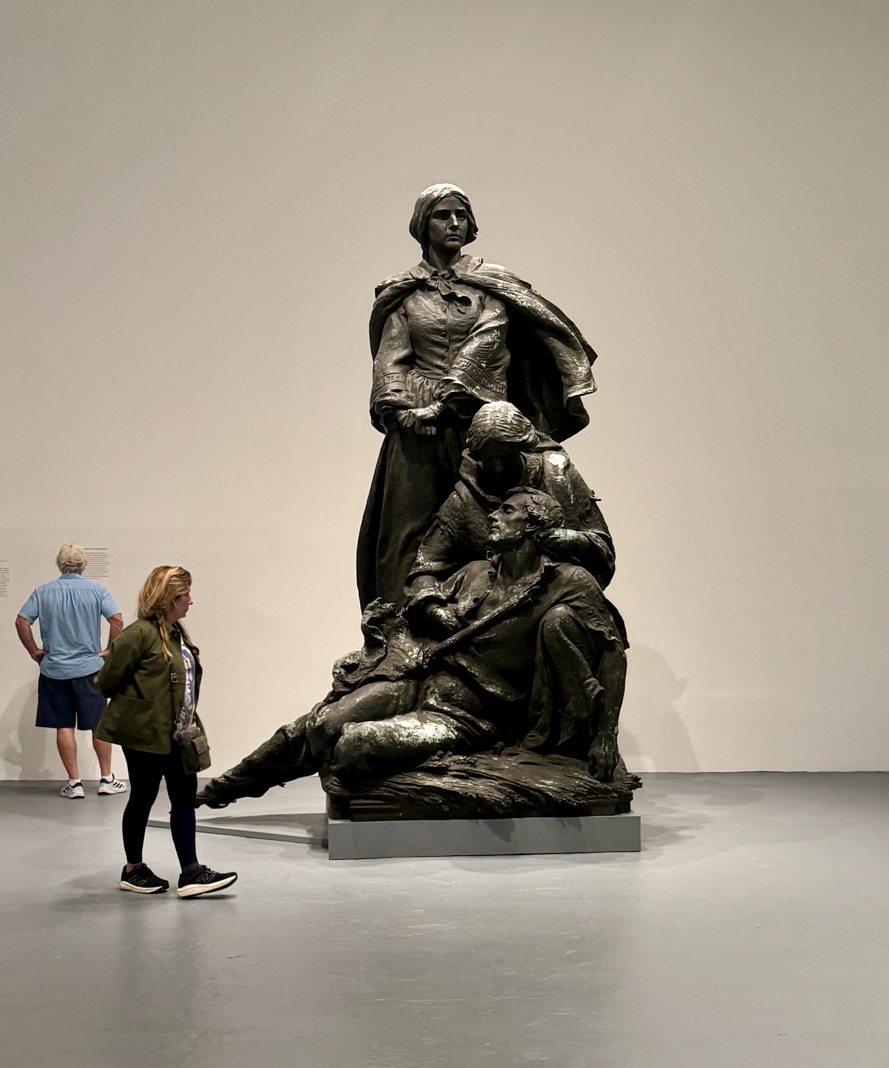
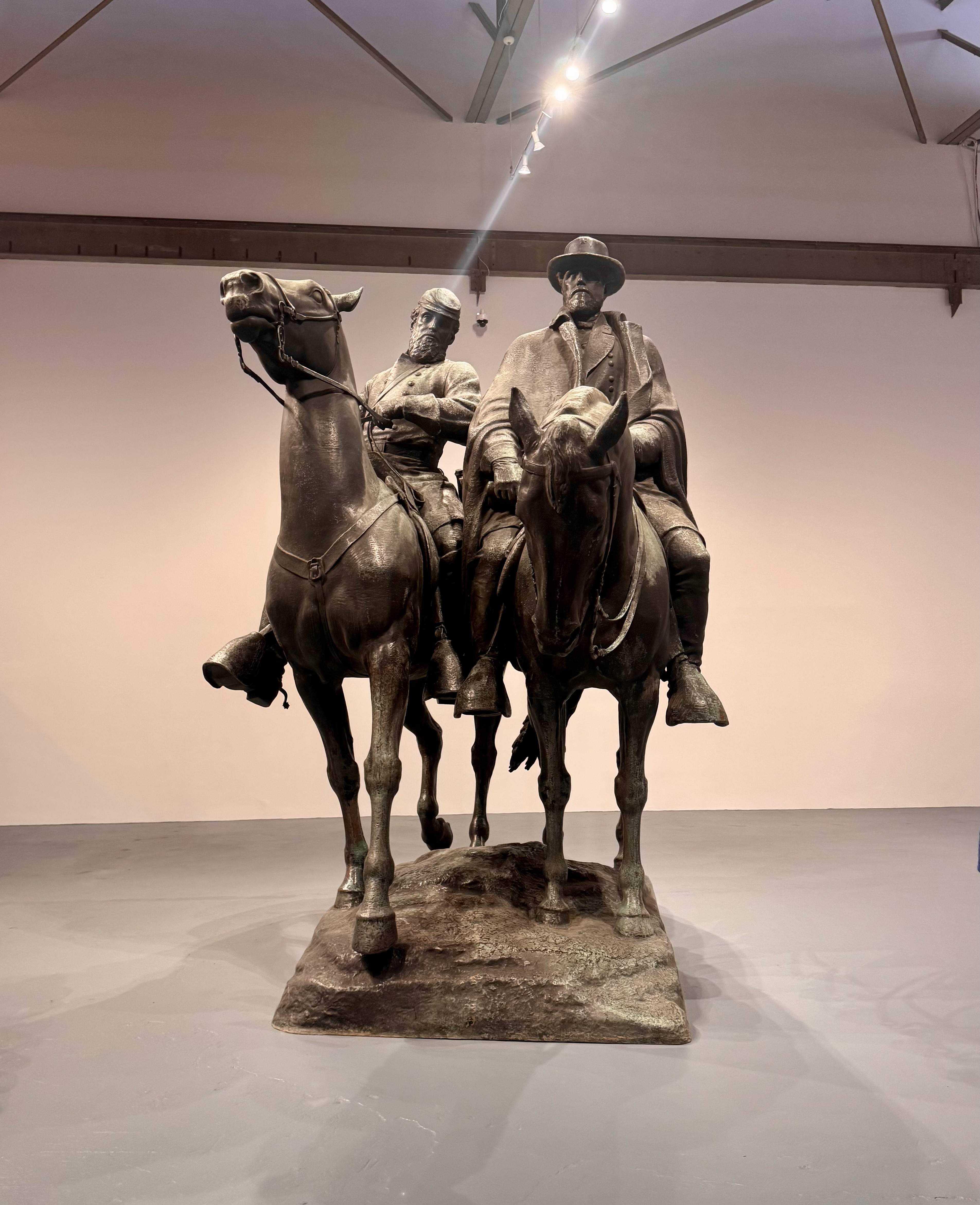
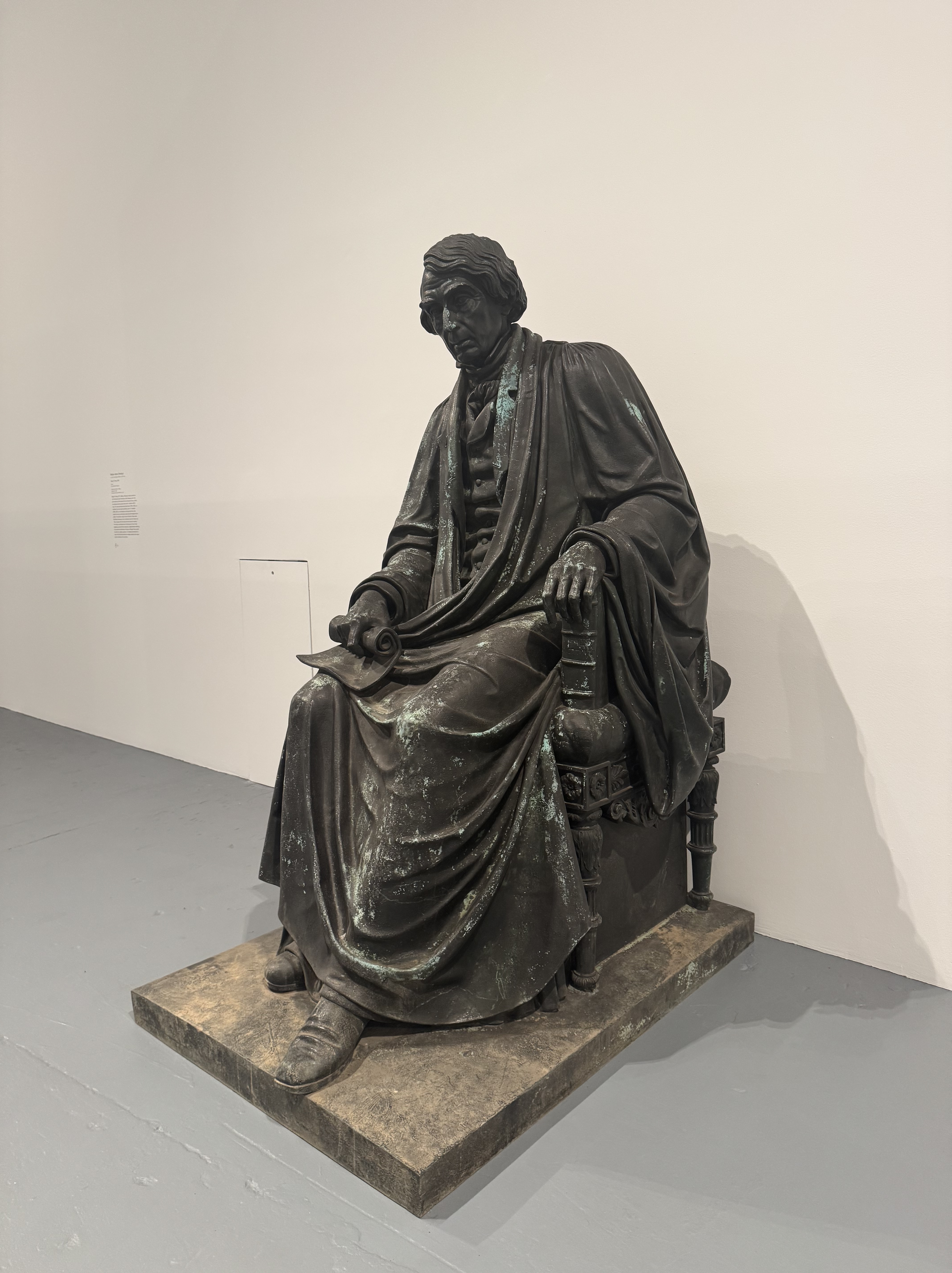
The exhibit was extraordinary. To see these monuments in person and inside a museum with other people milling about makes the huge size and power of these pieces apparent. It was astonishing to read the stories of how and why these monuments were brought into existence and the important message of taking them down, re-imagining them, and re-writing the narrative. Rather than attempt to characterize the exhibit, I recommend the comments I found here from a UVA professor and historian.
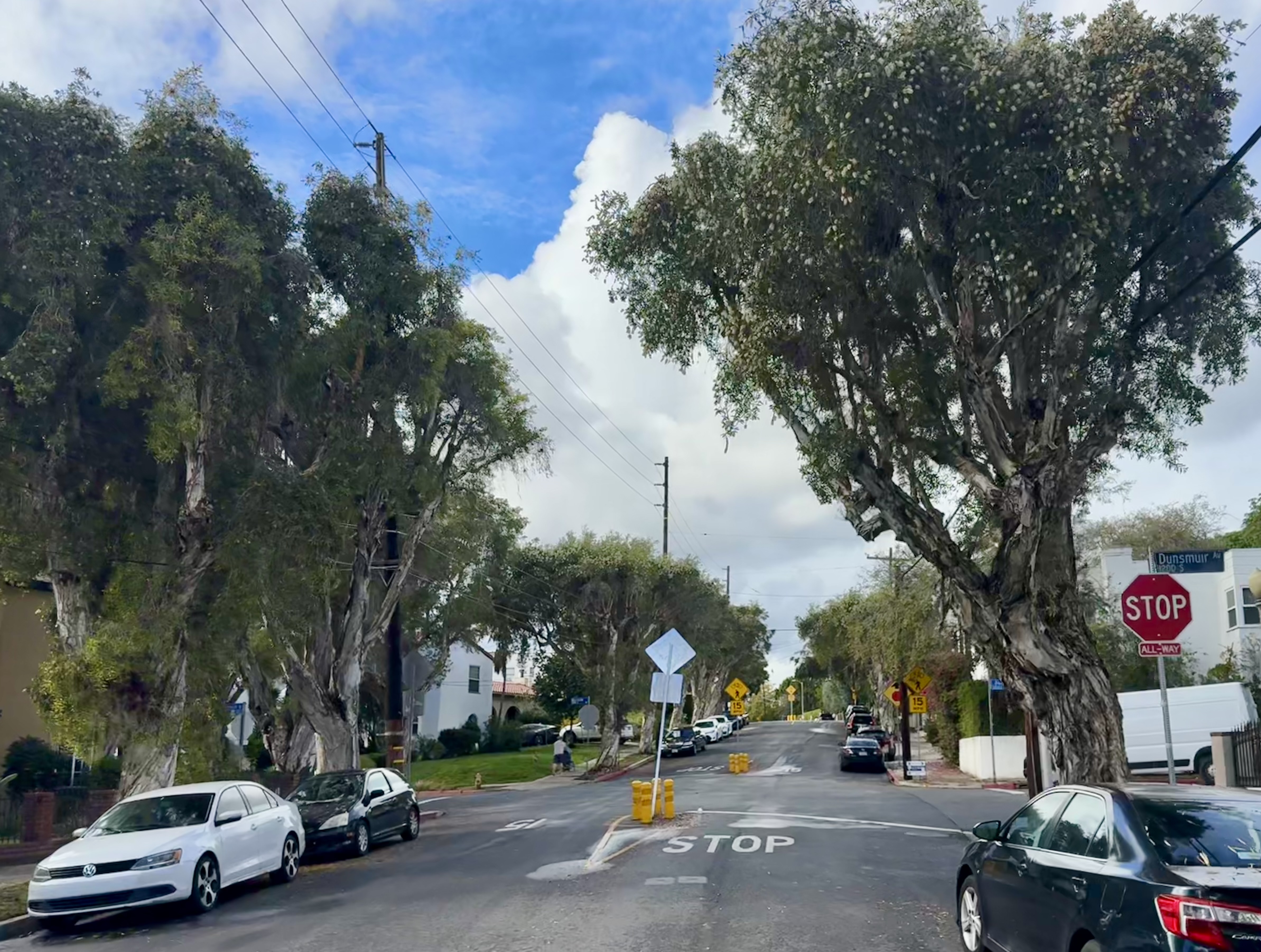
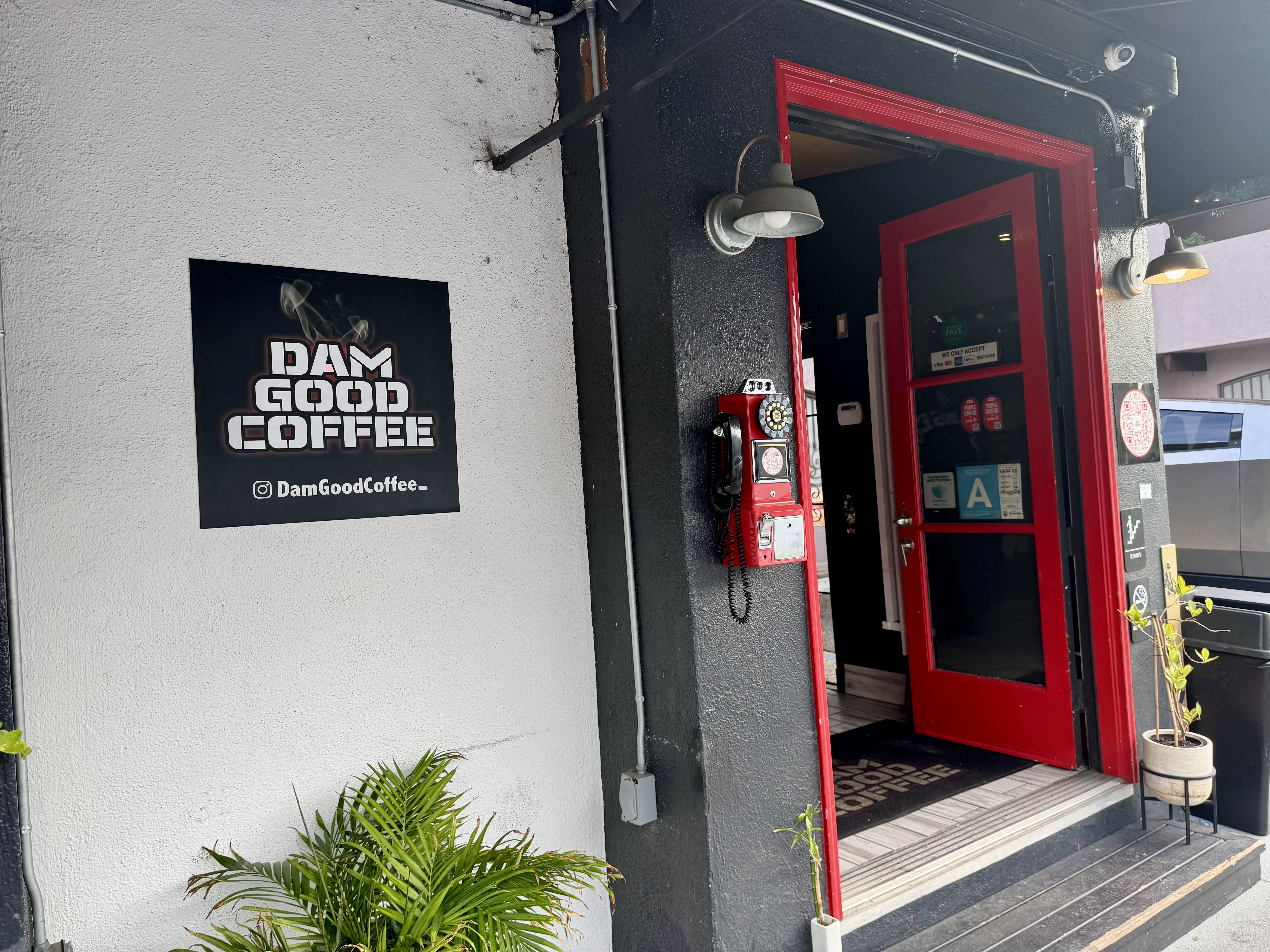
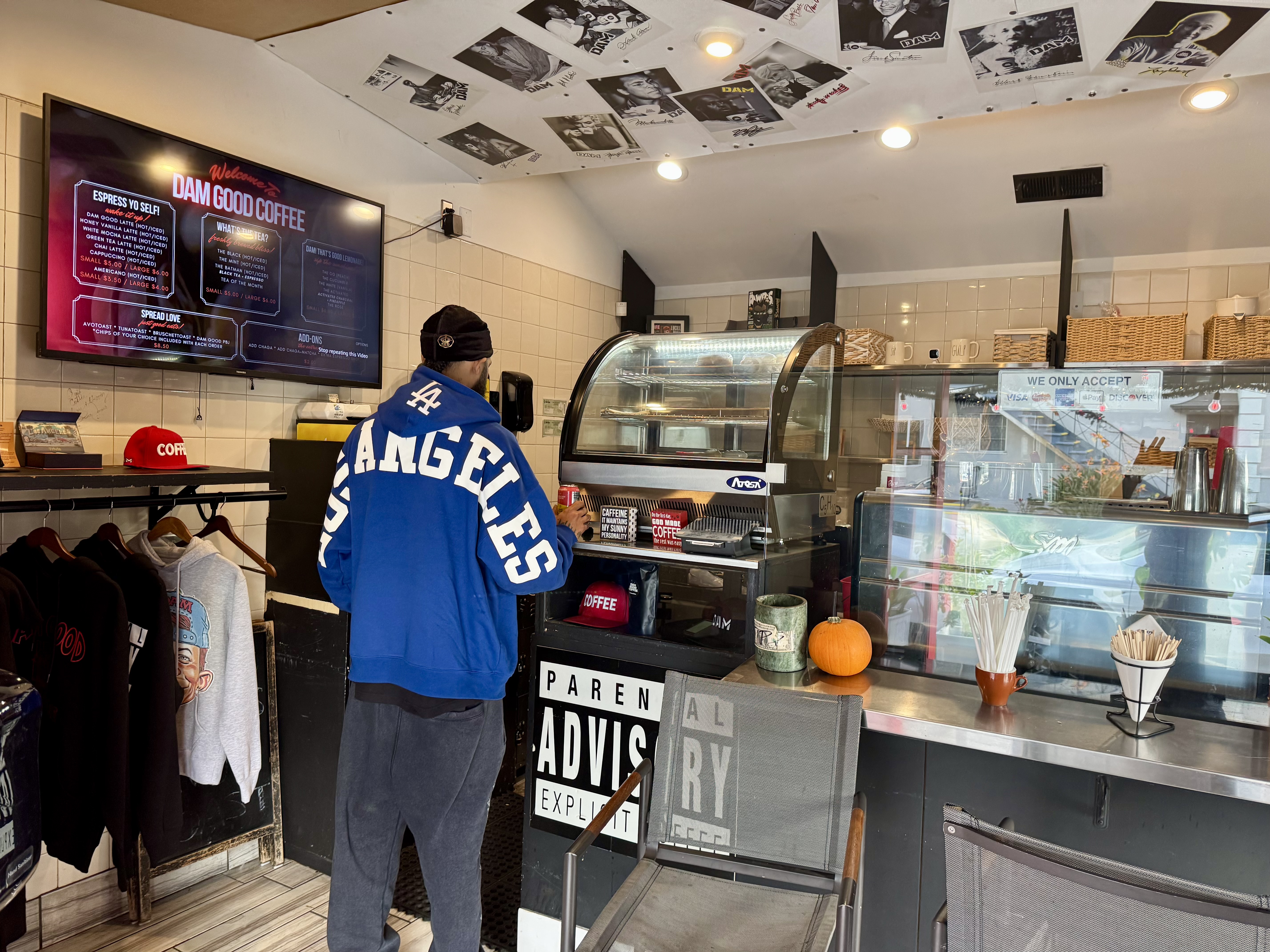
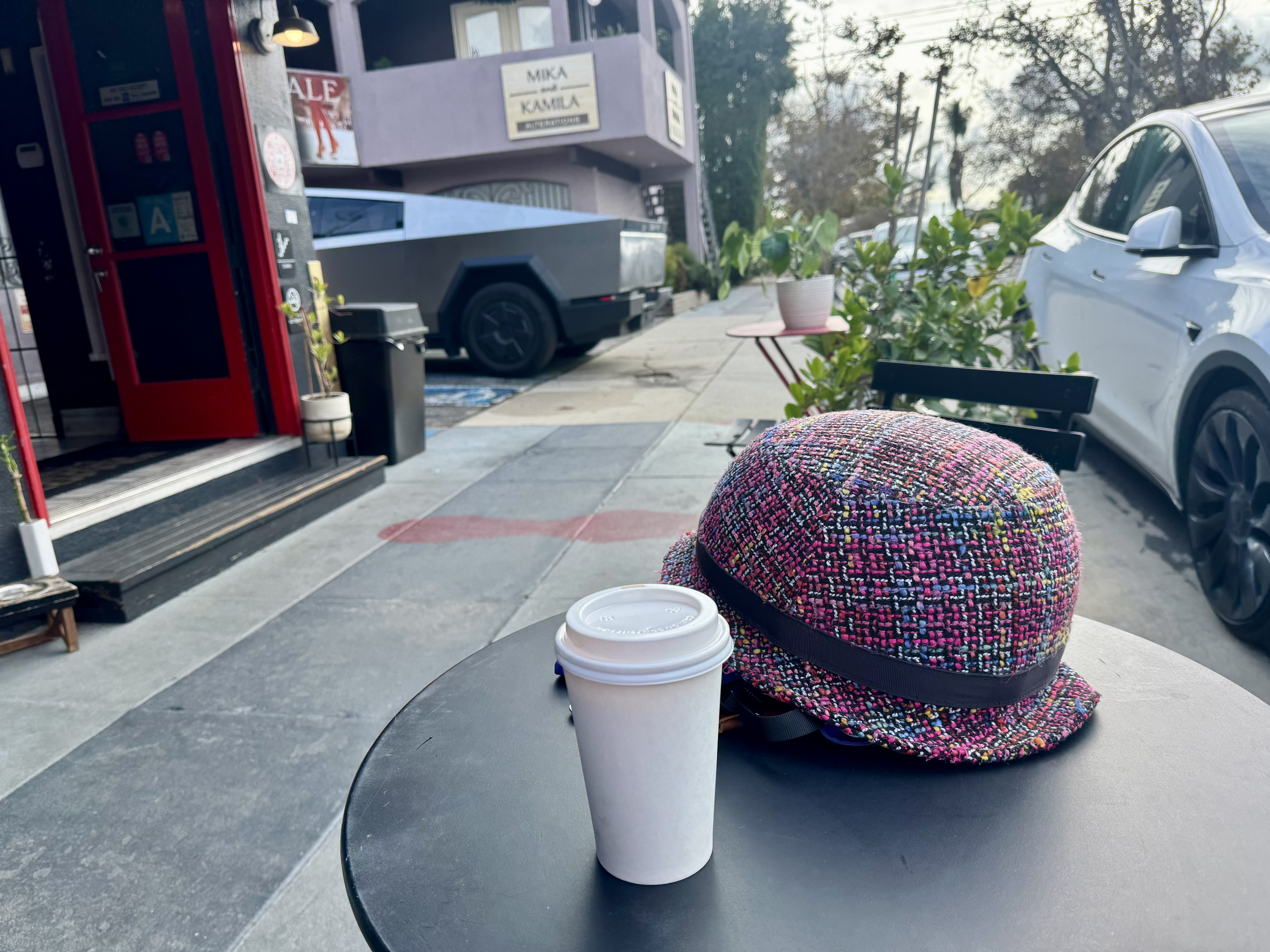
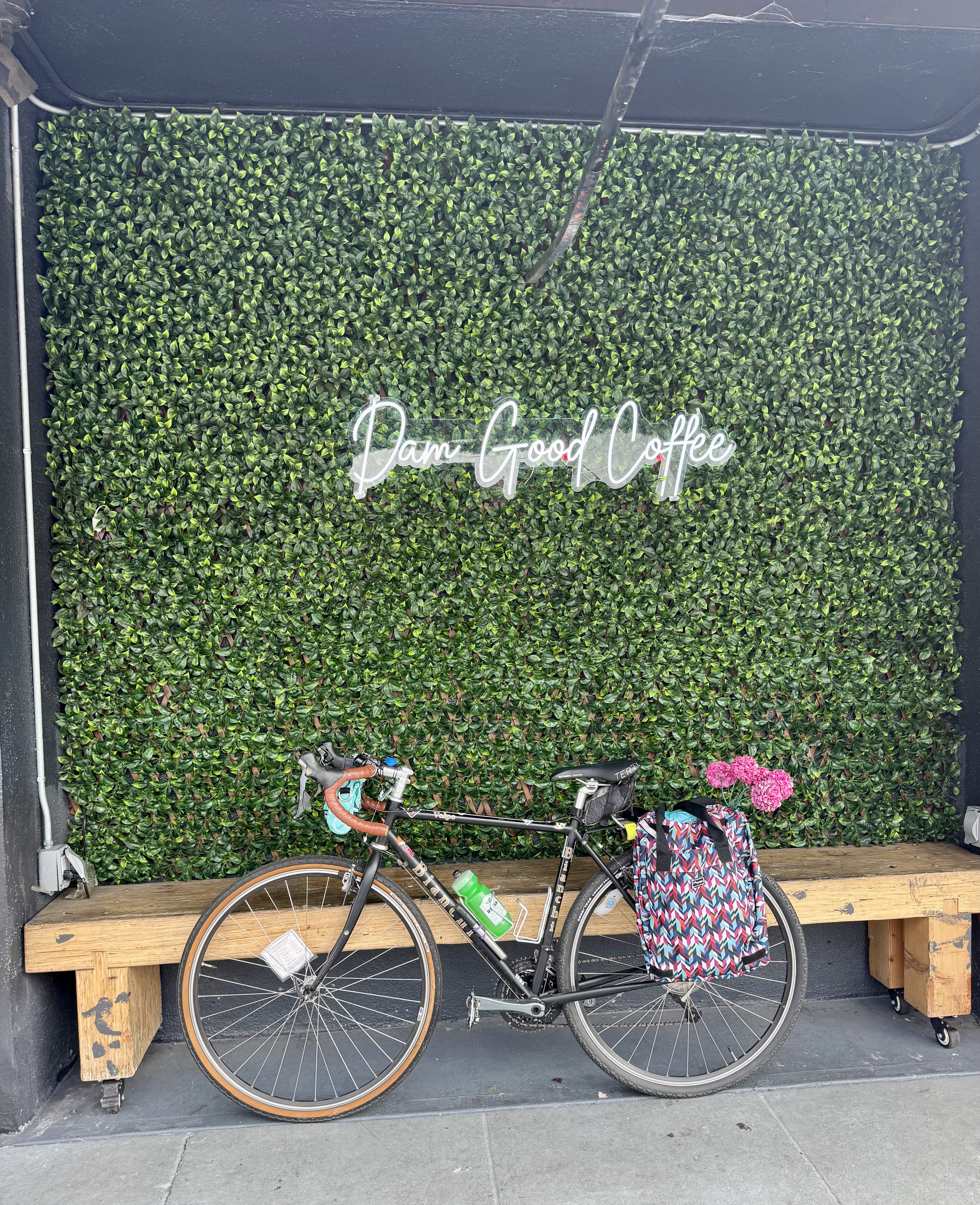
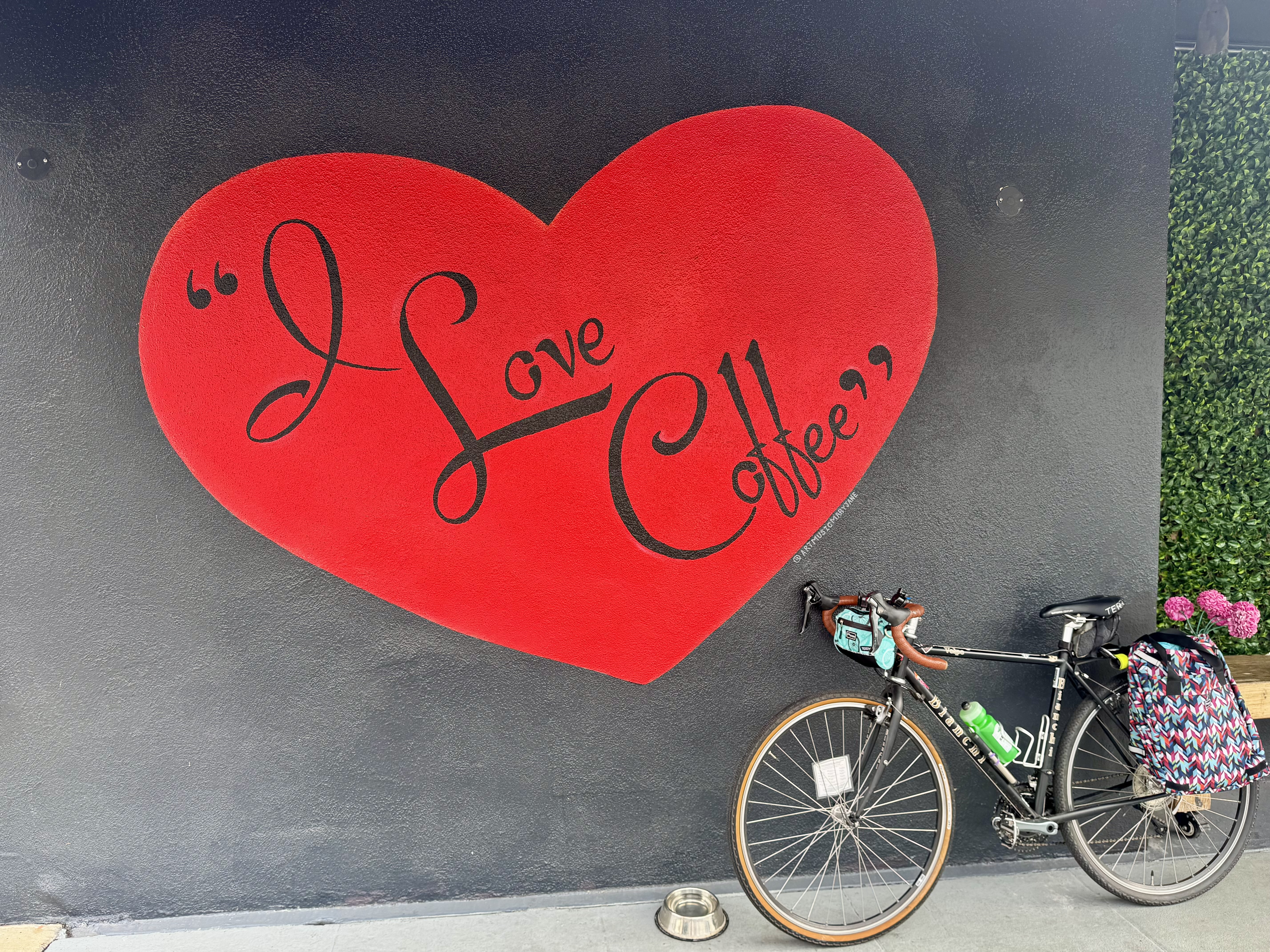
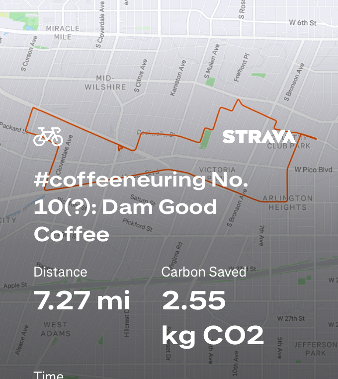
Control No. 10: 11/16/25 Dam Good Coffee (Los Angeles)
Beverage: Honey Vanilla Latte
Bike: Volpe
Bloomers: Groovy Tie Dye
C+1: The Coffee Shop Owner
Beauty: The longer, prettier route, and some Insta-worthy decor
Miles: 7.3
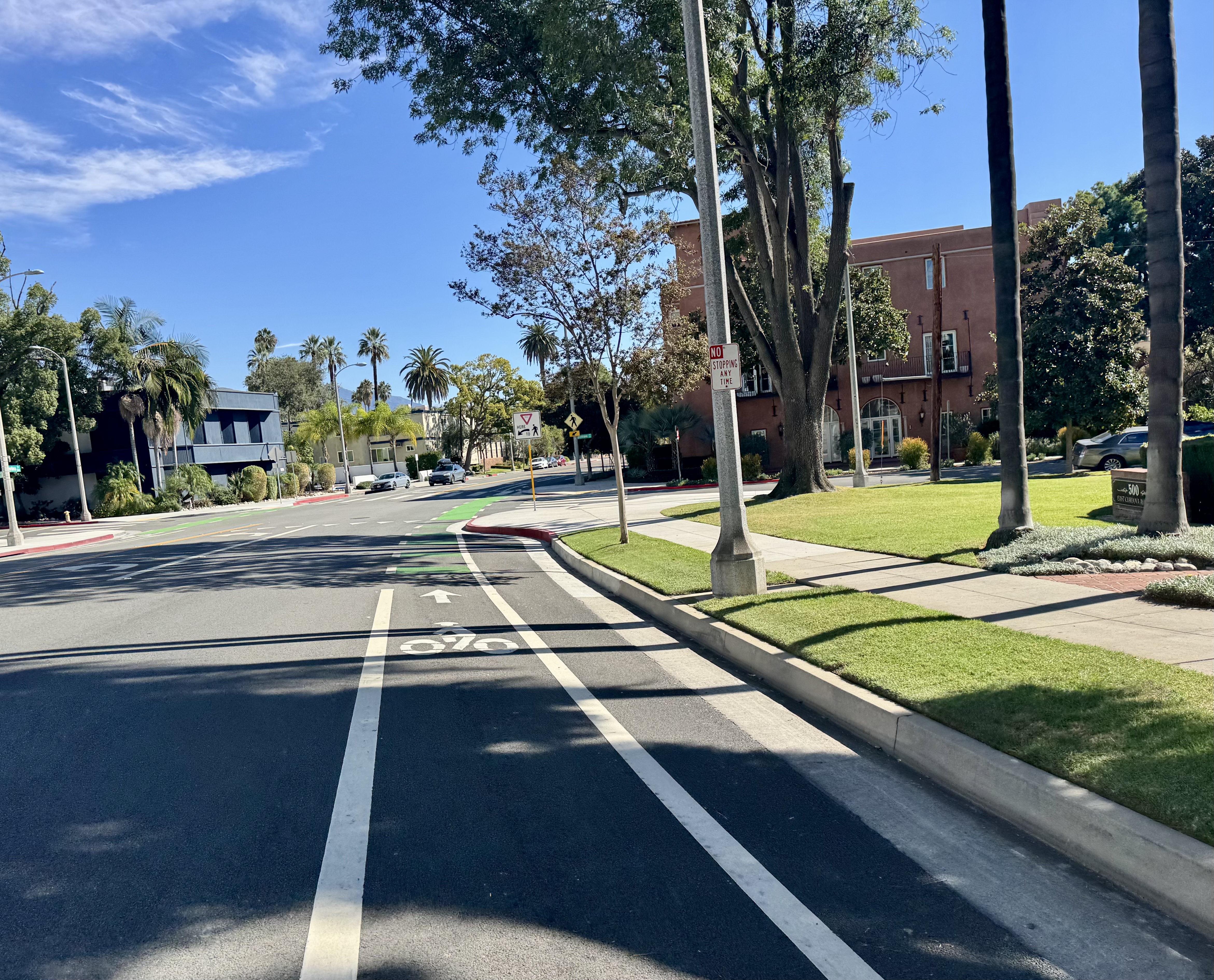
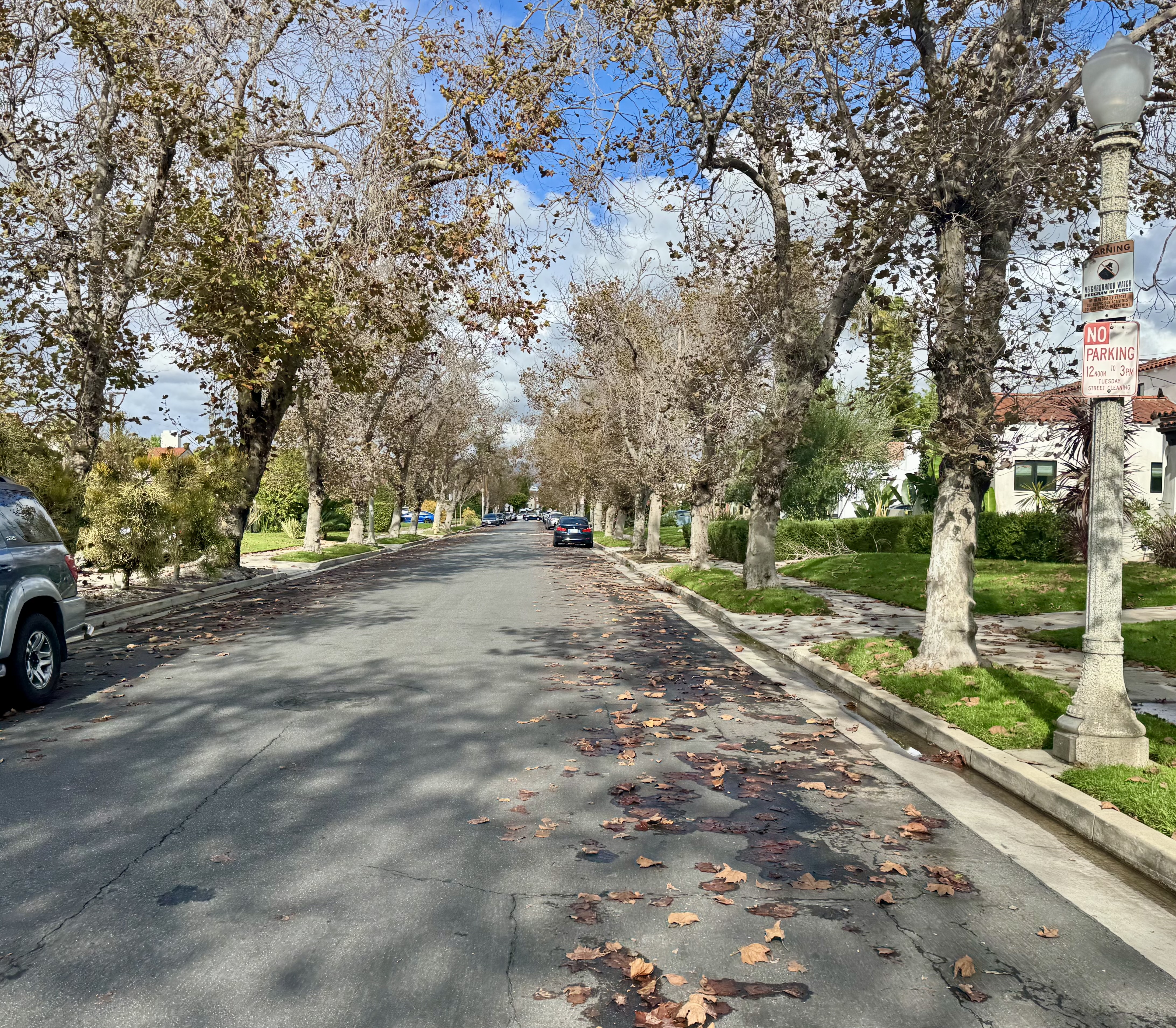
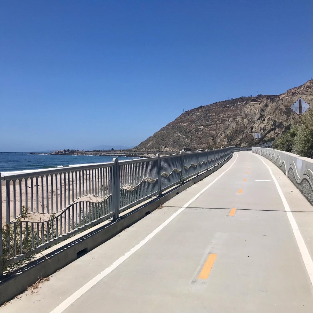
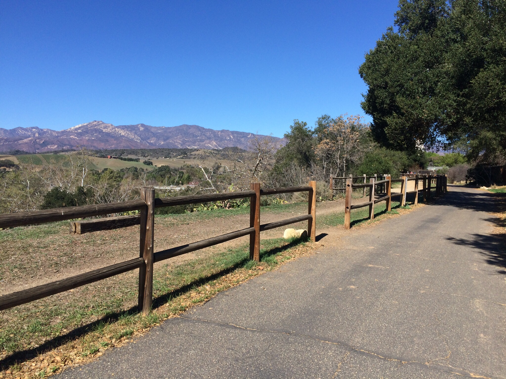
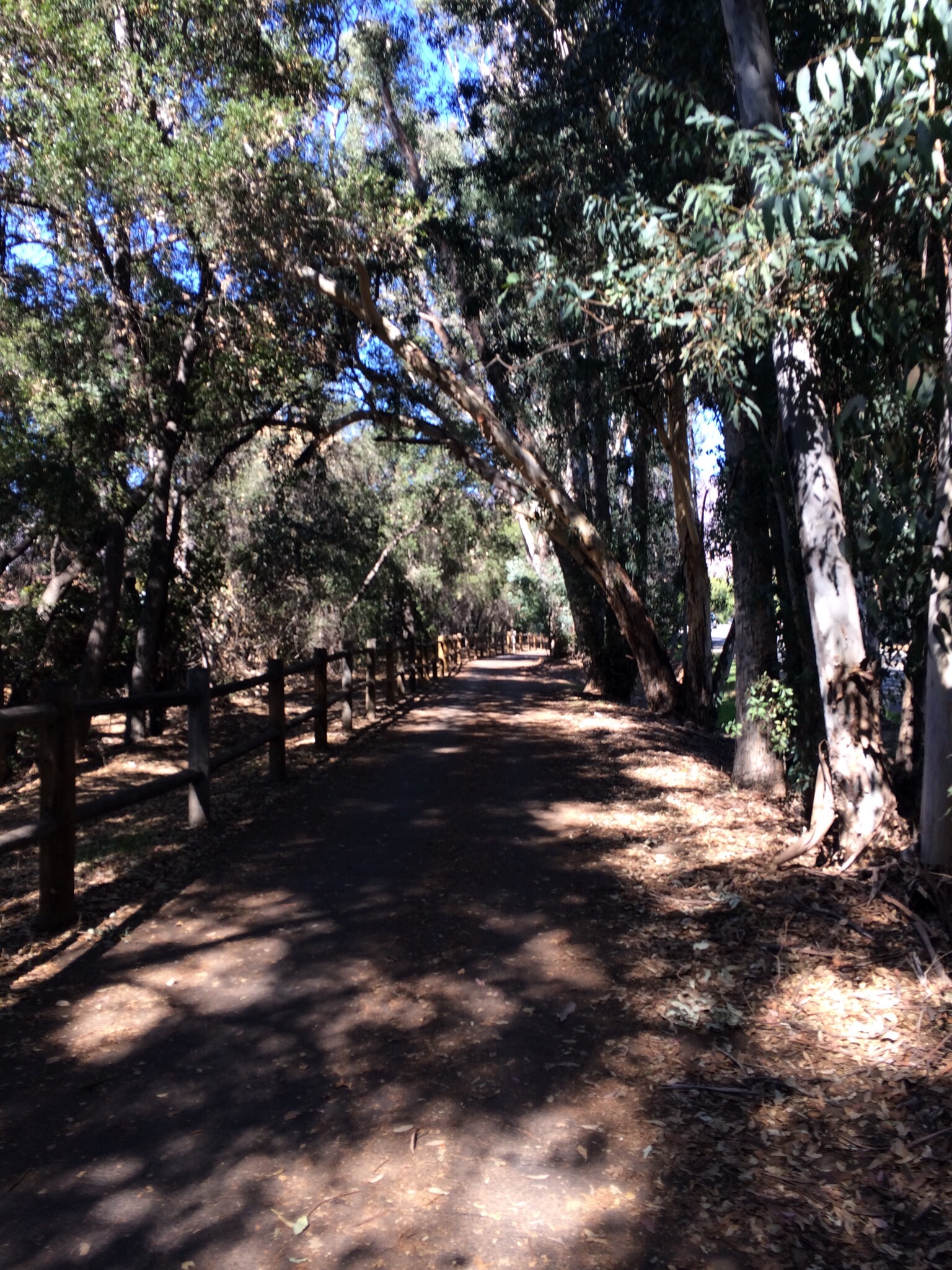
Ever since the new protected bike lanes were added to San Vicente Boulevard in the area close-ish to where I live, I have been using these bike lanes on the regular. The lanes take me past a place at the intersection of San Vicente & Carmona that advertises “Dam Good Coffee”, and every time I’d ride by, I would think to myself: “I should stop at this place for one of my coffeeneuring rides!” So finally I did just that. This one is just a mile up San Vicente from my current favorite grocery store, so I turned it into an errandonnee event. But first I had to plan my route to the coffee shop. Taking the most direct route was simply not an option.
I looked at a map to consider the bike-friendly streets I could take, and settled on the 4th Ave bike lanes to the Venice Blvd bike lanes to get me to Cochran Ave and then take Packard Ave to Carmona. This was indeed the route of bike-friendliness + beauty, as the latter streets were pretty, tree-lined “slow streets”, meaning they had added features to slow down traffic and make drivers aware of pedestrians and cyclists.
When I got to Dam Good Coffee, I saw someone sitting outside, seemingly finishing up their coffee, and I decided on a place to lock up my bike near the outdoor tables. But when I went to enter, the door seemed to be locked. I walked around to a side door that was open but behind a locked security screen door. I hollered through that open area to see if someone might be in the back, but got no response. I hung around for a bit, trying to decide if I should just roll on or wait awhile. I checked the shop’s hours on my phone and saw that it should be open, so perhaps someone had taken a short break and would return. Then one of those cyber trucks sped up and pulled into a driveway next to the side door and out jumped a man who told me he’d seen me on the security camera and rushed back to let me in. Turns out he’d been dealing with some kind of emergency involving his water system, and had to leave to address it.
So I got to go inside, and the owner explained to me the little crisis he’d just had that took him away shortly before my arrival. And then I told him how I like to try different coffee drinks, and that I tend to like the liquid dessert variety. He recommended the Honey Vanilla Latte, and it was indeed the kind of sweet, comforting drink I enjoy. The shop is interesting, as it features some merch (sweatshirts, hats & T-shirts), plus some hints of humor, such as a sign that reads: PARENTAL ADVISORY EXPLICIT COFFEE. I liked the fun touches on the outside best. There’s a bright red old-timey pay phone mounted near the front door, and a couple of Instagram-worthy wall spaces. One is a wall of plastic greenery with neon script reading: “Dam Good Coffee”. The other is a red heart painted on a black background that reads, in script reminiscent of the “I Love Lucy” show, “I Love Coffee”. The latter had always caught me eye from the bike lane when riding by. So I enjoyed my sweet latte at one of the cute tables out by the sidewalk, and then took a few moments before leaving to snap pics of my bike in front of the cool wall art. Afterward, I rolled on to stop and get some groceries at the nearby Sprouts before rolling on home via one of my usual routes.
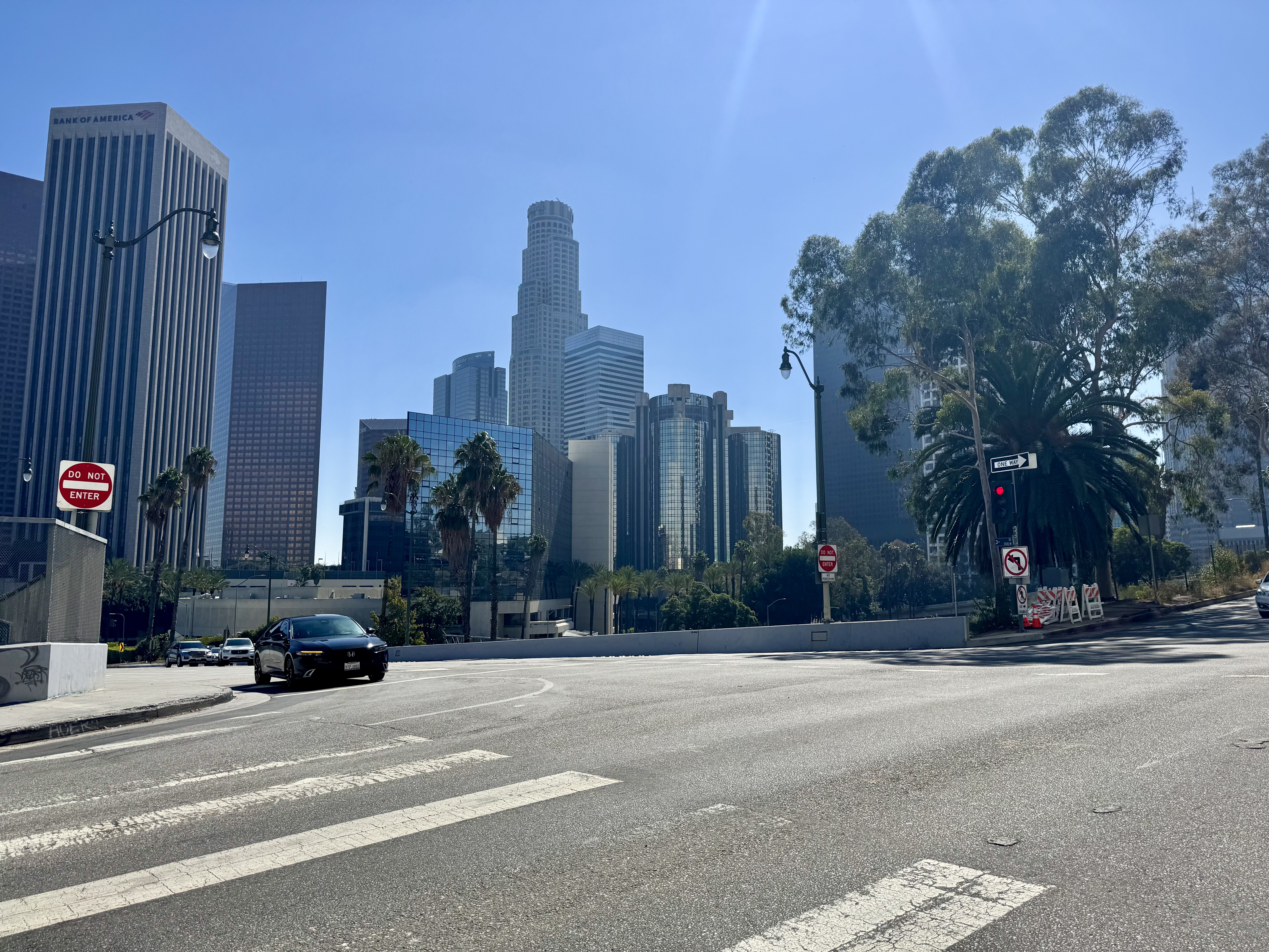
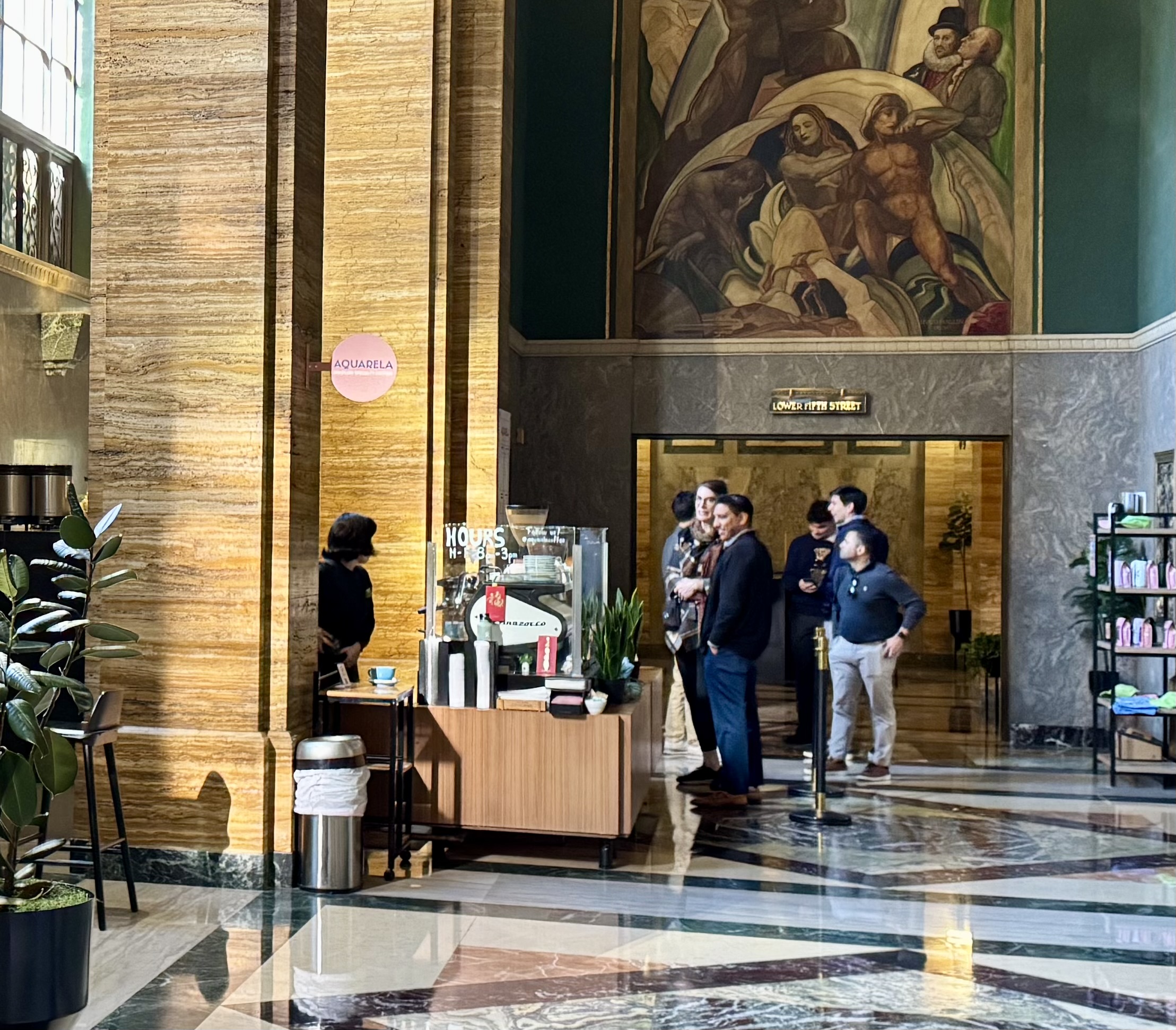
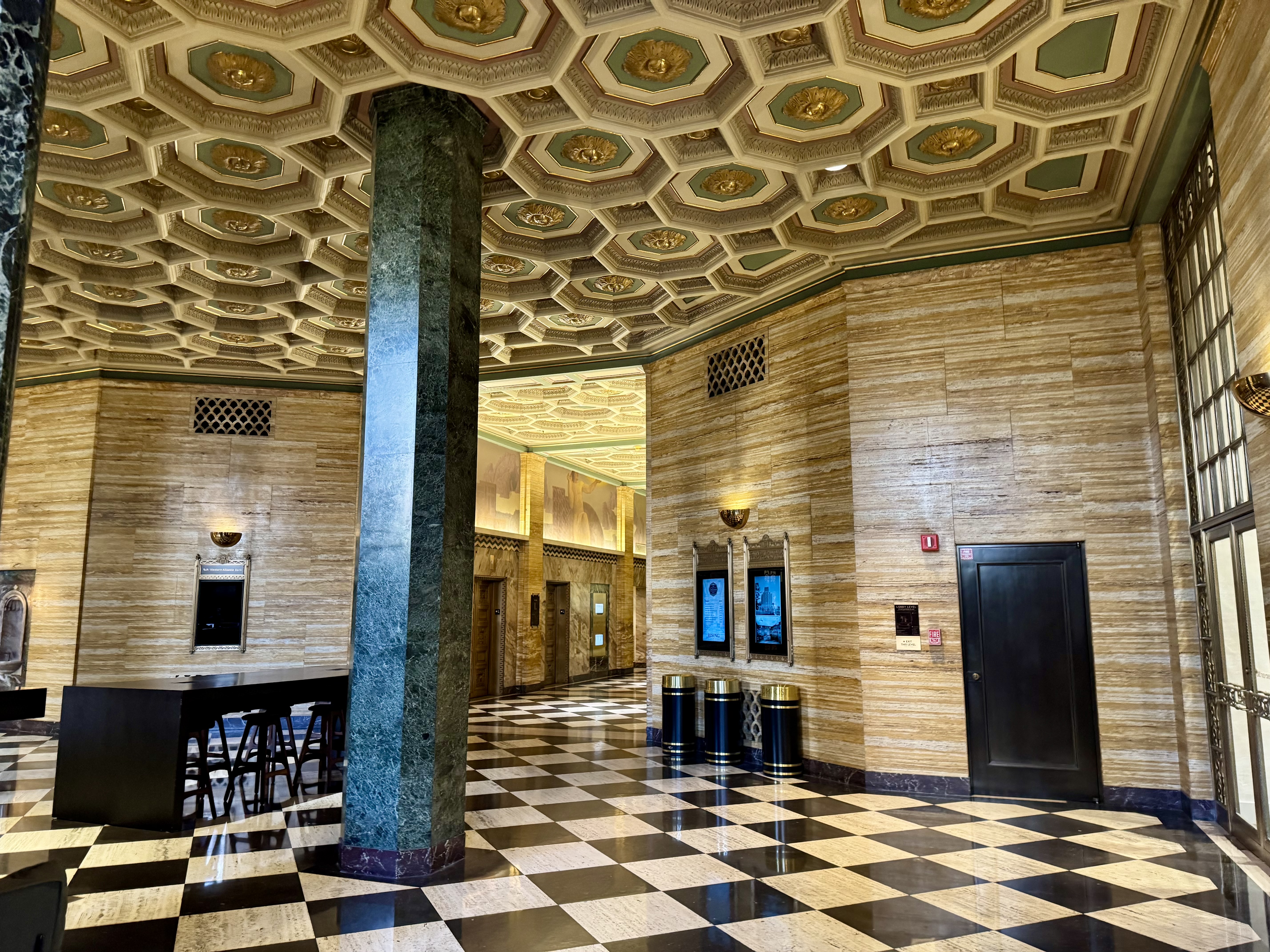
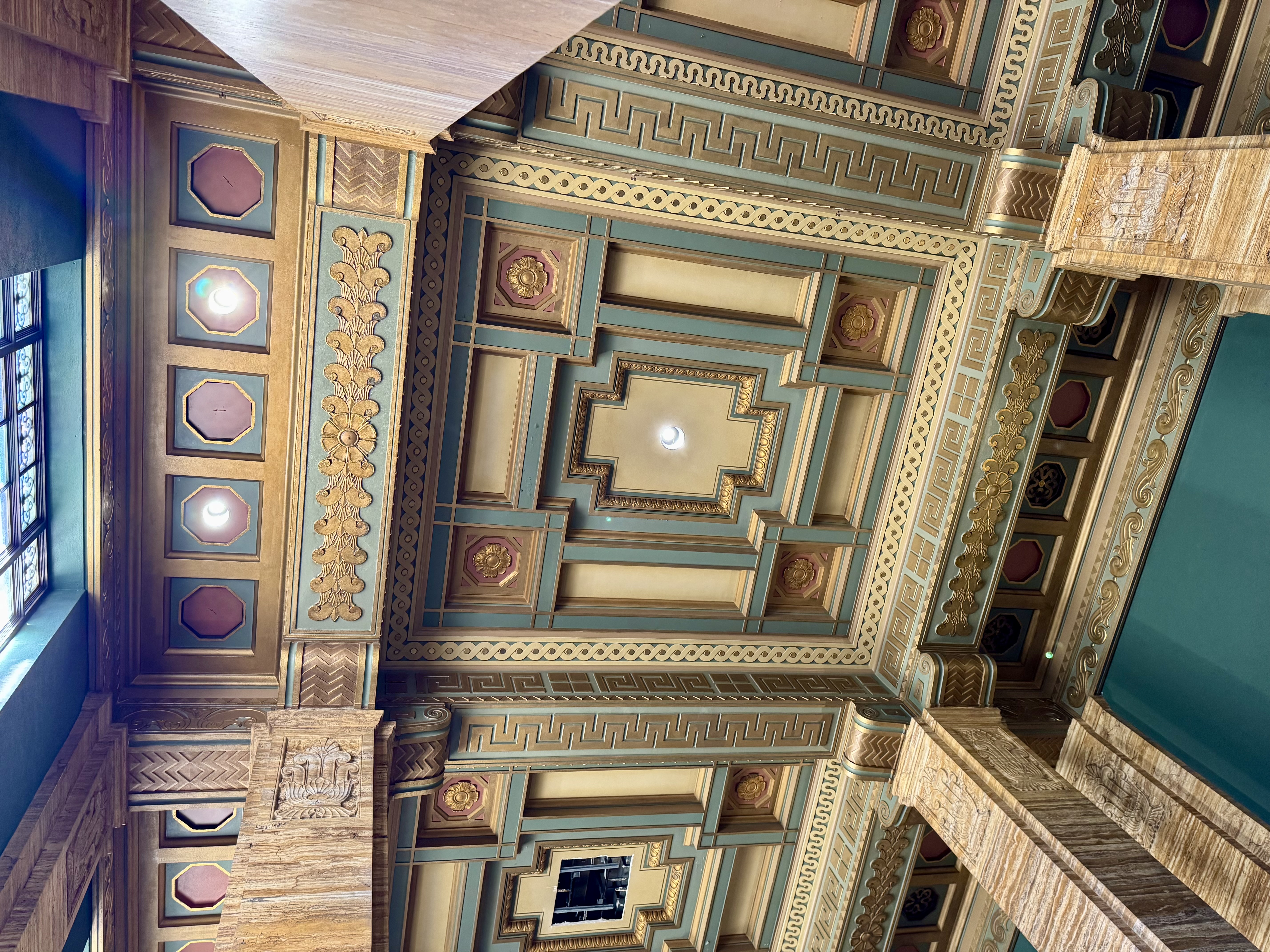
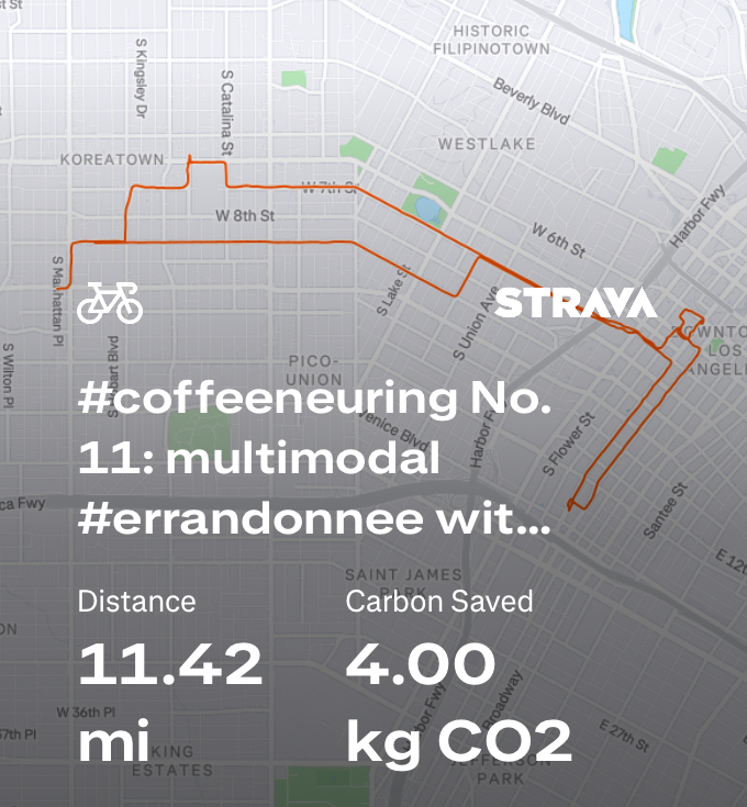
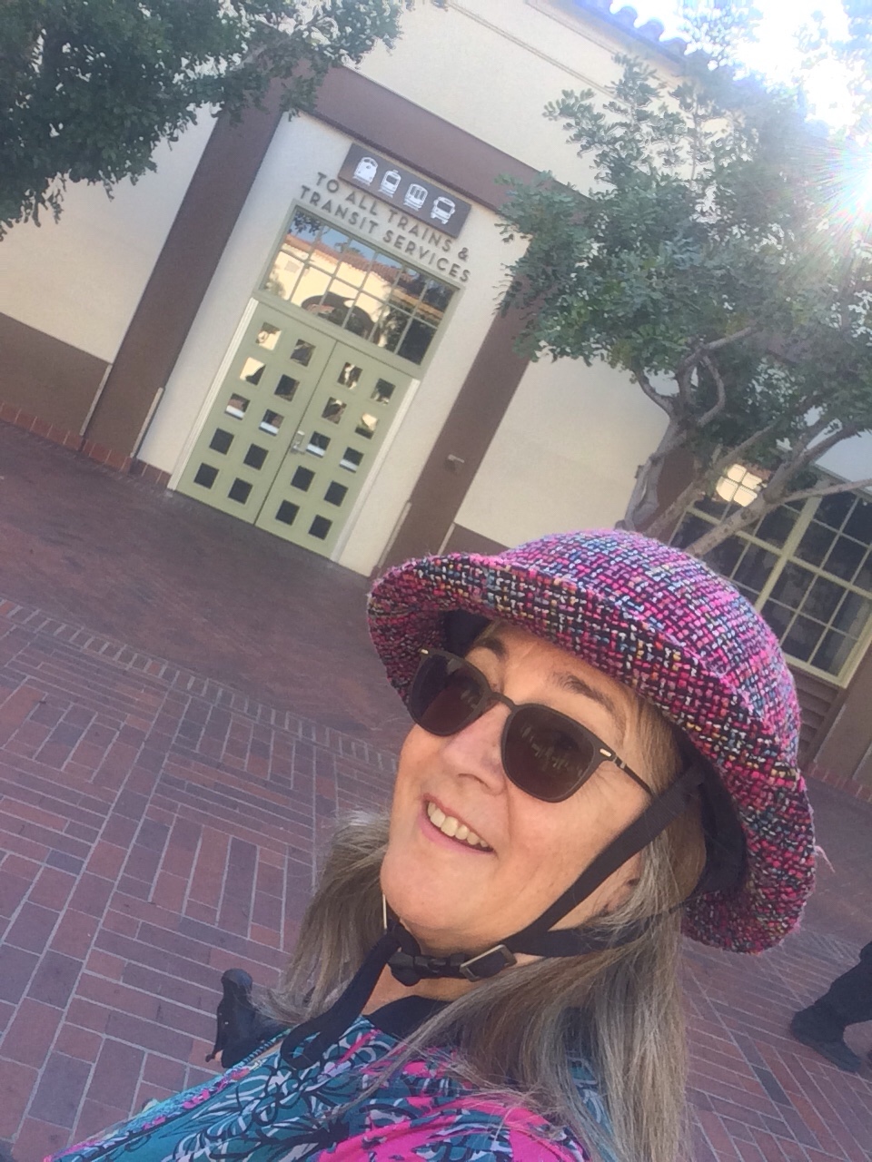
Control No. 11: 11/11/25 Aquarela Coffee in Downtown (Los Angeles)
Beauty: Stunning architecture & lobby of the CalEdison Building
Miles: about 10
On my list from Instagram of beautiful coffee shops was Aquarela, in the lobby of the CalEdison building downtown. The challenge for this one was that it is only open on weekdays. As it turned out, my doctor had asked me to get a blood test and to make sure that (this time) I get the blood drawn before 9 AM. Apparently, last time it wasn’t enough that I had refrained from eating until after the blood draw. That time I had encountered a comedy of errors and did not get the blood drawn until after 11 AM. So not only was I hangry and frustrated with the process of figuring out which lab would accept my insurance, I had wasted my efforts by not scheduling an appointment before 9 AM. And there was an 8:30 AM appointment available at a Quest lab location in downtown, not terribly far from where I live.
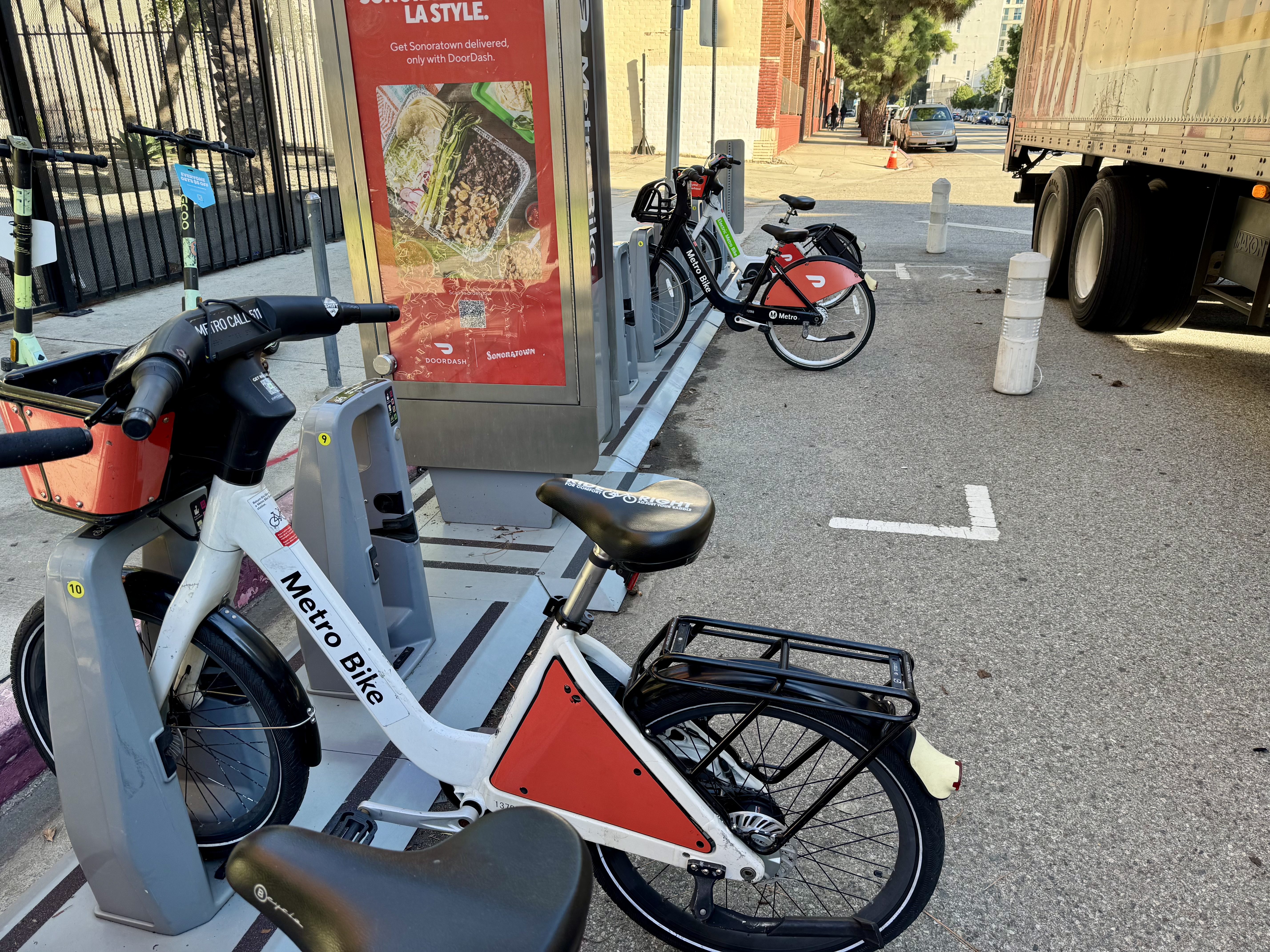
One thing I don’t like about biking to downtown L.A. is having to identify a secure place to lock up my bike. I sometimes solve this problem by using bike share. Turns out there is a bike share dock just across the street from the Quest lab where I had made my appointment, and there is also a bike share dock just across the street from the CalEdison building. Problem solved!
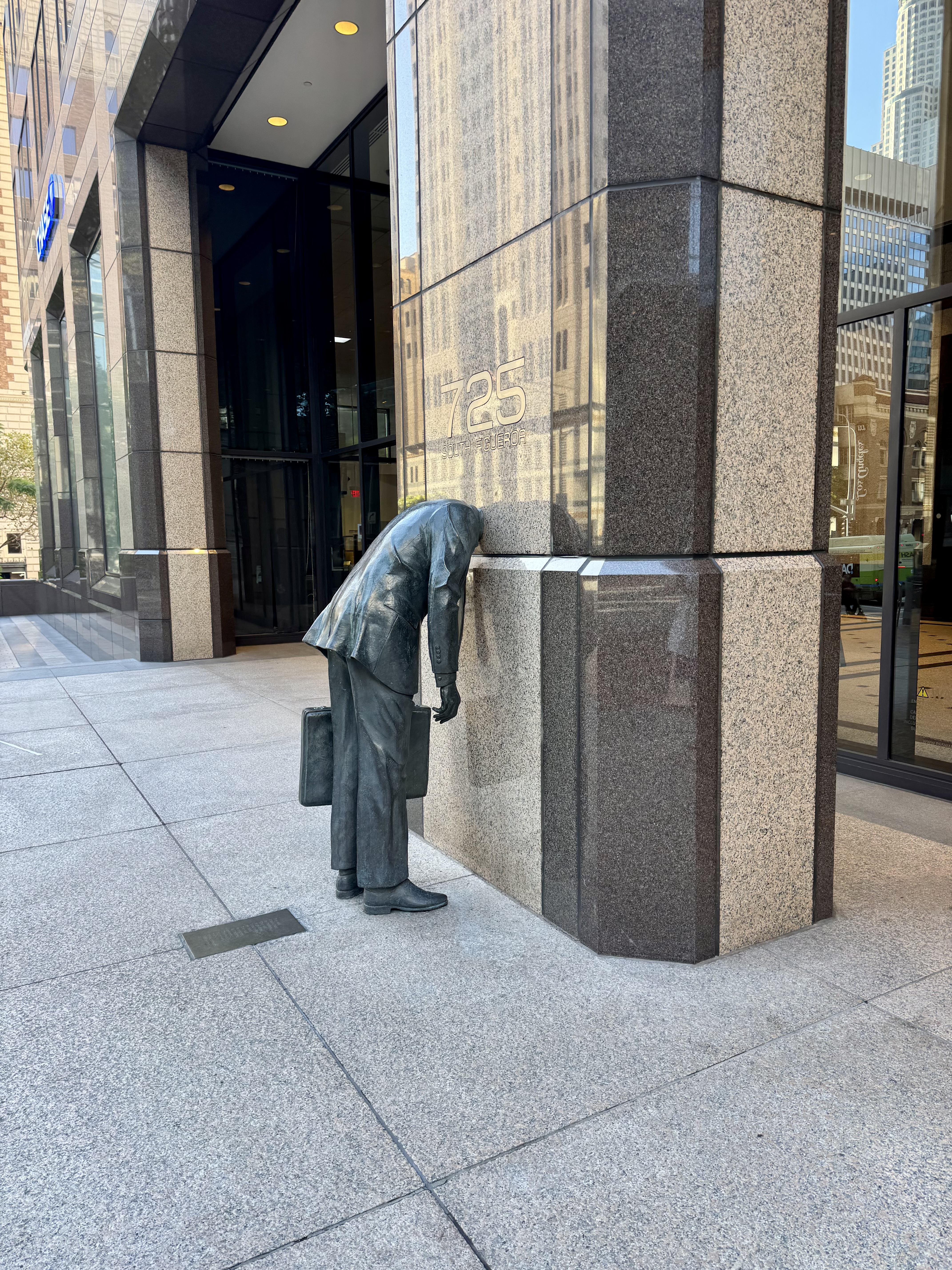
First I walked a quarter of a mile to get to the bike share station closest to my house. As I was riding into downtown, it occurred to me that I might not make it all the way to Quest before the allotted 30 minutes of free riding expired, so I decided to stop as I passed a docking station just before downtown to “re-charge” my rental. Unfortunately, I didn’t stop to consider the warning message I had seen in the app that some stations would be unavailable that day. So when I docked the bike, I discovered that the docking station was out of service, and that I could not check out my bike, or any other bike, due to the non-functioning dock. Oops. So I started walking briskly, but after a block or so, I realized I was never going to make my 8:30 appointment if I just walked the rest of the way. As I approached 7th & Figueroa, I felt a kinship with the statue there of a man in a suit carrying a briefcase with his head lodged inside the exterior of the office building. But at that corner, I also saw some Lime scooters, and figured that would be the way to get myself over to Quest in time. I’m not real confident and comfortable on those e-scooters, but at least I had my helmet and access to bike lanes for the entire 1.2 mile journey.
By the time I finished my blood draw, the support team at Metro Bike had responded to my support request and I was able to check out a bike again. At first I couldn’t see the docking station that I had expected to see just across the street, but then I realized it was hidden behind a very large tractor/trailer combination that was parked in the street and obscuring the dock. The station was in service (yay!) and I was able to get rolling by bike again. From there, I rode over to the CalEdison building, or actually to a bike share station on the other side of the Public Library, as the docking station closest to the CalEdison building was another one that was out of service that day. I did not mind, though, as the downtown library is a beautiful building, and I enjoyed walking around it.
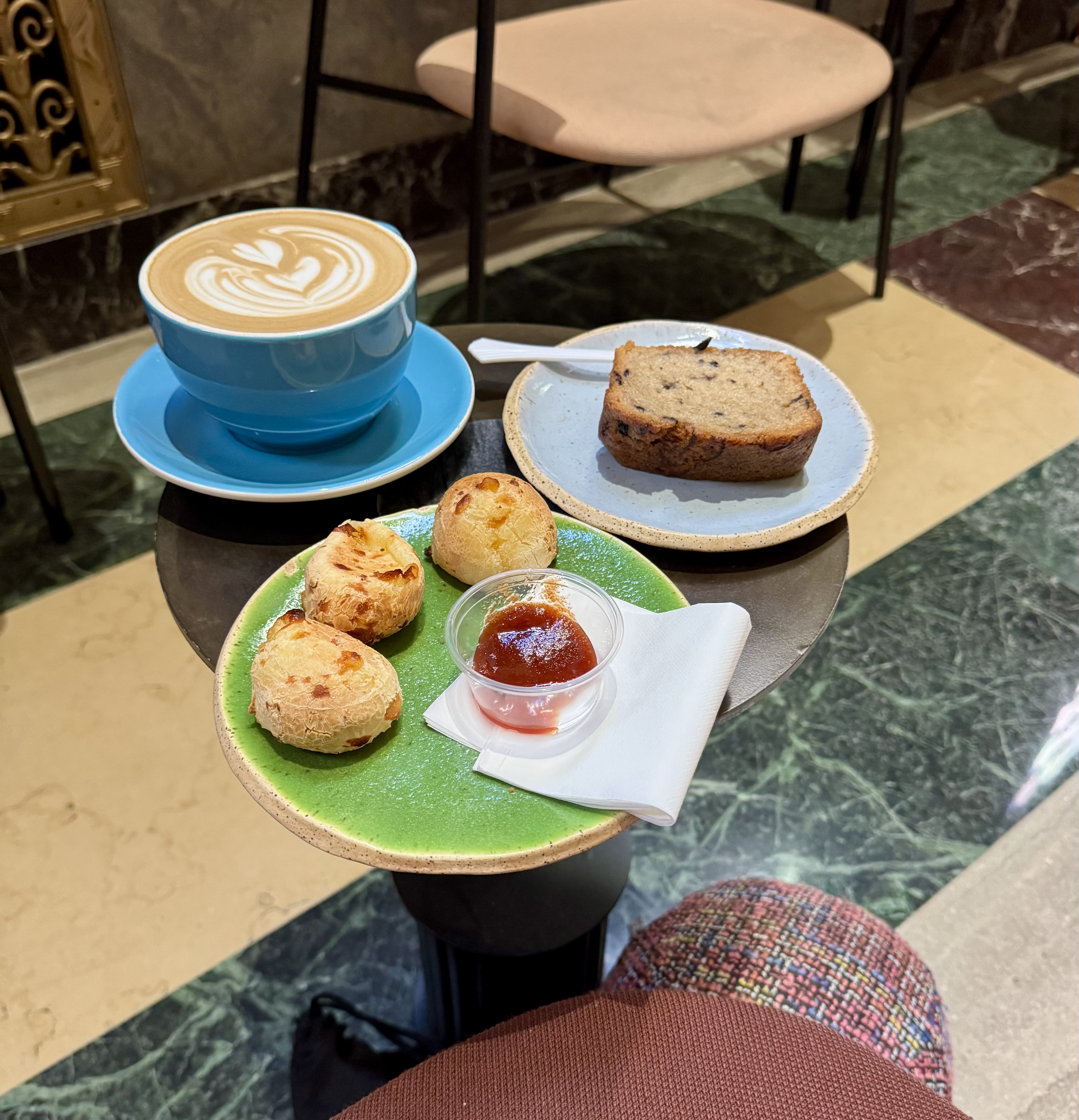
The lobby of the CalEdison building is truly stunning. The beauty and architectural detail that went into that lobby is a treasure. After taking a moment to gawk at the lobby, it was easy to spot Aquarela. I walked up and was greeted by a friendly women who gave me the run-down on their offerings, which include some special Brazilian treats and coffee drinks. I opted for the Sabotage Latte, which features both chocolate and spices. Since I was hungry, I also tried both the blueberry cake and the Brazilian cheese balls, Pão de Queijo, that are served with a red sauce. Everything was scrumptious and tasty!
This ride was a multi-stop errandonnee, as after getting my fill of coffee, treats, and gorgeous architecture, I needed to swing by the office where I pick up my business mail. Luckily, there is a docking station right across the street from the office as well, and it too was in service that day. Then, with mail in hand, I rode back to the station closest to home. Although my Strava record shows 11.42 miles, I must deduct the 1.2 miles of scootering plus a little walking for that stretch in the middle when I was not on a bike, so I’m calling it 10 miles of riding.
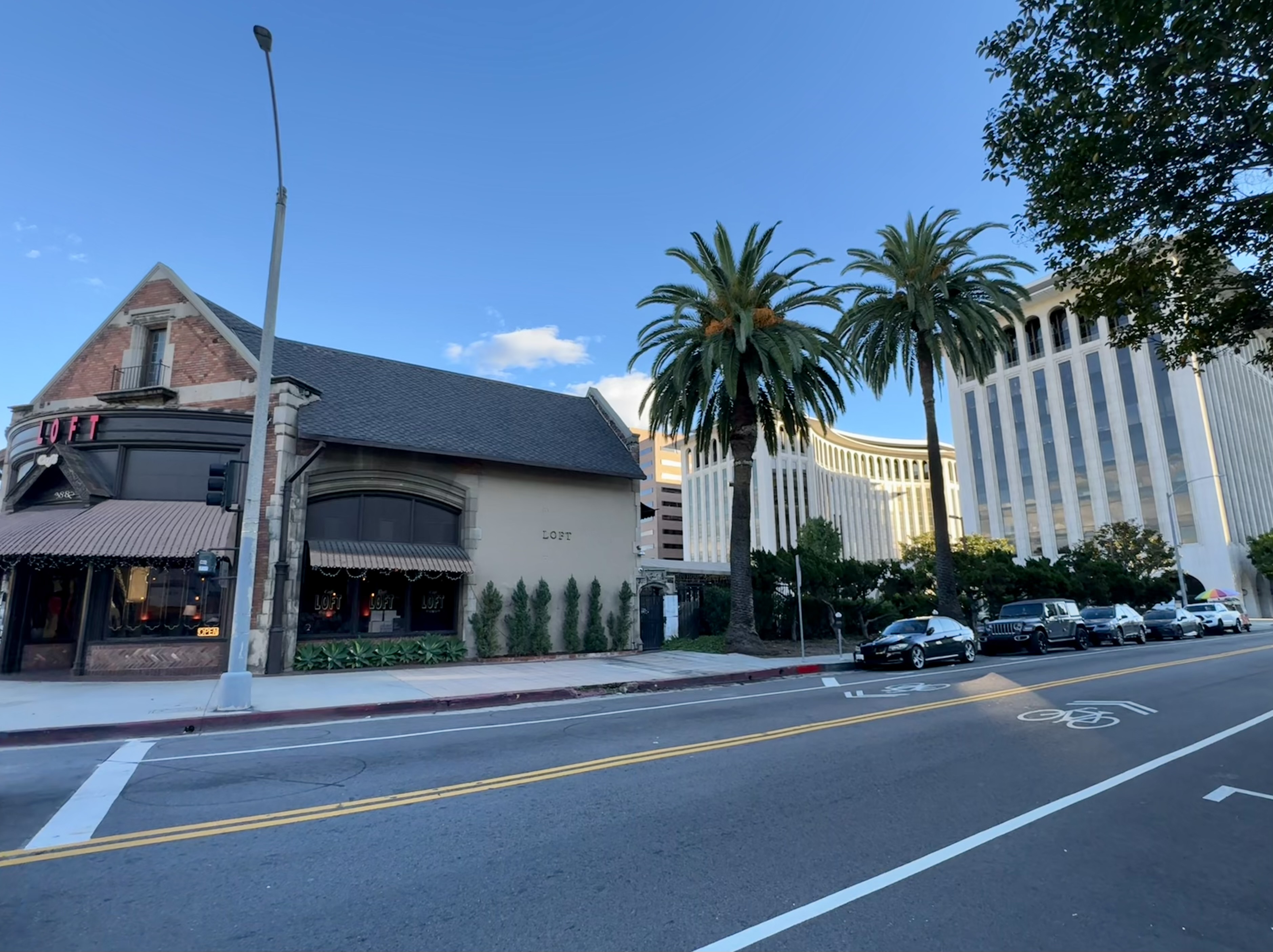
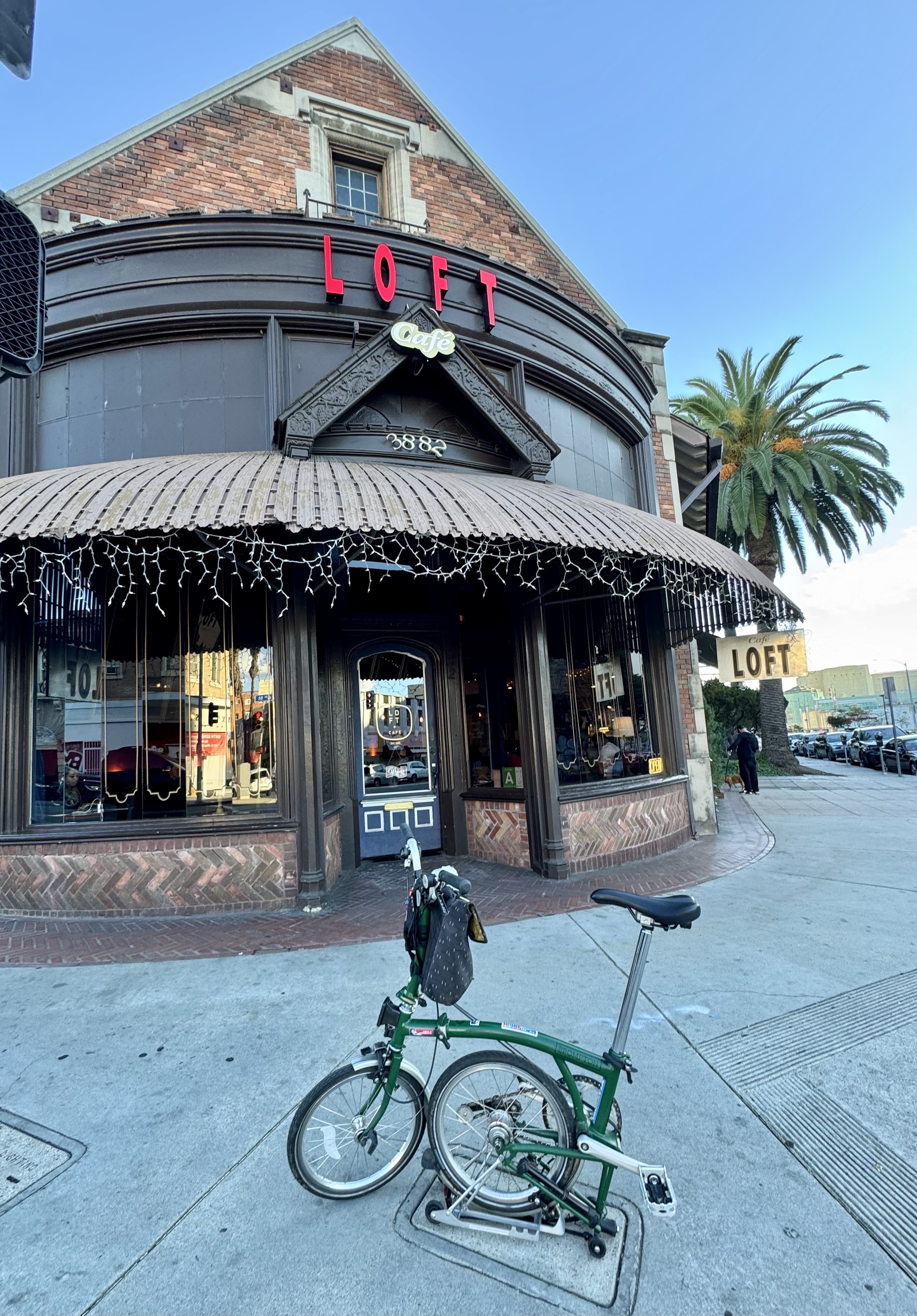
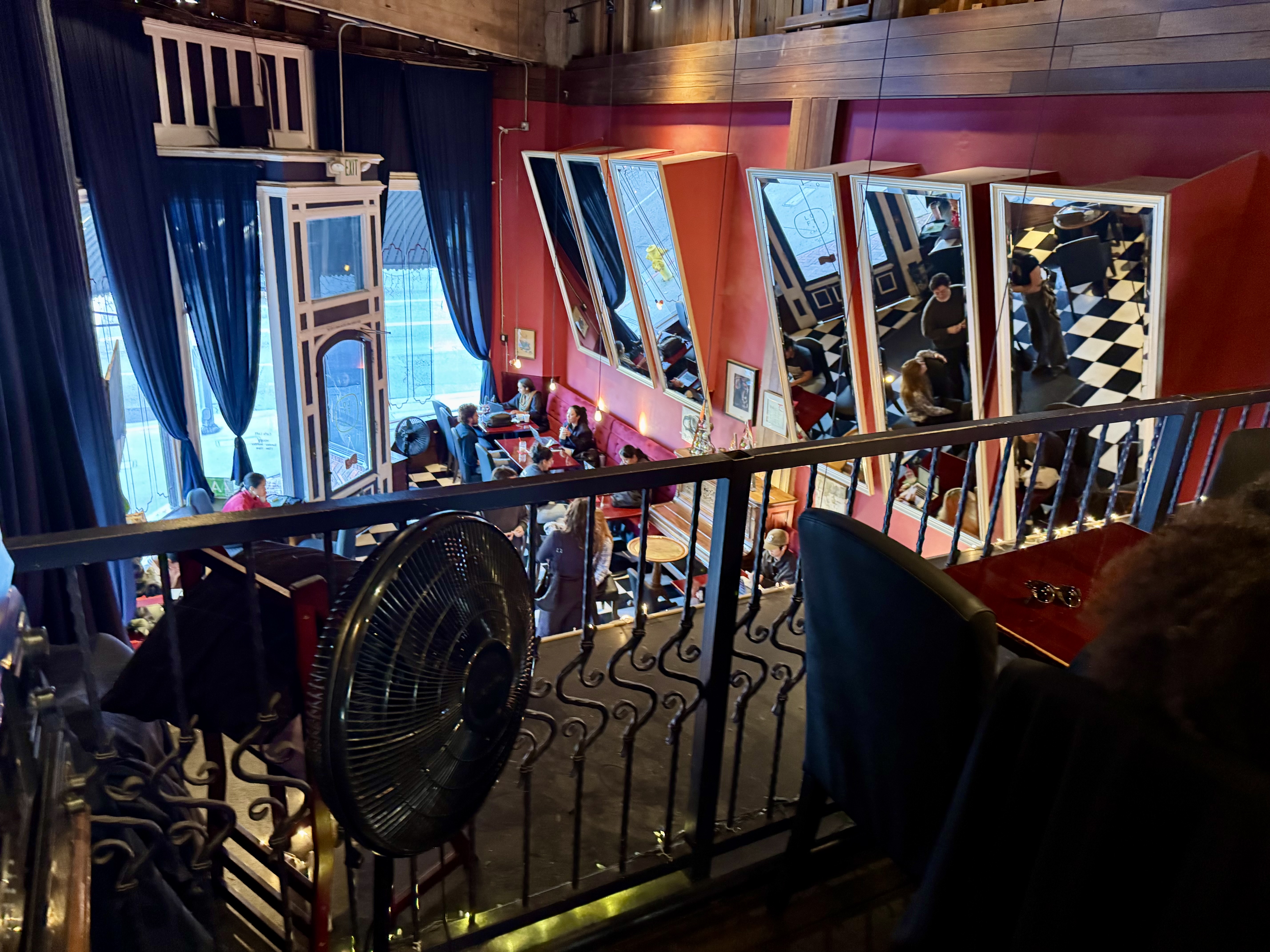
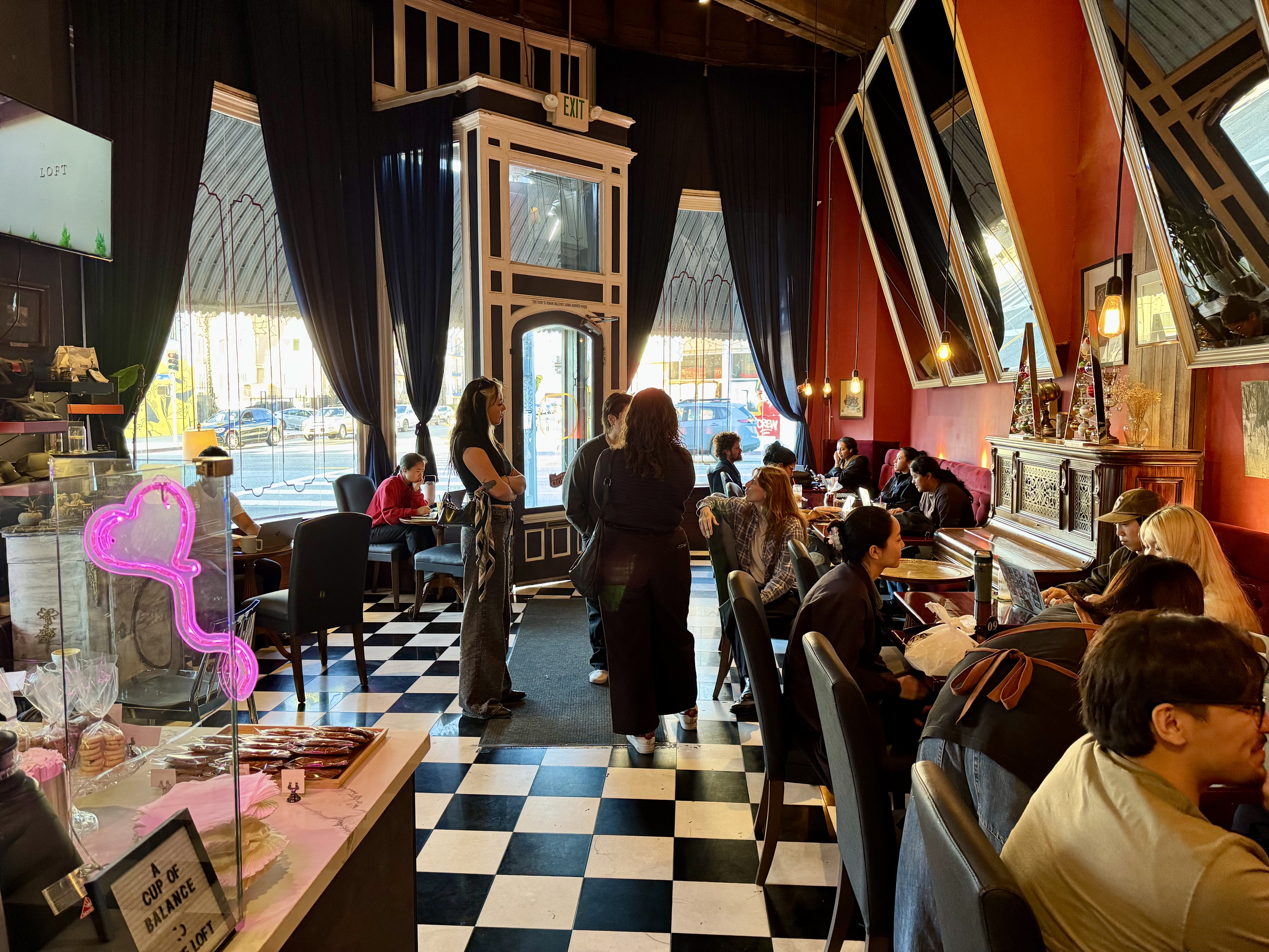
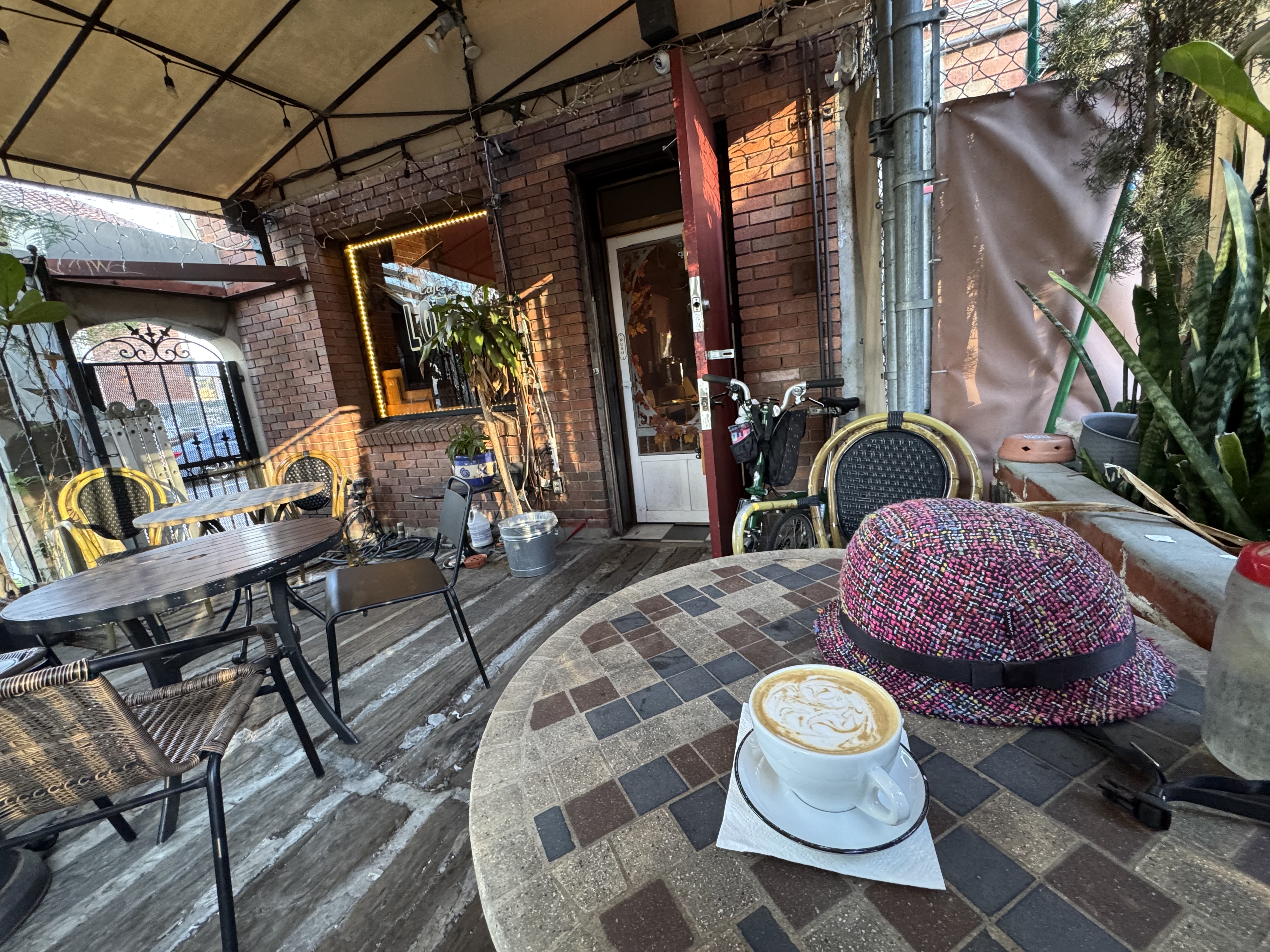
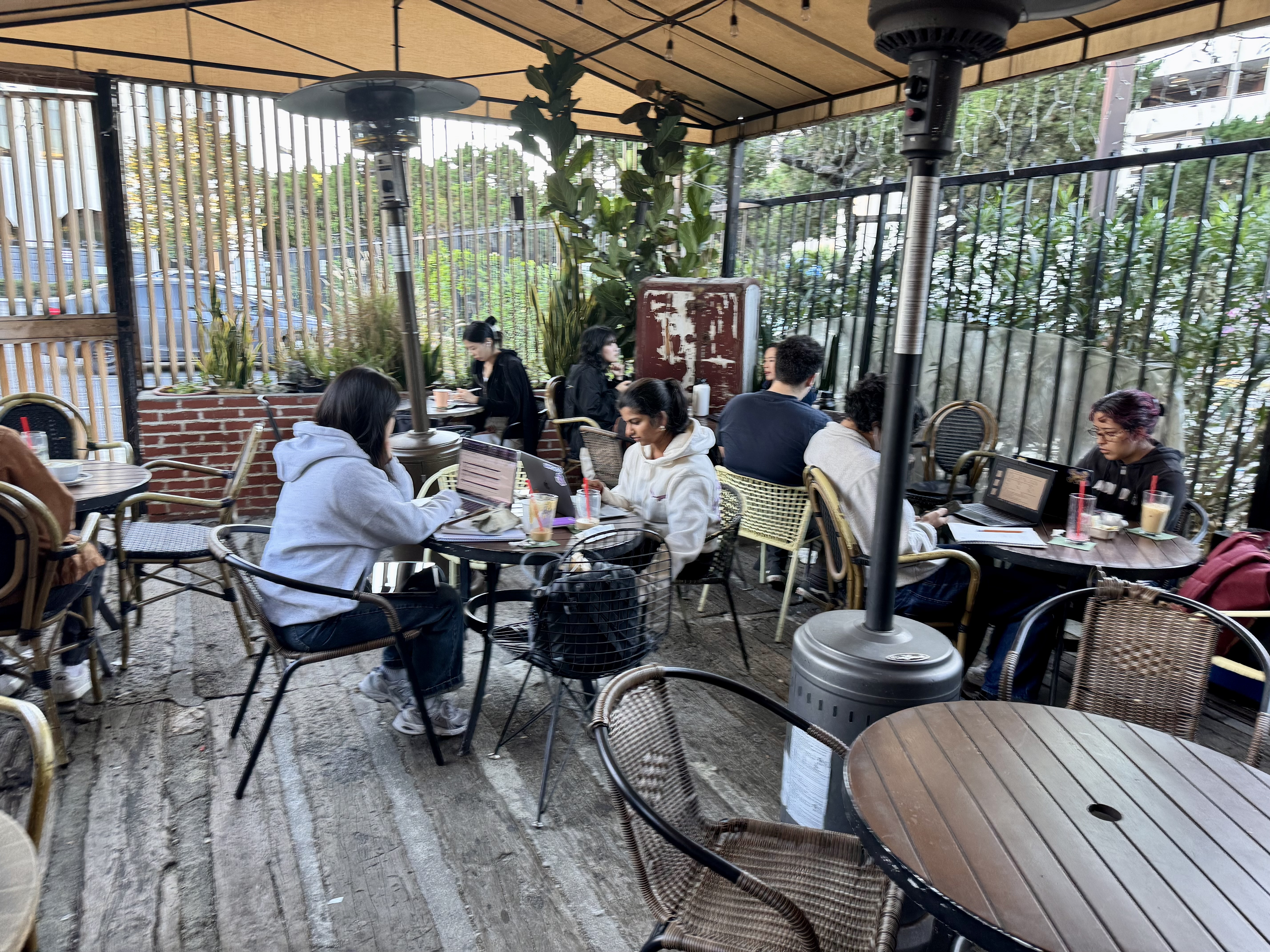
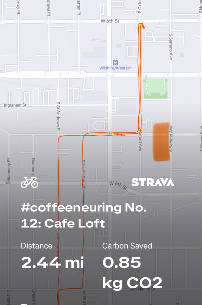
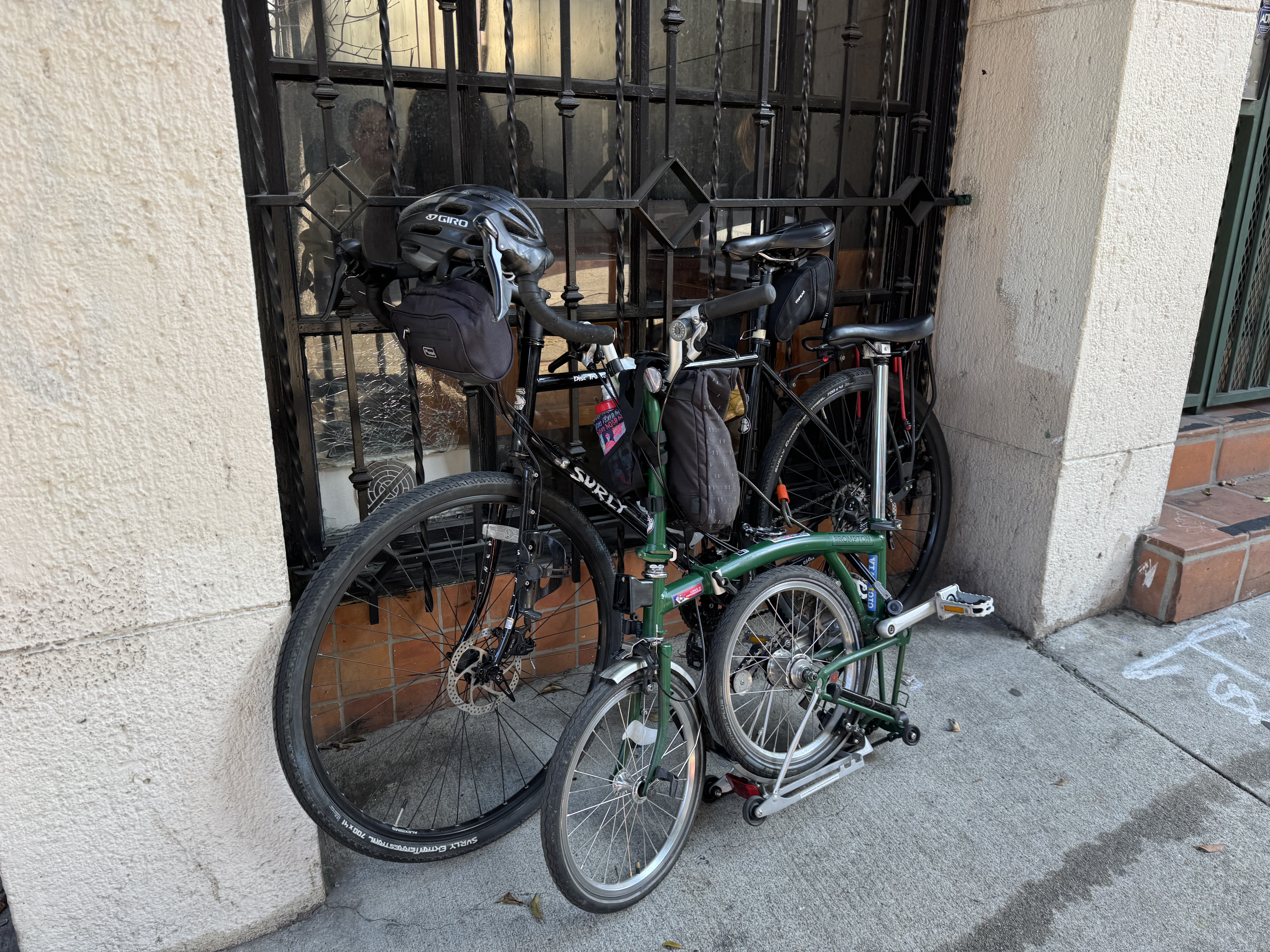
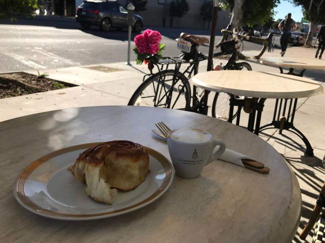
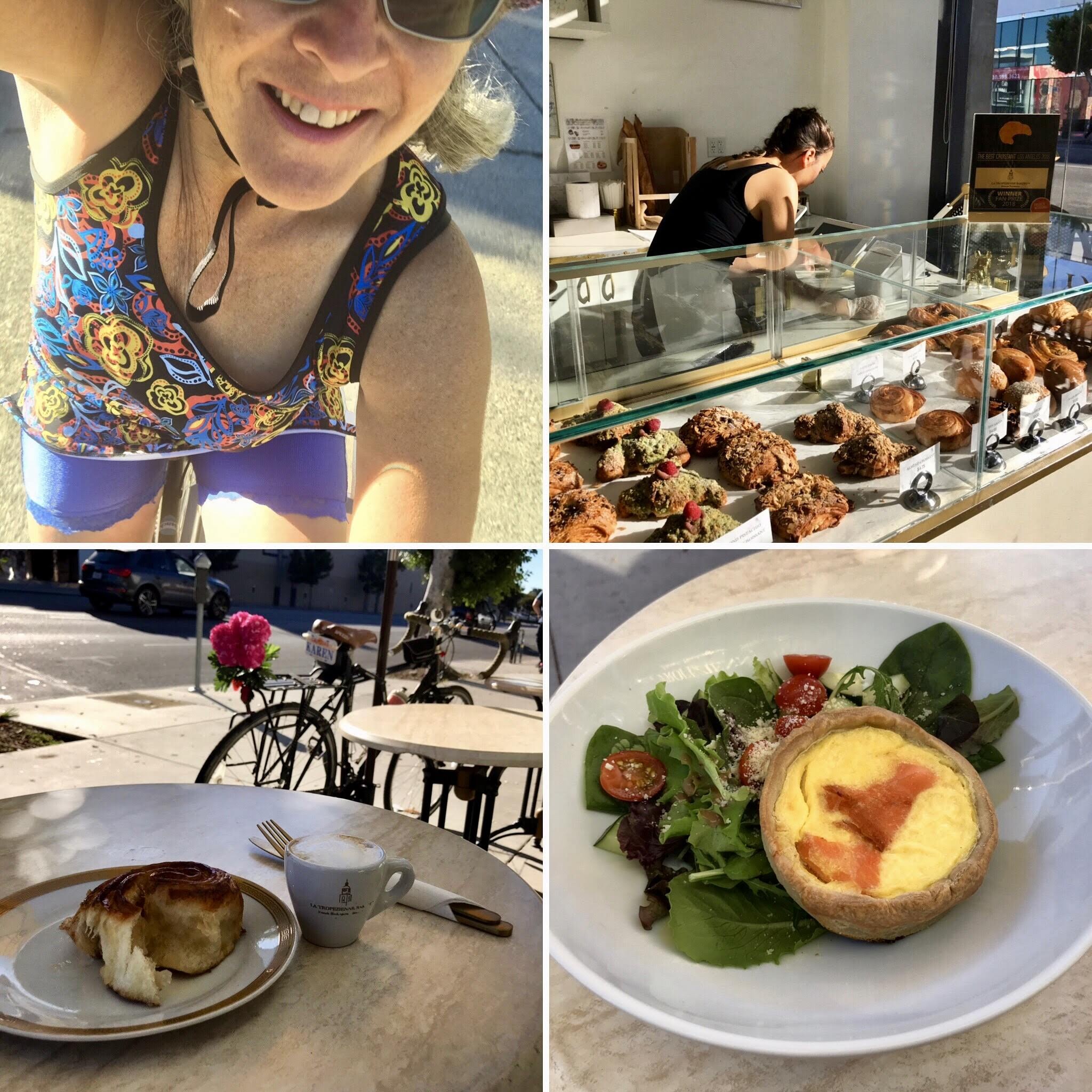
Control No. 12: 11/22/25 Loft Cafe in Koreatown (Los Angeles)
Beverage: Honey Latte
Bike: Brompton
Bloomers: Crazy Daisy
Beauty: Charming architecture & lovely patio
Miles: 2.4
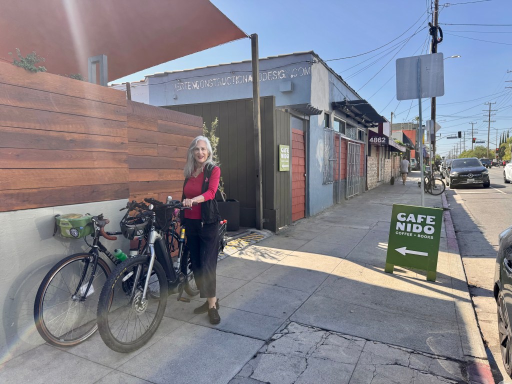
From 2012 to 2022, I rented office space for my patent law practice in the Wilshire Colonnade, a building I loved that took up most of a large block on Wilshire Blvd, between Oxford Ave & Serrano Ave. The smaller portion of the block, along 6th Street, featured a row of cute brick-faced shops, in particular, one especially attractive coffee shop at the corner of 6th & Oxford. Oxford is one of the more bike-friendly streets in this busy part of town, and I use it a LOT, even when not commuting to that office. I often would say to myself, “I ought to check out this coffee shop next time I’m coffeeneuring.” And yet, year after year, I did not. At last, I have now rectified that situation.
It was a simple Saturday with no big plans, and the final weekend of the coffeeneuring challenge. Loft Cafe is just a nudge over a mile from my house. I’d been busy clearing junk out of one of the kids’ old bedrooms to make space for guests coming in for Thanksgiving. I needed a break, and a quick late afternoon coffee ride was just the ticket.
I hopped on the Brompton, hoping that I’d be able to roll my bike inside since Koreatown is known as a hotbed of bike theft and I did not know what the bike parking situation would be. That worked out nicely, as no one complained when I rolled it inside and on out to the back patio. There was even a nice little space near the back door and near an open table where I could park it while I enjoyed my beverage. I had a honey latte that was a nice sweet reward after a day of tackling a dusty room full of junk.
This coffee shop deserves to be considered for lists of beautiful coffee shops. The architecture of the building is very quaint, there really is a loft, and the back patio is a pleasant surprise in the middle of this bustling part of Koreatown. It’s amazing that I worked on this block for 10 years and never tried this cafe!
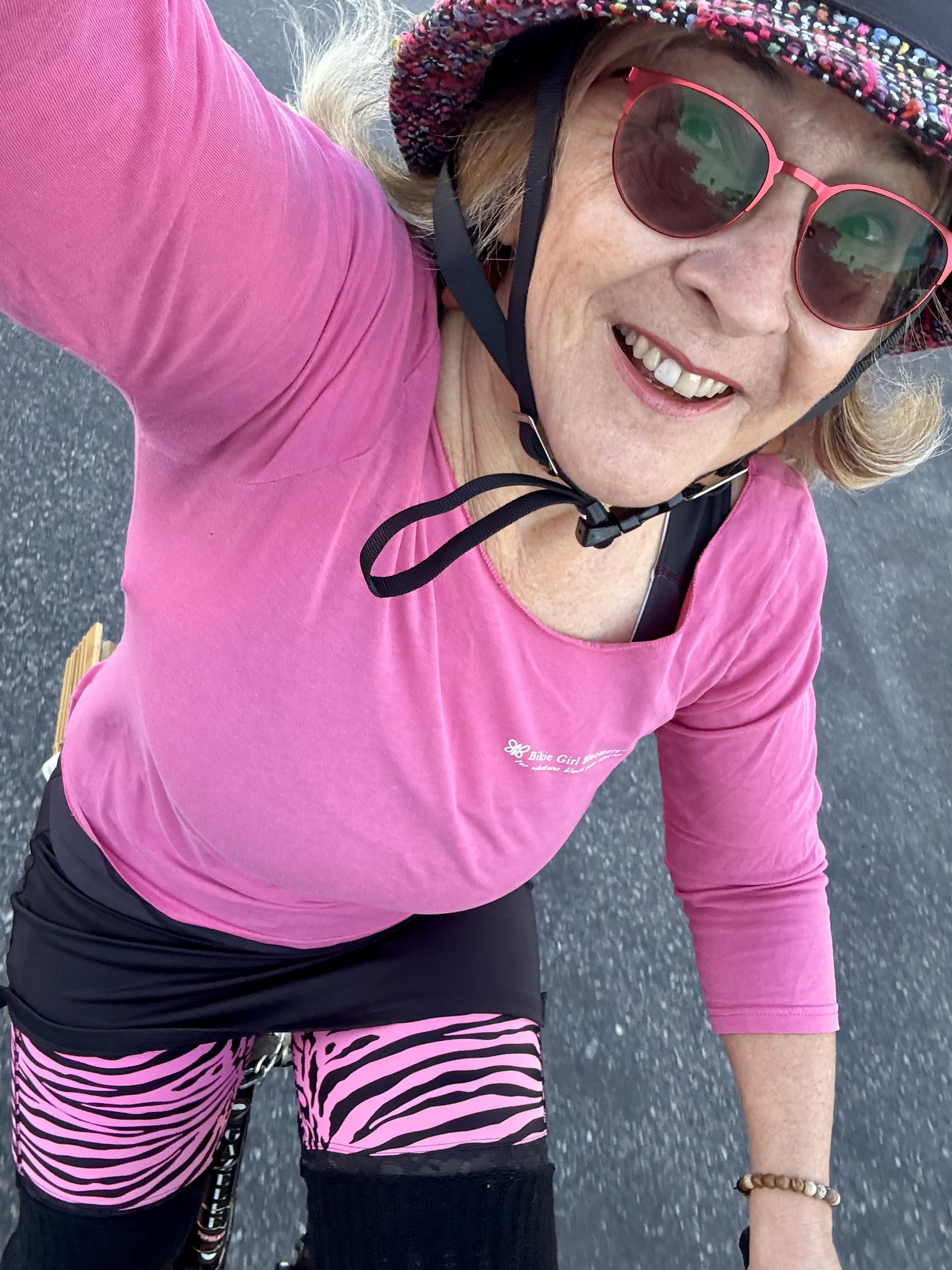
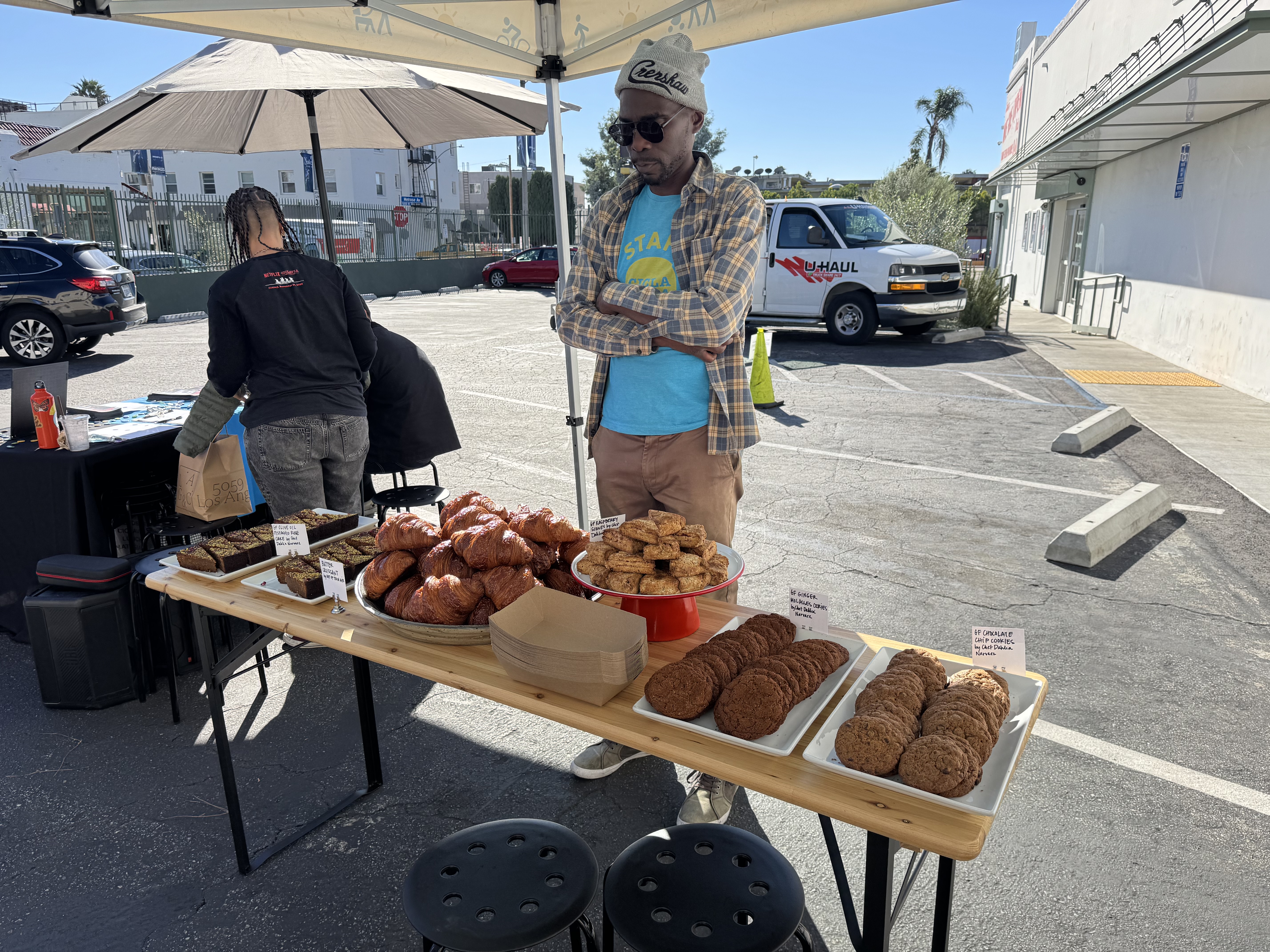
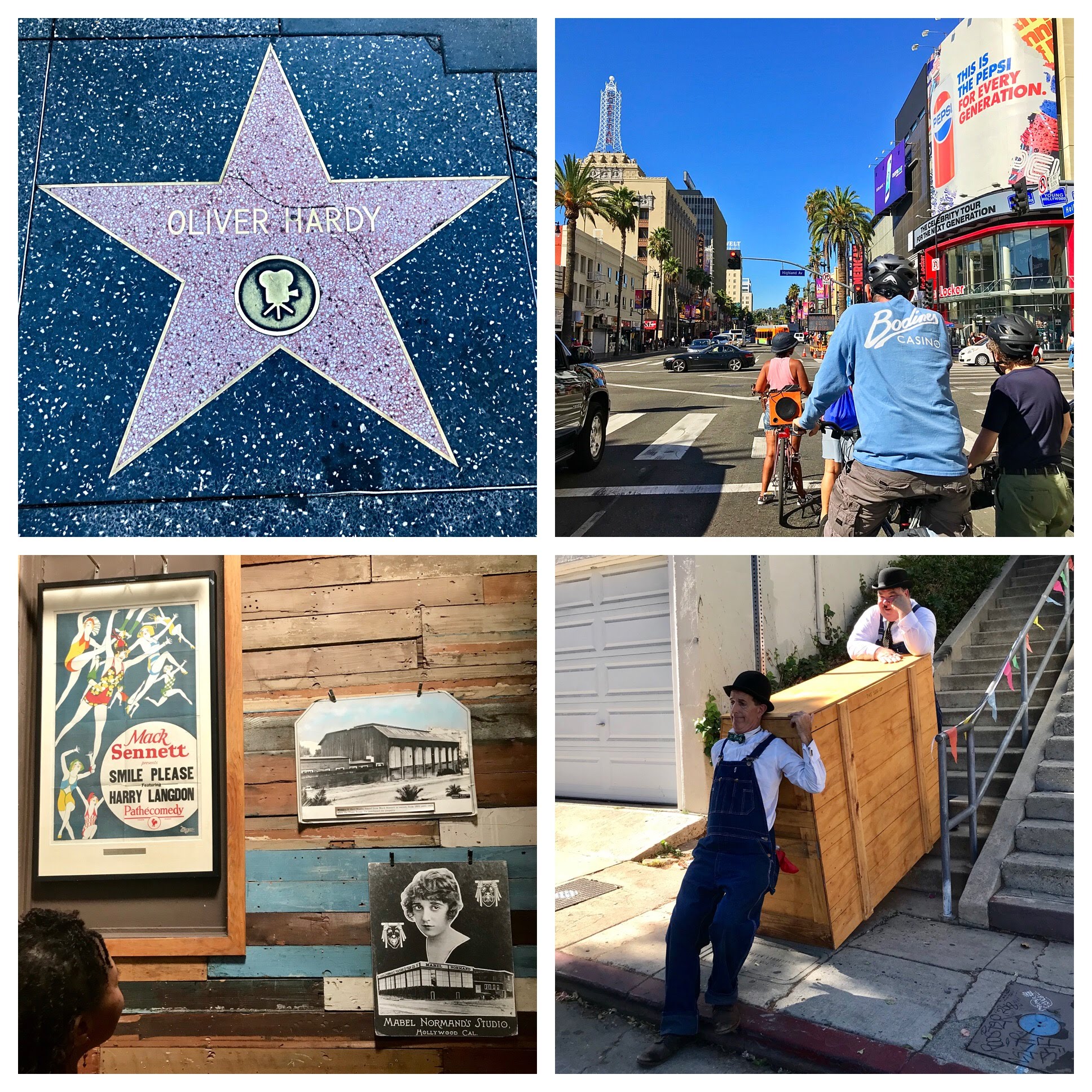
Control No. 13: 11/23/25 L.A. Grocery in Hollywood (Los Angeles)
Beverage: Coffee with Okinawan black sugar syrup (+ croissant)
Bike: Gazelle Tour Populaire
Bloomers: Hot Pink Zebra
C+1: Fellow Street Stars
Beauty: Great looking fresh produce
Miles: 5
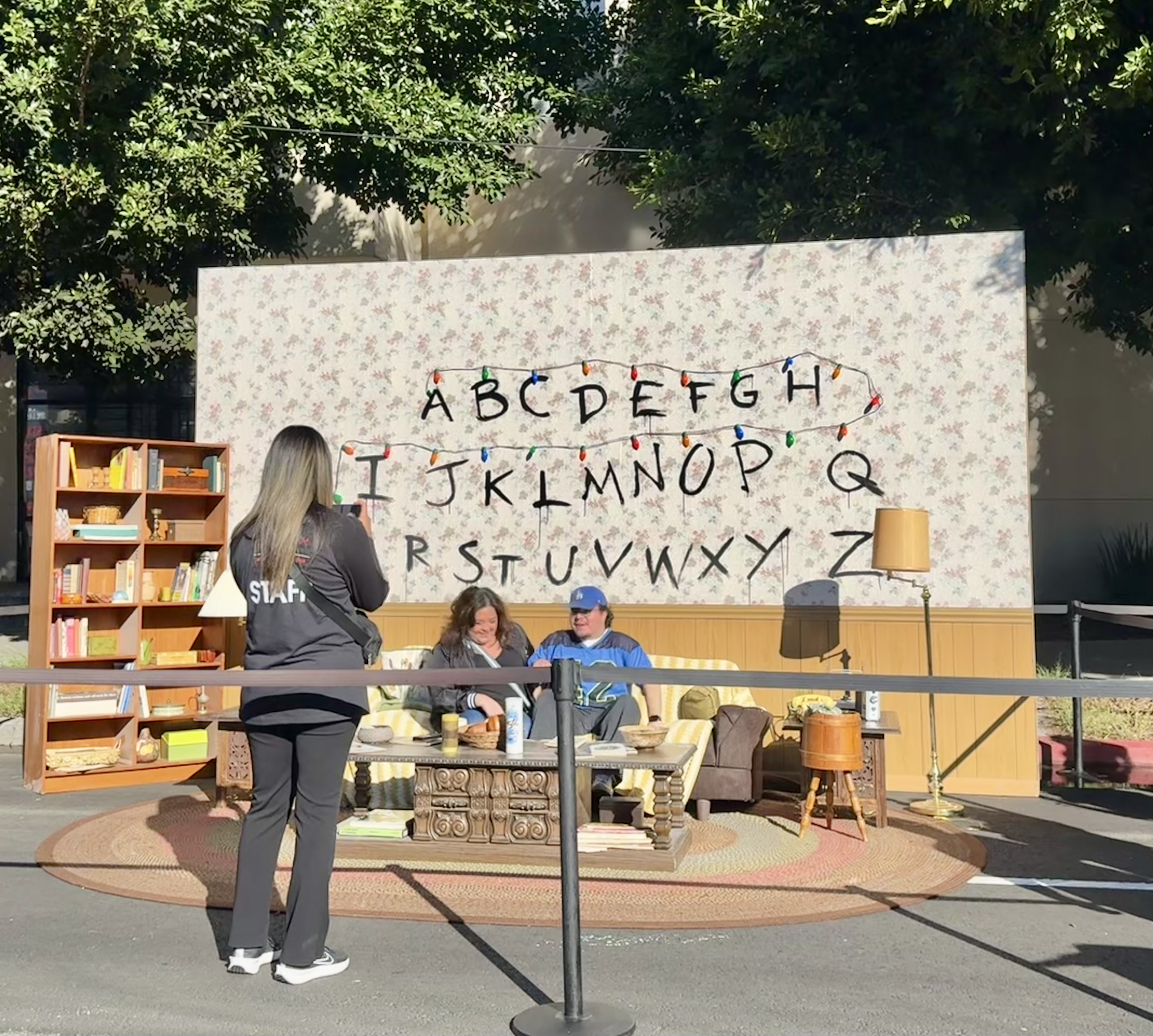
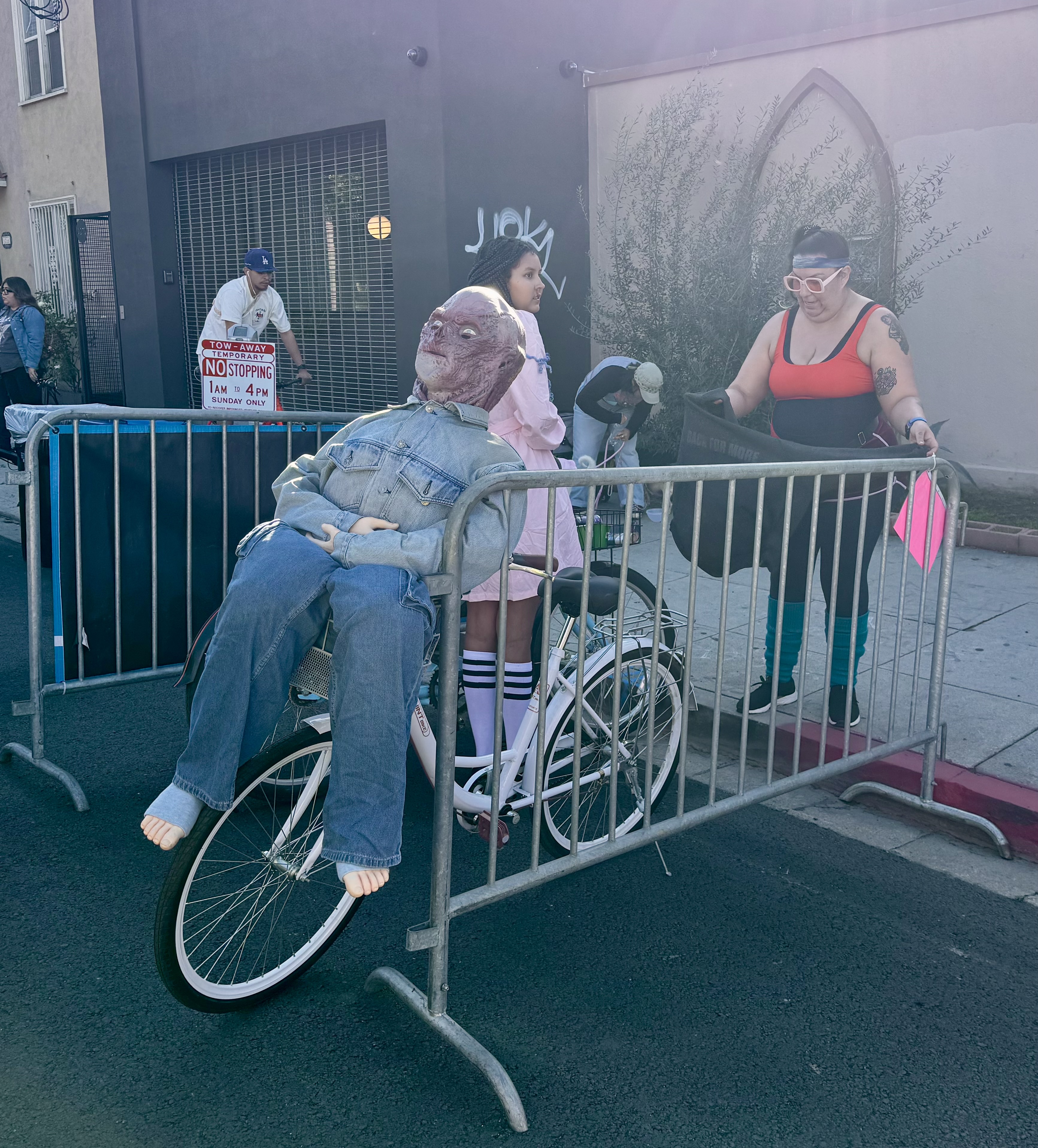
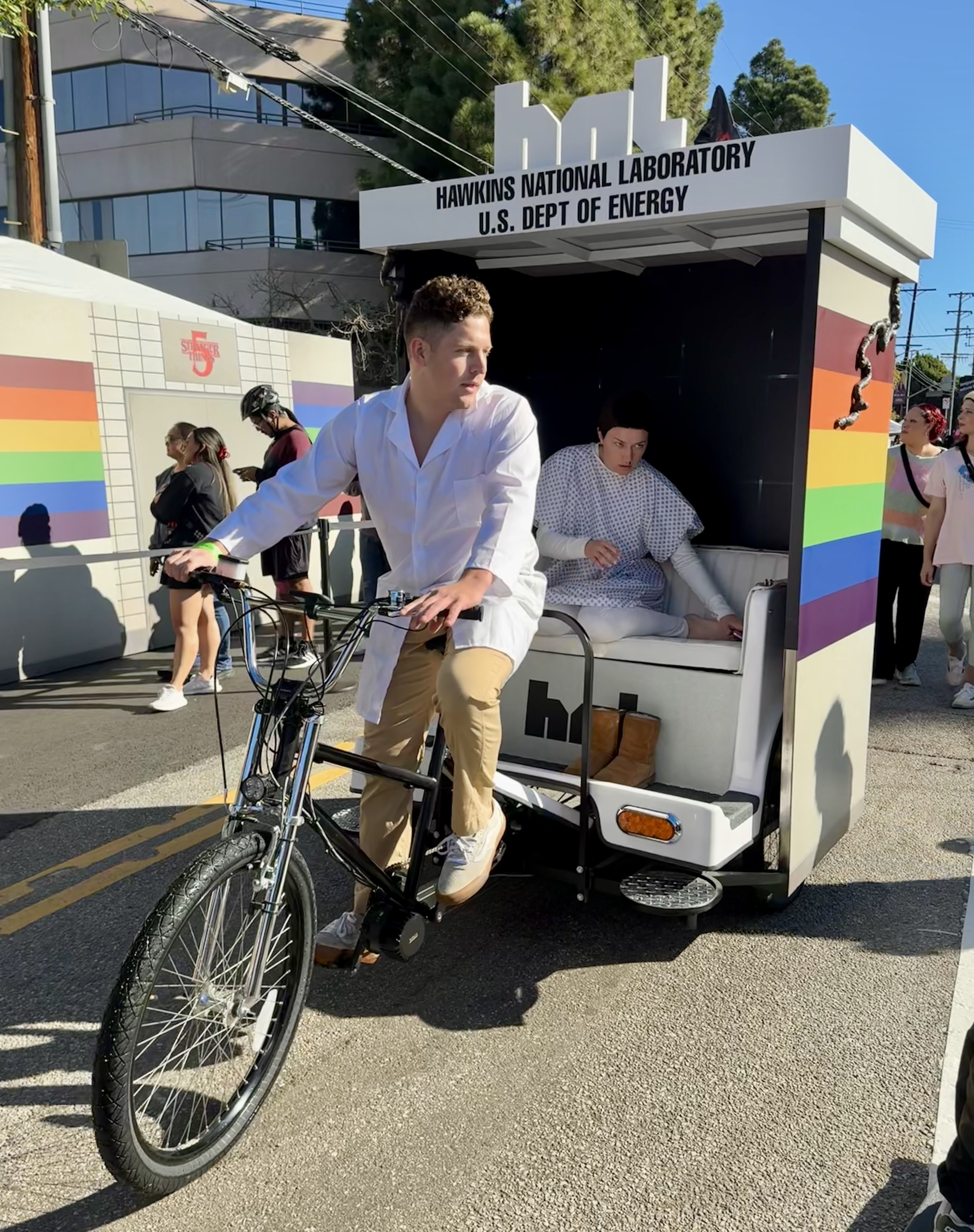
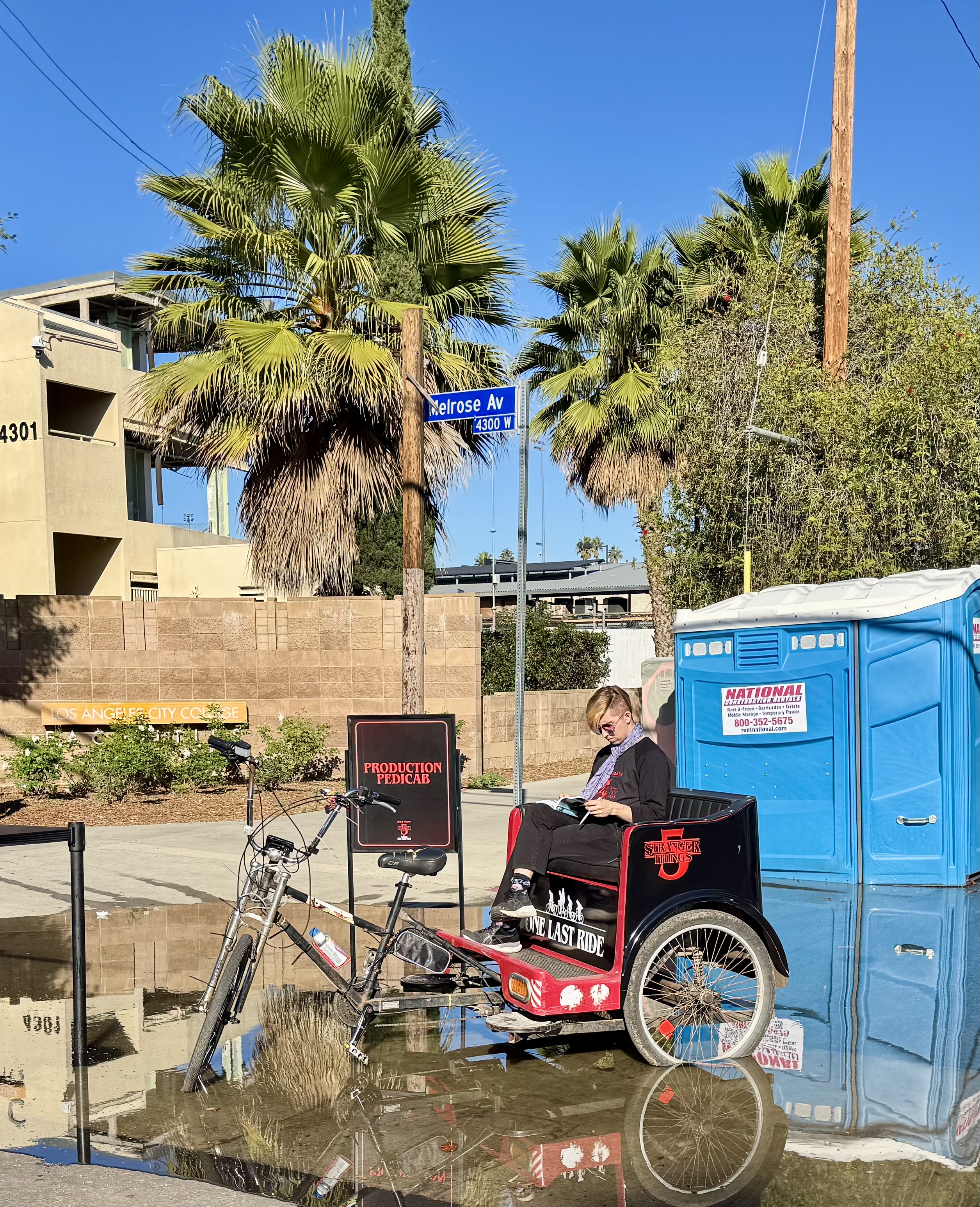
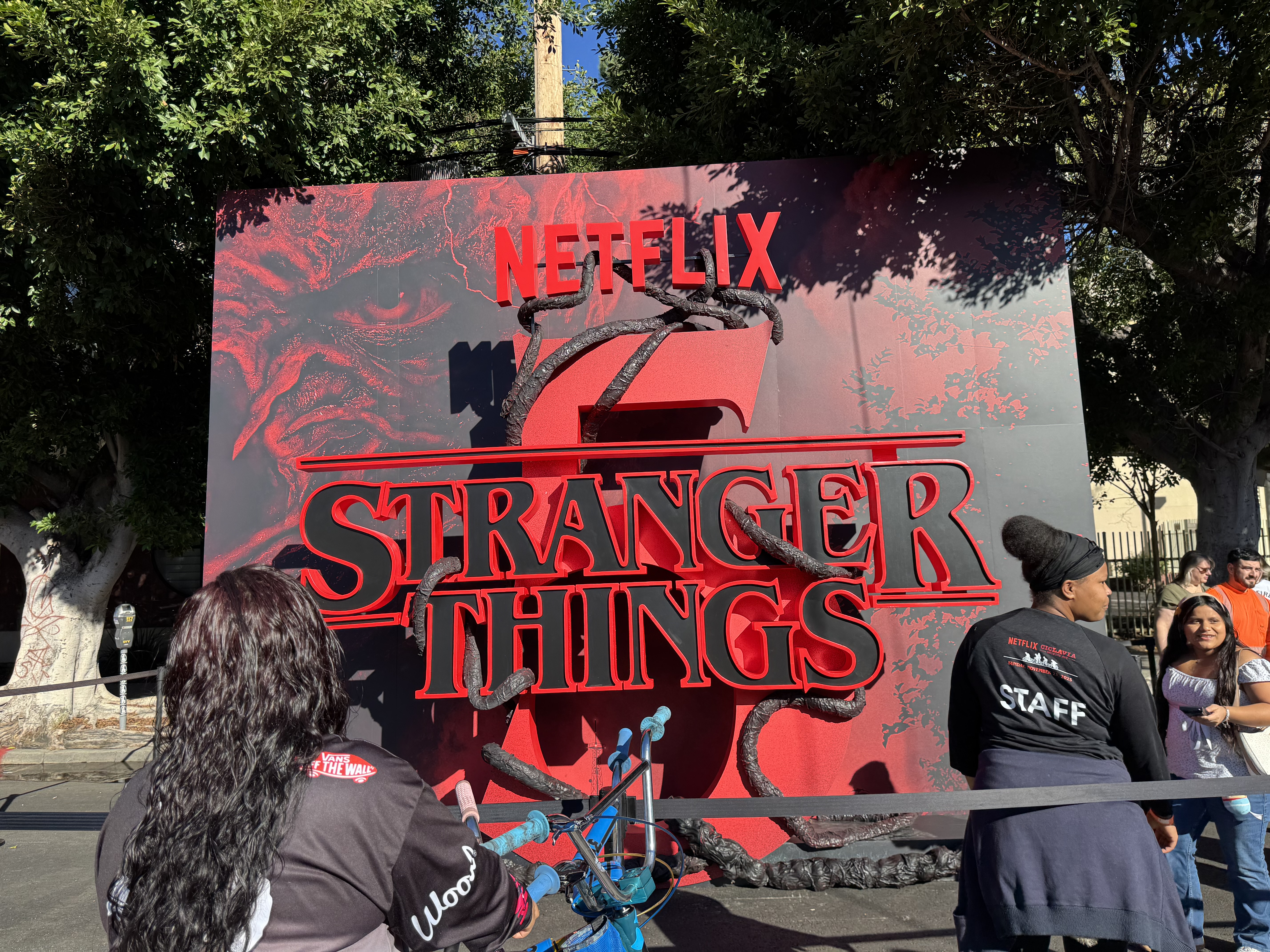
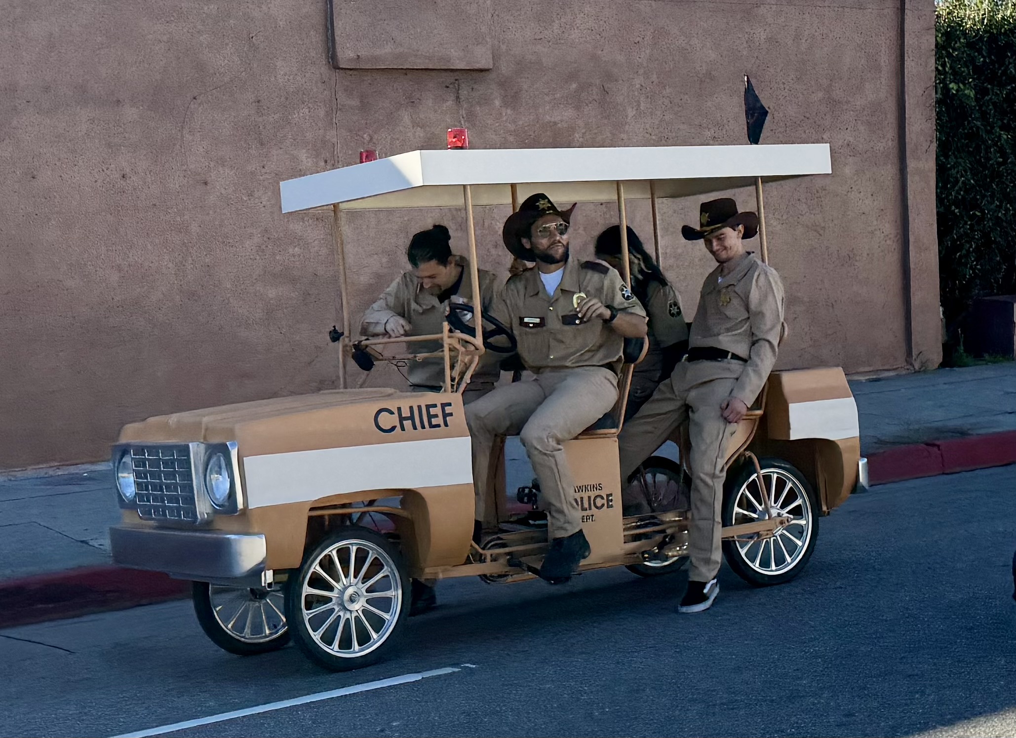
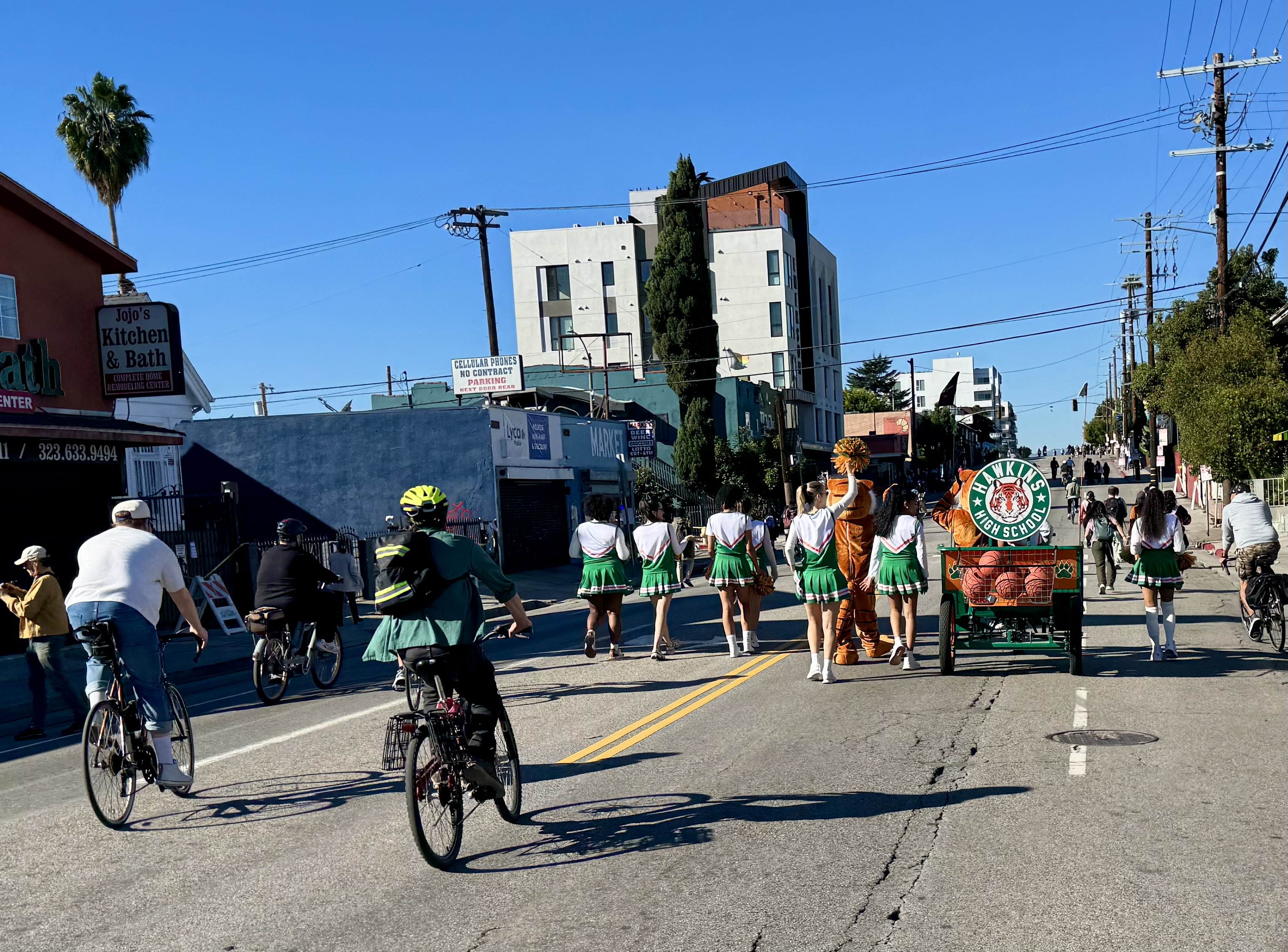
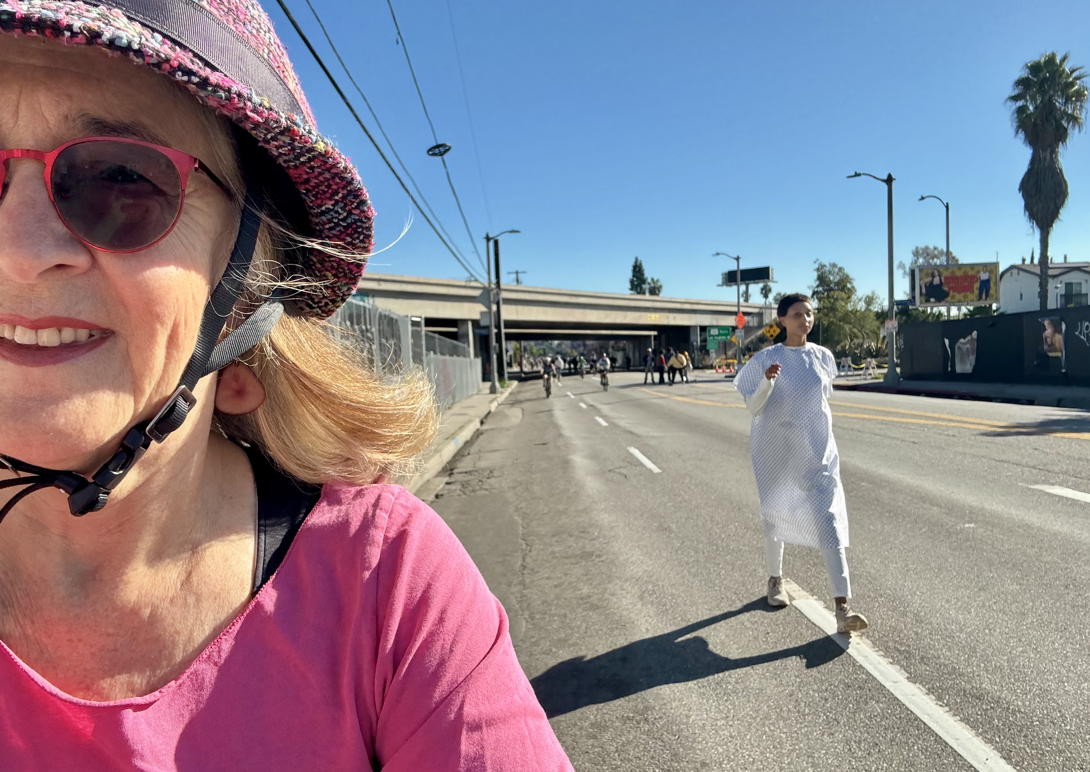
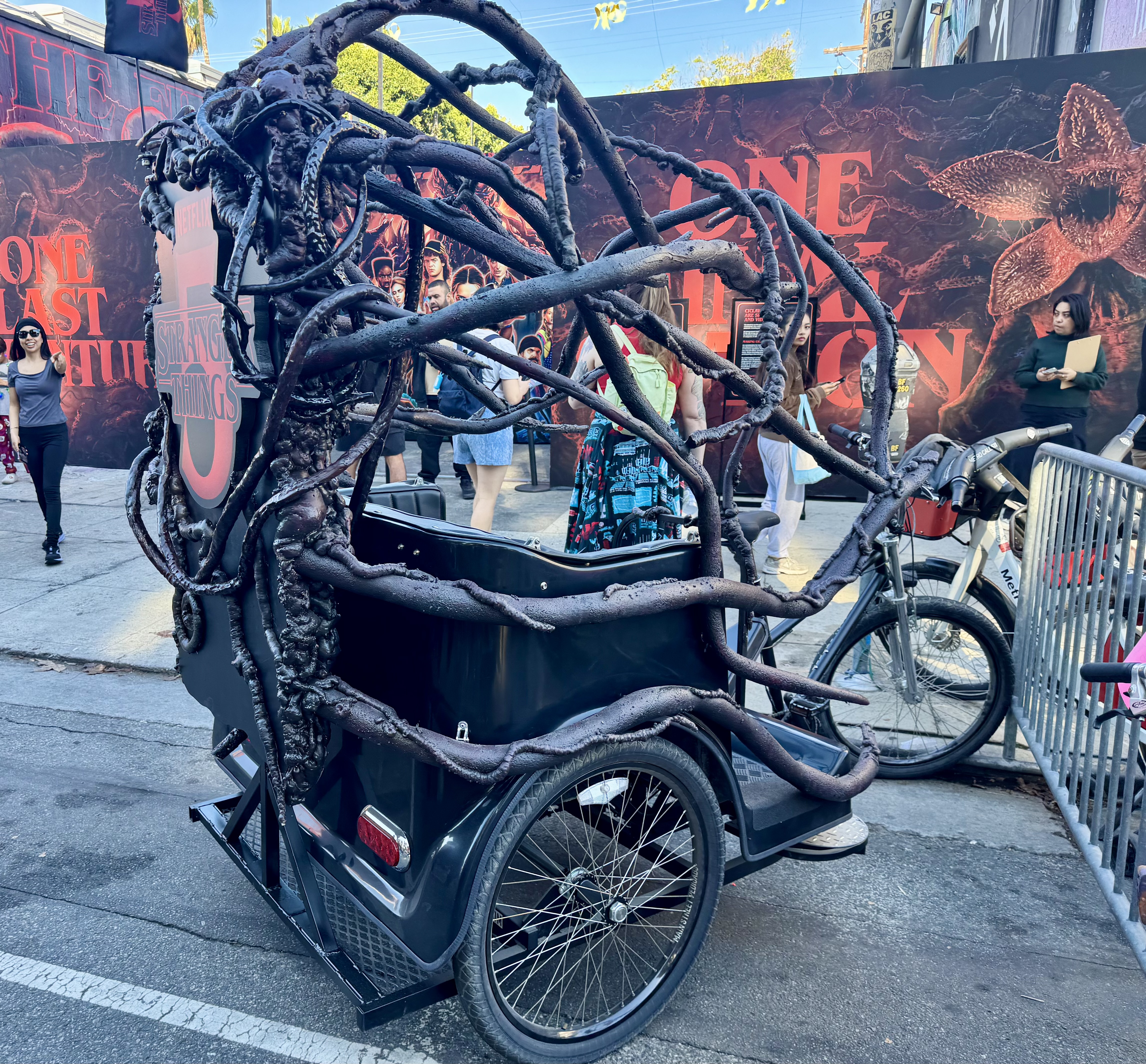
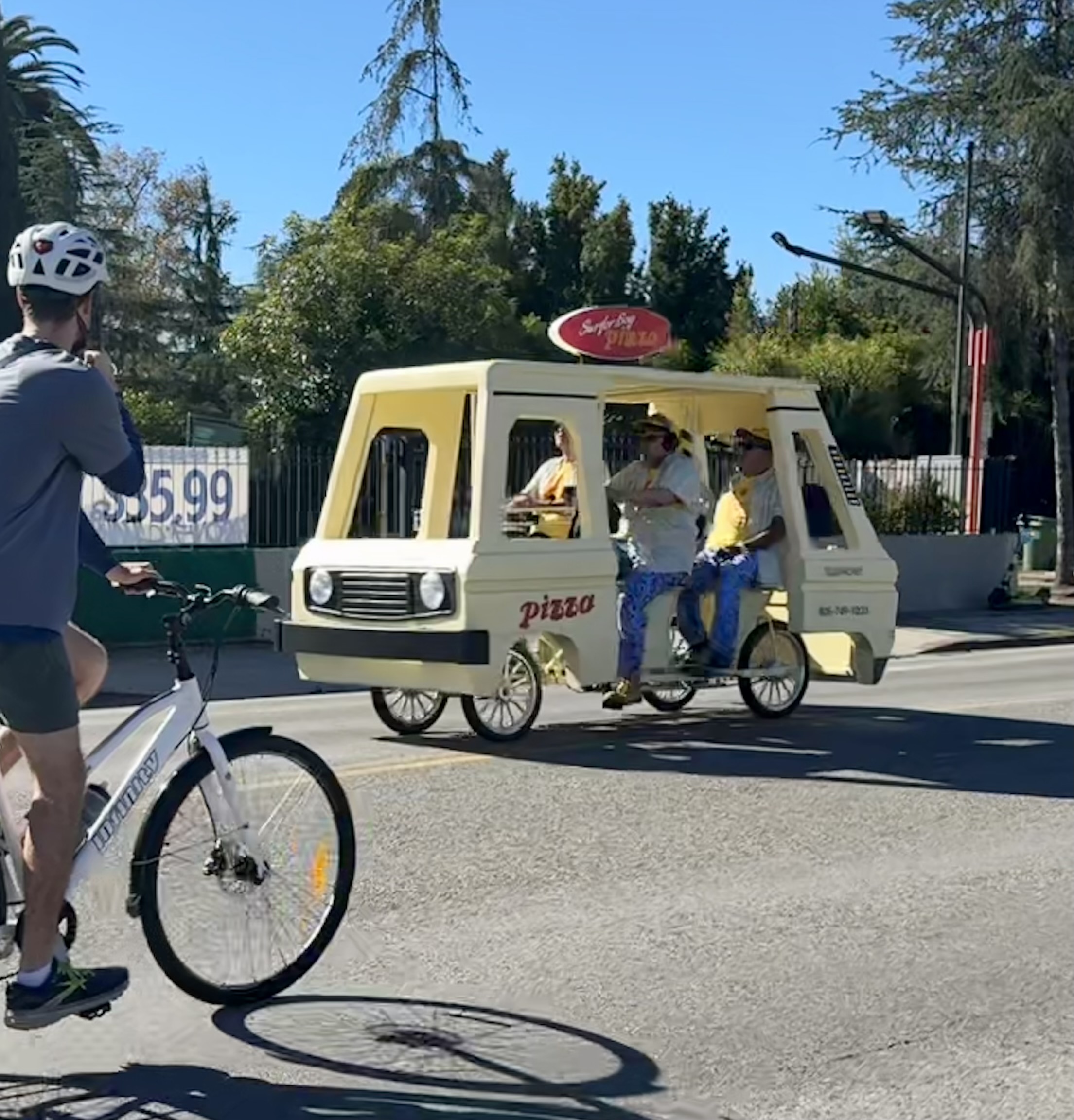
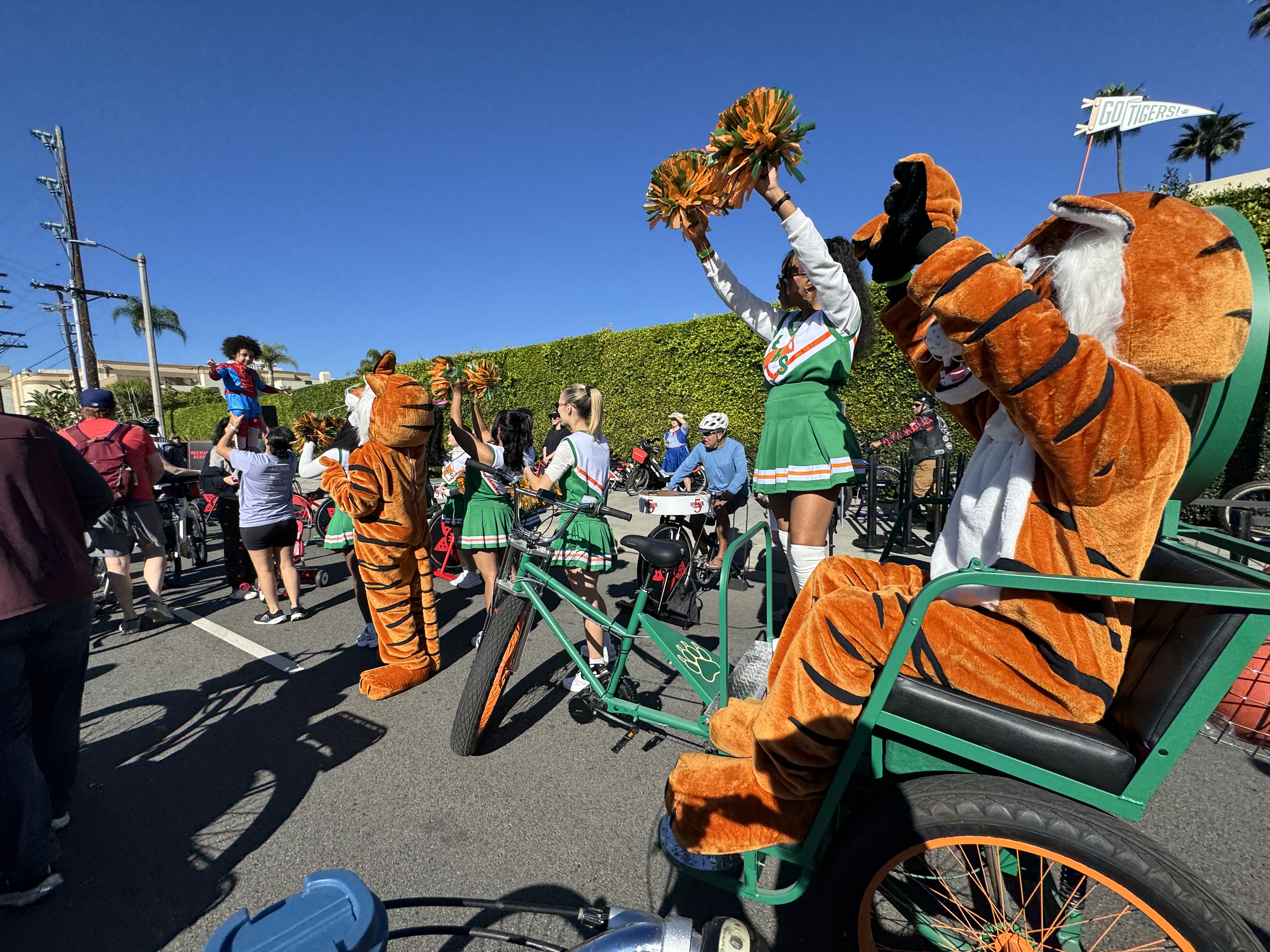
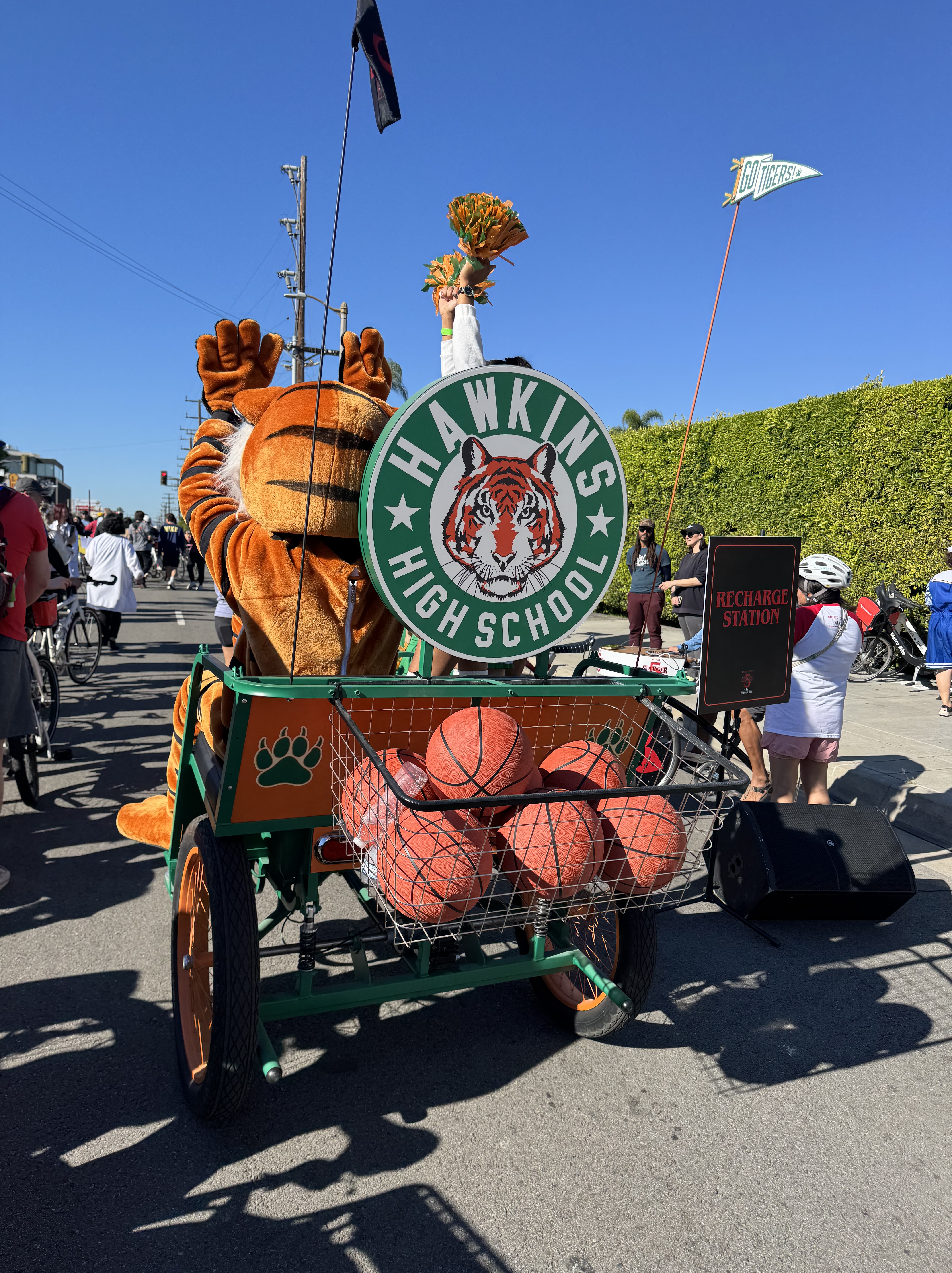
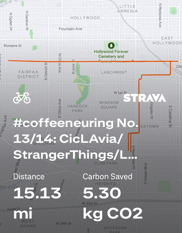
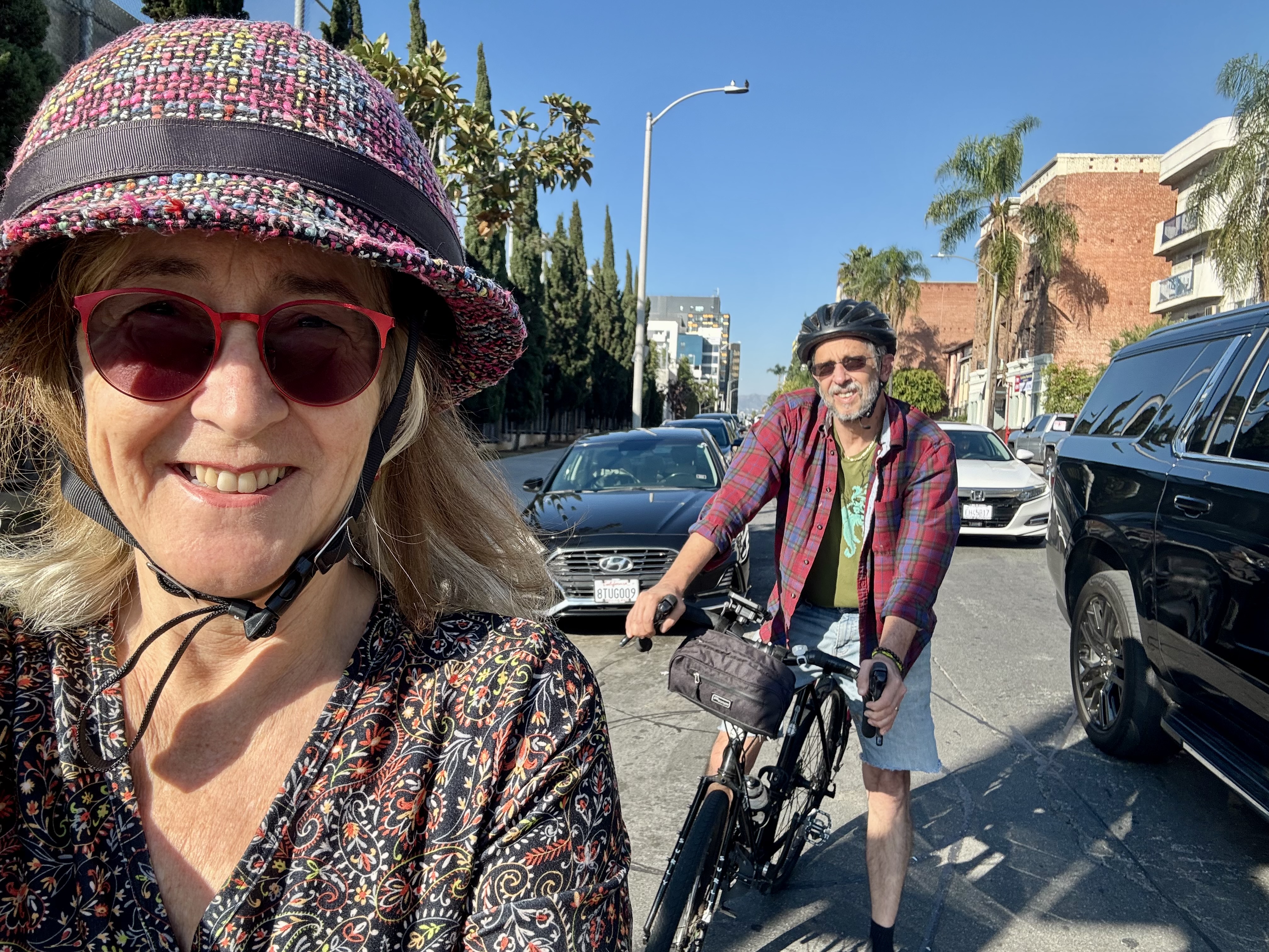
The Sunday of opening weekend of Coffeeneuring season included a CicLAvia (open streets) event. It seemed fitting then that the closing weekend also featured a CicLAvia event, this one along Melrose Ave in Hollywood. The event had originally been schedule for December 7th, but it got moved up to November 23rd to align with the release of the final season of Stranger Things. Why? You may be wondering. Well, funding for these popular open streets events has been threatened, and apparently Metro found a sponsor in Netflix. I have to say, Netflix played it up quite well. There were many characters from Stranger Things all along the route, from El in her surgical gown with black stuff oozing out of a nostril to the cheerleaders of Hawkins High School, and even creatures from the upside down.
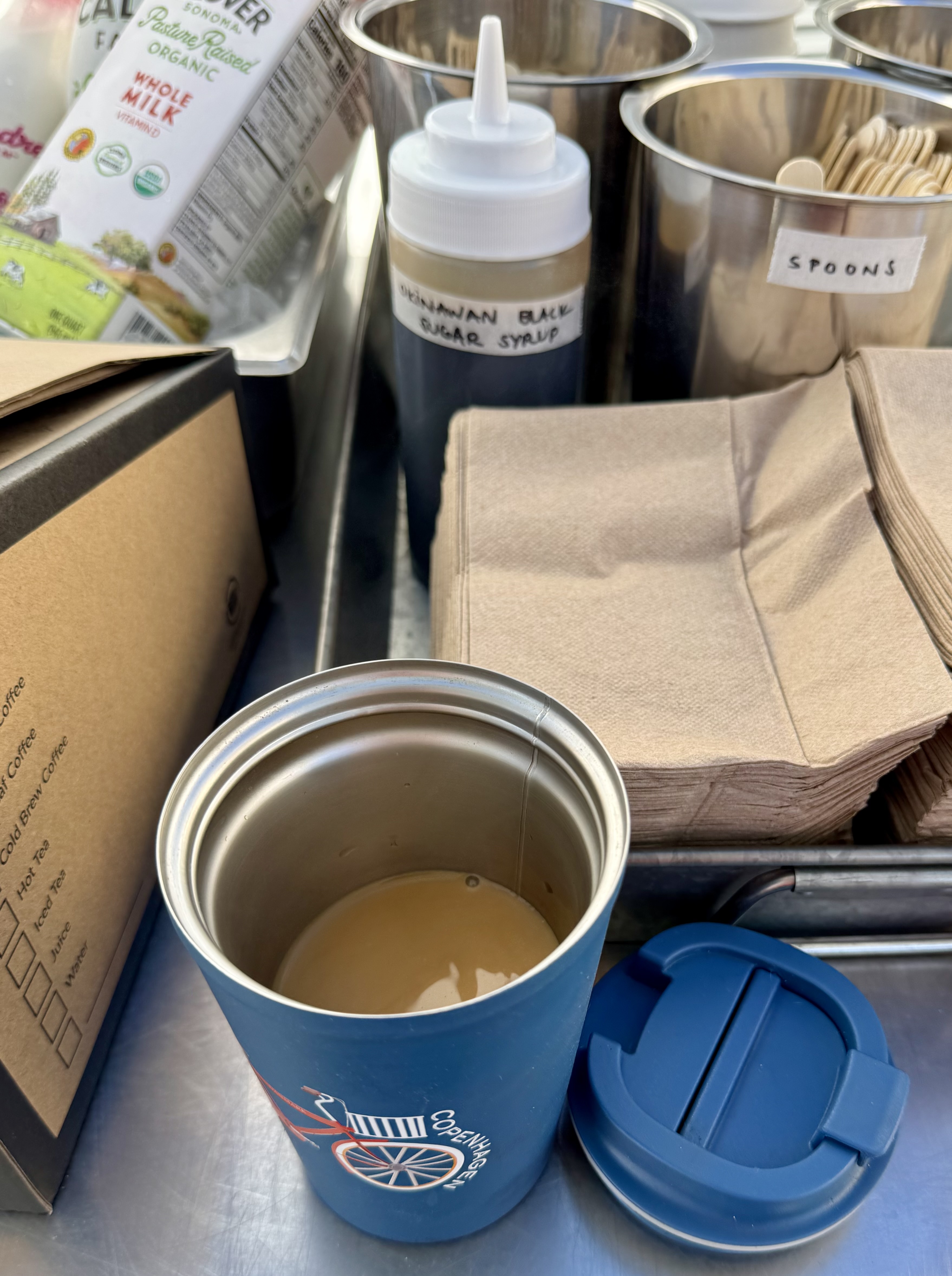
I dressed for the occasion in the closest thing I had to 80’s attire: hot pink boat neck shirt, my hot pink zebra bloomers, a black skirt, and black leg warmers. I got onto the route at the east end and headed west along Melrose. My first stop was at L.A. Grocery, where those of us who support CicLAvia with monthly donations (“Street Stars”) had been invited for coffee and goodies. I poured some coffee from the big box into my reusable travel cup and added some Okinawan black sugar syrup just because I was so intrigued by the name of it. To go with that, I had a nice flaky croissant. This was my first time visiting L.A. Grocery, a very well manicured market filled with gorgeous fresh produce and an impressive selection of healthy food and eco-friendly household products, plus a prepared foods counter and a seating area.
From there, I kept on rolling, but I split my reported mileage with the remainder of my ride, since I knew I would need to double up today in order to get 15 coffee rides in before the challenge ends on Monday. I chuckled to myself when I realized that I need not fret about violating the rule limiting the number of coffeeneuring rides to one a day or to two in a week. I had already surpassed the 7 required rides, so this was all in the bonus territory. So what if it wasn’t “legal”?!
Control No. 14: 11/23/25 Sweet Corner Coffee & Cakes in Hollywood (Los Angeles)
Beverage: Hot Chocolate (+ apple bar)
Bike: Gazelle Tour Populaire
Bloomers: Hot Pink Zebra
C+1: Lynn
Beauty: Historic architecture
Miles: 10
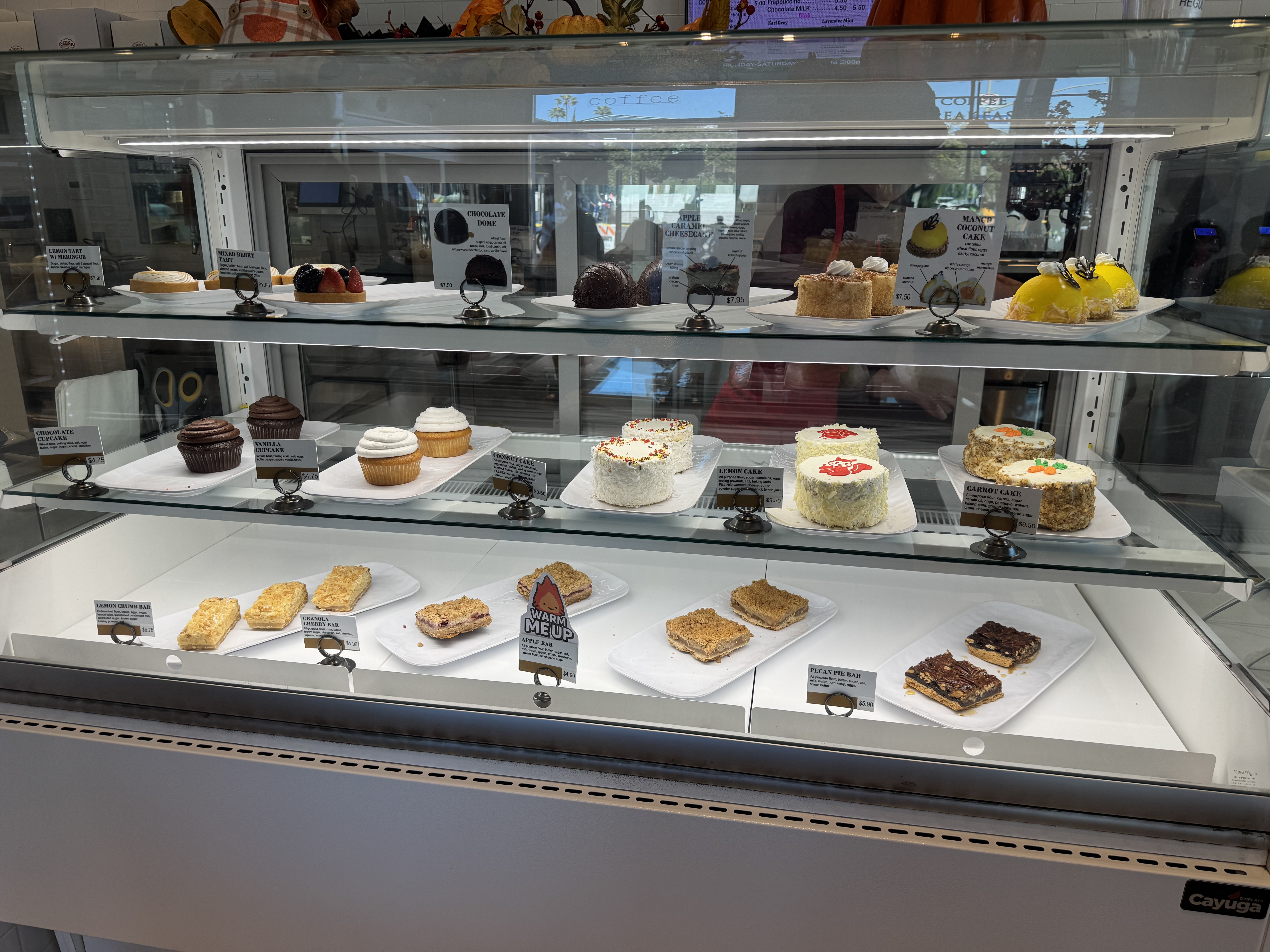
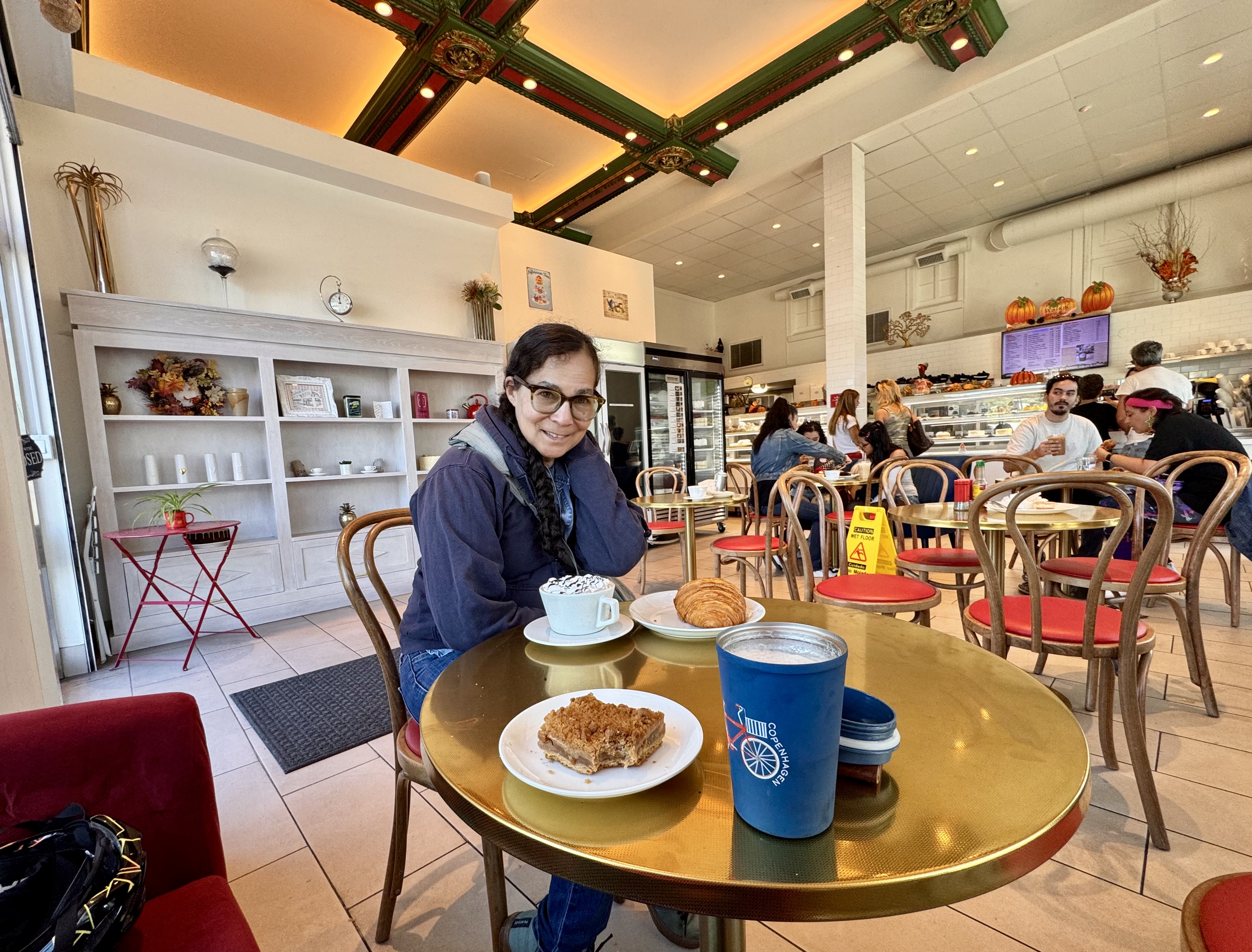
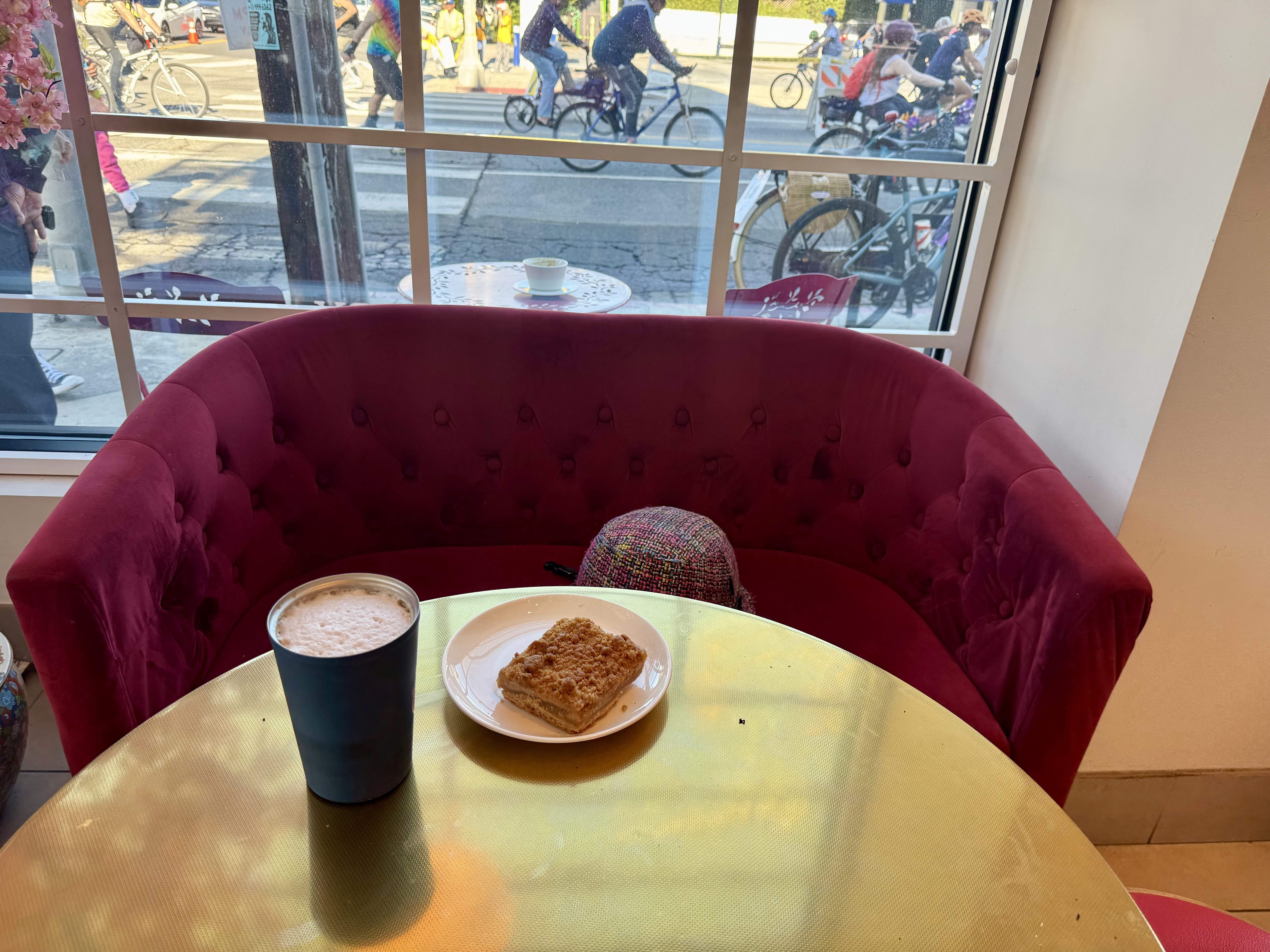
Continuing west on Melrose Ave on this same CicLAvia ride, I rode to the route’s other end at Fairfax, where I was trying to position myself to snap a selfie by the big overhead sign reading “One Last Ride”. Just then, someone was teasing me, and I realized it was my friend Lynn. So we snapped our selfie together, and then rode back toward the east end of the route. I told Lynn that I had long wanted to try the coffee and dessert shop at the corner of Melrose & Wilton, Sweet Corner Coffee & Cakes. That’s another very appealing historic building with great architectural features that I have gone past dozens of times and thought to myself, “I ought to stop there next time I’m coffeeneuring.”
Fortunately, Lynn was game for trying this place with me, so we parked our bikes out front and went on in. The pastry case was an impressive display of cakes and goodies. I opted for hot chocolate as my beverage, plus an apple bar for my treat. The goodies did not disappoint. And I got to sit on a cute little red couch by the front window.
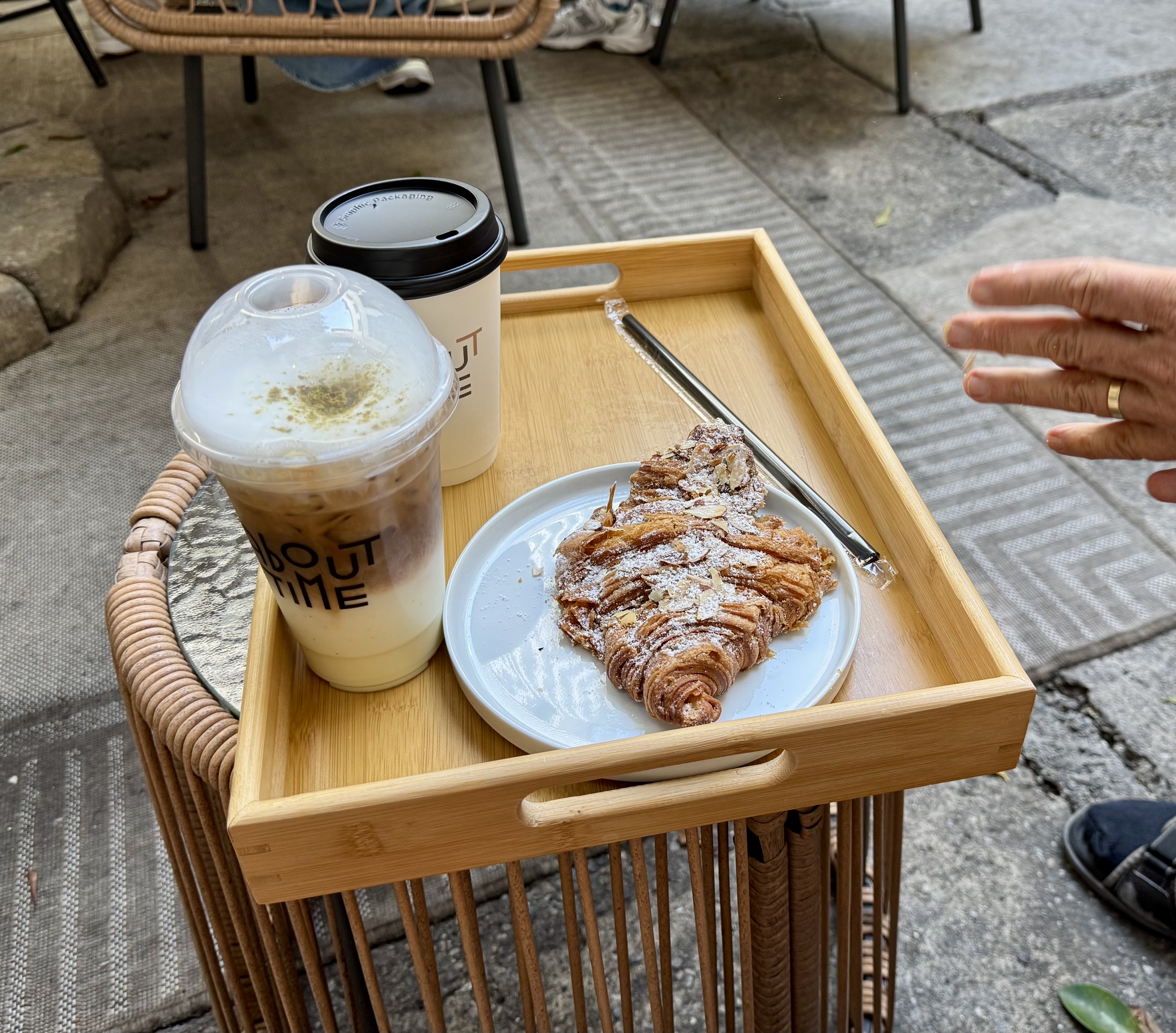
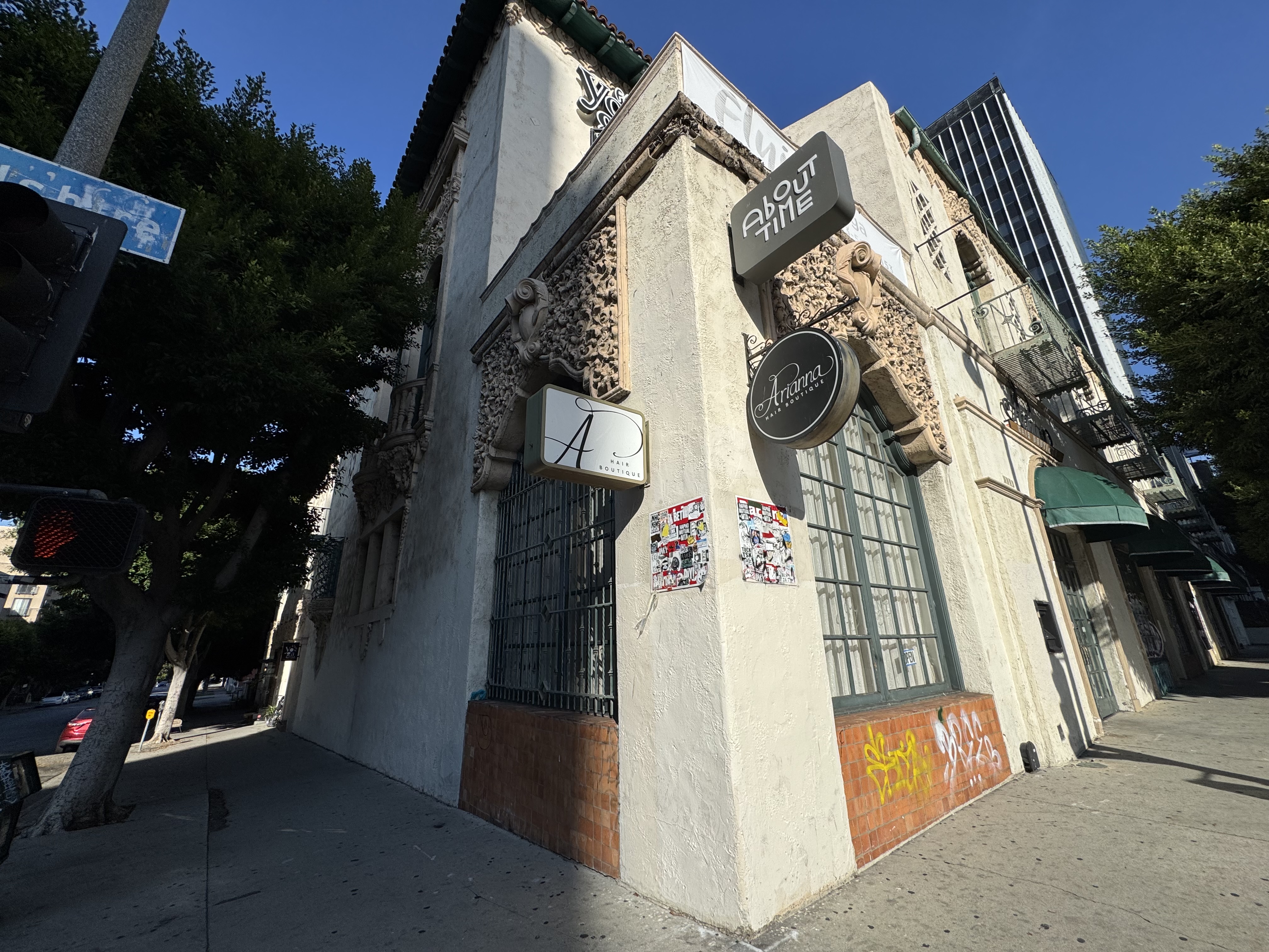
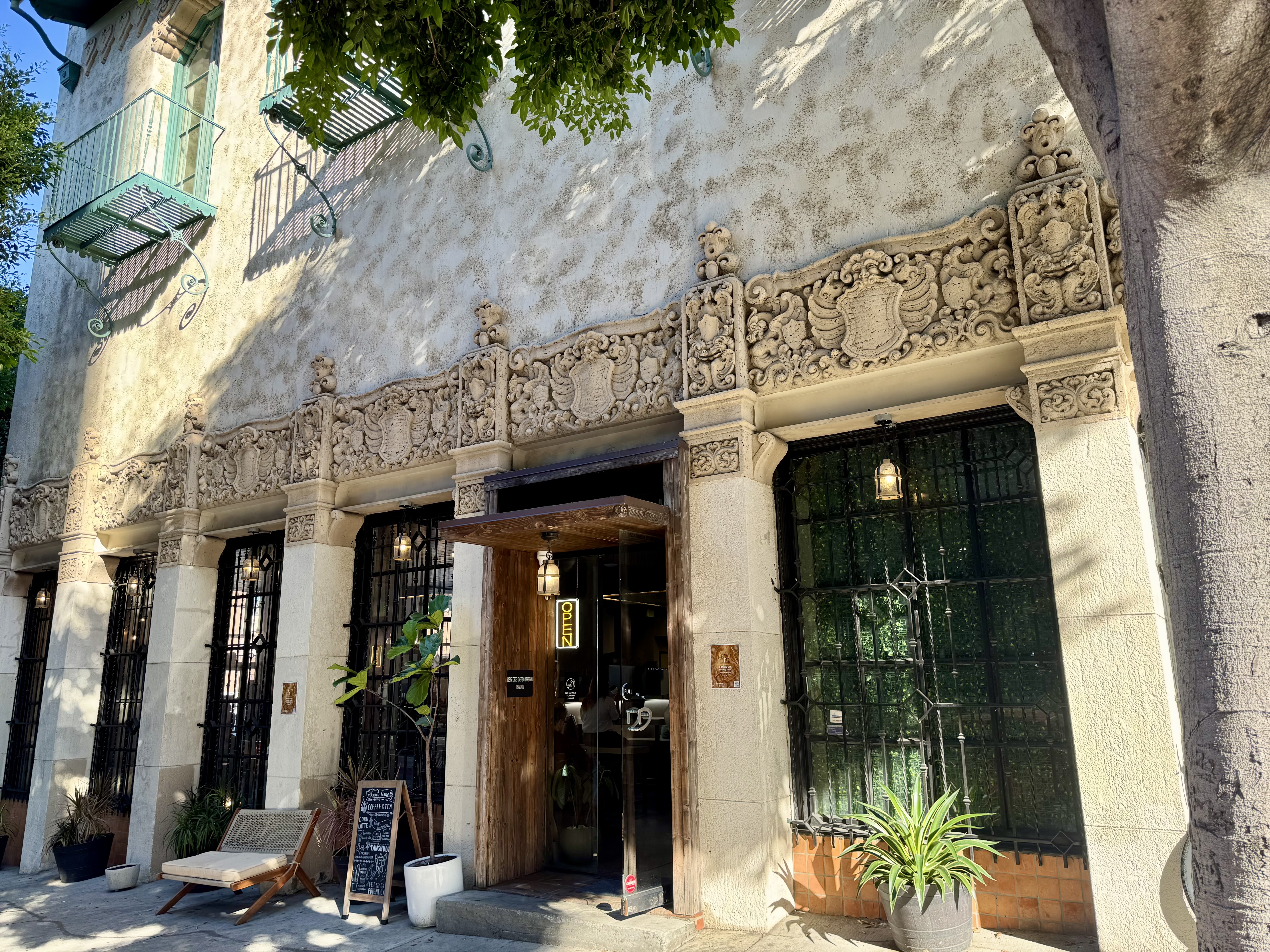
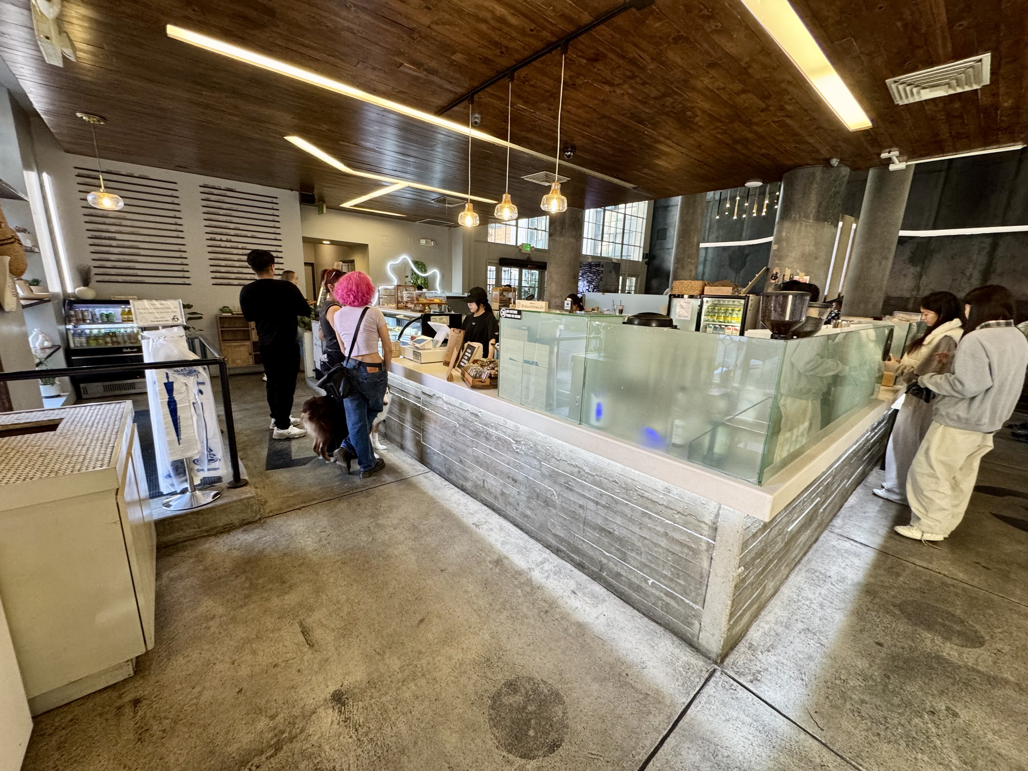
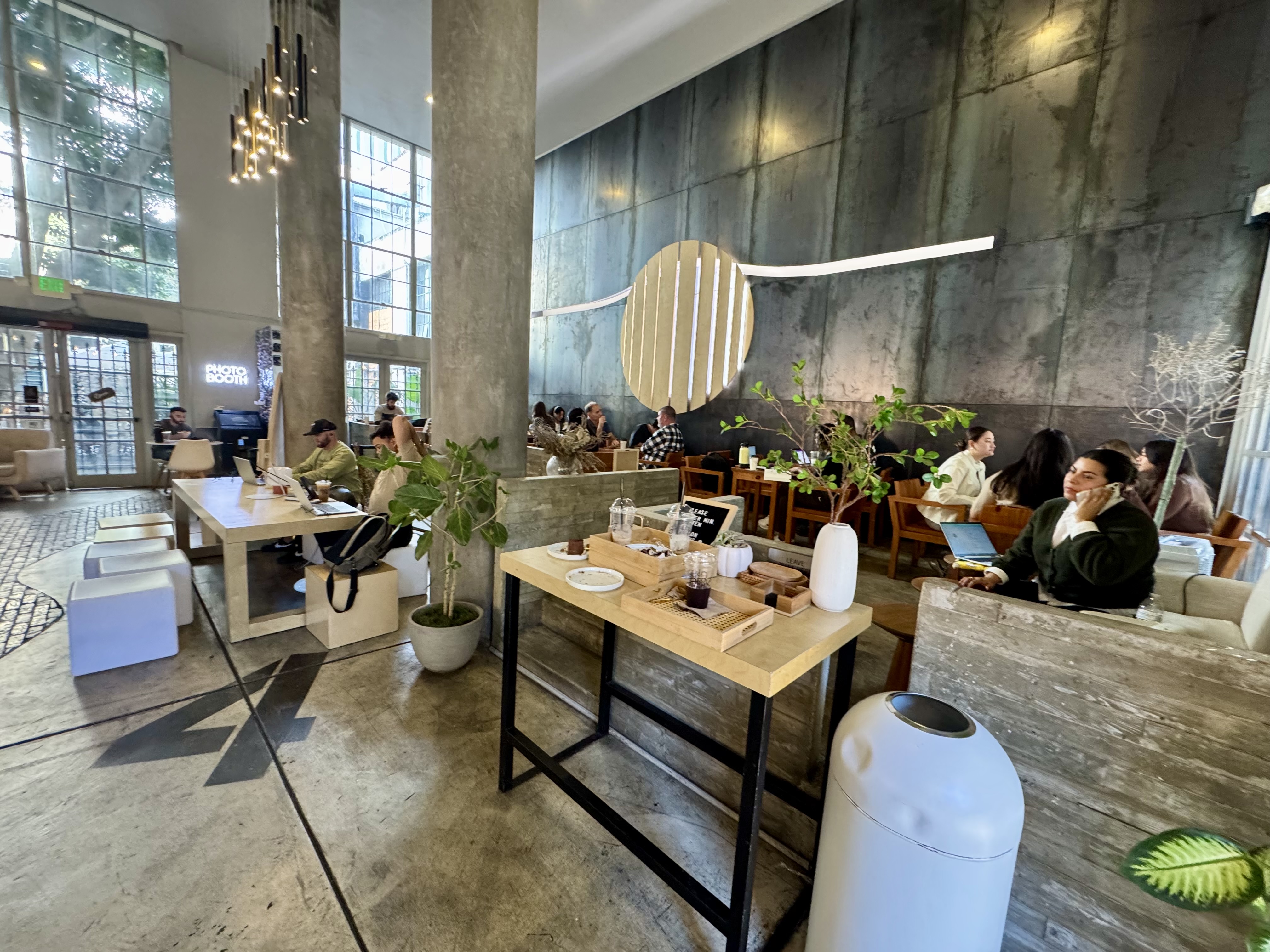
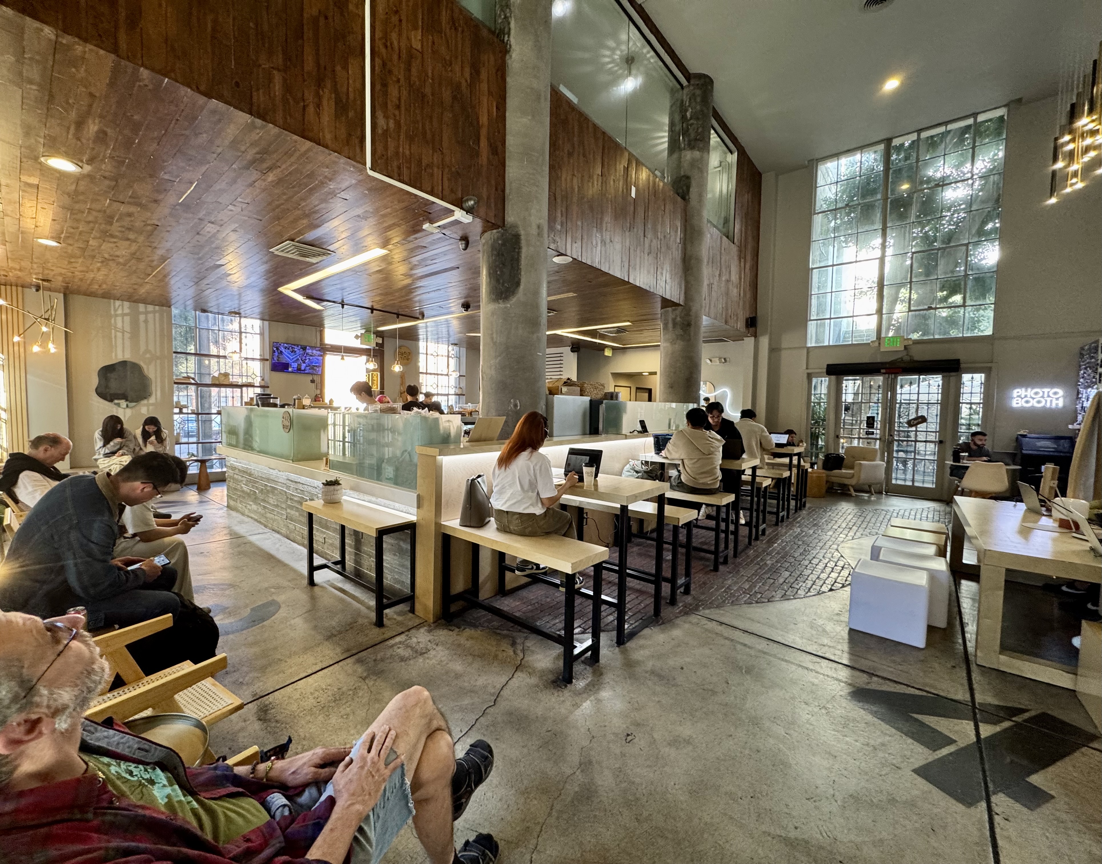
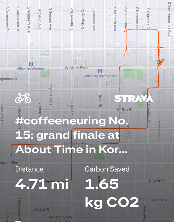
Control No. 15: 11/24/25 About Time in Koreatown (Los Angeles)
Beverage: Pistacchio Latte (+ almond croissant)
Bike: Brompton
Bloomers: Smokin Hot Flame
C+1: El Cochinito
Beauty: Historic architecture & modern interior
Miles: 4.7
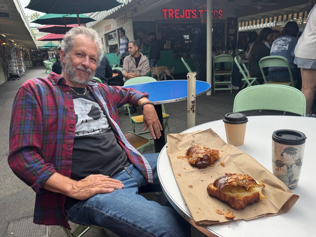
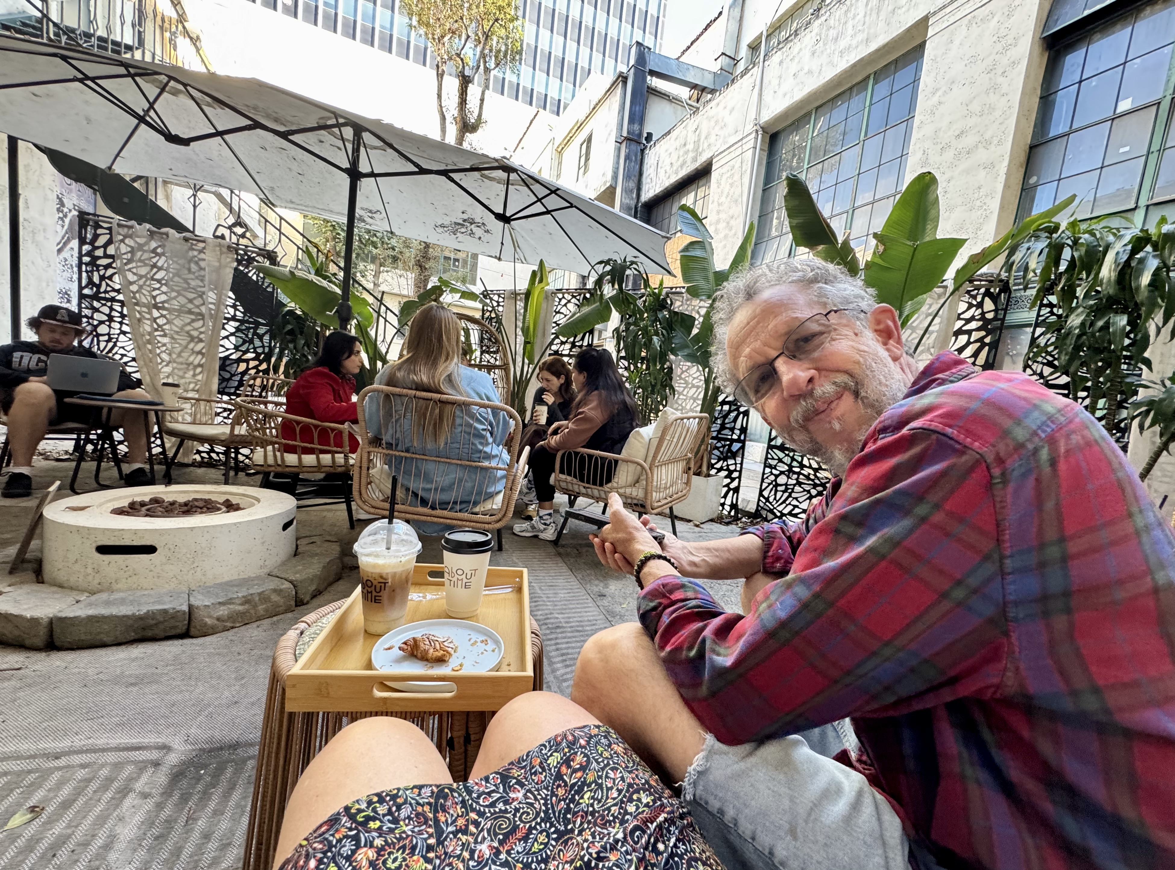
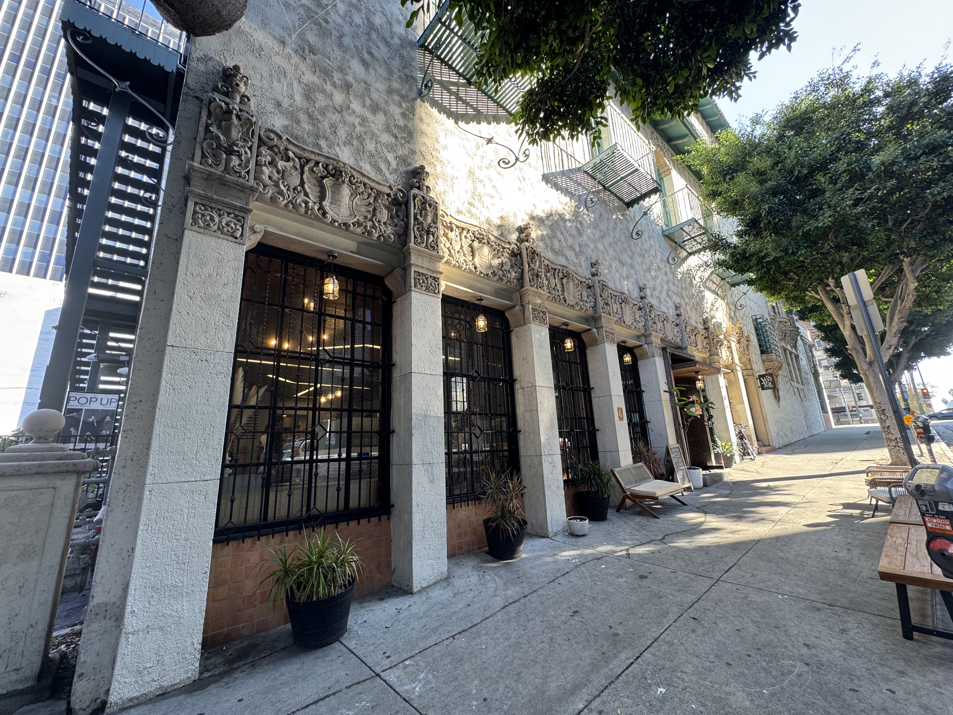
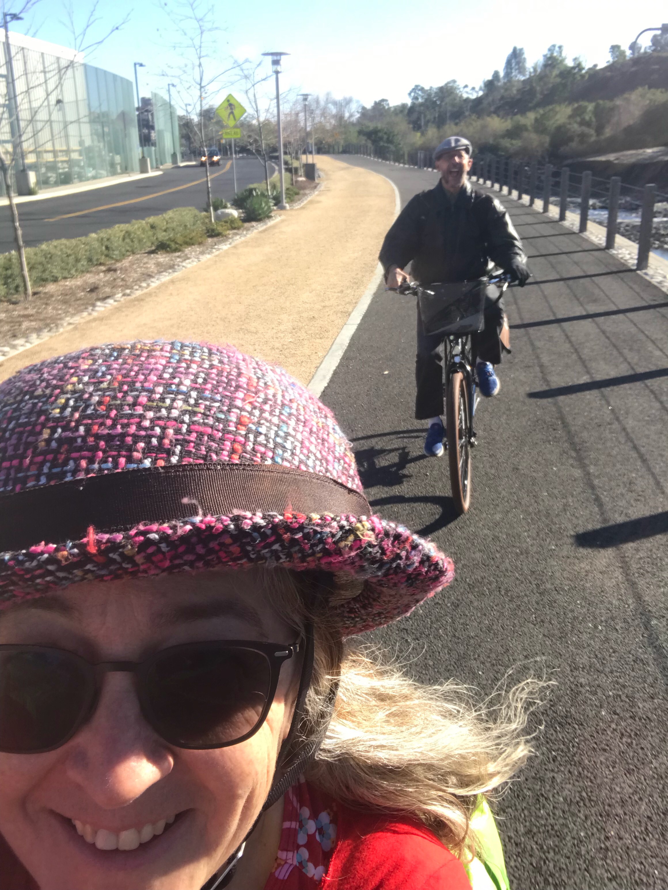
It was down to the last day of the challenge (although the Chief Coffeeneur had just announced an extension of the deadline by a few days). It was a Monday, and my teacher-husband had the week off from school due to the Thanksgiving holiday. I had spent the morning doing more house cleaning in preparation for our kids coming into town for Thanksgiving. I told him I needed a break, and there was a coffee shop not far away, in Koreatown, that had been on the list of beautiful coffee shops, and that I wanted to give it a try on this last day of the challenge. He decided to join me, so we hopped on our bikes and rolled on over. First we stopped at the office building where I needed to check the mail, and then we were just a few blocks from About Time, our coffee destination.
It’s an extraordinary place, both inside and out. The exterior features an ornate, historical facade. The interior is spacious and filled with chic, modern decor. There is a lot of indoor seating, although much of it appears to be taken up by folks who set up their laptops and spend the day there. The menu is a bit overwhelming and rather pricey. I treated myself to a pistachio latte ($9) and El Cochinito had a mocha ($8), and we shared an almond croissant. We found a place to sit on the patio that takes up a portion of the buildings courtyard. Most of the courtyard looks rather industrial and sadly neglected, but the portion About Time uses is set up rather attractively with umbrellas and bamboo furniture.
It was fun to discover this gorgeous building and novel coffee shop so close to home, and to be able to share it with my sweetie. A lovely way to wrap up the 15th year of coffeeneuring, my eleventh.
And then, after the challenge had been completed, I was interviewed by Taylor Nichols of Bike Talk, a podcast you should follow (if you don’t already) about coffeeneuring! You can find it here at 15:38.
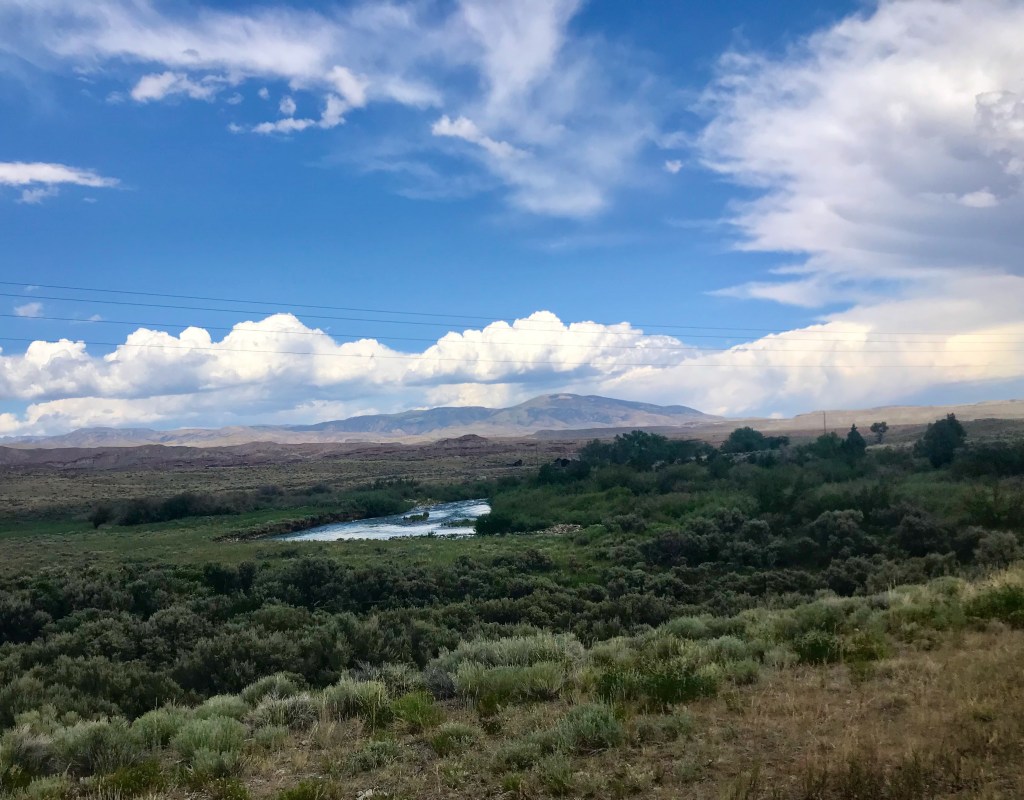
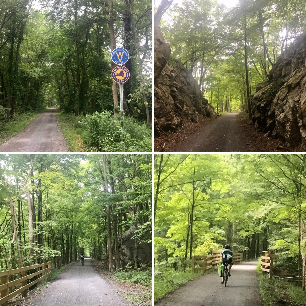
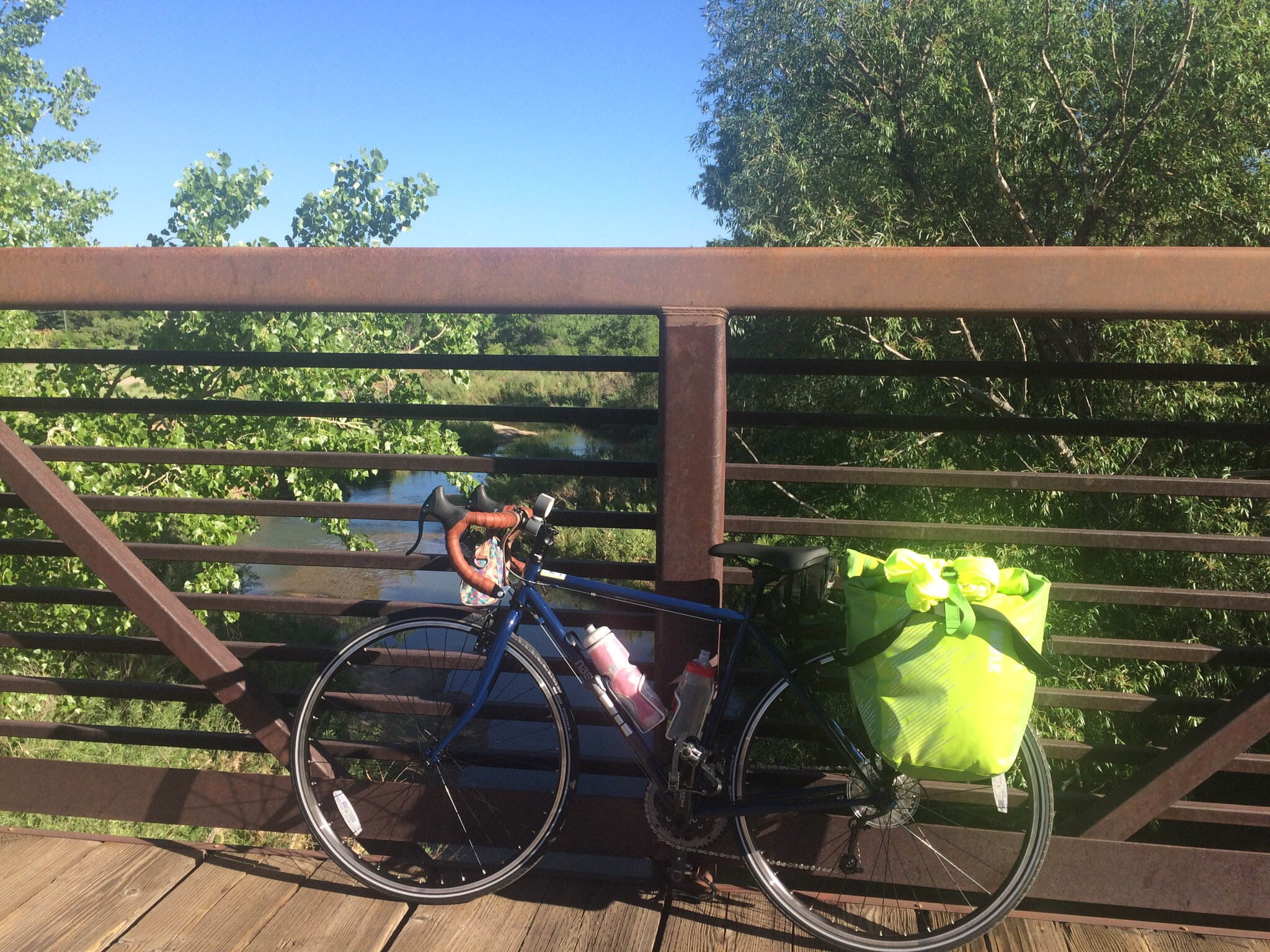
As soon as we’d learned that the extended family’s Summer 2022 gathering would be near Jackson Hole, El Cochinito made the suggestion: why don’t we plan our bike adventure around that, and explore Wyoming? Wow! What an intriguing thought. There are a couple of great National Parks right there, and, well, who knows what else Wyoming has to offer? But I also hesitated for a moment: what are the roads like in Wyoming? Is it bike friendly? Aren’t the roads through the National Parks narrow and filled with RVs and their extra wide side mirrors? After all, it was one of those side mirrors that knocked him off his bike back in 1977 when he rode the Bike Centennial route as a teen. So I started looking to see what the interwebs had to say about biking in Wyoming. I discovered the Wyoming Highway Department has put out a map of all their state highways, coded to indicate such useful information as how wide the shoulders are, how much traffic they get, and even noteworthy headwinds and inclines. That was impressive, but it was also dated 2006. Did they stop updating because they figured no one in their right mind would bike on Wyoming highways any more, or were conditions pretty much the same? (I have since found one that is dated 2013, so it has been updated, and perhaps one must do a better job of searching than I did to find the most recent version.)
2006 Wyoming State Bicycle Guidance Map
This trip got planned in a bit of an odd sequence. We first bought the plane tickets, timed to get us to Jackson a full two weeks before the family gathering would begin. Then we started looking at maps and figuring out a route that would take us through interesting sights and set us up with a decent target destination for each night without committing to an unrealistic daily mileage. I purchased a couple of pertinent maps from the Adventure Cycling Association (ACA), and also investigated the bike trails of Wyoming. We booked our accommodations, and worked a few rest days into our planning. The search for accommodations was fascinating, and the range of prices spanned an order of magnitude, but we knew we would be getting a taste of Wyoming. We had no idea what a fantastic trip we were planning.
That was February. We had five months to get ready. Given that we would be riding at altitude and into headwinds, we knew we needed to be in good shape. In addition to training rides, we started taking iron supplements to boost our oxygen-carrying capacity, and I added some higher intensity cardio workouts to my regular exercise routine to increase my stamina. Beyond our favorite local training rides, we enjoyed a couple of special training opportunities. In early April, we joined some friends for a few days of camping and biking in Death Valley (hmmm, no blog post on that adventure). For Memorial Day weekend, we did a two-day ride up to Santa Barbara (I did blog about that one here). I started stocking up on Cliff bars, electrolyte tablets, and energy gels, and making lists of things we’d want to bring, mindful that each little thing would add weight to the bike.
The excitement builds
One aspect of the anticipation was a new bike we were expecting, which we believed would arrive in time for the trip. Back in December, I had seen a campaign for a raffle drawing for a Surly Midnight Special, with each $5 donated to a charity entitling the donor to an entry. The cause was a worthy one: Full Cycle, a bike shop in Minneapolis that offers youth a chance to earn a bike by helping out as they learn how to work on bikes. And Surly is known for bikes that serve well for touring, adventure, and hauling stuff. I thought that might be the way to get El Cochinito to try a touring bike: win one for him. Well, I donated $100 to the cause, and ended up being the lucky winner. The folks at Surly, upon learning of my intentions for the bike, offered to swap a more suitable touring bike from their collection for the Midnight Special. The designated beneficiary opted for the well-regarded Surly Disc Trucker; we just needed to wait a wee bit for a new shipment to come in.
We waited, and we waited, and we waited, patiently, of course, but then we started getting nervous that it might not arrive in time. You know how those supply chain issues can be — out of everyone’s control, especially in the age of covid. We really wanted to have a little time for testing out and adjusting the bike. What if it was like the new bike El Cochinito got me in 2020 – the one that arrived just AFTER we had already left town for our bike adventure in the Eastern Sierras? But then, wouldn’t you know it: just in the nick of time, the Surly was shipped directly to our local bike shop for assembly. Soon it would be ready for its first test ride.
And now for the hiccups
Then, shortly before our trip, El Cochinito came down with covid. He had supported me when I had my bout with the virus just a month prior. Now it was my turn to be the caregiver, and I had every incentive to do what I could to ensure he was able to rest and recover as quickly and completely as possible. He was able to start taking Paxlovid right away, and remained optimistic, but we had to give some thought to how we could modify our plans if necessary. Yet neither of us liked the idea of missing out on a trip we had been planning and preparing for over the last several months. Luckily, just in time, he tested negative, and felt sort of well enough to take the Surly out for a test ride. That test ride was on the short side, and it was apparent he wasn’t back to 100%, but neither was he deterred. We knew we had to remain flexible with our plans, but things were (maybe) looking up.
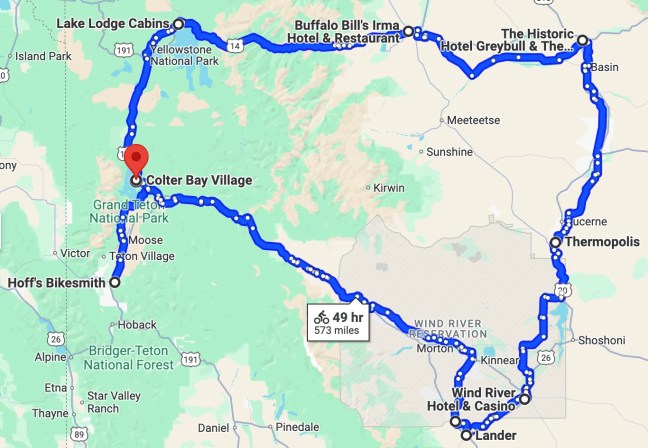
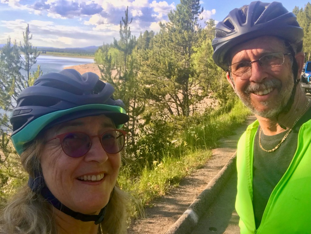
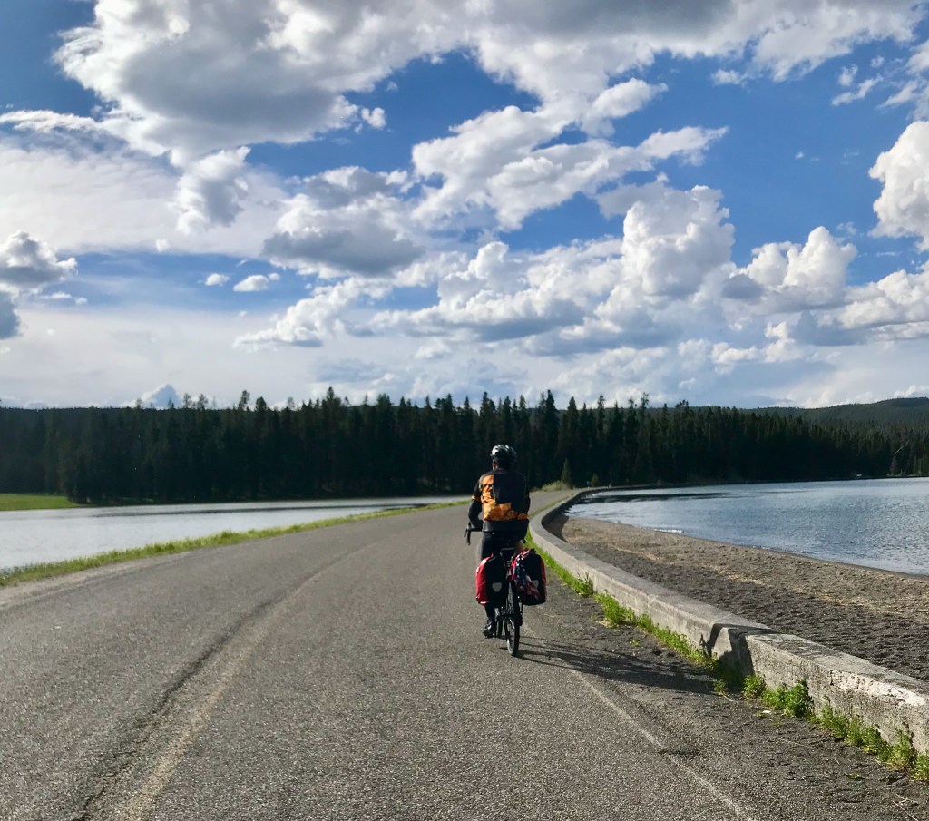
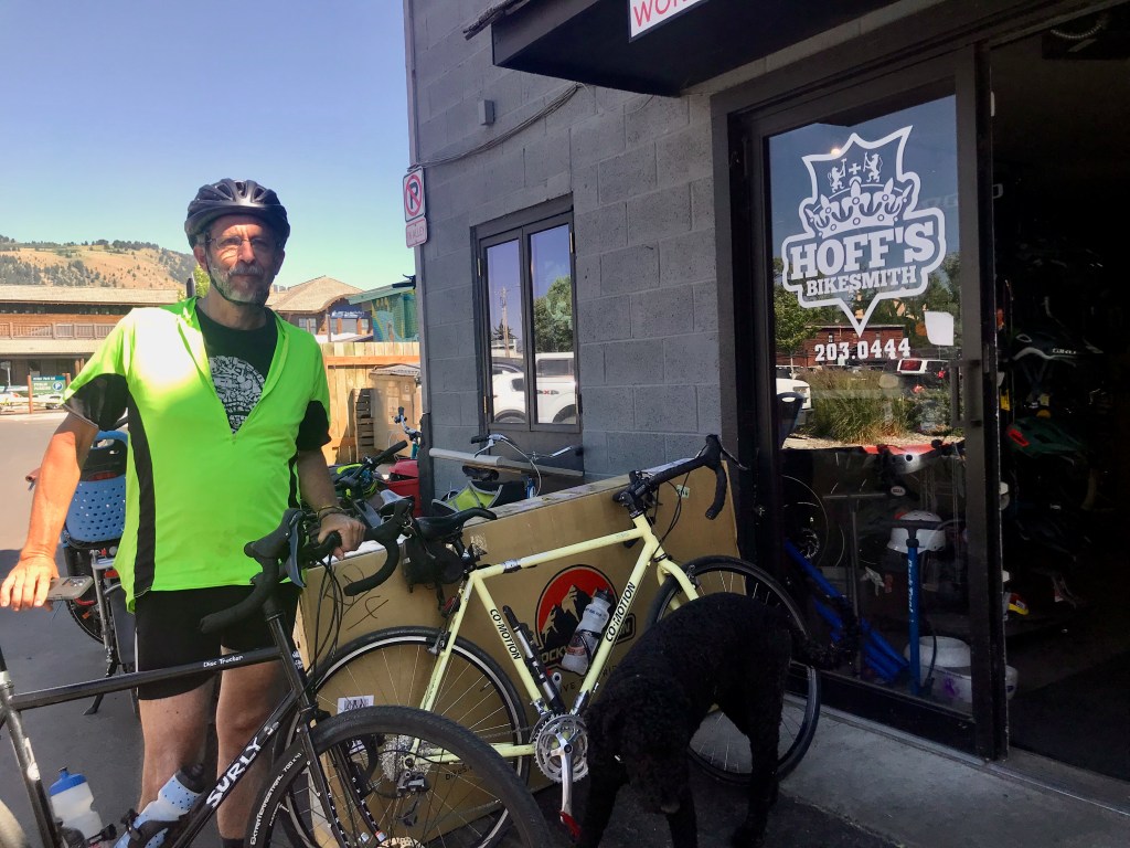
Day 1: Jackson to Colter Bay (Grand Teton National Park) – 32, no, make that 42 miles
We flew to Jackson, unpacked and assembled our bikes out in front of the airport, and got ready to roll. As soon as we mounted our bikes, we encountered our next glitch: the steering tube of my bike, which hadn’t looked right when I went to assemble it, was haywire, and my bike was simply unrideable. Holy jeepers, now what? We needed to ride 32 miles to get to our first night’s lodging, yet we couldn’t even ride out of the airport parking lot. We started googling for local bike shops, hoping someone could help us. We called a mobile bike repair service, but they weren’t available. We got lucky with Hoff’s Bikesmith in downtown Jackson, who said they could help us out if we could get ourselves and our bikes over there. Luckily, there were several large SUV rideshare vehicles waiting at the airport to offer rides to arriving visitors, and we found one that could accommodate the two of us and our two bikes. Our driver took us to Hoff’s, and we were able to make sure both of our bikes were properly assembled and road-ready. That little delay meant, however, that instead of starting our 32-mile ride at 2 PM, we were starting a 42-mile ride at 4 PM.
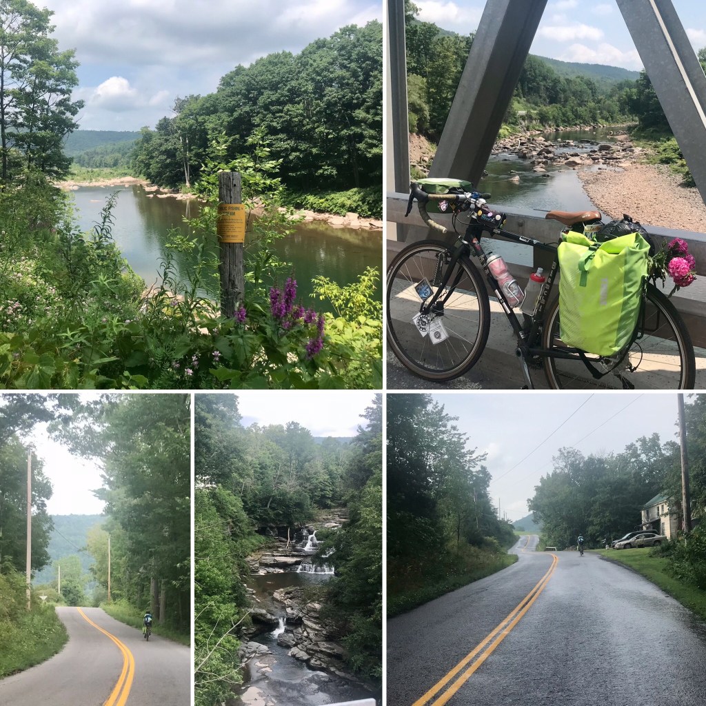
The bike path from Jackson into Grand Teton National Park
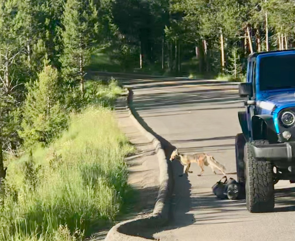
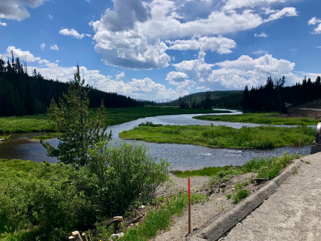
At least the first 20 of those miles was on a lovely bike path that takes you from Jackson into Grand Teton National Park. We then stopped for a rest break at Jenny Lake. We filled our water bottles and had some Cliff bars. El Cochinito was really feeling the misery of biking while being in covid recovery. He said, at that point, that he could maybe, maybe, ride at most another 10 miles, but certainly not another 20. We figured we would just take it as it comes, and flag down one of the many RVs or trucks passing by if he ended up needing a ride to get to our cabin for the night.
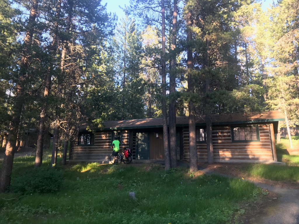
That rest break at Jenny Lake served us well, though, and we got back on our way. The park is beautiful, the lake is beautiful, and we were there – finally actually riding our much-anticipated tour. We paused briefly to take in the view of the lake and watch a fox slink by. We took our time, and El Cochinito surprised us both by powering through. No RV assistance required after all. We were delighted to make it to our cabin at Colter Bay at 8 PM, just before it got dark. We got dinner at the camp restaurant, and spent our evening listening to a fascinating audiobook about the history of Yellowstone National Park, our destination for the next day.
Arriving at our cabin at Colter Bay – still light out after 8 PM
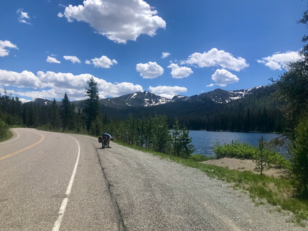
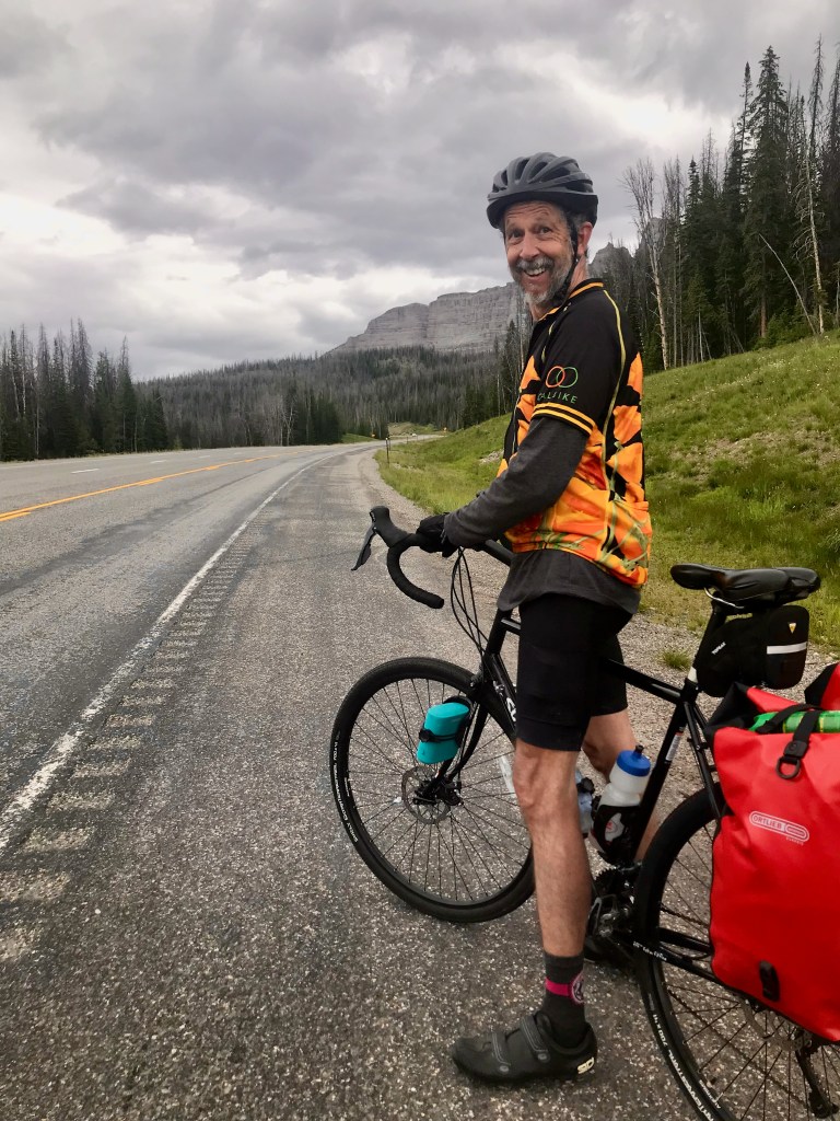
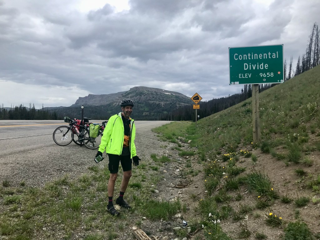
Day 2: Colter Bay to Lake Lodge (Yellowstone National Park) – 62 miles
That next morning, or actually starting during the night, El Cochinito woke up to a new challenge: tooth pain. And I woke up to find that my rear tire was flat. The latter he was able to fix for me, but I was helpless to fix his problem. We decided we would simply continue to take it as it comes, and keep an open mind about modifying our trip if necessary. But who wants to have a dental emergency while on a bike tour? Hard to just put that out of mind.
Although I didn’t like my ride buddy having to struggle with his discomforts, I have to admit I enjoyed the slower pace we were riding. It was nice to not be the one holding us up, to feel free to tootle along at a leisurely pace. Besides, I wanted to savor the riding for as long as it might last. There was no telling how long our bike tour would continue, so I might as well make the most of it. This was, after all, one of the most beautiful places to ride.
With sleeping in, a flat tire repair, and some phone calls to be made, we got a late start on day 2, but we still had a gorgeous day of riding. We took some moderate climbs at a relaxed pace, took in the beauty of Lewis Falls off to our left, found ourselves awestruck looking down at the Lewis River snaking along off to our right, and got ourselves up and over the Continental Divide. The second half of the ride was gentle and beautiful, highlighted by a mystical, magical moment when the lightest sprinkle of mist added a glistening glow in the late afternoon sun as we rode through a forest. We made it to our cabin at 6:30. My ride buddy set us up with a dinner reservation at the nearby Yellowstone Lake Lodge. The Lodge has a nice grand room where we took in the view of Yellowstone Lake before dinner. The restaurant was huge, with a high ceiling, large windows facing the lake, and was even grander than the lobby. At the same time, it was bustling with guests, including families with kids running around. The ambiance was a delightful mixture of fine dining elegance and family camp.
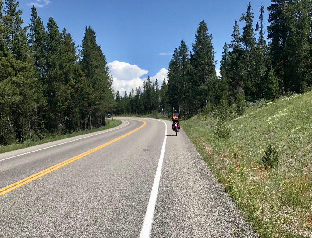
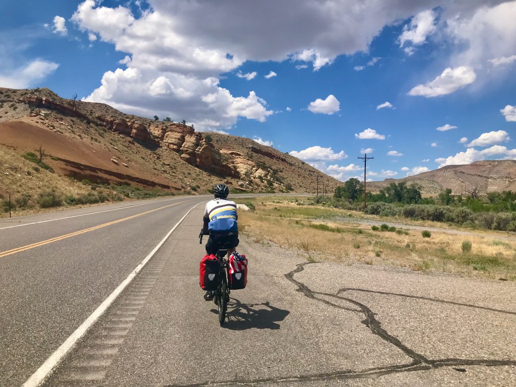
Day 3: Lake Lodge to Cody – 82 miles
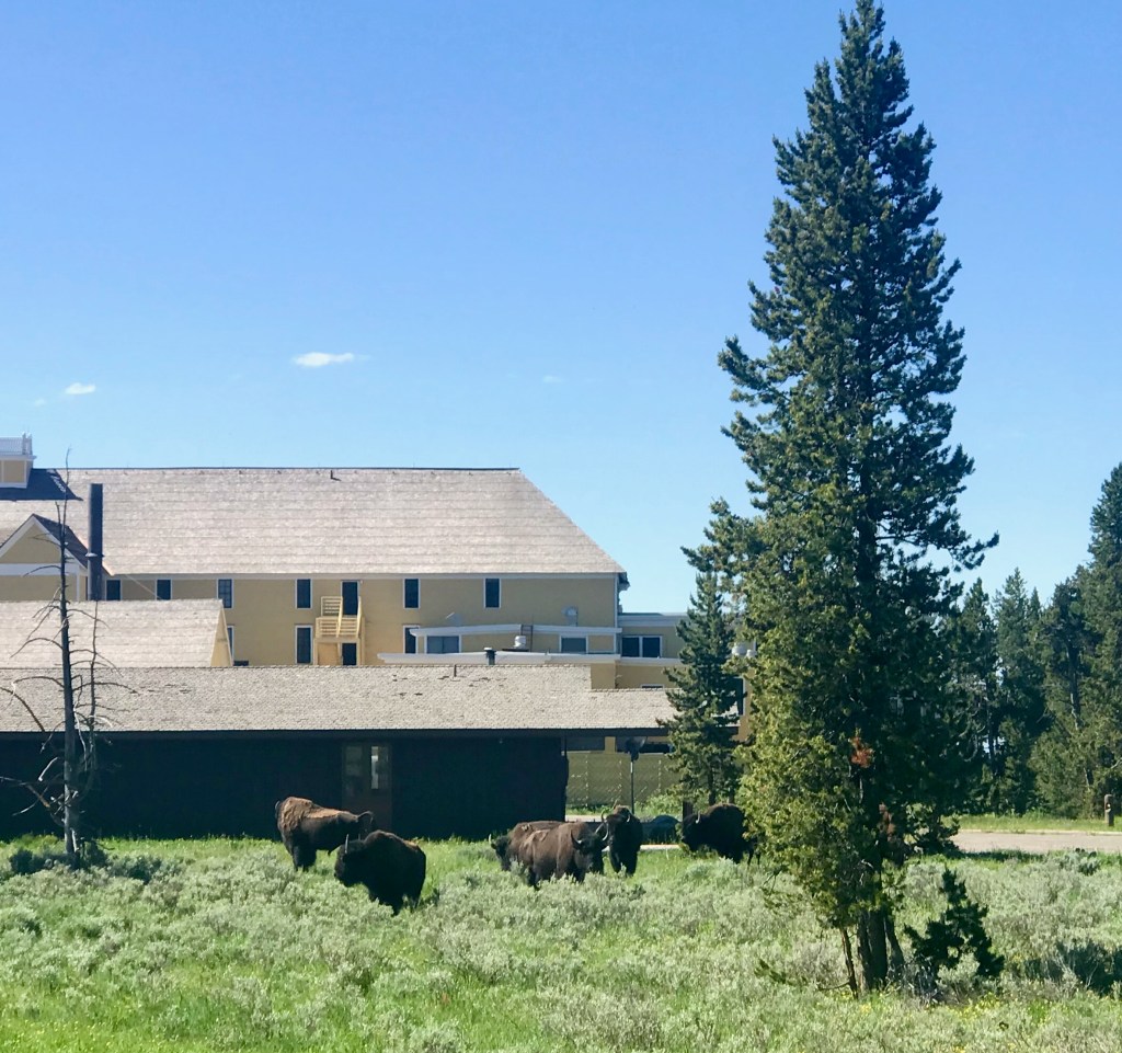
The next morning, we had some matters to attend to that required access to a printer, and that required a stop at the big Lodge before heading out, making for yet another late start to our riding day. Once business was resolved, we were treated to a crowd of bison grazing on the lawn just outside the big Lodge as we rolled out and on our way. We continued eastward through the park, taking in the gorgeous scenery. I couldn’t help but wonder how many people may have driven through here and missed so much of the beauty due to the speed and constraints of being in a car.
Bison chilling outside of Lake Lodge (big yellow building) in Yellowstone
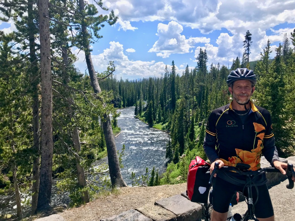
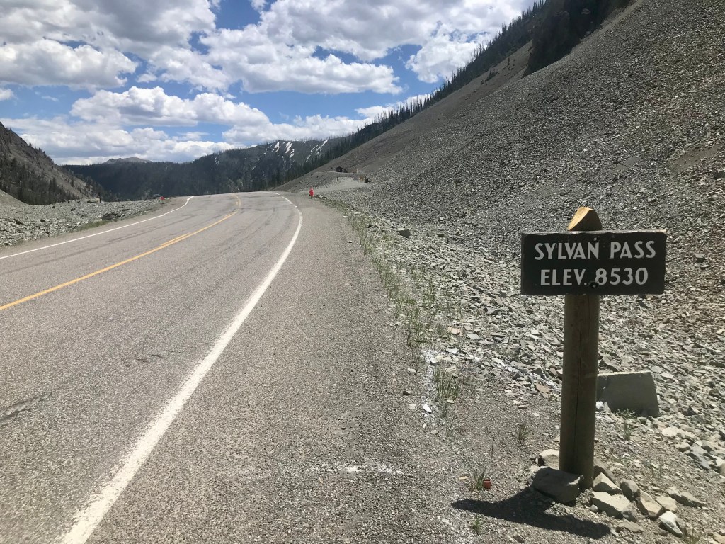
We knew we had a long day ahead, and that there would be some distance to cover between amenities, so we stocked up at a store before leaving the park, making sure we had snack food and extra water. We had a lot of miles to cover that day, but we also knew that, after Sylvan Pass, it would be pretty much all downhill into Cody.
Heading east out of Yellowstone on East Entrance Road it was beautiful and quiet
The summit already! And what a glorious descent . . .
Sylvan Pass was both beautiful and exhilarating. The climbing wasn’t bad, we reached the 8,530-foot summit sooner than expected, and the descent was absolutely glorious. I hope I never lose my memory of that descent. Still glowing from the thrill, we arrived at Pahaska Tepee, which turned out to be a great place to stop for lunch. The man who served us seemed to be either the owner, or perhaps a life-long employee, but certainly knowledgeable and proud of the local history, which he was happy to share with us.
So far, so good, right?
Pretty and pleasant
Nearly 2 hours after leaving Yellowstone, still beautiful
By now it’s nearly 5 PM and the day is getting long.
Another 2 hours to go – and nothing picture worthy after this
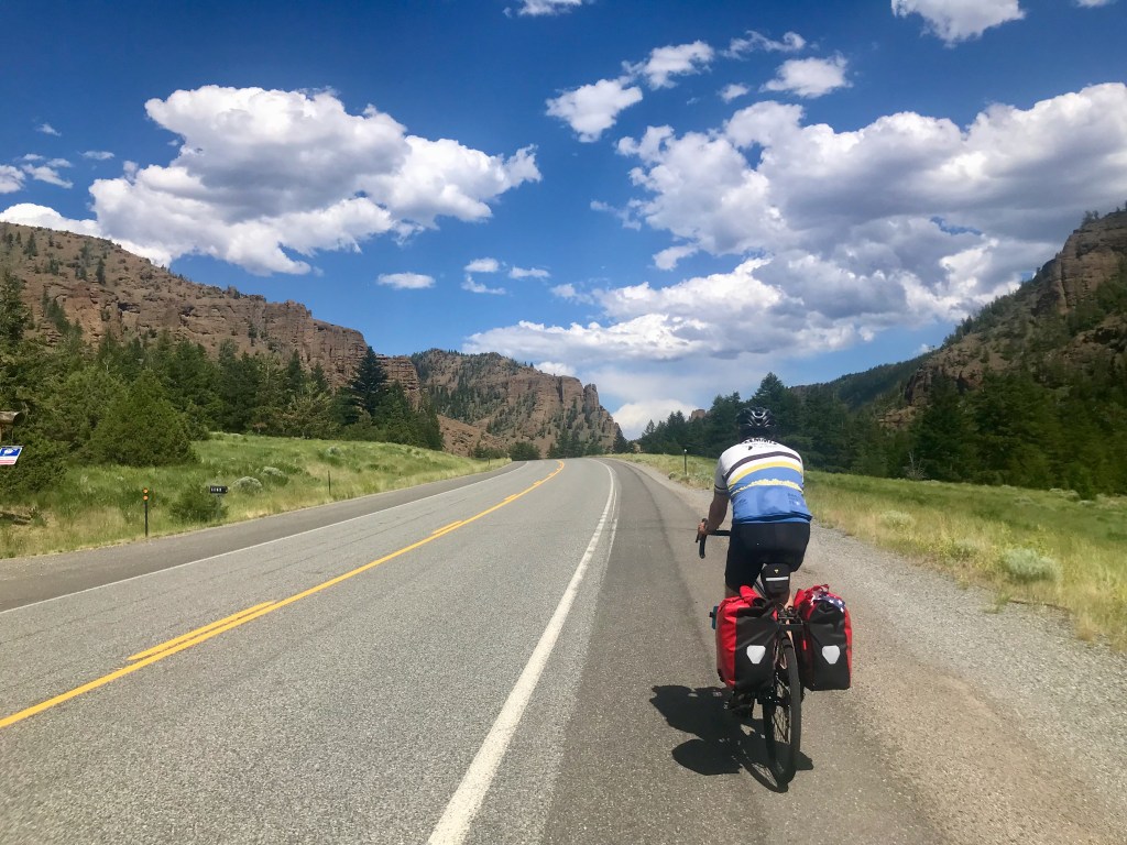
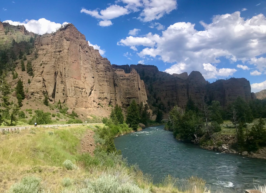
After filling our bellies and our water bottles, we continued our eastward trek. While it may have been downhill, it didn’t really seem so, as the heat and headwinds bore down on us. As glorious as the first 30 or so miles had been that day, the next 50 miles after Pahaska Tepee were tough. The day got long, the scenery more sparse, dry, and more, well, what I have long imagined most of Wyoming to be: rather on the harsh and barren side. We had to stop from time to time and take a rest. My ride buddy was miserable. This was no ride to be doing while recovering from covid and nursing a toothache. We began to wonder how long it would take to get to Cody. Would we even get there before dark? Previously, we had thought we might get to Cody with enough time to explore the town, maybe even take in a rodeo. It became clear that such bonus activities were not going to happen – we’d be glad just to get there and make it to our hotel.
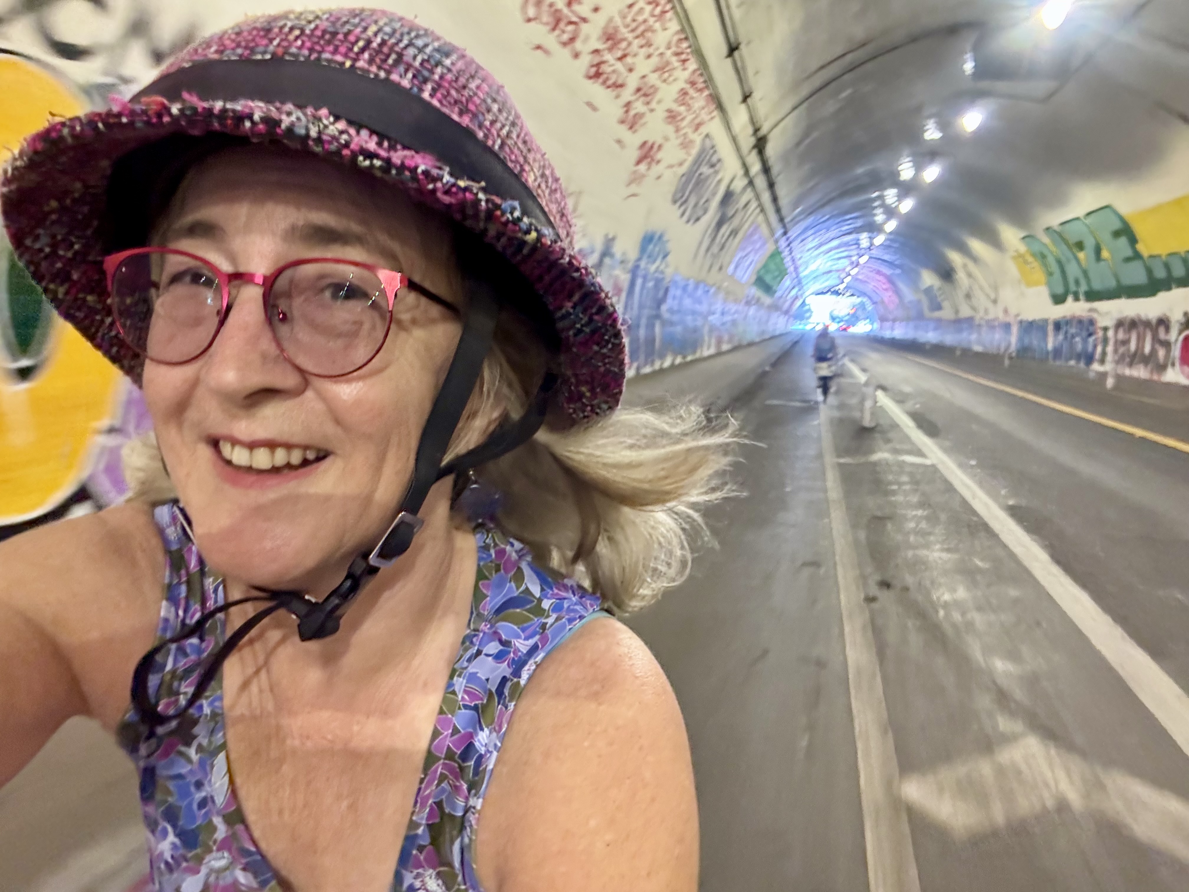
We were following the ACA bike route, which sometimes led us to get off the highway and take an alternate road. Sometimes those detours meant a quieter, less-stressful road that ran more or less parallel to the highway, but other times, it took us on a rough, rocky gravel road or something that added more extra miles than we wanted to take on. As we got closer to Cody, the route seemed to lead us to a dam area that we started to enter until realizing the road was not open. We had to turn around and get back on the shoulder of the highway, just as it passed through a big tunnel. I was nervous, as it was dark and long, and there was no shoulder – we had to ride in the same travel lane with motorized highway traffic. The first part of the tunnel was actually quite fun. We were moving at a fast pace and it was exciting. But as we got faster, my wheels started to feel a bit unstable under me, and I wasn’t sure I could maintain control of the bike. Between the uncertain control, the dark, the fear of cars behind us, and not knowing how much longer we would be in tunnel, it was all I could do to keep from freaking out. After all, pulling off to the side of the road was certainly not an option. When we finally made it to the end of the last of a series of tunnels, I had to pull over and pull myself together. It turned out El Cochinito had loved the whole thing. He did not experience the instability I was having, and loved the thrill of it. Shortly after we resumed riding, I noticed there was a road off to the left side of the highway that seemed to have come up from underneath, and perhaps might have been part of that ACA bike route that had directed us to the dam area. I studied the map later, and my working theory is that, had we arrived earlier in the day when the dam was still open to visitors, we could have biked on through and connected up with that road that comes up the other side, avoiding the scary tunnel experience.
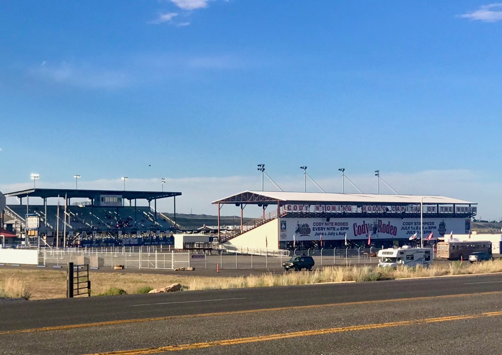
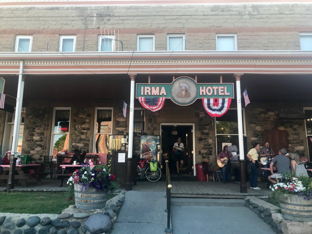
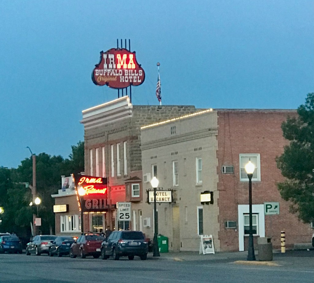
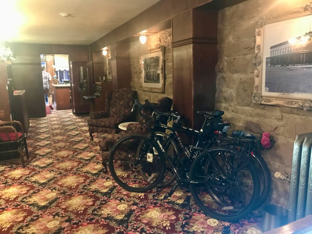
Soon, we could see Cody ahead of us. That brought welcome relief. One of the first things we saw as we approached the town from the west was the rodeo grounds. We stopped to snap a photo, and figured that was enough rodeo experience for us. We still had a few miles to go before arriving at our accommodations for the night, the historic Buffalo Bill Cody’s Irma Hotel. Each room of this charming establishment was named after a different person from the town’s history. But first we had to get checked in. Although we’d been promised a room on the ground floor so that we could roll our bikes in, that turned out not to be available to us. El Cochinito was speaking with the woman at the front desk while I waited outside with the bikes. I missed the part where the woman was taken aback when she heard we were from Los Angeles. You’d think we were alien life forms. She was kind to us, though, and let us park our bikes in the hallway of the ground floor. We just locked the bikes to each other, and they were fine.
We must be entering Cody!
Bike parking in the lobby of the Irma Hotel
You can’t beat the decor at the Irma Hotel
We encountered lots of folks in Wyoming who were very friendly, but also made it clear they did not want anybody like us (from California, of all places) to entertain thoughts of moving to Wyoming. As much as we enjoyed visiting the place, we were not tempted to make it our home.
We were too beat to consider going anywhere that night, and looked for a restaurant that was open and within as short a walking distance as possible. Although there were several establishments right across the street, most either weren’t open or had a long wait. Luckily, we found a pizza place a few blocks away that fit the bill.
Day 4: Cody to Greybull – 60 miles
Another longer-than-expected day of riding in heat and headwinds had us making a point of having one rider pull the other to keep our energy going. We also got a full sense of how few and far between the towns are in Wyoming. My ride buddy was really feeling the tooth pain and needed to do something about it. He called ahead to an urgent care clinic just south of Greybull and was assured that he could be seen that evening. Although the ACA bike route has riders take a road that drops a little south of state route 14 through the town of Burlington before heading east into Basin, a town just south of Greybull where the clinic is located, we opted to stay on 14 because it heads more directly into Greybull and avoids an uphill climb to go north from Basin into Greybull. Shortly after making that decision, we rolled into the town of Emblem, where we were eager to get water, as we had completely run out. That’s when we began to understand why the ACA route sends cyclists south through Burlington. Emblem, Wyoming has a population of 10, and zero shops of any kind. Burlington is an actual town, and, had we paid more attention to the ACA map, we would have noted that it has a store. The only business of any kind we encountered in Emblem was the post office, which appeared deserted. But there was a residence behind the post office, and El Cochinito knocked at the door. When no one answered, he looked around and found a garden hose, and used that to refill our bottles. I get uncomfortable about helping myself to someone else’s garden hose without permission, but I am grateful that my ride buddy has no such qualms. We found a shady spot nearby to rest and rehydrate.
The Emblem, Wyoming Post Office
Thank goodness my ride buddy had found us some water, as shortly thereafter, I got a flat tire, which meant more time in the heat. Those last 20 miles into Greybull seemed like an eternity. We knew the road would curve right and head south just before Greybull, and as excited as I was to spot the curve in the road, even that curve seemed to take forever. It was over 100 degrees when we got to Greybull, no wonder it felt so rough even though it was a gentle downhill most of the day. The town of Greybull is quite small, though, and once there, it was easy to spot the Historic Greybull Hotel. A charming place with a friendly owner who did have a ground floor room that was perfect for us to roll our bikes into. And the air conditioning felt marvelous.
Greybull, Wyoming – don’t blink, or you’ll miss it
As a first order of business, El Cochinito asked our friendly hotel proprietor about the best way to get transportation to the urgent care clinic, as we were not going to bike anywhere that evening. In response, the owner asked, “Are you a good driver?” He told us the keys to his car were in the door pocket, and we could find it just outside in front of the hotel. So we left our bikes and panniers in our room, and headed off to urgent care. The good folks at the clinic set El Cochinito up with some antibiotics and pain medication, after which we returned to Greybull and enjoyed a prime rib dinner at the speakeasy-like restaurant down below the ground floor. We had come a long grueling way from Yellowstone National Park, but things were looking up.
Day 5: Greybull to Thermopolis – 73 miles
Continuing south the next morning was nice and downhill (that same hill between Greybull and Basin that we carefully avoided riding up the day before. We saw lots of bee hotels along the way, and followed the ACA route’s guidance to take Orchard Bench Road, which took us through some nice farmland. We rolled along the kind of gently curving roads and scenery that put one’s being at ease. Later, we were back on the main road, and grateful we got our early start before the heat kicked in.
Easy riding south out of Greybull
Bee hotels
We stopped for lunch in Worland, which has a number of businesses, including a bike shop, but unfortunately it was Sunday, and the shop was closed. No re-stocking of inner tubes on this day. We rode into town over an old bridge and enjoyed Mexican food for lunch. Although we only had another 41 miles to Thermopolis, it was another day that got longer and hotter in the afternoon. As refreshing and pleasant as our day began, the afternoon heat was grueling. We left Worland with all 5 of our water bottles filled, plus the spare liter, and it still wasn’t enough to get us all the way. Our hopes were raised when we saw signs for Kirby, a small community just north of Thermopolis, where we turned off the road, thinking we could refill our water bottles. Although there was a billboard on the highway pointing to the family-friendly Kirby Bar & Grill, and also a tavern called Butch’s Place, neither was open, and the entire sad little “town” seemed deserted. In fact, the Kirby Bar & Grill looked as if it must have closed when covid hit, if not before then, and would not be reopening ever. The one business that looked like it was a going operation was the Distillery, which unfortunately is closed on Sundays. Although whiskey wasn’t quite what we needed at that moment, we had hoped they could provide some water. Feeling a bit defeated, not to mention overheated, we laid down on the shaded porch in front of Butch’s Place and took a little rest.
Kirby Bar & Grill was looking rather sad
No signs of life at Butch’s Place, but we enjoyed the shade
Laying on concrete never felt so good
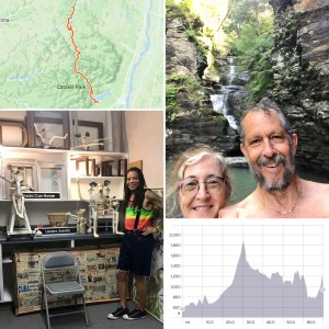
Heading out of Kirby, the ACA route was directing us to a small road running parallel to the state highway, and so we tried taking that road south toward Thermopolis. But the road surface was unpaved, with large, loose rocks that were hard to ride on. Even though the road was barely rideable, it turned out to be fortuitous that we headed this way, as we saw some kids playing in the front yard of a house. El Cochinito asked the young boy out front if they had a hose we could use to get some water, and the sweet kid offered us cold water from the house. His older sister graciously took our water bottles inside to fill them while the boy visited with us, asking if we were in a race. We chatted with him about our ride and the plan to spend the next few days in Thermopolis. He gave us his recommendations for where to eat and which hot springs to visit during our upcoming stay. He also gave us the scoop on the road ahead – that it leads to a bridge that is privately owned and can’t be crossed without permission of the owner. When his sister returned, she confirmed that we should not go that way, as we would not be able to cross the bridge. With that information, we turned back along the gravel road and returned to the highway. Although we were close to Thermopolis, we were so grateful to get that much-needed water to get us through those last several miles. The scenery quickly turned more colorful, and it became necessary to stop and snap pictures of the river bending through the red earth. Those last 15 miles were some of the most beautiful. We rolled into town about 5:30, completely wiped out, but glad to have completed the 312 miles of the first half of our journey. Today’s roadkill tally: 2 raccoons, 2 skunks, 3 birds, 1 rabbit, 1 cat?/fox?, and 1 lazyboy-type recliner.
Thermopolis would be our place to take a few days of rest in the middle of our journey. We had booked a small cottage through AirBnB, and planned to take advantage of the town’s hot springs. The cottage was just right for our needs. As a first order of business, El Cochinito contacted our host to ask if she could recommend a local dentist. That referral led to his new favorite place to go for dental work: Paintbrush Dental in Thermopolis, Wyoming. But it was still only Sunday, and first we had to shower up and find us a place for dinner. When we walked the few blocks into town, we noticed a Thai restaurant that looked interesting, but it was closed. The main street through downtown Thermopolis is only about two blocks long, and we saw only one other restaurant, which we recognized as the one recommended by our new friend from the gravel road: One Eyed Buffalo Brewing Company.
We refreshed ourselves at the One Eyed Buffalo with some hard-earned beer, and tried our first Rocky Mountain Oysters. I can now say that I’ve tried them. They were neither repulsive nor delectable. Points for novelty, but no need to try them again.
Days 6 to 8: Chilling in Thermopolis
Monday morning, while El Cochinito visited Paintbrush Dental, I rode to a market to stock up on groceries. We then had lunch at a café in the back of a health food store on the main drag, but upon returning to our bikes parked out front, I discovered the first of a series of flat tires I would get while we were in Thermopolis. The place may be known for its natural hot springs, but it’s got goatheads like nobody’s business. I was running out of spare inner tubes, so got to work patching up the punctured ones. The more I patched, the more punctures I found. It got a bit ridiculous, but Thermopolis doesn’t have any bike shops, so I had to do what I could with the tubes I had. For dinner we ventured off the main street and along the big road heading south from downtown, where we found Los Cabos, a Mexican restaurant with large metal dinosaur statues out front, because, well, this is Wyoming. Apparently, Thermopolis is the home of the Wyoming Dinosaur Center.
First of many flat tires in Thermopolis
Dinosaurs set the mood at Los Cabos
On Tuesday, we embraced the thermal part of Thermopolis, a town that boasts itself as home of the world’s largest mineral hot springs. There are three different places you can go to soak here. We went to Star Plunge, as recommended by our little friend, where we did our best to rejuvenate ourselves before tackling the second half of our tour.
Our last full day in Thermopolis began with a final soak in the hot springs. After getting yet another flat tire (did I mention there are goatheads everywhere here?), we switched to walking to get around town. This gave us a better opportunity to take in the local architecture and varied housing structures. I will assume the building code is fairly flexible here, and that folks go with what meets their practical needs and/or expresses their peculiar tastes. A charming and funky form of free expression, if not aesthetically pleasing.
By this time, I’d learned there might be inner tubes available at the Thermopolis Hardware & Mercantile. I biked over there, a ways beyond the Mexican/dinosaur restaurant. The Mercantile is the kind of place where you just lean your bike against something out front and maybe lock it to itself, not worrying about it still being there when you return. I found my way through the large store to the aisle that has bike things, and spent an inordinate amount of time agonizing over whether to buy an inner tube that was sort of close to the right size, and/or buy some sealant (that’s what the locals say you have to use to stand a chance against the goatheads). I kept looking things up on my phone, trying to figure out how to translate the tire sizes they had (marked in inches) to metric dimensions that I could compare to my own bike tires. I worried that sealant was a bad idea, given instructions to first completely deflate and then put in the sealant – what if part one worked, and part two failed? I ended up buying both a wrong-sized tube and the sealant, and ultimately never used either. But it did give me some small peace of mind to know that I had these available as a last resort in case things got desperate.
Looking back as we rode south out of Thermopolis
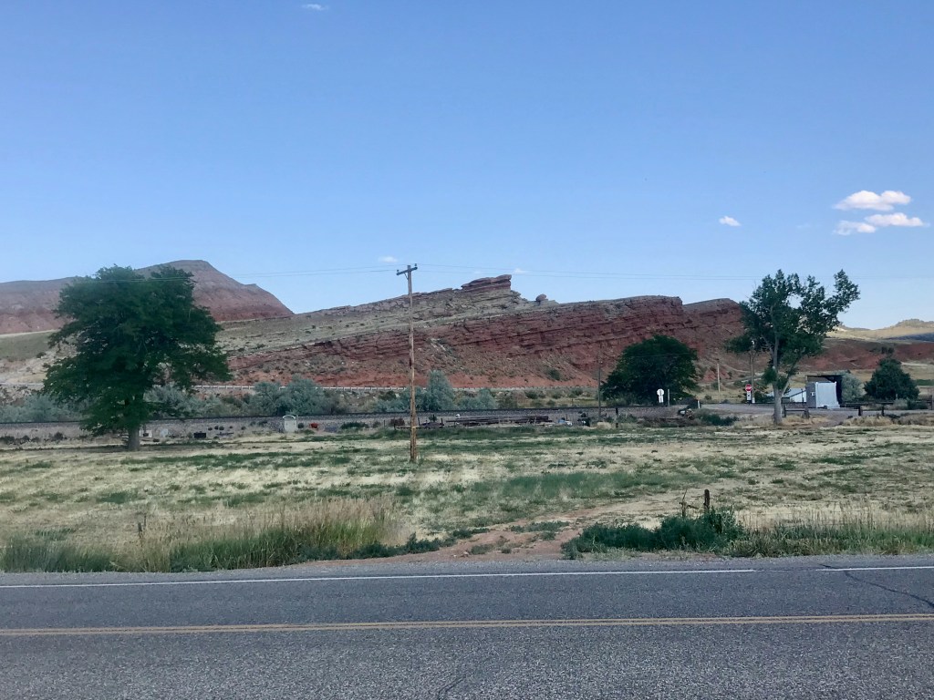
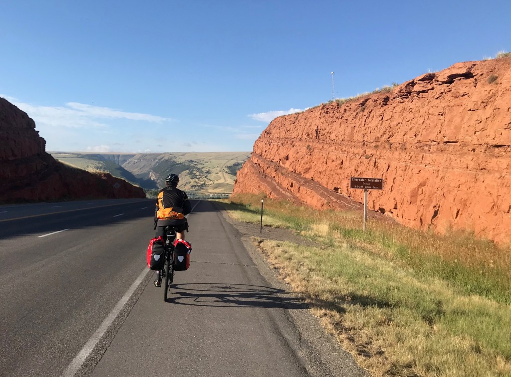
Chugwater Formation – Bedrock from the Triassic Era
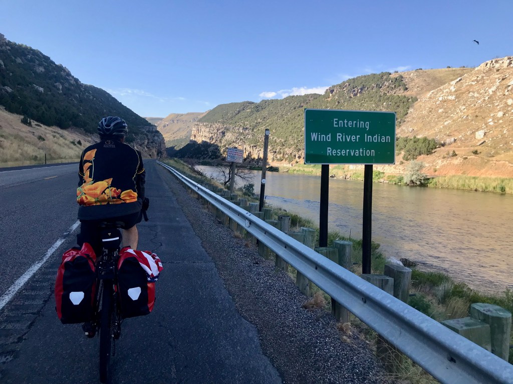
Day 9: Thermopolis to Riverton via Wind River Canyon – 62 miles
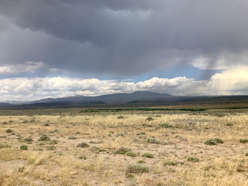
Rolling south out of Thermopolis provided pretty scenery and great riding as we made our way through Wind River Canyon. This place has a mystical quality to it. The wind is real, the river is beautiful, and the canyon is stately. I could go back and enjoy that ride again. We passed a few campgrounds along the river, where we stopped at one point to refill water bottles and inspect El Cochinito’s wheel that seemed unable to roll quite right, although it was functional enough. As we continued south on Highway 20, we took in the best scenery and a few pictures in the heart of the canyon. We rode past Boysen Dam and Reservoir. Highway 20 ends at Shoshoni, where we turned west onto Highway 26. At that junction, we stopped for lunch at a convenience store that offered a sandwich counter and a small picnic area in the parking lot. We ended up sharing the picnic spot with a large group of motorcyclists. They were a friendly lot who perfectly suited any stereotypes you might have of a friendly motorcycle gang, and we enjoyed sharing stories about our riding adventures.
Later in the day, we felt some heat and encountered high speed traffic as we continued southwest to Riverton. We rolled with it and got the job done. After 60+ miles, though, we were HUNGRY!! We feasted at the Riverton Hotel & Casino, where we enjoyed nice accommodations for a bargain price, as well as a selection of dining options.
Loaded fry bread hit the spot
No flat tires (yay!); Roadkill: 2 birds, 1 raccoon, 1 bicycle tire (not my size), 1 work boot.
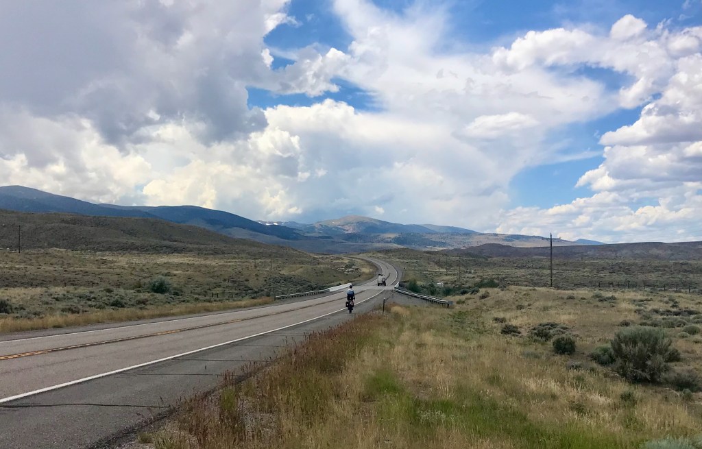
Day 10: Riverton to Lander – 30 miles
This was a delightful day of easy rolling from one Hotel/Casino to another. Before getting to the Lander Casino, we stopped in town at The Bike Mill, a shop that knew just what was wrong with El Cochinito’s wheel. We learned that his new Surly was missing a special end cap piece that can come loose when the bike is unpacked from its original box, and the mechanic set out to create a custom replacement part. While he worked on that, we stepped across the street to enjoy a delicious lunch at Gannett Grill. Back at The Bike Mill, we picked up the repaired Surly, pumped up my tires, and stocked up on bike supplies. We stayed in town a little longer since I had a zoom meeting with a client on the schedule, which I was able to do at Lander Bake Shop, just a couple blocks farther up Main Street. After finishing up with my meeting, we headed on to the Shoshone Rose Casino, our stop for the night. Those last few miles served up some powerfully strong winds, which turned the short distance into a real bike ride! El Cochinito set up his Bose speaker and served up some tunes to help us turn the chore into a party.
The Bike Mill
Interesting bike display outside the Lander Bake Shop
The Shoshone Rose Casino & Hotel
Roadkill tally: 2 birds, 1 mouse, 2 bunnies, 4 presumptive raccoons, and one half of a gopher or other small rodent (just the hindquarters).
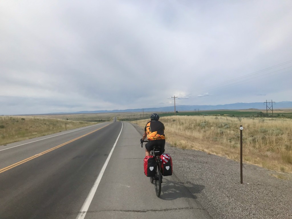
Day 11: Lander to Dubois – 70 miles
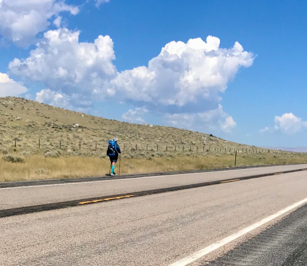
We got an early start to take care of business before the winds could wear us down. This was, after all, the area on the State Highway map where handy indicators note the average strength and direction of the winds would be working against us. There are also long stretches with no businesses. Yet we saw a guy backpacking along the road, just him, his backpack, and his brightly colored socks.
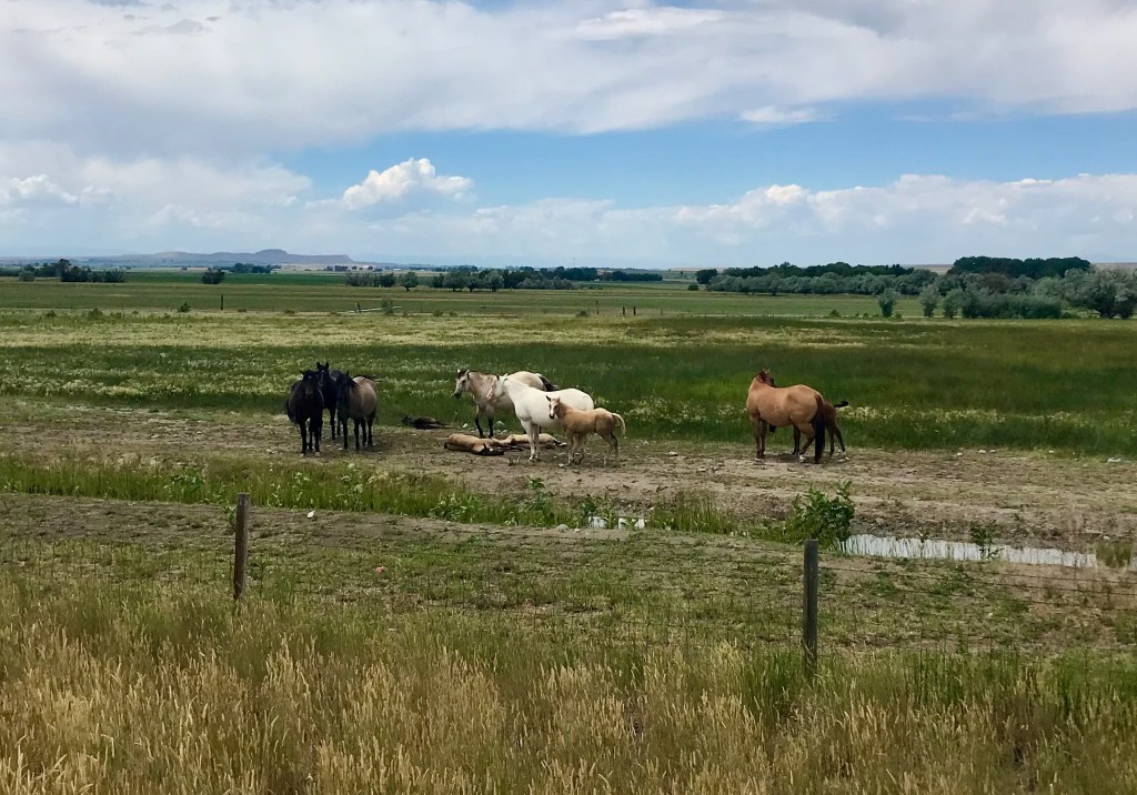
We were grateful for the general store in Crowheart, where we got some lunch and snacks, and dined at the picnic table out front. There we met three other bike tourists making the same trip from Lander to Dubois. We ended up hanging around at the picnic table for an hour, waiting for a storm to blow by. Farther up the road, we had fun interacting with an adorable group of horses, who seemed to be fascinated with us, then started gallivanting around. It felt like a playful conversation.
The latter part of the trek from Lander to Dubois featured some strong headwinds accompanied by ever more beautiful scenery as we worked our way to higher elevations. At one point, we saw a face in the rocky formation of Wind Ridge. We tried to decide who it looked like: Jesus? Guy Fawkes? It was a tiring day, but we made it!
We spent two nights in a cute little cabin at the Twin Pines Lodge & Cabins in Dubois. Our cabin featured a front porch and a very pine-y interior, complete with just the kind of bed you would expect in a log cabin. We enjoyed a couple of meals at the outdoor tables of the Cowboy Café. If a town is only going to have one place worth eating at, this is a good one for the purpose. I used the day off the bike to write a patent application, grateful for a profession that allows me this kind of flexibility. But it felt weird to not ride the bike at all that day.
The town features another curious site that looks like it might be part of an abandoned mine, or??? But, per the interwebs, this is where a guy named Appleman, who owned a bar in Dubois, blasted a hole in this hill and used it for cold storage for his booze.
Twin Pines Lodge & Cabins
Our cute little cabin
Our rstic room also had a little desk where I did my work
Beers at the Cowboy Cafe
Old Timey Refrigeration System
Day 13: Dubois to Colter Bay – 68 miles
We found a diner where we loaded up on a hearty breakfast on our way out of Dubois. The first 20 miles out of Dubois featured mosquitos and some gradual climbing. We then stopped for a break and a second breakfast at the Lava Mountain Lodge before tackling the last, hardest part of the climb up Togwotee (pronounced “TAA·gwuh·tee”) Pass. Just being in the mountains was feeding my soul and giving me energy, so I remained hopeful that powerful mountain vibe would carry me all the way.
Heading out of Dubois
The mountains for which we are headed
Inside the Lava Mountain Lodge
Gaining some altitude
Looking back at the climb El Cochinito did twice
We were more than two miles up that climb when we stopped to take a few swigs from our water bottles, and that’s when El Cochinito realized he’d left his bottles behind at the Lava Mountain Lodge. He insisted I stay put and wait while he circled back to retrieve them. Considering the distance and climb, he returned rather quickly, but it was hard to be comfortable with simply waiting around while he took that little trek alone. I explored the area a wee bit, and looked for a suitable place to rest and wait while also making myself easy to find when he returned. It all turned out fine, and soon enough, I was biking with my ride buddy again.
The rest of the ride to Colter Bay was glorious! After the headwinds-enhanced climb up Togwotee Pass and crossing the continental divide once again, we were treated to a looong 6% grade descent, all facing the beauty of Grand Teton. We stopped at a vista point a little ways beyond the summit and took in some awe-inspiring beauty. We snapped several pictures of the giant meadow with pretty light purple wildflowers and the gorgeous mountains of Grand Teton standing proudly in the distance. It was one of those extraordinary experiences that won’t be forgotten.
Flowers!
Approaching the summit
Togwotee Pass
Okay, it’s COLD up here!
Amazing viewpoint
That night we settled in to our cute little tent/cabin in Colter Bay, where we rented sleeping bags and spent the next two nights.
Day 14: Colter Bay to Jackson – 42 miles
What a grand finale! We spent some time in the morning exploring the Colter Bay area, and then enjoyed a really fun, fast, and beautiful ride back to Jackson. (Jackson! As in we sang along to Johnny Cash and June Carter singing about how “we’re going to Jackson – Jackson!”)
Colter Bay
Plenty of bike parking where the bike path meets Jenny Lake
Never tired of this view
Since we would be returning to our tent/cabin at Colter Bay that night, we didn’t need to bring our panniers, and it felt great to roll a little lighter. The bike path that runs all the way from Jenny Lake to Jackson is an absolute treat (especially in this direction). Along the way, we stopped at the Jackson airport to greet two of our kids who were going to join us for the retreat in nearby Alpine with the extended family. The kids picked up a rental car and drove into Jackson proper, while we rolled on into town to drop off our bikes with the good folks at Hoff Bike Smith, who had fixed our bikes on day one, and would pack them up for the return flight home. We grabbed some lunch in town with the kids, and then drove back to Colter Bay to spend that last night camping with them before heading on to Alpine the next day.
Thank you, Hoff’s, for taking good care of us and our steeds
And, with that, we had completed 600 miles of biking in two weeks. Not bad, especially when you consider that one of us was recovering from covid and battling tooth pain. Real cyclists don’t let a little root canal get in the way of an epic journey, right?
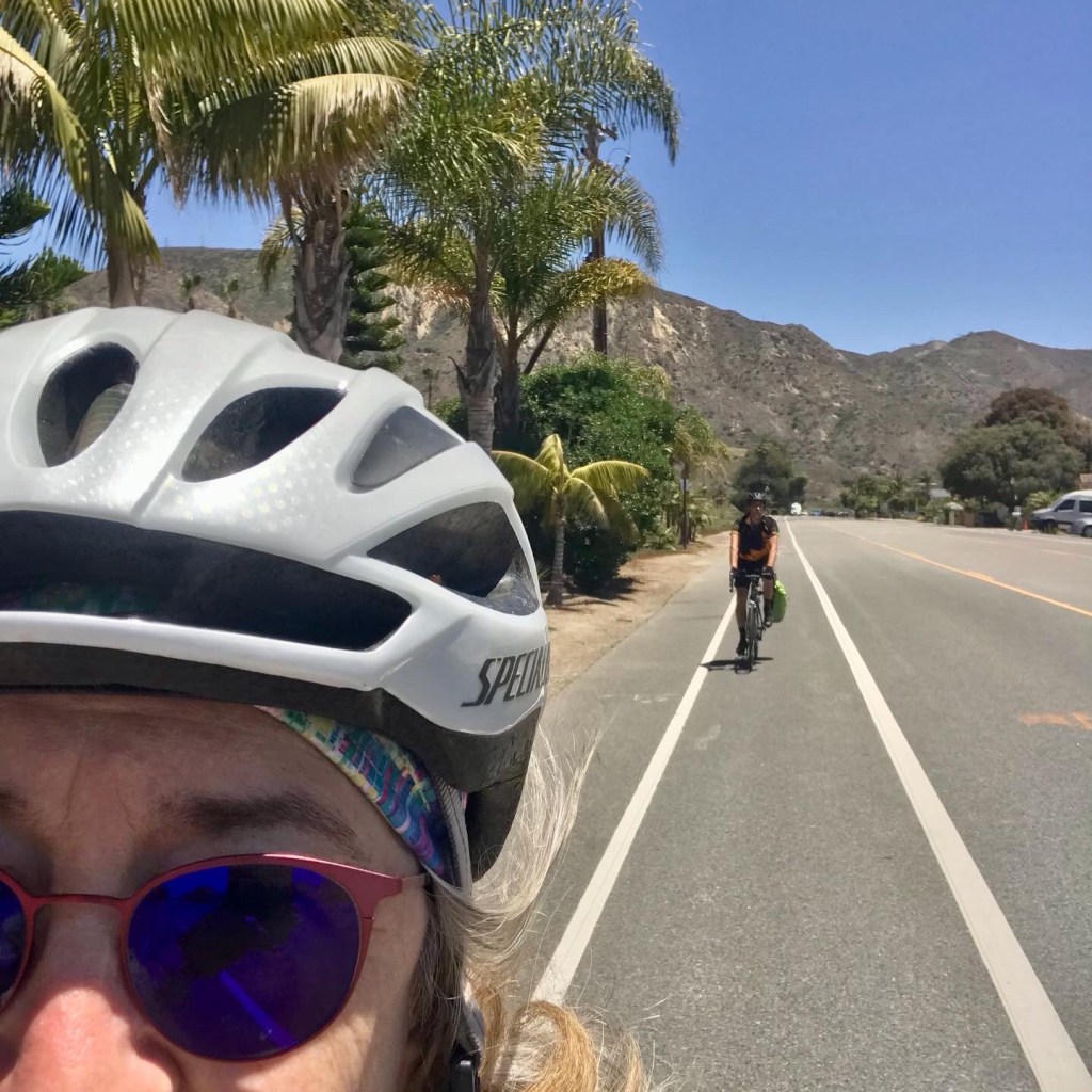
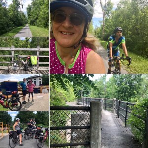
A doable adventure for those looking for a longer ride is the trek from Los Angeles to Santa Barbara, a distance of 95 miles by car or 105 by bicycle, give or take, depending on exactly where in the vast metropolis of L.A. you begin. Some ride up and take the train back, while others spend the night and ride back the next day. I was worried we were not quite up to the challenge of a century ride at this particular time. We also had no intention of taking the usual and more direct route along the coast the entire way, as the stretch of the Pacific Coast Highway (“PCH” to locals) between Santa Monica and the far reaches of Malibu is a harrowing place for cyclists. It’s true that many bike along this stretch, and most do live to see another day, but the high-speed motorists, the narrow shoulder that occasionally disappears, the many surfers preoccupied with loading and unloading their gear from cars parked alongside the highway, make for a stressful experience. So we decided to split the ride into two days, and add some extra miles by routing the first half of the ride through the San Fernando Valley. This meant no need for the stress of riding on PCH.
A ride planned by a friend a few years ago inspired the plan. She invited a group of us to meet at the Amtrak train station in Chatsworth (in the San Fernando Valley) and start the ride from there, following an 85-mile route through Simi Valley and into Camarillo before hitting the coast in the Oxnard/Ventura area, and then heading north to Santa Barbara. We then took a train back to Chatsworth that same evening, where we’d left our cars. I prefer to leave cars out of it entirely, when possible, and we already know how to ride our bikes from our home to Chatsworth, so why not just append our route to Chatsworth onto my friend’s route to Santa Barbara? That brings the total mileage closer to 120, but split between two days, that’s not bad at all. We developed a 60-mile route to get us to Thousand Oaks, and it was another 60 miles from there to Santa Barbara – perfect.
Saturday morning, we fed the cats, made arrangements with our houseguests to feed them while we were away, fixed ourselves breakfast, packed our essentials into a single pannier, and off we went. Knowing we only had to cover 60 miles, we were able to leave without rushing. All we had to do was make it to our hotel in Thousands Oaks. We didn’t get out the door until 9:15 AM, but we had plenty of time to complete our task for the day, even allowing for some stops along the way.
Heading out!
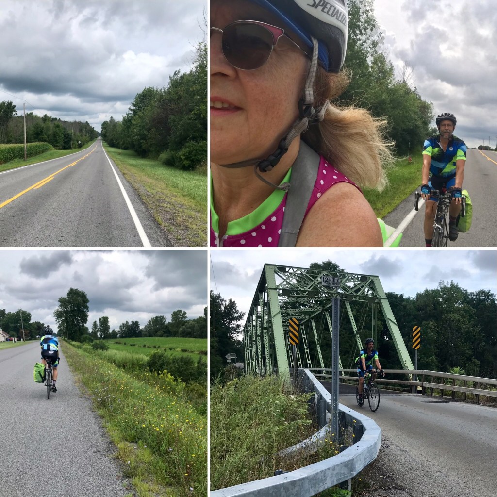
We headed north into Hollywood, and rode over the Cahuenga Pass. It’s not the most pleasant bikeway, but it’s doable, and there just aren’t appealing options for getting over to the San Fernando Valley from central Los Angeles. If you’re willing to approach the Valley from farther east, there’s a much more pleasant route through Griffith Park or the Los Angeles River Trail, but Cahuenga is more direct and it’s not too bad going northbound in the morning. (Southbound is a completely different story: DON’T TRY IT!)
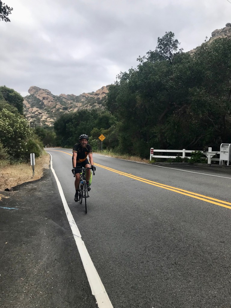
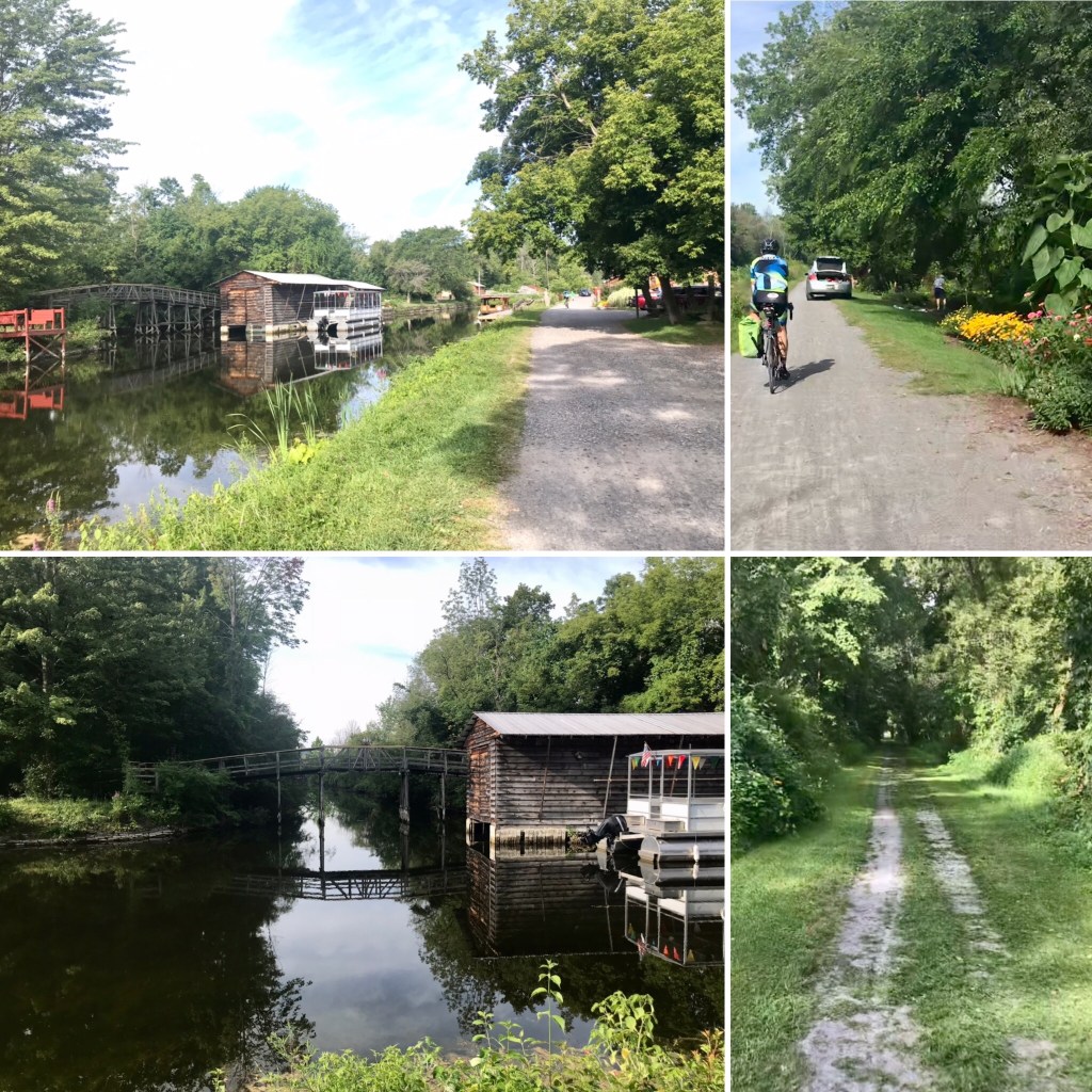
After navigating a few busy, stressful streets, like Lankershim Boulevard, we got onto Vineland Ave’s buffered bike lane to connect us with the Chandler bike path, which continues west, and then north, as the Orange Line Bikeway to Chatsworth. That got us close to the home of a friend, where we took our first rest stop. We were about 30 miles and 3 hours into our journey, so it was perfect timing. We enjoyed a pleasant social call, had a snack, and used the facilities before heading on again. From there, we were close to Box Canyon. That meant a somewhat narrow winding road and a grueling climb, but with gorgeous scenery. We pulled over a few times to catch our breath, guzzle some water, and let some traffic pass us by. The climb was steep enough that we could just manage it, but not without a few stops along the way. I kept thinking I could not recall doing a climb like this on my friend’s route to Santa Barbara a few years ago. As it turns out, we were not following my friend’s route for this part; it was just so much more convenient to go this way from the location of our friend’s house where we’d stopped. If you are planning your own trip out of Chatsworth, you can consider whether you prefer a gentler route heading straight north on Topanga Canyon Blvd to Santa Susana Pass Road, or going west and following Box Canyon Road, with it’s challenge and beauty.
Orange Line bike path; Box Canyon on the right
After the climb, Box Canyon Road ended at Santa Susana Pass Road, which took us to Simi Valley. After a short stretch on East Los Angeles Ave, we next hopped onto the Arroyo Simi Bike Path. This is a great bike path that takes you a good 7-8 miles across Simi Valley. From there, we headed southwest on Madera Road, which took us all the way to Thousand Oaks. A little pro tip in case you decide to take this route: when you turn left to head south on Madera Road, DO NOT make a full left turn into the southbound traffic lanes! Instead, take an immediate left onto the side path that runs along the eastern side of the Road. Madera Road at this point is one of those suburban highways and it does not have a bike lane in the road. Luckily, we noticed the side path and crossed over at one of the intersections after a rather stressful stint in the rightmost traffic lane. Later on, Google maps will also guide you onto Country Club Ct, which gives a break from Madera Road and a proper bike lane for awhile. When you get back onto Madera Road, this time, DO NOT take the sidewalk, as it will come to an abrupt end. There is a proper (but unprotected) bike lane on Madera Road beginning at this point. Soon thereafter, Madera Road becomes Olsen Road, which then becomes Lynn Road. While on the Olsen Road portion, we enjoyed riding past California Lutheran University, a place we both knew was in the Thousand Oaks area, but had never seen.
Bike trails through Simi Valley
From Lynn Road, we hung a right onto Hillcrest Road. After a couple miles, that brought us to our destination for the evening, the lovely Premier Inns of Thousand Oaks. Okay, maybe not exactly lovely, but perfectly adequate for our needs. They were nice enough about letting us bring our bikes into the room, which had plenty of room for them, but we couldn’t get a room on the ground floor, so had to lug our bikes up the (external) stairs and wheel them around a maze of angled breezeways to get to our room, all the while bathed in the stench of cigarette smoke. I hadn’t realized the room I had booked was a “smoking” room, but the way the whole place smelled as we made our way to the room, it seemed perhaps all of their rooms are smoking rooms. We were looking for an inexpensive place to crash for the night, and that’s what we got. We were also able to walk to a nearby strip mall that offered lots of restaurants to choose from. We enjoyed a nice dinner at Stella’s, and, along the way, spotted an IHOP that was positioned perfectly for grabbing breakfast when it would be time to head out in the morning.
Day two started out with a hearty breakfast at IHOP, which put us in position to continue west on Borchard Road. After about two and a half miles, Borchard fed us into Rancho Dos Vientos, and then to Portrero Road. There appears from the map to be a more direct option, but we liked the scenic route. And next is where the ride gets extra fun: going west on Portrero serves you up with a few gentle rollers, and then, despite not having climbed any significant hills, you get treated to a delightful descent into the coastal flatlands. A memorable thrill.
We continued through farmland, heading towards Port Hueneme (pronounced hu-NAY-mee, although it always sounds to me like folks are saying “wuh-NEE-mee”). We rode past acres of strawberry fields, which smelled delicious, and resisted the urge to stop and try to “sample” the sweet-smelling fruit.
As we entered the residential areas of Oxnard, it was interesting to see the neighborhoods and various styles of apartments and houses, imagining this is where the workers of the nearby fields are living. As we got closer to the water, the homes gradually became larger. We rode though the Channel Islands area, taking Channel Islands Boulevard, which I’d not seen before. Closely packed houses, some quite large, line the channels, with boats docked in front of each one. It’s quite picturesque, and you just can’t ride by and not take photos. From there, we turned north, following Harbor Blvd into Ventura.
Channel Islands
Soon thereafter, we came to the entrance to the bike path along Ventura Beach, where we found ample opportunities for a restroom break, and much to our delight, an ideal place to stop for lunch. Right along the bike path, is the Jolly Oyster, which has two trailers and several picnic tables. At one trailer, you can buy fresh oysters to take home and prepare yourself. At the other, you can buy prepared oysters to eat right there. The menu offered several appealing choices. We shared one plate of raw oysters, and one of grilled, plus had some scallop ceviche. It was awesome. We felt like we’d won the lottery to have stumbled across such a perfect lunch spot at just the right time.
Ventura to Santa Barbara, with a lunch stop at the Jolly Oyster
After our little feast, we filled up our water bottles and continued north on the beach path. Okay, well there was an odd little section shortly thereafter where we had to wangle our way on a road (not so clearly marked to guide cyclists) for a short bit before the beach path resumed, but from there on out it was quite delightful riding along the ocean, separated from the cars. We rolled along with that beautiful soul-enriching ocean view for nearly 30 miles into Santa Barbara.
Rolling into Santa Barbara
We rode into town, not sure of where we wanted to hang out next, until we came across Dune Coffee Roasters, along Cota Street. We parked our bikes next to an outdoor table and enjoyed some refreshments as well as some interesting characters, making it a true Santa Barbara experience. Actually, we later took the true Santa Barbara experience to a more typical level by heading over to State Street, which is closed to cars and filled with people. There we parked our bikes again, and slurped up some margaritas. We followed that with a slow roll around town and found ourselves a little park where we could hang for a bit before heading to the train station for our ride back to L.A.
Cool architecture A delightful character in the parking lot at Dune Coffee RoastersMargarita time!Santa Barbara
The platform at the Santa Barbara train station was quite the party scene. There were lots of folks in good spirits, many part of a large group that appeared to be celebrating an occasion together. The atmosphere was noisy and rambunctious, but luckily didn’t veer into obnoxious. Once the train arrived, we secured our bikes in the lower level of the special car for bikes, and proceeded to find us some seats on the upper level. Turns out the party from the platform was continuing in our car of the train, and we enjoyed their good humor for our ride home.
Another year, another round of coffeeneuring. Whataneuring, you ask? See my coffeeneuring reports from previous years to get the backstory. Quick answer: Coffeeneuring is a challenge put out each Fall to bike (or run) to seven different coffee shops (or coffee outside locations) over the course of seven weeks, providing documentation. There are a few more rules, but that’s the gist of it. Each year the challenge has a theme, and participants have the option of embracing the theme in their own way, or creating a theme to add to the fun. This year’s theme was “C+1”, and I decided to make that about inviting someone along for each outing. I also find myself unable to resist keeping track of which Bloomers I wore each time (because that’s my thing, as in literally, that’s my side hustle).
The following is my report:
#1: Date: October 24, 2021
Where: La Tropezienne, Mid-City Los Angeles
Beverage: Cappuccino
Lynn and I enjoying our goodies at a sidewalk table in front of La Tropezienne
Distance: 23.5 miles
Bloomers: Dazzling Amethyst
Dazzling Amethyst Bloomers & official coffeeneuring socks
C+1: Lynn
Angie at the Helipad, sporting her Leopard Print Bloomers
My friend Angie and I sometimes ride to Griffith Park together, so when she reached out to ask if I’d like to ride together this time, I was happy to do so. Then another friend, Lynn, ended up joining us. Turns out Angie needed to skedaddle on home right after our ride through the park, but Lynn was game for a coffee run. I hold fond memories of delectable goodies from La Tropezienne, and wanted to visit them again this year. Along with my cappuccino (they do those right), I enjoyed an almond croissant that featured all the perfect flakiness and almondy goodness.
#2: Date: October 30, 2021
The Mt. Vernon Trail runs along the Potomac River
Where: Lot 38, Washington, D.C.
Beverage: Macchiato Caramello
The Memorial Bridge, a Capital Bikeshare docking station, and my yummy treats at Lot 38
Distance: 16+
Bloomers: Pinkadot Black
C+1: Spirit of Frederick Douglass
Exploring the new Frederick Douglass Memorial Bridge
Every year, during coffeeneuring season, I make a trip to our nation’s capitol to attend a conference, where I make use of their bikeshare system and bike routes. One year I was lucky enough to meet up with one of the many coffeeneurs in the area, and share a coffeeneuring ride together, but this year I was unable to find a ride buddy who was available at the same time I was free. Through the marvels of Instagram, I had been following the development of the new Frederick Douglass Memorial Bridge (I love biking over bridges), so I decided to designate the spirit of Frederick Douglass as my C+1. We had a great time despite getting a wee bit lost on the way there (missed my turn off the Mt. Vernon Trail, so took the Arlington Memorial Bridge over the Potomac River instead of crossing by way of Hains Point). Before getting to the new Frederick Douglass Bridge, however, I had to get to Lot 38, a coffee shop nearby that was going to close soon so I had to save the exploration for after my treats. The macchiato caramello and cinnamon bun were well worth the trip. Afterward, I had fun riding across the new bridge with its fantastically generous bike lane as well as exploring both sides of the Anacostia River. It was a glorious adventure, and I relished the opportunity to see some autumn colors along the way.
#3: Date: October 31, 2021
The back entrance to Stories Books & Cafe
Where: Stories Books & Cafe, Echo Park
Beverage: Drip Coffee with Milk & Caramel
Distance: 12
Restocking the little free libraries
Bloomers: Rustica Leggings (not Bloomers!)
Proof that I don’t wear bloomers every day
C+1: Quoc
Quoc and my goodies
The very next day, I was back in L.A., and was able to join the Street Librarians for their monthly visit to re-stock some little free libraries in the Silver Lake / Echo Park / Koreatown areas. The group meets up at Stories Books & Cafe in Echo Park, typically enjoying goodies before the ride begins. This time I had the pleasure of meeting someone new to me, Quoc, my C+1 for this ride. It was Halloween, so we embraced a spooky theme, and I had fun dressing for the occasion.
#4: Date: November 6, 2021
Where: Sidecar Donuts, Fairfax District
Beverage: Vintage Brew Coffee
Distance: 25
Heading up Nichols Canyon
Bloomers: Conventional Black Bike Shorts (again, no Bloomers!)
C+1: El Cochinito
This was an unplanned coffeeneuring excursion of the best kind. El Cochinito and I had simply planned to ride one of my favorite routes togethers, the Nichols Canyon / Franklin Canyon Loop that features quiet roads, beautiful scenery, and just enough climbing to feel legitimate without being too taxing. As we were back on the flats and working our way home, he surprised me with a stop at Sidecar Donuts. I was delighted to try this new location, and the Dulce de Leche Churro donut I had was divine, complemented by a brewed coffee with milk and honey. Sweetness with my Sweetie!
#5: Date: November 14, 2021
Tour of the urban forest
Where: Mendocino Farms, Culver City
Beverage: Lemonade
Patricia
Distance: 23
Bloomers: Party Pants
C+1: Patricia
So maybe the theme this year was really figuring out how to turn each weekend’s bike ride into a coffeeneuring ride. Certainly that was the case here, as I didn’t want to miss a tour of the urban forest in Culver City, led by Patricia Bijvoet. Patricia is a local urban landscape architect whom I met through Women on Bike Culver City. I was unfamiliar with urban forestry and what that meant, and this was a fascinating educational experience. Does having lemonade with the ride leader count as coffeeneuring? I think so.
#6: Date: November 20, 2021
Celebrating the new mobility lanes in downtown Culver City
Where: Akasha, Culver City
Beverage: Drip Coffee with Caramel
Jennifer and our goodies
Distance: 15
Bloomers: Dazzling Amethyst
C+1: Jennifer
I found myself back in Culver City the very next weekend, this time not wanting to miss the grand opening celebration of the new mobility lanes that transform the streets through Culver City’s charming downtown from scary-insane to delightful. After all, they didn’t just add bike lanes and a bus lane, they painted pretty flourishes along the way. Afterward, Jennifer gladly joined me as my C+1 for coffee and treats at Akasha. I had a drip coffee with caramel and half & half, and a delicious pistachio croissant.
#7: Date: November 27, 2021
Where: Pailin, Hollywood
Bike parking right in front of Pailin
Beverage: Thai Iced Coffee
Kat
Distance: 8
Bloomers: Red Hot Aqua Dot
C+1: Kat
Time was running out, and here I was, looking for a way to turn my next outing into a coffeeneuring ride. El Cochinito had made arrangements for us to meet up with a former student of his at a nearby Thai restaurant, so we biked there and I made sure I had me a Thai iced coffee with my lunch. I had some time hanging with the former student’s partner, Kat, while our respective dates were outside for a bit. Kat was fun to visit with, and was gracious about letting me photograph her to document my C+1.
And with that, just under the wire, another season of coffeeneuring was completed.
What’s a pair of empty nesters in Los Angeles to do when all of their adult offspring move to the northeastern United States? Especially after being cut off for a year or two by a lousy pandemic? The only logical solution: take our bikes out east and visit them.
In the Summer of 2019, our eldest and his wife moved from northern California to Chicago. I was planning to pay them a visit the following Spring, but then, along came COVID-19. Shortly thereafter, a new career opportunity arose, and they left Chicago in the Summer of 2020 for Rochester, New York. Next thing we know, our youngest decided it would be more fun to quarantine with them than to keep living at home with the old folks. Go figure. Then this summer, our middle child and her fiancée decided to move to Philadelphia. Just like that, we found ourselves without any of our kids nearby, and the summer was soon going to run out on us. So we started making our plans for the Epic Tour de Kids.
The Planning
We are AirBnB hosts, renting out one of the no-longer-occupied kid’s rooms, so first we identified an 18-day stretch after the last booking and before El Cochinito had to resume his teaching duties. Then we had to consider the essential visits to include in a trip out east: friends in the DC area, and another who had recently moved to the Catskills. The routing of our adventure flowed quite easily from there: fly to DC, visit El Cochinito’s college buddy, take our bikes on the train to Philadelphia, spend a few days visiting our daughter and her fiancée, ride our bikes from Philly to West Fulton, New York, visit our friend there for a couple days, then roll on to Rochester, New York to spend a few days with our kids there before we fly home.
Next, we needed to plan the actual biking part as well as get our bikes in touring condition. El Cochinito tackled the first portion of the routing: Philadelphia to West Fulton, and I took on the West Fulton to Rochester part. Each portion was about 240 miles or so, and we decided to spread those miles over 4 days to ensure we wouldn’t be rushed or stressed about making each day’s goal. Once we had that figured out, we started booking accommodations, and with that, our daily routes could be planned out.
The Training
This was near the end of June, and the trip was planned for August 3rd-21st. That meant we had to begin our training in earnest. Not just because we had a lot of miles to prepare for, but especially because we had both encountered some unfortunate unintended contact with the pavement while biking in recent months, and we needed to make sure we were sufficiently recovered from our respective injuries and up to the task. In December, El Cochinito had taken a super bad fall after hitting an abrupt ripple in the asphalt at the intersection of Sunset Blvd & Highland in Hollywood that left him with a 3rd degree separated shoulder, then another fall in early March that caused some minor fractures and rang his bell, which was followed a few days later by yours truly having her own spill biking to the office the morning after a little rain and going down hard upon hitting some slick pavement, resulting in a fractured pelvis. It was as if we were competing to see who could have the more pitiful solo crash.
Alas, although we suffered some significant aches and pains, we both gradually recovered over the course of a few months, with the help of some physical therapy and determination. As of May, I had remained quite frustrated at what seemed then like a serious lack of progress. By June, I was feeling increasingly confident. So, on June 26th, we took our bikes to Ventura and road a 49-mile loop from Ventura to Ojai, on the Ojai Valley Trail, then on to Santa Paula, where we stopped for beer, and then a final leg back to Ventura. It was a hot day, and we covered more miles and climbed more elevation than either of us had done thus far in 2021, but we did it!
To make sure we could also handle back-to-back riding days, we got back on our bikes the following day. This ride was flat, but long, as we logged 69 miles by first riding the San Gabriel River Path down to Seal Beach, swinging through Long Beach with a stop for lunch, and then riding back on the Los Angeles River Bike Path. Our fannies felt it, but we were able to do it, and that was a big boost to our confidence.
The following weekend presented an opportunity to work on our climbing. I was not at all sure I could do this one, as the most challenging part of my recovery from the fractured pelvis was regaining the ability to ride uphill. Even the slightest inclines had been hard. But I did not want to miss the chance to ride Glendora Mountain Road / Glendora Ridge Road while it was closed to cars for the 4th of July weekend. This is one of those bucket list rides: spectacular scenery from an undulating ribbon of road that traces the crest of Glendora Ridge as you climb up to Mt. Baldy Village. I had only done this ride twice before. In 2019, I did it right after returning from my Colorado trip in which I rode from Denver to Estes Park and back, so, hey, I was definitely able to handle it that year. In 2020, I did it again, but struggled with the heat and had to stop frequently to keep from bonking, especially during that final slog to the top. I had no reason to think it would be any easier in my not-quite-fully-recovered state this year, but I did have a fancy new Bianchi Infinito carbon bike, giving me a chance to see if a lightweight bike might make it manageable. After 46 miles and 6,423 feet of climbing, I am proud to say we did it. I also PR’d the climb. Not too shabby.
With life and all that, the next few weeks’ training rides consisted of an occasional ride up to the Griffith Observatory or up Nichols Canyon, nothing too challenging. Finally, on the last day of July, we put in one last serious effort before the big trip. We rode south to San Pedro, up that steep little bugger of a hill to visit the Korean Friendship Bell, and then rode back up through Palos Verdes and along the coast, returning via the Ballona Creek Bike Path, with a final and very steep climb up to the Baldwin Hills Overlook. That gave us a total of 73 miles and 2,415 feet of climbing for a decent confirmation that we were ready to take on our big bike tour. Which is good, because that was our last opportunity to train for the tour.
Korean Friendship Bell, San Pedro, California
Turning Our Road Bikes Into Touring Bikes
I had recently decided to put gravel tires on my Volpe, since I knew it could accommodate wider tires than the 28mm tires it came with. And with a newer, fancier, carbon Bianchi Infinito in my collection, it made sense to devote the Volpe to more adventurous riding on varied surface conditions and for touring. El Cochinito wanted to use his aluminum-frame road bike for our tour, and consulted with our local bike shop about how to adapt it for touring and riding trails paved with crushed gravel and the like. The shop was able to install a rear rack despite the lack of braze-ons, and switched out his 23mm tires with 25mm Gatorskins. They also did a bike fitting, and made several key adjustments to make long distance riding much more comfortable.
Getting our bikes to DC
We had our local bike shop tune up our bikes and box them for our flight to DC. That gave us confidence the bikes were packed right and protected for the journey. And I had planned ahead to find an airport transportation service that could handle getting two people and two bike boxes from our house to the airport, as we needed to get us to LAX very early on a Tuesday morning. I found one company that offered van service, and carefully reviewed the stated luggage capacity for their private van service. I almost booked with them, but then noticed a number of bad reviews complaining that the service did not show up for many of its customers, so I kept looking. I found another company that offered what appeared to be very similar private vans, but no explicit information about their luggage capacity. I figured a large van with no other passengers could surely handle us and our bikes, so I booked it. There was no FAQ or chat or phone number I could use to confirm that capacity, but then two days before our flight, the confirmation email did provide a phone number. I called to make sure we would be okay, and learned that, no, their vans were not big enough to meet our needs. Flummoxed, I decided to reach out to a bike friend who lives near the airport and ask if she could help. She was great about it. We drove our boxed bikes and ourselves in El Cochinito’s pick up to her house early the morning of our departure, and she rode with us to LAX. She drove the truck back to her house, and kept it there until time to come pick us up on the return. Thank you, Lynn, you’re a lifesaver!
At LAX, we donned our KN95 masks and drug our bike boxes into the terminal to get them checked in. We were flying American Airlines, whose baggage policy treats bike boxes like any other form of checked baggage – no extra charge just because it’s a bike. But, there was no clear indication as to where we should go with said bike boxes. We tried one line and then another, and when we eventually made it to the front of the line, we were told we hadn’t needed to wait in that line, but did need to take our bike boxes to a special drop off location. The check in agent was kind enough to walk us to this mysterious other location.
Our direct flight to National Airport in DC was uneventful, but all we had to eat on that flight was one Cliff bar apiece plus the cookies the airlines hands out. We were starving by the time we landed, but afraid to stop for food lest our bikes be picked up by someone else before we got to baggage claim. Once we had our bikes, we had to get to work assembling them, right there in the baggage claim area. The bikes were a little more dismantled than I had expected, and we had some work to do: reinsert the stem and tighten the handlebars so the bike steers straight, reattach the front wheel and the rear brake, replace the pedals, reinsert the seat post, and replace the bottle cages (arrgghh, why did those have to come off??). Finally, we had to reinflate the tires using my mini frame pump. Doing all of this is hard enough on a good day; doing it while sleep-deprived and hangry is a serious challenge. And that latter part, about inflating the tires, turned out to be a bit of a problem, but not right away.
Bike assembly at DCA
DC & Maryland
We managed to get our bikes in working order, attached our panniers to the rear racks, and headed for the Metro station. We got our fare cards loaded up, a station attendant let us know that we needed to take our bikes around the side to an elevator to get to the platform, and we made our way to the Yellow Line train that would get us to Metro Center, where we could transfer to the Red Line. A lot of squeezing our two bikes and our two bodies onto elevators, but it was all doable. I was a bit confused by the DC Metro bike policy, as the center doors of each train had a “no bikes” symbol, but the center door was the only way to get to the wheelchair zone, which has enough space for the bikes. Does DC prefer that folks with bikes use the doors at the ends of each car and just stand in the aisle with their bikes? That didn’t seem to make sense, so we used the center doors. Luckily, our trains never got too terribly crowded.
DC’s Metro Trains Aren’t Clear on Where to Go With Bikes
We disembarked at the Grosvenor Station, and from there, rode our bikes 6 miles to Potomac, where our friends live. My bike felt a little sluggish, but I wasn’t sure if it was because I wasn’t that accustomed to my new GravelKing tires (although I did ride on them for the last few training rides), or because of the weight of my pannier and handlebar bag, or because my tires weren’t properly inflated. Or maybe I was just feeling slow in the way I often do when I can’t keep up with El Cochinito. We figured we’d borrow a floor pump from our friend to make sure the tires were adequately inflated, but then the floor pump couldn’t be found. Oh, well. We just pumped them up again as best we could with the mini pump.
Taking Our Bikes on Amtrak
After two nights and a full day spent with El Cochinito’s old college buddy, we were ready to roll out, reversing our route to the Red Line, and taking that to Union Station. There we grabbed some breakfast and tried to figure out where exactly we needed to go in order to board our train to Philadelphia with the bikes. There was no guidance at the station, but once we got to our train, each door had a bicycle symbol by it, so we figured we could board anywhere. But it was not easy lifting our bikes onto the train, as we had to go up a few steep steps. Once on board, we could not see anywhere for our bikes to go. We ended up trying to make our way through the passenger car’s narrow aisle with our bikes and panniers – not easy at all, and a bit annoying to the other passengers, also trying to make their way to an available seat.
I kept looking around for a train attendant, conductor, or someone who might be able to give us a clue as to where we were supposed to put our bikes. We’d paid an extra $20 each for the bike reservation, and yet there did not appear to be any suitable place for them. Finally, in the second or third car we tried, there was an attendant. Her reply was to “put it in the bike rack”. I asked her where the bike rack was. She pointed in the direction of a luggage rack next to the restroom at the end of the car. I asked again where the bike rack was. She explained that I needed to move the luggage off the rack, and then put the bike in. That seemed odd. The rack had lots of large suitcases on it, and I started trying to lift them off, one-by-one, without losing control of my bike. It was a bit crazy and stressful, and I was blocking the aisle that was full of folks waiting to pass by in both directions. A woman came up to me and asked me why I was moving her suitcase, and I told her I was doing what the attendant told me to do so that I could park my bike there. She seemed rather miffed. After the shelves were cleared of luggage, it was possible to lift the two shelves up, revealing a hook against the back wall and a sign that said “reserved for bicycle storage”. Sure would be nice if that sign were visible when the shelves were down. The other thing we learned is that each car of the train has storage for only one bicycle, so El Cochinito had to keep moving on down the train, looking for an available bike rack.
Next, I had to lift my bike up to get the front wheel onto the hook. That was not easy at all. The shelves kept falling back down. I needed about six hands to be able to manage this maneuver. Luckily, a nice person helped me keep the shelves from falling while I lifted my bike. Even then, it was hard to get it aligned on its end and inside the little cubby and then get the front wheel onto the hook.
Top left: Washington’s Union Station; lower left: that rack filled with luggage is where I was to put my bike; lower right shows what it looks like after luggage removed, shelves lifted, and bike wheel hung on hook.
Once that feat had been accomplished, I wondered where and how I might be able to find El Cochinito. I start heading down to the next car, and the next, and the next, through a dining car, and on to the next passenger car, and so on. Finally I found him. Some kind conductor/attendant person had seen him trying car after car, discovering that each bike rack was already occupied by a bike, and they’d opened up another car at the far end, where he was able to store his bike, and also find us two seats together. At last, we were able to sit down and enjoy our train ride!
The two hour ride from DC to Philadelphia was interesting. We passed through cities like Baltimore, Maryland, and Wilmington, Delaware. I never tire of gawking at train stations and seeing the often older architecture of houses that are near the train tracks.
Philly
Our daughter and her fiancée met us at the 30th Street Station in Philadelphia, and guided us to the adjacent SEPTA station so we could hop onto a local train to get to our AirBnB. We had a little apartment that looked like it used to be a storefront, fluorescent tube lighting and all, that was conveniently right next to (literally right next to) the SEPTA elevated train tracks. The host had thoughtfully provided ear plugs with the apartment, for which I was grateful. The good thing about our place, besides being within walking distance of our daughter’s new digs, was that it was a street-level walk-up, making it easy to roll our bikes inside. I was most glad we wouldn’t need to heave the bikes up a skinny staircase.
Our funky AirBnb was as close to the elevated train as you could get — the front unit of this building.
Our visit to Philly included time to do some exploring by bike with our daughter and her fiancée who had just moved there. They weren’t feeling ready to bike on all the city streets, but were interested in the bike path along the Schuylkill River. So we took SEPTA to get us closer to the Philadelphia Art Museum, where we were able to rent some Indego bikes. We rode north a few miles and back, got some ice cream treats, and then walked to Dilworth Park. We switched to SEPTA for the rest of our transportation needs, up until realizing, after dinner, that I didn’t have my SEPTA card with me. But I knew we still had time left on our 24-hour Indego rental, so El Cochinito and I decided to bike back to our AirBnb that night. Ah, but we were able to get some e-bikes at the Indego station, so then we decided to extend the ride and do a little more urban exploration. We rode through the Sharswood area (no, I’d never heard of that), and saw an interesting mix of older, modest buildings, and some quite new developments, including one that looked like a Virgin Atlantic version of an apartment building, complete with neon glow.
Does this one really need a caption?
We finished off our time in Philly by visiting Reading Terminal Market, where I had my first whoopie pie, after which we did more walking, with some brief exploration of Independence Hall and Penn’s Landing. We did get on our bikes a bit that day, riding them over to a nearby bike shop to make sure we had reassembled our bikes correctly and to purchase some CO2 cartridges. We then continued riding to make sure the bikes felt right, and it was an interesting part of Philly we ended up exploring. There were moments when I have to admit I felt a little unsafe on my Bianchi as we passed through some rather desperate-looking neighborhoods. But we made our way right back to Fishtown and our AirBnb by following under the elevated train.
Top row: Biking along the Schuylkill River, Father & Daughter at Penn’s Landing; Bottom Row: Daughter & fiancée; my first whoopie pie; Reading Terminal Market
And the Adventure Begins: Philly to Long Valley, NJ
Ready to roll out!
Bright and early on a Sunday morning, we packed up our panniers, rolled by our daughter’s place for goodbye hugs, and began our tour. We got an early start, as we knew we had 80 miles ahead of us, and we didn’t want to be rushed or worried about getting to our Bed & Breakfast in Long Valley too late to be able to enjoy it. As we worked our way out of town, a Dunkin’ Donuts offered just what we needed: breakfast sandwiches and coffee! We dined al fresco in an adjacent parking lot to get some social distance from the peculiar guy hanging out in front of the donut shop, and soon we were well-nourished and ready to roll. As we headed northeast out of Philadelphia, El Cochinito let me know that he had a surprise in store for me. I was filled with curiosity: would it be a funky old cemetery? A famous person’s house? A historical site? Some weird public art? I kept looking around me for clues.
It was fun seeing the varying neighborhoods as we got farther out. Two-story row houses are the norm throughout this area, but the style shifted to more porches; places that made me think of classic blue collar families, like the one depicted in All In the Family back in the 70’s. Then it shifted to a more industrial setting. Then I saw my surprise: Four Seasons Total Landscaping! The iconic “Four Seasons” where Rudy Giuliani held his rather infamous post-election press conference (which, by the way, has its own Wikipedia entry). It was a delight, indeed. The green awning over the door, the parking lot where the press conference was held that is so recognizable from the TV coverage, and, yes, the adult bookstore right next to it.
Four Seasons Total Landscaping; the adjacent adult book store; the parking lot made famous by a certain Rudy Giuliani press conference
We rode alongside the Delaware River, taking our first little inadvertent detour when I saw a sign for the Delaware River Trail, only to realize I was following it into a park in the wrong direction. We doubled back to see that all we needed to do was continue straight from where we’d been in order to follow the Trail in the correct direction. It didn’t go for long anyway, but, oh well. Our next detour was entirely intentional: we turned left at Tullytown to explore the historic suburb of Levittown. The planned community of look-alike homes and curving streets was built in the 1950’s to provide suburban homes for the blue collar workers of the Delaware Valley, particularly as US Steel was opening a new division in the region. We saw a lot of white picket fences.
We continued northeast, delighted to hop onto the D&L Towpath / Delaware Canal Trail, which was beautiful. I was downright giddy. The earth had a reddish hue, the canal was lined with wildflowers, and the trail was enveloped by lush greenery. I noticed my new wider gravel tires felt a little mushy on this trail of crushed stone and dirt. Was that normal for this type of tire, or did I have a flat? I stopped to check, and sure enough, I had my first flat. The tire wasn’t completely flat, so I tried to see if I could pump more air back in, and keep pumping to the max, and see how much farther that would get me. I suppose I was hoping to make it to the end of the trail and find a bike shop to help me get it right. Alas, after stopping to pump more air into it a few times, I accepted that we would just have to fix the tire right there along the trail. El Cochinito did the dirty work for me, and we continued on our way. We were planning to turn right from the trail at a road that would take us over the Lower Trenton Bridge, but when we got to it, there was just a very steep staircase up to the street, and no way to continue on the trail. Our first google maps fail of the trip. We backtracked a short way to a parking lot we’d seen for a motel, and did a little wandering. Another cyclist helped us find our way to the bridge, and that brought us to an exciting moment: crossing the Delaware! We later realized that Washington’s army had crossed the Delaware much farther north, and then approached Trenton taking a longer journey southward from there. Nevertheless, after an awkward realization that we had to cross over to a pedestrian access on the far side of the bridge, we managed to complete our crossing of the Delaware, heading in to Trenton, where we stopped at the Battle Monument, and I learned a thing or two about the significance of the Battle of Trenton in the Revolutionary War. (You learn some things when your spouse is a history buff, whose graduate studies focused on the American Revolution.)
Delaware Canal Trail; first flat tire; crossing the Delaware; one of many beautiful bridges
We continued on toward Princeton, and took our next little side journey at the Princeton Battleground, where we just so happened upon a tour. We were able to listen in as a tour guide explained the critical days between December 26, 1776, and January 3, 1777, culminating in the Battle of Princeton. After a fascinating history lesson, we decided to skip our planned foray into the town of Princeton, and continue on our way north. Good thing we moved on when we did, as a couple more flat tires, this time on El Cochinito’s bike, meant we were falling a little behind schedule, not that we were on a strict schedule, but, hey, the second flat left us realizing we were out of inner tubes, and that was a problem. Luckily, El Cochinito found, through the wonders of Google, a bike shop not too far away, in Hopewell. We decided I would ride on ahead to the bike shop to get ahold of some inner tubes, and El Cochinito would start walking and also see if he could get an Uber to take him and his bike to the shop. If not, I could ride back to him with the inner tubes.
Princeton Battleground; another flat tire; rolling through rural New Jersey
The bike shop, Sourland Cycles, was a godsend! The owner, upon hearing of our predicament, offered to hop in his car and go retrieve El Cochinito and his bike. First, he was kind enough to top off the air in my tires, and Mike confirmed my suspicion that we were riding on underinflated tires. My tires were actually even lower than I suspected, and very much in need of proper inflation. Mike pointed out that the frequent flats were a direct result of riding on the underinflated tires, especially when carrying the added weight of our panniers — likely the reason we were getting our flats in the rear tire. I browsed the store, used the restroom, and filled my water bottles while Mike went off to find El Cochinito. That was particularly good, since by the time I called El Cochinito to let him know help was on the way, he had just concluded that it was not going to be possible to put his bike into the Uber that had come to pick him up. The alternate rescue was successful, our bikes were put into good working order, and we stocked up on extra inner tubes and a few other just-in-case items before getting back on the road.
We revised our navigation to take the most direct route from Hopewell to Long Valley, our target destination for that first night. Of course, the only way to get into a valley is to go up and over whatever hills line it, right? So we were already more than 80 miles into our day’s ride when we got to the hill climbing part. That was not easy, but we did it, and we were very glad, no downright excited, when we finally arrived at the Neighbor House Bed & Breakfast in Long Valley, New Jersey! It ended up being a 91-mile day, about 13 miles longer than the original plan, and a total of 3,558′ elevation gain. Our hosts, Iris and Rafi, were most gracious, and brought us a pitcher of ice water to enjoy on their back porch while we savored some rest and recovery. We were much too tired to go out to dinner that night, and so ordered pizza for delivery. We thoroughly enjoyed that dinner!
Typical New Jersey farmhouse; our much deserved pizza & wine dinner; the 91-mile route and elevation profile for day 1
Sixty is the New Sexy: Long Valley, NJ to Unionville, NY
The next morning, I woke up a year older, and entered a new decade: 60. This brought up memories of the summer I was turning 50, when my goal was to get back into good enough cycling shape to be able to ride up Latigo Canyon (a favorite ride of mine that is a delight when I’m in shape, and a bummer when I’m not) by my birthday. Here I am, a decade later, and I’m tackling so much more. That feels good.
We enjoyed a delicious breakfast that included hard boiled eggs and fresh fruit, and said our good byes to Iris and Rafi. Iris had given us some tips about how to access the Columbia Trail from a driveway just across the road, rather than taking the longer way per Google maps. It was a beautiful morning, and I was excited about getting onto another bike trail, but the thrill went chill real fast. The Columbia Trail, at this segment at least, is a surface of big, loose rocks, much more suitable for a mountain bike than a road bike. El Cochinito was NOT happy, especially after all the flat tire trouble we’d been through the day before. I started getting nervous that this did not bode well for the rest of our journey. I began developing a steaming case of anger in my head, directed at our local bike shop guy back home who had convinced El Cochinito he could adapt his skinny-tired-aluminum-frame road bike for bike touring on trails. As soon as we got to an intersection with a road, we got off the trail and switched to Old Route 24. I was grumpy about being on the road instead of a trail, and struggled with thoughts running in my mind like: “What if the next segment of the trail was better and less rocky? or more beautiful?” “I was so excited to be riding trails on this trip, and now we have to ride on the shoulder and hope the drivers are nice. Is this what it will be like on all the trails?” “Why didn’t El Cochinito take my suggestion to get a proper touring bike for this trip?” Not a great state of mind to be in on the 2nd day of biking with my partner! But I knew the simple reality is that the trail was really rough, regardless of what kind of bike or tires we had, and it simply didn’t make sense to stay on it. No sense grumbling over what might have been anyway. Not that I was so quick to stop grumbling.
Soon enough, we got to the turn off for Bartley Road, where we would have left the Columbia Trail by the originally planned route, and the roads were fine, and we were fine. I was able to snap out of my silly little funk and embrace the beauty that surrounded us. The valley was lush and verdant, and we knew at some point soon we would need to confront the inevitable landscape feature essential to getting out of a valley: some kind of steep-arse hill. We turned off Bartley Road, and quickly took a second turn onto Tinc Road. Just like that, it was time to get down into low gear. Make that the lowest possible gear. Thankfully, the Volpe offers very low gearing, without which, I probably couldn’t have done that climb. It was hard, I mean really hard. Looking back now at the elevation profile on Strava, I see that the grade at the beginning of that climb was 18.6%. It was a little curvy-windy, and I dreaded the thought of some car trying to come down this narrow, winding road toward us while we were struggling our way up. Luckily, that didn’t happen. I also worried that I might reach a point of not moving forward enough to keep from tipping over. I considered getting off the bike and walking the rest of the hill, but dismissed the thought as it would likely be even harder to walk my loaded bike up that steep hill, especially wearing cleats. Plus, it was hard to tell how much longer the uphill would continue, and if I stopped riding, it would be that much harder to start up again on such a steep incline. I pedaled on.
We reached a slight leveling off point and took a rest at the entrance to someone’s driveway. Sweat came gushing down my face. It took me awhile to catch my breath and mop up the sweat. We guzzled some water, slurped energy gels, and collected our strength to finish off the hill. The rest of the climb wasn’t quite as hard, and once I realized I’d made it to the top, I stopped again to savor my triumph and snap a selfie. Another gushing stream of sweat rolled down my face, but I was exhilarated. THIS is what sixty looks like!
We had a glorious ride the rest of the way. We rode the Sussex Branch Trail, which treated us with a lake visible through the trees to our left, a nice crushed gravel surface that was great for riding on, and a bright green assortment of shrubs and trees lining our path. Eventually, we had to leave the trail to head north on Ross Corner Sussex Road, which had a decent shoulder. It was deceptively smooth, however, and at some point El Cochinito hit an unexpected something while we were traveling at a good clip. Shortly thereafter, he realized he had another flat tire. At least by now, he had gotten real efficient at changing a tire, plus we were finally equipped with the know-how to use a CO2 cartridge to get a proper inflation. Soon we were back on the road and continued to enjoy decent pavement, right up until we crossed the state line and entered New York. What a night and day difference in road quality! Suddenly we were navigating potholes, cracks, and bumps in the road.
Top right: my selfie of triumph after climbing out of Long Valley; left: beauty along the Sussex Branch Trail; lower right: one last flat tire
Not far over the state line, we rolled into Unionville, our destination for the night. It has a cute little main street, where we noticed the Wit’s End Tavern before turning up (oh, yes, UP!) towards our AirBnb. Our host for the night, together with her young daughter and her daughter’s friend, greeted us with warmth and enthusiasm, and lots of “HAPPY BIRTHDAY” greetings directed at me (I guess a little birdie told them), and a tour of their lovely historic home. There was even a bottle of wine waiting for us in our room. After showering up, El Cochinito and I walked back into town and enjoyed a birthday dinner of barbecue ribs, fries, and beer. We returned to our room and tried to enjoy the wine that awaited us, but we could only handle so much alcohol in one night. Normally, I would just save it for another day, but when you’re on a bike tour, you have to be selective about what is worth adding weight to the bike. A half (or maybe a little more) of a bottle of wine is not worth carrying along!
One of the pretty churches in Unionville; the Wit’s End Tavern; route and elevation profile for day 2
Day 2 of our 8 days of biking took us 51 miles and 2,462′ of elevation gain. Good that it was a little shorter today, as our tushies were feeling it. So glad we brought along the Bag Balm.
We had been so worried we might have underestimated the challenge of biking in the heat and humidity that would be typical for August in the Northeast. The forecast for this particular day included a heat advisory starting in the late morning, and in the area where we were headed. We decided to get an early start and seek out breakfast later.
That next morning, as we left Unionville, we were graced with a soft cloud cover as we rolled through farmland on gently rolling terrain. It was such a gorgeous day, and so far, so cool. One of the farmers whose home we passed must be a cyclist, or at least a supporter of cyclists. When we saw their silo, we absolutely had to stop and snap a photo. That blissful roll through farmland came to an abrupt end when we next had to manage a tense three-mile stretch on US6-E. We rode the narrow shoulder, alongside a couple of lanes of fast-moving traffic that emanated that familiar tension of impatient drivers in no mood for giving ample space to cyclists. It was stressful and miserable, but thankfully it didn’t last forever, or even for too terribly long, and despite feeling quite unsafe, we managed it without incident. Best of all, it was followed by a tranquil mile or two on the lovely Orange Heritage Trail, a freshly paved, forest-lined trail that took us into the town of Goshen. There we headed for Joe Fix Its, a bike shop, where we stocked up on CO2 cartridges and a few extra inner tubes for good measure. Conveniently, right next door was a cafe, just when we were feeling ready for a hearty meal. Howell’s Cafe has outside tables, allowing us to sit right by our bikes, and enjoy the beautiful architecture of this quaint town. As we rolled on through Goshen, we got more architectural eye candy, a feature that puts Goshen on my list of favorite towns to bike through.
Enjoying the ride; Orange Heritage Trail; breakfast in Goshen
We later got to ride some more nice trails. First up was the intermittent Shawangunk, Walden, and Wallkill Trail. Some segments of this trail are quite civilized, with pavement, benches, and good signage. A few spots were a little more adventurous. The beauty didn’t let up throughout. The best part of the day, however, was the 15-mile stretch on the Wallkill Valley Rail Trail, which forms part of the Empire State Trail that covers 750 miles running the length and width of New York. We took a rest stop in New Paltz, which has a colorful and quaint pedestrian zone of shops and eateries.
The Wallkill Valley Trail gets skinny at times, but look at the wildflowers; stopping in New Paltz to enjoy public art, shops, and eateries
The trail continues through some gorgeous scenery and several beautiful bridges, and these visual treats only got better the farther north we rode it. The most spectacular was the Rosendale Trestle, a 940′ former railroad bridge, first built in 1870, that runs 150′ above Rondout Creek. I would gladly go back and ride this trail again.
Wallkill Valley Rail Trail
The Rosendale Trestle offers amazing views of the creek below
Following our rail trail thrills, we had another 10 miles of rolling hills before we got to Olivebridge, where we had booked a small fishing cottage for the night. There isn’t a whole lot of commercial activity in Olivebridge. We saw a post office, and not much else. After our 67 miles of riding, we were ready for a good dinner, but discovered there were no stores or restaurants of any kind that were open in the area. We certainly did not feel like biking another 30 miles round trip to get dinner. Oops, now what? We searched the kitchen of our little cottage. There wasn’t much in the cupboards or the refrigerator, but we scored when we looked in the freezer: a package of boneless, skinless chicken breasts, a half a bag of curly fries, some sliced pineapple, and a little bit of vanilla ice cream at the bottom of a pint container of Ben & Jerry’s. El Cochinito found some garlic salt to season the chicken breasts that he fried up in a skillet, while I put the curly fries in the oven. Before long, dinner was served. Perhaps it would have been nice to have the rest of that bottle of wine with us from the night before, but we were just grateful we had managed to pull together a meal. I hate to think what we would have done had it not been for those freezer finds. There may have been some reference to the Donner party during our conversation that evening.
What’s a Few Extra Miles: Olivebridge to West Fulton
We split our remaining Cliff bar for a quick breakfast and got a bright and early start on another beautiful morning. We knew we were near a big butterfly-shaped lake, so the first order of business was to check out that expanse of water. Olivebridge borders the southern shore of the Ashokan Reservoir, below the lower left wing of the butterfly. This puts it at the opposite side of the reservoir from Woodstock, New York, a place of which you may have heard, positioned a tad north of the upper right butterfly wing. We had initially considered routing our trip through Woodstock, but the accommodations in that area were quite pricey. Now we know that, perhaps one feature that justifies the extra cost of accommodations in that northeastern side of the reservoir is availability of restaurants and markets, but we don’t really know.
Shortly into our ride, we veered right to explore a bridge that angles along the edge of that butterfly’s lower wing toward the middle of the reservoir. It was a tranquil morning. Scattered clouds reflected off the glassy surface of the lake. Eventually the bridge crossed well above a creek passing through a crack in the middle of a densely packed forest. We took a few minutes to savor the magic of that moment, the spiritual power of the stillness.
Our route began by tracing the left wing of the butterfly. Once we hit the northwestern wing’s tip, we turned southeast for a bit on NY-28, in search of the Bread Alone Bakery so we could get some real food for breakfast. We passed the Boiceville Inn, which didn’t appear to be open, a construction site, and then came upon Fabulous Furniture and their funky roadside display of flying saucers, rockets, and other attention-grabbing sculptures. As the detour dragged on, it became apparent we needed to double-check the google maps. Sure enough, we had flown right past the Bread Alone Bakery — it was hidden in the middle of that construction site. It turns out to be a very popular spot. The parking lot was busy, the line to place an order was steady, and the coffee and baked goods were well worth the detour.
Morning stillness of the Ashokan Reservoir; one of several distracting pieces on display outside Fabulous Furniture in Boiceville, down the road past the Bread Alone Bakery; the constant beauty of roadside flowers, dense forests, and verdant mountainsides of the Catskills
That turned out to be just the first in a series of google maps anomalies and unintended side trips for our day. But we were riding through the Catskills, and the scenery was non-stop luscious. Pretty wildflowers lined the shoulder of NY-28. Dense forests provided a dark green backdrop for the wildflowers and tall grasses. More dark green rose up over mountains all around us as we continued north.
The road curved right, and took us a bit southeasterly to Lexington, where we crossed a bridge over Schoharie Creek, before turning left to continue our northward journey. We were out of water at this point, and I was hopeful that the town of Lexington would have a place where we could refill our bottles. Just after crossing the bridge, we noticed a couple of women sitting on a front porch. We asked if they knew where we might be able to buy some water. They offered us their garden hose, which was wonderful, especially since Lexington didn’t seem to offer a market or other amenities as I’d hoped. We got into some extended conversation with our porch-sitting friends, and learned about the challenges that community faces when the Schoharie Creek overflows. They told of a recent flood that required evacuation, of particular concern for them, as one of them uses a wheelchair. As bad as it was for their creekside home, they said the flood pretty much wiped out the town of Prattsville, farther up the road.
After filling our water bottles and learning about the local communities, we got back on our bikes and continued north. As we approached Prattsville, we could see a number of homes and buildings that looked as we’d been told–likely too damaged to be saved. The town also turned out to be a good place to get lunch, and I liked the idea of supporting this community that has been through an exceptionally rough year. The folks at the Prattsville Diner were friendly, and the food hit the spot.
The gorgeous scenery continued. Soon the Schoharie Creek widened to form the Schoharie Reservoir, and Google Maps had guided us to take a less-traveled road, 990V, along the west side of the reservoir that appeared to give us a more direct route to West Fulton, our destination. North of the reservoir, at Gilboa, the routing had us veer right onto Flat Creek Road, which fed us some hills. We then turned onto Valenti, which fed us some more hills. This led us to Power Access Road, the name of which was our first big clue. El Cochinito had raised a concern about the wisdom of a route that required using a road with such a name, but by the time we were having that conversation, we were already at the turn off to Valenti, half way into that hilly commitment. I couldn’t resist giving it a try, as this route seemed to take us on less busy roads.
Alas, at the junction with Power Access Road, we encountered a large, high-security gate, where we picked up a telephone, hoping against hope that someone on the other end of the line might mercifully let us through, or at least guide us to an alternate route. Unfortunately, we were told in no uncertain terms that there was no way through, no matter that we were on bikes and needing to get through to NY-30. We proceeded to re-trace Valenti Road and Flat Creek Road, hills and all, back to 990V, which unfortunately dipped back south a bit before connecting us with NY-30. I know El Cochinito loves me because he never once said, “I told you so.”
The Schoharie Creek; bridge into Lexington; lush roadside greenery; a babbling brook; the memorable Bear Ladder Road into West Fulton
The ride up NY-30 was okay. Sure there was some traffic, but not too bad really. We encountered some light sprinkles that never quite turned into full-on rain. We then turned off onto Bear Ladder Road, which was pretty, lined with dense, dark greenery, and featured a series of rises, like a compound hill. By this time, my knees were really feeling the Catskills. I wasn’t sure I could manage any more hills. I began to worry that I was doing some damage to my knees that could prevent me from being able to keep biking — an unacceptable possibility. I was glad to know we would be taking a couple of rest days in West Fulton, hoping that the rest would be enough to restore my knees.
Bear Ladder Road was a 5.5 mile stretch, by the end of which we were damp with the mist of a light rain. I was excited, knowing we were almost to our destination. According to Google Maps, we needed to turn left at the T intersection onto West Fulton Road, and our destination would be on our right in 0.5 miles! But as soon as we looked left, we saw the steepest hill of the day. Okay, not a hill, really, more like a WALL. If only that white house at the intersection with Bear Ladder Road was the Waterfall House we were seeking. But, recognizing there was no point in entertaining such fantasies, I mustered up my courage, dropped into my lowest gear, and reminded myself that, after this one last hill, we would be done biking for the next few days. We powered up that horrendous hill, searching for the address we had for the Waterfall House. But there were no houses and no driveways or even mailboxes on the right, none at all. Finally, El Cochinito stopped a pick up truck that was driving by, and asked the driver if he could help us find the Waterfall House. He kindly informed us that it was that white house at the bottom of the hill! Once we dropped back down the hill to have a good look at that white house we’d passed, it was obvious from the objects sitting out on the porch that this was the place where our friend Lazaro lives.
So, that made two Google Maps fails in one day. Three, if you count our overshooting past the Bread Alone Bakery that morning. With that, our planned 60-mile, 2600’ day became a 70-mile, 4600’ day. Today’s tally: 0 flats; Roadkill: 1 beaver and 1 porcupine.
Our extended route to West Fulton featured a few “peak” experiences; we were ready to take a break from riding to spend some time with Lazaro (lower left) and the waterfall
Rest Days in the Catskills
The whole reason we routed our trip through the Catskills was to work in a visit to El Cochinito’s brother from another mother, Lazaro, who had moved to West Fulton this past year. The two met back in 2013, on El Cochinito’s first trip to Cuba, when he was taken by Lazaro’s artistic creations: his salsitas, formed from string, paste, and the official newspaper of the Cuban government, and which come to life as delightful creatures with big, mouse-like ears, pointy noses that curve upward, and extended arms that exude joy. Since then, we have visited Lazaro in Havana, and he has visited us in Los Angeles, including a stay of a few months just before the pandemic shut everything down. It was great to see him again, meet his boss and the pets of the house, get some laundry done, and visit the adjacent waterfall. The Waterfall House is an historic treasure that served as a Bed & Breakfast for many years, and has a magical quality to it. Part of its magic comes from its furry inhabitants: a fun dog and two cats, one of whom seems to be a dog living in a cat’s body.
The highlight of our stay was a trip to nearby Cobleskill, where the Jeff Tufano gallery was exhibiting some of Lazaro’s work. It was a delight to see his work on display there, and then to walk the cute main street of Cobleskill. On our way back to West Fulton, we stopped at the Breakabeen General Store — a real general store, as in very small, yet carries everything you need. We even filled the car’s gas tank at an old timey (pre-digital era) gas pump right outside the store. Yes, these things are thrilling after living in Los Angeles for the last 25 years.
There was some heavy rain during our two days of rest in West Fulton. The afternoon before we were to get back on the road, I gave the bikes (that had spent the last couple of days on the porch) a look-over, wiped down the grime, topped up the tire pressure, and made sure our steeds were in good working order. El Cochinito’s chain had gotten a bit rusty, so I cleaned that up a bit and applied some Tri-Flow. It felt good to acknowledge, through time with the bikes, where we’d been and where we had yet to go.
Onward to the Erie Canal Trail: West Fulton to Utica
We woke to a gorgeous morning. I was struck by the beautiful puffs of steam rising over the hills in the distance as we rolled north out of West Fulton. We’d had a choice between a longer route and a couple of shorter-but-hillier options. We chose the longer route, taking route 30A through Middleburgh, Schoharie, and Sloansville. That was an excellent choice! We rolled along, up and down gentle grades. After Sloansville, we curved onto Route 162, which angled us northwest toward the Mohawk River near the town of Spraker. Just before Canajoharie, we got onto the Erie Canal Trail. That was exciting, as we knew this was a relatively flat trail that would take us all the way to Rochester. My knees were relieved to know that we were done with hardcore hills. We stopped for a yummy breakfast in Canajoharie.
Steam rising from the hills as we rolled out of West Fulton; no shortage of American flags lining the main streets of most rural towns we passed through; getting started on the Erie Canal Trail
The trail was delightful and peaceful. We continued along the Mohawk River. At times the trail veered through parklands, and led us past the home of General Herkimer, where we learned a wee bit about the Battle of Oriskany, another tidbit of Revolutionary War history.
So far, great surfaces on the Erie Canal Trail; the Herkimer House
We rode through Ilion, where we encountered some other cyclists riding the Erie Canalway in the opposite direction. At Ilion, there is a substantial park area and a Marina with facilities, including restrooms and water. While stopped there, we met two enthusiastic bikepackers, Mohammed, who had started in Niagra Falls and was riding the Erie Canal Trail all the way to Albany, and Tekken, who had started his journey in Astoria, Oregon, and was riding all the way across the country, self-contained. We continue to follow each other on Instagram. We watched some boats pass through the locks, including one notable fancy boat with four engines across its stern heading westward, “Destination Blue”. We watched Destination Blue rise as water filled the lock and a woman made sure the boat stayed clear of the wall we were looking over. We chatted a bit with her, and then watched Destination Blue move on when the lock opened up on the west end.
Gorgeous trail and tunnel; Ilion Marina and our first sighting of Destination Blue
At Frankfort, the Trail crosses over to the north side of the Mohawk River, and riders have to take the shoulder of NY-5. That last part of the ride, well, it sucked. The shoulder really wasn’t adequate, the traffic was moving fast alongside us, and it was quite unpleasant the rest of the way to Utica. We did enjoy a brief stretch “drafting” behind an Amish horse-drawn carriage, where we felt safer for awhile. It was a short-lived thrill, but we made the most of it.
Fascinating lock structure; Mohammed & Tekken, bike packers we met at Ilion marina; more trail beauty,
At the end of our 80-mile day, we rolled in to the historic Pratt Smith House Bed & Breakfast. We arranged for a delivery of burgers and fries from Five Guys, and called it a day. Today’s tally: Dunkin Donuts: 1; flats: 0; Roadkill: 1 bird, 2 frogs, 2 unrecognizable mammals; Elevation gain: 2,055’
Great route, except for that last part from Frankfort to Utica
All Roads Lead to Rome: Utica to Syracuse
We had less miles and no hills in our route today, so we took it at a leisurely pace. We wandered a bit through downtown Utica, just to check it out. I hadn’t known before this day that Utica has its own replica of the Liberty Bell, cracked and all, on display in downtown. This little detour put us past the turn off for the designated bike trail along the water, but we enjoyed seeing the various industrial and residential neighborhoods as we headed west out of town on city streets. We rode through Yorkville, then Whitesboro, and Oriskany (as in, the battle site). We eventually got back onto a trail, and headed into Rome. Not that it was glamorous in any way. It was more like being on a trail, and then riding through a suburban stretch of strip malls and ridiculously wide roads. Then, at some point, we needed to turn left off of the over-wide, multi-lane road to get back onto the trail. A strange left turn, with no assistance from a traffic light or clear signage.
A couple shots from downtown Utica; passing through Rome; a trail side swamp; a pretty bridge
Later we met more trail riders at another of the locks along the canal. It was fun to meet people, find out where they’re from, and hear that we weren’t the only ones wondering why there weren’t more places along the trail to get water. One couple we talked to lives in Utica, and does a different part of the trail here and there, scoping it out for a future trip in which they plan to do the whole Erie Canal Trail from end to end.
Trail scenery; meeting other cyclists at the locks; a very skinny bridge
We took a slight detour south from the trail to check out Oneida. It’s a quaint little town, and we found a cool place to stop for lunch and beer, called Pop-A-Top. We picked it mostly because they have an enclosed patio, which provided a perfect spot to park our bikes. It was also a colorful and festive patio, and we had it to ourselves. Then we came to realize that the regulars hanging out at the bar inside, as well as the woman tending bar, were delightful people who wanted to ask about our bike trip, and made us feel quite at home, despite our spandex and cleats. One gentleman came out to the patio to visit with us some more, and even bought El Cochinito a second beer.
After that thoroughly leisurely and enjoyable lunch break, we returned to the trail, and rolled on next through Canastota. Like in many of the towns we rode through on this trip, we saw LOTS of American flags on display, both on residences and lining the main streets through a town’s central business district. It felt like the 4th of July everywhere we went. Another interesting find along the route from Oneida to Canastota: the largest greenhouse imaginable, or maybe even larger than one could imagine. A google search reveals that the place is Green Empire Farms, a giant hydroponic farm.
We enjoyed the varying terrain and trail surfaces we encountered along the way. Spinning my pedals for all these hours gave me lots of time to let my mind wander. I know some folks like to chat while riding together, and I don’t mind that, but my primary tendency is to get lost in the meditative state induced by the rhythm of the pedal stroke. My thoughts can go just about anywhere while I’m riding. I might try to imagine the day ahead, or what it will be like to reach our destination and see the faces of our kids again after such a long gap. Sometimes I look back on all that has transpired in the previous year or two. Just two years earlier, El Cochinito and I had gone through the most challenging strain on our relationship, one that nearly broke us. One of the things that helped us as we found our way back to each other was biking together. And look where that led us! Sometimes I reflect on how amazing it is that I have a riding buddy to do this kind of trip with me, and that we can do this without getting on each other’s nerves. At times, I am overwhelmed with gratitude for being able to do this trip. It’s incredible how all that needed to line up and fall into place for this trip did just that.
Having lunch on the gorgeous patio of the Pop-A-Top in Oneida; the giant hydroponic farm; pumping up our tires along the trail; cute median decor in Syracuse
Eventually, we came across a trail side repair stand that had a pump, enabling us to top off the air in our tires. That pumped up our confidence as well as our tires. In the late afternoon, we rolled into Syracuse where our AirBnb host graciously offered use of his washer and dryer, and guided us toward a nearby street with places to get dinner. It was nice to be able to walk to dinner, and to get some clean clothes again. We were staying in a nice neighborhood near Syracuse University, and took delight in the way the medians through the center of Meadowbrook Drive are not only beautifully landscaped with flower gardens at each intersection, but also feature odd sculptures, like one of a basketball with a big “S” on it. Another had a tower of colorful bird houses.
Today’s tally: 66 miles; no roadkill; no flats; 1 Dunkin’ Donuts.
Charm, Gardens, History: Syracuse to Canandaigua
We swung by Recess Coffee, a place we’d spotted when walking back from dinner the night before, to get our morning coffee and a bite to eat. From there, we decided not to head north through town in order to get to the Erie Canal Trail, but instead to just take the most direct route west out of town. We were pleased with that decision, as we rolled through some older, industrial areas, and through some less affluent residential areas. I loved gawking at the changing architecture and neighborhoods along the way.
Somewhere between Fairmount and Camillus, we got back on the Erie Canal Trail. The trail is especially beautiful in this area. Camillus wins for the most picturesque stretch of trail, with its bridges and boathouses. We passed several areas where flower gardens were being actively cultivated along the trail. Thanks to some large murals in Jordan, we learned a bit of the history of the canal in tis area, and why within 10 years of its completion it was obsolete. The city of Jordan has an impressive aqueduct built in the 1840s as part of the Enlarged Erie Canal that was in use until 1917. It is now a park, with grass covering the surface of the aqueduct, punctuated by stone arches. We continued along the Erie Canalway through Weedsport and Port Byron until the trail started to veer north, whereas we wanted to continue west and slightly southward into the finger lakes region.
Camillus wins for the most charming trail side views; I was initially startled to see a car parked on the trail, but soon realized it belonged to a woman who was tending that gorgeous flower bed
We hopped off the canal trail and rode some rolling hills, past farm after farm, enjoying an easy spin for the remaining 40 miles to our destination for this second to last day. We stopped for that night in Canandaigua, a very charming town that’s close enough to Rochester, we invited the kids to come out and join us for dinner. First we hung out in the back yard of our Airbnb to visit a bit. There aren’t words for how good it feels to see and hug your kids after such a long time apart. It was a Monday night, and finding a restaurant that was open wasn’t easy. On our third try, we got lucky, as the Bee Hive Brew Pub was open, and we were able to get a table on the patio. Turned out to be just the ticket.
An informative mural in Jordan offers a sample of Canal Law pertaining to speed limits and passing rules; more trail scenery
We could have taken a direct route from Canandaigua to Rochester, and finished off the tour in just 27 miles. But that’s just not how we roll. For one thing, it would have meant no more riding the Erie Canal Trail. For another, 27 miles would be over in a little more than two hours. First and foremost on my mind that morning was realizing that we had gone out of our way to venture into the finger lakes region, and yet we hadn’t seen any of the lakes. People travel to Canandaigua to experience the big, beautiful lake, so we were not going to just leave town without seeing the lake! I looked at maps for a route that could have us biking alongside the lake, but that just wasn’t practical. We would have to travel pretty far south to get to a park or something to “see”. We decided to just ride by the north end of the lake so we could have a look and then be on our way. It’s an astonishing lake; you can’t see from the north end to the south. It was a cool morning, and once we’d had our look at the lake, and felt the wind blowing around, we were ready to get on with our day.
After hanging with the kids and seeing a bit of Canandaigua (including this odd establishment — is it a residence? a business?), we decided we had to take a peek at Canandaigua Lake before rolling out the next morning.
Canandaigua features a lot of gorgeous old homes that provide pleasant eye candy for the ride through town. I routed us by the famed Sonnenberg Gardens and Mansion, hoping we could at least ride through the gardens, but shortly after we rode past the signs announcing that the place was closed, we saw folks zipping around in a golf cart, looking like they’d be ready to kick us off the property. We gave the place a cursory look, much like we gave to the lake, and got back on our way. No harm in saving something for our next visit.
Soon we were rolling on country roads again. By far this was our easiest day. We began with a fast, beautiful 13 mile spin through farmland heading north out of Canandaigua to Palmyra, where we stopped for a hearty meal at the Yellow Mills Diner. Then it was time to get back on the Erie Canal Trail. But first, there was a bridge that begged to be appreciated. El Cochinito had brought along his GoPro, and knowing how much I love biking over bridges, he was capturing them on video. I waited at the adjacent trailhead while he started across and got in position to ride back over the bridge. By this time, however, he realized it is a one-lane bridge, and a couple of motorized vehicles were waiting for him to finish up before taking their turn to cross. One vehicle was waiting at the north end, and another at the south end. It was a wee bit comical as the various participants in this dance tried to gesture and figure out who was going next.
You can see from that upper left photo how FAST the road was heading north to Palmyra. Lower right is the one lane bridge near Palmyra.
Biking along the Erie Canal in this next stretch involved some exceptionally gorgeous scenery. A delightful variety of bridges, trees, and waterway alongside us. We even caught yet another sighting of Destination Blue. I gave a hearty wave and greeting, but I’m pretty sure the woman on board with whom we’d chatted at Ilion Marina a few days ago did not recognize us as familiar in the slightest.
So many bridges! Such a nice trail!
After unbelievably great weather for each of our bike days, we finally got caught in some rain, I mean real rain this time. It was a major downpour for the last ten miles or so. It felt good, though, like a blessing as we finished up our trip. The trail got a little confusing as we got close to Rochester. Or maybe it’s not the trail, but Google Maps (I suspect both). The latter seemed to be telling us to get off the trail a bit early, at Pittsford, and take NY-31 (part of the NY State Bicycle Route 5). Looking at the map, it does appear to take one in to Rochester on a diagonal that is much more direct than continuing on the Erie Canal Trail into town, and then heading north. But NY-31 looked to be an insanely busy highway, and not the sort of road we would enjoy riding on. So we stopped to review our options. A kind gentleman asked if he could help us. We explained our confusion about whether we really should be getting on that busy street, or if we could continue on the Trail, which seemed to be hard to find at this point. He admitted he didn’t really know this area well, so he flagged down a woman in a van who apparently works for the Erie Canalway, as does he. She didn’t know how to help us either, but she sure was nice. We visited with the friendly gentleman for awhile. He gets paid to walk the trail and notice conditions, reporting back about things needing attention. Eventually, we found the resumption of the trail and decided to stay with the trail until we got to Rochester, and then head north, even if it was less direct. Along the way, we got a good soaking, and made it into Rochester thoroughly drenched.
I’m so glad we stayed on the trail for our ride into Rochester. Not just to avoid the heavy traffic on NY-31, but also because the trail experience was special. At one point, the trail had water on both sides, like we were on a long bridge over a lake. It felt magical. I wanted to record this feeling in my mind so I could call it up whenever I needed to feel this magic again. I also felt a well of emotion rising up as I reflected on our journey, how far we’d come, how lucky we had been, how fortunate we are to be able to have a vacation like this. I have long fantasized about a retirement life filled with bike adventures like this, and the success of this journey gives me confidence that my retirement dream is possible.
That’s Destination Blue again in the upper left; more pretty trail and a party boat; our kind friend and professional trail walker; the wet arrival into Rochester
Particularly special to me, at this point in my life, is gratitude for being able to share this experience with El Cochinito. We have been married for almost 15 years, plus dated for a couple of years before that. Biking together was something we did often during the early years of our relationship, and along the way, that diminished to occasional bike dates (biking a few miles to see a movie or go to a restaurant) and somewhat annual bike overnights, but more and more, the bigger bike adventures had been something I did either with friends or on my own. During our separation in the midst of that major crisis in our relationship that nearly split us up two years ago, I knew he was worried about attracting new guests to join him for his next trip to Cuba, and I suggested he could find travelers to join him if he made it a bike trip. Soon he was dusting off his road bike and getting back into riding. We both did a lot of riding that year, sometimes separately, sometimes together. Then a corner was turned. Not on the bikes, but in our marriage. We made a conscious decision to scrap our old marriage and start over fresh. We each worked on ourselves and on our relationship skills. It’s an ongoing process, but much like biking, there’s no reason not to just keep going.
Two years later, El Cochinito is my best riding buddy. We just rode over 500 miles together, spent two and a half weeks in each other’s constant presence while traveling, and we managed to roll together in harmony. A few tense moments here and there, yet none of them led to conflict or resentment (okay, so maybe there was one lingering issue we had to work out after we got home, but we did it). We seem to have finally learned how not to let issues that arise between us fester and turn into stony deposits into the First Bank of Resentments. We have found a way to take a step back or take a deep breath when necessary, and turn back towards each other and keep talking until we figure it out together.
We got off the trail at Brighton Town Park in the outskirts of the Rochester area, riding a trail alongside a small lake or large pond, and soon it seemed we might be in the wrong place. Maybe it was a parking lot, but soon we found our way. Then we were on South Clinton Ave for quite a long stretch, never quite sure if it was better to be on the road or the sidewalk. It was still quite wet, and I felt like we really had to keep our eyes out for wayward motorists who might not notice the two cyclists amidst all the mistiness and gray. But then I saw the sign and, despite the rain and needing to stay well to the right and out of traffic, I just had to stop for a photo – we had officially entered Rochester!
Within a couple more miles, we rolled into the driveway of our kids’ house. We were thoroughly soaked and thoroughly exhilarated. We had made it! We were greeted with a fantastic dinner and the best company you could hope for. Finally we were getting to see where our kids have been living and meet their newest dog, Santo, in real life.
The next day was another rainy one. We returned to the finger lakes area, this time by car, and this time near Seneca Lake, where we visited Watkins Glen State Park. We gawked at the amazing waterfalls and rock formations, whose beauty is enhanced by the rain.
Watkins Glen State Park
The following day brought better weather and we toodled around Rochester by bike. We rode along the Genesee River Trail and visited the University of Rochester campus, where we got to see the building where our oldest works. From there we ventured on to Mt. Hope Cemetery, which features some very old and some very famous graves as well as a few steep hills. After paying our respects to Susan B. Anthony and Frederick Douglass, we rode through downtown to High Falls, and then our daughter-in-law led us on her secret route to the Lower Falls.
On the UR campus; statue of Frederick Douglass & grave of Susan B. Anthony at Mt. Hope Cemetery; High Falls & Lower Falls
This final ride of 15 miles brought our grand total for the entire trip to 581 miles, and a total elevation gain of 20,311’ in 54 hours of riding time. Not too shabby.
Who knew riding 581 miles could be so fun!
It felt so fitting to end our Epic Tour de Kids biking with our kids. So glad we were able to do that in both Philly and Rochester. It warms my bike mama heart to be able to ride together as a family, and to see that each one of our kids, including the kids-in-law, is smart enough to see the genius in using bikes for both transportation and exploration. Maybe they do it because it’s cheap, maybe they do it because they know it’s one important way to slow the demise of our planet, maybe they do it because it’s an easy way to get exercise, maybe they do it because it’s often simpler and less frustrating to get around that way, maybe they do it to take in the fresh air, maybe they do it just to humor me, maybe they do it because it’s the best way to really see a city, and maybe they do it because it’s just plain fun. I like to think they see the value in all of the above.
Our final day in Rochester was spent laundering our wet and muddy clothes, cleaning up our wet and muddy bikes, and figuring out how to get our bikes disassembled and packed into boxes for the trip home. Glad we gave ourselves plenty of time for that, as figuring out just how to make it all work was rather challenging. One drawback to having had our local bike shop back home pack the bikes for the outbound trip is that we had to figure it out for ourselves now. Of course, there are youtubes aplenty to help, and we did have the tools we needed. It still seemed much more involved than what I remember from packing my bike for travel 35 years ago when I was a young’un too cheap/broke to pay for such services.
There were many amazements on this trip, but one last amazement was how our two bike boxes actually fit into the back of our son’s Honda HRV, with enough room to spare that a passenger seat remained available in the back. That meant our son was able to drive El Cochinito and me and our two bikes and our panniers to the airport. One thing (of many) we learned from this trip is that you have to figure out how to transport two people with two bike boxes to and from airports. You can’t just call a taxi or an Uber or even an airport van service for that. Believe me, I tried. On the Los Angeles side, the only way we could manage was to put the bike boxes in the back of El Cochinito’s pick up, drive over to the home of a friend who lives close to LAX, and have her drive us to and from the airport with our bikes. Thankfully, she was a good sport about having the truck at her place while we were gone and picking us up on our return.
With our hearts warm and full, our sense of adventure both sated and titillated, our bodies and our relationship strengthened, we returned home to our cats, who’d been well-cared for by a friend during our absence. Now we can start dreaming up our next bike adventure.
It’s been one heckuva year behind us, and if you’re feeling like I do, the pandemic fatigue has settled in. There’s good news for some of us, and bad news for others. Some things are sort of getting back to normal, but not really. We all need a boost, or at least a distraction, yes?
And here it is: Bike Month 2021. There are bike month events, sort of, in most locales, but many remain virtual, and it just isn’t the same as the bike months of years past. So let’s make the most of this one.
I dare you to take on the following five dares between now and May 31, 2021. Think of them as five easy pieces. They are doable. Some might be things you do all the time. Or you might have let some of these things slide, or never tried one or more of them at all. Yet each is something that is known to lift the spirits. So, whether these strike you as no big deal or feel a bit intimidating, I dare you to just do them. Do them with mindfulness and intention. And then claim your reward.
With BikieGirl Vanessa, all dressed up for a Tweed Ride.
THE FIVE DARES:
1. Dress up fancy for a bike ride. You can define fancy as you like: elegant, formal, colorful, sparkly, fishnet stockings, high heeled shoes, vintage attire. Maybe even decorate your bike. Get creative!
2. Go social. Ride to visit a friend you haven’t seen in awhile, or plan a ride together.
3. Be of service. Use your bike to help someone out. Suggestions: pick up groceries for someone who needs the help, drop off a donation to a charity or collection site, clean up litter, bike to donate blood, fix somebody else’s flat tire.
4. Try something new. Have you never biked to your workplace, or to run an errand, or on a bike share bike, or with your kids/partner/friend? Have you taken your bike on a train or bus? Bike camping? I bet there’s something you’ve thought about trying — this is your nudge to just give it a go!
5. Bike to beauty. Nothing nourishes the soul like the beauty of nature, or extraordinary architecture, or the delight of public art. Bike to a beautiful place and snap a photo of your bike there.
Near Estes Park, Colorado #biketobeauty
THE DIRTY DETAILS: Each of these dares is designed to encourage you to break out of the blahs of pandemic fatigue by doing an activity that is known to lift the spirits. This should be your guiding principle: make it fun and/or inspiring! Document your dare. Remember to have a camera or phone with you so you can take a photo that shows how you met the dare, and that you did so by bike. Share your dare. Social media sharing is encouraged (remember to use the hashtag #BikieGirlDaredMe). You can email me directly with your report — letting me know the dates and what you did for your 5 dares. Get rewarded. Usually with bike month, I feel the need to offer a sale or some kind of marketing gimmick to boost sales for my side hustle, Bikie Girl Bloomers. This year I decided to offer a credit towards the purchase of your choice. The email you use to send me your report will be the basis for a $20 Gift Certificate valid at BikieGirlBloomers.com. That means you can use it toward a full price items that may have been out of your price range, or on an item already on sale — giving you a superbargain.
If you already have an account with the BikieGirl website, the email associated with that account would be the ideal one to be associated with the Gift Certificate. If you have more than one email I should know about, please tell me so the credit goes to the right place!
Complete your dares by the end of May 2021. Send me your report by June 15, 2021 (extensions can be granted upon request).
I look forward to seeing your photos and hearing your stories. Let me know if the experiences served to lift your spirits. Did you discover anything new? What was most fun?
Roulez!
This activity is part of BikieGirl’s mission to empower more women to experience the joy and liberation of biking — in your own style and at your own speed. If you are female-identifying and would like to join our Facebook community, Club BikieGirl, just click here.
Last year’s bike date weekend in Ojai was so much fun, I had to plan another adventure for this President’s Day weekend. I have been drooling over posts on bike groups I see of trails all over the U.S. and beyond, making me wish I could retire now and go ride them all. Then I decided I ought to learn more about trails that are close to home. That is how I learned about the Aliso Creek Riding and Hiking Trail, an 18.5 mile trail that runs from the Laguna Hills to Rancho Santa Margarita.
The full 18.5-mile Aliso Creek Riding and Hiking Trail (map from TrailLink)
The first thing I realized when I began my planning for the trip was that I had months before registered for the L.A. Chinatown Firecracker Ride, a fun and beautiful 40-mile ride I had done for my first time last February, and this year the ride was scheduled for Saturday morning of President’s Day weekend. No problem, however, as there is a 2:00 train on Saturday afternoon from Union Station to Orange County, so I could work with that. This would get us to Mission Viejo at 3:19, leaving plenty of daylight for the 7.3 mile ride to Aliso Viejo, where I had found a hotel I could book using two free nights from Hotels.com that were about to expire. I confidently booked the room at the non-refundable rate that meant I only had to pay about $30 in taxes for the two nights at a place that had pretty good reviews.
As the trip dates drew near, however, a few different factors had me wondering if this was such a great idea. We got an unusual (albeit welcome) amount of rainfall in California this Winter, reminding us that we can’t always count on great biking weather in February. Then, just a week before the big weekend, our oldest son calls to tell us that he and his girlfriend of 10 years are going to a courthouse in Chicago on the Saturday of President’s Day Weekend to tie the knot. I had to decide whether to cancel my various plans for the weekend, or settle for throwing them a big party later. Ultimately, I decided that the celebration with family and friends would be more important than the formalities of the event.
Then my beloved El Cochinito came down with a wicked chest cold, and it didn’t seem to be clearing up. The weather forecast wasn’t encouraging, either: Sunday would be a day of rain, cold temperatures and wind gusts. That’s not great biking weather, and it’s definitely not good weather for going outside when you’re fighting a cold. We decided to keep a flexible mindset and see how things played out.
Saturday morning had to leave the house by 7ish to get to Chinatown in time to pick up my bib number, drop off my pannier packed with all I’d need for the next few days with the much-appreciated bag check, and get in position for the Firecracker Ride set to begin at 8:00. El Cochinito got up shortly before I left, and let me know he was not feeling well. We agreed to check in with each other later and decide whether to go forward with the planned bike/train adventure, stay home, or consider a modified plan.
When I got downtown everything fell into place: the bib pick-up, the bag drop off, getting into place just as the ride began, and even meeting up with some friends to ride with. The ride was as fun as I’d remembered from last year. I had friends to ride with this time, and the ride through Pasadena, on to Sierra Madre, and back via Huntington Drive does not disappoint. When we stopped at one of the rest stops during the ride, I saw a text from my son with a picture from the courthouse taken as he slipped the ring on his bride’s finger. I showed it to my friends and proudly announced that I now have a daughter-in-law!
We got back to Chinatown at 12:30, leaving us enough time for the snack and beer that were included with our ride registration. I tried to text and call El Cochinito to see how he was feeling, but no reply. Perhaps he was he sleeping? Busy coughing? I figured it wasn’t a good sign, and resigned to enjoying the festival in Chinatown and hanging with friends. Then I got his text at 12:55: “I’m leaving in 5 minutes.” So, the trip was a “go” after all!
At the finish of the Chinatown Firecracker Ride with my bike friends
I retrieved my bike and the pannier from the valet service and rode on over to Union Station to meet El Cochinito. We bought our train tickets and headed to the platform for the southbound Orange County Line. Metrolink has a weekend fare that lets you go anywhere for $10. Since the regular fare to Mission Viejo is $12, it was still a savings for just the one-way ride. Metrolink has special bicycle cars with open bays for bike parking (and also special netted bays for surfboards) on the lower level. This train had twice as many bike bays as I’d seen on other Metrolink trains, and all the passenger seating was upstairs.
Metrolink’s Bike Car; inset shows our bikes in the bay
El Cochinito explained that the way he’d been feeling throughout the morning swung between absolutely miserable and quite optimistic. Ultimately, he decided he was OK enough to at least make the trip, and decide later about how much biking he would be up for. What he had not recalled from back when we first planned this trip was that we would need to ride 7.3 miles from the Mission Viejo Metrolink station to our hotel in Aliso Viejo. I had booked a hotel that is close to the Aliso Creek Trail, not close to the train station. He was not happy to hear that.
The 7.3 miles from the Mission Viejo Station to our Hotel in Aliso Viejo
We were both happy, however, with the presence of a separated bike path right there as soon as we disembarked. We had bike path or bike lanes the entire trip. El Cochinito was noticing that his Pedego battery is not holding charge as well as it used to, so he was a little nervous about whether he had enough juice to get the whole 7.3 miles, especially on the hilly parts. It was a bit cold as well. I was feeling aware that I had already biked 48 miles earlier that day, and especially when climbing the hill to get up from the bike path into Aliso Viejo with my loaded pannier on board.
Bike path right there at Mission Viejo train station
We rolled through the utterly neo-suburban landscape of super-wide multi-lane roads and look-alike office parks, and found our hotel, the Renaissance Club Sport, which fit the description we’d seen in some of the online reviews: a large fitness center with a hotel attached. The place is nice, though, and the clerk who checked us in was utterly welcoming and kind. We were given the green light to take our bikes up to our room. While most hotels allow that, not all do, and it’s always a relief to be assured on arrival that the bikes will be secure. We were quite happy with our room; nicely appointed, with plenty of space for our bikes. El Cochinito was pleasantly surprised that the hotel was such a nice one (sometimes I go for something more on the quaint and funky side). It was a good choice for one needing some convalescence.
Our suburban hotel; plenty of room for our bikes in our room
We had no interest in going out that first night, and enjoyed some top-notch hamburgers and cocktails in the on-site restaurant, Citrus. Sunday morning, the day for which rain had been in the forecast, we woke up feeling reasonably well and aware that we had sunshine that was expected to last until about 11 or 12. That meant we had enough energy and enough time to explore the south end of the Aliso Creek Trail before the afternoon rain kicked in. We found a little donut shop at one of the nearby strip malls for breakfast, and continued on to find the trail. The Google Maps guidance for accessing the Aliso Creek Riding and Hiking Trail was rather confusing. We got to Aliso Viejo Community Park, which seemed to be near the entry point, but there were paths and sidewalks going every which way, and so we asked a local to point us in the right direction. If this confusion happens to you, just hop on any trail in the park, and it will likely lead you to the Aliso Creek Trail.
We rode a few miles on the Trail until we came to a T at a road where there didn’t seem to be any signs pointing out where the Trail resumes on the other side of the road. Turns out that we were near the entrance to the Aliso and Wood Canyons Wilderness Park (just turn right on that road and then you’ll see the park on the left). A park ranger was there, but bearing the disappointing news that the park’s trail was closed due to the recent heavy rains. He also pointed to El Cochinito’s Pedego and said that e-bikes aren’t allowed there any way (I believe this is no longer true, so check for updated regulations before you go, if taking an e-bike). The ranger suggested we head left instead and go to the Laguna Niguel Regional Park, just across the main road. He told us to turn right on the main road and then use the crosswalk up ahead, which would lead us to a bike trail.
We took his suggestion and hopped on the bike trail. Turned out to be a trail more suitable for a mountain bike. It was a narrow dirt path with some rather rocky bumps and not exactly flat. As the little trail started heading uphill even more, I told El Cochinito, “we’re single-tracking!” I wasn’t sure if this trail was within the capabilities of my relatively nimble Bianchi Volpe with its 28mm tires, not to mention El Cochinito’s commuter bike. I got nervous on the downhill part where it was a wee bit steep and muddy, so I walked it. Soon we found an adjacent paved road, and switched over to terra firma.
The park was a nice one. We followed the road as it wound past large grassy areas that featured picnic areas and volleyball courts. The volleyball courts looked quite beautiful, as the entire playing surface was filled with water, creating a nice, smooth pool with a net across the center, surrounded by ducks and geese accenting the rectangular pond. As we continued to follow the road, we came upon a sizable reservoir, and rode all the way around that. We then explored a road leading out of the park and used Google Maps to find a route back toward the hotel from there.
Laguna Niguel Regional Park
El Cochinito became intrigued by a curious Mayan-style structure we kept seeing in the distance. As we drew closer, he just had to find out what it was. It appeared to be an office building, and it was surrounded on all sides by a ginormous parking lot. The building itself sat atop a hill, and as we got closer, it seemed a bit strange. We continued on around to the front, and saw that it was the Chet Holifield Federal Building. We rode past some bollards to look at the building up close, and snapped a few photos. We then turned to leave, when a small car zoomed quickly up the front drive and came to an abrupt stop right in front of us. I was a bit frightened by the aggressive approach, and wondered what this guy’s problem was. I then realized this was a security vehicle, and out popped a rent-a-cop, who looked like a character out of a low-budget comedy.
The Intriguing Federal Building
He told us we were trespassing on government property, and asked us what we were doing there. He told us we’d been seen on camera and looked suspicious. We told him we were curious about the interesting architecture of the building and that we were just riding by. He gave a us stern scolding, and then we were on our way.
Sunday’s meandering came to about 12 miles
With that excitement behind us, we completed our trip back to the hotel. The weather had held out OK for us thus far, but the rains were clearly moving in. We planned an afternoon at a nearby shopping mall that offered restaurants and a movie theater. Rather than worry about where to park our bikes for the afternoon, we just walked from our hotel the 3/4 of a mile to the mall. We had lunch followed by a movie, “Bohemian Rhapsody,” which we thoroughly enjoyed. For the most part, we’d timed that well, missing the rain while were in the movie. It was still coming down when the movie got out, so we dashed over to a nearby Panera for some coffee until the rain had stopped.
As El Cochinito’s cold was winding down, mine was getting started. We spent the evening in our room the second night as well, and had another dinner at Citrus, the on-site restaurant. We felt grateful to have landed a hotel with a good onsite restaurant for a weekend when were weren’t interested in going out for nightlife. We ate there again for a hearty breakfast the next morning, checked out of our room, and headed for the Aliso Creek Trail again, this time heading the other direction.
After starting out on the super-wide suburban streets, the Aliso Creek Trail was a welcome respite.
The trail is interesting, as it passes through a variety of communities and parks. Some stretches provide a nice, off-street bike path, with occasional stretches along a road and taking some twists and turns. Unfortunately, there are parts where it just isn’t clear where the trail resumes after ending at an intersection or street. We got fooled by riding on what seemed to be the Trail as it turned a corner in front of Laguna Hills High School. It didn’t seem right in that, shortly after that right turn, the trail turned right again, heading back in the direction we’d started. A stop to consult Google Maps led me to believe we should have gone left instead of right at that first turn by the high school. We headed back to that intersection, and looked around for signs. None were apparent, so we started to take the bike lane heading in what seemed to be the correct direction. It was one of those bike lanes alongside a super-wide, multi-lane road, and it was heading uphill, arcing to the right, and it started to feel not quite right, so we stopped again to review the maps. All I could ascertain at that point was that we were off the trail and needed to head somewhat to our left to get back to it.
Some underpasses were still muddy from the recent rains; mostly the path runs through parks
Eventually, with some additional frustration, we managed to find our way back to the trail. As we followed it though one of the parks (Sheep Hills Park) along the way, we encountered another fork in the path that did not seem clearly marked. One sign pointed left and said “Aliso Creek”, so we went left. As it turns out, that path took us to the Aliso Creek, but the trail we were on came to a dead end after about a quarter mile.
One fork took us to a trail that seemed right up until this dead end at a wall.
I had downloaded onto my phone a map of the trail through TrailLink, but it did not provide navigational guidance. I had to keep checking back and forth between Google Maps and the TrailLink map to sort it out. That’s how I noticed that the trail does deviate from the creek for awhile. So, we turned around and went back to take the other way. Not long after that detour, we encountered a place where the trail was closed at an underpass that had been flooded. We were able to get back on the trail after patiently waiting for a chance to cross another very busy, super-wide street.
Scenes from the middle section of the Aliso Creek Trail
Other than those few points of confusion, the trail is a nice one. El Cochinito was feeling ready for a rest stop where he could plug in his Pedego battery, so we got off the trail to seek a place to stop. We ended up circling back a little ways on El Toro Road, trying not to get killed (we rode the sidewalk), and found a Starbucks in the Lake Forest area. After a hot beverage break there, I looked at the map to see how much of the Aliso Creek Trail remained: 6 miles. El Cochinito was not interested in continuing, preferring to save his energy for the ride back to the Irvine train station. I realized I had just enough time to finish the trail, so he stayed put and I got back on the trail. This last part turned out to be my favorite part of the trail. After a couple more residential areas and small parks, the path got wider and became a little more rural-ish, with fewer street crossings. I enjoyed riding along as the natural setting became more natural, with foothills in the background and lots of trees along the path.
The latter part of the trail transitions from suburban to a more rural and natural setting
I came to the end, or near the end. Again, I encountered a fork in the path where it wasn’t clear which way to go. I stayed on what seemed to be the main path, but it ended shortly thereafter at a crossing of a major road. I wondered if that was the end of the trail, or if I should have taken the other fork. I asked a mother-daughter pair I saw walking by, who’d come from that other fork in the path, if I was at the end of the trail. They told me yes (sort of), and explained that going the other way would lead to a historic building that is very interesting. I knew that was probably the way I should have gone, but if I went there, I might end up lingering too long, so I decided to save that exploration for another time, and started making my way back.
Making it to the end of the trail, and a fast, beautiful return
The ride back towards Lake Forest was fast and fun! The grade was in my favor this way, and before I knew it, I recognized the bridge I’d taken when first getting back on the trail after leaving Starbucks. It was getting cold and I started feeling a few rain drops. I stopped to put on my jacket and check with El Cochinito to see if we was still at the same Starbucks. We met up there, made a quick stop at a grocery store to grab some lunch (I had worked up a significant appetite by this time), and began our ride to the Irvine station, racing to beat the rain. The rain won, but at least we had an indoor waiting area to sit in while eating our lunches before the train arrived.
The cold, windy wait for our train at the Irvine Station
Not only was it cold, rainy and windy when it came time to head to the platform, but the elevator on the far side of the bridge to the platform was out of service. We were grateful we didn’t have to carry our bikes up the stairs to access the bridge, but carrying our bikes down on the other side was quite the challenge. Getting on the train was a welcome treat, and we were able to sit right next to the bike bay.
Happy to be on the train
It was a trip that could have been better, but also could have been miserable. For a couple of fifty-somethings fighting colds and dodging rainstorms, we managed to make the most of our weekend. The riding, the movie, the meals, the hotel, the train ride, all worked out well, and we had a delightfully good time.
A total of 26.9 miles for this day on the Aliso Creek Trail
Entering my fourth year of participation in the Coffeeneuring challenge, generously sponsored by the Coffeeneur in Chief of Chasing Mailboxes, I knew I needed to approach this round in a fresh way. The general idea is to bike to seven coffee shops in seven-ish weeks, each ride at least 2 miles, and no more than two rides can qualify per week. My first few years of it, I focused on using the challenge to explore new coffee shops I might never have tried and to explore different geographic locations. Last year, I extended that to a theme of exploring new donut shops. These were good aspects of the game, but I feared I might get into a rut with that approach, in which I had created my own little “rule” requiring new shops and differing cities (we have so many to choose from right here in the Los Angeles area).
The declared theme for this year’s challenge was “intention”, and that inspired me to ensure I approached each coffee ride with conscious intent – not simply doing something the way I had done my coffeeneuring planning in years past. I confess that I wasn’t quite sure what I meant by “intent” at the outset, and occasionally that intent was more apparent after the ride was over, but I continued to embrace it regardless. Because, like daily flossing, I just knew it was good for me. In addition, I approached each ride with the intention to make the most of whatever riding experience I had in store for me that particular day.
Part of my intention for this year’s season included a relaxing of any rules that might add to my stress (without, of course, compromising my intention to fully comply with the official rules of Coffeeneuring). My work life provides enough stress, thank you very much, and bicycling is supposed to be my stress-reliever. I thus gave myself permission to double up on my ride planning, by hitching a coffeeneuring ride onto another planned ride. In past years, most of my coffeeneuring rides were solo rides, which I do enjoy, but I have come to appreciate a special delight in social rides, and then there is an added joy to spreading the Coffeeneuring love around. I ended up with a mixture of social rides, solo rides, and solo coffeeneuring tacked onto the beginning or end of a social ride. What follows is my official Control Card and report for the record books. I’m rather pleased that the series does not follow some rigid theme.
Control No. 1: My friend’s Sukkah*
Date: October 14, 2018
Beverage: Butter Coffee in a bottle purchased from Whole Foods en route
Bike-friendliness: Excellent. We parked our bikes in the hallway of her home.
Observations: One of my bike friends invited me to visit her Sukkah, which was still standing in her back yard after the recent holiday. Another bike friend wanted to join me for a ride to get in some extra miles and hills. So we combined the two ideas, and I picked up some bottled coffee to bring along in order to qualify. I took this opportunity to try butter coffee, since so many have sung its praises, despite it sounding like an odd idea. I liked it well enough, but do not feel any desire to have that again. The coffee may not have been impressive, but all the rest of the adventure was superb, particularly the opportunity to see our hostess’ art. Her works in bronze are extraordinary.
*This one might not qualify, since it is not an official coffeeneuring destination. I added this note only after feeling confident I have plenty of bonus rides to spare, because I’m clever that way.
Control No. 2: La Tropezienne Bakery
Date: October 20, 2018
Beverage: Caramel Macchiato
Bike-friendliness: Very good. In addition to bike racks on the sidewalk, the umbrellas at the outside tables provide a nice spot to lock up the bike.
Observations: I first visited this bakery as part of a visit to the three top winners of a croissant competition, and I knew it was well worth a return. This is where to go if you want a properly flaky pastry treat in the French style. And the coffee is excellent as well. It was also conveniently on my way to the start for a social ride to visit the Music Box Steps in Silverlake. Our group ride visited the stars of Stan Laurel and Oliver Hardy on the Hollywood Walk of Fame (they are not near each other), learned some history about these stars of the silver screen, toured the Mack Sennett Studios, and ended at Laurel and Hardy Park, where the neighborhood hosts a party where the film, The Music Box, is screened, and Laurel and Hardy themselves make an appearance and perform a reenactment of the famous scene in which they attempt to carry a piano up a long flight of stairs.
Top: Hollywood Walk of Fame; Biking on Hollywood Boulevard; Lower left: Mack Sennett Studios; Lower right: Laurel & Hardy reenactment of the famous scene from The Music Box, where it was originally filmed in Silverlake
Observations: Since my intention of ride number one above, to get in more miles and hills, was compromised by a late start, I took this opportunity to ride solo and explore Elysian Park, a place I’ve ridden through a number of times on group rides, but without ever feeling like I’d gotten to know the park as well as I’d like to. It’s not far from Griffith Park, where I do most of my riding, and both are treasures with plenty to explore, so this was my chance to visit both parks in one ride. Each park offers some hills to climb, rewarded with spectacular views of Los Angeles.
Upper left is along my favorite route to Griffith Observatory (domed building at hilltop), with downtown L.A. skyline in the distance; Lower left is a completely different view of downtown from Elysian Park.
Control No. 4: Coffee Commissary*
Date: October 22, 2018
Beverage: Cold Brew (a generous pour that kept me buzzing all day)
Bike-friendliness: Awesome – check out that bike corral right out front!
Observations: This makes three days in a row, and exceeds the maximum of two Coffeeneuring rides in a week for the challenge, hence the designation as a “bonus ride”. Over the past year, I have enjoyed getting to know the Women on Bikes Culver City group, which meets every other Monday morning at a different coffee shop. I try to go when I can, and this one was relatively close to my part of town.
*This one does not qualify since I had already done two this week, and no matter which day one declares the beginning of the week, I would end up with three in the same week if this one were to be included.
Control No. 5: La Colombe
Date: October 26, 2018
Beverage: Hot Chocolate
Bike-friendliness: Very good, at least I know it is accessible by bike share
Observations: I love it when I can work a bike ride into my travel plans when visiting another city. This time I was in Philadelphia for the Philly Bike Expo, where I would be pitching my Bikie Girl Bloomers at a booth shared with Sarah Canner of Vespertine NYC. I had a little free time on Friday in the late afternoon, and knew that was my one opportunity to get out for a coffee ride, as I would be busy at my booth all day Saturday and Sunday. I made use of the city’s bike share system, IndeGo, which had a docking station a few blocks from my AirBnB. I wanted to go somewhere not too far, and in the heart of the city, so settled on La Colombe, right next to City Hall and Dilworth Park and in easy reach of a docking station. I didn’t mind that I missed it the first time I passed, causing me to loop around the square a bit in the midst of a frenzy of rush hour traffic, plus zigzag some until I found the docking station. It was fun, albeit a little scary, and I knew I needed to add some extra riding to hit the minimum two miles for my trip. The hot chocolate was selected for comfort on a brisk afternoon, and to avoid caffeine so late in the day. It was served without any sweetener, and I was offered a bottle of simple syrup so I could sweeten it to my own taste. That took me a couple of tries to get it right, but the drink was delicious.
A major highlight of this trip was that I got to meet the Coffeeneur in Chief in real life at the Philly Bike Expo. That was fun!
Yours truly, with Mary, Chief Coffeeneur, and Sarah of Vespertine NYC
Control No. 6: Spoke Bicycle Cafe
Upper right: Angel’s Flight sculpture in Elysian Park
Date: November 4, 2018
Beverage: Orange Ginger Cubano (OMG I LOVE this drink)
Bike-friendliness: Top Notch – loads of bike parking right next to the seating area, plus bike repairs and rentals available
Observations: So glad I gave myself permission to visit a coffee shop that isn’t new to me. I wanted to do more with Elysian Park, and also to revisit my original intention to go from Elysian Park to Spoke Bicycle Cafe, which is along the LA River Bike Path. (I had messed up that plan on control number 3.) Besides, the meet up for this day’s Sunday Funday social ride with the Los Angeles County Bicycle Coalition was Spoke Bicycle Cafe, so why not do my coffeeneuring there? The social ride was easy and flat, continuing north on the river path to Griffith Park, and ending at a Harvest Festival there. Some friends and I wanted to continue riding after the group ride was over, so the four of us rode up to the Griffith Observatory together. One young 73-year-old in our group had never ridden up there via Mt. Hollywood Drive, and is not big hill-climber type, but we all agreed to take it slow and stop for a rest whenever she needed one. It was a difficult climb for her, but we enjoyed taking it slow and having plenty of time to stop and snap photos. It was a lot of fun, and we enjoyed celebrating with Jennifer at her achievement once we reached the Observatory.
Good times in Griffith Park
Control No. 7: Highly Likely Cafe
Date: November 5, 2018
Beverage:
Bike-friendliness: Not ideal – no bike racks and staff let us know that they had experienced bike theft themselves on that street, so they let us bring our bikes inside (there is a fair amount of room for bikes in the cafe)
Observations: Once again, the Women on Bikes Culver City group held their Monday morning meet up at a coffee shop close to my part of town – and in a completely different area this time! I was delighted to have such a short ride (no excuses about being too late to the office) and to try a new spot not far from home. I hadn’t known there were any cafes in this area, and this place is quite popular.
Control No. 8: La Colombe (Bonus ride, except I definitely need this one)
Date: November 11, 2018
Beverage: Draft Latte (you have to try this!)
Bike-friendliness: Very good – right off the LA River Bike Path; small bike racks, but in a safe area of the patio.
Observations: Due to the Woolsey Fire raging in Malibu and Thousand Oaks, the air quality was poor, so we hesitated about whether we should pass on riding this Sunday. But my friends and I couldn’t miss our one day to ride this weekend, so we decided to keep it short and simple. We rode downtown, took the Chinatown way to the LA River Path, and checked out the new La Colombe that recently opened just south of Spoke Bicycle Cafe. We tied bandanas over our faces to minimize the particle exposure, although that may not have been sufficient filter out the problematic small particles. I was impressed with the Draft Latte, their signature drink, a tall glass that is at least half foam and has a rather heavenly texture to it – unlike any latte I’ve ever had.
Clockwise from top left: I Am Finley mural in downtown L.A., riding the LA River Bike Path, riding the bike lane on Sunset Blvd, and three amigas coping with smoky air from local wildfires
Control No. 9: Stir Crazy Coffee House (Bonus ride in case #1 doesn’t count)
Date: November 18, 2018
Beverage: Cafe au Lait (good, solid classic)
Bike-friendliness: Not so much. No bike racks, but we were able to lock our bikes in pairs around the parking meters.
Observations: This was a ripe opportunity to recruit new Coffeeneurs. I invited fellow members of the Los Angeles Bicycle Advisory Committee to join me for a short coffee run before we began our meeting. I picked a spot that was 1.5 miles from our meeting location, and that could be accessed via local bike-friendly streets in a loop, so we wouldn’t have to take the exact same route back. I was happy to find that five others joined me for the ride, and all were happy to learn about Coffeeneuring.
Control No. 10: Bar 9 (Another bonus ride, just in case)
Date: November 19, 2018
Beverage: House Pour Over (a generous pour and so good, even I could drink it black)
Bike-friendliness: Good. There’s a bike rack on front, although one of those unfortunate designs that seems to only secure the front wheel, but they also have posts that can be used to secure the bike.
Observations: This coffee shop is rather hard to find, and Google maps does not help much. This was another meeting of the Women on Bikes Culver City, and it was a good location for our large group, as they have a big table where we could all sit together.
Control No. 11: Caribou Coffee (OK, one more bonus ride, because.)
Riding with El Cochinito in Atlanta’s Midtown, followed by a stop at Caribou Coffee
Date: November 25, 2018
Beverage: Turtle Mocha (a.k.a. liquid dessert)
Bike-friendliness: Must confess I didn’t really notice the bike rack situation here. It is just a block from a bike share station, and that made it an excellent choice for an out-of-town visitor arriving by bike share.
City: Atlanta, Georgia
Bike: Relay Bike Share
Bloomers: Oh, no, busted without my Bloomers! I was wearing Levi’s jeans this time! (But I always wear long pants and support socks on days I will be flying across the country.)
Mileage: 5
Observations: This is not exactly in keeping with my intentional approach to coffeeneuring. But sometimes you just have to go with the flow and be ready for anything, especially a chance to ride a bike. I had brought my helmet, saddle cover, and reflective vest along with me on a short weekend trip to Atlanta, knowing that I would get out for a bike ride if I could squeeze in a chance between family events. Although I had the intention to try to work in a coffeeneuring ride during this short visit, I knew it was neither necessary nor worth compromising on the plans with others for this family-oriented weekend. On Saturday, I had done so, as the rain let up and I took bike share from a station near where we were staying to the restaurant where we would meet family for lunch. I was glad to have my handy saddle cover with me, as it had been raining and the saddle was well-soaked. The 3-1/2 mile ride was gorgeous – all of it through parks on bike paths or bike lanes, the city bursting with autumn colors. It occurred to me later that, had I snapped a photo of the coffee I drank after lunch, this could have qualified as a coffeeneuring ride. Alas, on Sunday, my husband and I had a few hours free before our flight home, and he suggested we get on some bikes and explore Piedmont Park (the man knows what makes me happy). My helmet, saddle cover, and high-viz vest were packed away in my suitcase, but not really needed, so off we went. At least, I thought we were only riding in the park, so who needs a helmet for that, right? But I should have known that we would end up spending most of the ride exploring other streets, and without searching for bike-friendly roads. I am glad to report that the absence of helmets did not cause us any problems. We did enjoy a lovely 5-miles of meandering, and after docking our bikes, we were both feeling thirsty. We found a Caribou Coffee shop right nearby, a chain I only find when away from home, and which I love for their delicious turtle mochas. I’m a sucker for chocolate and caramel!
El Cochinito dropped me off at LAX, and snapped this photo of me. I’m all ready for my big adventure, everything I need for the next five days and four nights is packed in these two panniers, and my bike helmet dangles from one of the straps. A few months in the planning, this trip all started with a search for flights from Los Angeles to Colorado Springs so I could attend my nephew’s wedding. When I saw that the fare to Colorado Springs from L.A. would be at least double the fare to Denver, it was not a complete surprise, and I started to think I would just fly to Denver and rent a car.
All I needed for 4 nights & 5 days was in these panniers.
But wait, why rent a car? Just how far is it from Denver to Colorado Springs? Wouldn’t that be a bikeable distance? Wouldn’t that be fun?! Could I bike it in one day? As soon as I saw that the ride would be around 65-75 miles, depending on where in Denver I started from, I began looking into bike shipping and other logistics.
I checked Bike Flights, and learned that the cheapest option is $41 each way, and I would have to pack and ship my bike off the Friday before Memorial Day weekend in order for it to get to Denver in time. Plus I would need to learn how to pack the bike for shipping and re-assemble it on arrival. And again for the trip back to L.A. And I haven’t done that in over 20 years. I’d rather pay a bike shop to do that for me, but most places charge $65-$90 for that service. Yikes! Multiply that times 4, and, well, that’s ridiculous.
So then I looked into renting a bike. There are shops in Denver that rent bikes, but most are either carbon road bikes that can’t take a rack for carrying panniers, or some kind of city bike that would not be suitable for a 70-ish mile ride. And the rental cost would add up after four days, to $230. Although I’d rather spend the money on a bike rental than a car rental, I’m still not sure I want to spend that much for a bike ride that might not be comfortable when I’m going that distance.
Then I remembered that, as a grad student, Nashbar had been my savior, offering affordable bikes that were great for touring. I decided to see what they had. Holy moly! I found that Nashbar had a woman’s road bike on sale for $419, and a touring bike on sale for $699! I read through the specs and the reviews, and found them encouraging.
The obvious next step was to begin the necessary justifications and rationalization. I go to Denver at least once a year, and always want a bike while I’m there. Last time I had to walk a mile (in the cold & snow!) to get from my brother’s house to the nearest bike share station. I’ve been itching to ride a bike in the Colorado Rockies again, just like in the glory days of my youth. For less than the cost of two multi-day bike rentals, I could own a bike that stays in Colorado. See? That didn’t take long! The rule of n+1 wins again!
I spent several of my evenings on Google Maps and checking Colorado biking web sites to plan my route. I ordered a kindle book on road biking in Colorado. The ride certainly looked doable, with bike trails for a good bit of the way, both heading out of Denver and again into Colorado Springs. There appeared to be this one stretch of about 10 miles in the middle of the ride where I’d have to ride on Highway 105, and I wasn’t sure what that would be like. I searched for blog posts or discussions about biking between Denver and Colorado Springs, and was disappointed to find very little on this. You would think others have done this many times. Is this a bad sign?
I came across one discussion that was not encouraging. Back in 2012, someone had put the question out there about planning to bike from Denver to Colorado Springs and back for a weekend trip. The discussion resulted in the Someone deciding to take Highway 73 into Franktown, and approach it that way. He did the ride, and posted afterward that it was not a good idea. The road was heavily trafficked with trucks and had no adequate shoulder to bike on.
I asked, in the same thread, if anyone had any updates now that several years had passed, as I was planning to follow the route Google Maps suggested, using 105 after Castle Rock and before Palmer Lake. I also found a YouTube video of a motorcyclist riding Highway 105. I could see that it is a pretty ride, and that it is, indeed a road with no shoulder.
I was happy to learn that my son, who lives in Seattle these days, would be making the trip to Colorado for the wedding. El Cochinito had to stay in L.A for graduation at the school where he teaches, and other other adult children couldn’t get away for the trip either. But my son, who bikes all the time to get where he needs to go, is not the type to be interested in a 70-ish mile bike ride, and so it became clear that I would be doing this trip solo. At least I wouldn’t have to worry about something awful happening to him on Highway 105. When you’re a mom, it’s hard not to think that way.
I then checked with my brother, who lives in Denver, to see how he felt about the idea of me keeping a bike in his garage. He was quite receptive to the idea. So that was it: I would be buying a bike, my “Colorado bike”. I contacted Cycleton, the bike shop that is closest to the Denver airport, and also not too far from my sister-in-law’s place, and made arrangements for them to receive and assemble my new bike. Then I called Nashbar and got a helpful consultation on the decision between the woman’s road bike and the touring bike. Of course, the touring bike was a better fit for my needs.
As it turned out, the weekend of my nephew’s wedding just so happens to be official Bike Travel Weekend, a creation of the Adventure Cycling Association. It’s all about encouraging folks to get out and enjoy a weekend adventure by bicycle. Bike packing is a thing, after all, and figuring out how to plan the logistics for such a trip can be understandably intimidating to one who hasn’t yet done it. Adventure Cycling encourages people to share their ride plans on the web site, and help others find rides they can join. I decided to sign up with them (there is a drawing for a free bike, after all), even though I didn’t really want to advertise that I would be a woman biking alone on this trip). And I wasn’t bikepacking to go camping or do something like that, I was just getting myself to a wedding and spending my weekend at a hotel. But, hey, they sent me a sticker!
My nifty sticker
Because I’d signed up with Adventure Cycling, I started receiving emails encouraging me to make use of their resources to help support my trip planning. They offered “advisors”, folks in a variety of geographical regions who’d volunteered to provide guidance and answer questions for others planning their trips. I saw a woman’s name listed as an advisor in Colorado Springs, so I decided to ask her about my route plan and whether I should consider an alternative to Highway 105. Maybe I should consider passing through Larkspur instead? Debbie wrote back and said she’d ridden that stretch of Highway 105 several years ago and found the drivers to be quite considerate, but offered to check with a friend who might know more about it. She wrote back and confirmed that this was the way to go, and so I stuck with my plan.
A full two months before the trip, I started making my list and thinking through all that I would need to take. I coordinated the timing of the bike purchase with the bike shop that would be receiving and assembling it. I ordered bottle cages, a saddle bag and tool kit for the new bike. I planned my outfits for the five-day trip, making sure I was minimizing the bulk and that it would all fit in my two panniers. Ah, and I remembered that I would need to take with me the special magnets that attach to the rear rack to secure my Thule panniers.
As the trip drew closer, I began to realize that so much of the joy of this trip is in the planning and looking forward to it. What if the actual ride was a let-down? But, no matter what the ride turned out to be, there was no doubt that this would be an adventure. Nothing could take that element away from my trip! I did make sure I kept up my training so that the nearly 70-mile ride, at high altitude, would be within my conditioning level. In fact, the Monday before, Memorial Day, a friend and I rode a century. It was a pretty flat ride, but we had some tough headwinds, and that turned out to be good training! By the time the trip rolled around I had been waking up each morning realizing that I had been bicycling in my dreams!
When my flight landed in Denver, my panniers and I went from the plane to the A train that connects the airport to the city. I had a patent application to file, and was able to use my time on the train to get online and take care of the filing.
Bike racks on the A train that runs from Denver airport to Union Station in downtown
Filing a patent application on the fly!
My son had already arrived earlier in the day, and was with my nephew. They picked me up at the train station nearest to the bike shop, and gave me and my panniers a ride. At the bike shop, my bike was mostly ready, although there was some concern about whether my saddle had arrived (uh-oh! But they found it.), adjustments were made to the saddle height, my bottle cages and saddle bag with tool kit were put in place, the mechanic helped me get the magnets attached to the rear rack (not so easy, as the rack has skinnier rails than my other bike), and at the last minute, I remembered that I needed to purchase a lock. Once all that was sorted out, I was able to put my panniers on and take the new bike for its first test ride!
My newly assembled bike
I had been unsure how it would feel to ride a 30 pound bike with 25 pounds worth of panniers, but it handled just fine and the load did not seem to be a problem. I had to get used to the bar-end shifters and the toe clips, as I’d never used the former before, and it had been 20 years since the last time I rode with toe clips.
More interesting about that first ride was the awareness that I was in my home town of Denver, but in an area that had been completely transformed since “my day”. The bike shop was in Stapleton, a new development where Denver’s airport used to be. From there, I passed through Lowry, another new development that used to an Air Force base. I was able to use bike paths and bike lanes most of the way, and that was nice, although a bit confusing sometimes when following Google Maps’ navigation. I managed to turn a 6.6 mile trip into 7.6 mile one with my missed turns and whatnot.
At one point, I was routed through Fairmount Cemetery, a place I have been to when visiting the mausoleum that holds my grandparents’ ashes. Apparently, I had not been through this part, though, as it was full of interesting old grave stones and a few historic above-ground tombs. I decided to stop and snap a portrait of my new bike, which I had decided to name “Rocky”. I don’t usually name my bikes, but this one seemed like it out to have one, as it was otherwise lacking a bit in personality. The name seemed like the obvious choice, as my hope for this bike is to be able to come back and explore the Colorado Rockies with it in future bike adventures.
Rocky, at Fairmount Cemetery
I spent the evening visiting with family at my sister-in-law’s place, and then got up and left for my big adventure at 8:00 a.m. I told my relatives I expected the 69-mile ride to take me 8 hours. My goal was to arrive at the hotel in Colorado Springs by 4:00, allowing plenty of time to shower and get cleaned up before family gathered for dinner at 5:30.
Fresh and excited, as I start out on the High Line Canal bike path
The ride started out lovely, first on the High Line Canal, and then, well, only about 15 minutes into my ride, I already missed a turn! It was sunny and warm, so I decided to stop and take off the long sleeved shirt I had on over my Nuu-Muu dress and WABA jersey. At this point, I also double-checked the directions to make sure I got back on the correct trail. It was time to cross a bridge and get on the Cherry Creek Bike Path. I love bridges, so I snapped a photo of my bike on the bridge. Thus began a cheerful meandering along the bike path. Google Maps was predicting I would get there by 3:30 p.m. I knew I needed to allow more time than that for pits stops and lunch, but it just seemed like I had gobs of time — all day, in fact — so why not enjoy the experience and take photos whenever I wanted?
One of many bridges I crossed
I marveled at the bike route. I took delight in how long I kept going, still continuing on bike paths. How lucky! How beautiful! And there was a full on rest stop and picnic area at the Arapahoe Trailhead, right along the bike path, so I took the opportunity to use the rest room. It was one of those nice ones, with toilet rooms big enough I could roll my bike right on in. No need to lock it up and worry about my panniers.
I continued on more and more trails, continuing to marvel at the beauty and how nice it was to be able to ride without car traffic like this. I stopped and snapped photos along the way. It was getting warmer still, so about 90 minutes into my ride, I stopped again at one of the many shaded benches along the trail so I could take off another layer.
Tall grasses, trees, and the Rocky Mountains in the distance
Miles of nice bike path
This map shows the full 42-mile bike path linking Denver to Franktown
Eventually, I came to the turn off from the Cherry Creek Trail to take Crowfoot Valley Road, which angles over toward Castle Rock. I was on this road for about six miles, and it seemed to be a slow and gradual incline into a strong headwind. It started out feeling a bit challenging, but I’m the type that is content to just use a low gear and keep at it, knowing I will get there eventually. But it began to feel like a never ending drudgery. I kept at it. I told myself this would not be forever. I looked forward to taking a good lunch break in Castle Rock. I was getting tired, and beginning to feel like I wasn’t making much progress. I kept at it. Finally, I got to my next turn, and soon I could see Castle Rock ahead of me, and a downhill stretch! I was excited again, and looking forward to lunch, and feeling hopeful that, after a good lunch, I’d find some renewed energy for whatever awaited me in the second half of my ride.
The welcome downhill into Castle Rock
Riding into Castle Rock, I enjoyed being routed via an odd mixture of busy high-traffic streets (rode the sidewalk at one point) and pretty, off-road bike paths. I rode through the center of town, ever on the lookout for the right place to stop for lunch. The main street passed quickly, as did an interesting riverfront-ish area, and pretty soon I was worried I’d missed my chance. Soon I was in semi-suburbanish terrain again, but spotted a Dairy Queen that even had an adjacent outdoor play area surrounded by a metal railing. In other words, my perfect lunch stop, complete with bike parking! I suspect my food choices were influenced by how wiped out I was feeling from the long, slow climb into headwinds. I had a cheeseburger and a blizzard (ice cream treat blended with pieces of Heath candy bar).
Pretty bike path ride heading into Castle Rock
My lunch at Dairy Queen, plus crushed ice for my water bottles
I knew the first five miles heading south out of Castle Rock would be on a frontage road that runs alongside Interstate 25, and I had imagined the frontage road would be a relatively calm stretch before heading over to Highway 105, the 10-mile stretch of narrow road with no shoulder. Little did I know, that frontage road is the most insane and unsafe place for a cyclist I can imagine! Traffic along the frontage road was heavy and constant, there was absolutely no shoulder whatsoever, and the cars where flying past much faster than the traffic on the nearby interstate. I was scared and stressed and could not wait for it to be over. I would have walked my bike on the shoulder, but there wasn’t even a place for that. When I finally got to my turnoff for Tomah Road, I pulled off to the side and took a little break, just to collect my senses and breathe a bit.
The next four miles, I was on Tomah Road, which connected me to Highway 105. Tomah Road was better than the frontage road, but still had a lot of traffic, and not much of a shoulder. It also involved about 600 feet of climbing, and, well, I quickly regained the feeling of drudgery that characterized my experience of Crowfoot Valley Road. I felt like I had to stop several times on the way up. I began to fantasize about waving down a pickup truck and asking for a ride. I started to walk my bike on the shoulder, but the shoulder was soft, and it wasn’t working out. Finally, I crossed over to the left shoulder, where my feet were walking on the soft part, and the wheels of my bike were rolling on the edge of the pavement. I could see when cars were coming toward me, and pull farther over onto the shoulder if necessary as they passed. It wasn’t efficient, but it worked to get me to the top of that hill.
Tomah Road
I kept hoping things would be better once I got to Highway 105. As it turned out, Highway 105 was as described: little traffic, courteous drivers, no shoulder, and pretty scenery. I saw other cyclists along this part, although none carrying panniers. Under other circumstances, I think I might have loved this ride. But the rolling hills got old. It seemed like a lot more uphill and rarely any downhill. Looking at an elevation profile of that road suggests that’s exactly right. It was another 1500 or so feet of climbing, and I had to stop a lot. I drank lots of water and my electrolyte drink. I chewed on some Cliff blocks. I kept wishing I felt stronger, but it was just plain slow going. Sometimes I would walk the last part of a hill, never sure which was slower, riding or walking. I couldn’t help but notice the time. I’d told my family I planned to get to the hotel in Colorado Springs by 4 PM. But it was past 4, and I still had at least an hour and a half to go. I texted my son to let him know I was running late. He gave me the details on where we’d be meeting for dinner, a family gathering with the wedding party that had been scheduled for 5:30.
I reached a point where I just didn’t know if I could take another hill. And then there was yet another hill. I stopped in some shade at this point, noticed a little shaking in my legs, and called El Cochinito for moral support. I got his voicemail, but just describing how I was feeling seemed to help in some small way. I got back on the bike and started pedaling again, reminding myself to just focus on the next small stretch of road, and stop worrying about the entire hill or what might lay ahead after this hill. At some point on that climb, I saw a text come in from El Cochinito: “You got this!” I knew he was right. I was miserable, but I was going to make it.
Luckily, that did turn out to be my last climb on Highway 105. I got to Spruce Mountain Road, and soon was getting on to the New Santa Fe Regional Trail. Just when I was nervous about being out of water, there was a park with a rest room and drinking fountain. Phew! And, wow, was that trail ever fun! A beautiful red gravel trail, with gorgeous scenery, and what must have been a slight downhill. I was rolling fast, and my 32 mm tires were just wide enough to handle the gravel. Occasionally, I could feel the tires shift a bit in a looser patch of gravel, but I just kept my focus and my speed, and never took a spill. After all the drudgery that preceded this part, the ride was now exhilarating! I found a new wave of energy. The latter part of the trail was rather rocky. I wasn’t sure I had the right bike for rocks this big, but again, it was kind of exciting, and I was having a blast!
Scenery snapped on the fly while riding the New Santa Fe Regional Trail
Loved the red gravel
The trail was about 6.5 miles, then I had to do the last 6 miles on suburban roads. There were bike lanes for most of it, and some hills here and there. Every time I had to go up hill, it felt pretty tough, but I was close enough to the end, and none of those hills was as bad as what I’d already done that day, so I was able to get through it. I was feeling the thrill of realizing that, for all it’s challenges, I was going to complete this ride!
By the time I got to the hotel, it was already 6:00! I took a quick shower and got a Lyft ride over to the restaurant. My family was relieved to see that I’d made it. I was certainly relieved that it was over! I knew one thing for sure: I was not going to take the same route back to Denver. I wasn’t 100% sure I would even ride back, especially if I couldn’t identify a suitable route that would avoid the I-25 frontage road. I figured I would give myself some time to think about it, and just enjoy the weekend with family.
Friends & family of the groom at this table
Saturday we had time to go visit the Garden of the Gods. We did some hiking, went out to lunch, and then got ready for the big wedding, which was being held Saturday evening at a barn in Peyton, out in the farmlands northeast of Colorado Springs. Originally, I had thought it might be fun to bike to the wedding, but it would have been a two hour ride each way, and not on pleasant roads for cycling. Given how late we stayed at the wedding, and how drunk many of the guests were, I was especially glad I did not take my bike!
With my son at Garden of the Gods
The barn where Michael & Katie tied the knot
Before I could go to sleep Saturday night, however, I just had to study the maps and make my decision about my route for the ride back to Denver on Sunday. I considered just riding on the nice wide shoulder on I-25 until I got to Castle Rock. It would suck to ride alongside freeway traffic for hours, but at least I would have plenty of room. Yet I just couldn’t see doing that. I decided to take Highway 83 north out of Colorado Springs, and then take Russelville Road to Franktown. Highway 83 might be a bit trafficky, but I’d only be on it for 19 miles, and then Russelville Road would be quiet farmland, and once I got to Franktown, the rest of the way would be on the Cherry Creek Trail.
Even though I really should have gone to sleep sooner, I slept well knowing that I had my route figured out. Sunday morning, I enjoyed a leisurely breakfast with extended family, we said our goodbyes, I gave one of my panniers to my sister-in-law to take in her car, and began my journey.
Highway 83 was definitely more trafficked than Highway 105, but not too bad, and most drivers did pass with care. The good news was that, although the shoulder was narrow, there was a shoulder – always at least 8 inches of pavement to the right of the fog line, and sometimes more. Even better news: there was just one significant hill, shortly after coming out of Colorado Springs, and it seemed I’d climbed it in no time. I stopped near the top for a light snack and to snap a couple photos, and then the fun began. Part of what I liked about taking this route back was that it took me through the Black Forest area.
Bye, bye, Colorado Springs!
The crest of my only significant hill on the trip back to Denver
Climbing is easier with a lighter load & some cool cloud cover
It felt like I was flying downhill almost the whole way to the intersection with Russelville Road, and I was so excited when I saw that sign! It seemed like I got there in no time at all. Russelville Road was peaceful and beautiful. Riding those gentle rolling hills reminded me of cycling the rolling hills around Forest Grove, Oregon, where I’d gone to college and first fell in love with cycling.
So happy to see this sign!
I passed through Franktown in the blink of an eye (I think it consists of one gas station and one cafe), turned onto a gravel road that connected me with the Cherry Creek Trail, and ta da! I was ecstatic, knowing that it would be easy riding on trails the rest of the day.
The gravel road between Franktown and the Cherry Creek Trail
I rolled along with a happy smile on my face, even when I encountered some confusion when the trail crossed a road without clear marking as to where it resumed on the other side. I started to realize I must have missed the trail entrance on the other side of the road, so I stopped to consult Google maps. That was not helpful! I decided instead to just turn back and scan the roadside for the entrance.
Really, Google? I don’t think so!
Not long after rejoining the trail, I came upon another obstacle.
Oops!
Not only was the trail closed, there was no information provided to help me figure out where it resumes. I wandered through the nearby residential neighborhood and found some other access points to the trail, but it was still closed. In fact, it appeared to be a vast construction site. So, I ended up back on Highway 83 for awhile. Although it had lots of high speed traffic, the shoulder was huge, and I felt safe, if not entirely at peace.
Luckily, I was successful on my third attempt to find where the trail resumes. From there on, I had no more problems with routing, and soon was back on the part of the trail I’d ridden the previous Friday. Since I had passed the one diner in Franktown so quickly before realizing that was it, I decided to have a lunch stop at the lovely rest area at the beginning of the bike trail. Since the ride was going so quickly, I was fine dining on a Cliff bar, a banana, and trail mix.
Nice rest stop
This rest stop even had a bike repair stand
With time on my side, I stopped to snap photos whenever the urge hit me. Before I knew it, I was rolling into Denver! Seeing the familiar sights, especially the Rockies framing the cityscape, made me feel so good. It was great to end the ride on such a high note!
A beautiful spot along the trail, in Cottonwood
The next morning, I rode “Rocky” over to my brother’s house, where the bike would stay in his garage until my next trip to Denver. As I rode those six miles, I realized there were beautiful parts of my hometown, not far from places I’d been many times, that I still didn’t know. There is always so much more to discover when you see a city by bicycle.
As it turns out, I rode a total of 147 miles in Colorado that weekend. Strava didn’t record all of it, but I think the total elevation gain for the round trip was just over 5000 feet. Thank you, Rocky, for a fantastic adventure!
This Presidents’ Day weekend, I knocked another item off my bike-it list: El Cochinito and I took our bikes on the train to Ventura, and then rode the Ojai Valley Trail to Ojai. If you have ever had doubts about whether you could do a bike overnight trip, this is the one. Anyone can do this! You will be rewarded with fantastic scenery and a delightfully liberating car-free weekend.
The Ojai Valley Trail is a 16 mile separated bike path that runs all the way from Ventura to Ojai on what was once a railway route. The trail is nearly flat, with a very gradual incline as you head north and east into the Ojai Valley. Ever since I’d heard about this bike path, I knew I had to do it. I was particularly excited to have such a treat so close to home, and a distance that would work for both me on my road bike and El Cochinito on his Pedego electric assist bike (well within the range his battery can handle on a single charge).
Panniers packed. I’m ready to roll!
El Cochinito and his steed
First, we checked the Amtrak schedule, and made a reservation for the Pacific Surfliner from Los Angeles’ Union Station to Ventura. Amtrak makes it very easy to roll your bike onto the train. There’s a car that has six spaces for securing a bike on the train; all you have to do is reserve a spot for your bike. This influenced our schedule, as some of the trains had already been maxed out for bike reservations. Luckily, even though we were planning our trip on fairly short notice, we had a schedule that worked quite well. We took the 9:11 train on Saturday morning, and a 5:30 train for the return Monday evening. Round trip fare was $43 each.
From our place in Koreatown, we can either take the purple line subway from the Western/Wilshire Station one mile from home, or simply bike the six miles to Union Station. I find it takes about the same amount of time, when you allow for working around the train schedule, so I prefer to just ride my bike downtown. It was brisk, but not too cold.
We got to the designated train platform at the recommended 30 minutes before our train, but I’d say that’s about 10 minutes sooner than necessary. That did give El Cochinito time to grab some breakfast while I waited with our bikes. There was a very nice and helpful Amtrak employee on the platform who cheerfully pointed us to the right spot to wait for the train and be ready to load our bikes on to the appropriate car.
Waiting on the platform at Union Station
Rolling our bikes onto the train was easy (easier than with Metrolink), and the lower level of the bike car has six spots with straps to hold the bikes in place. We found seats on the upper level, just above our bikes. The train stopped at Glendale, Burbank airport, Van Nuys, Chatsworth, Camarillo, and Oxnard on the way to Ventura. The scenery along the route is just what you’d expect for this mix of suburbia and industrial parks. Perhaps not what you imagine for a scenic train ride, but I took pictures anyway.
Velcro straps make it easy to secure one wheel of the bike to the wall in the train’s bike car
Getting off the train at Ventura was also easy, and we had just a short ride to the Ojai Valley Trail bike path, which at this end, is called the Ventura River Trail.
The Amtrak Pacific Surfliner, pulling out of the Ventura Station
The first portion of the trail is a little less impressive on the scenery side, but features some curious markers along the way. Perhaps next time I do this ride, I will stop at each one (there were several) and pay a little more attention to see if I can pick up on a theme. You can read a little about them on this trail description here.
Some of the semi-industrial scenery along the Ventura River Trail
Making the ride even more fun was the soundtrack provided by El Cochinito, courtesy of the Bose speaker he brought along in his bike basket. We listened to everything from the old crooners to Lady Gaga.
The trail is paved the whole way, transitioning to more natural beauty as you head north into the Ojai Valley
After about 6 miles on the trail, it becomes the Ojai Valley Trail, and the scenery becomes more pleasing. We rode alongside a park, some pretty fencing, over a couple of bridges, past many beautiful trees, and looked out at mountains in the distance. We took a brief detour at Oak View, where we headed into town to get some lunch. We had some perfectly acceptable Mexican food at Casa de Lago, and then returned to the trail to complete our trip into Ojai. Our total mileage from Ventura to Ojai, including the side trip to Oak View, was 19.2 miles, with an elevation gain of 1,022 feet.
Our favorite bridge along the route
Making all of our travel plans just two weeks before the holiday weekend limited our choice of accommodations. I would have liked to try staying at the bike-friendly Ojai Rancho Inn that was recommended in this piece from The Path Less Pedaled, but they were already booked. As it turned out, we did alright with the Topa Vista Inn in Meiners Oaks. Perhaps because it’s not right in the center of town, it was very reasonably priced, plus it turned out to be a charming area in which to stay. We had a beautiful view, some cute amenities close by, and an easy enough ride into town. It was also fun to explore the variety of ways we could route our bike rides from where we were staying each time we rode into Ojai.
The Topa Vista Inn is located at the junction of Highway 33 & Cuyama Road
Posing in front of our room. I kept my wardrobe simple: Nuu-Muu dresses & Bloomers. Easy to carry in my panniers.
Plenty of room for our bikes inside the room
We arrived a little too early for check in, so we rolled on into Ojai, taking a pretty route to Bart’s Books. This bookstore is a must for any visit to Ojai. Bart’s is a delightful outdoor bookstore that’s been around awhile. I was happy to see that the place looked freshly painted and cheery. (You never know when an old beloved bookstore is going to fade away.) A special perk of this bookstore is that they allow you to bring your bike inside. We browsed, got some cold drinks (they do offer refreshments), and sat awhile reading what we’d found.
We rolled back to the Topa Vista to drop off our things and rest a bit before dinner. It was a bit frustrating to pick a place to go out for dinner in Ojai. There are restaurants, of course, but nothing that satisfies what you might expect for a tourist destination. Even the places with the better ratings have mixed reviews, and we weren’t able to make reservations on such short notice. I made us a reservation for Sunday night, and El Cochinito picked a place for our first night.
His choice turned out to be an excellent one. We went to Nest, a casual place where you order from a window and seat yourself on an outdoor patio. This meant not having to worry too much about where we parked our bikes, as we could sort of see them from our table. The atmosphere was pleasant, the vibe relaxed, and the food did not disappoint. Of the various meals we had in Ojai, I think I liked this one best. But maybe that’s because we also got a full carafe of a very drinkable red wine to go with it.
Sunday morning, we ventured out into Meiners Oaks. We stopped for breakfast just a short ride down the street from the Topa Vista Inn at the Farmer and the Cook. This is a cute, folksy market and cafe that offers an impressive selection (for its size) of very good for you foods in the market, and some tasty options for a cooked breakfast. El Cochinito had their huevos rancheros, and I had a classic breakfast of eggs and toast, and an unusual drink whose intriguing name now escapes me. You have to allow a bit of a wait for it, and I can only say that it tasted like it probably had ingredients that were good for me, but I’m not likely to order one again. Next time, I’ll just have coffee!
From there, we continued west to explore Meiners Oaks. We were rewarded with a gorgeous view of the valley. We continued on north-ish from there, and ended up going down into an area that had an avocado orchard at the end of the road. Across the road from the orchard was a yard with an odd variety of items, some of which appeared to have been burned in the recent Thomas Fire. We returned back up that road, then found a way to turn our ride into a loop that took us back to the Topa Vista Inn.
We saw some burnt debris, likely damaged in the recent Thomas Fire
Avocado trees behind the fence
Later, we ventured out again on our bikes, this time heading east-ish and exploring an alternative road we hadn’t yet tried. We worked our way over to Foothills Road, and got a little bit of hill work in, although nothing too challenging. We then found a way to arc back toward downtown.
Exploring Rancho Drive
After stopping for lunch, we continued our meander. I was curious to see the part of the bike trail that runs alongside downtown, so we headed there. That was nice, but ended soon. From there, we decided to continue east on the main drag (Hwy 150; Ojai Ave). Along the way, we stumbled across a pottery show, so we stopped there. We ended up meeting a woman who had recently sold her business and moved to Ojai. She had bought a house and set up a pottery studio to create a space for local artists to work and show their creations. There were several artists showing their work that day, accompanied by refreshments and live music.
El Cochinito enjoyed extended conversation with Oxnard-based potter Jacqueline Biaggi
From there we went a wee bit further east, then a smidge north into the farmland areas, and looped back on Grand Ave, which took us all the way back into town. We completed the entire “Tour de Ojai” for a total Sunday afternoon ride of 12 miles.
Our 12-mile Sunday afternoon Tour de Ojai
For dinner, we had our reservation at Azu, a funky restaurant that is connected to the Ojai Valley Brewery. The place happens to be at the far end of the same block as Nest, where we’d eaten the night before. Our experience at Azu was, well, consistent with the mixed reviews we’d seen online. Luckily, we enjoy each other’s company and had sufficiently low expectations that it wasn’t too serious a disappointment. It’s a charming enough place, but nothing to get excited about.
By Monday morning, we had run out of the coffee supplied for our room at the Topa Vista, and we were ready to try the coffee shop just across the street. The Coffee Connection is a good find, and I heartily recommend it. After relaxing back in our room for a bit, we started packing up our things, checked out of the Topa Vista, and rode into town for an early lunch. Feeling we had seen all there was to see in Ojai by this time, we started looking into what we might be able to do in Ventura before our 5:26 train back to Los Angeles. We had been thinking of seeing a movie, and saw that there was a 1:10 showing of Black Panther, which had just come out. It occurred to me that, if we left immediately, we just might be able to make that show.
Our last glimpse of the trail as we left downtown Ojai
We hopped on our bikes and began riding the trail back to Ventura. The ride back, with its gradual downhill, was fast and fun! We did not stop to snap photos on this trip. According to Strava, we did this 17-mile ride in one hour and eight minutes.
We managed to get to the theater in Ventura at 1:05 pm, but alas, the 1:10 showing of Black Panther was sold out! We decided to see The Post instead. A good movie, with excellent performances by Meryl Streep and Tom Hanks.
Downtown Ventura; note the wind in the palm trees.
We still had some time to spare after the movie, so we wandered down the main drag in Ventura, and browsed a charming bookstore, the Calico Cat Bookshop. That was a treasure. El Cochinito found a book he wanted there, and we got to “bookend” our trip with visits to cool bookstores.
Bundled up for the ride home from Union Station, visibly pleased with our bike adventure!
Having logged each of our rides on Strava, I can tell you that our total mileage for the 3-day weekend was 72.4 miles (total elevation gain 2,567 feet), spread out over more than a dozen small trips.