What’s a pair of empty nesters in Los Angeles to do when all of their adult offspring move to the northeastern United States? Especially after being cut off for a year or two by a lousy pandemic? The only logical solution: take our bikes out east and visit them.
In the Summer of 2019, our eldest and his wife moved from northern California to Chicago. I was planning to pay them a visit the following Spring, but then, along came COVID-19. Shortly thereafter, a new career opportunity arose, and they left Chicago in the Summer of 2020 for Rochester, New York. Next thing we know, our youngest decided it would be more fun to quarantine with them than to keep living at home with the old folks. Go figure. Then this summer, our middle child and her fiancée decided to move to Philadelphia. Just like that, we found ourselves without any of our kids nearby, and the summer was soon going to run out on us. So we started making our plans for the Epic Tour de Kids.
The Planning
We are AirBnB hosts, renting out one of the no-longer-occupied kid’s rooms, so first we identified an 18-day stretch after the last booking and before El Cochinito had to resume his teaching duties. Then we had to consider the essential visits to include in a trip out east: friends in the DC area, and another who had recently moved to the Catskills. The routing of our adventure flowed quite easily from there: fly to DC, visit El Cochinito’s college buddy, take our bikes on the train to Philadelphia, spend a few days visiting our daughter and her fiancée, ride our bikes from Philly to West Fulton, New York, visit our friend there for a couple days, then roll on to Rochester, New York to spend a few days with our kids there before we fly home.
Next, we needed to plan the actual biking part as well as get our bikes in touring condition. El Cochinito tackled the first portion of the routing: Philadelphia to West Fulton, and I took on the West Fulton to Rochester part. Each portion was about 240 miles or so, and we decided to spread those miles over 4 days to ensure we wouldn’t be rushed or stressed about making each day’s goal. Once we had that figured out, we started booking accommodations, and with that, our daily routes could be planned out.
The Training
This was near the end of June, and the trip was planned for August 3rd-21st. That meant we had to begin our training in earnest. Not just because we had a lot of miles to prepare for, but especially because we had both encountered some unfortunate unintended contact with the pavement while biking in recent months, and we needed to make sure we were sufficiently recovered from our respective injuries and up to the task. In December, El Cochinito had taken a super bad fall after hitting an abrupt ripple in the asphalt at the intersection of Sunset Blvd & Highland in Hollywood that left him with a 3rd degree separated shoulder, then another fall in early March that caused some minor fractures and rang his bell, which was followed a few days later by yours truly having her own spill biking to the office the morning after a little rain and going down hard upon hitting some slick pavement, resulting in a fractured pelvis. It was as if we were competing to see who could have the more pitiful solo crash.
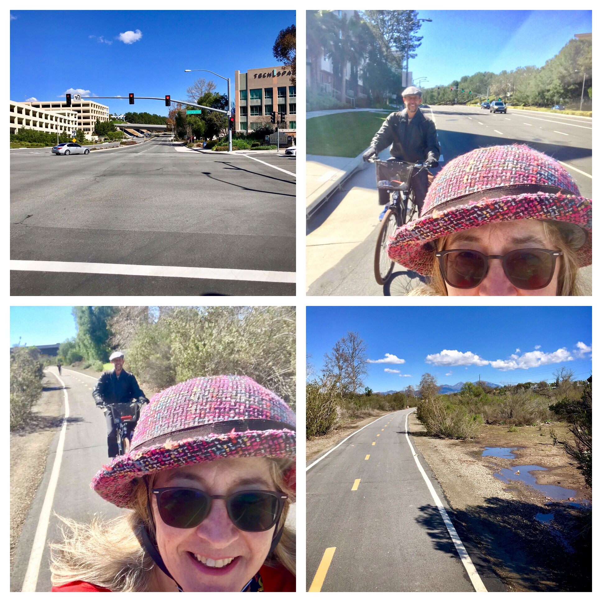
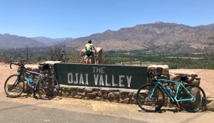
Alas, although we suffered some significant aches and pains, we both gradually recovered over the course of a few months, with the help of some physical therapy and determination. As of May, I had remained quite frustrated at what seemed then like a serious lack of progress. By June, I was feeling increasingly confident. So, on June 26th, we took our bikes to Ventura and road a 49-mile loop from Ventura to Ojai, on the Ojai Valley Trail, then on to Santa Paula, where we stopped for beer, and then a final leg back to Ventura. It was a hot day, and we covered more miles and climbed more elevation than either of us had done thus far in 2021, but we did it!
To make sure we could also handle back-to-back riding days, we got back on our bikes the following day. This ride was flat, but long, as we logged 69 miles by first riding the San Gabriel River Path down to Seal Beach, swinging through Long Beach with a stop for lunch, and then riding back on the Los Angeles River Bike Path. Our fannies felt it, but we were able to do it, and that was a big boost to our confidence.
The following weekend presented an opportunity to work on our climbing. I was not at all sure I could do this one, as the most challenging part of my recovery from the fractured pelvis was regaining the ability to ride uphill. Even the slightest inclines had been hard. But I did not want to miss the chance to ride Glendora Mountain Road / Glendora Ridge Road while it was closed to cars for the 4th of July weekend. This is one of those bucket list rides: spectacular scenery from an undulating ribbon of road that traces the crest of Glendora Ridge as you climb up to Mt. Baldy Village. I had only done this ride twice before. In 2019, I did it right after returning from my Colorado trip in which I rode from Denver to Estes Park and back, so, hey, I was definitely able to handle it that year. In 2020, I did it again, but struggled with the heat and had to stop frequently to keep from bonking, especially during that final slog to the top. I had no reason to think it would be any easier in my not-quite-fully-recovered state this year, but I did have a fancy new Bianchi Infinito carbon bike, giving me a chance to see if a lightweight bike might make it manageable. After 46 miles and 6,423 feet of climbing, I am proud to say we did it. I also PR’d the climb. Not too shabby.
With life and all that, the next few weeks’ training rides consisted of an occasional ride up to the Griffith Observatory or up Nichols Canyon, nothing too challenging. Finally, on the last day of July, we put in one last serious effort before the big trip. We rode south to San Pedro, up that steep little bugger of a hill to visit the Korean Friendship Bell, and then rode back up through Palos Verdes and along the coast, returning via the Ballona Creek Bike Path, with a final and very steep climb up to the Baldwin Hills Overlook. That gave us a total of 73 miles and 2,415 feet of climbing for a decent confirmation that we were ready to take on our big bike tour. Which is good, because that was our last opportunity to train for the tour.

Turning Our Road Bikes Into Touring Bikes
I had recently decided to put gravel tires on my Volpe, since I knew it could accommodate wider tires than the 28mm tires it came with. And with a newer, fancier, carbon Bianchi Infinito in my collection, it made sense to devote the Volpe to more adventurous riding on varied surface conditions and for touring. El Cochinito wanted to use his aluminum-frame road bike for our tour, and consulted with our local bike shop about how to adapt it for touring and riding trails paved with crushed gravel and the like. The shop was able to install a rear rack despite the lack of braze-ons, and switched out his 23mm tires with 25mm Gatorskins. They also did a bike fitting, and made several key adjustments to make long distance riding much more comfortable.
Getting our bikes to DC
We had our local bike shop tune up our bikes and box them for our flight to DC. That gave us confidence the bikes were packed right and protected for the journey. And I had planned ahead to find an airport transportation service that could handle getting two people and two bike boxes from our house to the airport, as we needed to get us to LAX very early on a Tuesday morning. I found one company that offered van service, and carefully reviewed the stated luggage capacity for their private van service. I almost booked with them, but then noticed a number of bad reviews complaining that the service did not show up for many of its customers, so I kept looking. I found another company that offered what appeared to be very similar private vans, but no explicit information about their luggage capacity. I figured a large van with no other passengers could surely handle us and our bikes, so I booked it. There was no FAQ or chat or phone number I could use to confirm that capacity, but then two days before our flight, the confirmation email did provide a phone number. I called to make sure we would be okay, and learned that, no, their vans were not big enough to meet our needs. Flummoxed, I decided to reach out to a bike friend who lives near the airport and ask if she could help. She was great about it. We drove our boxed bikes and ourselves in El Cochinito’s pick up to her house early the morning of our departure, and she rode with us to LAX. She drove the truck back to her house, and kept it there until time to come pick us up on the return. Thank you, Lynn, you’re a lifesaver!
At LAX, we donned our KN95 masks and drug our bike boxes into the terminal to get them checked in. We were flying American Airlines, whose baggage policy treats bike boxes like any other form of checked baggage – no extra charge just because it’s a bike. But, there was no clear indication as to where we should go with said bike boxes. We tried one line and then another, and when we eventually made it to the front of the line, we were told we hadn’t needed to wait in that line, but did need to take our bike boxes to a special drop off location. The check in agent was kind enough to walk us to this mysterious other location.
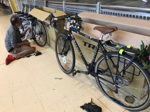
Our direct flight to National Airport in DC was uneventful, but all we had to eat on that flight was one Cliff bar apiece plus the cookies the airlines hands out. We were starving by the time we landed, but afraid to stop for food lest our bikes be picked up by someone else before we got to baggage claim. Once we had our bikes, we had to get to work assembling them, right there in the baggage claim area. The bikes were a little more dismantled than I had expected, and we had some work to do: reinsert the stem and tighten the handlebars so the bike steers straight, reattach the front wheel and the rear brake, replace the pedals, reinsert the seat post, and replace the bottle cages (arrgghh, why did those have to come off??). Finally, we had to reinflate the tires using my mini frame pump. Doing all of this is hard enough on a good day; doing it while sleep-deprived and hangry is a serious challenge. And that latter part, about inflating the tires, turned out to be a bit of a problem, but not right away.
DC & Maryland
We managed to get our bikes in working order, attached our panniers to the rear racks, and headed for the Metro station. We got our fare cards loaded up, a station attendant let us know that we needed to take our bikes around the side to an elevator to get to the platform, and we made our way to the Yellow Line train that would get us to Metro Center, where we could transfer to the Red Line. A lot of squeezing our two bikes and our two bodies onto elevators, but it was all doable. I was a bit confused by the DC Metro bike policy, as the center doors of each train had a “no bikes” symbol, but the center door was the only way to get to the wheelchair zone, which has enough space for the bikes. Does DC prefer that folks with bikes use the doors at the ends of each car and just stand in the aisle with their bikes? That didn’t seem to make sense, so we used the center doors. Luckily, our trains never got too terribly crowded.

We disembarked at the Grosvenor Station, and from there, rode our bikes 6 miles to Potomac, where our friends live. My bike felt a little sluggish, but I wasn’t sure if it was because I wasn’t that accustomed to my new GravelKing tires (although I did ride on them for the last few training rides), or because of the weight of my pannier and handlebar bag, or because my tires weren’t properly inflated. Or maybe I was just feeling slow in the way I often do when I can’t keep up with El Cochinito. We figured we’d borrow a floor pump from our friend to make sure the tires were adequately inflated, but then the floor pump couldn’t be found. Oh, well. We just pumped them up again as best we could with the mini pump.
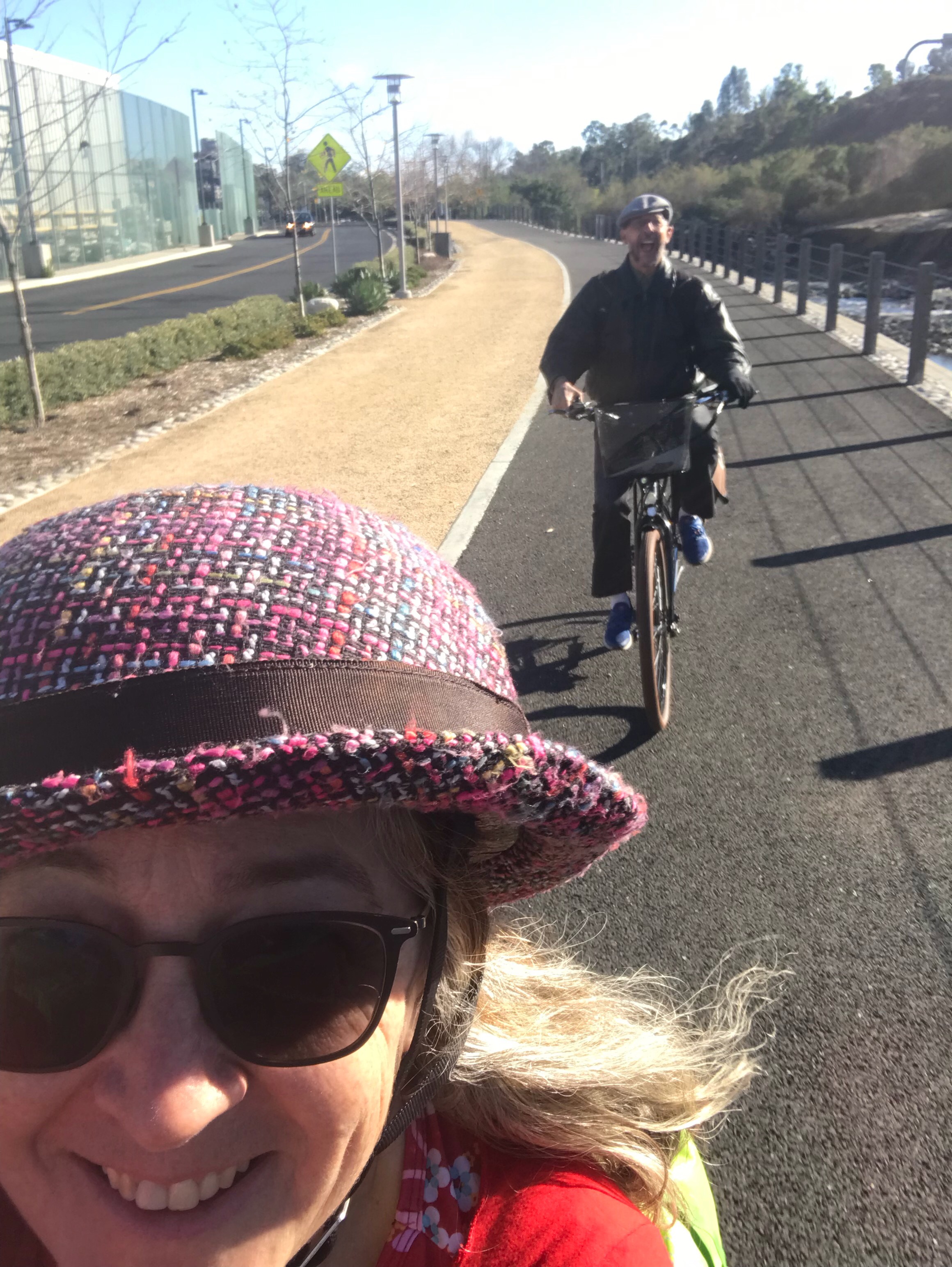
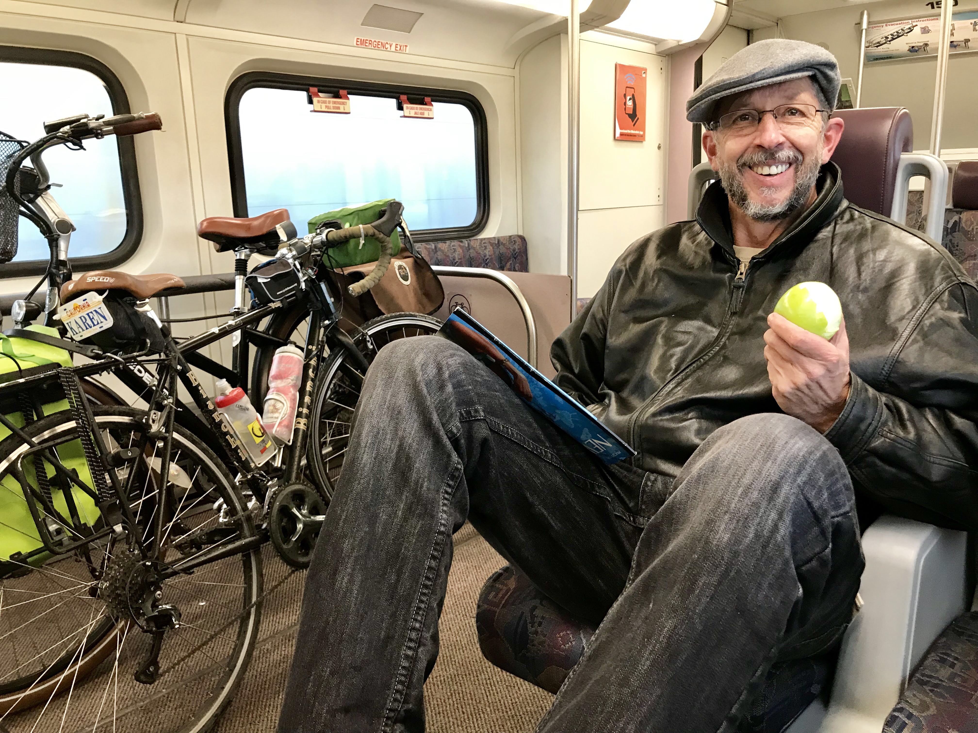
Taking Our Bikes on Amtrak
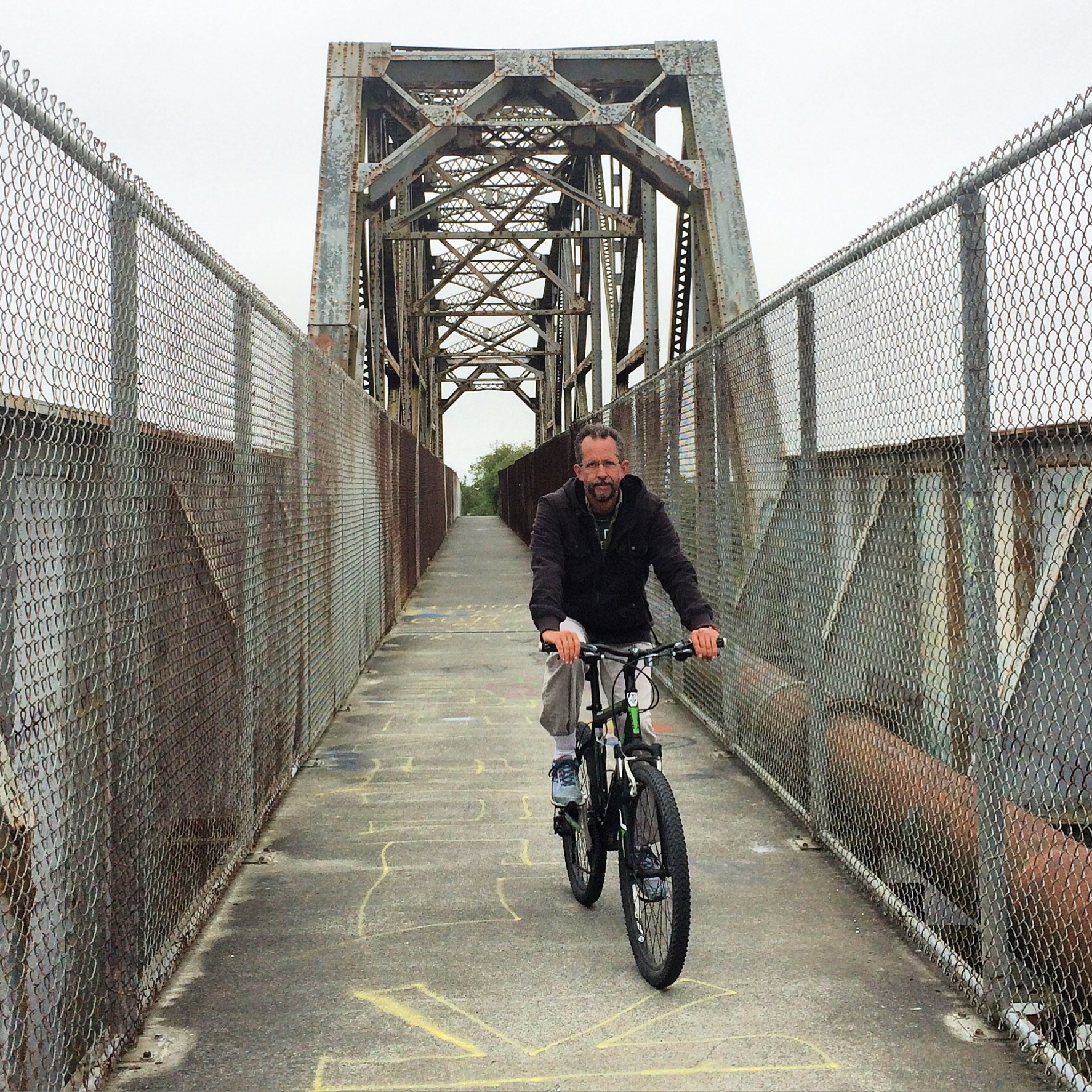
After two nights and a full day spent with El Cochinito’s old college buddy, we were ready to roll out, reversing our route to the Red Line, and taking that to Union Station. There we grabbed some breakfast and tried to figure out where exactly we needed to go in order to board our train to Philadelphia with the bikes. There was no guidance at the station, but once we got to our train, each door had a bicycle symbol by it, so we figured we could board anywhere. But it was not easy lifting our bikes onto the train, as we had to go up a few steep steps. Once on board, we could not see anywhere for our bikes to go. We ended up trying to make our way through the passenger car’s narrow aisle with our bikes and panniers – not easy at all, and a bit annoying to the other passengers, also trying to make their way to an available seat.
I kept looking around for a train attendant, conductor, or someone who might be able to give us a clue as to where we were supposed to put our bikes. We’d paid an extra $20 each for the bike reservation, and yet there did not appear to be any suitable place for them. Finally, in the second or third car we tried, there was an attendant. Her reply was to “put it in the bike rack”. I asked her where the bike rack was. She pointed in the direction of a luggage rack next to the restroom at the end of the car. I asked again where the bike rack was. She explained that I needed to move the luggage off the rack, and then put the bike in. That seemed odd. The rack had lots of large suitcases on it, and I started trying to lift them off, one-by-one, without losing control of my bike. It was a bit crazy and stressful, and I was blocking the aisle that was full of folks waiting to pass by in both directions. A woman came up to me and asked me why I was moving her suitcase, and I told her I was doing what the attendant told me to do so that I could park my bike there. She seemed rather miffed. After the shelves were cleared of luggage, it was possible to lift the two shelves up, revealing a hook against the back wall and a sign that said “reserved for bicycle storage”. Sure would be nice if that sign were visible when the shelves were down. The other thing we learned is that each car of the train has storage for only one bicycle, so El Cochinito had to keep moving on down the train, looking for an available bike rack.
Next, I had to lift my bike up to get the front wheel onto the hook. That was not easy at all. The shelves kept falling back down. I needed about six hands to be able to manage this maneuver. Luckily, a nice person helped me keep the shelves from falling while I lifted my bike. Even then, it was hard to get it aligned on its end and inside the little cubby and then get the front wheel onto the hook.

Once that feat had been accomplished, I wondered where and how I might be able to find El Cochinito. I start heading down to the next car, and the next, and the next, through a dining car, and on to the next passenger car, and so on. Finally I found him. Some kind conductor/attendant person had seen him trying car after car, discovering that each bike rack was already occupied by a bike, and they’d opened up another car at the far end, where he was able to store his bike, and also find us two seats together. At last, we were able to sit down and enjoy our train ride!
The two hour ride from DC to Philadelphia was interesting. We passed through cities like Baltimore, Maryland, and Wilmington, Delaware. I never tire of gawking at train stations and seeing the often older architecture of houses that are near the train tracks.
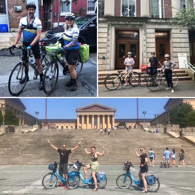
Philly
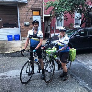
Our daughter and her fiancée met us at the 30th Street Station in Philadelphia, and guided us to the adjacent SEPTA station so we could hop onto a local train to get to our AirBnB. We had a little apartment that looked like it used to be a storefront, fluorescent tube lighting and all, that was conveniently right next to (literally right next to) the SEPTA elevated train tracks. The host had thoughtfully provided ear plugs with the apartment, for which I was grateful. The good thing about our place, besides being within walking distance of our daughter’s new digs, was that it was a street-level walk-up, making it easy to roll our bikes inside. I was most glad we wouldn’t need to heave the bikes up a skinny staircase.

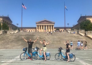
Our visit to Philly included time to do some exploring by bike with our daughter and her fiancée who had just moved there. They weren’t feeling ready to bike on all the city streets, but were interested in the bike path along the Schuylkill River. So we took SEPTA to get us closer to the Philadelphia Art Museum, where we were able to rent some Indego bikes. We rode north a few miles and back, got some ice cream treats, and then walked to Dilworth Park. We switched to SEPTA for the rest of our transportation needs, up until realizing, after dinner, that I didn’t have my SEPTA card with me. But I knew we still had time left on our 24-hour Indego rental, so El Cochinito and I decided to bike back to our AirBnb that night. Ah, but we were able to get some e-bikes at the Indego station, so then we decided to extend the ride and do a little more urban exploration. We rode through the Sharswood area (no, I’d never heard of that), and saw an interesting mix of older, modest buildings, and some quite new developments, including one that looked like a Virgin Atlantic version of an apartment building, complete with neon glow.
We finished off our time in Philly by visiting Reading Terminal Market, where I had my first whoopie pie, after which we did more walking, with some brief exploration of Independence Hall and Penn’s Landing. We did get on our bikes a bit that day, riding them over to a nearby bike shop to make sure we had reassembled our bikes correctly and to purchase some CO2 cartridges. We then continued riding to make sure the bikes felt right, and it was an interesting part of Philly we ended up exploring. There were moments when I have to admit I felt a little unsafe on my Bianchi as we passed through some rather desperate-looking neighborhoods. But we made our way right back to Fishtown and our AirBnb by following under the elevated train.

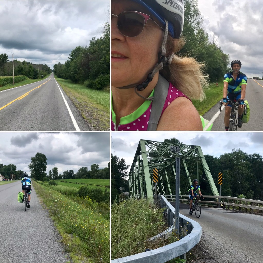
And the Adventure Begins: Philly to Long Valley, NJ
Bright and early on a Sunday morning, we packed up our panniers, rolled by our daughter’s place for goodbye hugs, and began our tour. We got an early start, as we knew we had 80 miles ahead of us, and we didn’t want to be rushed or worried about getting to our Bed & Breakfast in Long Valley too late to be able to enjoy it. As we worked our way out of town, a Dunkin’ Donuts offered just what we needed: breakfast sandwiches and coffee! We dined al fresco in an adjacent parking lot to get some social distance from the peculiar guy hanging out in front of the donut shop, and soon we were well-nourished and ready to roll. As we headed northeast out of Philadelphia, El Cochinito let me know that he had a surprise in store for me. I was filled with curiosity: would it be a funky old cemetery? A famous person’s house? A historical site? Some weird public art? I kept looking around me for clues.
It was fun seeing the varying neighborhoods as we got farther out. Two-story row houses are the norm throughout this area, but the style shifted to more porches; places that made me think of classic blue collar families, like the one depicted in All In the Family back in the 70’s. Then it shifted to a more industrial setting. Then I saw my surprise: Four Seasons Total Landscaping! The iconic “Four Seasons” where Rudy Giuliani held his rather infamous post-election press conference (which, by the way, has its own Wikipedia entry). It was a delight, indeed. The green awning over the door, the parking lot where the press conference was held that is so recognizable from the TV coverage, and, yes, the adult bookstore right next to it.
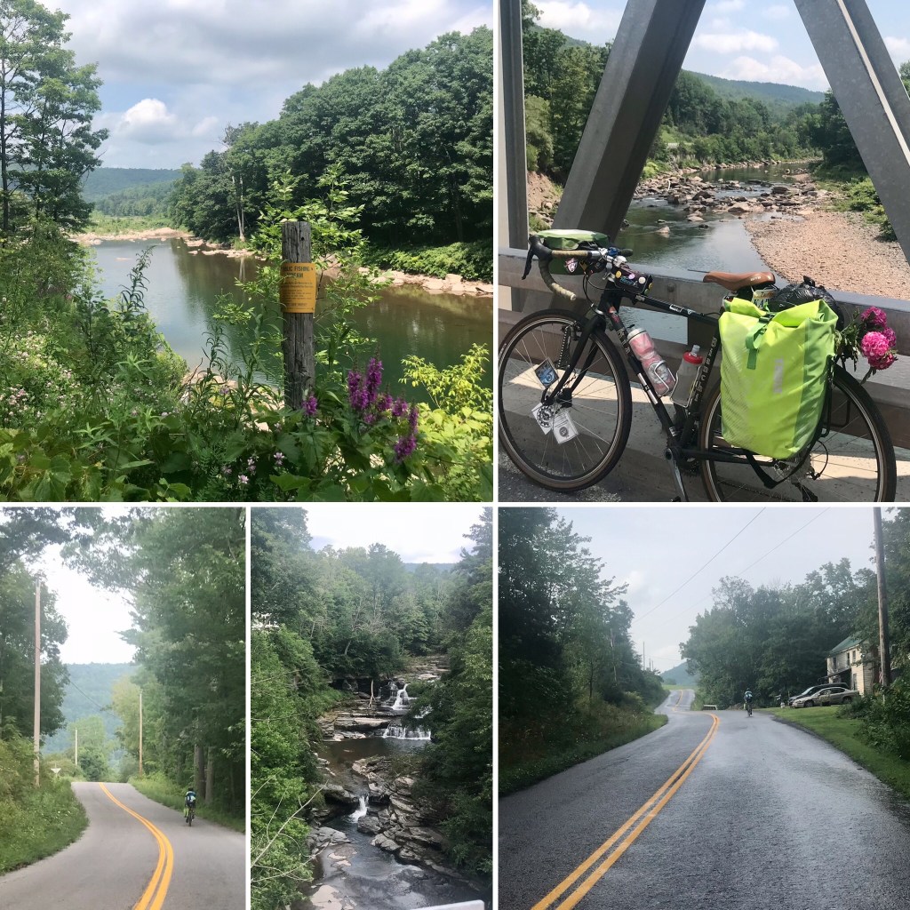
We rode alongside the Delaware River, taking our first little inadvertent detour when I saw a sign for the Delaware River Trail, only to realize I was following it into a park in the wrong direction. We doubled back to see that all we needed to do was continue straight from where we’d been in order to follow the Trail in the correct direction. It didn’t go for long anyway, but, oh well. Our next detour was entirely intentional: we turned left at Tullytown to explore the historic suburb of Levittown. The planned community of look-alike homes and curving streets was built in the 1950’s to provide suburban homes for the blue collar workers of the Delaware Valley, particularly as US Steel was opening a new division in the region. We saw a lot of white picket fences.
We continued northeast, delighted to hop onto the D&L Towpath / Delaware Canal Trail, which was beautiful. I was downright giddy. The earth had a reddish hue, the canal was lined with wildflowers, and the trail was enveloped by lush greenery. I noticed my new wider gravel tires felt a little mushy on this trail of crushed stone and dirt. Was that normal for this type of tire, or did I have a flat? I stopped to check, and sure enough, I had my first flat. The tire wasn’t completely flat, so I tried to see if I could pump more air back in, and keep pumping to the max, and see how much farther that would get me. I suppose I was hoping to make it to the end of the trail and find a bike shop to help me get it right. Alas, after stopping to pump more air into it a few times, I accepted that we would just have to fix the tire right there along the trail. El Cochinito did the dirty work for me, and we continued on our way. We were planning to turn right from the trail at a road that would take us over the Lower Trenton Bridge, but when we got to it, there was just a very steep staircase up to the street, and no way to continue on the trail. Our first google maps fail of the trip. We backtracked a short way to a parking lot we’d seen for a motel, and did a little wandering. Another cyclist helped us find our way to the bridge, and that brought us to an exciting moment: crossing the Delaware! We later realized that Washington’s army had crossed the Delaware much farther north, and then approached Trenton taking a longer journey southward from there. Nevertheless, after an awkward realization that we had to cross over to a pedestrian access on the far side of the bridge, we managed to complete our crossing of the Delaware, heading in to Trenton, where we stopped at the Battle Monument, and I learned a thing or two about the significance of the Battle of Trenton in the Revolutionary War. (You learn some things when your spouse is a history buff, whose graduate studies focused on the American Revolution.)

We continued on toward Princeton, and took our next little side journey at the Princeton Battleground, where we just so happened upon a tour. We were able to listen in as a tour guide explained the critical days between December 26, 1776, and January 3, 1777, culminating in the Battle of Princeton. After a fascinating history lesson, we decided to skip our planned foray into the town of Princeton, and continue on our way north. Good thing we moved on when we did, as a couple more flat tires, this time on El Cochinito’s bike, meant we were falling a little behind schedule, not that we were on a strict schedule, but, hey, the second flat left us realizing we were out of inner tubes, and that was a problem. Luckily, El Cochinito found, through the wonders of Google, a bike shop not too far away, in Hopewell. We decided I would ride on ahead to the bike shop to get ahold of some inner tubes, and El Cochinito would start walking and also see if he could get an Uber to take him and his bike to the shop. If not, I could ride back to him with the inner tubes.

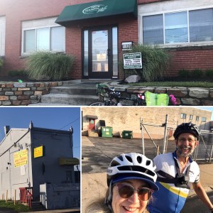
The bike shop, Sourland Cycles, was a godsend! The owner, upon hearing of our predicament, offered to hop in his car and go retrieve El Cochinito and his bike. First, he was kind enough to top off the air in my tires, and Mike confirmed my suspicion that we were riding on underinflated tires. My tires were actually even lower than I suspected, and very much in need of proper inflation. Mike pointed out that the frequent flats were a direct result of riding on the underinflated tires, especially when carrying the added weight of our panniers — likely the reason we were getting our flats in the rear tire. I browsed the store, used the restroom, and filled my water bottles while Mike went off to find El Cochinito. That was particularly good, since by the time I called El Cochinito to let him know help was on the way, he had just concluded that it was not going to be possible to put his bike into the Uber that had come to pick him up. The alternate rescue was successful, our bikes were put into good working order, and we stocked up on extra inner tubes and a few other just-in-case items before getting back on the road.
We revised our navigation to take the most direct route from Hopewell to Long Valley, our target destination for that first night. Of course, the only way to get into a valley is to go up and over whatever hills line it, right? So we were already more than 80 miles into our day’s ride when we got to the hill climbing part. That was not easy, but we did it, and we were very glad, no downright excited, when we finally arrived at the Neighbor House Bed & Breakfast in Long Valley, New Jersey! It ended up being a 91-mile day, about 13 miles longer than the original plan, and a total of 3,558′ elevation gain. Our hosts, Iris and Rafi, were most gracious, and brought us a pitcher of ice water to enjoy on their back porch while we savored some rest and recovery. We were much too tired to go out to dinner that night, and so ordered pizza for delivery. We thoroughly enjoyed that dinner!

Today’s tally: Dunkin Donuts spotted: 3; Flat tires: 3; Roadkill: 1 bird, 1 squirrel, 1 possum, 1 deer.
Sixty is the New Sexy: Long Valley, NJ to Unionville, NY
The next morning, I woke up a year older, and entered a new decade: 60. This brought up memories of the summer I was turning 50, when my goal was to get back into good enough cycling shape to be able to ride up Latigo Canyon (a favorite ride of mine that is a delight when I’m in shape, and a bummer when I’m not) by my birthday. Here I am, a decade later, and I’m tackling so much more. That feels good.
We enjoyed a delicious breakfast that included hard boiled eggs and fresh fruit, and said our good byes to Iris and Rafi. Iris had given us some tips about how to access the Columbia Trail from a driveway just across the road, rather than taking the longer way per Google maps. It was a beautiful morning, and I was excited about getting onto another bike trail, but the thrill went chill real fast. The Columbia Trail, at this segment at least, is a surface of big, loose rocks, much more suitable for a mountain bike than a road bike. El Cochinito was NOT happy, especially after all the flat tire trouble we’d been through the day before. I started getting nervous that this did not bode well for the rest of our journey. I began developing a steaming case of anger in my head, directed at our local bike shop guy back home who had convinced El Cochinito he could adapt his skinny-tired-aluminum-frame road bike for bike touring on trails. As soon as we got to an intersection with a road, we got off the trail and switched to Old Route 24. I was grumpy about being on the road instead of a trail, and struggled with thoughts running in my mind like: “What if the next segment of the trail was better and less rocky? or more beautiful?” “I was so excited to be riding trails on this trip, and now we have to ride on the shoulder and hope the drivers are nice. Is this what it will be like on all the trails?” “Why didn’t El Cochinito take my suggestion to get a proper touring bike for this trip?” Not a great state of mind to be in on the 2nd day of biking with my partner! But I knew the simple reality is that the trail was really rough, regardless of what kind of bike or tires we had, and it simply didn’t make sense to stay on it. No sense grumbling over what might have been anyway. Not that I was so quick to stop grumbling.
Soon enough, we got to the turn off for Bartley Road, where we would have left the Columbia Trail by the originally planned route, and the roads were fine, and we were fine. I was able to snap out of my silly little funk and embrace the beauty that surrounded us. The valley was lush and verdant, and we knew at some point soon we would need to confront the inevitable landscape feature essential to getting out of a valley: some kind of steep-arse hill. We turned off Bartley Road, and quickly took a second turn onto Tinc Road. Just like that, it was time to get down into low gear. Make that the lowest possible gear. Thankfully, the Volpe offers very low gearing, without which, I probably couldn’t have done that climb. It was hard, I mean really hard. Looking back now at the elevation profile on Strava, I see that the grade at the beginning of that climb was 18.6%. It was a little curvy-windy, and I dreaded the thought of some car trying to come down this narrow, winding road toward us while we were struggling our way up. Luckily, that didn’t happen. I also worried that I might reach a point of not moving forward enough to keep from tipping over. I considered getting off the bike and walking the rest of the hill, but dismissed the thought as it would likely be even harder to walk my loaded bike up that steep hill, especially wearing cleats. Plus, it was hard to tell how much longer the uphill would continue, and if I stopped riding, it would be that much harder to start up again on such a steep incline. I pedaled on.
We reached a slight leveling off point and took a rest at the entrance to someone’s driveway. Sweat came gushing down my face. It took me awhile to catch my breath and mop up the sweat. We guzzled some water, slurped energy gels, and collected our strength to finish off the hill. The rest of the climb wasn’t quite as hard, and once I realized I’d made it to the top, I stopped again to savor my triumph and snap a selfie. Another gushing stream of sweat rolled down my face, but I was exhilarated. THIS is what sixty looks like!
We had a glorious ride the rest of the way. We rode the Sussex Branch Trail, which treated us with a lake visible through the trees to our left, a nice crushed gravel surface that was great for riding on, and a bright green assortment of shrubs and trees lining our path. Eventually, we had to leave the trail to head north on Ross Corner Sussex Road, which had a decent shoulder. It was deceptively smooth, however, and at some point El Cochinito hit an unexpected something while we were traveling at a good clip. Shortly thereafter, he realized he had another flat tire. At least by now, he had gotten real efficient at changing a tire, plus we were finally equipped with the know-how to use a CO2 cartridge to get a proper inflation. Soon we were back on the road and continued to enjoy decent pavement, right up until we crossed the state line and entered New York. What a night and day difference in road quality! Suddenly we were navigating potholes, cracks, and bumps in the road.

Not far over the state line, we rolled into Unionville, our destination for the night. It has a cute little main street, where we noticed the Wit’s End Tavern before turning up (oh, yes, UP!) towards our AirBnb. Our host for the night, together with her young daughter and her daughter’s friend, greeted us with warmth and enthusiasm, and lots of “HAPPY BIRTHDAY” greetings directed at me (I guess a little birdie told them), and a tour of their lovely historic home. There was even a bottle of wine waiting for us in our room. After showering up, El Cochinito and I walked back into town and enjoyed a birthday dinner of barbecue ribs, fries, and beer. We returned to our room and tried to enjoy the wine that awaited us, but we could only handle so much alcohol in one night. Normally, I would just save it for another day, but when you’re on a bike tour, you have to be selective about what is worth adding weight to the bike. A half (or maybe a little more) of a bottle of wine is not worth carrying along!

Day 2 of our 8 days of biking took us 51 miles and 2,462′ of elevation gain. Good that it was a little shorter today, as our tushies were feeling it. So glad we brought along the Bag Balm.
Today’s tally: flat tires: 1; Road kill: 1 bird, 1 possum, 1 deer.
Enjoy the Ride: Unionville to Olivebridge
We had been so worried we might have underestimated the challenge of biking in the heat and humidity that would be typical for August in the Northeast. The forecast for this particular day included a heat advisory starting in the late morning, and in the area where we were headed. We decided to get an early start and seek out breakfast later.
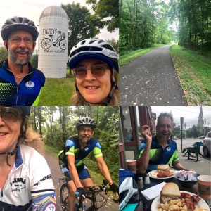
That next morning, as we left Unionville, we were graced with a soft cloud cover as we rolled through farmland on gently rolling terrain. It was such a gorgeous day, and so far, so cool. One of the farmers whose home we passed must be a cyclist, or at least a supporter of cyclists. When we saw their silo, we absolutely had to stop and snap a photo. That blissful roll through farmland came to an abrupt end when we next had to manage a tense three-mile stretch on US6-E. We rode the narrow shoulder, alongside a couple of lanes of fast-moving traffic that emanated that familiar tension of impatient drivers in no mood for giving ample space to cyclists. It was stressful and miserable, but thankfully it didn’t last forever, or even for too terribly long, and despite feeling quite unsafe, we managed it without incident. Best of all, it was followed by a tranquil mile or two on the lovely Orange Heritage Trail, a freshly paved, forest-lined trail that took us into the town of Goshen. There we headed for Joe Fix Its, a bike shop, where we stocked up on CO2 cartridges and a few extra inner tubes for good measure. Conveniently, right next door was a cafe, just when we were feeling ready for a hearty meal. Howell’s Cafe has outside tables, allowing us to sit right by our bikes, and enjoy the beautiful architecture of this quaint town. As we rolled on through Goshen, we got more architectural eye candy, a feature that puts Goshen on my list of favorite towns to bike through.
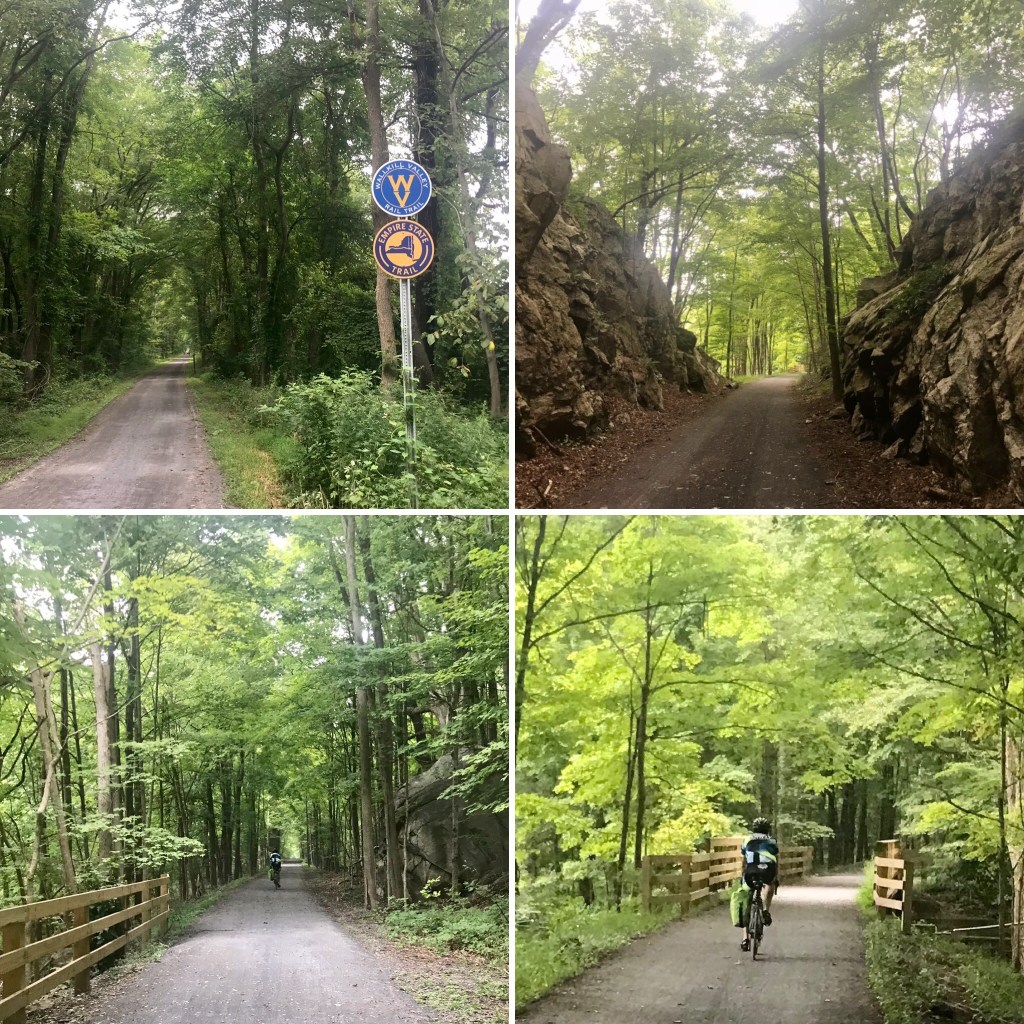
We later got to ride some more nice trails. First up was the intermittent Shawangunk, Walden, and Wallkill Trail. Some segments of this trail are quite civilized, with pavement, benches, and good signage. A few spots were a little more adventurous. The beauty didn’t let up throughout. The best part of the day, however, was the 15-mile stretch on the Wallkill Valley Rail Trail, which forms part of the Empire State Trail that covers 750 miles running the length and width of New York. We took a rest stop in New Paltz, which has a colorful and quaint pedestrian zone of shops and eateries.

The trail continues through some gorgeous scenery and several beautiful bridges, and these visual treats only got better the farther north we rode it. The most spectacular was the Rosendale Trestle, a 940′ former railroad bridge, first built in 1870, that runs 150′ above Rondout Creek. I would gladly go back and ride this trail again.

Following our rail trail thrills, we had another 10 miles of rolling hills before we got to Olivebridge, where we had booked a small fishing cottage for the night. There isn’t a whole lot of commercial activity in Olivebridge. We saw a post office, and not much else. After our 67 miles of riding, we were ready for a good dinner, but discovered there were no stores or restaurants of any kind that were open in the area. We certainly did not feel like biking another 30 miles round trip to get dinner. Oops, now what? We searched the kitchen of our little cottage. There wasn’t much in the cupboards or the refrigerator, but we scored when we looked in the freezer: a package of boneless, skinless chicken breasts, a half a bag of curly fries, some sliced pineapple, and a little bit of vanilla ice cream at the bottom of a pint container of Ben & Jerry’s. El Cochinito found some garlic salt to season the chicken breasts that he fried up in a skillet, while I put the curly fries in the oven. Before long, dinner was served. Perhaps it would have been nice to have the rest of that bottle of wine with us from the night before, but we were just grateful we had managed to pull together a meal. I hate to think what we would have done had it not been for those freezer finds. There may have been some reference to the Donner party during our conversation that evening.

Miles: 67. Elevation gain: 2630′. Flat tires: 0. Roadkill spotted: 1 bird, 2 beavers, 2 mice, 1 bunny, 1 unseen, but quite odiferous critter, species unknown.
What’s a Few Extra Miles: Olivebridge to West Fulton
We split our remaining Cliff bar for a quick breakfast and got a bright and early start on another beautiful morning. We knew we were near a big butterfly-shaped lake, so the first order of business was to check out that expanse of water. Olivebridge borders the southern shore of the Ashokan Reservoir, below the lower left wing of the butterfly. This puts it at the opposite side of the reservoir from Woodstock, New York, a place of which you may have heard, positioned a tad north of the upper right butterfly wing. We had initially considered routing our trip through Woodstock, but the accommodations in that area were quite pricey. Now we know that, perhaps one feature that justifies the extra cost of accommodations in that northeastern side of the reservoir is availability of restaurants and markets, but we don’t really know.
Shortly into our ride, we veered right to explore a bridge that angles along the edge of that butterfly’s lower wing toward the middle of the reservoir. It was a tranquil morning. Scattered clouds reflected off the glassy surface of the lake. Eventually the bridge crossed well above a creek passing through a crack in the middle of a densely packed forest. We took a few minutes to savor the magic of that moment, the spiritual power of the stillness.
Our route began by tracing the left wing of the butterfly. Once we hit the northwestern wing’s tip, we turned southeast for a bit on NY-28, in search of the Bread Alone Bakery so we could get some real food for breakfast. We passed the Boiceville Inn, which didn’t appear to be open, a construction site, and then came upon Fabulous Furniture and their funky roadside display of flying saucers, rockets, and other attention-grabbing sculptures. As the detour dragged on, it became apparent we needed to double-check the google maps. Sure enough, we had flown right past the Bread Alone Bakery — it was hidden in the middle of that construction site. It turns out to be a very popular spot. The parking lot was busy, the line to place an order was steady, and the coffee and baked goods were well worth the detour.

That turned out to be just the first in a series of google maps anomalies and unintended side trips for our day. But we were riding through the Catskills, and the scenery was non-stop luscious. Pretty wildflowers lined the shoulder of NY-28. Dense forests provided a dark green backdrop for the wildflowers and tall grasses. More dark green rose up over mountains all around us as we continued north.
The road curved right, and took us a bit southeasterly to Lexington, where we crossed a bridge over Schoharie Creek, before turning left to continue our northward journey. We were out of water at this point, and I was hopeful that the town of Lexington would have a place where we could refill our bottles. Just after crossing the bridge, we noticed a couple of women sitting on a front porch. We asked if they knew where we might be able to buy some water. They offered us their garden hose, which was wonderful, especially since Lexington didn’t seem to offer a market or other amenities as I’d hoped. We got into some extended conversation with our porch-sitting friends, and learned about the challenges that community faces when the Schoharie Creek overflows. They told of a recent flood that required evacuation, of particular concern for them, as one of them uses a wheelchair. As bad as it was for their creekside home, they said the flood pretty much wiped out the town of Prattsville, farther up the road.
After filling our water bottles and learning about the local communities, we got back on our bikes and continued north. As we approached Prattsville, we could see a number of homes and buildings that looked as we’d been told–likely too damaged to be saved. The town also turned out to be a good place to get lunch, and I liked the idea of supporting this community that has been through an exceptionally rough year. The folks at the Prattsville Diner were friendly, and the food hit the spot.
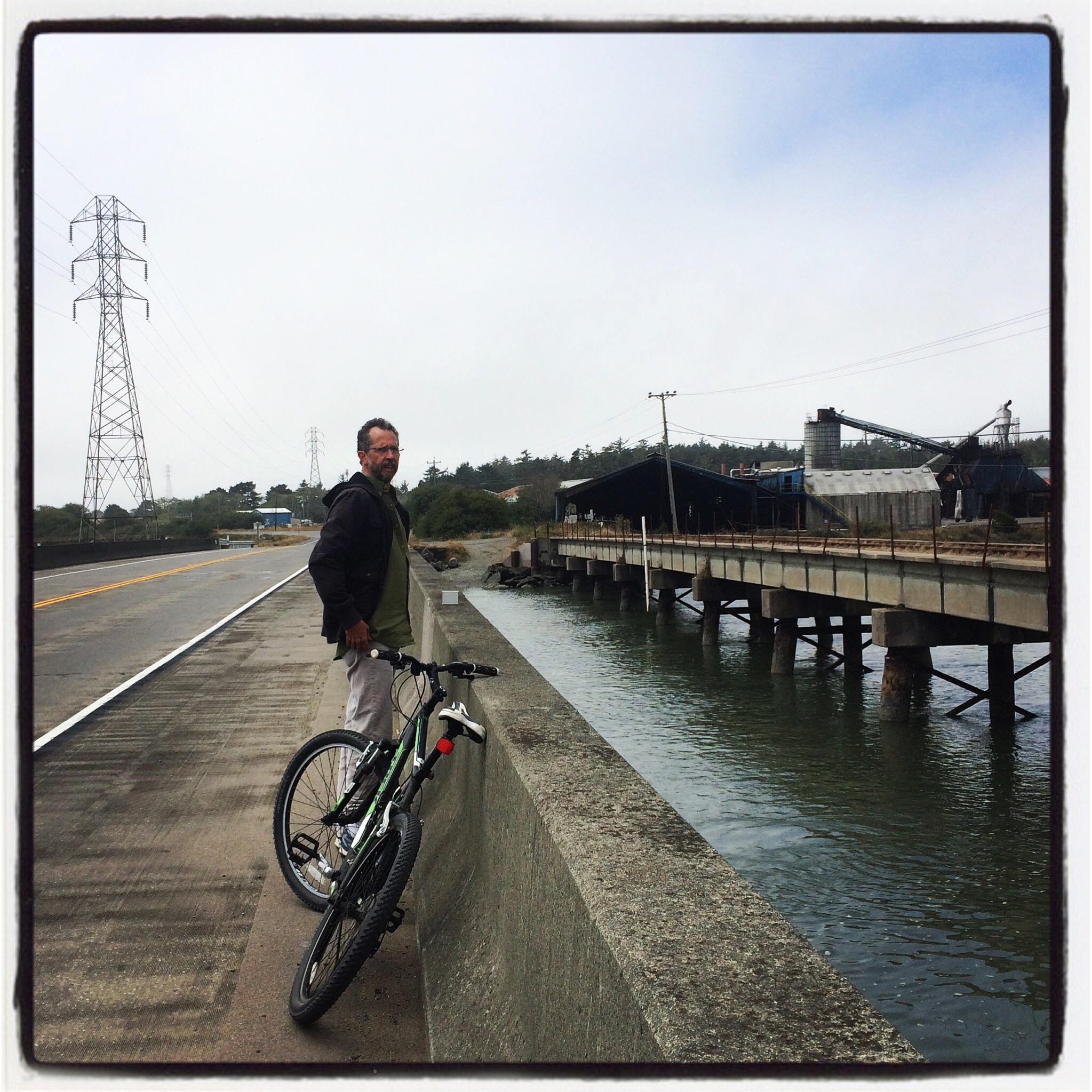
The gorgeous scenery continued. Soon the Schoharie Creek widened to form the Schoharie Reservoir, and Google Maps had guided us to take a less-traveled road, 990V, along the west side of the reservoir that appeared to give us a more direct route to West Fulton, our destination. North of the reservoir, at Gilboa, the routing had us veer right onto Flat Creek Road, which fed us some hills. We then turned onto Valenti, which fed us some more hills. This led us to Power Access Road, the name of which was our first big clue. El Cochinito had raised a concern about the wisdom of a route that required using a road with such a name, but by the time we were having that conversation, we were already at the turn off to Valenti, half way into that hilly commitment. I couldn’t resist giving it a try, as this route seemed to take us on less busy roads.
Alas, at the junction with Power Access Road, we encountered a large, high-security gate, where we picked up a telephone, hoping against hope that someone on the other end of the line might mercifully let us through, or at least guide us to an alternate route. Unfortunately, we were told in no uncertain terms that there was no way through, no matter that we were on bikes and needing to get through to NY-30. We proceeded to re-trace Valenti Road and Flat Creek Road, hills and all, back to 990V, which unfortunately dipped back south a bit before connecting us with NY-30. I know El Cochinito loves me because he never once said, “I told you so.”
The ride up NY-30 was okay. Sure there was some traffic, but not too bad really. We encountered some light sprinkles that never quite turned into full-on rain. We then turned off onto Bear Ladder Road, which was pretty, lined with dense, dark greenery, and featured a series of rises, like a compound hill. By this time, my knees were really feeling the Catskills. I wasn’t sure I could manage any more hills. I began to worry that I was doing some damage to my knees that could prevent me from being able to keep biking — an unacceptable possibility. I was glad to know we would be taking a couple of rest days in West Fulton, hoping that the rest would be enough to restore my knees.
Bear Ladder Road was a 5.5 mile stretch, by the end of which we were damp with the mist of a light rain. I was excited, knowing we were almost to our destination. According to Google Maps, we needed to turn left at the T intersection onto West Fulton Road, and our destination would be on our right in 0.5 miles! But as soon as we looked left, we saw the steepest hill of the day. Okay, not a hill, really, more like a WALL. If only that white house at the intersection with Bear Ladder Road was the Waterfall House we were seeking. But, recognizing there was no point in entertaining such fantasies, I mustered up my courage, dropped into my lowest gear, and reminded myself that, after this one last hill, we would be done biking for the next few days. We powered up that horrendous hill, searching for the address we had for the Waterfall House. But there were no houses and no driveways or even mailboxes on the right, none at all. Finally, El Cochinito stopped a pick up truck that was driving by, and asked the driver if he could help us find the Waterfall House. He kindly informed us that it was that white house at the bottom of the hill! Once we dropped back down the hill to have a good look at that white house we’d passed, it was obvious from the objects sitting out on the porch that this was the place where our friend Lazaro lives.
So, that made two Google Maps fails in one day. Three, if you count our overshooting past the Bread Alone Bakery that morning. With that, our planned 60-mile, 2600’ day became a 70-mile, 4600’ day. Today’s tally: 0 flats; Roadkill: 1 beaver and 1 porcupine.
Rest Days in the Catskills
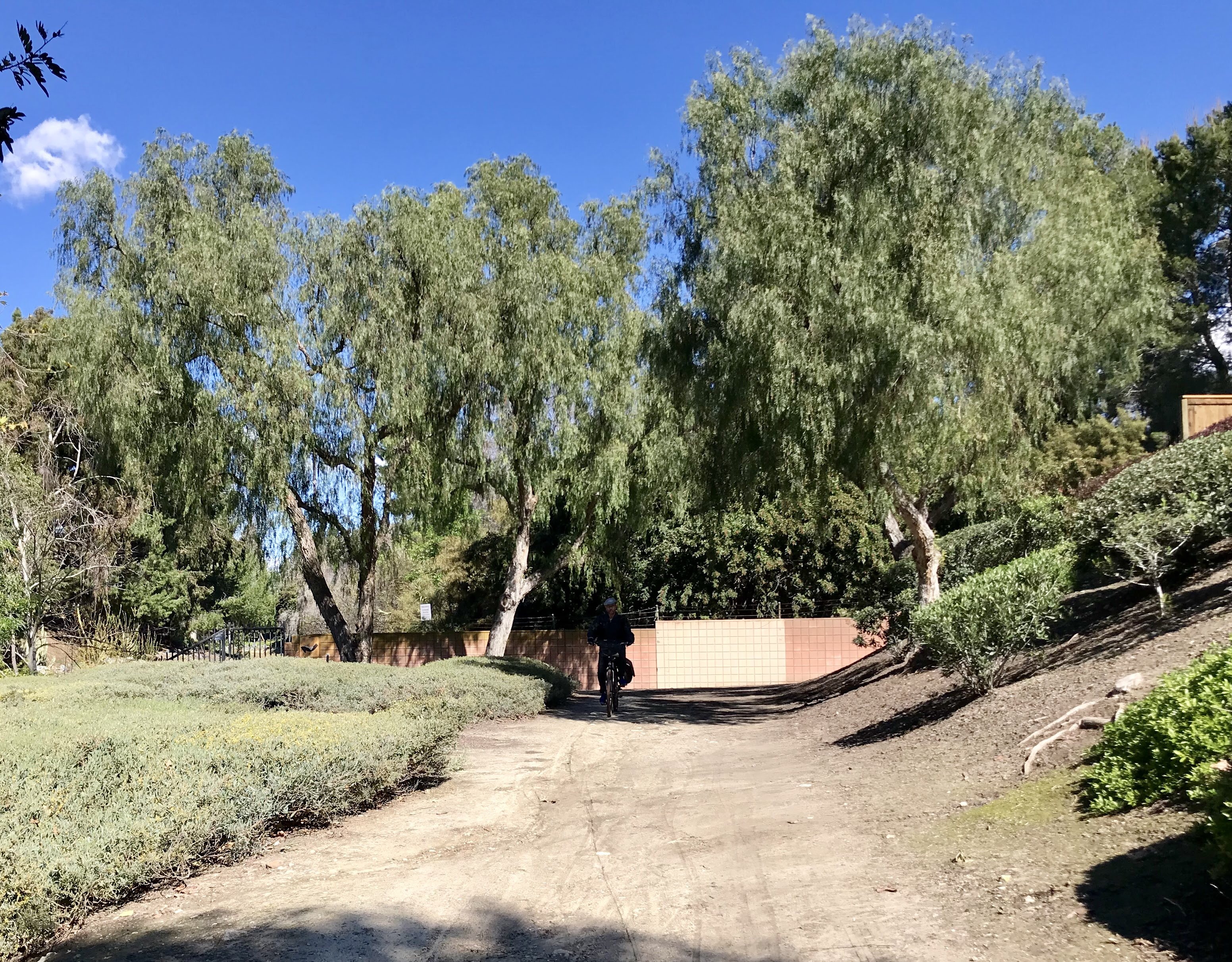
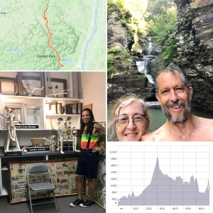
The whole reason we routed our trip through the Catskills was to work in a visit to El Cochinito’s brother from another mother, Lazaro, who had moved to West Fulton this past year. The two met back in 2013, on El Cochinito’s first trip to Cuba, when he was taken by Lazaro’s artistic creations: his salsitas, formed from string, paste, and the official newspaper of the Cuban government, and which come to life as delightful creatures with big, mouse-like ears, pointy noses that curve upward, and extended arms that exude joy. Since then, we have visited Lazaro in Havana, and he has visited us in Los Angeles, including a stay of a few months just before the pandemic shut everything down. It was great to see him again, meet his boss and the pets of the house, get some laundry done, and visit the adjacent waterfall. The Waterfall House is an historic treasure that served as a Bed & Breakfast for many years, and has a magical quality to it. Part of its magic comes from its furry inhabitants: a fun dog and two cats, one of whom seems to be a dog living in a cat’s body.
The highlight of our stay was a trip to nearby Cobleskill, where the Jeff Tufano gallery was exhibiting some of Lazaro’s work. It was a delight to see his work on display there, and then to walk the cute main street of Cobleskill. On our way back to West Fulton, we stopped at the Breakabeen General Store — a real general store, as in very small, yet carries everything you need. We even filled the car’s gas tank at an old timey (pre-digital era) gas pump right outside the store. Yes, these things are thrilling after living in Los Angeles for the last 25 years.
There was some heavy rain during our two days of rest in West Fulton. The afternoon before we were to get back on the road, I gave the bikes (that had spent the last couple of days on the porch) a look-over, wiped down the grime, topped up the tire pressure, and made sure our steeds were in good working order. El Cochinito’s chain had gotten a bit rusty, so I cleaned that up a bit and applied some Tri-Flow. It felt good to acknowledge, through time with the bikes, where we’d been and where we had yet to go.
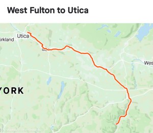
Onward to the Erie Canal Trail: West Fulton to Utica
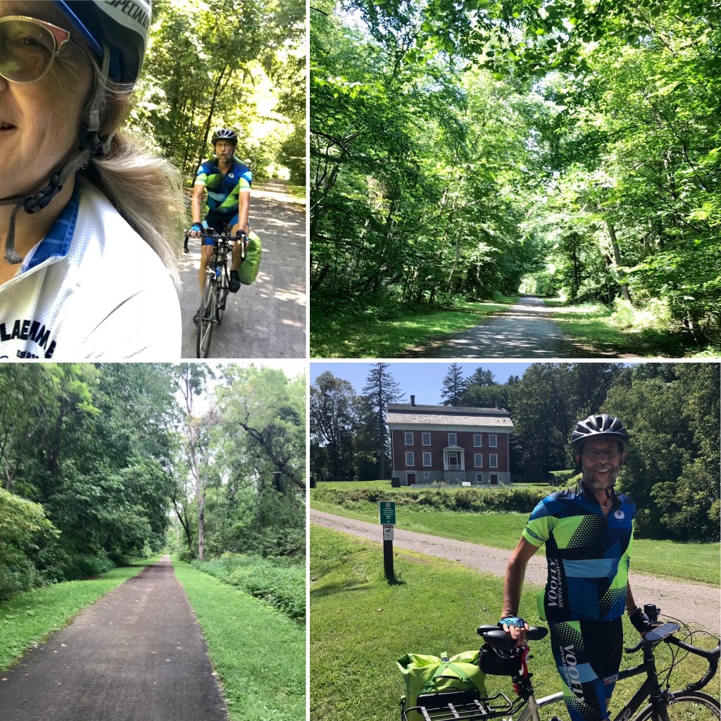
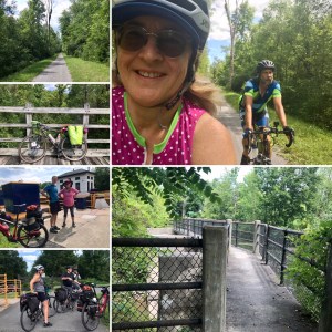
We woke to a gorgeous morning. I was struck by the beautiful puffs of steam rising over the hills in the distance as we rolled north out of West Fulton. We’d had a choice between a longer route and a couple of shorter-but-hillier options. We chose the longer route, taking route 30A through Middleburgh, Schoharie, and Sloansville. That was an excellent choice! We rolled along, up and down gentle grades. After Sloansville, we curved onto Route 162, which angled us northwest toward the Mohawk River near the town of Spraker. Just before Canajoharie, we got onto the Erie Canal Trail. That was exciting, as we knew this was a relatively flat trail that would take us all the way to Rochester. My knees were relieved to know that we were done with hardcore hills. We stopped for a yummy breakfast in Canajoharie.

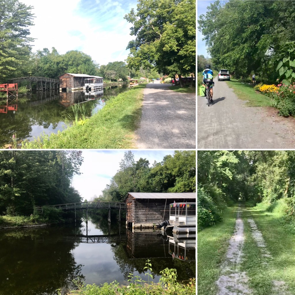
The trail was delightful and peaceful. We continued along the Mohawk River. At times the trail veered through parklands, and led us past the home of General Herkimer, where we learned a wee bit about the Battle of Oriskany, another tidbit of Revolutionary War history.
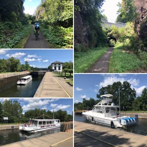
We rode through Ilion, where we encountered some other cyclists riding the Erie Canalway in the opposite direction. At Ilion, there is a substantial park area and a Marina with facilities, including restrooms and water. While stopped there, we met two enthusiastic bikepackers, Mohammed, who had started in Niagra Falls and was riding the Erie Canal Trail all the way to Albany, and Tekken, who had started his journey in Astoria, Oregon, and was riding all the way across the country, self-contained. We continue to follow each other on Instagram. We watched some boats pass through the locks, including one notable fancy boat with four engines across its stern heading westward, “Destination Blue”. We watched Destination Blue rise as water filled the lock and a woman made sure the boat stayed clear of the wall we were looking over. We chatted a bit with her, and then watched Destination Blue move on when the lock opened up on the west end.
At Frankfort, the Trail crosses over to the north side of the Mohawk River, and riders have to take the shoulder of NY-5. That last part of the ride, well, it sucked. The shoulder really wasn’t adequate, the traffic was moving fast alongside us, and it was quite unpleasant the rest of the way to Utica. We did enjoy a brief stretch “drafting” behind an Amish horse-drawn carriage, where we felt safer for awhile. It was a short-lived thrill, but we made the most of it.

At the end of our 80-mile day, we rolled in to the historic Pratt Smith House Bed & Breakfast. We arranged for a delivery of burgers and fries from Five Guys, and called it a day. Today’s tally: Dunkin Donuts: 1; flats: 0; Roadkill: 1 bird, 2 frogs, 2 unrecognizable mammals; Elevation gain: 2,055’
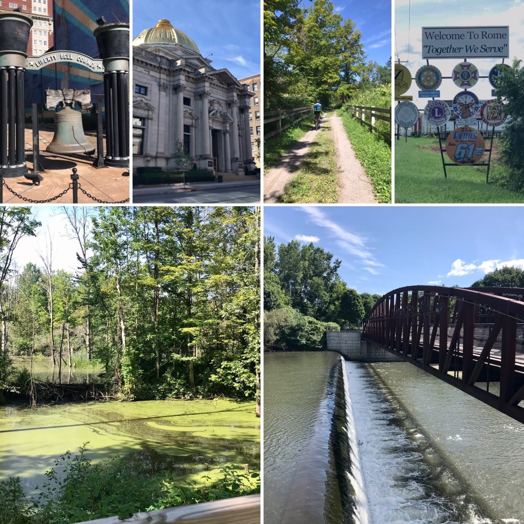
All Roads Lead to Rome: Utica to Syracuse
We had less miles and no hills in our route today, so we took it at a leisurely pace. We wandered a bit through downtown Utica, just to check it out. I hadn’t known before this day that Utica has its own replica of the Liberty Bell, cracked and all, on display in downtown. This little detour put us past the turn off for the designated bike trail along the water, but we enjoyed seeing the various industrial and residential neighborhoods as we headed west out of town on city streets. We rode through Yorkville, then Whitesboro, and Oriskany (as in, the battle site). We eventually got back onto a trail, and headed into Rome. Not that it was glamorous in any way. It was more like being on a trail, and then riding through a suburban stretch of strip malls and ridiculously wide roads. Then, at some point, we needed to turn left off of the over-wide, multi-lane road to get back onto the trail. A strange left turn, with no assistance from a traffic light or clear signage.
Later we met more trail riders at another of the locks along the canal. It was fun to meet people, find out where they’re from, and hear that we weren’t the only ones wondering why there weren’t more places along the trail to get water. One couple we talked to lives in Utica, and does a different part of the trail here and there, scoping it out for a future trip in which they plan to do the whole Erie Canal Trail from end to end.
We took a slight detour south from the trail to check out Oneida. It’s a quaint little town, and we found a cool place to stop for lunch and beer, called Pop-A-Top. We picked it mostly because they have an enclosed patio, which provided a perfect spot to park our bikes. It was also a colorful and festive patio, and we had it to ourselves. Then we came to realize that the regulars hanging out at the bar inside, as well as the woman tending bar, were delightful people who wanted to ask about our bike trip, and made us feel quite at home, despite our spandex and cleats. One gentleman came out to the patio to visit with us some more, and even bought El Cochinito a second beer.
After that thoroughly leisurely and enjoyable lunch break, we returned to the trail, and rolled on next through Canastota. Like in many of the towns we rode through on this trip, we saw LOTS of American flags on display, both on residences and lining the main streets through a town’s central business district. It felt like the 4th of July everywhere we went. Another interesting find along the route from Oneida to Canastota: the largest greenhouse imaginable, or maybe even larger than one could imagine. A google search reveals that the place is Green Empire Farms, a giant hydroponic farm.
We enjoyed the varying terrain and trail surfaces we encountered along the way. Spinning my pedals for all these hours gave me lots of time to let my mind wander. I know some folks like to chat while riding together, and I don’t mind that, but my primary tendency is to get lost in the meditative state induced by the rhythm of the pedal stroke. My thoughts can go just about anywhere while I’m riding. I might try to imagine the day ahead, or what it will be like to reach our destination and see the faces of our kids again after such a long gap. Sometimes I look back on all that has transpired in the previous year or two. Just two years earlier, El Cochinito and I had gone through the most challenging strain on our relationship, one that nearly broke us. One of the things that helped us as we found our way back to each other was biking together. And look where that led us! Sometimes I reflect on how amazing it is that I have a riding buddy to do this kind of trip with me, and that we can do this without getting on each other’s nerves. At times, I am overwhelmed with gratitude for being able to do this trip. It’s incredible how all that needed to line up and fall into place for this trip did just that.

Eventually, we came across a trail side repair stand that had a pump, enabling us to top off the air in our tires. That pumped up our confidence as well as our tires. In the late afternoon, we rolled into Syracuse where our AirBnb host graciously offered use of his washer and dryer, and guided us toward a nearby street with places to get dinner. It was nice to be able to walk to dinner, and to get some clean clothes again. We were staying in a nice neighborhood near Syracuse University, and took delight in the way the medians through the center of Meadowbrook Drive are not only beautifully landscaped with flower gardens at each intersection, but also feature odd sculptures, like one of a basketball with a big “S” on it. Another had a tower of colorful bird houses.

Today’s tally: 66 miles; no roadkill; no flats; 1 Dunkin’ Donuts.
Charm, Gardens, History: Syracuse to Canandaigua
We swung by Recess Coffee, a place we’d spotted when walking back from dinner the night before, to get our morning coffee and a bite to eat. From there, we decided not to head north through town in order to get to the Erie Canal Trail, but instead to just take the most direct route west out of town. We were pleased with that decision, as we rolled through some older, industrial areas, and through some less affluent residential areas. I loved gawking at the changing architecture and neighborhoods along the way.
Somewhere between Fairmount and Camillus, we got back on the Erie Canal Trail. The trail is especially beautiful in this area. Camillus wins for the most picturesque stretch of trail, with its bridges and boathouses. We passed several areas where flower gardens were being actively cultivated along the trail. Thanks to some large murals in Jordan, we learned a bit of the history of the canal in tis area, and why within 10 years of its completion it was obsolete. The city of Jordan has an impressive aqueduct built in the 1840s as part of the Enlarged Erie Canal that was in use until 1917. It is now a park, with grass covering the surface of the aqueduct, punctuated by stone arches. We continued along the Erie Canalway through Weedsport and Port Byron until the trail started to veer north, whereas we wanted to continue west and slightly southward into the finger lakes region.
We hopped off the canal trail and rode some rolling hills, past farm after farm, enjoying an easy spin for the remaining 40 miles to our destination for this second to last day. We stopped for that night in Canandaigua, a very charming town that’s close enough to Rochester, we invited the kids to come out and join us for dinner. First we hung out in the back yard of our Airbnb to visit a bit. There aren’t words for how good it feels to see and hug your kids after such a long time apart. It was a Monday night, and finding a restaurant that was open wasn’t easy. On our third try, we got lucky, as the Bee Hive Brew Pub was open, and we were able to get a table on the patio. Turned out to be just the ticket.

Today’s tally: 72 miles, 1 Dunkin Donuts, 0 flats, Roadkill: 1 skunk, 1 possum, 4 mice, 2 birds, 2 cats, 1 frog, 1 squirrel.
Rolling in to Rochester
We could have taken a direct route from Canandaigua to Rochester, and finished off the tour in just 27 miles. But that’s just not how we roll. For one thing, it would have meant no more riding the Erie Canal Trail. For another, 27 miles would be over in a little more than two hours. First and foremost on my mind that morning was realizing that we had gone out of our way to venture into the finger lakes region, and yet we hadn’t seen any of the lakes. People travel to Canandaigua to experience the big, beautiful lake, so we were not going to just leave town without seeing the lake! I looked at maps for a route that could have us biking alongside the lake, but that just wasn’t practical. We would have to travel pretty far south to get to a park or something to “see”. We decided to just ride by the north end of the lake so we could have a look and then be on our way. It’s an astonishing lake; you can’t see from the north end to the south. It was a cool morning, and once we’d had our look at the lake, and felt the wind blowing around, we were ready to get on with our day.

Canandaigua features a lot of gorgeous old homes that provide pleasant eye candy for the ride through town. I routed us by the famed Sonnenberg Gardens and Mansion, hoping we could at least ride through the gardens, but shortly after we rode past the signs announcing that the place was closed, we saw folks zipping around in a golf cart, looking like they’d be ready to kick us off the property. We gave the place a cursory look, much like we gave to the lake, and got back on our way. No harm in saving something for our next visit.
Soon we were rolling on country roads again. By far this was our easiest day. We began with a fast, beautiful 13 mile spin through farmland heading north out of Canandaigua to Palmyra, where we stopped for a hearty meal at the Yellow Mills Diner. Then it was time to get back on the Erie Canal Trail. But first, there was a bridge that begged to be appreciated. El Cochinito had brought along his GoPro, and knowing how much I love biking over bridges, he was capturing them on video. I waited at the adjacent trailhead while he started across and got in position to ride back over the bridge. By this time, however, he realized it is a one-lane bridge, and a couple of motorized vehicles were waiting for him to finish up before taking their turn to cross. One vehicle was waiting at the north end, and another at the south end. It was a wee bit comical as the various participants in this dance tried to gesture and figure out who was going next.
Biking along the Erie Canal in this next stretch involved some exceptionally gorgeous scenery. A delightful variety of bridges, trees, and waterway alongside us. We even caught yet another sighting of Destination Blue. I gave a hearty wave and greeting, but I’m pretty sure the woman on board with whom we’d chatted at Ilion Marina a few days ago did not recognize us as familiar in the slightest.

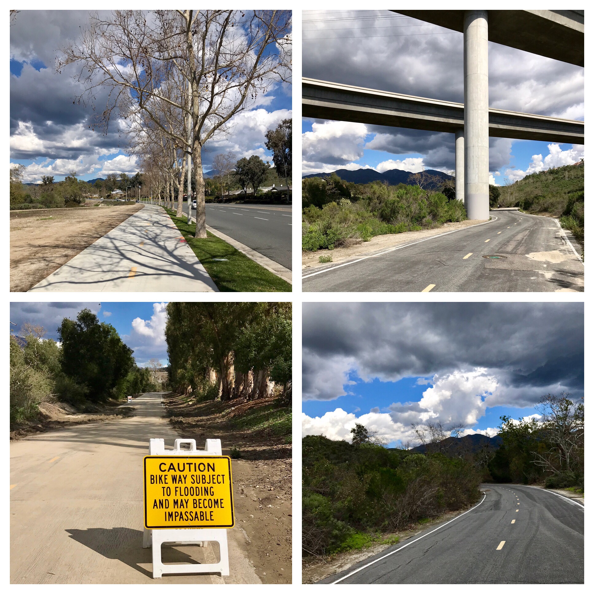
After unbelievably great weather for each of our bike days, we finally got caught in some rain, I mean real rain this time. It was a major downpour for the last ten miles or so. It felt good, though, like a blessing as we finished up our trip. The trail got a little confusing as we got close to Rochester. Or maybe it’s not the trail, but Google Maps (I suspect both). The latter seemed to be telling us to get off the trail a bit early, at Pittsford, and take NY-31 (part of the NY State Bicycle Route 5). Looking at the map, it does appear to take one in to Rochester on a diagonal that is much more direct than continuing on the Erie Canal Trail into town, and then heading north. But NY-31 looked to be an insanely busy highway, and not the sort of road we would enjoy riding on. So we stopped to review our options. A kind gentleman asked if he could help us. We explained our confusion about whether we really should be getting on that busy street, or if we could continue on the Trail, which seemed to be hard to find at this point. He admitted he didn’t really know this area well, so he flagged down a woman in a van who apparently works for the Erie Canalway, as does he. She didn’t know how to help us either, but she sure was nice. We visited with the friendly gentleman for awhile. He gets paid to walk the trail and notice conditions, reporting back about things needing attention. Eventually, we found the resumption of the trail and decided to stay with the trail until we got to Rochester, and then head north, even if it was less direct. Along the way, we got a good soaking, and made it into Rochester thoroughly drenched.
I’m so glad we stayed on the trail for our ride into Rochester. Not just to avoid the heavy traffic on NY-31, but also because the trail experience was special. At one point, the trail had water on both sides, like we were on a long bridge over a lake. It felt magical. I wanted to record this feeling in my mind so I could call it up whenever I needed to feel this magic again. I also felt a well of emotion rising up as I reflected on our journey, how far we’d come, how lucky we had been, how fortunate we are to be able to have a vacation like this. I have long fantasized about a retirement life filled with bike adventures like this, and the success of this journey gives me confidence that my retirement dream is possible.

Particularly special to me, at this point in my life, is gratitude for being able to share this experience with El Cochinito. We have been married for almost 15 years, plus dated for a couple of years before that. Biking together was something we did often during the early years of our relationship, and along the way, that diminished to occasional bike dates (biking a few miles to see a movie or go to a restaurant) and somewhat annual bike overnights, but more and more, the bigger bike adventures had been something I did either with friends or on my own. During our separation in the midst of that major crisis in our relationship that nearly split us up two years ago, I knew he was worried about attracting new guests to join him for his next trip to Cuba, and I suggested he could find travelers to join him if he made it a bike trip. Soon he was dusting off his road bike and getting back into riding. We both did a lot of riding that year, sometimes separately, sometimes together. Then a corner was turned. Not on the bikes, but in our marriage. We made a conscious decision to scrap our old marriage and start over fresh. We each worked on ourselves and on our relationship skills. It’s an ongoing process, but much like biking, there’s no reason not to just keep going.
Two years later, El Cochinito is my best riding buddy. We just rode over 500 miles together, spent two and a half weeks in each other’s constant presence while traveling, and we managed to roll together in harmony. A few tense moments here and there, yet none of them led to conflict or resentment (okay, so maybe there was one lingering issue we had to work out after we got home, but we did it). We seem to have finally learned how not to let issues that arise between us fester and turn into stony deposits into the First Bank of Resentments. We have found a way to take a step back or take a deep breath when necessary, and turn back towards each other and keep talking until we figure it out together.
We got off the trail at Brighton Town Park in the outskirts of the Rochester area, riding a trail alongside a small lake or large pond, and soon it seemed we might be in the wrong place. Maybe it was a parking lot, but soon we found our way. Then we were on South Clinton Ave for quite a long stretch, never quite sure if it was better to be on the road or the sidewalk. It was still quite wet, and I felt like we really had to keep our eyes out for wayward motorists who might not notice the two cyclists amidst all the mistiness and gray. But then I saw the sign and, despite the rain and needing to stay well to the right and out of traffic, I just had to stop for a photo – we had officially entered Rochester!
Within a couple more miles, we rolled into the driveway of our kids’ house. We were thoroughly soaked and thoroughly exhilarated. We had made it! We were greeted with a fantastic dinner and the best company you could hope for. Finally we were getting to see where our kids have been living and meet their newest dog, Santo, in real life.
Today’s tally: 44 miles, 0 flats, Roadkill: 2 mice. Plus: one sweet victory.
Epiloguing in Rochester: Rolling As a Family
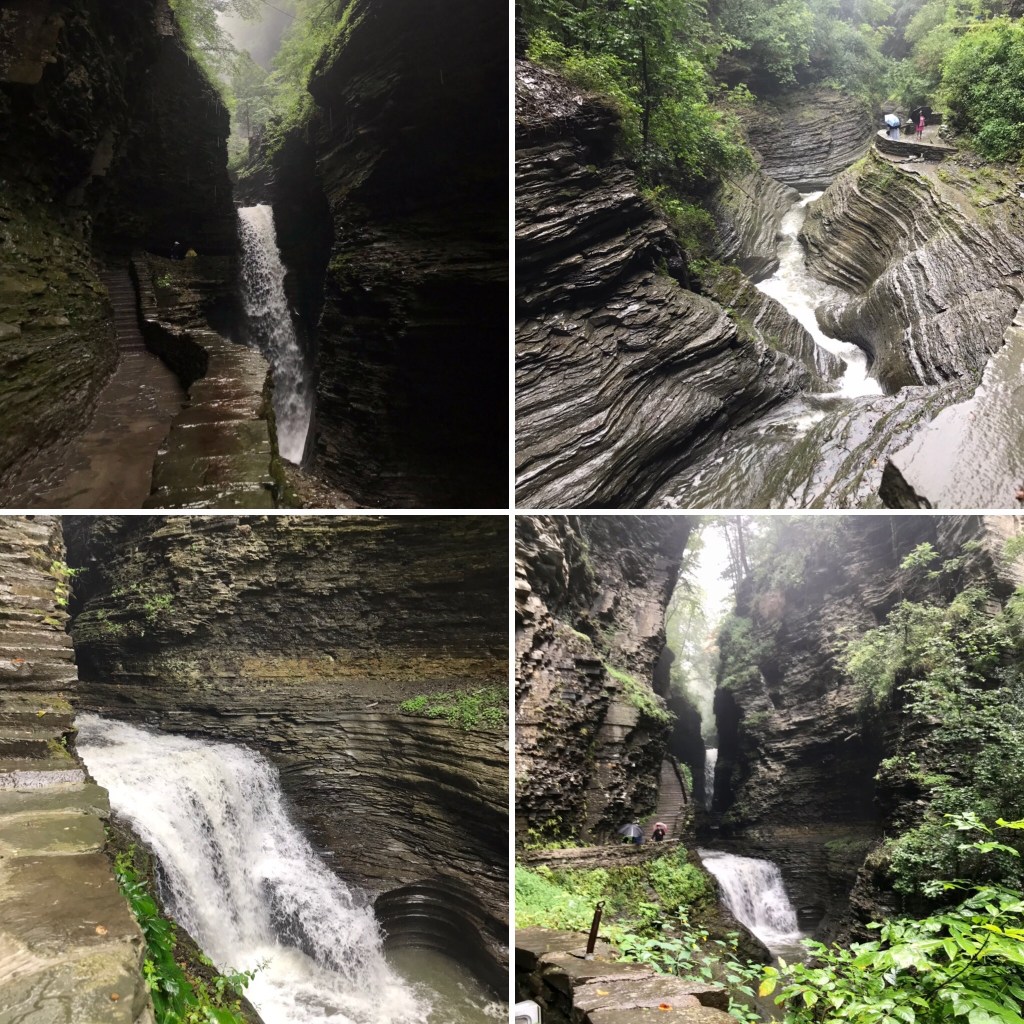
The next day was another rainy one. We returned to the finger lakes area, this time by car, and this time near Seneca Lake, where we visited Watkins Glen State Park. We gawked at the amazing waterfalls and rock formations, whose beauty is enhanced by the rain.
The following day brought better weather and we toodled around Rochester by bike. We rode along the Genesee River Trail and visited the University of Rochester campus, where we got to see the building where our oldest works. From there we ventured on to Mt. Hope Cemetery, which features some very old and some very famous graves as well as a few steep hills. After paying our respects to Susan B. Anthony and Frederick Douglass, we rode through downtown to High Falls, and then our daughter-in-law led us on her secret route to the Lower Falls.

This final ride of 15 miles brought our grand total for the entire trip to 581 miles, and a total elevation gain of 20,311’ in 54 hours of riding time. Not too shabby.

It felt so fitting to end our Epic Tour de Kids biking with our kids. So glad we were able to do that in both Philly and Rochester. It warms my bike mama heart to be able to ride together as a family, and to see that each one of our kids, including the kids-in-law, is smart enough to see the genius in using bikes for both transportation and exploration. Maybe they do it because it’s cheap, maybe they do it because they know it’s one important way to slow the demise of our planet, maybe they do it because it’s an easy way to get exercise, maybe they do it because it’s often simpler and less frustrating to get around that way, maybe they do it to take in the fresh air, maybe they do it just to humor me, maybe they do it because it’s the best way to really see a city, and maybe they do it because it’s just plain fun. I like to think they see the value in all of the above.
Our final day in Rochester was spent laundering our wet and muddy clothes, cleaning up our wet and muddy bikes, and figuring out how to get our bikes disassembled and packed into boxes for the trip home. Glad we gave ourselves plenty of time for that, as figuring out just how to make it all work was rather challenging. One drawback to having had our local bike shop back home pack the bikes for the outbound trip is that we had to figure it out for ourselves now. Of course, there are youtubes aplenty to help, and we did have the tools we needed. It still seemed much more involved than what I remember from packing my bike for travel 35 years ago when I was a young’un too cheap/broke to pay for such services.
There were many amazements on this trip, but one last amazement was how our two bike boxes actually fit into the back of our son’s Honda HRV, with enough room to spare that a passenger seat remained available in the back. That meant our son was able to drive El Cochinito and me and our two bikes and our panniers to the airport. One thing (of many) we learned from this trip is that you have to figure out how to transport two people with two bike boxes to and from airports. You can’t just call a taxi or an Uber or even an airport van service for that. Believe me, I tried. On the Los Angeles side, the only way we could manage was to put the bike boxes in the back of El Cochinito’s pick up, drive over to the home of a friend who lives close to LAX, and have her drive us to and from the airport with our bikes. Thankfully, she was a good sport about having the truck at her place while we were gone and picking us up on our return.
With our hearts warm and full, our sense of adventure both sated and titillated, our bodies and our relationship strengthened, we returned home to our cats, who’d been well-cared for by a friend during our absence. Now we can start dreaming up our next bike adventure.


 Control No. 5: 10/28/19 – Bar Nine in Culver City