Last year’s bike date weekend in Ojai was so much fun, I had to plan another adventure for this President’s Day weekend. I have been drooling over posts on bike groups I see of trails all over the U.S. and beyond, making me wish I could retire now and go ride them all. Then I decided I ought to learn more about trails that are close to home. That is how I learned about the Aliso Creek Riding and Hiking Trail, an 18.5 mile trail that runs from the Laguna Hills to Rancho Santa Margarita.

The first thing I realized when I began my planning for the trip was that I had months before registered for the L.A. Chinatown Firecracker Ride, a fun and beautiful 40-mile ride I had done for my first time last February, and this year the ride was scheduled for Saturday morning of President’s Day weekend. No problem, however, as there is a 2:00 train on Saturday afternoon from Union Station to Orange County, so I could work with that. This would get us to Mission Viejo at 3:19, leaving plenty of daylight for the 7.3 mile ride to Aliso Viejo, where I had found a hotel I could book using two free nights from Hotels.com that were about to expire. I confidently booked the room at the non-refundable rate that meant I only had to pay about $30 in taxes for the two nights at a place that had pretty good reviews.
As the trip dates drew near, however, a few different factors had me wondering if this was such a great idea. We got an unusual (albeit welcome) amount of rainfall in California this Winter, reminding us that we can’t always count on great biking weather in February. Then, just a week before the big weekend, our oldest son calls to tell us that he and his girlfriend of 10 years are going to a courthouse in Chicago on the Saturday of President’s Day Weekend to tie the knot. I had to decide whether to cancel my various plans for the weekend, or settle for throwing them a big party later. Ultimately, I decided that the celebration with family and friends would be more important than the formalities of the event.
Then my beloved El Cochinito came down with a wicked chest cold, and it didn’t seem to be clearing up. The weather forecast wasn’t encouraging, either: Sunday would be a day of rain, cold temperatures and wind gusts. That’s not great biking weather, and it’s definitely not good weather for going outside when you’re fighting a cold. We decided to keep a flexible mindset and see how things played out.
Saturday morning had to leave the house by 7ish to get to Chinatown in time to pick up my bib number, drop off my pannier packed with all I’d need for the next few days with the much-appreciated bag check, and get in position for the Firecracker Ride set to begin at 8:00. El Cochinito got up shortly before I left, and let me know he was not feeling well. We agreed to check in with each other later and decide whether to go forward with the planned bike/train adventure, stay home, or consider a modified plan.
When I got downtown everything fell into place: the bib pick-up, the bag drop off, getting into place just as the ride began, and even meeting up with some friends to ride with. The ride was as fun as I’d remembered from last year. I had friends to ride with this time, and the ride through Pasadena, on to Sierra Madre, and back via Huntington Drive does not disappoint. When we stopped at one of the rest stops during the ride, I saw a text from my son with a picture from the courthouse taken as he slipped the ring on his bride’s finger. I showed it to my friends and proudly announced that I now have a daughter-in-law!
We got back to Chinatown at 12:30, leaving us enough time for the snack and beer that were included with our ride registration. I tried to text and call El Cochinito to see how he was feeling, but no reply. Perhaps he was he sleeping? Busy coughing? I figured it wasn’t a good sign, and resigned to enjoying the festival in Chinatown and hanging with friends. Then I got his text at 12:55: “I’m leaving in 5 minutes.” So, the trip was a “go” after all!

I retrieved my bike and the pannier from the valet service and rode on over to Union Station to meet El Cochinito. We bought our train tickets and headed to the platform for the southbound Orange County Line. Metrolink has a weekend fare that lets you go anywhere for $10. Since the regular fare to Mission Viejo is $12, it was still a savings for just the one-way ride. Metrolink has special bicycle cars with open bays for bike parking (and also special netted bays for surfboards) on the lower level. This train had twice as many bike bays as I’d seen on other Metrolink trains, and all the passenger seating was upstairs.

El Cochinito explained that the way he’d been feeling throughout the morning swung between absolutely miserable and quite optimistic. Ultimately, he decided he was OK enough to at least make the trip, and decide later about how much biking he would be up for. What he had not recalled from back when we first planned this trip was that we would need to ride 7.3 miles from the Mission Viejo Metrolink station to our hotel in Aliso Viejo. I had booked a hotel that is close to the Aliso Creek Trail, not close to the train station. He was not happy to hear that.

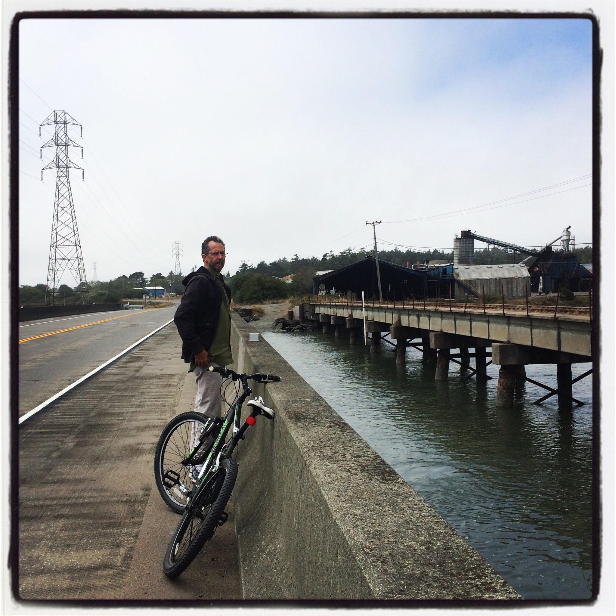
We were both happy, however, with the presence of a separated bike path right there as soon as we disembarked. We had bike path or bike lanes the entire trip. El Cochinito was noticing that his Pedego battery is not holding charge as well as it used to, so he was a little nervous about whether he had enough juice to get the whole 7.3 miles, especially on the hilly parts. It was a bit cold as well. I was feeling aware that I had already biked 48 miles earlier that day, and especially when climbing the hill to get up from the bike path into Aliso Viejo with my loaded pannier on board.

We rolled through the utterly neo-suburban landscape of super-wide multi-lane roads and look-alike office parks, and found our hotel, the Renaissance Club Sport, which fit the description we’d seen in some of the online reviews: a large fitness center with a hotel attached. The place is nice, though, and the clerk who checked us in was utterly welcoming and kind. We were given the green light to take our bikes up to our room. While most hotels allow that, not all do, and it’s always a relief to be assured on arrival that the bikes will be secure. We were quite happy with our room; nicely appointed, with plenty of space for our bikes. El Cochinito was pleasantly surprised that the hotel was such a nice one (sometimes I go for something more on the quaint and funky side). It was a good choice for one needing some convalescence.

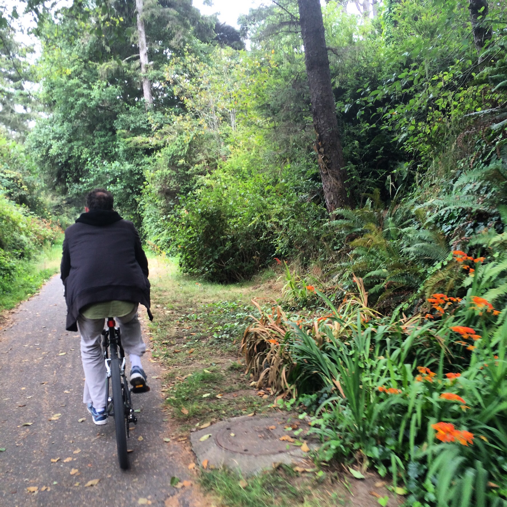
We had no interest in going out that first night, and enjoyed some top-notch hamburgers and cocktails in the on-site restaurant, Citrus. Sunday morning, the day for which rain had been in the forecast, we woke up feeling reasonably well and aware that we had sunshine that was expected to last until about 11 or 12. That meant we had enough energy and enough time to explore the south end of the Aliso Creek Trail before the afternoon rain kicked in. We found a little donut shop at one of the nearby strip malls for breakfast, and continued on to find the trail. The Google Maps guidance for accessing the Aliso Creek Riding and Hiking Trail was rather confusing. We got to Aliso Viejo Community Park, which seemed to be near the entry point, but there were paths and sidewalks going every which way, and so we asked a local to point us in the right direction. If this confusion happens to you, just hop on any trail in the park, and it will likely lead you to the Aliso Creek Trail.
We rode a few miles on the Trail until we came to a T at a road where there didn’t seem to be any signs pointing out where the Trail resumes on the other side of the road. Turns out that we were near the entrance to the Aliso and Wood Canyons Wilderness Park (just turn right on that road and then you’ll see the park on the left). A park ranger was there, but bearing the disappointing news that the park’s trail was closed due to the recent heavy rains. He also pointed to El Cochinito’s Pedego and said that e-bikes aren’t allowed there any way (I believe this is no longer true, so check for updated regulations before you go, if taking an e-bike). The ranger suggested we head left instead and go to the Laguna Niguel Regional Park, just across the main road. He told us to turn right on the main road and then use the crosswalk up ahead, which would lead us to a bike trail.
We took his suggestion and hopped on the bike trail. Turned out to be a trail more suitable for a mountain bike. It was a narrow dirt path with some rather rocky bumps and not exactly flat. As the little trail started heading uphill even more, I told El Cochinito, “we’re single-tracking!” I wasn’t sure if this trail was within the capabilities of my relatively nimble Bianchi Volpe with its 28mm tires, not to mention El Cochinito’s commuter bike. I got nervous on the downhill part where it was a wee bit steep and muddy, so I walked it. Soon we found an adjacent paved road, and switched over to terra firma.
The park was a nice one. We followed the road as it wound past large grassy areas that featured picnic areas and volleyball courts. The volleyball courts looked quite beautiful, as the entire playing surface was filled with water, creating a nice, smooth pool with a net across the center, surrounded by ducks and geese accenting the rectangular pond. As we continued to follow the road, we came upon a sizable reservoir, and rode all the way around that. We then explored a road leading out of the park and used Google Maps to find a route back toward the hotel from there.

El Cochinito became intrigued by a curious Mayan-style structure we kept seeing in the distance. As we drew closer, he just had to find out what it was. It appeared to be an office building, and it was surrounded on all sides by a ginormous parking lot. The building itself sat atop a hill, and as we got closer, it seemed a bit strange. We continued on around to the front, and saw that it was the Chet Holifield Federal Building. We rode past some bollards to look at the building up close, and snapped a few photos. We then turned to leave, when a small car zoomed quickly up the front drive and came to an abrupt stop right in front of us. I was a bit frightened by the aggressive approach, and wondered what this guy’s problem was. I then realized this was a security vehicle, and out popped a rent-a-cop, who looked like a character out of a low-budget comedy.

He told us we were trespassing on government property, and asked us what we were doing there. He told us we’d been seen on camera and looked suspicious. We told him we were curious about the interesting architecture of the building and that we were just riding by. He gave a us stern scolding, and then we were on our way.

With that excitement behind us, we completed our trip back to the hotel. The weather had held out OK for us thus far, but the rains were clearly moving in. We planned an afternoon at a nearby shopping mall that offered restaurants and a movie theater. Rather than worry about where to park our bikes for the afternoon, we just walked from our hotel the 3/4 of a mile to the mall. We had lunch followed by a movie, “Bohemian Rhapsody,” which we thoroughly enjoyed. For the most part, we’d timed that well, missing the rain while were in the movie. It was still coming down when the movie got out, so we dashed over to a nearby Panera for some coffee until the rain had stopped.
As El Cochinito’s cold was winding down, mine was getting started. We spent the evening in our room the second night as well, and had another dinner at Citrus, the on-site restaurant. We felt grateful to have landed a hotel with a good onsite restaurant for a weekend when were weren’t interested in going out for nightlife. We ate there again for a hearty breakfast the next morning, checked out of our room, and headed for the Aliso Creek Trail again, this time heading the other direction.

The trail is interesting, as it passes through a variety of communities and parks. Some stretches provide a nice, off-street bike path, with occasional stretches along a road and taking some twists and turns. Unfortunately, there are parts where it just isn’t clear where the trail resumes after ending at an intersection or street. We got fooled by riding on what seemed to be the Trail as it turned a corner in front of Laguna Hills High School. It didn’t seem right in that, shortly after that right turn, the trail turned right again, heading back in the direction we’d started. A stop to consult Google Maps led me to believe we should have gone left instead of right at that first turn by the high school. We headed back to that intersection, and looked around for signs. None were apparent, so we started to take the bike lane heading in what seemed to be the correct direction. It was one of those bike lanes alongside a super-wide, multi-lane road, and it was heading uphill, arcing to the right, and it started to feel not quite right, so we stopped again to review the maps. All I could ascertain at that point was that we were off the trail and needed to head somewhat to our left to get back to it.

Eventually, with some additional frustration, we managed to find our way back to the trail. As we followed it though one of the parks (Sheep Hills Park) along the way, we encountered another fork in the path that did not seem clearly marked. One sign pointed left and said “Aliso Creek”, so we went left. As it turns out, that path took us to the Aliso Creek, but the trail we were on came to a dead end after about a quarter mile.

I had downloaded onto my phone a map of the trail through TrailLink, but it did not provide navigational guidance. I had to keep checking back and forth between Google Maps and the TrailLink map to sort it out. That’s how I noticed that the trail does deviate from the creek for awhile. So, we turned around and went back to take the other way. Not long after that detour, we encountered a place where the trail was closed at an underpass that had been flooded. We were able to get back on the trail after patiently waiting for a chance to cross another very busy, super-wide street.

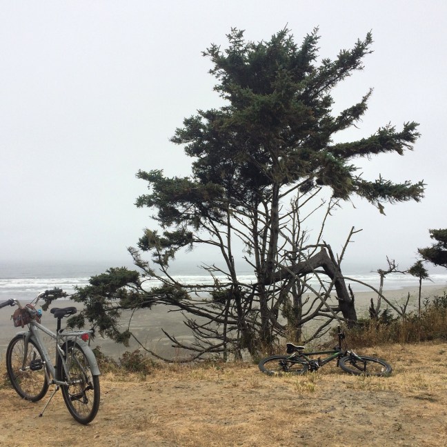
Other than those few points of confusion, the trail is a nice one. El Cochinito was feeling ready for a rest stop where he could plug in his Pedego battery, so we got off the trail to seek a place to stop. We ended up circling back a little ways on El Toro Road, trying not to get killed (we rode the sidewalk), and found a Starbucks in the Lake Forest area. After a hot beverage break there, I looked at the map to see how much of the Aliso Creek Trail remained: 6 miles. El Cochinito was not interested in continuing, preferring to save his energy for the ride back to the Irvine train station. I realized I had just enough time to finish the trail, so he stayed put and I got back on the trail. This last part turned out to be my favorite part of the trail. After a couple more residential areas and small parks, the path got wider and became a little more rural-ish, with fewer street crossings. I enjoyed riding along as the natural setting became more natural, with foothills in the background and lots of trees along the path.

I came to the end, or near the end. Again, I encountered a fork in the path where it wasn’t clear which way to go. I stayed on what seemed to be the main path, but it ended shortly thereafter at a crossing of a major road. I wondered if that was the end of the trail, or if I should have taken the other fork. I asked a mother-daughter pair I saw walking by, who’d come from that other fork in the path, if I was at the end of the trail. They told me yes (sort of), and explained that going the other way would lead to a historic building that is very interesting. I knew that was probably the way I should have gone, but if I went there, I might end up lingering too long, so I decided to save that exploration for another time, and started making my way back.

The ride back towards Lake Forest was fast and fun! The grade was in my favor this way, and before I knew it, I recognized the bridge I’d taken when first getting back on the trail after leaving Starbucks. It was getting cold and I started feeling a few rain drops. I stopped to put on my jacket and check with El Cochinito to see if we was still at the same Starbucks. We met up there, made a quick stop at a grocery store to grab some lunch (I had worked up a significant appetite by this time), and began our ride to the Irvine station, racing to beat the rain. The rain won, but at least we had an indoor waiting area to sit in while eating our lunches before the train arrived.

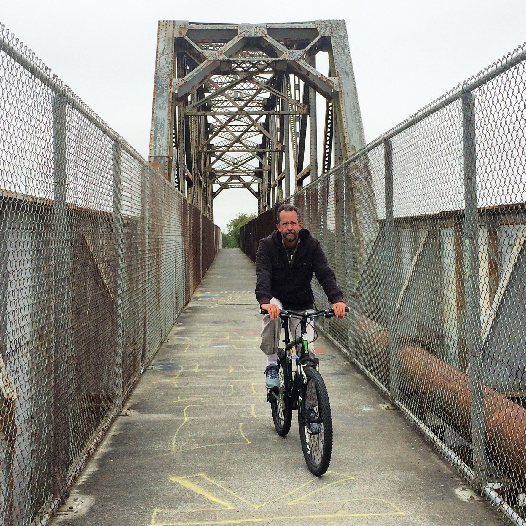
Not only was it cold, rainy and windy when it came time to head to the platform, but the elevator on the far side of the bridge to the platform was out of service. We were grateful we didn’t have to carry our bikes up the stairs to access the bridge, but carrying our bikes down on the other side was quite the challenge. Getting on the train was a welcome treat, and we were able to sit right next to the bike bay.

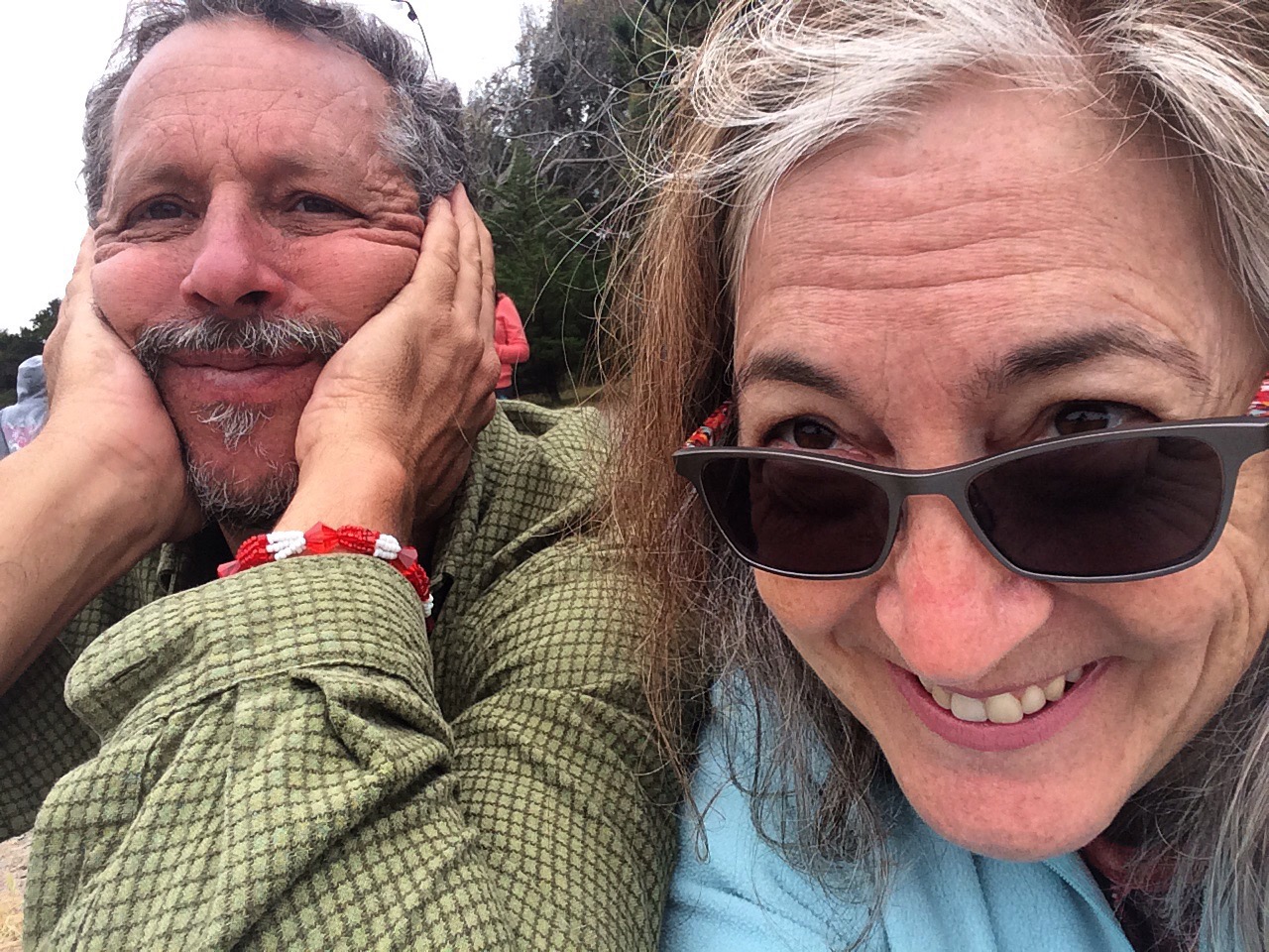
It was a trip that could have been better, but also could have been miserable. For a couple of fifty-somethings fighting colds and dodging rainstorms, we managed to make the most of our weekend. The riding, the movie, the meals, the hotel, the train ride, all worked out well, and we had a delightfully good time.